From Surf Wiki (app.surf) — the open knowledge base
Smolyan
| Field | Value | ||
|---|---|---|---|
| official_name | Smolyan | ||
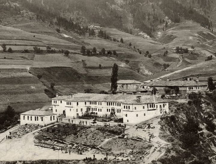
| image_skyline | Kaptaja.jpg | ||
| image_shield | Smolyan Coat of Arms.png | ||
| map_caption | Location of Smolyan | ||
| pushpin_map | Bulgaria | ||
| pushpin_label_position | |||
| pushpin_map_caption | Location of Smolyan | ||
| coordinates | |||
| subdivision_type | Country | ||
| subdivision_name | Bulgaria | ||
| subdivision_type1 | Province | ||
| (Oblast) | |||
| subdivision_name1 | Smolyan | ||
| leader_title | Mayor | ||
| leader_name | Nikolay Melemov (GERB) | ||
| area_total_km2 | 134.59 | ||
| elevation_m | 1002 | ||
| population_total | 30 689 | ||
| population_as_of | Census 2021 | ||
| population_density_km2 | auto | ||
| population_urban | 34465 | ||
| timezone | EET | ||
| utc_offset | +2 | ||
| timezone_DST | EEST | ||
| utc_offset_DST | +3 | ||
| postal_code_type | Postal Code | ||
| postal_code | 4700 | ||
| area_code | 0301 | ||
| website | |||
| <!-- | MunicipalCode | CM-- | settlement_type = Town |
(Oblast)
Smolyan () is a town and ski resort in the south of Bulgaria near the border with Greece. It is the administrative and industrial centre of the Smolyan Province. The town is built along the narrow valley of the Cherna ('black') and the Byala ('white') river in the central Rhodope Mountains. It is located at the foot of the mountain's highest peak Golyam Perelik (2191 m). Popular ski resorts of Pamporovo and Chepelare lie in the vicinity. As of June 2022 the town has a population of 30 689 inhabitants.
Name
The name of the town comes from the local Slavic tribe of the Smolyani, the name of whom is probably cognate to the Slavic word smola ("resin").
History
According to archaeological evidence, the area around Smolyan was first settled in the 2nd-1st millennium BC. In the Middle Ages it acquired its name from the Slavic tribe, the Smolyani, who settled in the region in the 7th century. During the Middle Ages, it was ruled by the Part of the Byzantine and Bulgarian Empires. For a while during the 14th century it came under the control of the Bulgarian feudal lord Momchil, alongside the whole Rhodope mountains, before eventually being subjugated by the Ottoman Empire. During the Ottoman period the town was renamed to "Paşmaklı". It remained under Ottoman rule for five centuries, a township of the Ottoman Sanjak of Gümülcine in the Adrianople Vilayet between 1867 and 1912. It remained a Muslim-majority town with a large Christian minority until 1912.
The area was liberated by the 21st Sredna Gora Regiment led by Vladimir Serafimov in 1912, during the First Balkan War. However, the town retained its Ottoman-era name "Paşmaklı" until 1934, when it was changed to "Smolyan" by official decree. The modern town of Smolyan was formed by the merger of three existing villages — Ustovo, Raykovo and Ezerovo — in 1960.

Population
The population of Smolyan just after World War II was about 5,000. Since then, it started growing decade by decade, mostly because of the migrants from the rural areas and the surrounding smaller towns, reaching its peak in the beginning of the 1990s, exceeding 34,000.
Ethnic linguistic and religious composition
According to the latest 2011 census data, the individuals who declared their ethnic identity were distributed as follows:
- Bulgarians: 25,045 (97.0%)
- Roma: 258 (1.0%)
- Turks: 153 (0.6%)
- Others: 120 (0.5%)
- Indefinable: 248 (1.0%)
- Undeclared: 4,818 (15.7%) Total: 30,642
In Smolyan Municipality 32708 declared as Bulgarians, 301 as Roma and 170 as Turks, and 9,000 did not declare their ethnic group.
Culture and sports
Due to its suitable location on top of Mount Rozhen, the Bulgarian National Astronomical Observatory is located nearby, with a planetarium in operation in the town. There is one theatre, the Rhodope Drama Theatre, and a gathering of theatre practitioners and scholars known as The Rhodopi International Theatre Laboratory is held every summer. There is also a regional historical museum founded in 1935.
Smolyan has an elite division football team, PFC Rodopa Smolyan, that had been playing in the A Professional Football Group between 2003-2007.
The largest church in southern Bulgaria, the Cathedral of Saint Vissarion of Smolyan, was inaugurated in the city in July 2006.
Municipality
Smolyan is also the seat of Smolyan municipality (part of Smolyan Province), which includes the following 79 villages:
- Aligovska
- Arda
- Belev dol
- Bilyanska
- Borikovo
- Bostina
- Bukata
- Bukatsite
- Chamla
- Chepleten
- Chereshkite
- Chereshovo
- Chereshovska Reka
- Chokmanovo
- Chuchur
- Dimovo
- Dunevo
- Elenska
- Elyovo
- Fatovo
- Gabritsa
- Gela
- Gozdevitsa
- Gorna Arda
- Gorovo
- Gradat
- Gudevitsa
- Hasovitsa
- Isyovtsi
- Katranitsa
- Kiselichevo
- Kokorkovo
- Koshnitsa
- Kremene
- Kukuvitsa
- Kutela
- Laka
- Levochevo
- Lipets
- Lyulka
- Milkovo
- Mogilitsa
- Momchilovtsi
- Mugla
- Nadartsi
- Oreshitsa
- Ostri Pazlak
- Petkovo
- Peshtera
- Pisanitsa
- Podvis
- Polkovnik Serafimovo
- Poprelka
- Potoka
- Rechani
- Reka
- Rovina
- Selishte
- Shiroka Laka
- Sivino
- Slaveyno
- Smilyan
- Sokolovtsi
- Solishta
- Sredok
- Stikal
- Stoykite
- Sarnino
- Strazha
- Taran
- Tikale
- Trebishte
- Turyan
- Uhlovitsa
- Varbovo
- Vievo
- Vlahovo
- Zaevite
- Zmievo
Geography
Climate
Smolyan has a dry-warm-summer humid continental climate (Köppen climate classification: Dsb), featuring warm, dry summers and cold, snowy winters.
Honour
Smolyan Point on Livingston Island in the South Shetland Islands, Antarctica is named after Smolyan.
Notable people
- Valya Balkanska
- Victor Houteff, founder of the Davidian branch, an offshoot of the Seventh-day Adventist Church.
- Velichko Cholakov
- Daniil of Bulgaria
Gallery
File:Смолян Райково 2713784204 3519c6e659 o.jpg File:Смолян Технически Колеж 2727441793 76680bdefa o.jpg File:Смолян Невястата 2702326413 a0331a0230 o.jpg File:Смолян Стенопис 1 2827787856 aae5a15ff2 o.jpg File:Смолян 2695825013 82452c9437 o.jpg File:Смолян 2691396959 f63b323fab o.jpg File:Смолян Райково 2724872359 21527b973c o.jpg File:Смолян Устово 2851700364 587e738628 o.jpg File:Kaptaja.jpg File:Stanevska.jpg File:Ustovo.jpg File:Historical-museum-smolian.jpg
References
References
- "гр. Смолян". BGGLOBE.
- [http://pop-stat.mashke.org/bulgaria-cities.htm България / Bălgarija] pop-stat.mashke.org
- {{in lang. en [http://www.citypopulation.de/Bulgaria-Cities.html „WorldCityPopulation“]
- {{in lang. bg [http://www.nsi.bg/ORPDOCS/Census2011_1.pop_by_age.xls Population on 01.02.2011 by provinces, municipalities, settlements and age; National Statistical Institute]
- [http://www.nsi.bg/ORPDOCS/Census2011_4.pop_by_ethnos.xls Population by province, municipality, settlement and ethnic identification, by 01.02.2011; Bulgarian National Statistical Institute] {{in lang. bg
- "Weather Base". Weather Base.
This article was imported from Wikipedia and is available under the Creative Commons Attribution-ShareAlike 4.0 License. Content has been adapted to SurfDoc format. Original contributors can be found on the article history page.
Ask Mako anything about Smolyan — get instant answers, deeper analysis, and related topics.
Research with MakoFree with your Surf account
Create a free account to save articles, ask Mako questions, and organize your research.
Sign up freeThis content may have been generated or modified by AI. CloudSurf Software LLC is not responsible for the accuracy, completeness, or reliability of AI-generated content. Always verify important information from primary sources.
Report