From Surf Wiki (app.surf) — the open knowledge base
Shire of Yarriambiack

| Field | Value |
|---|---|
| type | lga |
| name | Shire of Yarriambiack |
| state | vic |
| image | Australia Victoria Yarriambiack Shire.svg |
| caption | Location in Victoria |
| pop | 6,556 |
| pop_year | |
| pop_footnotes | |
| area | 7326 |
| area_footnotes | |
| est | 1995 |
| gazetted | 20 January 1995 |
| mayor | Kylie Zanker |
| seat | Warracknabeal |
| region | Grampians |
| logo | Yarriambiack Shire logo.svg |
| url | http://www.yarriambiack.vic.gov.au/ |
| stategov | Lowan |
| stategov2 | Mildura |
| fedgov | Mallee |
| near-nw | Mildura |
| near-n | Mildura |
| near-ne | Mildura |
| near-w | Hindmarsh |
| near-e | Buloke |
| near-sw | Horsham |
| near-s | Northern Grampians |
| near-se | Northern Grampians |
| near-nw = Mildura | near-n = Mildura | near-ne = Mildura | near-w = Hindmarsh | near-e = Buloke | near-sw = Horsham | near-s = Northern Grampians | near-se = Northern Grampians The Shire of Yarriambiack is a local government area of Victoria, Australia, located in the north-western part of the state. It covers an area of 7326 km2 and at the , had a population of 6,556. It includes the towns of Hopetoun, Murtoa, Rupanyup and Warracknabeal.
The Shire is governed and administered by the Yarriambiack Shire Council; its seat of local government and administrative centre is located at the council headquarters in Warracknabeal, it also has service centres located in Hopetoun and Rupanyup. The Shire is named after Yarriambiack Creek, a geographical feature that meanders through the LGA from the Wimmera River, through Warracknabeal, to Lake Coorong at Hopetoun.
History
The Shire of Yarriambiack was formed in 1995 from the amalgamation of the Shire of Warracknabeal, Shire of Karkarooc, most of the Shire of Dunmunkle, and part of the Shire of Wimmera.
In January 1996 part of the Richardson River catchment east and south of Rupanyup was transferred from the Northern Grampians Shire to Yarriambiack after a further Local Government Board review.
Council
Current composition
The council is composed of three wards and six councillors. The current councillors, elected at the 2024 election, are:
| Ward | Councillor | Notes | |
|---|---|---|---|
| Dunmunkle | Corinne Heintze | ||
| Melinda Keel | |||
| Hopetoun | Andrew Mclean | ||
| Chris K. Lehmann | |||
| Warracknabeal | Karly Kirk | ||
| Kylie Zanker | Mayor |
Administration and governance
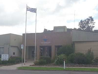
The council meets in the council chambers at the council headquarters in the Warracknabeal Municipal Offices, which is also the location of the council's administrative activities. It also provides customer services at both its administrative centre in Warracknabeal, and its service centres in Hopetoun and Rupanyup.
Townships and localities
| Population | Locality | 2016 | 2021 |
|---|---|---|---|
| 35 | 18 | ||
| 10 | 3 | ||
| 57 | 62 | ||
| 329 | 312 | ||
| 37 | 38 | ||
| 48 | 56 | ||
| 48 | 45 | ||
| ^ | 11 | 15 | |
| ^ | 1,730 | 1,635 | |
| 739 | 694 |
| Population | Locality | 2016 | 2021 |
|---|---|---|---|
| ^ | 241 | # | |
| 17 | 13 | ||
| ^ | 48 | 57 | |
| ^ | * | 4 | |
| 48 | 57 | ||
| 93 | 82 | ||
| ^ | 19 | 16 | |
| ^ | * | 237 | |
| ^ | 36 | 40 |
| Population | Locality | 2016 | 2021 |
|---|---|---|---|
| 524 | 525 | ||
| ^ | 72 | 63 | |
| 865 | 897 | ||
| ^ | 133 | 149 | |
| ^ | 683 | 672 | |
| 5 | 0 | ||
| ^ | 536 | 545 | |
| 28 | 27 | ||
| 78 | 53 |
| Population | Locality | 2016 | 2021 |
|---|---|---|---|
| ^ | 57 | 62 | |
| 29 | 30 | ||
| 31 | 28 | ||
| 2,438 | 2,359 | ||
| ^ | 18 | 29 | |
| ^ | 49 | 28 | |
| 9 | 17 | ||
| 201 | 191 | ||
| 84 | 75 |
^ - Territory divided with another LGA
***** - Not noted in 2016 Census
# - Not noted in 2021 Census
References
References
- {{Census 2021 AUS
- (27 March 2019). "3218.0 – Regional Population Growth, Australia, 2017–18: Population Estimates by Local Government Area (ASGS 2018), 2017 to 2018". [[Australian Bureau of Statistics]].
- Victoria Government Gazette – Online Archive. (1837–1997). "S4 of 1995: Order estg (Part 16) the Shire of Yarriambiack". State Government of Victoria.
- (25 January 1996). "Order altering the boundary between the municipal districts of the Northern Grampians and Yarriambiack Shire Councils".
- VEC. "Yarriambiack Shire Council election".
- Yarriambiack Shire Council. "Meet Your Mayor & Councillors". Yarriambiack Shire Council.
This article was imported from Wikipedia and is available under the Creative Commons Attribution-ShareAlike 4.0 License. Content has been adapted to SurfDoc format. Original contributors can be found on the article history page.
Ask Mako anything about Shire of Yarriambiack — get instant answers, deeper analysis, and related topics.
Research with MakoFree with your Surf account
Create a free account to save articles, ask Mako questions, and organize your research.
Sign up freeThis content may have been generated or modified by AI. CloudSurf Software LLC is not responsible for the accuracy, completeness, or reliability of AI-generated content. Always verify important information from primary sources.
Report