From Surf Wiki (app.surf) — the open knowledge base
Sheridan, Colorado
City in Colorado, United States
City in Colorado, United States
| Field | Value | |
|---|---|---|
| <!-- Basic info ----------------> | name | Sheridan, Colorado |
| native_name | ||
| settlement_type | Home rule municipality | |
| official_name | City of Sheridan | |
| motto | ||
| image_skyline | Sheridan, Colorado.JPG | |
| image_caption | The Sheridan City Hall. | |
| image_map | Arapahoe County Colorado Incorporated and Unincorporated areas Sheridan Highlighted 0869645.svg | |
| map_caption | Location of the City of Sheridan in Arapahoe County, Colorado. | |
| pushpin_map | USA | |
| pushpin_label | Sheridan | |
| pushpin_label_position | right | |
| pushpin_map_caption | Location of the City of Sheridan in the United States. | |
| <!-- Location ------------------> | subdivision_type | Country |
| subdivision_name | United States | |
| subdivision_type1 | State | |
| subdivision_name1 | Colorado | |
| subdivision_type2 | County | |
| subdivision_name2 | Arapahoe County | |
| subdivision_type3 | City | |
| subdivision_name3 | Sheridan | |
| government_type | Home rule municipality | |
| leader_title | Mayor | |
| leader_name | Sally Diagle | |
| leader_title1 | ||
| established_title | ||
| established_title2 | Incorporated | |
| established_date2 | April 1890 | |
| established_title3 | ||
| named_for | Philip Sheridan | |
| unit_pref | US | |
| area_footnotes | ||
| area_total_km2 | 5.93 | |
| area_land_km2 | 5.76 | |
| area_water_km2 | 0.17 | |
| area_total_sq_mi | 2.29 | |
| area_land_sq_mi | 2.22 | |
| area_water_sq_mi | 0.07 | |
| area_blank1_sq_mi | ||
| population_as_of | 2020 | |
| population_footnotes | ||
| population_total | 6105 | |
| population_density_km2 | auto | |
| population_density_sq_mi | auto | |
| population_density_blank1_sq_mi | ||
| timezone | MST | |
| utc_offset | -7 | |
| timezone_DST | MDT | |
| utc_offset_DST | -6 | |
| coordinates | ||
| elevation_footnotes | ||
| elevation_m | 1623 | |
| elevation_ft | 5325 | |
| <!-- Area/postal codes & others --------> | postal_code_type | ZIP code |
| postal_code | 80110 | |
| area_codes | Both 303 and 720 | |
| blank_name | FIPS code | |
| blank_info | 08-69645 | |
| blank1_name | GNIS feature ID | |
| blank1_info | 0204714 | |
| website |
The City of Sheridan is a home rule municipality located in Arapahoe County, Colorado, United States. Sheridan is a part of the Denver–Aurora–Lakewood, CO Metropolitan Statistical Area. The population was 6,105 at the 2020 census.
History
Sheridan was originally part of the Indian Territory and has always been a small community. The first white settler of what would become Sheridan was John McBroom in the spring of 1859. He homesteaded 160 acre. The town was initially named Petersburg. McBroom built his first log cabin near Bear Creek which he later abandoned in 1866 when he married Emma J. Bennett. He prospered as a farmer and found a viable market in Denver for his goods. He was joined by his brother, Isaac McBroom, in June 1860, who also homesteaded a little over 160 acre. The laying out of the town of Sheridan is credited to Isaac. He was also responsible for the name change from Petersburg to Sheridan. Isaac McBroom's cabin can be toured at the Littleton Historical Museum.
Another prominent figure in Sheridan's early history was Peter Magnes. Originally from Sweden, Magnes was a farmer who immigrated to the United States at the age of 26. In 1859, his first daughter was born on the banks of Cherry Creek. He also purchased 160 acre of land and built a small log cabin. In 1865 Magnes laid out the town of Petersburg and encouraged Swedish families to immigrate to his town. The town had a railroad, hotel, blacksmith, church, newspaper, post office and, of course, taverns. The state of Colorado was formed in 1876, putting Sheridan within its new boundaries.
Citizens began moving toward incorporation of Sheridan in January 1890. There was some dispute among the petitioners about boundaries, and the final results were filed in February 1890. On April 14, 1890, the town of Sheridan was incorporated.
Sheridan gets its name from U.S. Army General Philip H. Sheridan. General Sheridan established Fort Logan, which was originally known as the "Camp close to Denver". It was on the site known as the Johnson Tract, south of the city, with a water supply, the proximity of the railroad, "available space for a parade ground, artesian well possibilities, the beautiful view and the distance from Denver and its saloons." Because of the military post Sheridan continued to flourish. However, eventually the post was shut down, and it is now a mental health facility that borders Sheridan.
Sheridan has remained a community that continues to influence the surrounding areas, most recently with current redevelopment projects.
Geography
Sheridan is located at (39.648920, -105.017681).
According to the United States Census Bureau, the city has a total area of 5.9 km2, of which 5.7 km2 is land and 0.2 km2, or 2.91%, is water.
Demographics
There were 2,236 households, out of which 30.3% had children under the age of 18 living with them, 39.9% were married couples living together, 15.2% had a female householder with no husband present, and 38.6% were non-families. 31.7% of all households were made up of individuals, and 12.5% had someone living alone who was 65 years of age or older. The average household size was 2.50 and the average family size was 3.14.
In the city, the population was spread out, with 26.2% under the age of 18, 10.1% from 18 to 24, 30.5% from 25 to 44, 20.6% from 45 to 64, and 12.6% who were 65 years of age or older. The median age was 35 years. For every 100 females, there were 103.2 males. For every 100 females age 18 and over, there were 103.1 males.
The median income for a household in the city was $34,984, and the median income for a family was $38,500. Males had a median income of $29,655 versus $22,500 for females. The per capita income for the city was $16,635. About 9.0% of families and 11.8% of the population were below the poverty line, including 15.3% of those under age 18 and 11.3% of those age 65 or over.--
Education
The Sheridan School District operates area public schools.
Transportation
Highways
Three highways run through the city of Sheridan:
- [[File:US 85.svg|25px]] US 85 (South Santa Fe Drive) runs along the city's eastern edge, both entering and exiting Sheridan via Englewood
- [[File:US 285.svg|25px]] US 285 runs east–west within the city. It runs from the city's eastern border with Englewood to its western border with Denver.
- [[File:Colorado 88.svg|25px]] State Highway 88 (South Federal Boulevard) runs from the city's southern border with Englewood to its northern border with Denver.
Mass transit
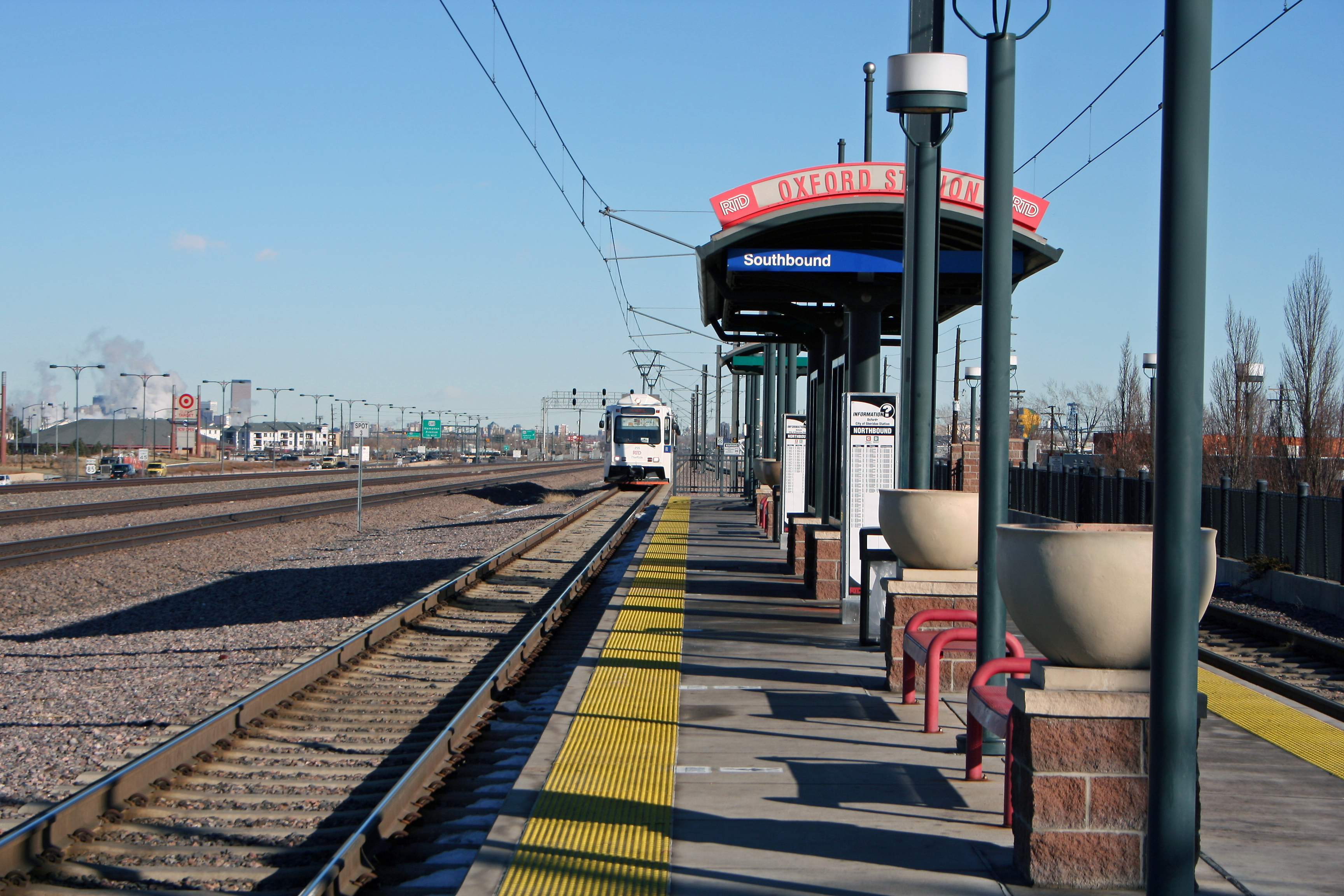
The Regional Transportation District provides bus and light rail service to Sheridan. Light rail service to the city began on July 14, 2000, on the C and D Lines, however C Line operation ended on January 10, 2021. Oxford-City of Sheridan station serves as the sole light rail station within the city. While the station platform is located within the city, the only entrance to the station is in Englewood.
References
References
- "Active Colorado Municipalities". [[Colorado.
- "Colorado Counties". [[Colorado.
- "Member Terms & Ward Maps". [[City of Sheridan, Colorado]].
- (December 1, 2004). "Colorado Municipal Incorporations". [[Colorado.
- "2019 U.S. Gazetteer Files". United States Census Bureau.
- United States Census Bureau. "Sheridan city; Colorado".
- (October 25, 2007). "US Board on Geographic Names". [[United States Geological Survey]].
- "ZIP Code Lookup". [[United States Postal Service]].
- Hulse, D. F.. (2004). "Littleton History: Biographies, McBroom Family". [[Littleton, Colorado.
- Dorward, R.. (2004). "Littleton History: Biographies, Peter Magnes". [[Littleton, Colorado.
- Bonita Hutchenson. (2002). "A History of Sheridan, Colorado". Sheridan Historical Society.
- (2001). "General Philip Henry Sheridan". Sheridan Historical Society.
- (February 12, 2011). "US Gazetteer files: 2010, 2000, and 1990". [[United States Census Bureau]].
- "Geographic Identifiers: 2010 Demographic Profile Data (G001): Sheridan city, Colorado". U.S. Census Bureau, American Factfinder.
- "U.S. Census website". [[United States Census Bureau]].
- "2020 CENSUS - SCHOOL DISTRICT REFERENCE MAP: Arapahoe County, CO". [[U.S. Census Bureau]].
This article was imported from Wikipedia and is available under the Creative Commons Attribution-ShareAlike 4.0 License. Content has been adapted to SurfDoc format. Original contributors can be found on the article history page.
Ask Mako anything about Sheridan, Colorado — get instant answers, deeper analysis, and related topics.
Research with MakoFree with your Surf account
Create a free account to save articles, ask Mako questions, and organize your research.
Sign up freeThis content may have been generated or modified by AI. CloudSurf Software LLC is not responsible for the accuracy, completeness, or reliability of AI-generated content. Always verify important information from primary sources.
Report