From Surf Wiki (app.surf) — the open knowledge base
Sentinel-2
Earth observation mission
Earth observation mission
| Field | Value | |
|---|---|---|
| name | Sentinel-2 | |
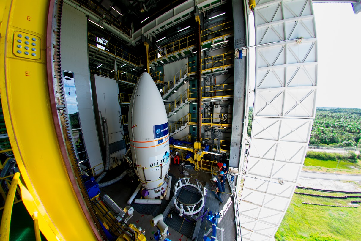
| image | Sentinel 2-IMG 5873-white (crop).jpg | |
| image_size | 275px | |
| image_caption | Model of a Sentinel-2 satellite | |
| manufacturer | {{plainlist | |
| * Astrium/Airbus<ref name | "Sent3EarthESA" | |
| * Boostec<ref name | "Sent3EarthESA" / | |
| * Jena-Optronik<ref name | "Sent3EarthESA" / | |
| * SENER<ref name | "Sent3EarthESA" / | |
| country | European Union | |
| operator | European Space Agency | |
| applications | Land and sea monitoring, natural disasters mapping, sea ice observations, ships detection | |
| <!--Specifications--> | spacecraft_type | Satellite |
| spacecraft_bus | AstroBus-L | |
| constellation | 3 | |
| design_life | 7 years | |
| launch_mass | 2513 lb | |
| dry_mass | 2240 lb | |
| dimensions | 3.4 xx | |
| power | 1,700 W | |
| <!--Production--> | status | Active |
| built | 3 | |
| orders | 1 | |
| launched | 3 | |
| operational | 3 | |
| first | Sentinel-2A | |
| 23 June 2015 | ||
| last | Sentinel-2C | |
| 5 September 2024 | ||
| previous | Sentinel-1 | |
| next | Sentinel-3 |
- Astrium/Airbus
- Thales Alenia Space
- Boostec
- Jena-Optronik
- SENER
23 June 2015 5 September 2024
Sentinel-2 is an Earth observation mission from the Copernicus Programme that acquires optical imagery at high spatial resolution (10 m to 60 m) over land and coastal waters. The mission's Sentinel-2A and Sentinel-2B satellites were joined in orbit in 2024 by a third, Sentinel-2C, and in the future by Sentinel-2D, eventually replacing the A and B satellites, respectively. The mission supports services and applications such as agricultural monitoring, emergencies management, land cover classification, and water quality. Sentinel-2 has been developed and is being operated by the European Space Agency. The satellites were manufactured by a consortium led by Airbus Defence and Space in Friedrichshafen, Germany.
Overview
The Sentinel-2 mission includes:
- Multi-spectral data with 13 bands in the visible, near infrared, and short wave infrared part of the spectrum
- Systematic global coverage of land surfaces from 56° S to 84° N, coastal waters, and all of the Mediterranean Sea
- Revisiting every 10 days under the same viewing angles. At high latitudes, Sentinel-2 swath overlap and some regions will be observed twice or more every 10 days, but with different viewing angles.
- Spatial resolution of 10 m, 20 m and 60 m
- 290 km field of view
- Free and open data policy
To achieve frequent revisits and high mission availability, two identical Sentinel-2 satellites (Sentinel-2A and Sentinel-2B) operate together. The satellites are phased 180 degrees from each other on the same orbit. This allows for what would be a 10-day revisit cycle to be completed in 5 days. The 290 km swath is created by the VNIR and SWIR, which are each made of 12 detectors that are lined in two offset rows.
The orbits are Sun-synchronous at 786 km altitude, 14.3 revolutions per day, with a 10:30 a.m. descending node. This local time was selected as a compromise between minimizing cloud cover and ensuring suitable Sun illumination. It is close to the Landsat local time and matches SPOT, allowing the combination of Sentinel-2 data with historical images to build long-term time series.
File:Orbit path - Sentinel 2A descending - day.png|Sentinel 2A's descending orbital path File:Orbit path - Sentinel 2B descending - day.png|Sentinel 2B's descending orbital path
Launches
The launch of the first satellite, Sentinel-2A, occurred 23 June 2015 at 01:52 UTC on a Vega launch vehicle. Sentinel-2B was launched on 7 March 2017 at 01:49 UTC, also aboard a Vega rocket. Sentinel-2C was launched on 5 September 2024 on the last Vega launch vehicle.
Instrument
The Sentinel-2 satellites each carry a single instrument, the Multi-Spectral Instrument (MSI), which has 13 spectral channels in the visible/near infrared (VNIR) and short wave infrared spectral range (SWIR). Within the 13 bands, the 10 m spatial resolution allows for continued collaboration with the SPOT-5 and Landsat-8 missions, with the core focus being land classification.
Designed and built by Airbus Defense and Space in France, the MSI uses a push-broom concept and its design was driven by the large 290 km swath requirements together with the high geometrical and spectral performance required of the measurements. It has a 150 mm aperture and a three-mirror anastigmat design with a focal length of about 600 mm; the instantaneous field of view is about 21° by 3.5°. The mirrors are rectangular and made of silicon carbide, a similar technology to those on the Gaia astrometry mission. The MSI system also employs a shutter mechanism preventing direct illumination of the instrument by the sun. This mechanism is also used in the calibration of the instrument. Out of the existing civic optical earth observation missions, Sentinel-2 is the first acquiring three bands in the red edge. MSI has 12-bit radiometric resolution (bit depth) with brightness intensity ranging from 0–4095.
Spectral bands
| Sentinel-2 bands | Sentinel-2A | Sentinel-2B | Central wavelength (nm) | Bandwidth (nm) | Central wavelength (nm) | Bandwidth (nm) | Spatial resolution (m) |
|---|---|---|---|---|---|---|---|
| Band 1 – Coastal aerosol | 442.7 | 21 | 442.2 | 21 | 60 | ||
| Band 2 – Blue | 492.4 | 66 | 492.1 | 66 | 10 | ||
| Band 3 – Green | 559.8 | 36 | 559.0 | 36 | 10 | ||
| Band 4 – Red | 664.6 | 31 | 664.9 | 31 | 10 | ||
| Band 5 – Vegetation red edge | 704.1 | 15 | 703.8 | 16 | 20 | ||
| Band 6 – Vegetation red edge | 740.5 | 15 | 739.1 | 15 | 20 | ||
| Band 7 – Vegetation red edge | 782.8 | 20 | 779.7 | 20 | 20 | ||
| Band 8 – NIR | 832.8 | 106 | 832.9 | 106 | 10 | ||
| Band 8A – Narrow NIR | 864.7 | 21 | 864.0 | 22 | 20 | ||
| Band 9 – Water vapour | 945.1 | 20 | 943.2 | 21 | 60 | ||
| Band 10 – SWIR – Cirrus | 1373.5 | 31 | 1376.9 | 30 | 60 | ||
| Band 11 – SWIR | 1613.7 | 91 | 1610.4 | 94 | 20 | ||
| Band 12 – SWIR | 2202.4 | 175 | 2185.7 | 185 | 20 |
Temporal offsets
Due to the layout of the focal plane, spectral bands within the MSI observe the surface at different times and vary between band pairs. These temporal offsets can be used to gain additional information, for example to track propagating natural and human-made features such as clouds, airplanes or ocean waves
Applications

Sentinel-2 serves a wide range of applications related to Earth's land and coastal water.
The mission provides information for agricultural and forestry practices and for helping manage food security. Satellite images will be used to determine various plant indices such as leaf area chlorophyll and water content indexes. This is particularly important for effective yield prediction and applications related to Earth's vegetation.
As well as monitoring plant growth, Sentinel-2 is used to map changes in land cover and to monitor the world's forests. It also provides information on pollution in lakes and coastal waters. Images of floods, volcanic eruptions and landslides contribute to disaster mapping and help humanitarian relief efforts.
Examples of applications include:
- Monitoring land cover change for environmental monitoring
- Agricultural applications, such as crop monitoring and management to help food security
- Identification of buried archaeological sites
- Mapping of palaeo-channels through multitemporal analysis
- Detailed vegetation and forest monitoring and parameter generation (e.g. leaf area index, chlorophyll concentration, carbon mass estimations)
- Observation of coastal zones (marine environmental monitoring, coastal zone mapping)
- Inland water monitoring (Harmful Algal Blooms (HABs) monitoring and assessment)
- Glacier monitoring, ice extent mapping, snow cover monitoring
- Flood mapping & management (risk analysis, loss assessment, disaster management during floods)
- Lava flow mapping
The Sentinel Monitoring web application offers an easy way to observe and analyse land changes based on archived Sentinel-2 data.
Products
The following two main products are generated by the mission:
- Level-1C: Top-of-atmosphere reflectances in cartographic geometry (combined UTM projection and WGS84 ellipsoid). Level-1C products are tiles of 100 km x 100 km each one with a volume of approximately 500 MB. These products are radiometrically and geometrically corrected (including orthorectification). This product can be obtained from the Copernicus Data Space Ecosystem. Read instructions.
- Level-2A: Surface reflectances in cartographic geometry. This product is considered as the mission Analysis Ready Data (ARD), the product that can be used directly in downstream applications without the need for further processing. This product can be obtained either from the Copernicus Data Space Ecosystem (Read instructions), or generated by the user with the Sen2Cor processor from ESA's SNAP Toolbox.
Additionally, the following product for expert users is also available:
- Level-1B: Top of atmosphere radiances in sensor geometry. Level-1B is composed of granules, one granule represents the sub-image one of the 12 detectors in the across track direction (25 km), and contains a given number of lines along track (approximately 23 km). Each Level-1B granule has a data volume of approximately 27 MB. Given the complexity of Level-1B products, their usage require an advanced expertise.
Gallery
File:Sentinel-2A satellite - CSG - Carefully aligning the satellite to the adapter.jpg|Aligning Sentinel-2A to its adapter before launch File:Sentinel-2A satellite - Half-shells close.jpg|Encapsulating Sentinel-2A in the Vega rocket fairing File:Lake MacKay Australia.jpg|Lake Mackay, Australia by Copernicus Sentinel-2B File:Central District Botswana ESA373976.jpg|Central District, Botswana by Copernicus Sentinel-2A File:Vojvodina, Serbia ESA375680.jpg|Vojvodina, Serbia by Copernicus Sentinel-2A File:Central-eastern Brazil, by Copernicus Sentinel-2A satellite.jpg|Central-eastern Brazil, by Copernicus Sentinel-2A File:Lake Balaton Hungary(1).jpg|Lake Balaton, Hungary File:PV power plants cluster Bhadla (India) develpment 2016 2018 2020.png|Timeline of the Bhadla Solar Park (India) development, the world's largest photovoltaic power plants cluster in 2020 File:Sentinel-2 L1C image on 2020-08-09.jpg|The Port of Beirut as seen from Sentinel-2 after the August 4, 2020 explosion that decimated much of Beirut, Lebanon File:La Palma lava flows into the sea (51564701938).jpg|Sentinel-2 photograph of the area covered by the 2021 Cumbre Vieja volcanic eruption flow on Monday afternoon 20 September 2021 File:Hunga Tonga–Hunga Haʻapai on Sentinel-2 L2A 20 December 2021 (cropped).jpg|Sentinel-2 image of Hunga Tonga–Hunga Haʻapai island on 20 December 2021 (the only major subaerial part of the volcano) formed a single island from 2015 to 2022 File:LakeStClair sentinel2 (cropped).jpg|An image of Lake St. Clair from April 19, 2023
References
References
- "Sentinel 2". European Space Agency.
- (August 2013). "Sentinel-2 Data Sheet". [[European Space Agency]].
- (9 August 2021). "Gearing up for third Sentinel-2 satellite". [[ESA]].
- (2025-03-24). "Exploring Sentinel-2: High-Resolution Earth Observation for Land Monitoring".
- "Orbit - Sentinel 2 - Mission - Sentinel Online".
- "Sentinel-2 - Missions - Instrument Payload - Sentinel Handbook".
- Nowakowski, Tomasz. (23 June 2015). "Arianespace successfully launches Europe's Sentinel-2A Earth observation satellite". Spaceflight Insider.
- Bergin, Chris. (6 March 2017). "Sentinel-2B rides Vega to join Copernicus fleet". [[NASASpaceFlight.com]].
- van Oene, Jacques. (17 November 2016). "ESA's Sentinel 2B spacecraft steps into the spotlight". Spaceflight Insider.
- Parsonson, Andrew. (4 December 2023). "The Case of the Missing Vega AVUM Propellant Tanks". European Spaceflight.
- "Sentinel-2C joins the Copernicus family in orbit".
- "Copernicus: Sentinel-2 - Satellite Missions - eoPortal Directory".
- "Sentinel-2 MSI: Overview". European Space Agency.
- Chorvalli, Vincent. (9 October 2012). "GMES Sentinel-2 MSI Telescope Alignment".
- "MSI Instrument – Sentinel-2 MSI Technical Guide – Sentinel Online".
- "Radiometric - Resolutions - Sentinel-2 MSI - User Guides - Sentinel Online".
- "MultiSpectral Instrument (MSI) Overview". European Space Agency.
- (January 2017). "Sun glitter imagery of ocean surface waves. Part 1: Directional spectrum retrieval and validation". Journal of Geophysical Research.
- (January 2019). "Radon-Augmented Sentinel-2 Satellite Imagery to Derive Wave-Patterns and Regional Bathymetry". Remote Sensing.
- (2019). "Mapping Recent Lava Flows at Mount Etna Using Multispectral Sentinel-2 Images and Machine Learning Techniques". Remote Sensing.
- Brandolini F, Domingo-Ribas G, Zerboni A ''et al''. A Google Earth Engine-enabled Python approach for the identification of anthropogenic palaeo-landscape features [version 2; peer review: 2 approved, 1 approved with reservations]. Open Research Europe 2021, 1:22 (https://doi.org/10.12688/openreseurope.13135.2)
- (2024). "Application of multi-temporal and multisource satellite imagery in the study of irrigated landscapes in arid climates". Remote Sensing.
- (January 2024). "Estimating Chlorophyll-a and Phycocyanin Concentrations in Inland Temperate Lakes across New York State Using Sentinel-2 Images: Application of Google Earth Engine for Efficient Satellite Image Processing". Remote Sensing.
- (2021). "Combining Radar and Optical Satellite Imagery with Machine Learning to Map Lava Flows at Mount Etna and Fogo Island". Energies.
- "Sentinel Monitoring". Sentinel Hub/Sinergise.
- "Sentinel-2 MSI: Product Types". European Space Agency.
This article was imported from Wikipedia and is available under the Creative Commons Attribution-ShareAlike 4.0 License. Content has been adapted to SurfDoc format. Original contributors can be found on the article history page.
Ask Mako anything about Sentinel-2 — get instant answers, deeper analysis, and related topics.
Research with MakoFree with your Surf account
Create a free account to save articles, ask Mako questions, and organize your research.
Sign up freeThis content may have been generated or modified by AI. CloudSurf Software LLC is not responsible for the accuracy, completeness, or reliability of AI-generated content. Always verify important information from primary sources.
Report