From Surf Wiki (app.surf) — the open knowledge base
Sedalia, Missouri
.png)
| Field | Value |
|---|---|
| name | Sedalia, Missouri |
| official_name | City of Sedalia |
| settlement_type | City |
| nickname | Queen City of the Prairie |
| image_skyline | {{multiple image |
| perrow | 1/2/2 |
| border | infobox |
| total_width | 300 |
| caption_align | center |
| image1 | Sedalia - Picturesque Downtown Area.jpg |
| caption1 | Downtown Sedalia |
| image2 | Hotel Bothwell, Sedalia, MO.jpg |
| caption2 | Hotel Bothwell |
| image3 | Missouri State Fair Entry Gate, Sedalia, MO.jpg |
| caption3 | Missouri State Fairgrounds |
| image4 | Sedalia station, September 2024.jpg |
| caption4 | Sedalia Station |
| image5 | Pettis County Courthouse, Sedalia, MO.jpg |
| caption5 | Pettis County Courthouse |
| image_map | Pettis_County_Missouri_Incorporated_and_Unincorporated_areas_Sedalia_Highlighted.svg |
| mapsize | 250x200px |
| map_caption | Location of Sedalia, Missouri |
| subdivision_type | Country |
| subdivision_name | United States |
| subdivision_type1 | State |
| subdivision_name1 | Missouri |
| subdivision_type2 | County |
| subdivision_name2 | Pettis |
| leader_title | Mayor |
| leader_name | Andrew Dawson |
| leader_title1 | City Administrator |
| leader_name1 | Kelvin Shaw |
| established_title | Founded |
| established_date | 1857 |
| unit_pref | Imperial |
| area_footnotes | |
| area_total_km2 | 37.09 |
| area_land_km2 | 37.00 |
| area_water_km2 | 0.09 |
| area_total_sq_mi | 14.32 |
| area_land_sq_mi | 14.29 |
| area_water_sq_mi | 0.03 |
| population_as_of | 2020 |
| population_est | 22086 |
| pop_est_as_of | 2023 |
| population_total | 21725 |
| population_density_km2 | 587.16 |
| population_density_sq_mi | 1520.72 |
| population_demonym | Sedalian |
| timezone | Central (CST) |
| utc_offset | -6 |
| timezone_DST | CDT |
| utc_offset_DST | -5 |
| elevation_footnotes | |
| elevation_ft | 899 |
| coordinates | |
| postal_code_type | ZIP codes |
| postal_code | 65301-65302 |
| area_code | 660 |
| blank_name | FIPS code |
| blank_info | 29-66440 |
| blank1_name | GNIS feature ID |
| blank1_info | 2396567 |
| website | www.cityofsedalia.com |
Sedalia is a city located approximately 30 mi south of the Missouri River and, as the county seat of Pettis County, Missouri, United States, it is the principal city of the Sedalia Micropolitan Statistical Area. As of the 2020 census, the city had a total population of 21,725. Sedalia is also the location of the Missouri State Fair and the Scott Joplin International Ragtime Festival. U.S. Routes 50 and 65 intersect in the city.
History
Indigenous peoples lived along the Missouri River and its tributaries for thousands of years before European contact. Historians believe the entire area around Sedalia was long occupied by the Osage (among historical American Indian tribes). When the land was first settled by European Americans, bands of Shawnee, who had migrated from east of the Mississippi River, lived in the vicinity of Sedalia.
Until the city was incorporated in 1860 as Sedalia, it had existed only "on paper" from November 30, 1857, to October 16, 1860. According to local lore, the town council changed the name from Sedville to Sedalia in part because "towns that end in -ville don't amount to anything." (Lawrence Ditton Sr.). Here is another account:
The area that became the European-American city of Sedalia was founded by General George Rappeen Smith (1804–1879), who also founded nearby Smithton, Missouri. He filed plans for the official record on November 30, 1857, and gave the area the name Sedville. The original plat included the land from today's Missouri Pacific Railroad south to Third Street.
The version jointly filed by General Smith and David W. Bouldin on October 16, 1860, displayed the city extending from Clay Street to the north and to Smith Street (today's Third Street) in the south, and from Missouri Street in the west to Washington Street in the east; and, although Smith and Bouldin predicted that the city would grow to the north, it grew in a southern direction.
Railhead
Following a victory for those proposing the "ridge route" for the railway over those advocating the "river route", the railway reached Sedalia in January 1861. Sedalia's early prosperity was directly related to the railroad industry. Many jobs were associated with men maintaining tracks and operating large and varied machine shops run by both the Missouri Pacific and the Missouri-Kansas-Texas Railroad lines. The Missouri-Kansas & Texas Railroad was widely known as the "KATY", from its "K-T" stock exchange code.
Sedalia was an important railhead for the massive Texas cattle drive of 1866. It maintained stockyards to receive cattle from drives and shipping through much of the 19th century.
During the spring and summer of 1866, some 260,000 head followed the trail to Sedalia, Missouri, the terminus of the Missouri Pacific Railroad." (McComb, 1989, p.84).}}
For nearly a century, Sedalia's economy was tied to the railroads. By the end of the 19th century, the MK&T had numerous buildings and a wide variety of workers in the city: the MK&T shops, stockyards, roundhouse, and the hospital for employees working in the Sedalia Division were among the Katy's properties in Sedalia.
After the KATY reduced its operations in the 20th century, its railroad right-of-way through much of Missouri was converted to a 240-mile multi-use trail. The KATY Trail is used by bikers, walkers and horseback riders. This has been the largest new trail developed in the nation among the late 20th-century federal and state "Rails to Trails" projects.
Civil War
During the Civil War, the U.S. Army had a small garrison in the area, adding to its boomtown atmosphere of accelerated development as merchants and traders attracted to the military business came to the area. In the postbellum period, two railroads were constructed connecting it to other locations, and Sedalia grew at a rapid pace, with the rough energy of travelers and cowboys. From 1866 to 1874, it was a railhead terminus for cattle drives, and stockyards occupied a large area. At the same time, the town established schools (racially segregated for white and black children), churches, and other civic amenities.
On October 15, 1864, Shelby's Confederate cavalry brigade surrounded the Union post of Sedalia. The post commander, Colonel John D. Crawford, fled. Captain Oscar B. Queen of Company M, 7th Cavalry, Missouri State Militia, surrendered the post shortly thereafter. Missouri State Guard Brigadier-General M. Jeff Thompson subsequently paroled the prisoners of war and moved on, leaving Sedalia to itself.
Late 19th century

While the Civil War delayed development of the town in some respects, Sedalia was the terminus of the railroad for three years. Once the war was over, many of the thousands of Union soldiers who had been stationed more or less permanently at Sedalia and recognized its potential, made the choice to migrate there from their former homes in other areas. The population grew rapidly.
In the late 19th century, Sedalia was well known as a center of vice, especially prostitution, which accompanied its large floating class of railroad workers and commercial travelers. In 1877 the St. Louis Post-Dispatch called Sedalia the "Sodom and Gomorrah of the nineteenth century." Middle-class businessmen made money off illegal prostitution as building owners and lessees; others did business with people in the industry, who banked, used lawyers, etc., in town. Residents were reluctant to raise taxes and services were provided from the fines charged to prostitutes.
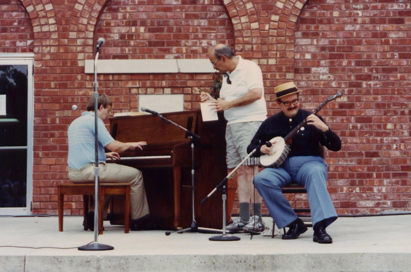
In the 1870s brothels were distributed throughout the city, but in the 1890s, they became more concentrated above businesses on West Main Street, as the middle class tried to isolate less desirable elements in town. These establishments also employed musicians, particularly piano players, contributing to a thriving musical culture. It fostered the development of many artists, including the renowned ragtime composer Scott Joplin.
20th and 21st centuries
While the city attracted many commercial travelers and railroad workers, its population of married couples and families also grew. By 1900 its population of more than 15,000 made it the sixth-largest city in the state. The entrepreneurial middle class created more formal separations between its residential areas and those of working class whites and African Americans.
During World War II, the military built Sedalia Glider Base in Johnson County to the west. After the war, this facility was transferred to the Strategic Air Command. It was converted to a bomber base, the Whiteman Air Force Base, named after 2nd Lt. George A. Whiteman, an Army Air Corps pilot who was killed during the 1941 Japanese attack on Pearl Harbor. After a massive construction program, the base became the center of 150 ICBM silos and administrative offices. These were decommissioned in the 1990s.
Sedalia is home to the nation's first sheltered workshop, which opened in 1965.
The expansion of the railroad and cattle drives in the late 19th century brought many male laborers to the rough town on the frontier. It sparked the related rise of a notorious "red light district", with numerous prostitutes who did business with the men in saloons and brothels, which also featured musical entertainments.
As more families settled in the area, they made the culture more stable, creating institutions such as schools and churches. In the late 20th century, structural changes in the railroads meant the loss of many industrial jobs, but the city has held on to a population close to its 1960 peak while developing new bases for the economy. The city is informally known as the "Trailer Capital of the Midwest", due to the high number of trailer manufacturers and dealers in the area.
Residents have emphasized the colorful history of the town for heritage tourism, and identified many significant historic structures for state and national recognition.
According to The History of the Boy Scouts of America (William D. Murray, 1937), the first Boy Scout Troop in Missouri (and one of the first in the nation) was formed in Sedalia in 1909, a year before the national organization was officially chartered on February 8, 1910.
Tornadoes
On October 24, 2021, a EF0 tornado touched down east of Sedalia. It is the most recent tornado to strike Sedalia.
Geography
According to the United States Census Bureau, the city has a total area of 13.32 sqmi, of which 13.29 sqmi is land and 0.03 sqmi is water.
Climate
Sedalia has a typical temperate climate. As with most continental climates, the micropolitan area has four seasons. Springs in Sedalia are noted for their rainy days and variable temperatures. Thunderstorms are common and tornadoes occur during this time of year. Summers are usually hot and humid, with droughts occurring during several summers. Autumns are usually cool and rainy, although several days of warm weather are not uncommon. Winters are generally cold, with snow accumulating several days of the winter season. Although not as common, ice storms occur as well.
| Jan record high F = 77 | Feb record high F = 78 | Mar record high F = 90 | Apr record high F = 92 | May record high F = 96 | Jun record high F = 105 | Jul record high F = 116 | Aug record high F = 107 | Sep record high F = 107 | Oct record high F = 97 | Nov record high F = 85 | Dec record high F = 75 | year record high F =
|Jan avg record high F = 63.7 |Feb avg record high F = 69.0 |Mar avg record high F = 77.6 |Apr avg record high F = 84.0 |May avg record high F = 87.4 |Jun avg record high F = 92.1 |Jul avg record high F = 96.3 |Aug avg record high F = 96.6 |Sep avg record high F = 91.6 |Oct avg record high F = 84.8 |Nov avg record high F = 73.7 |Dec avg record high F = 66.1 |year avg record high F = 97.9
|Jan avg record low F = -2.1 |Feb avg record low F = 3.2 |Mar avg record low F = 13.4 |Apr avg record low F = 26.8 |May avg record low F = 37.3 |Jun avg record low F = 50.1 |Jul avg record low F = 56.6 |Aug avg record low F = 53.5 |Sep avg record low F = 39.9 |Oct avg record low F = 27.2 |Nov avg record low F = 16.0 |Dec avg record low F = 5.6 |year avg record low F = -6.1
| Jan record low F = −23 | Feb record low F = −30 | Mar record low F = −17 | Apr record low F = 15 | May record low F = 26 | Jun record low F = 40 | Jul record low F = 44 | Aug record low F = 39 | Sep record low F = 27 | Oct record low F = 17 | Nov record low F = −6 | Dec record low F = −28 | year record low F =
| access-date = August 2, 2021}} | access-date = August 2, 2021}}
Demographics
|align-fn=center

Sedalia had a population of around 300 people in 1860, and what was described as a "bona fide population" of around 1,000 in 1865. Sedalia has recently become home to many immigrants from Russia or former Soviet bloc nations, who may account for up to 15% of the population. Most of the Russian and Ukrainian immigrants who live in Sedalia are members of one of the seven Pentecostal Churches there.
2020 census
The 2020 United States census counted 21,725 people, 8,750 households, and 5,056 families in Sedalia. The population density was 1,520.3 per square mile (587.2/km). There were 10,109 housing units at an average density of 707.4 per square mile (273.2/km). The racial makeup was 77.12% (16,754) white, 5.37% (1,166) black or African-American, 0.67% (145) Native American, 0.8% (173) Asian, 0.35% (76) Pacific Islander, 6.85% (1,488) from other races, and 8.85% (1,923) from two or more races. Hispanic or Latino of any race was 12.9% (2,794) of the population.
Of the 8,750 households, 25.5% had children under the age of 18; 41.0% were married couples living together; 32.0% had a female householder with no husband present. Of all households, 36.7% consisted of individuals and 14.3% had someone living alone who was 65 years of age or older. The average household size was 2.4 and the average family size was 3.1.
24.6% of the population was under the age of 18, 9.7% from 18 to 24, 26.3% from 25 to 44, 22.4% from 45 to 64, and 16.5% who were 65 years of age or older. The median age was 35.5 years. For every 100 females, the population had 97.5 males. For every 100 females ages 18 and older, there were 91.9 males.
The 2016-2020 5-year American Community Survey estimates show that the median household income was $42,152 (with a margin of error of +/- $2,806) and the median family income was $55,083 (+/- $4,958). Males had a median income of $31,223 (+/- $1,860) versus $21,210 (+/- $2,076) for females. The median income for those above 16 years old was $26,397 (+/- $1,258). Approximately, 12.2% of families and 18.1% of the population were below the poverty line, including 24.3% of those under the age of 18 and 11.1% of those ages 65 or over.
2010 census
As of the census of 2010, there were 21,387 people, 8,850 households, and 5,226 families residing in the city. The population density was 1609.3 PD/sqmi. There were 9,979 housing units at an average density of 750.9 /sqmi. The racial makeup of the city was 85.3% White, 5.2% African American, 0.5% Native American, 0.7% Asian, 0.1% Pacific Islander, 5.2% from other races, and 3.0% from two or more races. Hispanic or Latino of any race were 9.0% of the population.
There were 8,850 households, of which 31.8% had children under the age of 18 living with them, 39.3% were married couples living together, 14.4% had a female householder with no husband present, 5.3% had a male householder with no wife present, and 40.9% were non-families. 34.1% of all households were made up of individuals, and 13.6% had someone living alone who was 65 years of age or older. The average household size was 2.36 and the average family size was 3.00.
The median age in the city was 34.6 years. 25% of residents were under the age of 18; 11% were between the ages of 18 and 24; 26% were from 25 to 44; 23% were from 45 to 64; and 15% were 65 years of age or older. The gender makeup of the city was 48% male and 52% female.
2000 census
As of the census of 2000, there were 20,339 people in the city, organized into 8,628 households and 5,228 families. The population density was 1,700.8 PD/sqmi. There were 9,419 housing units at an average density of 787.6 /sqmi. The racial makeup of the city was 88.6% White, 5.0% African American, 0.4% Asian, 0.4% Native American,
There were 8,628 households, out of which 28.8% had children under the age of 18 living with them, 44.0% were married couples living together, 12.6% had a female householder with no husband present, and 39.4% were non-families. 33.1% of all households were made up of individuals, and 14.7% had someone living alone who was 65 years of age or older. The average household size was 2.32 and the average family size was 2.94.
In the city, the population was spread out, with 24.7% under the age of 18, 10.8% from 18 to 24, 27.7% from 25 to 44, 19.4% from 45 to 64, and 17.4% who were 65 years of age or older. The median age was 36 years. For every 100 females, there were 90.0 males. For every 100 females age 18 and over, there were 86.3 males.
The median income for a household in the city was $28,641, and the median income for a family was $34,938. Males had a median income of $28,208 versus $19,520 for females. The per capita income for the city was $15,931. 15.3% of the population and 12.5% of families were below the poverty line. Out of the total population, 20.8% of those under the age of 18 and 10.5% of those 65 and older were living below the poverty line.
Arts and culture
Carnegie Library
The Sedalia Public Library was the first Carnegie Grant awarded in Missouri. The Board of Trustees received word of the $50,000 grant in the fall of 1899. After securing the property on which to build, and having gained voter approval of a tax to support the library, the Board laid the cornerstone in 1900. The building was completed in July 1901. Dedicated in 1901, the library is listed on the National Register of Historic Places.
Museums
Sedalia is home to the Daum Museum of Contemporary Art, named after its primary benefactor, Sedalia radiologist and art collector Harold Daum. The museum, located on the State Fair Community College campus, is home to the works of many famous artists including Dale Chihuly (1941–), Sam Francis (1923–1994), Helen Frankenthaler (1928–), Sol LeWitt (1928–2007), Robert Motherwell (1915–1991), Julian Schnabel (1951–), and Andy Warhol (1928–1987).
The 16000 sqft museum, designed by St. Louis-based Gunn & Smith Architects, features three stories of gallery space—including a 3400 sqft main gallery with a translucent clerestory, a cantilevered stairway, a two-story atrium, and an open-air sculpture court. It features both permanent displays as well as temporary displays from world-renowned artists.

Sedalia is also home to The Pettis County Museum and Historical Society, located at 228 Dundee Ave. The building was once a Jewish Synagogue and features many Historical artifacts from all periods of Pettis County history. It is currently open on Friday and Saturday from 1:00pm to 4:00pm, and by appointment at other times.
State Fair
Since 1901, the Missouri State Fair has been held in Sedalia every August, with the exception of 1943 and 1944 because of World War II. Many singers and actors make the annual trip to the fair. Ronald Reagan, George W. Bush and other presidents have given speeches on the fairgrounds, though not during the State Fair.
In 1974, the Missouri State Fairgrounds was the site of the Ozark Music Festival, one of the largest but least remembered major music festivals of the 1970s. While the plan was for the pop/rock/bluegrass festival's selling about 50,000 tickets, an influx of about 184,000 fans and many rock bands strained the capacity of the fairgrounds and the city. Some estimates put the crowd count at 350,000. It counts as one of the largest music events (Rock Festivals) in history. The festival, hosted by Wolfman Jack, took out a full-page ad in Rolling Stone magazine and attracted people from outside the region.
Historic sites
The following Sedalia locations have been listed on the National Register of Historic Places:
- Building at 217 West Main Street, former brothel
- G and G Veterinary Hospital
- William H. Gentry House
- John T. and Lillian Heard House
- Harris House
- Hotel Bothwell
- C.C. Hubbard High School
- Henry Jones Farmstead
- McVey School
- Missouri, Kansas and Texas Railroad Depot
- Missouri/Sedalia Trust Company
- Missouri State Fairgrounds Historic District
- Sedalia Commercial Historic District
- Sedalia Public Library
Little Sister of Liberty
In 1950, to celebrate its fortieth anniversary—which had the theme of "Strengthen the Arm of Liberty"—the Boy Scouts of America donated two hundred 8 ft 6in (260 cm) copper replicas of the Statue of Liberty, which were known collectively as the "Little Sisters of Liberty", to various communities in 39 states. The project was the brainchild of the Scout Commissioner of the (then) Kansas City Area Council, Kansas City businessman J.P. Whitaker.
One of the 200 replicas was donated to Sedalia; and it was installed at the County Courthouse.The following unsigned tribute appeared on the plaque affixed to its base:
::40TH ANNIVERSARY CRUSADE TO
::1950 :Taken from the Smithsonian American Art Museum's Inventory of American Sculpture, Control Number MO000269.
''A Sedalia Christmas''
A Sedalia Christmas is a multi-media play written in celebration of the Christmas traditions and celebrations of Sedalia from 1866 to 1969. It was written by Rebecca Imhauser, a Sedalia native. Local actors and actresses portray Sedalians and the events that shaped their lives. Historic photos are projected during the play to represent pivotal time frames, with an emphasis on Christmas during the depression and World War II eras. Sedalia's Christmas heritage is celebrated through favorite holiday and patriotic songs, as well as choreographed dance numbers. This musical is set in Sedalia. Imhauser, a member of the Board of the Liberty Center Arts Association, created the show in 2008, basing it on her own knowledge, extensive research of Sedalia's history and from her book All Along Ohio Street. The musical was first performed in the Liberty Center, a theater in downtown Sedalia, on December 5, 2008. It was shown again in December 2009 with an improved script and a slightly altered cast.
Education
Sedalia School District 200 administers one early childhood center, five elementary schools, one middle school, one junior high school, and two high schools, Whittier High School (an alternative school) and Smith-Cotton High School. Sacred Heart Elementary and High School, St. Paul's Lutheran School, and Applewood Christian School are private institutions.
State Fair Community College is a public two-year institution offering post-secondary college level courses.
George R. Smith College, a historically black college (HBCU), operated from 1894 until it burned down on April 26, 1925.
The Sedalia Business College and Institute of Penmanship was founded in 1881. It was the predecessor of Robbins' Business College, founded by Clark W. Robbins (1858–1918) in 1883. This evolved into Central Business College.
Media
Newspapers
A number of newspapers have been published in Sedalia, in alphabetical order:
- The Daily Democrat (1871–1873)
- The Independent Press (1871–1873)
- The Pacific Enterprise (1863–1864)
- The Sedalia Advertiser (1864–1865)
- The Sedalia Bazoo (1881–1895)
- The Sedalia Capital
- The Sedalia Daily Democrat (1874–1925)
- The Sedalia Democrat (1949–)
- The Sedalia News-Journal (2003–)
- The Sedalia Times
Radio stations
- KSDL 92.3FM (Sedalia) http://www.ksdl.com
- KSIS 1050 AM (Sedalia) http://www.ksisradio.com
- KXKX 105.7 FM (Sedalia)http://www.kxkx.com/
- KDRO 1490 AM (Sedalia)http://www.kdro.com
- KPOW 97.7 FM (Sedalia)http://www.power977.com
Television stations
- KMOS-TV (Channel 6) http://www.kmos.org
- K11OJ-TV (Channel 11)
Infrastructure
Transportation
Air
- Sedalia Regional Airport
Train
- Sedalia (Amtrak station)
Notable people
In popular culture
Film
The 1948 film Scudda Hoo! Scudda Hay! premiered at Fox Theatres. The premiere was attended by Lon McCallister, Colleen Townsend, Luanne Hogan and Betty Ann Lynn. A crowd of over 10,000 gathered to watch the celebrities paraded through downtown Sedalia on a donkey cart.

In the American television movie The Day After (1983), aired by ABC, Sedalia is destroyed when the Soviet Union attacks the Minuteman II Missile silos around the area. At the time of the movie's release, 150 of the missiles were located in the Sedalia area in underground silos. They had been sited there since activation in early 1964 of the first Minuteman missiles under the control of the 351st Missile Wing located at Whiteman Air Force Base. The release of the movie led to a significant (if belated) increase in local community concern about the missiles. Concern remained high until all the missiles were dismantled between 1992 and 1997 as a result of the Strategic Arms Reduction Treaty between the United States and Russia.
Sedalia was featured in two widely seen 1977 films: Heroes, starring Henry Winkler and Harrison Ford; and the made-for-TV movie Scott Joplin, starring Billy Dee Williams.
Sedalia was mentioned briefly in the motion picture MASH. Parts of the 1941 film Bad Men of Missouri are set in Sedalia. The city was mentioned in Old Yeller.
Television
The classic, long running Western series Rawhide, which ran on CBS from 1959 to 1966, featured Sedalia as a destination for cattle drives. It starred Eric Fleming as the trail boss, Gil Favor, and the emerging Clint Eastwood as the "ramrod" (i.e., second in charge), Rowdy Yates.
Music
Sedalia is well known as the adopted home of ragtime music's most well known musician and stylist Scott Joplin. Joplin's famous Maple Leaf Rag was named for a saloon in Sedalia. Sedalia was also the hometown to Joe Harris, vocalist and trombonist with Benny Goodman and His Orchestra and later MGM Studios.
In 1935, in the midst of the Great Depression, which affected Sedalia severely, Abe Rosenthal along with other music-loving residents formed the Sedalia Symphony Society and established a symphony orchestra, which, as the second oldest in Missouri, celebrated its 75th season in 2009–2010.
Sedalia has been the host to several rock and roll events, such as the Ozark Music Festival in 1974, and the Delicious Rox Festival in 2006.
References
References
- "ArcGIS REST Services Directory". United States Census Bureau.
- "U.S. Census website". [[United States Census Bureau]].
- {{GNIS. 2396567
- "Find a County". National Association of Counties.
- (April 2020{{cbignore)
- Ihrig, et al., 1960, p.5.
- Also christening the city "The Queen of the Prairies" (Ihrig, et al., 1960, p.9).
- [http://www.rootsweb.com/~mopettis/bio/SmithGR.html "GEORGE R. SMITH"], Rootsweb, accessed 10 February 2008. Website states content was "excerpted" from Conard, H.L. (ed), ''Encyclopedia of the History of Missouri (in Six Volumes)'', The Southern History Company, (New York), 1901; the volume and page numbers were not cited.
- Ihrig, et al., 1960, p.8.
- Ihrig, et al., 1960, pp.2, 8.
- Ihrig, et al., 1960, p.7.
- (June 14, 2004). "Ladies of the Evening: Prostitution and Class in a 19th-century Railroad Town". University of Missouri.
- Ihrig, et al., 1960, p.10.
- link. (2013-05-21 , History Sites)
- Mueller, (2007), pp.85–86
- Ihrig, et al., 1960, p.13.
- Whites (2004), "Ladies of the Evening," pp. 155-157
- Staff, KMBC 9 News. (2021-10-25). "National Weather Service says several tornadoes touched down Sunday in Missouri".
- "US Gazetteer files 2010". [[United States Census Bureau]].
- Ihrig et al., (1960 p. 123) also noted "There is considerable disagreement about the 1950 census, as critics contend that many people were missed. The "Survey on {{sic Buying Power" [viz., the ''Sales and Marketing Management'' magazine's annual Survey of Buying Power] indicates an estimated population of 26,300 on January 1, 1958. The 1960 census had not been taken when this [centenary] history was written, but the 1960 population of Sedalia was estimated to be between 28,000 and 30,000."
- Ihrig et al. (1960 p. 12)
- The significance of the description of "bona fide population" is that "from 1861 to 1864 Missouri was under martial law and Sedalia, as a military post, was governed by the post commander. There was no mayor, council or executive or legislative body except the military power" (Ihrig et al., 1960 p.12).
- (2006). "The Most Russian City in the U.S.".
- [https://meduza.io/en/feature/2015/05/20/i-ve-seen-hell-and-it-is-real "‘I’ve seen hell, and it is real’ - Ukrainian Pentecostals in the American Midwest ..."] at Meduza — The Real Russia. Today. Retrieved September 30, 2019.
- "Explore Census Data".
- "Explore Census Data".
- "U.S. Census website". [[United States Census Bureau]].
- [http://www.librarytechnology.org/lwc-displaylibrary.pl?RC=20320 Sedalia Public Library - Sedalia, MO [lib-web-cats]]
- "Daum Museum of Contemporary Art".
- "Daum Museum of Contemporary Art".
- Kinzer, S., " IN THE MIDDLE; What's This? An Art Boom In the Heartland", ''New York Times'', (24 April 2002), pp.E1–E2.
- [[List of Registered Historic Places in Missouri, Counties O-St.#Pettis County. "Registered Historic Places in Pettis County, MO"]], Wikipedia
- "Building at 217 West Main Street NRHP nomination".
- (2011-04-22). "National Register of Historic Places Listings". National Park Service.
- "William H. Gentry House NRHP nomination".
- {{NRISref
- "NRHP nomination".
- "NRHP nomination".
- "Hotel Bothwell NRHP nomination".
- "McVey School NRHP nomination".
- "Missouri, Kansas and Texas Railroad Depot NRHP nomination".
- "Missouri/Sedalia Trust Company NRHP nomination".
- [http://www.dnr.mo.gov/shpo/nps-nr/91000853.pdf Missouri State Fairgrounds Historic District NRHP nomination]
- "Sedalia Commercial Historic District NRHP nomination".
- [http://www.dnr.mo.gov/shpo/nps-nr/80002389.pdf Sedalia Public Library NRHP nomination]{{Dead link. (December 2025)
- [http://www.scoutingmagazine.org/issues/0710/d-wwas.html Attoun, M., "Little Sisters of Liberty", ''Scouting'', (October 2007)]
- [http://troop101.thescouts.com/liberty Boy Scouts of America, Troop 101, Cheyenne, Wyoming: Replica Statue of Liberty Search (includes a photograph of Sedalia's "Little Sister of Liberty")] {{webarchive. link. (2008-02-10)
- [http://kxkx.com/a-sedalia-christmas-celebrates-local-holiday-traditions/ "A Sedalia Christmas" Celebrates Local Holiday Traditions]
- [http://923bobfm.com/events-sedalia/lcaa-auditions-for-a-sedalia-christmas/17-september-2013-liberty-center/ LCAA Auditions for A Sedalia Christmas]
- [https://books.google.com/books?id=BmU3X_ZMG7cC&dq=Christmas+is+a+multimedia+holiday+production&pg=PA17 Legendary Locals of Sedalia, Missouri] By Rebecca Carr Imhauser (Google Books)
- [http://www.beckyimhauser.com/about.html Becky Carr Imhauser] {{Webarchive. link. (August 28, 2018 personal website)
- [https://issuu.com/missourilifemagazine/docs/ml_1208_lr Missouri Life Magazine], page 25
- "Whittier High School". Sedalia 200 School District.
- "Homepage". Sedalia 200 School District.
- "Homepage". Sacred Heart School.
- "Homepage". Sedalia St. Paul's Lutheran School.
- "Homepage". Applewood Christian School.
- "George R. Smith College". Lost Colleges.
- Conroy, (2009), pp. 15–25.
- (2013). "Legendary Locals of Sedalia, Missouri". Arcadia.
- "''Scott Joplin'' (1977)". IMDb.com.
- James Lincoln Collier, Benny Goodman and the Swing Era, Oxford University Press, page 199
This article was imported from Wikipedia and is available under the Creative Commons Attribution-ShareAlike 4.0 License. Content has been adapted to SurfDoc format. Original contributors can be found on the article history page.
Ask Mako anything about Sedalia, Missouri — get instant answers, deeper analysis, and related topics.
Research with MakoFree with your Surf account
Create a free account to save articles, ask Mako questions, and organize your research.
Sign up freeThis content may have been generated or modified by AI. CloudSurf Software LLC is not responsible for the accuracy, completeness, or reliability of AI-generated content. Always verify important information from primary sources.
Report