From Surf Wiki (app.surf) — the open knowledge base
Scheldt
River in France, Belgium and the Netherlands

River in France, Belgium and the Netherlands
| Field | Value |
|---|---|
| name | Scheldt |
| name_native | |
| image | Schelde_Antwerpen.jpg |
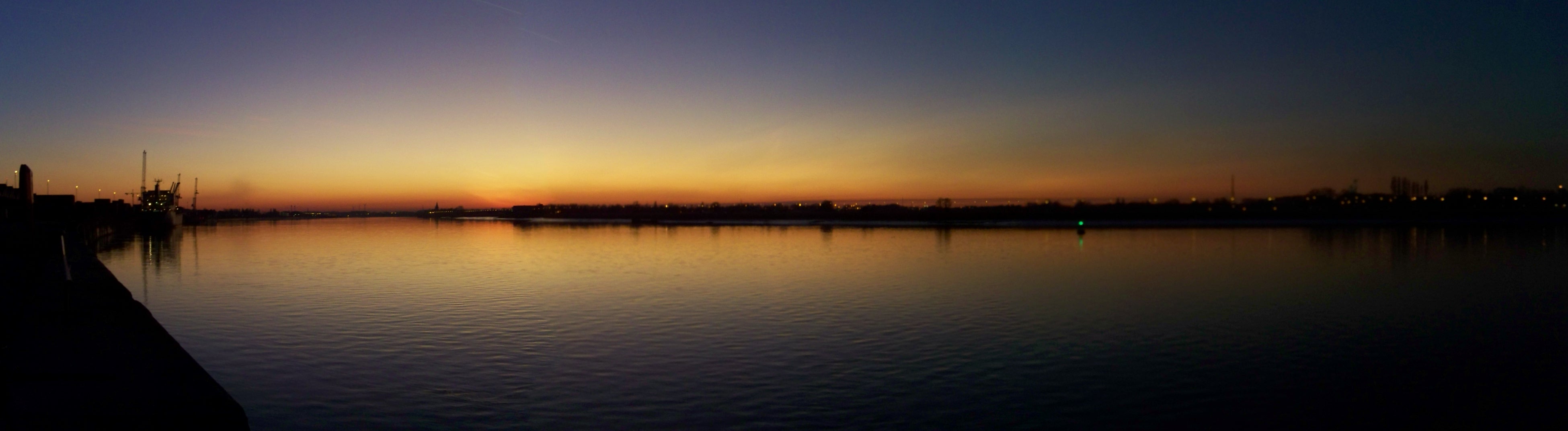
| image_caption | The Scheldt in Antwerp |
| pushpin_map | France#Belgium#Netherlands |
| mapframe | yes |
| mapframe-zoom | 6 |
| source1_location | France |
| mouth_location | North Sea |
| mouth_coordinates | |
| subdivision_type1 | Countries |
| subdivision_name1 | |
| length | 360 km |
| source1_elevation | 97 m |
| discharge1_avg | 104 m3/s |
| basin_size | 21,863 km2 |
| map | Locatiemaas2.GIF |
| map_caption | Course of the Scheldt |
| embed | yes |
| designation1 | Ramsar |
| designation1_offname | Schorren van de Beneden Schelde |
| designation1_date | 4 March 1986 |
| designation1_number | 327 |
| designation2 | Ramsar |
| designation2_offname | Westerschelde & Saeftinghe |
| designation2_date | 9 April 1995 |
| designation2_number | 748 |
| designation3 | Ramsar |
| designation3_offname | Vallées de la Scarpe et de l'Escaut |
| designation3_date | 2 February 2020 |
| designation3_number | 2405 |
| mapframe-zoom = 6
The Scheldt ( ; ; ) is a 435 km{{Cite web | access-date = 2014-06-03
Course
The headwaters of the Scheldt are in Gouy, in the Aisne department of northern France. It flows north through Cambrai and Valenciennes, and enters Belgium near Tournai. Ghent developed at the confluence of the Lys, one of its main tributaries, and the Scheldt, which then turns east. Near Antwerp, the largest city on its banks, the Scheldt flows west into the Netherlands toward the North Sea.
Originally there were two branches from that point: the Oosterschelde (Eastern Scheldt); and the Westerschelde (Western Scheldt). In the 19th century, however, the Dutch built a dyke that cuts the river off from its eastern (northern) branch and connects Zuid-Beveland with the mainland (North Brabant). Today the river continues into the Westerschelde estuary only, passing Terneuzen to reach the North Sea between Breskens in Zeelandic Flanders and Vlissingen (Flushing) on Walcheren.
The Scheldt is an important waterway, and has been made navigable from its mouth up to Cambrai. Above Cambrai, the Canal de Saint-Quentin follows its course. The port of Antwerp, the second-largest in Europe, developed on its banks. Several canals (including the Scheldt-Rhine Canal connecting Antwerp to Rotterdam, the Albert Canal connecting it to Liège and the Brussel-Scheldt, Brussels and Brussels-Charleroi canals connecting it to Charleroi via Brussels) connect the Scheldt with the basins of the Rhine, Meuse, and Seine rivers, and with the industrial areas around Brussels, Liège, Lille, Dunkirk, and Mons.
The Scheldt flows through the following departments of France, provinces of Belgium, provinces of the Netherlands, and towns:
- Aisne (F): Gouy
- Nord (F): Cambrai, Denain, Valenciennes
- Hainaut (B): Tournai
- West Flanders (B): Avelgem
- East Flanders (B): Oudenaarde, Ghent, Dendermonde, Temse
- Antwerp (B): Antwerp
- Zeeland (NL): Hulst, Terneuzen, Sluis, Vlissingen
History


The Scheldt estuary has always had considerable commercial and strategic importance. Called Scaldis in Roman times, it was important for the shipping lanes to Roman Britain. Nehalennia was venerated at its mouth. The Franks took control over the region about the year 260 and at first interfered with the Roman supply routes as pirates. Later they became allies of the Romans. With the various divisions of the Frankish Empire in the 9th century, the Scheldt eventually became the border between the Western and Eastern parts of the Empire, which later became France and the Holy Roman Empire.
This status quo remained intact, at least on paper, until 1528, but by then, both the County of Flanders on the western bank and Zeeland and the Duchy of Brabant on the east were part of the Habsburg possessions of the Seventeen Provinces. Antwerp was the most prominent harbour in Western Europe. After this city fell back under Spanish control in 1585, the Dutch Republic took control of Zeelandic Flanders, a strip of land on the left bank, and closed the Scheldt for shipping. That shifted the trade to the ports of Amsterdam and Middelburg and seriously crippled Antwerp, an important and traumatic element in the history of relations between the Netherlands and what was to become Belgium.
Access to the river was the subject of the brief Kettle War of 1784, and during the French Revolution shortly afterwards, the river was reopened in 1792. Once Belgium had claimed its independence from the Netherlands in 1830, the treaty of the Scheldt determined that the river should remain accessible to ships heading for Belgian ports. Nevertheless, the Dutch government would demand a toll from passing vessels until 16 July 1863.
The Question of the Scheldt, a study providing "a history of the international legal arrangements governing the Western Scheldt", was prepared for the use of British negotiators at the Treaty of Versailles in 1919.{{Cite book | access-date = 2014-06-03
In the Second World War, the Scheldt estuary once again became a contested area. Despite Allied control of Antwerp, German forces still occupied fortified positions in September 1944 throughout the Scheldt estuary west and north, preventing any Allied shipping from reaching the port. In the Battle of the Scheldt, the Canadian First Army successfully cleared the area, allowing supply convoys direct access to the port of Antwerp by November 1944.
Tributaries and sub-tributaries
- Western Scheldt or Honte (Vlissingen)
- Schijn (Antwerp)
- Rupel (Rupelmonde)
- Nete (Rumst)
- Kleine Nete (Lier)
- Aa (Grobbendonk)
- Wamp (Kasterlee)
- Grote Nete (Lier)
- Wimp (Herenthout)
- Molse Nete (Geel)
- Laak (Westerlo)
- Kleine Nete (Lier)
- Dijle (Rumst)
- Zenne (Mechelen)
- Maalbeek (Grimbergen)
- Woluwe (Vilvoorde)
- Maalbeek (Schaerbeek)
- Molenbeek (Brussels-Laeken)
- Neerpedebeek (Anderlecht-Neerpede)
- Zuun (Sint-Pieters-Leeuw-Zuun)
- Geleytsbeek (Drogenbos)
- Linkebeek (Drogenbos)
- Molenbeek (Lot)
- Senette (Tubize)
- Hain (Tubize)
- Samme (Braine-le-Comte-Ronquières)
- Thines (Nivelles)
- Vrouwvliet (Mechelen) further upstream named [Grote Beek, Meerloop, Raambeek, Zwartwaterbeek, Boeimeer]
- Demer (Rotselaar)
- Velp (Halen)
- Gete (Halen)
- Herk (Halen)
- Melsterbeek (Herk-de-Stad)
- Grote Gete (Zoutleeuw)
- Kleine Gete (Zoutleeuw)
- Herk (Halen)
- Voer (Leuven)
- IJse (Huldenberg-Neerijse)
- Nethen (Grez-Doiceau-Nethen)
- (Huldenberg-Terlanen-Sint-Agatha-Rode)
- Zilverbeek (Rixensart-Genval)
- Thyle (Ottignies-Louvain-la-Neuve)
- Zenne (Mechelen)
- Nete (Rumst)
- Durme (Temse)
- Molenbeek (Wichelen)
- Dender (Dendermonde)
- Mark (Lessines-Twee-Akren)
- Ruisseau d'Ancre (Lessines)
- Zulle (Ath)
- Eastern Dender (Ath)
- Western Dender (Ath)
- Molenbeek-Ter Erpenbeek (Hofstade)
- Lys/Leie (Ghent)
- Mandel (Wielsbeke)
- Heulebeek (Kuurne)
- Gaverbeek (Kortrijk)
- Douve (Comines-Warneton)
- Deûle/Deule or Feule (Deûlémont)
- Marque (Wasquehal)
- Souchez (Lens)
- Carency (Souchez)
- Saint-Nazaire (Souchez)
- Laquette (Aire-sur-la-Lys)
- Lawe (De Gorge-Stegers)
- Brette, (Biette), Blanche, ruisseau de Caucourt, fossé d'Avesnes (Loisne)
- Clarence (Meregem)
- Nave, Grand Nocq
- Becque de Steenwerk (..)
- Zwalm (Zwalm)
- Rone (Kluisbergen)
- Rhosne (Ronse)
- Scarpe (Mortagne-du-Nord)
- Crinchon (..)
- Ugy (..)
- Haine (Condé-sur-l'Escaut)
- Trouille (Mons-Jeumont)
- Hogneau of Honneau (Condé-sur-l'Escaut)
- Honelle (Quiévrain)
- Aunelle (..)
- Grande Honelle (..)
- Petite Honelle (..)
- Honelle (Quiévrain)
- Rhonelle (Valenciennes)
- Écaillon (Thiant)
- Selle (Denain)
- Torrent d'Esnes
- Sensée (Bouchain)
- Hirondelle (..)
- Erclin (Iwuy)
- Eauette (Marcoing)
Navigation

Canalisation from Cambrai down to Valenciennes was completed in 1788. Napoleon saw the benefits of linking Paris to Belgium and accelerated completion of the Canal de Saint-Quentin to the south. The locks were deepened and doubled, as coal became the essential commodity of the industrial revolution. Upgrading downstream from Bouchain was started in the 1960s in both France and Flanders, but the waterway is still not fully compliant with European standards. All the locks on the high-capacity section are being doubled by European Class Vb size locks, 185 by, as part of the overall European Seine-Scheldt waterway project. The Pont des Trous, a listed fortified bridge in Tournai that has already been substantially modified, will again be raised to provide the necessary dimensions, including an air draught of 7.10 m.
The 13 km section between Cambrai (connection with Canal de Saint-Quentin) and Hordain (connection with Canal de la Sensée) is only navigable for small ships (péniche) and has 5 locks.
References
References
- "Schorren van de Beneden Schelde".
- "Westerschelde & Saeftinghe".
- "Vallées de la Scarpe et de l'Escaut".
- "Avalon Project - Belgian-American Diplomacy - Convention for the Extinguishment of the Scheldt Dues: July 20, 1863".
- Zuehlke, Mark. (2009). "Terrible Victory: First Canadian Army and the Scheldt Estuary Campaign: September 13 - November 6, 1944". Douglas & McIntyre.
- {{sandre
- Edwards-May, David. (2010). "Inland Waterways of France". Imray.
- [http://www.fluviacarte.com/fr/voies-navigables/region-r-1/voie--18 Fluviacarte], Escaut (à petit gabarit)
This article was imported from Wikipedia and is available under the Creative Commons Attribution-ShareAlike 4.0 License. Content has been adapted to SurfDoc format. Original contributors can be found on the article history page.
Ask Mako anything about Scheldt — get instant answers, deeper analysis, and related topics.
Research with MakoFree with your Surf account
Create a free account to save articles, ask Mako questions, and organize your research.
Sign up freeThis content may have been generated or modified by AI. CloudSurf Software LLC is not responsible for the accuracy, completeness, or reliability of AI-generated content. Always verify important information from primary sources.
Report