From Surf Wiki (app.surf) — the open knowledge base
Scenic Rim Region

| Field | Value | |
|---|---|---|
| type | lga | |
| name | Scenic Rim Region | |
| state | qld | |
| image | ScenicRimRegion-QldLGA.svg | |
| caption | Location within South East Queensland | |
| pop | 42984 | |
| pop_year | ||
| pop_footnotes | ||
| area | 4243 | |
| area_footnotes | ||
| mayor | Tom Sharp | |
| seat | Beaudesert | |
| region | West Moreton | |
| stategov | Scenic Rim | |
| fedgov | Wright | |
| logo | Scenic rim regional council.svg | url = https://www.scenicrim.qld.gov.au/ |
| near-n | Ipswich | |
| near-ne | Logan | |
| near-e | Gold Coast | |
| near-se | Tweed (NSW) | |
| near-s | Kyogle (NSW) | |
| near-sw | Southern Downs | |
| near-w | Southern Downs | |
| near-nw | Lockyer Valley | |
| est | 2008 |
local government
| near-n = Ipswich | near-ne = Logan | near-e = Gold Coast | near-se = Tweed (NSW) | near-s = Kyogle (NSW) | near-sw = Southern Downs | near-w = Southern Downs | near-nw = Lockyer Valley
The Scenic Rim Region is a local government area (LGA) in the West Moreton region of South East Queensland, Australia. Established in 2008, it was preceded by several previous local government areas with histories extending back to the early 1900s and beyond. The main town of the region is Beaudesert.
It has an estimated operating budget of A$33 million.
In the , the Scenic Rim Region had a population of 42,984 people.
History
Prior to 2008, the new Scenic Rim Region was an entire area of three previous and distinct local government areas:
- the Shire of Boonah;
- the southern part of the Shire of Beaudesert;
- and the Harrisville and Peak Crossing areas from the City of Ipswich.


In July 2007, the Local Government Reform Commission released its report and recommended that the areas amalgamate. It identified a rural community of interest as well as ecotourism potential from the Scenic Rim, a group of mountain ranges forming part of the Great Dividing Range, and recommended the transfer of the entire urban growth corridor previously within Beaudesert to Logan City. Along with Lockyer Valley and Somerset, it was expected to provide a rural hinterland for urban South East Queensland. The arrangement was Boonah's second preference (its first was simply absorbing the rural areas of Ipswich) while Beaudesert opposed splitting or amalgamation.
The legislation passed to effect the merger on 10 August 2007. A Local Transition Committee made up of staff and councillors of the dissolving entities was formed to manage the process. On 15 March 2008, the Shires formally ceased to exist, and elections were held on the same day to elect councillors and a mayor to the Regional Council.
Geography

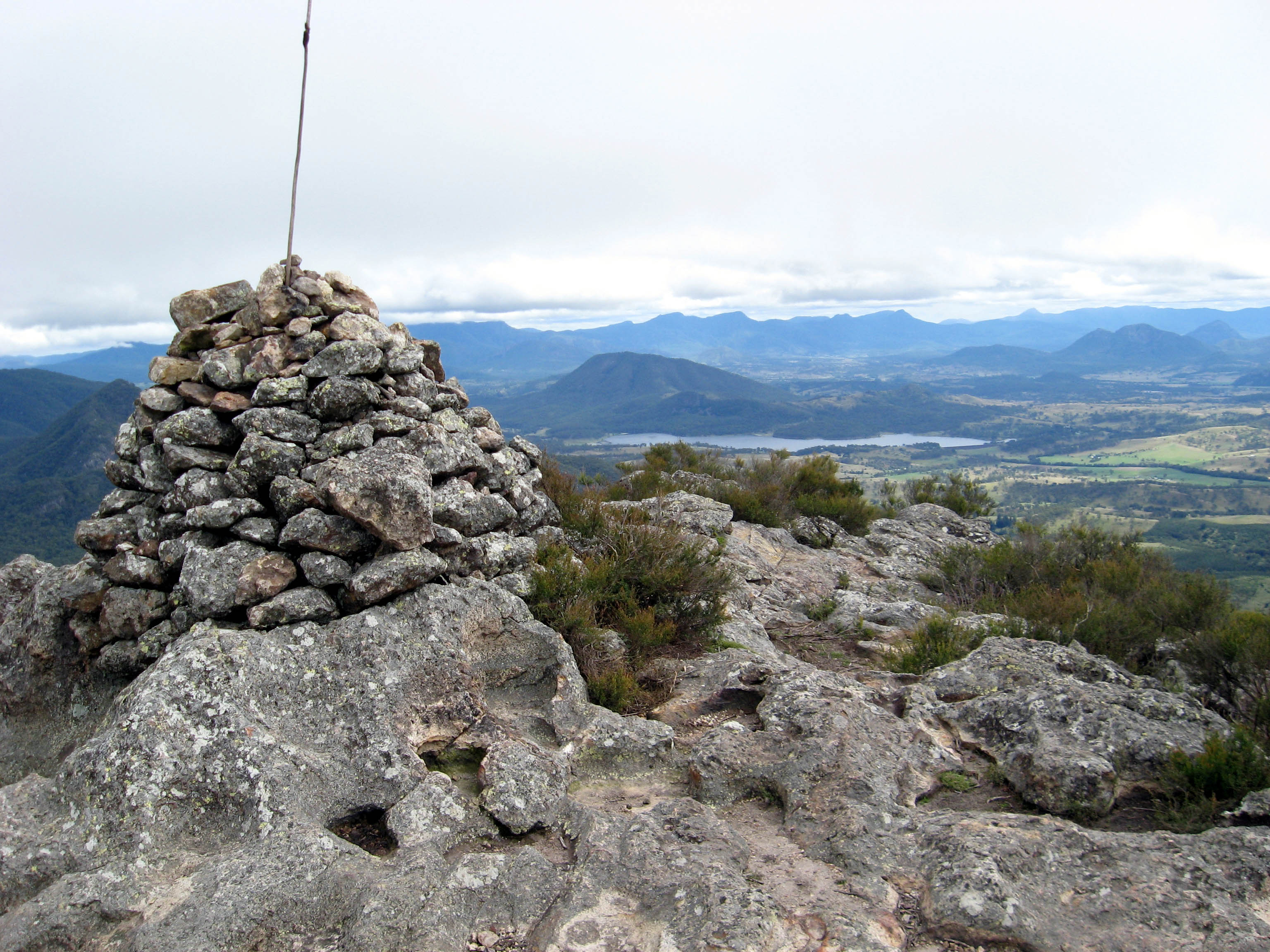
The region is mostly rural, with Beaudesert and Boonah the main towns. It lies within the catchment areas of the Bremer River, the Logan River/Albert River and the Coomera River/Nerang River. The centre of the area is dominated by the Flinders Peak Group and broad sweep of mountainous terrain forming a southern boundary with the local government area on Queensland's southern border with New South Wales. Many high-altitude areas are covered by forests and protected in national parks (including World Heritage listings) at Tamborine Mountain, McPherson Range, Main Range National Park, Mount Barney National Park and landforms including Cunninghams Gap and Fassifern Valley. South East Queensland's highest mountain is Mount Barney, reaching 1356 m above sea level. Wyaralong Dam is the region's newest reservoir.
In the south east of the local government area is the Lamington National Park. It includes villages such as Canungra, Kooralbyn, Rathdowney, Beechmont and Harrisville. The peak at Mount French, part of Moogerah Peaks National Park is noted for its traditional rock climbing and does not have bolted climbing routes. The peak also boasts a '32' rated climb (one of the hardest in the world) which attracts international rock climbing visitors to the area. The area of Boonah is fairly flat with large areas of very productive soils for the growing of vegetables and other crops. Beechmont and O'Reillys are mountainous areas overlooking the Gold Coast hinterland. These areas attract visitors for camping, bushwalking and bird watching.
Council
The council is split into six wards (divisions), each returning one councillor, along with a directly-elected mayor.
Current composition
The current council, elected in 2024, is:
| Ward | Councillor | Party | |
|---|---|---|---|
| Mayor | Tom Sharp | ||
| Division 1 | Amanda Hay | ||
| Division 2 | Kerri Cryer | ||
| Division 3 | Stephen Moriarty | ||
| Division 4 | Jennifer Sanders | ||
| Division 5 | Marshall Chalk | ||
| Division 6 | Duncan McInnes |
Mayors
John Brent was the region's first mayor. He was first elected as a councillor in the Shire of Boonah in 1976 and was chairman of the Shire of Boonah beginning on 12 April 1994, becoming mayor of the Scenic Rim Region following the amalgamation.
2008−present
| No. | Portrait | Mayor | Party | Term start | Term end | Council control | ||||||
|---|---|---|---|---|---|---|---|---|---|---|---|---|
| (term) | 1 | Independents majority | ||||||||||
| (2008–present) | 2 | (2) | 3 | |||||||||
| [[File:3x4.svg | 70px]] | John Brent | Independent | 15 March 2008 | 19 March 2016 | |||||||
| [[File:3x4.svg | 70px]] | Greg Christensen | Independent LNP | 19 March 2016 | 26 April 2023 | |||||||
| Independent | 27 April 2023 | 16 March 2024 | ||||||||||
| [[File:3x4.svg | 70px]] | Tom Sharp | Independent | 16 March 2024 | incumbent |
Deputy mayors
In 2016, the council resolved to review the position of deputy mayor annually, instead of having it be the longer-term position it was from 2008 to 2016.
| No. | Portrait | Mayor | Party | Term start | Term end | Mayor | 1 | Brent | |||||||||||
|---|---|---|---|---|---|---|---|---|---|---|---|---|---|---|---|---|---|---|---|
| (Independent) | 2 | 3 | Christensen | ||||||||||||||||
| (Ind. LNP/Independent) | 4 | 5 | 6 | 7 | 8 | 9 | Sharp | ||||||||||||
| (Independent) | |||||||||||||||||||
| [[File:3x4.svg | 70px]] | Dave Cockburn | Independent | 2008 | 2012 | ||||||||||||||
| [[File:3x4.svg | 70px]] | Virginia West | Independent | 2012 | 2016 | ||||||||||||||
| [[File:3x4.svg | 70px]] | Nigel Waistell | Independent | 2016 | 2017 | ||||||||||||||
| [[File:3x4.svg | 70px]] | Nadia O'Carroll | Independent | 2017 | 2018 | ||||||||||||||
| [[File:3x4.svg | 70px]] | Rick Stanfield | Independent | 2018 | 2019 | ||||||||||||||
| [[File:3x4.svg | 70px]] | Duncan McInnes | Independent | 2019 | 2021 | ||||||||||||||
| [[File:3x4.svg | 70px]] | Michael Enright | Independent | 2021 | 2022 | ||||||||||||||
| [[File:3x4.svg | 70px]] | Jeff McConnell | Independent | 2021 | 2024 | ||||||||||||||
| [[File:3x4.svg | 70px]] | Duncan McInnes | Independent | 2024 | incumbent |
Past councillors
2008−present
| Year | Division 1 | Division 2 | Division 3 | Division 4 | Division 5 | Division 6 | Councillor | Party | Councillor | Party | Councillor | Party | Councillor | Party | Councillor | Party | Councillor | Party | ||||||
|---|---|---|---|---|---|---|---|---|---|---|---|---|---|---|---|---|---|---|---|---|---|---|---|---|
| 2008 | independent}} | Derek Swanborough | Independent | independent}} | Richard Adams | Independent | independent}} | Virginia West | Independent | independent}} | Dave Cockburn | Independent | independent}} | Kathy Bensted | Independent | independent}} | Heather Wehl | Independent | ||||||
| 2012 | independent}} | Nigel | Independent | independent}} | Nadia O'Carroll | Independent | independent}} | Jennifer Sanders | Independent | independent}} | Rick Stanfield | Independent | independent}} | Duncan McInnes | Independent | |||||||||
| 2016 | independent}} | Michael Enright | Independent | |||||||||||||||||||||
| 2020 | independent}} | Derek Swanborough | Independent | independent}} | Jeff McConnell | Independent | independent}} | Marshall Chalk | Independent | |||||||||||||||
| 2023 | independent}} | Amanda | Independent | |||||||||||||||||||||
| 2024 | Amanda | Independent | Kerri Cryer | Independent | Stephen | Independent | Jennifer | Independent | Marshall | Independent | Duncan | Independent |
Towns and localities


The Scenic Rim Region includes the following settlements:
Beaudesert area:
- Beaudesert
- Beechmont
- Benobble
- Biddaddaba
- Birnam
- Boyland
- Bromelton
- Canungra
- Christmas Creek
- Cryna
- Gleneagle
- Hillview
- Innisplain
- Josephville
- Kerry
- Kooralbyn
- Lamington
- Lamington National Park
- Laravale
- Palen Creek
- Rathdowney
- Tabooba
- Tabragalba
- Tamborine Mountain
- Tamrookum
- Tamrookum Creek
- Witheren
- Wonglepong Boonah area:
- Boonah
- Aratula
- Charlwood
- Coulson
- Fassifern
- Harrisville1
- Kalbar
- Maroon
- Moogerah
- Mount Alford
- Mount Walker
- Roadvale
- Rosevale
- Silverdale
- Tarome
- Templin
- Warrill View
Other areas:
- Allandale
- Allenview
- Anthony
- Barney View
- Binna Burra
- Blantyre
- Bunburra
- Bunjurgen
- Burnett Creek
- Cainbable
- Cannon Creek
- Carneys Creek
- Chinghee Creek
- Clumber
- Coleyville
- Coochin
- Croftby
- Darlington
- Dugandan
- Fassifern Valley
- Ferny Glen
- Flying Fox
- Frazerview
- Frenches Creek
- Hoya
- Illinbah
- Kagaru
- Kents Lagoon
- Kents Pocket
- Knapp Creek
- Kulgun
- Limestone Ridges1
- Lower Mount Walker
- Merryvale
- Milbong
- Milford
- Milora
- Moorang
- Morwincha
- Mount Barney
- Mount Edwards
- Mount Forbes1
- Mount French
- Mount Gipps
- Mount Lindesay
- Mount Walker West
- Munbilla
- Mutdapilly1
- Nindooinbah
- North Tamborine
- Oaky Creek
- Obum Obum
- O'Reilly
- Peak Crossing1
- Radford
- Running Creek
- Sarabah
- Southern Lamington
- Tamborine2
- Teviotville
- Undullah2
- Veresdale2
- Veresdale Scrub2
- Wallaces Creek
- Washpool
- Wilsons Plains
- Woolooman
- Wyaralong
1 - split with the City of Ipswich 2 - split with Logan City
Demographics

The populations given relate to the component entities prior to 2008.
| Year | Population |
|---|---|
| 1986 | 22,992 |
| 1991 | 28,512 |
| 1996 | 32,997 |
| 2001 | 35,342 |
| 2006 | 34,659 |
In the , the Scenic Rim Region had a population of 36,456 people.
In the , the Scenic Rim Region had a population of 40,072 people.
In the , the Scenic Rim Region had a population of 42,984 people.
Heritage register
In 2014, the Scenic Rim Regional Council established its local heritage register as required by the Queensland Heritage Act 1992. In February 2015, it listed 54 places based on criteria in the Australia ICOMOS Burra Charter 1999.
Libraries
The Scenic Rim Regional Council operate libraries in Beaudesert, Boonah, Canungra and Tamborine Mountain. The council commenced a mobile library service in 2008, which serves Beechmont, Harrisville, Hillview, Kalbar, Kooralbyn, Peak Crossing, Rathdowney and Tamborine.
References
References
- (27 March 2019). "3218.0 – Regional Population Growth, Australia, 2017-18: Population Estimates by Local Government Area (ASGS 2018), 2017 to 2018". [[Australian Bureau of Statistics]].
- Queensland Local Government Reform Commission. (July 2007). "Report of the Local Government Reform Commission". Local government Reform Commission.
- "One of the most enduring leaders in Queensland local government, Scenic Rim Mayor John Brent has a blunt and simple response to questions about the role of a council and its mayor... - Local Government Association of Queensland".
- "Nomination for Mayor or Councillor". Electoral Commission of Queensland.
- (28 May 2019). "COUNCIL ELECTS NEW DEPUTY MAYOR". Scenic Rim Regional Council.
- {{Census 2011 AUS
- {{Census 2016 AUS
- {{Census 2021 AUS
- "Local Heritage Register". Scenic Rim Regional Council.
- (November 2017). "Public Libraries Statistical Bulletin 2016-17". [[State Library of Queensland]].
- "Locations and Membership".
This article was imported from Wikipedia and is available under the Creative Commons Attribution-ShareAlike 4.0 License. Content has been adapted to SurfDoc format. Original contributors can be found on the article history page.
Ask Mako anything about Scenic Rim Region — get instant answers, deeper analysis, and related topics.
Research with MakoFree with your Surf account
Create a free account to save articles, ask Mako questions, and organize your research.
Sign up freeThis content may have been generated or modified by AI. CloudSurf Software LLC is not responsible for the accuracy, completeness, or reliability of AI-generated content. Always verify important information from primary sources.
Report