From Surf Wiki (app.surf) — the open knowledge base
Scarborough, Queensland
.jpg)
| Field | Value |
|---|---|
| type | suburb |
| name | Scarborough |
| state | qld |
| image | Scarborough Beach, Redcliffe.jpg |
| caption | Scarborough Beach |
| coordinates | |
| local_map | yes |
| zoom | 12 |
| pop | 9178 |
| pop_year | |
| pop_footnotes | |
| established | 1878 |
| postcode | 4020 |
| area | 3.3 |
| timezone | AEST |
| utc | +10:00 |
| dist1 | 2.7 |
| dir1 | N |
| location1 | Redcliffe |
| dist2 | 40.5 |
| dir2 | NNE |
| location2 | Brisbane CBD |
| region | South East Queensland |
| lga | City of Moreton Bay |
| stategov | Redcliffe |
| fedgov | Petrie |
| near-n | Deception Bay |
| near-ne | Moreton Bay |
| near-e | Moreton Bay |
| near-se | Redcliffe |
| near-s | Redcliffe |
| near-sw | Newport |
| near-w | Newport |
| near-nw | Deception Bay |
| near-n = Deception Bay | near-ne = Moreton Bay | near-e = Moreton Bay | near-se = Redcliffe | near-s = Redcliffe | near-sw = Newport | near-w = Newport | near-nw = Deception Bay Scarborough is a coastal suburb on the Redcliffe Peninsula in the City of Moreton Bay, Queensland, Australia. In the , Scarborough had a population of 9,178 people.
Along with its neighbouring coastal suburbs on the Redcliffe Peninsula, the suburb is a popular recreational destination within the Brisbane metropolitan area. Scarborough Beach is a safe swimming beach, with an adjacent playground.
Geography
Scarborough is at the northernmost suburb of the Redcliffe Peninsula. It is bounded by Deception Bay (a side bay of Moreton Bay) to the north-west and by Moreton Bay to the north and east.
Scarborough has the following coastal features (from north to south):
- Castlereagh Point (Cooturrumba Point, Reef Point) ()
- Scarborough Point ()
- Scarborough Beach ()
- Drury Point ()
- Queens Beach North ()
- Osbourne Point ()
- Queens Beach () extending south into Redcliffe
History

In 1882, the proprietors of the re-surveyed town of Scarborough offered for auction, with no reserve, the remaining 250 allotments, advertising in great detail the attractions of the area. These included the "abundance of schnapper, whiting, turtle, crabs, oysters, etc awaiting capture." In 1884, land from Queen's Beach "adjoins to and forms part of the property reserved for the Hon S.W. Griffith [Samuel Griffith] for the purpose of building a seaside residence" was advertised. In 1886, land from " late marine residence of Dr Hobbs"- his house standing on three of the 295 allotments - was offered for sale. Free steamer travel, departing from Howard Smith wharves was provided on the day, Easter Monday, 16 April 1886.
In 1900–1901, allotments in the Moreton Bay Estate were advertised for sale. In the 1920s, further sales, with land north of the Redcliffe Jetty [1920], in the Walsh Estate [1927], and the Sea Breeze Estate [1929] occurred, with Silvesters, a house and land agent at Adelaide Street, Brisbane, arranging sales into the 1930s, producing an annotated map showing the location of vacant land and the asking prices. However, it was with the opening in 1935 of the Hornibrook Highway, linking the area north of Hay's Inlet to Brisbane, that lead to the rapid growth in this area.

Scarborough State School opened on 9 March 1925 with 30 students.
On Saturday 11 December 1937, a stump-capping ceremony took place for the Scarborough Methodist Church. The new church building was relocated from Deagon where it had served as a Sunday school hall. It was officially opened on Sunday 9 January 1938 by Reverend J. A. Pratt. On 28 August 1948 the foundation stone for a new Scarborough Methodist Church was laid by Reverend Hubert Hedley Trigge, the master of Kings College at the University of Queensland, with the new church building being officially opening on 1 April 1950 by Trigge, with the former church building becoming the church hall. The church is now used by the Scarborough Samoan Seventh-Day Adventist Church.
St Bernadette's Catholic Church opened at 28 Mein Street () in 1946. The architect was Frances Leo Cullen. The church was sold in 1998.
St Bernadette's Catholic School opened in 1948; it was operated by the Brigidine Sisters.
Soubirous College, a Catholic secondary school, opened on 5 February 1951.
The first St Anne's Anglican Church Hall opened at 190–192 Mein Street on Sunday 1 April 1951. Funds to build the church hall were raised in part by the sales of a book "Scarborough Calling" by Cannon William Perry French Morris. The foundation stone of the current St Anne's Anglican Church was laid by Archbishop Philip Strong on Sunday 2 November 1969, with the new church officially opening on 22 November 1970. The 1951 church hall remains on the site.
Scarborough Baptist Church opened in 1952. The Baptist church was at 151 Turner Street (), and, although still extant, it is now in private ownership.
De La Salle College, a Catholic primary and secondary school, opened on 4 February 1955.
In 1970, the senior years at Soubirous College and De Le Salle College were combined to create Frawley College, named after parish priest Monsignor Bartholomew Frawley. On 24 May 1995 the following Catholic schools combined to form Southern Cross Catholic College:
- St Bernadette's Catholic School, Scarborough
- Soubirous College, Scarborough
- De La Salle College, Scarborough
- Frawley College, Scarborough
- Our Lady Help of Christians School, Redcliffe
- Our Lady of Lourdes School, Woody Point
The suburb used to act as a gateway to Moreton Island via the Combie Trader barge, but this service ceased in July 2008 due to matters with the terminal and landing areas.
Demographics
In the , Scarborough had a population of 7,986 people.
In the , Scarborough had a population of 8,705 people, 53.3% female and 46.7% male. The median age of the Scarborough population was 49 years, 11 years above the national median of 38. 68.7% of people living in Scarborough were born in Australia. The other top responses for country of birth were England 7.5%, New Zealand 5.4%, South Africa 1.1%, Scotland 0.9%, Philippines 0.8%. 87.8% of people spoke only English at home; the next most common languages were 0.7% German, 0.4% Spanish, 0.3% French, 0.3% Italian, 0.3% Russian.
In the , Scarborough had a population of 9,178 people.
Education

Scarborough State School is a government primary (Prep–6) school for boys and girls at Eversleigh Road (). In 2018, the school had an enrolment of 751 students with 53 teachers (49 full-time equivalent) and 35 non-teaching staff (20 full-time equivalent). It includes a special education program.
Southern Cross Catholic College is a Catholic primary and secondary (Prep–12) school for boys and girls. Its main campus at 307 Scarborough Road () accommodates the secondary school, while three other campuses in Scarborough, Kippa-Ring and Woody Point are primary schools. In 2018, the school had an enrolment of 1,555 students with 121 teachers (106 full-time equivalent) and 90 non-teaching staff (62 full-time equivalent).
Australian Trade College North Brisbane is a private secondary (11–12) school for boys and girls at 294 Scarborough Road (). In 2018, the school had an enrolment of 230 students with 20 teachers (15 full-time equivalent) and 11 non-teaching staff (7 full-time equivalent).
There is no government secondary school in Scarborough; the nearest government secondary school is Redcliffe State High School in neighbouring Redcliffe to the south.
Amenities

Churches in Scarborough include:
- St Anne's Anglican Church, south-eastern corner of Mein Street and Warde Street ()
- Scarborough Presbyterian Church, 5 Jeays Street ()
- Scarborough Samoan Seventh-Day Adventist Church, 143 Prince Edward Parade () Scarborough Boat Harbour is a 13.7 ha marina (). Scarborough Harbour Entrance is the channel at the entry to the boat harbour (). It is managed by the Department of Transport and Main Roads.
There are a number of boating facilities in the suburb:
- Bird O'Passage Parade boat ramp, jetty and floating walkway at the eastern end of Scarborough Boat Harbour (), managed by the Department of Transport and Main Roads
- Thurecht Parade boat ramp, pontoon and floating walkway at the western end of Scarborough Boat Harbour (), managed by the Department of Transport and Main Roads
- Flinders Parade boat ramp at Queens Beach North, opposite Griffith Road (), managed by the Moreton Bay City Council
Ballycara Retirement Village is at 16b Oyster Point Road ().
Attractions
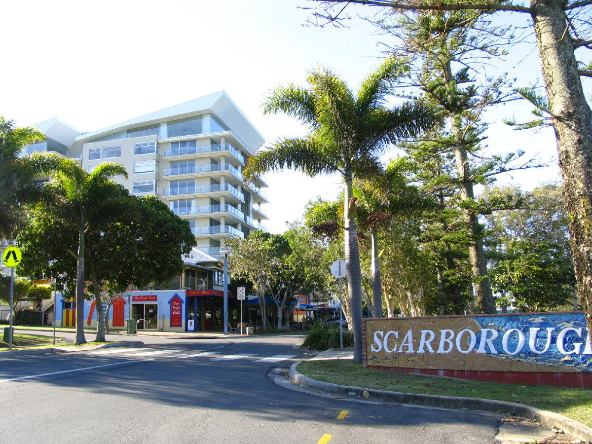
The main street of Scarborough, Landsborough Avenue, is a popular location for families and day visitors from Brisbane with numerous cafés. Part of the reason for its popularity is its overlooking views to Moreton Island across Moreton Bay, and quieter ambience compared to the Redcliffe central business district. The point of Scarborough is home to Scarborough Marina and Scarborough Holiday Village, while further around the bay is Newport Marina.

The suburb is known for its thriving seafood industry centred upon the Scarborough Boat Harbour. Scarborough Beach is one of a number of sandy beaches along its eastern coastline, with its Scarborough Beach Park awarded the "Queensland's Friendliest Beach" in 2003 and "Australia's Friendliest Beach" in 2004. The beach is safe for swimming and kayaking, and popular with fishers.
Turner Reef is a 20.0 ha artificial reef in the Moreton Bay Marine Park (). It was named after Bill Turner, who lobbied for over 20 years to establish an artificial reef off Scarborough. It is 1 nmi east of the coast of Scarborough at a depth of approximately 6 m.
In popular culture
Parts of the movie Scooby-Doo were filmed at Queens Beach in Scarborough; the majority of the movie was filmed at Tangalooma Resort at Moreton Island.
References
References
- {{cite QPN. 45496. Scarborough. suburb in Moreton Bay Region
- {{Queensland Globe
- (12 November 2020). "Mountain peaks and capes - Queensland". [[Queensland Government]].
- {{cite QPN. 6464. Castlereagh Point. mountain in Moreton Bay Region
- {{cite QPN. 30079. Scarborough Point. mountain in Moreton Bay Region
- (12 November 2020). "Mountain ranges beaches and sea passages - Queensland". [[Queensland Government]].
- {{cite QPN. 10582. Drury Point. mountain in Moreton Bay Region
- {{cite QPN. 25600. Osbourne Point. mountain in Moreton Bay Region
- (20 July 1878). "Advertising". [[The Week (Brisbane)]].
- {{cite archive. . . (c. 1900)
- (19 December 1882). "Advertising". [[Telegraph (Brisbane).
- {{cite archive. . . (1882)
- (12 January 1884). "Classified Advertising". [[The Brisbane Courier]].
- {{cite archive. . . (c. 1880)
- {{cite archive. . . (1886)
- (22 April 1886). "Advertising". [[Toowoomba Chronicle and Darling Downs General Advertiser]].
- (20 December 1900). "Advertising". [[The Brisbane Courier]].
- {{cite archive. . . (c. 1900)
- {{cite archive. . . (n.d.)
- {{cite archive. . . (1927)
- {{cite archive. . . (1927)
- (7 January 1929). "Advertising". [[The Brisbane Courier]].
- {{cite archive. . . ()
- (2010). "Queensland schools past and present". [[Queensland Family History Society]].
- (2019-12-11). "Our School".
- (11 December 1937). "Additional Redcliffe Methodist Church Part of World Plan Of Wesley Celebration". [[The Telegraph (Brisbane).
- (April 1959). "Redcliffe's 160 years". [[Redcliffe Town Council]].
- (8 January 1938). "News Of The Churches". [[The Courier-mail]].
- (15 January 1938). "Second Sunday After The Epiphany.". [[The Telegraph (Brisbane).
- (25 March 1950). "The Churches". [[The Courier-mail]].
- "43 Prince Edward Parade, Scarborough QLD 4020".
- (1971). "St. Bernadette's Scarborough: history of Parish progress in first 25 years, 1946-1971". St. Bernadette's Parish Council.
- Blake, Thom. "St Bernadette's Catholic Church".
- "History of our College".
- (2 April 1951). "Was only a delay". [[The Courier-mail]].
- (31 March 1951). "News From The Churches". [[The Courier-mail]].
- Blake, Thom. "St Anne's Anglican Church".
- (1 October 1949). "Plan Church At Scarborough". [[Brisbane Telegraph]].
- Blake, Thom. "St Anne's Anglican Church (1970)".
- "190 Mein St, Scarborough QLD 4020".
- "Queensland Baptist churches by date of erection/opening".
- "Scarborough Baptist Church - Former".
- {{Census 2011 AUS
- {{Census 2016 AUS
- {{Census 2021 AUS
- (9 July 2018). "State and non-state school details". [[Queensland Government]].
- (2022-12-14). "Scarborough State School".
- "ACARA School Profile 2018". [[Australian Curriculum, Assessment and Reporting Authority]].
- "Scarborough SS - Special Education Program".
- "Southern Cross Catholic College".
- "Australian Trade College North Brisbane".
- "Scarborough Post Office".
- "St Anne's Anglican Church".
- (17 November 2020). "Building points - Queensland". [[Queensland Government]].
- "Scarborough Presbyterian Church".
- "Scarborough Samoan Adventist Church".
- "Scarborough Samoan Seventh-Day Adventist Church".
- (18 November 2020). "Marinas - Queensland". [[Queensland Government]].
- (12 November 2020). "Recreational Boating Facilities Queensland". [[Queensland Government]].
- "Must-see Attractions". Redcliffe City Council.
- "Scarborough Beach - Redcliffe".
- (18 November 2020). "Artificial reef sites - Queensland". [[Queensland Government]].
- (2009-10-27). "Moreton Bay artificial reefs: Moreton Bay Marine Park". [[Queensland Government]].
This article was imported from Wikipedia and is available under the Creative Commons Attribution-ShareAlike 4.0 License. Content has been adapted to SurfDoc format. Original contributors can be found on the article history page.
Ask Mako anything about Scarborough, Queensland — get instant answers, deeper analysis, and related topics.
Research with MakoFree with your Surf account
Create a free account to save articles, ask Mako questions, and organize your research.
Sign up freeThis content may have been generated or modified by AI. CloudSurf Software LLC is not responsible for the accuracy, completeness, or reliability of AI-generated content. Always verify important information from primary sources.
Report