From Surf Wiki (app.surf) — the open knowledge base
Santa Monica Mountains National Recreation Area
Protected area in Southern California, US

Protected area in Southern California, US
| Field | Value |
|---|---|
| name | Santa Monica Mountains National Recreation Area |
| iucn_category | V |
| photo | Backbone Trail near Mishe Mokwa.jpg |
| photo_caption | Backbone Trail near Mishe Mokwa Trail in the SMMNRA |
| map | California#USA |
| relief | 1 |
| location | Santa Monica Mountains; Los Angeles and Ventura Counties, California, U.S. |
| nearest_city | Malibu, California |
| Newbury Park, California | |
| coordinates | |
| area_acre | 157,700 |
| area_ref | |
| established | |
| mapframe | yes |
| mapframe-zoom | 9 |
| mapframe-wikidata | yes |
| visitation_num | 795,217 |
| visitation_year | 2022 |
| visitation_ref | |
| governing_body | National Park Service; with State and local agencies. |
| website | Santa Monica Mountains National Recreation Area |
Newbury Park, California | mapframe-zoom = 9 | mapframe-wikidata = yes The Santa Monica Mountains National Recreation Area (SMMNRA) is a national recreation area containing many individual parks and open space preserves, located primarily in Southern California's Santa Monica Mountains. Located in greater Los Angeles, two thirds of SMMNRA's parklands are in northwest Los Angeles County and the remaining third, including a Simi Hills extension, is in southeastern Ventura County. It is administered by the National Park Service in coordination with state, county, municipal, and university agencies.
In size, the Santa Monica Mountains National Recreation Area is the largest urban national park in the world. It is also one of the best examples of a Mediterranean climate ecosystem and it protects one of the highest densities of archaeological resources in any mountain range in the world.
Geography
The Santa Monica Mountains NRA contains 153075 acre in the Transverse Ranges's Santa Monica Mountains, with its southeastern slopes part of the Los Angeles River headwaters. The California State Park system and other public agencies own 49756 acre, the National Park Service own 25117 acre, and the rest of the SMMNRA lands are owned by local agencies, university reserves, and private property conservation easements.
Park history
National Forest proposal
During the first decade of the twentieth century, Frederick H. Rindge attempted to create a forest reserve (precursors to national forests) in the Santa Monica Mountains several times. In 1902, California's State Mining Bureau also attempted to establish a forest reserve, but their proposal was denied.
In 1907, a proposal requesting at least 70,000 acres in the Santa Monica Mountains be designated a forest reserve was submitted to the Secretary of the Interior, but state mineralogist Lewis E. Aubury opposed the venture. The U. S. Forest Service then advised Aubury that it was highly improbable a forest reserve would be created owing to local opposition and the small amount of public land still remaining in the mountains.
National Park proposals
In 1925, limestone deposits were discovered in the mountains behind Pacific Palisades, which led to a lengthy battle between home owners and land developers. Alphonzo Bell Sr. led the push for development, while local opposition was led by Sylvia Morrison. After much criticism of Bell's original plan, Bell submitted an updated plan that saw the limestone pulverized, mixed with water, and pumped via a buried pipeline to the mouth of Santa Ynez Canyon, where it would continue along the ocean floor to an offshore buoy. Will Rogers parodied the plan on the front page of the Los Angeles Times, after which William Mulholland came to Bell's defense. Around the same time, Morrison urged to establish the Santa Monica Mountains as Whitestone National Park, named after the limestone cliffs.
In 1930, lifelong national park advocate Frederick Law Olmsted Jr. proposed a network of parks, beaches, playgrounds, and forests to promote social, economic, and environmental vitality in Los Angeles, and he also advocated for public ownership of at least 10,000 acres of beach and mountain between Topanga and Point Dume. His report, however, was not successful.
In 1938, May Rindge (widow of Frederick H. Rindge) lost control of her Santa Monica Mountain lands and was forced into bankruptcy. She proposed to establish a park in exchange for the cancellation of $1.1 million in unpaid taxes, but the county refused her offer.
In the 1960s and 70s, possibly even as early of the 1950s, several proposals designating the Santa Monica Mountains as Toyon National Park went before U.S. Congress, and in 1971, Representative Alphonzo Bell Jr. introduced the first a bill to create Toyon National Park.
State Parks
In 1944, Will Rogers State Historic Park was created, marking the first state park in the Santa Monica Mountains and the first public land in the mountains since Griffith Park in 1896.
In 1967, the State Division of Beaches and Parks acquired 6700 acre of the Broome Ranch (originally part of Rancho Guadalasca) for $15.1 million , which they used to establish Point Mugu State Park. In 1972, the park system purchased 5,800 acres for $2.1 million , nearly doubling the park's size. In 1980, a remaining 850 acre that adjoined the property was purchased, becoming Rancho Sierra Vista open space park.
In 1974, the 11525 acre Topanga State Park (originally Topanga Canyon State Park) was opened to the public. The park encompass large areas outside Topanga Canyon, from Pacific Coast Highway to Mulholland Drive.
Establishment of the National Recreation Area
In 1964, Susan B. Nelson, later known as the mother of the Santa Monica Mountain National Recreation Area, helped organize Friends of the Santa Monica Mountains, Parks and Seashore. The SMMNRA was established on November 10, 1978, with a strategy of growing the park through "mosaic pieces" that would link critical habitats, save unique areas, and expand the existing park.

In the 1980s, the Santa Monica Mountains Conservancy was created to acquire and preserve land for open spaces, habitat preserves, and public recreation. One of their first acquisitions was Rancho Sierra Vista in 1980, and Paramount Ranch was also acquired that year.
In the early 1990s, Bob Hope created controversy when he proposed selling 5900 acre of land in the Corral Canyon area to the government in exchange for 59 acre in the nearby Cheeseboro Canyon section of the SMMNRA, land he planned to use for access road to a new golf course and housing development. The land swap was never completed, with the Jordan Ranch becoming the Palo Commado section of the Cheeseboro Canyon/Palo Comado Canyon Open Space parks and most of the land for the 1000 acre Corral Canyon Park later donated by Hope.

In 2003, Ahmanson Ranch was acquired by the Santa Monica Mountains Conservancy to create the 2983 acre Upper Las Virgenes Canyon Open Space Preserve. In 2010, 200 acre of land northwest of the U.S. 101/Las Virgenes Road junction, as well as additional land to the southeast of Las Virgenes Road, were acquired by the Santa Monica Mountain Conservancy. Additionally, several hills with undeveloped ranch land in the area also had their viewsheds protected from development, and these areas now serve as an unofficial gateway to the SMMNRA and its visitor center on Las Virgenes Road at King Gillette Ranch.
In 2018, the Woolsey Fire burned 88% of the federal parkland and more than 40% of the natural area in the Santa Monica Mountains.
Park superintendents
- Robert Chandler, 1979–1982
- Daniel Kuehn, 1983–1988
- William Webb (Acting Superintendent), 1988–1989
- David Gackenbach, 1989–1995
- Arthur Eck, 1995–2002
- Woody Smeck, 2002–2012
- David Szymanski, 2012–2024
- Jody Lyle, 2024–present
Studies

In order to understand the effects of U.S. 101 on Santa Monica Mountains wildlife survival, movement, and genetic diversity, the National Park Service began tracking bobcats in the area in 1996, mountain lions in 2002, and black bears in 2019. The Wallis Annenberg Wildlife Crossing, a vegetated overpass spanning U.S. 101 at Liberty Canyon, is meant to alleviate some of the negative effects discovered by the study.
The National Park Service's Rim of the Valley Corridor Special Resource Study, which entails connecting the Santa Monica Mountains and parklands surrounding the San Fernando, Crescenta, Santa Clarita, Simi, and Conejo valleys is also currently under study. This study could involve adding up to 313,000 acres to the SMMNRA.
Cultural resources
.jpg)
The Santa Monica Mountains have been occupied by humans for more than 10,000 years and contain many prehistoric and historic sites. More than 1,000 archaeological sites are in the Santa Monica Mountains National Recreation Area, making it one of the highest densities of archaeological resources in any mountain range in the world.
At least 73 archeological sites, structures, cultural landscapes, and cultural properties in the SMMNRA are eligible for listing on the National Register of Historic Places. The SMMNRA also contains 26 known Chumash pictograph sites and a number of California Historical Landmarks lie within the area, including the site of the Port of Los Angeles Long Wharf (#881), Point Dume (#965), and Adamson House (#966). Also within the SMMNRA is Paramount Ranch, however, the Woolsey Fire severely damaged the ranch in 2018.
Santa Monica Mountains Fund (SAMO Fund) works to encourage appreciation and understanding of the Santa Monica Mountains National Recreation Area (SMMNRA) by supporting its National Park Service and California State Parks programs. The SMMNRA encompasses homelands of indigenous people including the Chumash people in the western portion and the Tongva people in the eastern end.
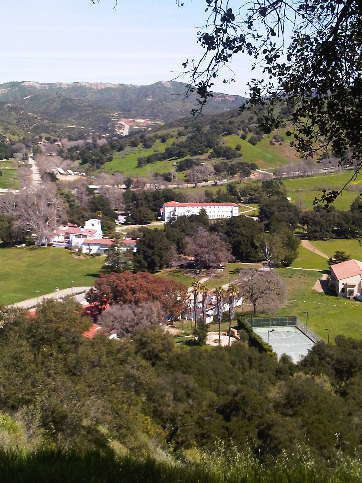
Facilities
.jpg)
The Anthony C. Beilenson Interagency Visitor Center opened in June 2012 and is operated by four partner agencies: National Park Service, California State Parks, Santa Monica Conservancy, and Mountains Recreation and Conservation Authority. The Satwiwa Native American Indian Culture Center is the only site in the SMMNRA dedicated to Indian cultures. Park headquarters are located offsite in Thousand Oaks.
Main entrances to the SMMNRA are located in Malibu, Newbury Park, Agoura Hills, Calabasas, Woodland Hills, and Topanga.
Parks within
State Parks

- Topanga
- Leo Carrillo
- Malibu Creek
- Point Mugu
- Will Rogers
Beaches

- Carbon
- County Line
- Robert H. Meyer (El Matador, El Pescador, and La Piedra)
- Las Tunas
- Malibu Lagoon
- Point Dume
- Santa Monica
- Topanga
- Thornhill Broome
- Will Rogers
- Zuma
Other

- Arroyo Sequit
- Backbone Trail System
- Circle X Ranch
- Corral Canyon
- Franklin Canyon
- King Gillette Ranch
- Marvin Braude
- Morrison Ranch
- Paramount Ranch
- Peter Strauss Ranch
- Rancho Sierra Vista
- Rocky Oaks
- Runyon Canyon
- Solstice Canyon
- Upper Las Virgenes Canyon Open Space Preserve
- Zuma and Trancas Canyons
References
References
- http://www.conejo-openspace.org/open_space_areas_in_TO.htm#Santa {{webarchive. link. (February 9, 2016 Monica Mountains National Recreation Area)
- {{NPS area. (2011)
- {{NPS visitation
- White, Mel (2009). ''Complete National Parks of the United States''. National Geographic Books. Page 405. {{ISBN. 9781426205279.
- Schreiner, Casey (2016). ''Day Hiking Los Angeles: City Parks / Santa Monica Mountains / San Gabriel Mountains''. Page: Introduction. Mountaineers Books. {{ISBN. 9781680510096.
- Vlahides, John A. and Tullan Spitz (2004). ''Coastal California''. Lonely Planet. Page 162. {{ISBN. 9781740594684.
- "Area Attractions | Bank of America Performing Arts Center | Official Site".
- National Park Service, ''Santa Monica Mountains National Recreation Area: Statement of National Significance'', ca. 2000, page 4
- "Santa Monica Mountains National Recreation Area Frequently Asked Questions". [[National Park Service]].
- "Forest reserves. Santa Monica scheme turned down," ''Los Angeles Times'', March 8, 1907, section II, page 5
- "Private snap of reserve?" ''Los Angeles Times'', February 10, 1907, section II, page 19
- L.E. Aubury, "Against the Malibu reserve," ''Los Angeles Times'', February 10, 1917, section II, page 4
- Betty Lou Young, ''Pacific Palisades: Where the Mountains meet the Sea'', Pacific Palisades Historical Society Press, 1983, page 135
- Young, ''Pacific Palisades'', page 139
- Young, ''Pacific Palisades'', page 141–142
- Young, ''Pacific Palisades'', page 144
- Robert Garcia, ''et al'', ''Free the Beach! Public Access, Equal Justice, and the California Coast'', Center for Law in the Public Interest, April 2005, 6–7
- Mike Davis, "Let Malibu Burn: A Political History of the Fire Coast", ''L.A. Weekly'', 1996
- "Mrs. May Rindge loses control of great rancho", ''L.A. Times'', June 30, 1938, A1
- Mike Davis, "Let Malibu Burn: A Political History of the Fire Coast", ''L.A. Weekly'', 1996, page 3
- Skip Ferderber, "U.S. will hear 100,000 acre park proposal," ''Los Angeles Times'', June 13, 1974, page WS1
- "Point Mugu Park Land Acquired," ''Los Angeles Times'', March 5, 1967, page H6.
- "Point Mugu Park Addition OKd," ''San Diego Union'', March 12, 1972, page 17.
- "Parkland history – Topanga Canyon Docents".
- California, California State Parks, State of. "Topanga State Park General Plan".
- Also in 1974, the State of California purchased the {{convert. 2700. acres. Century Ranch]] including a 120-acre property formerly owned by [[Ronald Reagan]] for $4.8 million {{USDCY. 4800000. 1974. In 1975, [[Bob Hope]]'s Century Ranch-abutting Hope Ranch was purchased for $4.1 million {{USDCY. 4100000
- "Honored Women of the Santa Monica Mountains". Santa Monica Mountains Fund.
- McLellan, Dennis (May 22, 2003) [https://www.latimes.com/archives/la-xpm-2003-may-22-me-nelson22-story.html Susan Nelson, 76; Mountain Parklands Advocate] Obituary. ''[[Los Angeles Times]]''
- [http://www.biodiversity.ca.gov/newsletter/v2n3/conservancy.html "Santa Monica Mountains Conservancy Preserves Nature's Treasures in Metropolitan Los Angeles"] {{webarchive. link. (May 27, 2010 California Biodiversity Newsletter. [[California Environmental Resources Evaluation System). CERES]] accessed February 28, 2010
- "Santa Monica Mountains Conservancy".
- "Paramount Ranch – Santa Monica Mountains National Recreation Area (U.S. National Park Service)".
- (January 13, 1991). "Agoura Hills Journal; Bob Hope Stirs Debate In Going for the Green". The New York Times.
- "Parks – LAMountains.com".
- "Parks – LAMountains.com".
- "Parks – LAMountains.com".
- "Parks – LAMountains.com".
- "Magnificent milestone in the mountains – Zev Yaroslavsky".
- Wallack, Roy. (April 19, 2019). "Hiking in the Woolsey fire's burn area: See photos of nature's remarkable comeback". [[Los Angeles Times]].
- Simon, Scott. (May 5, 2019). "How Last Year's Massive Woolsey Fire In Southern California Impacted Wildlife". NPR News, Weekend Edition.
- "Bobcats: Living on the Urban Edge". [[National Park Service]].
- "Puma Profiles". [[United States Department of the Interior]] – [[National Park Service]].
- (May 3, 2023). "National Park Service biologists capture a black bear in Santa Monica Mountains National Recreation Area". [[National Park Service]].
- (2022-04-22). "Crews break ground on world's largest wildlife crossing over 101 Fwy in L.A.".
- "Pacific West Regional Office (U.S. National Park Service)".
- "Pacific West Regional Office (U.S. National Park Service)".
- Groves, Martha. (May 23, 2015). "Push grows to add Rim of the Valley lands to national recreation area". [[Los Angeles Times]].
- Groves, Martha. (May 23, 2015). "Four options for Rim of the Valley". [[Los Angeles Times]].
- Sosa, Anabel. (December 10, 2025). "Senators propose adding 138K acres to 2 Calif. national park sites". SFGATE.
- National Park Service, ''General Management Plan: Santa Monica Mountains National Recreation Area'', March 5, 2003, page 17
- National Park Service, ''Statement of National Significance'', page 1
- National Park Service, ''Statement of National Significance'', page 4
- National Park Service, ''General Management Plan'', page 17
- "SAMO Fund". Santa Monica Mountains Fund.
- "Parks | LAMountains.com".
- "Topanga SP".
- "Parks | LAMountains.com".
- "Malibu Creek SP".
- "Parks | LAMountains.com".
- [http://www.lamountains.com/parks.asp?parkid=88 Paramount Ranch Park], access date: 6/9/2010
- "Parks | LAMountains.com".
- "Parks | LAMountains.com".
This article was imported from Wikipedia and is available under the Creative Commons Attribution-ShareAlike 4.0 License. Content has been adapted to SurfDoc format. Original contributors can be found on the article history page.
Ask Mako anything about Santa Monica Mountains National Recreation Area — get instant answers, deeper analysis, and related topics.
Research with MakoFree with your Surf account
Create a free account to save articles, ask Mako questions, and organize your research.
Sign up freeThis content may have been generated or modified by AI. CloudSurf Software LLC is not responsible for the accuracy, completeness, or reliability of AI-generated content. Always verify important information from primary sources.
Report