From Surf Wiki (app.surf) — the open knowledge base
Santa Clara County, California
County in California, United States

County in California, United States
| Field | Value |
|---|---|
| name | Santa Clara County |
| settlement_type | County |
| image_skyline | {{multiple image |
| total_width | 280 |
| border | infobox |
| perrow | 1/2/2/1 |
| caption_align | center |
| image1 | SJ_skyline_at_night_horizontal.jpg |
| caption1 | San Jose |
| image2 | Ramona_Street_Architectural_District,_Palo_Alto,_CA_5-27-2012_2-48-37_PM.JPG |
| caption2 | Palo Alto |
| image3 | Aerial_view_of_Apple_Park_dllu.jpg |
| caption3 | Cupertino |
| image4 | Stanford_University_Main_Quad_May_2011_001_(cropped).jpg |
| caption4 | Stanford |
| image5 | Mission Santa Clara de Asís Frazier (cropped).JPG |
| caption5 | Santa Clara |
| image6 | Friday May 10, 130 365 (8761584621) (cropped).jpg |
| caption6 | Santa Cruz Mountains in Morgan Hill |
| image_flag | Flag of Santa Clara County, California.svg |
| flag_size | 115px |
| image_seal | Seal of Santa Clara County, California.svg |
| seal_size | 85px |
| image_map | |
| map_caption | Interactive map of Santa Clara County |
| image_map1 | Map of California highlighting Santa Clara County.svg |
| mapsize1 | 200px |
| map_caption1 | Location in the state of California |
| coordinates | |
| subdivision_type | Country |
| subdivision_name | United States |
| subdivision_type1 | State |
| subdivision_name1 | California |
| subdivision_type2 | Region |
| subdivision_name2 | San Francisco Bay Area |
| established_title | Incorporated |
| established_date | February 18, 1850 |
| named_for | Mission Santa Clara de Asís, St. Clare of Assisi |
| seat_type | County seat |
| and largest city | |
| seat | San Jose |
| government_type | Council–CEO |
| governing_body | Board of Supervisors |
| leader_title1 | Board President |
| leader_name1 | Otto Lee |
| leader_title2 | Board Vice President |
| leader_name2 | Sylvia Arenas |
| leader_title3 | Board of Supervisors |
| leader_name3 | {{Collapsible list |
| title | Supervisors |
| frame_style | border:none; padding:0; |
| list_style | text-align:left; |
| 1 | Sylvia Arenas |
| 2 | Betty Duong |
| 3 | Otto Lee |
| 4 | Susan Ellenberg |
| 5 | Margaret Abe-Koga |
| leader_title4 | Chief executive officer |
| leader_name4 | James R. Williams, J.D. |
| unit_pref | US |
| area_total_sq_mi | 1304 |
| area_land_sq_mi | 1290 |
| area_water_sq_mi | 14 |
| elevation_max_footnotes | |
| elevation_max_ft | 4216 |
| population_as_of | 2020 |
| population_rank | 6th in California |
| population_footnotes | |
| population_total | 1936259 |
| population_density_sq_mi | auto |
| demographics_type2 | GDP |
| demographics2_footnotes | |
| demographics2_title1 | Total |
| demographics2_info1 | $419.917 billion (2023) |
| timezone | Pacific |
| utc_offset | −8 |
| timezone_DST | Pacific Daylight Time |
| utc_offset_DST | −7 |
| postal_code_type | |
| area_code_type | Area codes |
| area_code | 408/669, 650 |
| blank_name_sec1 | FIPS code |
| blank_info_sec1 | 06-085 |
| blank1_name_sec1 | GNIS feature ID |
| blank1_info_sec1 | |
| blank_name_sec2 | Congressional districts |
| blank_info_sec2 | 16th, 17th, 18th, 19th |
| website |
and largest city
Santa Clara County, officially the County of Santa Clara, is the sixth-most populous county in the U.S. state of California, with a population of 1,936,259 as of the 2020 census. Santa Clara County and neighboring San Benito County form the San Jose–Sunnyvale–Santa Clara metropolitan statistical area, which is part of the larger San Jose–San Francisco–Oakland combined statistical area. Santa Clara is the most populous county in the San Francisco Bay Area and in Northern California.
The county seat and largest city with a population of 971,233 is San Jose, the 13th-most populous city in the United States, California's third-most populous city, and the most populous city in Northern California.
Home to Silicon Valley, Santa Clara County is an economic center for high technology, and had the third-highest gross domestic product (GDP) per capita in the world as of 2015 behind Zürich and Oslo, according to the Brookings Institution. Located on the southern coast of San Francisco Bay, the urbanized Santa Clara Valley within Santa Clara County contains most of the county's population. More recently, extensive droughts in California, further complicated by drainage of the Anderson reservoir within the county for seismic repairs, have strained the county's water security.
As of 2020, it has a median household income of $130,890, the third-highest household income of any county in the nation behind Loudoun County, Virginia and Falls Church, Virginia, and the highest of any county in the Western United States.
Etymology
Santa Clara County is named for Mission Santa Clara, which was established in 1777, and was in turn named for Saint Clare of Assisi.
History
Main article: History of Santa Clara County, California

Santa Clara County was one of the original counties of California, formed in 1850 at the time of statehood. The original inhabitants included the Ohlone, residing on Coyote Creek and Calaveras Creek. Part of the county's territory was given to Alameda County in 1853.
In 1882, Santa Clara County tried to levy taxes upon property of the Southern Pacific Railroad within county boundaries. The result was the U.S. Supreme Court case of Santa Clara County v. Southern Pacific Railroad, 118 U.S. 394 (1886), in which the court extended due-process rights to artificial legal entities.
In the early 20th century, the area was promoted as the "Valley of the Heart's Delight" due to its natural beauty, including a significant number of orchards. The region was also memorably referred to as the "sun-kissed Santa Clara Valley" in Jack London's 1903 Call of the Wild.
The first major technology company to be based in the area was Hewlett-Packard, founded in a garage in Palo Alto in 1939. IBM selected San Jose as its West Coast headquarters in 1943. Varian Associates, Fairchild Semiconductor, and other early innovators were in the county by the late 1940s and 1950s. The U.S. Navy had a large presence in the area and began giving large contracts to Silicon Valley electronics companies. The term "Silicon Valley" was coined in 1971. The trend accelerated in the 1980s and 1990s, and agriculture has since been nearly eliminated from the northern part of the county.
Santa Clara County is the headquarters for about 6500 high-technology companies, including many of the world's largest such companies, including AMD, Nvidia, Cisco Systems, and Intel, computer and consumer electronics companies Apple Inc. and Hewlett-Packard, and internet companies eBay, Google, and Yahoo!. Most of what is considered to be Silicon Valley is within the county, although some adjoining tech regions in San Mateo (e.g., Meta), Alameda, and Santa Cruz counties are also considered part of Silicon Valley.
Geography
According to the U.S. Census Bureau, the county has a total area of 1291.08 sqmi.
Counties which border with Santa Clara County are, clockwise, Alameda County, San Joaquin (within a few hundred feet at Mount Boardman), Stanislaus, Merced, San Benito, Santa Cruz, and San Mateo County. Santa Clara County formerly shared borders with Contra Costa, San Francisco, Mariposa, Monterey, and Tuolumne counties until 1853, 1856, 1874, and 1854 respectively (Monterey County currently comes within a few miles of Santa Clara).
The San Andreas Fault runs along the Santa Cruz Mountains in the south and west of the county.
National protected area
- Don Edwards San Francisco Bay National Wildlife Refuge (part)
Fauna

Both tule elk (Cervus canadensis nannodes) and pronghorn (Antilocapra americana) were historically native to Santa Clara County. In June 1776, Lieutenant Commander Don José Joaquín Moraga led a group of soldiers and colonists from the Presidio of Monterey to establish Mission San Francisco de Asis and encountered both tule elk and pronghorn, and clearly distinguished these two species from deer. The deer in California being California mule deer (Odocoileus hemionus).
Regarding elk, Moraga wrote: "In the great plain called San Bernardino (the Santa Clara Valley which stretches from south San Jose to Gilroy), while the expedition was strung out at length, we descried in the distance a herd of large animals that looked like cattle, but we could not imagine where they belonged or from whence they had come...with horns similar in shape to those of the deer, but so large that they measured sixteen palms from tip to tip." Upon measurement, Morago reported the elk horns as four varas [11 ft] across... "These animals [elk] are called ciervos in order to differentiate them from the ordinary Spanish variety of deer, here called venados, which also exist in abundance and of large size in the vicinity."
Regarding pronghorn, Moraga reported: "In the said plains of San Bernardino (Santa Clara Valley)…there is another species of deer about the size of three-year-old sheep. They are similar in appearance to the deer, except they have short horns and also short legs like the sheep. They live in the plains where they go in herds of 100, 200, or more. They run all together over the plains so fast that they seem to fly…These animals are called berrendos and there are many of them also in the southern Missions wherever the country is level."
Herbert Eugene Bolton also wrote of elk reports from another Spanish expedition, from the De Anza Expedition on March 23, 1776: " In Gilroy Valley (Santa Clara Valley) Moraga 's larder was replenished by three elks which the men killed without leaving the road." General John Bidwell, of the 1841 Bartleson-Bidwell Party wrote: "In some of the fertile valleys, such as Napa and Santa Clara, there were elk literally by the thousand."
In 1978, California Department of Fish and Game warden Henry Coletto urged the department to choose the Mount Hamilton area as one of California's relocation sites under a new statewide effort to restore tule elk. While other ranchers refused, tech pioneers Bill Hewlett and David Packard allowed Coletto and state biologists to translocate the initial 32 tule elk from the Owens Valley in the eastern Sierra onto the 28,000 acre San Felipe Ranch, which the families jointly own, in the hills east of Morgan Hill. From the three original 1978–1981 translocations (totaling 65 animals) to the Mount Hamilton region of the Diablo Range, there are multiple herds in different locations including the Isabel Valley, San Antonio Valley, Livermore area, San Felipe Ranch, Metcalf Canyon, Coyote Ridge, Anderson Lake, and surrounding areas such as the Sunol and Cottonwood Creek (near San Luis Reservoir in western Merced County, California) herds. , an estimated 400 tule elk roam 1875 km2 in northeastern Santa Clara County and southeastern Alameda County. In March 2014 CDFW translocated nine bull elk from the San Luis National Wildlife Refuge to add genetic diversity to the San Antonio Valley Ecological Reserve herd in San Antonio Valley in extreme eastern Santa Clara County. As of 2017 there were four herds in the Coyote Ridge area, often visible from U. S. Highway 101, according to Craige Edgerton, recently retired executive director of the Silicon Valley Land Conservancy and local naturalist Michael Hundt. In 2019, a fifth herd of tule elk was documented by local naturalist Roger Castillo, likely having split from the Coyote Ridge herd and established itself in Silver Creek Valley around the closed Ranch Golf Club. The elk herds in eastern Santa Clara County are blocked from dispersal to the west by U.S. Highway 101, with environmentalists advocating re-purposing the Metcalf Road bridge at the Coyote Gap into a wildlife overcrossing. This would enable elk to recolonize rural southwestern Santa Clara County, as well as Santa Cruz and San Mateo Counties.
In 1990, the California Department of Fish and Game's Henry Coletto translocated excess pronghorn from Modoc County to six locations in California, including 51 animals to the San Felipe Ranch in Santa Clara County, where the swift-footed ungulates had not lived for generations. The animals left the San Felipe Ranch for the Isabel and San Antonio Valleys, as well as an area near Lake Del Valle in Alameda County may now be extirpated by poaching, highway vehicle collisions, and insufficient numbers to defend pronghorn fawns against coyote predation. As of 2012, the Isabel Valley Ranch herd had dwindled to 3 animals, and the Lake del Valle herd to 13. Currently, iNaturalist.org has zero observer records of pronghorn in Santa Clara County.
The Nature Conservancy "Mount Hamilton Project" has acquired or put under conservation easement 100000 acre of land towards its 500000 acre goal for habitat conservation within a 1200000 acre area encompassing much of eastern Santa Clara County as well as portions of southern Alameda County, western Merced and Stanislaus Counties, and northern San Benito County. Acquisitions to date include the 1,756 acre Rancho Cañada de Pala, straddling the Alameda Creek and Coyote Creek watersheds for California tiger salamander habitat; a conservation easement on the 3,259-acre Blue Oak Ranch Reserve, which abuts the north side of Joseph D. Grant County Park; a conservation easement on the 28,359-acre San Felipe Ranch, connecting Joseph D. Grant County Park with Henry W. Coe State Park; the 2,899-acre South Valley Ranch which protects a tule elk herd in the San Antonio Valley, and other properties.
As of 1980, Santa Clara County had the highest number of Superfund Sites of any county in the United States, accounting for 25 polluted locations requiring a long-term response to clean up hazardous material contaminations. , Santa Clara County has 23 active Superfund Sites, still more than any other county in the United States. The vast majority of these Superfund sites were caused by firms associated with the high tech sector in Silicon Valley.
Demographics
| align-fn = center 1790–1960 1900–1990 1990–2000 2010 2020
2020 census
As of the 2020 census, the county had a population of 1,936,259. The median age was 37.5 years. 21.0% of residents were under the age of 18 and 13.8% of residents were 65 years of age or older. For every 100 females there were 101.5 males, and for every 100 females age 18 and over there were 100.4 males age 18 and over.
There were 656,063 households in the county, of which 35.4% had children under the age of 18 living with them and 21.7% had a female householder with no spouse or partner present. About 20.2% of all households were made up of individuals and 7.5% had someone living alone who was 65 years of age or older.
There were 688,035 housing units, of which 4.6% were vacant. Among occupied housing units, 53.7% were owner-occupied and 46.3% were renter-occupied. The homeowner vacancy rate was 0.7% and the rental vacancy rate was 4.9%.
98.7% of residents lived in urban areas, while 1.3% lived in rural areas.
Racial and ethnic composition
As of the 2020 census, the racial makeup of the county was 32.2% White, 2.3% Black or African American, 1.1% American Indian and Alaska Native, 39.2% Asian, 0.4% Native Hawaiian and Pacific Islander, 14.0% from some other race, and 10.8% from two or more races. Hispanic or Latino residents of any race comprised 25.2% of the population.
| Race / Ethnicity (NH = Non-Hispanic) | Pop 1980 | Pop 1990 | title=P004: Hispanic or Latino, and Not Hispanic or Latino by Race – 2000: DEC Summary File 1 – Santa Clara County, California | url=https://data.census.gov/table?g=050XX00US06085&tid=DECENNIALSF12000.P004 | website=United States Census Bureau | access-date= }} | title=P2: Hispanic or Latino, and Not Hispanic or Latino by Race – 2010: DEC Redistricting Data (PL 94-171) – Santa Clara County, California | url=https://data.census.gov/cedsci/table?q=p2&g=050XX00US06085&tid=DECENNIALPL2010.P2 | website=United States Census Bureau | access-date= }} | Pop 2020 | % 1980 | % 1990 | % 2000 | % 2010 | % 2020 |
|---|---|---|---|---|---|---|---|---|---|---|---|---|---|---|---|---|
| White alone (NH) | 913,154 | 869,874 | 744,282 | 626,909 | 555,708 | 70.51% | 58.09% | 44.23% | 35.19% | 28.70% | ||||||
| Black or African American alone (NH) | 42,237 | 52,583 | 44,475 | 42,331 | 42,148 | 3.26% | 3.51% | 2.64% | 2.38% | 2.18% | ||||||
| Native American or Alaska Native alone (NH) | 8,506 | 6,694 | 5,270 | 4,042 | 3,240 | 0.66% | 0.45% | 0.31% | 0.23% | 0.17% | ||||||
| Asian alone (NH) | 99,935 | 251,496 | 426,771 | 565,466 | 753,399 | 7.72% | 16.79% | 25.36% | 31.74% | 38.91% | ||||||
| Native Hawaiian or Pacific Islander alone (NH) | x | x | 5,040 | 6,252 | 5,945 | x | x | 0.30% | 0.35% | 0.31% | ||||||
| Other race alone (NH) | 4,628 | 2,366 | 3,522 | 3,877 | 10,195 | 0.36% | 0.16% | 0.21% | 0.22% | 0.53% | ||||||
| Mixed race or Multiracial (NH) | x | x | 49,824 | 53,555 | 78,267 | x | x | 2.96% | 3.01% | 4.04% | ||||||
| Hispanic or Latino (any race) | 226,611 | 314,564 | 403,401 | 479,210 | 487,357 | 17.50% | 21.00% | 23.98% | 26.90% | 25.17% | ||||||
| Total | 1,295,071 | 1,497,577 | 1,682,585 | 1,781,642 | 1,936,259 | 100.00% | 100.00% | 100.00% | 100.00% | 100.00% |
The most reported ancestries in 2020 were Mexican (20%), Chinese (11.6%), Indian (10.6%), Vietnamese (8%), English (7.7%), and German (7.7%).
2018
Census demographics data released in 2019 show Asian Americans have had the plurality of Santa Clara's population since 2014.

2010 census
The 2010 United States census reported that Santa Clara County had a population of 1,781,642. The racial makeup of Santa Clara County was 836,616 (47.0%) White, 46,428 (2.6%) African American, 12,960 (0.7%) Native American, 7,060 (0.4%) Pacific Islander, 570,524 (32.0%) Asian, 220,806 (12.4%) from other races, and 87,248 (4.9%) from two or more races. Hispanics or Latinos of any race were 479,210 persons (26.9% of the population).
Demographic profile The largest ancestry groups were:
- 22.5% Mexican
- 8.6% Chinese
- 8.2% German
- 7.1% Vietnamese
- 6.6% Indian
- 6.0% English
- 6.0% Irish
- 4.9% Filipino
- 4.6% Italian
- 2.0% French
- 1.6% Portuguese
- 1.6% Korean
- 1.4% American
- 1.4% Japanese
- 1.4% Scottish
- 1.2% Polish
- 1.2% Swedish
- 1.1% Russian
- 1.1% Norwegian
- 1.0% Dutch
| Population reported at 2010 United States census |
|---|
| Santa Clara County |
| Campbell |
| Cupertino |
| Gilroy |
| Los Altos |
| Los Altos Hills |
| Los Gatos |
| Milpitas |
| Monte Sereno |
| Morgan Hill |
| Mountain View |
| Palo Alto |
| San Jose |
| Santa Clara |
| Saratoga |
| Sunnyvale |
| Alum Rock |
| Burbank |
| Cambrian Park |
| East Foothills |
| Fruitdale |
| Lexington Hills |
| Loyola |
| San Martin |
| Stanford |
| All others not CDPs (combined) |
2000
As of the census of 2000, 1,682,585 people, 565,863 households, and 395,538 families were residing in the county. The population density was 503 /km2. The 579,329 housing units had an average density of 173 /km2. The ethnic makeup of the county was 53.8% White, 2.8% African American, 0.7% Native American, 25.6% Asian, 0.3% Pacific Islander, 12.1% from other races, and 4.7% from two or more races. About 24.0% of the population were Hispanic or Latino of any race.
Of the 565,863 households, 34.9% had children under 18 living with them, 54.9% were married couples living together, 10.0% had a female householder with no husband present, and 30.1% were not families. About 21.4% of all households were made up of individuals, and 5.9% had someone living alone who was 65 or older. The average household size was 2.92, and the average family size was 3.41.
In the county, the age distribution was 24.7% under 18, 9.3% from 18 to 24, 35.4% from 25 to 44, 21.0% from 45 to 64, and 9.5% who were 65 or older. The median age was 34 years. For every 100 females, there were 102.80 males. For every 100 females 18 and over, there were 101.90 males.
The median income for a household in the county was $74,335, and for a family was $81,717. Males had a median income of $56,240 versus $40,574 for females. The per capita income for the county was $32,795. About 4.9% of families and 7.5% of the population were below the poverty line, including 8.4% of those under age 18 and 6.4% of those age 65 or over.
2020 religion census
Santa Clara County is among the most religiously diverse counties in the US. A 2020 census by the Public Religion Research Institute (unconnected to the official US census) calculates a religious diversity score of 0.876 for Santa Clara County, where 1 represents complete diversity (each religious group of equal size) and 0 a total lack of diversity. Only four counties in the US have higher diversity scores than Santa Clara County.
Government
Santa Clara County has five elected supervisors, elected within their districts. The board appoints the County Executive, who is James R. Williams, J.D. The County Executive is responsible for the administration of the county and appoints almost all other officers and department heads.
The county is one among three counties in California (with Napa and Madera) to establish a separate department, the Santa Clara County Department of Corrections, to deal with corrections pursuant to California Government Code §23013.
The county operates the Santa Clara County Health System of medical centers and clinics.
In the United States House of Representatives, Santa Clara County is split among four congressional districts:{{Cite web |access-date = September 24, 2014 |archive-url = https://web.archive.org/web/20130930184128/http://wedrawthelines.ca.gov/downloads/meeting_handouts_072011/handouts_20110729_q2_cd_finaldraft_splits.zip |archive-date = September 30, 2013 |url-status = dead
- ,
- ,
- , and
- .
In the California State Senate, the county is split among four legislative districts:{{Cite web |access-date = September 24, 2014 |archive-url = https://web.archive.org/web/20151023054153/http://wedrawthelines.ca.gov/downloads/meeting_handouts_072011/handouts_20110729_q2_sd_finaldraft_splits.zip |archive-date = October 23, 2015 |url-status = dead
- ,
- ,
- , and
- .
In the California State Assembly, the county is split among six legislative districts:{{Cite web |access-date = September 24, 2014 |archive-url = https://web.archive.org/web/20151023054757/http://wedrawthelines.ca.gov/downloads/meeting_handouts_072011/handouts_20110729_q2_ad_finaldraft_splits.zip |archive-date = October 23, 2015 |url-status = dead
- ,
- ,
- ,
- ,
- , and
- .
Voters in the county also elect a number of other officials to county-wide positions, including the Santa Clara County District Attorney, the Santa Clara County Sheriff, and a large number of criminal and civil judges that serve in courts throughout the county.
Politics
Historically, Santa Clara County was a Republican stronghold in presidential elections. From 1872 through 1984, the only Democrats to carry Santa Clara County were Franklin Roosevelt, Lyndon Johnson, and Hubert Humphrey. However, 1988 would begin to mark a significant shift in the county's political leanings, starting with Michael Dukakis' narrow win and culminating in Bill Clinton's substantial 20-point victory in 1992. Since then, the Democratic presidential candidate has won Santa Clara County by large margins, and it also strongly supports Democratic candidates in congressional elections: all politicians representing the county at the state and federal level are members of the party. The last Republican to win a majority in the county was Ronald Reagan in 1984. While Republicans remained competitive at the state and local level throughout the 1990s, there are currently no elected Republicans representing the county above the local level.
| Year | Republican | Democratic |
|---|---|---|
| 2022 | 30.0% 162,518 | 70.0% 379,377 |
| 2018 | 28.6% 175,791 | 71.4% 438,758 |
| 2014 | 27.1% 107,113 | 72.9% 288,732 |
| 2010 | 34.9% 178,695 | 61.3% 314,022 |
| 2006 | 52.2% 225,132 | 42.9% 185,037 |
| 2002 | 32.4% 116,862 | 55.3% 199,399 |
| 1998 | 31.7% 133,015 | 64.3% 270,105 |
| 1994 | 47.5% 212,075 | 47.5% 211,904 |
| 1990 | 42.6% 178,310 | 52.2% 218,843 |
| 1986 | 59.9% 227,285 | 37.6% 142,907 |
| 1982 | 44.0% 180,232 | 52.9% 216,781 |
| 1978 | 29.8% 110,444 | 61.4% 227,493 |
| 1974 | 46.7% 153,761 | 50.6% 166,760 |
| 1970 | 51.5% 172,562 | 46.1% 154,570 |
| 1966 | 55.4% 164,970 | 44.6% 132,793 |
| 1962 | 47.6% 112,700 | 51.2% 121,149 |
According to the California Secretary of State, as of October 2023, Santa Clara County has 1,021,457 registered voters. Of those, 525,176 (51.41%) are registered Democrats, and 167,840 (16.43%) are registered Republicans.
In November 2012, all of the cities, towns, and unincorporated areas of Santa Clara County had more registered Democrats than Republicans. In 2008, Barack Obama carried every city and town in the county, as well as the unincorporated areas.
Following the passage of Proposition 8, Santa Clara County joined San Francisco and Los Angeles in a lawsuit, becoming, along with San Francisco and Los Angeles, the first governmental entities in the world to sue for same-sex marriage.
Voter registration
| Population and registered voters (2013) | Total population | Registered votersPercentage of registered voters with respect to total population. Percentages of party members with respect to registered voters follow. | Democratic | Republican | Democratic–Republican spread | American Independent | Green | Libertarian | Peace and Freedom | Americans Elect | Other | No party preference |
|---|---|---|---|---|---|---|---|---|---|---|---|---|
| 1,762,754 | ||||||||||||
| 817,310 | 46.4% | |||||||||||
| 372,979 | 45.6% | |||||||||||
| 177,268 | 21.7% | |||||||||||
| +195,711 | +23.9% | |||||||||||
| 17,009 | 2.1% | |||||||||||
| 4,326 | 0.5% | |||||||||||
| 4,843 | 0.6% | |||||||||||
| 1,950 | 0.2% | |||||||||||
| 36 | 0.0% | |||||||||||
| 1,542 | 0.2% | |||||||||||
| 237,357 | 29.0% |
Cities by population and voter registration
| Cities by population and voter registration | City | Population | Registered voters | |||||
|---|---|---|---|---|---|---|---|---|
| Democratic | Republican | D–R spread | Other | No party preference | ||||
| Campbell | 39,108 | 53.4% | 45.3% | 23.8% | +21.5% | 7.3% | 26.2% | |
| Cupertino | 57,459 | 48.2% | 37.0% | 20.0% | +17.0% | 4.0% | 40.4% | |
| Gilroy | 47,808 | 42.7% | 48.5% | 25.2% | +23.3% | 6.8% | 22.1% | |
| Los Altos | 28,752 | 67.4% | 41.5% | 29.4% | +12.1% | 4.3% | 26.2% | |
| Los Altos Hills | 7,912 | 73.6% | 34.9% | 33.6% | +1.3% | 4.3% | 28.7% | |
| Los Gatos | 29,165 | 65.0% | 41.0% | 31.5% | +9.5% | 6.2% | 23.7% | |
| Milpitas | 66,038 | 40.4% | 42.5% | 19.2% | +23.3% | 5.3% | 35.0% | |
| Monte Sereno | 3,338 | 73.7% | 37.1% | 36.9% | +0.2% | 6.1% | 22.3% | |
| Morgan Hill | 37,278 | 52.6% | 40.9% | 32.0% | +8.9% | 6.9% | 23.0% | |
| Mountain View | 73,394 | 46.0% | 49.1% | 16.4% | +32.7% | 5.3% | 30.8% | |
| Palo Alto | 63,475 | 59.7% | 52.6% | 15.5% | +37.1% | 3.8% | 29.2% | |
| San Jose | 939,688 | 44.6% | 46.8% | 20.6% | +26.2% | 6.0% | 28.8% | |
| Santa Clara | 114,482 | 41.9% | 46.5% | 19.9% | +26.6% | 6.1% | 29.7% | |
| Saratoga | 29,781 | 66.8% | 34.2% | 31.5% | +2.7% | 3.9% | 31.8% | |
| Sunnyvale | 138,436 | 41.1% | 45.0% | 19.9% | +25.1% | 5.0% | 31.8% |
Crime
The following table includes the number of incidents reported in 2009 and the rate per 1,000 persons for each type of offense. Law Enforcement in Santa Clara County is handled by the Santa Clara County Sheriff's Office and local police departments.
| Population and crime rates | Population | Violent crime | Homicide | Forcible rape | Robbery | Aggravated assault | Property crime | Burglary | Larceny-theftOnly larceny-theft cases involving property over $400 in value are reported as property crimes. | Motor vehicle theft | Arson |
|---|---|---|---|---|---|---|---|---|---|---|---|
| 1,762,754 | |||||||||||
| 5,013 | 2.84 | ||||||||||
| 46 | 0.03 | ||||||||||
| 387 | 0.22 | ||||||||||
| 1,499 | 0.85 | ||||||||||
| 3,081 | 1.75 | ||||||||||
| 23,790 | 13.50 | ||||||||||
| 7,094 | 4.02 | ||||||||||
| 28,303 | 16.06 | ||||||||||
| 7,356 | 4.17 | ||||||||||
| 403 | 0.23 |
Cities by population and crime rates
| Cities by population and crime rates | City | Population | Violent crimes | Violent crime rate | ||
|---|---|---|---|---|---|---|
| per 1,000 persons | Property crimes | Property crime rate | ||||
| per 1,000 persons | ||||||
| Campbell | 42,697 | 89 | 2.08 | 1,357 | 31.78 | |
| Cupertino | 60,357 | 55 | 0.91 | 1,018 | 16.87 | |
| Gilroy | 60,106 | 251 | 4.18 | 1,479 | 24.61 | |
| Los Altos | 30,716 | 21 | 0.68 | 310 | 10.09 | |
| Los Altos Hills | 8,622 | 3 | 0.35 | 67 | 7.77 | |
| Los Gatos | 30,793 | 14 | 0.45 | 419 | 13.61 | |
| Milpitas | 82,344 | 102 | 1.24 | 2,193 | 26.63 | |
| Monte Sereno | 3,507 | 0 | 0.00 | 12 | 3.42 | |
| Morgan Hill | 46,118 | 52 | 1.13 | 703 | 15.24 | |
| Mountain View | 84,599 | 165 | 1.95 | 2,463 | 29.11 | |
| Palo Alto | 66,938 | 86 | 1.28 | 1,983 | 29.62 | |
| San Jose | 1,040,008 | 4,559 | 4.38 | 25,164 | 24.20 | |
| Santa Clara | 131,173 | 214 | 1.63 | 4,748 | 36.20 | |
| Saratoga | 30,666 | 16 | 0.52 | 240 | 7.83 | |
| Sunnyvale | 154,859 | 259 | 1.67 | 3,380 | 21.83 |
Economy
The county's economy is heavily services-based. Technology, both hardware and software, dominates the service sector by value, but like any other county, Santa Clara has its share of retail and office support workers.
The San Jose/Sunnyvale/Santa Clara metropolitan region, comprising Santa Clara County and San Benito County, was ranked as the highest performing metropolitan area in the US in 2012, ahead of Austin, Texas and Raleigh, North Carolina, according to the Milken Institute. The GDP of the metro area reached $176.7 billion in 2011, or $94,587 per capita, roughly on par with Qatar in both total GDP and per capita (nominal). GDP grew 7.7% in 2011, and in contrast with most of California, GDP and per capita GDP (nominal) was well above levels during the 2008 financial crisis. Despite relative wealth vis a vis other regions nationally, a large underclass exists whose income is roughly equivalent to that elsewhere in the country, despite extreme land prices. The surge in metro GDP is highly correlated with home prices, which for average single-family homes passed $1 million ($1,017,528) in August 2013. As of the fourth quarter of 2021, the median value of homes in Santa Clara County was $1,253,400, an increase of 11.9% from the prior year, and ranking fourth in the US for highest median home value.
Education
Colleges
- De Anza College, Cupertino
- Evergreen Valley College, San Jose
- Foothill College, Los Altos Hills
- Gavilan College, Gilroy
- Mission College, Santa Clara
- San Jose City College, San Jose
- West Valley College, Saratoga
Universities
- Palo Alto University, Palo Alto
- San Jose State University, San Jose
- Santa Clara University, Santa Clara
- Stanford University, Stanford
K-12 schools
School districts include:
; Unified
- Gilroy Unified School District
- Milpitas Unified School District
- Morgan Hill Unified School District
- Palo Alto Unified School District
- Patterson Joint Unified School District
- San Jose Unified School District
- Santa Clara Unified School District
; Secondary
- Campbell Union High School District
- East Side Union High School District
- Fremont Union High School District
- Los Gatos-Saratoga Joint Union High School District
- Mountain View–Los Altos Union High School District
; Elementary
- Alum Rock Union Elementary School District
- Berryessa Union Elementary School District
- Cambrian Elementary School District
- Campbell Union Elementary School District
- Cupertino Union Elementary School District
- Evergreen Elementary School District
- Franklin-McKinley Elementary School District
- Lakeside Joint Elementary School District
- Loma Prieta Joint Union Elementary School District
- Los Altos Elementary School District
- Los Gatos Union Elementary School District
- Luther Burbank Elementary School District
- Moreland School District
- Mountain View Whisman Elementary School District
- Mount Pleasant Elementary School District
- Oak Grove Elementary School District
- Orchard Elementary School District
- Saratoga Union Elementary School District
- Sunnyvale Elementary School District
- Union School District
; Defunct
- Montebello Elementary School District
Libraries
Santa Clara County Library is a public library system serving the communities and cities of Campbell, Cupertino, Gilroy, Los Altos, Los Altos Hills, Milpitas, Monte Sereno, Morgan Hill, Saratoga, and all unincorporated areas of the county. Other cities run their own library systems.
Transportation
Air
_(2).jpg)
The county's main airport is Norman Y. Mineta San José International Airport (SJC). It is a U.S. Customs and Border Protection port of entry and as of 2019 has five international routes (two to Canada, one to England, one to Japan, seven to Mexico, and one to China) but the airport's busiest routes are all to cities in the western United States. San Francisco International Airport (SFO) is also often used for commercial services by residents of Santa Clara County.
Moffett Federal Airfield (NUQ), a former U.S. Naval Air Station, is used by the Air National Guard, NASA, Lockheed Martin, Google, and by the Santa Clara County Sheriff's Department as an air operations base. There are also smaller general aviation airports in Palo Alto (PAO), San Jose (Reid-Hillview) (RHV), and San Martin(E16)
Rail
Santa Clara County is served by Caltrain commuter rail from Gilroy through San Jose and Silicon Valley north to San Francisco Airport and San Francisco. The Santa Clara Valley Transportation Authority operates the VTA light rail system, which primarily serves San Jose, with one line continuing as far north as Mountain View. Santa Clara and San Jose are also served by the Altamont Corridor Express commuter rail line which provides services to Stockton, and Amtrak which provides service to Sacramento and Oakland. The Amtrak Coast Starlight train between Seattle and Los Angeles also stops in San Jose. BART currently services Milpitas and North San Jose, with plans to extend to downtown San Jose and Santa Clara.
Road
Buses
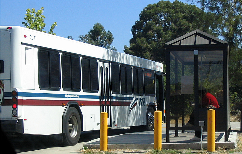
Santa Clara County has consolidated its transportation services into the Santa Clara Valley Transportation Authority, which operates a bus system.
Bicycle network
The Santa Clara Valley Transportation Authority is establishing a bicycle network throughout the county. Santa Clara County Bicycle network is part of the San Francisco Bay Area Regional Bikeway Network.
- Bikeways Map (Effective April 2011)
- Regional Bicycle Plan for the San Francisco Bay Area 2009 Update
Major highways
County expressways and roads
Santa Clara County maintains a separate expressway system. Unlike expressways virtually everywhere else in California, the Santa Clara County expressways were built, signed, and maintained as county roads instead of Caltrans or another state agency. There are still signed like other county routes in California and are patrolled by the California Highway Patrol.
There is also a large street network dominated by four- and six-lane arterials. Some of the newer boulevards (primarily in the West Valley) are divided with landscaped medians. —
Sea
The county has no commercial seaports, although small boats can access San Francisco Bay from several points. Like many other Bay Area counties, it is dependent upon the Port of Oakland for transport of ocean cargo.
Jails
Santa Clara County Department of Correction is administered by the county's sheriff's office and supervises the following facilities:
- Santa Clara County Main Jail
- Main Jail South (up to 674 men)
- Main Jail North (up to 919 men)
- Elmwood Correctional Facility (up to 600 women, 2,500 men)
- North County Jail (day use only for Palo Alto courthouse)
- Juvenile Detention
- Santa Clara County Juvenile Hall (up to 390 boys and girls)
- William F. James Boys Ranch (up to 96 teenage boys)
Parks
Main article: Santa Clara County Parks and Recreation Department
Santa Clara County has an extensive park system, much of it founded in the major park expansion of the late 1970s. Parks within the county include:
- Almaden Quicksilver County Park
- Grant Ranch Park
- Henry W. Coe State Park
- Sanborn Park
- Vasona Park Open space preserves include:
- El Sereno Open Space Preserve
Santa Clara County also contains Ulistac Natural Area, a volunteer maintained natural open space. Foreign and invasive species are removed when possible as native plants are introduced. Migratory birds and butterflies often use this area.
Climate
| {{climate chart | Santa Clara County | 4 | 13 | 30 | 4 | 15 | 51 | 6 | 20 | 46 | 7 | 24 | 28 | 12 | 31 | 1 | 14 | 37 | 2 | 15 | 38 | 1 | 17 | 37 | 1 | 14 | 34 | 4 | 10 | 28 | 9 | 7 | 18 | 63 | 4 | 13 | 106 | float=left | clear=left | url= http://neo.sci.gsfc.nasa.gov/dataset_index.php | title= NASA Earth Observations Data Set Index | access-date= January 30, 2016 | publisher= NASA | archive-date= May 10, 2020 | archive-url= https://web.archive.org/web/20200510015442/https://neo.sci.gsfc.nasa.gov/dataset_index.php | url-status= dead}} |
|---|
Sister counties
To promote friendship and understanding and to build bridges with countries of origin for various ethnic populations in the county, the County of Santa Clara has created a Sister County Commission to coordinate the program. As of 2023, there are two sister counties:
- Italy Metropolitan City of Florence, Italy
- ROC Hsinchu County, Taiwan (Republic of China) A previously established relationship with Moscow was terminated in 2022.
Communities
Cities
There are 15 incorporated places in Santa Clara County:
- Campbell
- Cupertino
- Gilroy
- Los Altos
- Milpitas
- Monte Sereno
- Morgan Hill
- Mountain View
- Palo Alto
- San Jose (county seat)
- Santa Clara
- Saratoga
- Sunnyvale
Towns
- Los Altos Hills
- Los Gatos
Census-designated places
- Alum Rock
- Burbank
- Cambrian Park
- East Foothills
- Fruitdale
- Lexington Hills
- Loyola also known as Loyola Corners
- San Martin
- Stanford
Unincorporated communities
- Bell Station, also known as Bell's Station and Hollenbeck's Station
- Casa Loma
- Chemeketa Park
- Coyote, also known as Burnett –1882
- East San Jose
- Llagas-Uvas
- Madrone, now part of Morgan Hill
- Redwood Estates
- Rucker
- San Antonio, also known as Deforest –1924
- Sveadal
Census county divisions
- Diablo Range
- Llagas–Uvas
- South Santa Clara Valley
- West Santa Clara
Former townships
- Almaden Township: Present-day Almaden Valley, Cambrian Park and portions of Campbell and Los Gatos.
- Alviso Township: Present-day Alviso.
- Burnett Township: Present-day Coyote, Santa Teresa and Morgan Hill.
- Fremont Township: Present-day Palo Alto, Sunnyvale, Mountain View, Los Altos, Los Altos Hills and part of Cupertino.
- Gilroy Township: Present-day Gilroy and San Martin.
- Milpitas Township: Present-day Milpitas.
- Redwood Township: Present-day Los Gatos, Monte Sereno, Saratoga, Redwood Estates and portions of Cupertino and Campbell.
- San Jose Township: Most of present-day San Jose.
- Santa Clara Township: Present-day Santa Clara and portions of San Jose, Cupertino and Campbell.
Population ranking
The population ranking of the following table is based on the 2020 census of Santa Clara County.
† county seat
| Rank | City/Town/etc. | Municipal type | Population (2020 Census) |
|---|---|---|---|
| 1 | † San Jose | City | 1,013,240 |
| 2 | Sunnyvale | City | 155,805 |
| 3 | Santa Clara | City | 127,647 |
| 4 | Mountain View | City | 82,376 |
| 5 | Milpitas | City | 80,273 |
| 6 | Palo Alto | City | 68,572 |
| 7 | Cupertino | City | 60,381 |
| 8 | Gilroy | City | 59,520 |
| 9 | Morgan Hill | City | 44,686 |
| 10 | Campbell | City | 43,959 |
| 11 | Los Gatos | Town | 33,529 |
| 12 | Los Altos | City | 31,625 |
| 13 | Saratoga | City | 31,051 |
| 14 | Stanford | CDP | 21,150 |
| 15 | Alum Rock | CDP | 12,042 |
| 16 | Los Altos Hills | Town | 8,489 |
| 17 | San Martin | CDP | 7,008 |
| 18 | East Foothills | CDP | 6,803 |
| 19 | Burbank | CDP | 4,940 |
| 20 | Cambrian Park | CDP | 3,719 |
| 21 | Loyola | CDP | 3,491 |
| 22 | Monte Sereno | City | 3,479 |
| 23 | Lexington Hills | CDP | 2,492 |
| 24 | Fruitdale | CDP | 989 |
Notes
References
References
- "Chronology". California State Association of Counties.
- "Santa Clara County Board of Supervisors".
- "Mount Hamilton". Peakbagger.com.
- "2020 Population and Housing State Data". United States Census Bureau.
- "Gross Domestic Product: All Industries in Santa Clara County, CA". Federal Reserve Bank of St. Louis.
- [http://www.bizjournals.com/sanjose/news/2015/01/23/san-jose-has-worlds-third-highest-gdp-per-capita.html Silicon Valley Business Journal – San Jose Area has World's Third-Highest GDP Per Capita, Brookings Says]
- Levy, Francesca. (March 4, 2010). "America's 25 Richest Counties".
- [https://gilroydispatch.com/anderson-reservoir-will-close-to-public-through-2030/] "Anderson Reservoir will close to public through 2030". Accessed March 30, 2022.
- [https://www.theguardian.com/us-news/2021/jun/12/dire-situation-silicon-valley-cracks-down-on-water-use-as-california-drought-worsens] "‘Dire situation’: Silicon Valley cracks down on water use as California drought worsens". Accessed June 23, 2022.
- (December 18, 2019). "The 20 wealthiest counties in the U.S., including these Washington, DC, suburbs: Report".
- (April 25, 2017). "Richest Counties In The United States".
- (1895). "Santa Clara County and Its Resources: Historical, Descriptive, Statistical : a Souvenir of the San Jose Mercury : 1895". San Jose Mercury Pub. & Print. Company.
- "About Us {{!}} Alameda County".
- (1914). "Automobiles: Good Roads". Sunset.
- "Page:London - The Call of the Wild, 1903.djvu/165 - Wikisource, the free online library".
- "U.S. Census Bureau QuickFacts: Santa Clara County, California".
- (June 1, 1935). "The Founding of the Presidio and Mission of Our Father Saint Francis". California Historical Quarterly.
- Herbert Eugene Bolton. (1930). "Anza's California Expeditions Volume I. An Outpost of Empire.". University of California Press.
- Rockwell D. Hunt. (1942). "John Bidwell, Prince of California Pioneers". The Caxton Printers, Ltd..
- (December 6, 2006). "Restoration of tule elk - California success story". Billings Gazette.
- Lisa M. Krieger. (November 27, 2017). "The elk are coming back- even to San Jose". San Jose Mercury News.
- (2012). ""Safe Passage for the Coyote Valley - A Wildlife Linkage for the Highway 101 Corridor"". De Anza College.
- (December 1, 2018). "Elk Conservation and Management Plan". California Department of Fish and Wildlife.
- Lisa M. Krieger. (November 27, 2017). "With elk on rebound, California releases new management plan". The San Jose Mercury News.
- Matt Bigler. (March 4, 2019). "documented by local naturalist Roger Castillo on video". KCBS Radio.
- Bruce Webber. (April 18, 1990). "Works in Progress; 'Oh, Give Me a Home...'". New York Times.
- Gilroy Dispatch Staff. (December 10, 1999). "A little bit of yesterday today". Gilroy Dispatch.
- California Department of Fish and Game. "2012 California Pronghorn Antelope Status Report and Management Plan Update".
- (February 2, 2020). "Pronghorn in Santa Clara County".
- "California: Mount Hamilton". The Nature Conservancy.
- (December 2010). "Draft Environmental Impact Report and Environmental Impact Statement for the Santa Clara Valley Habitat Plan". County of Santa Clara, City of San José, City of Morgan Hill, City of Gilroy, Santa Clara Valley Water District, Santa Clara Valley Transportation Authority.
- P.L. 96-510, {{USC. 42. 9601. 9675, December 11, 1980.
- "US Superfund Sites". Environmental Protection Agency.
- Schlossberg, Tatiana. (September 22, 2019). "Silicon Valley Is One of the Most Polluted Places in the Country".
- "EPA Region 9 Superfund Site Overview". Environmental Protection Agency.
- "Annual Estimates of the Resident Population for Counties: April 1, 2020 to July 1, 2024". United States Census Bureau.
- "Census of Population and Housing from 1790-2000". [[US Census Bureau]].
- "Historical Census Browser". University of Virginia Library.
- (March 27, 1995). "Population of Counties by Decennial Census: 1900 to 1990". United States Census Bureau.
- (April 2, 2001). "Census 2000 PHC-T-4. Ranking Tables for Counties: 1990 and 2000". United States Census Bureau.
- (2021). "2020 Decennial Census Demographic Profile (DP1)".
- (2023). "2020 Decennial Census Demographic and Housing Characteristics (DHC)".
- (2021). "2020 Decennial Census Redistricting Data (Public Law 94-171)".
- "California: 1980, General Social and Economic Characteristics, Part 1 - Table 59: Persons by Race, Hispanic Origin, and Sex".
- "California: 1990, Part 1 - Table 5: Race and Hispanic Origin".
- "P004: Hispanic or Latino, and Not Hispanic or Latino by Race – 2000: DEC Summary File 1 – Santa Clara County, California".
- "P2: Hispanic or Latino, and Not Hispanic or Latino by Race – 2010: DEC Redistricting Data (PL 94-171) – Santa Clara County, California".
- "P2: Hispanic or Latino, and Not Hispanic or Latino by Race – 2020: DEC Redistricting Data (PL 94-171) – Santa Clara County, California".
- included in the Asian category in the 1980 Census
- included in the Asian category in the 1990 Census
- not an option in the 1980 Census
- not an option in the 1990 Census
- "Detailed Races and Ethnicities in the United States and Puerto Rico: 2020 Census". U.S. Census Bureau.
- (June 20, 2019). "Asians are now largest group in these two Bay Area counties, new data shows".
- {{USCensus2010CA
- "Bay Area Census".
- "U.S. Census website". [[United States Census Bureau]].
- Public Religion Research Institute. "The 2020 Census of American Religion".
- [https://countyexec.sccgov.org/home County Executive]
- [https://boardclerk.sccgov.org/sites/g/files/exjcpb656/files/county-charter.pdf Charter of the County of Santa Clara, State of California, Revised August 30 2017]
- Leip, David. "Dave Leip's Atlas of U.S. Presidential Elections".
- (3 October 2023). "Report of Registration as of October 3, 2023".
- "Archived copy".
- [http://www.sos.ca.gov/elections/sov/2008_general/ssov/5-pres-by-political-districts.pdf] {{webarchive. link. (June 12, 2009)
- (November 5, 2008). "Herrera Joined by Los Angeles, Santa Clara Counterparts in Suing to Invalidate Prop 8". Office of the City Attorney of San Francisco.
- U.S. Census Bureau. American Community Survey, 2011 American Community Survey 5-Year Estimates, Table B02001. [https://www.census.gov U.S. Census website]. Retrieved October 26, 2013.
- California Secretary of State. [http://www.sos.ca.gov/elections/ror/ror-pages/ror-odd-year-2013/political-sub.pdf February 10, 2013 - Report of Registration] {{webarchive. link. (July 27, 2013 . Retrieved October 31, 2013.)
- Office of the Attorney General, Department of Justice, State of California. [http://stats.doj.ca.gov/cjsc_stats/prof09/00/11.pdf Table 11: Crimes – 2009] {{webarchive. link. (December 2, 2013 . Retrieved November 14, 2013.)
- United States Department of Justice, Federal Bureau of Investigation. [https://ucr.fbi.gov/crime-in-the-u.s/2019/crime-in-the-u.s.-2019/tables/table-8/table-8-state-cuts/california.xls Crime in the United States, 2019, Table 8 (California)]. Retrieved May 12, 2025.
- (January 16, 2013). "Santa Clara County economy ranked best performing".
- "Economic growth continues across metropolitan areas in 2011".
- "National Accounts - Analysis of Main Aggregates (AMA)". United Nations Statistics Division.
- (September 9, 2013). "Home Prices in Santa Clara County Continued to Rise in August".
- (January 4, 2019). "County Median Home Price".
- Geography Division. (January 6, 2021). "2020 CENSUS - SCHOOL DISTRICT REFERENCE MAP: Santa Clara County, CA". [[U.S. Census Bureau]].
- "Fast Facts".
- "San Jose's SJC flies past SFO to the top of rankings as America's best-run airport".
- [http://www.cbp.gov/xp/cgov/toolbox/contacts/ports/ca/2834.xml Port Of Entry - San Jose International Airport] {{webarchive. link. (October 30, 2012 . Cbp.gov (September 28, 2005). Retrieved on July 21, 2013.)
- Verne Kopytoff. (September 13, 2007). "Google founders pay NASA $1.3 million to land at Moffett Airfield". [[San Francisco Chronicle]].
- "Main Jail Complex - Sheriff - County of Santa Clara".
- "Elmwood Men's Facility - Sheriff - County of Santa Clara".
- "Juvenile Justice Detention Facilities - The Superior Court of California, County of Santa Clara".
- "NASA Earth Observations Data Set Index". NASA.
- "Sister County Commissions (PRG)". The County of Santa Clara.
- (March 24, 2022). "War in Ukraine: Santa Clara Co. terminates nearly 30 year 'Sister County' relationship with Russia". ABC7 News.
- Sharf, Samantha. "Full List: America's Most Expensive ZIP Codes 2017". Forbes.
- "Kron4 - Palo Alto Ranks No. 5 as Most Educated in the U.S.".
- (March 29, 2016). "Palo Alto, Atherton crack top 10 priciest ZIP codes in U.S.".
- (January 15, 2009). "Saratoga among most educated small towns".
- (January 12, 2018). "The top 10 wealthiest cities in America".
- (December 7, 2011). "America's Richest Zip Codes 2011".
- Zeveloff, Julie. "The 20 Most Expensive Housing Markets In America".
- "By Decade".
This article was imported from Wikipedia and is available under the Creative Commons Attribution-ShareAlike 4.0 License. Content has been adapted to SurfDoc format. Original contributors can be found on the article history page.
Ask Mako anything about Santa Clara County, California — get instant answers, deeper analysis, and related topics.
Research with MakoFree with your Surf account
Create a free account to save articles, ask Mako questions, and organize your research.
Sign up freeThis content may have been generated or modified by AI. CloudSurf Software LLC is not responsible for the accuracy, completeness, or reliability of AI-generated content. Always verify important information from primary sources.
Report