From Surf Wiki (app.surf) — the open knowledge base
Sanningasoq
Lake in Qeqqata, Greenland
Lake in Qeqqata, Greenland
| Field | Value |
|---|---|
| name | Sanningasoq |
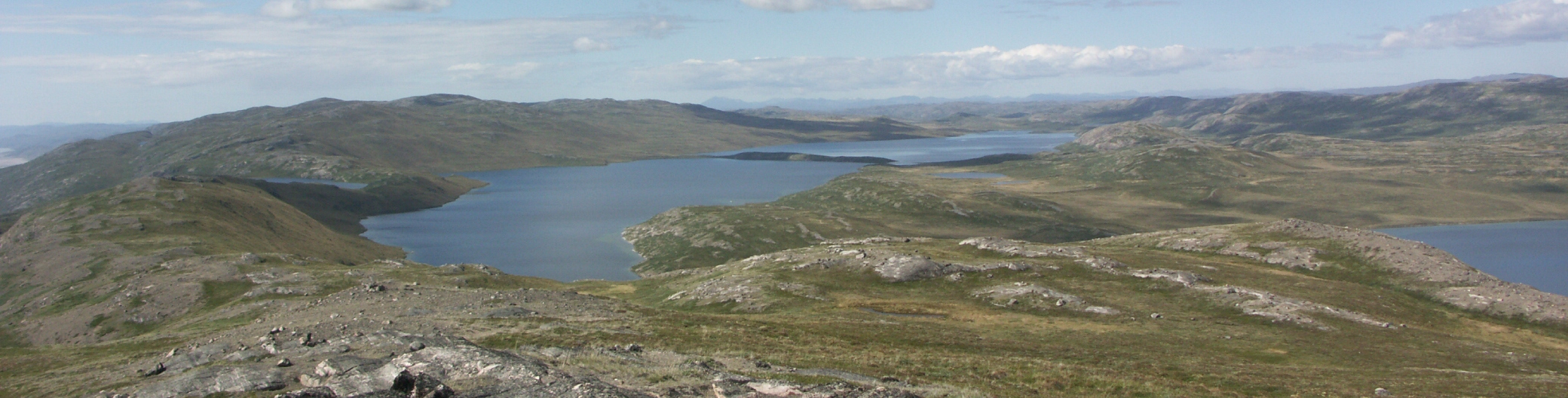
| image | Sanningasoq in summer 2010 (15).JPG |
| caption | Sanningasoq, with the characteristic broken isthmus |
| location | Greenland |
| coords | |
| type | Oligotrophic |
| basin_countries | Greenland |
| length | 10 km |
| width | 2 km |
| pushpin_map | Greenland |
| pushpin_map_alt | Location of lake within Greenland |
| max-depth =
Sanningasoq (old spelling: Sáningassoq) is a large oligotrophic twin lake in central-western Greenland, in the Qeqqata municipality. It is located approximately 9 km northeast of Kangerlussuaq. It is characteristic in that it is composed of two lakes connected via a narrow water passage through a broken isthmus. Its northwestern shore is at and its southeastern shore at .
Geography
The 2x10 km twin lake is separated from the Akuliarusiarsuup Kuua valley and Kangerlussuaq in the south by a low tundra ridge − part of the Kangaamiut dike swarm. To the east lies a sibling Aajuitsup Tasia lake, separated from Sanningasoq by a low marshland isthmus of little relief. To the north-east lies the 549 m Maniitsoq hill in the wide highland of Isunngua. The wide Tarajornitsut tundra highland lies to the west of the lake.
The surface of Sanningasoq is almost level with the surface of the neighboring Aajuitsup Tasia, both being in the ancient outflow path of Russell Glacier, and by extension, Sermersuaq, the Greenland Ice Sheet. The local depression part of which is occupied by the lake continues for several dozen kilometers in the west-north-western direction towards Sarfannguit and Sisimiut.
References
References
- [http://new.aslo.org/lo/toc/vol_49/issue_5/1549.pdf Klaus Peter Brodersen, Ole Pedersen, Claus Lindegaard, and Kirsten Hamburger (University of Copenhagen) − 'Chironomids (Diptera) and oxy-regulatory capacity: An experimental approach to paleolimnological interpretation' − Limnol. Oceanogr., 49(5), 2004, 1549–1559] {{webarchive. link. (2011-07-25)
- "Vandrekort Vestgrønland: Kangerlussuaq". Greenland Tourism a/s.
This article was imported from Wikipedia and is available under the Creative Commons Attribution-ShareAlike 4.0 License. Content has been adapted to SurfDoc format. Original contributors can be found on the article history page.
Ask Mako anything about Sanningasoq — get instant answers, deeper analysis, and related topics.
Research with MakoFree with your Surf account
Create a free account to save articles, ask Mako questions, and organize your research.
Sign up freeThis content may have been generated or modified by AI. CloudSurf Software LLC is not responsible for the accuracy, completeness, or reliability of AI-generated content. Always verify important information from primary sources.
Report