From Surf Wiki (app.surf) — the open knowledge base
San Blas, Nayarit

| Field | Value | ||||||
|---|---|---|---|---|---|---|---|
| name | San Blas | ||||||
| native_name_lang | es | ||||||
| settlement_type | Municipality | ||||||
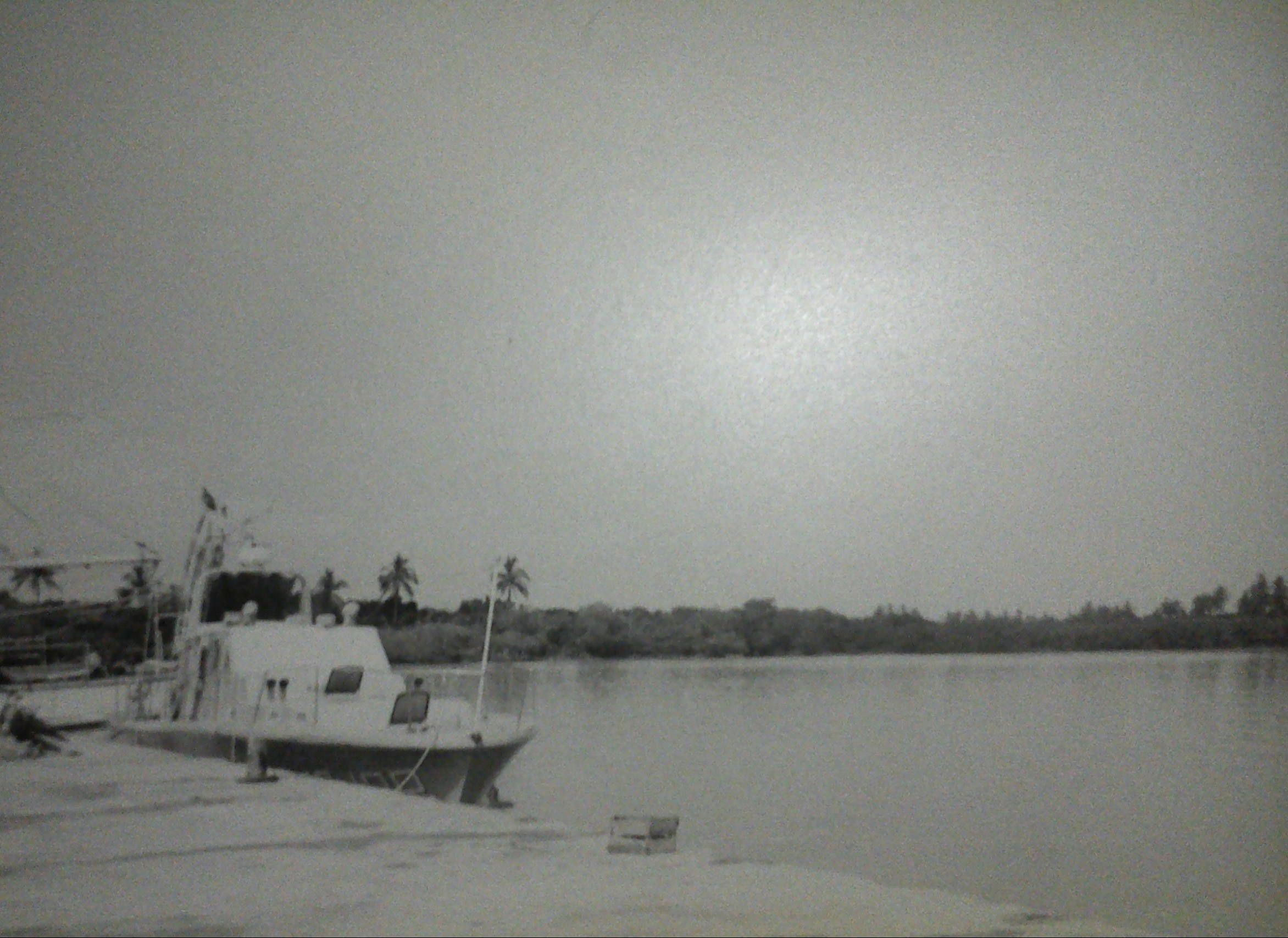
| image_skyline | San Blas (Mexico).JPG | ||||||
| image_caption | Panorama of San Blas | ||||||
| image_map | San Blas en Nayarit.svg | ||||||
| map_caption | Location of San Blas municipality in Nayarit | ||||||
| pushpin_map | Mexico | ||||||
| pushpin_label_position | left | ||||||
| pushpin_map_caption | Location of San Blas in Mexico | ||||||
| coordinates | |||||||
| subdivision_type | Country | ||||||
| subdivision_name | Mexico | ||||||
| subdivision_type1 | State | ||||||
| subdivision_name1 | Nayarit | ||||||
| established_title | Founded | ||||||
| established_date | 1530 | ||||||
| founder | Nuño de Guzmán | ||||||
| seat | San Blas | ||||||
| leader_party | [[File:PAN logo (Mexico).svg | 20px | link=National Action Party (Mexico)]] [[File:PRI logo (Mexico).svg | 20px | link=Institutional Revolutionary Party]] [[File:PRD logo (Mexico).svg | 20px | link=Party of the Democratic Revolution]] |
| leader_title | Presidente municipal | ||||||
| leader_name | José Antonio Barajas López | ||||||
| unit_pref | Metric | ||||||
| area_urban_footnotes | |||||||
| area_rural_footnotes | |||||||
| area_metro_footnotes | |||||||
| area_magnitude | |||||||
| area_blank2_title | |||||||
| area_total_km2 | 823.6 | ||||||
| elevation_max_m | 30 | ||||||
| population_as_of | 2020 | ||||||
| population_total | 37478 | ||||||
| population_density_km2 | auto | ||||||
| population_urban | 10187 | ||||||
| timezone1 | MST (Zona Pacífico) | ||||||
| utc_offset1 | -7 | ||||||
| timezone1_DST | MDT (Zona Pacífico) | ||||||
| utc_offset1_DST | -7 | ||||||
| postal_code_type | Postal Code | ||||||
| postal_code | 63740 | ||||||
| area_code_type | Area Code | ||||||
| area_code | 323 | ||||||
| website |
tags --| area_footnotes =
San Blas is both a municipality and municipal seat located on the Pacific coast of Mexico in Nayarit.
In 2023, the town of San Blas was designated a Pueblo Mágico by the Mexican government, recognizing its cultural and historical importance.
City
San Blas is a port and popular tourist destination, located about 160 km north of Puerto Vallarta, and 64 km west of the state capital Tepic, and three hours drive from Guadalajara. The town has a population of 8,707.
Municipality
The municipality had a population of 37,478 in 2005. The Islas Marías, the site of the former Islas Marías Federal Prison, are part of the municipality. President Andrés Manuel López Obrador announced in 2021 that the former prison would be rehabilitated as the environmental and cultural education center "Muros de Agua-José Revueltas" in honor of the writer who was imprisoned there.
History
In 1768, the Bourbon Visitador José de Gálvez decided to found the port of San Blas as a jumping off point for military expeditions to Sinaloa, Sonora, Baja California and Alta California. The military nature of San Blas distinguished it from the commercial port of Acapulco to the south. A subtext to the founding of San Blas may have been Gálvez' desire to curtail tax evasion on trade with Asia out of Acapulco, which was controlled by businessmen of Mexico City. Both Acapulco and San Blas tied New Spain to Asia through Manila. Gálvez also founded a shipyard in San Blas, with the next shipyard being Cavite in the Philippines. From 1774, navy ships delivered mail from San Blas to Manila. By tradition, the crew could carry private merchandise, so there was a small commercial subtext to San Blas from its inception In the 1790s, the Bourbon monarchy approved special permits for private ships to sail from Cadiz to San Blas. In 1801 and 1807, two ships of the Royal Philippine Company stopped in San Blas, though they were officially permitted only to sail to Lima. It was not until crisis broke out in the Spanish Empire in 1810 that San Blas opened its ports to trade between Lima, Panama, San Blas, Guaymas, Monterey and Manila. Silver mined in Mexico's northwest was shipped out of San Blas to pay for imports of goods, particularly from Panama, which was flooded with British products that entered through Jamaica on the other side of the isthmus.
At first, only two ships were assigned to the port: the packet ship San Carlos, commanded by Juan Pérez, and El Principe, commanded by Vicente Vila. Gálvez ordered four new vessels to be built, one of which was the schooner Sonora, later sailed in 1775 by Juan Francisco de la Bodega y Quadra to Alaska.
In many ways, San Blas was a poor choice for a deep sea harbor and settlement. The harbor was so small that it could never hold more than four ships at a time. Silting caused by the nearby Río Grande de Santiago resulted in the need for the harbor to be regularly dredged. The climate's stifling humidity and torrential rains from July to October, coupled with extensive mangrove swamps that surrounded the settlement, resulted in San Blas being plagued by clouds of voracious mosquitoes. A variety of sicknesses were endemic, including dysentery, typhoid fever, malaria, and other fevers. Naval officers and workers regularly complained about the climate. When Alessandro Malaspina visited in 1791, he found San Blas's climate so unhealthy that he refused to stay there, instead transferring his operations and some of San Blas' ships and personnel to Acapulco. San Blas's location was useful and logical, however, because it minimized travel time from Guadalajara and Mexico City without increasing the total distance to the Californias. Also, the area around San Blas had a plentiful supply of hardwoods useful for ship building and repair. Fresh water was also available year round.
A hillside fort was built in 1760 to defend the town's sea trade with the Philippines. Its front has stone carvings of the kings of Spain. On the hill behind the fort are the ruins of the Church of Our Lady of the Rosary, built in 1769. The ruins once contained the bronze bells that are said to have inspired Henry Wadsworth Longfellow's poem, "The Bells of San Blas". The ruins of a 19th-century customs house are on Calle Benito Juárez, three blocks from the main plaza.
During the colonial period, hardwood forests provided the raw materials for ships that did a brisk trade with the Philippines and the Manila galleon until the shipping moved to the port at Manzanillo, and later to Acapulco.
Modern history
In 2021, ejidatarios (farmers) from Jolotemba and nearby communities blocked access to the luxury tourist complex "Limoncitos Hills" owned by Canadian developer Angela Birkenbach. The complaints go back to 2019, when the developer deforested virgin land, without permission. Birkenbach's latest move was to take over an access road and 1.6 km of virgin beach, one of the last along the Nayarit coast.
San Blas and California
Spain's colony in California was supplied by two supply ships out of San Blas which arrived once a year. on March 12, 1768 Junípero Serra, Father President of the California Missions, departed for California on the locally built barque Purísima Concepción.
On March 16, 1775, the San Carlos was set to depart San Blas, Mexico, for San Francisco Bay, stopping in Monterey to unload supplies for the mission there. The vessel was a product of the shipyard established on the Santiago River. Her length was 58 feet, the officers and men numbered 30.
San Blas and Nootka
San Blas also became the base for Spanish expeditions to the Pacific Northwest. The Chinese were willing to pay up to $120 per otter hide ($ in dollars) which stimulated exploration of the Northwestern Pacific. From 1789 to 1795, San Blas was responsible for establishing and maintaining the Spanish post at Nootka Sound and Fort San Miguel (in present day British Columbia). For about twenty years in the late 18th century, San Blas was one of the busiest ports and shipbuilding centers on the Pacific coast of the Americas, rivaling Acapulco, the eastern terminus of the trans-Pacific Manila galleon convoy.
At its height, the town had 30,000 inhabitants and became headquarters of Spain's General of the Southern Seas.
Yaqui deportations
During the 1900s, San Blas served as the arrival port for thousands of Yaqui men, women and children forcibly removed from their lands and sold into slavery. At San Blas, these families were forcibly marched 200 miles to San Marcos and its train station. Those who did not die on the march were sold into slavery at San Marcos, where they were deported to the sugar cane plantations in Oaxaca, the tobacco planters of the Valle Nacional, and the henequen plantation owners of the Yucatán for use as slave labor. Most of the enslaved workers died within the first year of their captivity.
Government
Municipal presidents
| Term | Municipal president | Political party | Notes | ||
|---|---|---|---|---|---|
| 1917–1918 | Jesús N. Jiménez | ||||
| 1919–1920 | Luis Jordán | ||||
| 1921–1922 | Leonardo Quirarte | ||||
| 1923 | Daniel F. Martínez | ||||
| 1924 | Francisco L. Camberos | ||||
| 1925 | Guillermo A. Martínez | ||||
| 1926 | Rufino Quintero | ||||
| 1927 | Narciso de León | ||||
| 1928 | Maximiliano Morales | ||||
| 1929–1931 | Narciso Corona Tamayo | PNR [[File:Logo_Partido_Nacional_Revolucionario.svg | 22px]] | ||
| 1932–1933 | Leonardo Quirarte | PNR [[File:Logo_Partido_Nacional_Revolucionario.svg | 22px]] | ||
| 1933–1934 | Basilio Flores Moreno | PNR [[File:Logo_Partido_Nacional_Revolucionario.svg | 22px]] | ||
| 1935–1936 | Francisco González García | PNR [[File:Logo_Partido_Nacional_Revolucionario.svg | 22px]] | ||
| 1937–1938 | Antonio Parra | PNR [[File:Logo_Partido_Nacional_Revolucionario.svg | 22px]] | ||
| 1939–1940 | Lázaro Llanos | PRM [[File:Logo_Partido_de_la_Revolucion_Mexicana.svg | 21px]] | ||
| 1941–1942 | Ramón López Rentería | PRM [[File:Logo_Partido_de_la_Revolucion_Mexicana.svg | 21px]] | ||
| 1943–1944 | Ignacio Benítez Arias | PRM [[File:Logo_Partido_de_la_Revolucion_Mexicana.svg | 21px]] | ||
| 1945 | Leonardo Pérez | PRM [[File:Logo_Partido_de_la_Revolucion_Mexicana.svg | 21px]] | ||
| 1946–1948 | Pedro Betancourt Ramírez | PRI [[File:PRI Party (Mexico).svg | 22px]] | ||
| 1949–1951 | Narciso Corona Tamayo | PRI [[File:PRI Party (Mexico).svg | 22px]] | ||
| 1952–1954 | Manuel Yerena Alatorre | PRI [[File:PRI Party (Mexico).svg | 22px]] | ||
| 1955–1957 | Florentino Neza Plantillas | PRI [[File:PRI Party (Mexico).svg | 22px]] | ||
| 1958–1960 | Eugenio Plantillas Grajeda | PRI [[File:PRI Party (Mexico).svg | 22px]] | ||
| 1961–1963 | Juan García Gutiérrez | PRI [[File:PRI Party (Mexico).svg | 22px]] | ||
| 1964–1966 | Joel Robles Uribe | PRI [[File:PRI Party (Mexico).svg | 22px]] | ||
| 1967–1969 | Jorge R. Careaga Pérez | PRI [[File:PRI Party (Mexico).svg | 22px]] | ||
| 1970–1971 | Marcelino Márquez Uribe | PRI [[File:PRI Party (Mexico).svg | 22px]] | ||
| 1971–1972 | José Cruz Pacheco | PRI [[File:PRI Party (Mexico).svg | 22px]] | ||
| 1973–1975 | Rafael Gutiérrez Villaseñor | PRI [[File:PRI Party (Mexico).svg | 22px]] | ||
| 1976–1978 | Armando Trigueros Guerrero | PRI [[File:PRI Party (Mexico).svg | 22px]] | ||
| 1978 | Daniel Ibarra Guerrero | PRI [[File:PRI Party (Mexico).svg | 22px]] | ||
| 1978–1981 | Ponciano Bugarín Villa | PRI [[File:PRI Party (Mexico).svg | 22px]] | ||
| 1982–1983 | Ismael Hermosillo Hernández | PRI [[File:PRI Party (Mexico).svg | 22px]] | ||
| 1984–1987 | José Luis Lizaola H. | PRI [[File:PRI Party (Mexico).svg | 22px]] | ||
| 1987–1990 | Raúl Hermosillo Hernández | PRI [[File:PRI Party (Mexico).svg | 22px]] | ||
| 1990–1993 | Abelino Márquez Estrada | PRI [[File:PRI Party (Mexico).svg | 22px]] | ||
| 1993–1993 | Anselmo Hernández Sojo | PRI [[File:PRI Party (Mexico).svg | 22px]] | ||
| 1996–1999 | Carlos Luna Quirarte | PRI [[File:PRI Party (Mexico).svg | 22px]] | ||
| 1999–2002 | Alejandro Dávalos Valdés | PAN [[File:PAN Party (Mexico).svg | 22px]] | ||
| 2002–2005 | Eduardo Bernal Regalado | PRI [[File:PRI Party (Mexico).svg | 22px]] | ||
| 2005–2008 | Miguel Bernal Carrillo | National Action Party (Mexico) | PAN [[File:PAN Party (Mexico).svg | 22px]] | |
| 2008–2011 | Hilario Ramírez Villanueva "Layín" | National Action Party (Mexico) | PAN [[File:PAN Party (Mexico).svg | 22px]] | |
| 2011–2014 | Porfirio López Lugo | PRI [[File:PRI Party (Mexico).svg | 22px]] | ||
| 2014–2017 | Hilario Ramírez Villanueva "Layín" | Independent candidate | |||
| 2017–2021 | Candy Anisoara Yescas Blancas | PRI [[File:PRI Party (Mexico).svg | 22px]] | ||
| 17-09-2021–16-09-2024 | José Antonio Barajas López | PAN [[File:PAN Party (Mexico).svg | 22px]] | ||
| PRI [[File:PRI Party (Mexico).svg | 22px]] | ||||
| PRD [[File:PRD logo without border (Mexico).svg | 22px]] | Coalition "Va por Nayarit" | |||
| 17-09-2024– | José Antonio Barajas López | PAN [[File:PAN Party (Mexico).svg | 22px]] | ||
| PRI [[File:PRI Party (Mexico).svg | 22px]] | ||||
| PRD [[File:PRD logo without border (Mexico).svg | 22px]] | Coalition "Fuerza y Corazón por México" Reelected |
Climate
Retrieved on November 24, 2011.
Recreation and tourism
The area is noted for its surfing. Playa de Matanchen was famous for having the longest surfable wave in the world, as listed in the Guinness Book of World Records. A hurricane and subsequent storm surge filled part of the bay with sand, greatly reducing the size of the waves.
The area has an abundance of migratory birds in the surrounding estuaries and lowland palm forests, attracting significant numbers of birders. The Christmas Bird Count regularly finds well over 200 species, with a record 292 species in 1983.
The town is also a gateway, along with the nearby village of Matanchen, to the La Tovara park, an extensive mangrove forest and federally protected nature preserve accessible by small boat.
The formerly elegant Playa Hermosa, built in 1951, is on a lonely and beautiful stretch of beach about a mile from the plaza. In the 1960s, Hollywood had a brief hideaway flirtation with San Blas when actors, including Lee Marvin, discovered San Blas for its fishing. The hotel is now abandoned.
Economy
The economy is based on agriculture, fishing, and the tourist industry. The main crops are beans, sorghum, tobacco, corn, watermelon, and citrus fruits. There is a substantial cattle herd, and shrimp are raised in the extensive marshlands.
In popular culture
The San Blas Pier is the inspiration for the hit song "En el muelle de San Blas" by the Mexican rock band Maná. The song was inspired by Rebeca Méndez Jiménez who waited at the pier for 41 years for her fiancé fisherman Manuel to come back from a fishing trip. It is believed he died in a sea storm, in October 1971, amidst the Hurricane Priscilla.
San Blas in a poem
The last poem penned by American poet Henry Wadsworth Longfellow was "The Bells of San Blas", included in his book In the Harbor. He wrote it a few days before his passing.
Fragments:
*But to me, a dreamer of dreams,/ * *To whom what is and what seems/ * *Are often one and the same,/ * *The Bells of San Blas to me/ * Have a strange, wild melody,/ *And are something more than a name./ * [...]
*O Bells of San Blas in vain/ * *Ye call back the Past again;/ * *The Past is deaf to your prayer!/ * *Out of the shadows of night/ * *The world rolls into light;/ * It is daybreak everywhere.//
References
References
- "These are Mexico's newest Magical Towns".
- "Enciclopedia de los Municipios de México: Nayarit".
- (14 January 2021). "AMLO, anuncia pronto inicio del centro de educación ambiental de Islas Marías". El Universal.
- Priestley, Herbert Ingram. 1916. José de Gálvez: Visitor General of New Spain (1765-1771). Berkeley: University of California.
- Trejo Barrajas, Dení, and Marie Christine Duggan. 2018. “[https://www.academia.edu/38076398/28-47_San_Blas_and_the_Californias_00000002_.pdf San Blas and the Californias:] Hispanic Trade in the Northern Pacific Rim in a Time of Great Change” in Mains’l Haul, San Diego Museum of Maritime History.
- Pardo Hernández, Claudia Patricia (1994). San Blas y su relación con Filipinas, 1790-1820. Trabajo de licenciatura en historia. Iztapalapa: Universidad Autonoma Metropolitana.
- Trejo Barajas, Dení. 2006. “[http://revistadeindias.revistas.csic.es/index.php/revistadeindias/article/view/337 Implicaciones del comercio por el puerto de San Blas durante la guerra de Independencia],” Revista de Indias 66: 711-736.
- Valdés Lakowsky, Vera. 1987. De las Minas al Mar: Historia de la Plata Mexicana en Asia 1565-1934. Mexico: Fondo de Cultura Económica.
- Tovell, Freeman M.. (2008). "At the Far Reaches of Empire: The Life of Juan Francisco De La Bodega Y Quadra". University of British Columbia Press.
- (2023-10-21). "Fuerte de San Blas - Destinos México".
- (January 5, 2021). "La Jornada - Bloquean complejo turístico de empresaria canadiense en San Blas". La Jornada.
- Turner, John Kenneth, ''Barbarous Mexico'', Chicago: C.H. Kerr & Co., 1910, pp. 41–77
- "Enciclopedia de los Municipios y Delegaciones de México. Estado de Nayarit. San Blas".
- "Elección de presidente municipal y síndico".
- (10 June 2021). "Resultados Elecciones 2021: Así quedarían gobernados los municipios de Nayarit". Alcaldes de México.
- "Elección–Presidencias y Sindicaturas. Proceso Electoral Local Ordinario 2024. Cómputos Municipales. Votación por Partido Político, Coalición y Candidatura Común. San Blas". Instituto Estatal Electoral de Nayarit (IEEN).
- "Historical data for CBC Count Circle Code MXSB".
- "The works of... Henry Wadsworth Longfellow". Lancaster University.
- "The Bells of San Blas". Henry Wadsworth Longfellow. A Maine Historical Society Website.
This article was imported from Wikipedia and is available under the Creative Commons Attribution-ShareAlike 4.0 License. Content has been adapted to SurfDoc format. Original contributors can be found on the article history page.
Ask Mako anything about San Blas, Nayarit — get instant answers, deeper analysis, and related topics.
Research with MakoFree with your Surf account
Create a free account to save articles, ask Mako questions, and organize your research.
Sign up freeThis content may have been generated or modified by AI. CloudSurf Software LLC is not responsible for the accuracy, completeness, or reliability of AI-generated content. Always verify important information from primary sources.
Report