From Surf Wiki (app.surf) — the open knowledge base
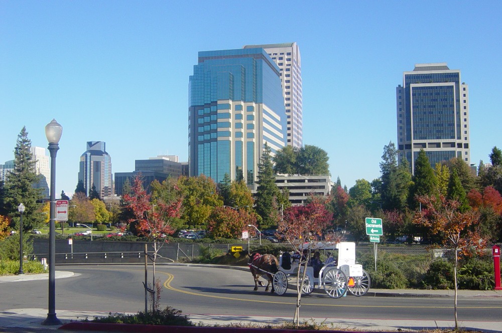
Sacramento County, California
County in California, United States
County in California, United States
| Field | Value | |
|---|---|---|
| name | Sacramento County | |
| settlement_type | County | |
| <!-- Images and maps -----------> | image_skyline | {{multiple image |
| total_width | 280 | |
| border | infobox | |
| perrow | 1/2/2/1 | |
| caption_align | center | |
| image1 | Sacramento,-California---State-Capitol_(cropped).jpg | |
| caption1 | California State Capitol in Sacramento | |
| image2 | Elk Grove Historic District - Sarah Stierch - 2 (cropped).jpg | |
| caption2 | Elk Grove | |
| image3 | -mypubliclandsroadtrip 2016- Wildlife Watching, Cosumnes River Preserve (28924370286).jpg | |
| caption3 | Cosumnes River Preserve | |
| image4 | Aerial view of Galt, August 2018.JPG | |
| caption4 | Galt | |
| image5 | East Gate Folsom Prison 2 (5434223305).jpg | |
| caption5 | Folsom | |
| image6 | Mokelumne River on Brannan-Andrus Island California DWR May 11, 2023 (cropped).jpg | |
| caption6 | Sacramento-San Joaquin River Delta | |
| image_flag | Flag of Sacramento County, California.svg | |
| image_seal | Seal of Sacramento County, California.svg | |
| named_for | The capital city of Sacramento, which is named for the Sacrament of the Holy Eucharist | |
| subdivision_type | Country | |
| subdivision_name | United States | |
| subdivision_type1 | State | |
| subdivision_name1 | California | |
| subdivision_type2 | Region | |
| subdivision_name2 | Sacramento Valley, San Joaquin Valley, Sacramento–San Joaquin River Delta | |
| subdivision_type3 | Metro area | |
| subdivision_name3 | Greater Sacramento | |
| coordinates | ||
| government_type | Council–CEO | |
| governing_body | Board of Supervisors | |
| leader_title | Chair | |
| leader_name | Phil Serna | |
| leader_title1 | Vice Chair | |
| leader_name1 | Rosario Rodriguez | |
| leader_title2 | Board of Supervisors | |
| leader_name2 | {{Collapsible list | |
| title | Supervisors | |
| frame_style | border:none; padding: 0; | |
| list_style | text-align:left; | |
| 1 | Phil Serna | |
| 2 | Patrick Kennedy | |
| 3 | Rich Desmond | |
| 4 | Rosario Rodriguez | |
| 5 | Patrick Hume | |
| leader_title3 | County Executive | |
| leader_name3 | David Villanueva | |
| seat_type | County seat (and largest city) | |
| seat | Sacramento | |
| unit_pref | US | |
| area_total_sq_mi | 994 | |
| area_land_sq_mi | 965 | |
| area_water_sq_mi | 29 | |
| elevation_max_footnotes | ||
| elevation_max_ft | 831 | |
| population_as_of | April 1, 2020 | |
| population_footnotes | ||
| population_total | 1,585,055 | |
| pop_est_as_of | 2024 | |
| population_est | 1,611,231 | |
| population_density_sq_mi | auto | |
| demographics_type2 | Gross Domestic Product | |
| demographics2_footnotes | ||
| demographics2_title1 | Total | |
| demographics2_info1 | US$98.990 billion (2022) | |
| established_title | Incorporated | |
| established_date | February 18, 1850 | |
| timezone | Pacific Standard Time | |
| utc_offset | −8 | |
| timezone_DST | Pacific Daylight Time | |
| utc_offset_DST | −7 | |
| image_blank_emblem | Sacramento County, CA logo.png | |
| blank_emblem_type | Wordmark | |
| image_map | ||
| map_caption | Interactive map of Sacramento County | |
| image_map1 | Map of California highlighting Sacramento County.svg | |
| mapsize1 | 200px | |
| map_caption1 | Location in the state of California | |
| blank_name | FIPS code | |
| blank_info | 06-067 | |
| area_codes | 209, 916 | |
| blank_name_sec1 | Congressional districts | |
| blank_info_sec1 | 3rd, 6th, 7th | |
| website |
Sacramento County () is located in the U.S. state of California. As of the 2020 United States census, the population was 1,585,055. Its county seat is Sacramento, which has been the state capital of California since 1854.
Sacramento County is the central county of the Greater Sacramento metropolitan area. The county covers about 1,026 sqmi in the northern portion of the Central Valley, on into Gold Country. Sacramento County extends from the low delta lands between the Sacramento River and San Joaquin River, including Suisun Bay, north to about 10 mi beyond the State Capitol and east into the foothills of the Sierra Nevada Mountains. The southernmost portion of Sacramento County has direct access to San Francisco Bay. Since 2010, statewide droughts in California have further strained Sacramento County's water security.
History
Sacramento County was one of the original counties of California, which were created in 1850 at the time of statehood. The county was named after the Sacramento River, which forms its western border. The river was named by Spanish cavalry officer Gabriel Moraga for the Santisimo Sacramento (Most Holy Sacrament), referring to the Catholic Eucharist.
Geography
According to the U.S. Census Bureau, the county has a total area of 1,026 sqmi, of which 984 sqmi is land and 41 sqmi (2.0%) is water. Most of the county is at an elevation close to sea level, with some areas below sea level. The highest point in the county is Carpenter Hill at 828 ft, in the southeast part of Folsom. Major watercourses in the county include the American River, Sacramento River, Cosumnes River, a tributary of the Mokelumne River, and Dry Creek, a tributary of the Sacramento River.
Adjacent counties
- Sutter County - northwest
- Placer County - north
- El Dorado County - northeast
- Amador County - east
- San Joaquin County - south
- Contra Costa County - southwest
- Solano County - west
- Yolo County - west
National protected areas
- Stone Lakes National Wildlife Refuge
- California National Historic Trail
- Pony Express National Historic Trail
Demographics
| align-fn = center 1790–1960 1900–1990 1990–2000 2010 2020
2020 census
As of the 2020 census, the county had a population of 1,585,055. The median age was 36.9 years. 23.2% of residents were under the age of 18 and 15.0% of residents were 65 years of age or older. For every 100 females there were 95.6 males, and for every 100 females age 18 and over there were 93.1 males age 18 and over.
The racial makeup of the county was 45.2% White, 9.6% Black or African American, 1.2% American Indian and Alaska Native, 17.8% Asian, 1.2% Native Hawaiian and Pacific Islander, 11.7% from some other race, and 13.4% from two or more races. Hispanic or Latino residents of any race comprised 23.6% of the population.
97.6% of residents lived in urban areas, while 2.4% lived in rural areas.
There were 564,445 households in the county, of which 33.5% had children under the age of 18 living with them and 28.9% had a female householder with no spouse or partner present. About 25.1% of all households were made up of individuals and 10.2% had someone living alone who was 65 years of age or older.
There were 587,551 housing units, of which 3.9% were vacant. Among occupied housing units, 57.1% were owner-occupied and 42.9% were renter-occupied. The homeowner vacancy rate was 1.0% and the rental vacancy rate was 4.1%.
Racial and ethnic composition
| Race / Ethnicity (NH = Non-Hispanic) | Pop 1980 | Pop 1990 | title=P004: Hispanic or Latino, and Not Hispanic or Latino by Race – 2000: DEC Summary File 1 – Sacramento County, California | url=https://data.census.gov/table?g=050XX00US06067&tid=DECENNIALSF12000.P004 | website=United States Census Bureau | access-date= }} | title=P2: Hispanic or Latino, and Not Hispanic or Latino by Race – 2010: DEC Redistricting Data (PL 94-171) – Sacramento County, California | url=https://data.census.gov/cedsci/table?q=p2&g=050XX00US06067&tid=DECENNIALPL2010.P2 | website=United States Census Bureau | access-date= }} | Pop 2020 | % 1980 | % 1990 | % 2000 | % 2010 | % 2020 |
|---|---|---|---|---|---|---|---|---|---|---|---|---|---|---|---|---|
| White alone (NH) | 599,830 | 721,932 | 706,655 | 687,166 | 650,271 | 76.57% | 69.34% | 57.76% | 48.43% | 41.03% | ||||||
| Black or African American alone (NH) | 57,883 | 93,970 | 118,073 | 139,949 | 145,724 | 7.39% | 9.02% | 9.65% | 9.86% | 9.19% | ||||||
| Native American or Alaska Native alone (NH) | 8,827 | 9,854 | 9,070 | 7,875 | 7,432 | 1.13% | 0.95% | 0.74% | 0.56% | 0.47% | ||||||
| Asian alone (NH) | 39,156 | 92,131 | 132,601 | 198,944 | 276,295 | 5.00% | 8.85% | 10.84% | 14.02% | 17.43% | ||||||
| Native Hawaiian or Pacific Islander alone (NH) | x | x | 6,788 | 13,099 | 18,011 | 0.55% | 0.92% | 0.55% | 0.92% | 1.14% | ||||||
| Other race alone (NH) | 3,544 | 1,788 | 3,406 | 3,418 | 10,104 | 0.45% | 0.17% | 0.28% | 0.24% | 0.64% | ||||||
| Mixed race or Multiracial (NH) | x | x | 51,016 | 62,141 | 102,784 | x | x | 4.17% | 4.38% | 6.48% | ||||||
| Hispanic or Latino (any race) | 74,141 | 121,544 | 195,890 | 306,196 | 374,434 | 9.46% | 11.67% | 16.01% | 21.58% | 23.62% | ||||||
| Total | 783,381 | 1,041,219 | 1,223,499 | 1,418,788 | 1,585,055 | 100.00% | 100.00% | 100.00% | 100.00% | 100.00% |

2010 census
The 2010 United States census reported that Sacramento County had a population of 1,418,788. The racial makeup of Sacramento County was 815,151 (57.5%) White, 200,228 (15.4%) African American, 14,308 (1.0%) Native American, 203,211 (14.3%) Asian, 13,858 (1.0%) Pacific Islander, 131,691 (9.3%) from other races, and 93,511 (6.6%) from two or more races. There were 306,196 Hispanic or Latino residents of any race (21.6%). Sacramento County has the largest population of Fijian Americans.
| Population reported at 2010 United States census |
|---|
| Sacramento County |
| Citrus Heights |
| Elk Grove |
| Folsom |
| Galt |
| Isleton |
| Rancho Cordova |
| Sacramento |
| Antelope |
| Arden-Arcade |
| Carmichael |
| Clay |
| Courtland |
| Elverta |
| Fair Oaks |
| Florin |
| Foothill Farms |
| Franklin |
| Freeport |
| Fruitridge Pocket |
| Gold River |
| Herald |
| Hood |
| La Riviera |
| Lemon Hill |
| Mather |
| McClellan Park |
| North Highlands |
| Orangevale |
| Parkway |
| Rancho Murieta |
| Rio Linda |
| Rosemont |
| Vineyard |
| Walnut Grove |
| Wilton |
| All others not CDPs (combined) |
2000 census
As of the census of 2000, there were 1,223,499 people, 453,602 households, and 297,562 families residing in the county. The population density was 1,267 PD/sqmi. There were 474,814 housing units at an average density of 492 /sqmi. The racial makeup of the county was 64.0% White, 10.6% Black or African American, 1.09% Native American, 13.5% Asian, 0.6% Pacific Islander, 7.5% from other races, and 5.8% from two or more races. 19.3% of the population were Hispanic or Latino of any race. 10.2% were of German, 7.0% English, 6.7% Irish and 5.1% American ancestry according to Census 2000. 75.7% spoke only English at home; 10.0% spoke Spanish, 1.5% Hmong, 1.4% Chinese or Mandarin, 1.3% Vietnamese, 1.2% Tagalog and 1.2% Russian.
There were 453,602 households, out of which 33.7% had children under the age of 18 living with them, 46.4% were married couples living together, 14.1% had a female householder with no husband present, and 34.4% were non-families. 26.7% of all households were made up of individuals, and 8.0% had someone living alone who was 65 years of age or older. The average household size was 2.64 and the average family size was 3.24.
In the county, 27.6% of the population was under the age of 18, 9.5% was from 18 to 24, 31.0% from 25 to 44, 20.9% from 45 to 64, and 11.1% was 65 years of age or older. The median age was 34 years. For every 100 females, there were 95.9 males. For every 100 female residents aged 18 and over, there were 92.5 males.
The median income for a household in the county was $43,816, and the median income for a family was $50,717. Males had a median income of $39,482 versus $31,569 for females. The per capita income for the county was $21,142. About 10.3% of families and 14.1% of the population were below the poverty line, including 20.2% of those under age 18 and 6.6% of those age 65 or over.
Government and policing
Main article: Government of Sacramento County, California
Government
The Government of Sacramento County is defined and authorized under the California Constitution, California law, and the Charter of the County of Sacramento. Much of the Government of California is in practice the responsibility of county governments such as the Government of Sacramento County, while municipalities such as the city of Sacramento and Folsom provide additional, often non-essential services.
It is composed of the elected five-member Board of Supervisors, several other elected offices including the Sheriff, District Attorney, and Assessor, and numerous county departments and entities under the supervision of the County Executive Officer. In addition, several entities of the government of California have jurisdiction conterminous with Sacramento County, such as the Sacramento County Superior Court.
Under its foundational Charter, the five-member elected Sacramento County Board of Supervisors (BOS) is the county legislature. The board operates in a legislative, executive, and quasi-judicial capacity. The current members are:
- Phil Serna, District 1
- Patrick Kennedy, District 2
- Rich Desmond, District 3
- Rosario Rodriguez, District 4
- Pat Hume, District 5
The Sacramento County Code is the codified law of Sacramento County in the form of local ordinances passed by the Board of Supervisors.
Policing
The Sacramento County Sheriff provides court protection and jail management for the entire county. It provides patrol and detective services for the unincorporated areas of the county. Incorporated municipalities within the county that have their own municipal police departments or contract with the Sacramento County sheriff for their policing are: Elk Grove, 170,000, municipal department; Citrus Heights, 88,000, municipal department; Folsom, 78,000, municipal department; Isleton, sheriff contract; Rancho Cordova, 73,000, sheriff contract; Galt, population 26,000, municipal department.
Other law enforcement agencies in the county include the Sacramento County Park Rangers that service the County Parks, Twin Rivers Unified School District Police servicing police services for Twin Rivers School District, and the Fulton-El Camino Park District Police Department servicing Recreation and Park Districts.
The Fulton-El Camino Park District Police operating under the Fulton-El Camino Recreation and Park District was disbanded as of November 26, 2024, following an alleged mismanagement of government funds, ethical and moral dilemmas by Emily Ballus (General Manager) and Beth Johnson (Interim Chief of Police). ABC10 conducted an investigation regarding misappropriation of funds.
Politics
Voter registration
| Total population | Registered votersPercentage of registered voters with respect to total population. Percentages of party members with respect to registered voters follow. | Democratic | Republican | Democratic–Republican spread | Independent | Green | Libertarian | Peace and Freedom | Unknown | Other | No party preference |
|---|---|---|---|---|---|---|---|---|---|---|---|
| 1,585,055 | |||||||||||
| 907,431 | 57.2% | ||||||||||
| 404,232 | 44.6% | ||||||||||
| 234,257 | 25.8% | ||||||||||
| +169,975 | +18.8% | ||||||||||
| 41,392 | 4.6% | ||||||||||
| 4,784 | 0.6% | ||||||||||
| 11,248 | 1.2% | ||||||||||
| 6,329 | 0.7% | ||||||||||
| 4,618 | 0.5% | ||||||||||
| 3,449 | 0.4% | ||||||||||
| 197,122 | 21.7% |
Cities by population and voter registration
| City | Population | Registered voters | |||||
|---|---|---|---|---|---|---|---|
| Democratic | Republican | D–R spread | Other | No party preference | |||
| Citrus Heights | 87,036 | 59.3% | 33.7% | 37.1% | -3.4% | 9.7% | 19.6% |
| Elk Grove | 177,221 | 64.2% | 45.7% | 24.6% | +20.9% | 6.9% | 22.8% |
| Folsom | 82,140 | 65.9% | 35.6% | 34.1% | +1.5% | 7.9% | 22.5% |
| Galt | 25,665 | 60.4% | 33.3% | 38.6% | -5.3% | 8.4% | 19.7% |
| Isleton | 649 | 60.4% | 40.0% | 27.3% | +12.7% | 10.7% | 21.9% |
| Rancho Cordova | 80,656 | 56.7% | 40.8% | 28.5% | +12.3% | 8.4% | 22.3% |
| Sacramento | 524,802 | 54.8% | 54.3% | 16.0% | +38.3% | 7.4% | 22.3% |
Overview
Sacramento County was politically competitive in most presidential elections between 1976 and 2004, but now votes significantly in favor of the Democratic candidates. Candidates from the Democratic Party have carried the county in the past eight presidential elections, and have won a majority of the county's votes five times during that timespan. The city of Sacramento is strongly Democratic, while rural areas are strongly Republican; suburban areas are more divided. This pattern is also present in congressional and state legislative elections. The last Republican presidential candidate to win a majority in the county was George H. W. Bush in 1988.
In gubernatorial elections, Sacramento County is typically a bellwether, having voted for the winner every time since 1962 with the exception of 1970 and 2002.
| Year | Republican | Democratic |
|---|---|---|
| 2022 | 42.5% 202,933 | 57.5% 274,680 |
| 2018 | 41.2% 212,010 | 58.8% 302,696 |
| 2014 | 37.7% 122,342 | 62.3% 202,416 |
| 2010 | 38.5% 162,369 | 56.7% 239,599 |
| 2006 | 60.5% 218,889 | 34.2% 123,685 |
| 2002 | 46.6% 147,456 | 40.8% 129,143 |
| 1998 | 39.7% 142,970 | 57.4% 206,870 |
| 1994 | 54.8% 196,229 | 40.9% 146,423 |
| 1990 | 50.3% 167,982 | 44.7% 149,215 |
| 1986 | 68.1% 207,086 | 30.1% 91,660 |
| 1982 | 52.4% 171,176 | 44.7% 146,167 |
| 1978 | 34.7% 88,445 | 54.9% 139,821 |
| 1974 | 45.9% 104,595 | 51.6% 117,711 |
| 1970 | 46.0% 105,523 | 52.5% 120,365 |
| 1966 | 50.9% 109,801 | 49.1% 105,861 |
| 1962 | 37.7% 71,788 | 60.7% 115,462 |
In the House of Representatives, all of California's 6th congressional district and portions of its 3rd, and 7th districts are in the county.
In the State Assembly, all of the 7th and 8th districts and parts of the 6th, 9th, and 11th districts are in the county.
In the State Senate, parts of the 1st, 3rd, 4th, 6th, and 8th districts are in the county.
According to the California Secretary of State, as of October 22, 2012, Sacramento County has 698,899 registered voters, out of 944,243 eligible (74%). Of those, 306,960 (44%) are registered Democrats, 225,688 (32%) are registered Republicans, and 134,677 (19%) have declined to state a political party.
Crime
The following table includes the number of incidents reported and the rate per 1,000 persons for each type of offense.
| Population and crime rates | Population | Violent crime | Homicide | Forcible rape | Robbery | Aggravated assault | Property crime | Burglary | Larceny-theft | Motor vehicle theft | Arson |
|---|---|---|---|---|---|---|---|---|---|---|---|
| 1,408,480 | |||||||||||
| 8,988 | 6.38 | ||||||||||
| 70 | 0.05 | ||||||||||
| 448 | 0.32 | ||||||||||
| 3,282 | 2.33 | ||||||||||
| 5,188 | 3.68 | ||||||||||
| 31,835 | 22.60 | ||||||||||
| 12,526 | 8.89 | ||||||||||
| 30,971 | 21.99 | ||||||||||
| 8,624 | 6.12 | ||||||||||
| 366 | 0.26 |
Cities by population and crime rates
| Cities by population and crime rates | City | Population | Violent crimes | Violent crime rate | ||
|---|---|---|---|---|---|---|
| per 1,000 persons | Property crimes | Property crime rate | ||||
| per 1,000 persons | ||||||
| Citrus Heights | 85,112 | 329 | 3.87 | 3,117 | 36.62 | |
| Elk Grove | 156,344 | 512 | 3.27 | 3,292 | 21.06 | |
| Folsom | 73,678 | 85 | 1.15 | 1,277 | 17.33 | |
| Galt | 24,163 | 59 | 2.44 | 470 | 19.45 | |
| Rancho Cordova | 66,214 | 393 | 5.94 | 2,107 | 31.82 | |
| Sacramento | 476,557 | 3,520 | 7.39 | 19,967 | 41.90 |
Education
Colleges and universities
; Public universities
- California State University Sacramento
- UC Davis Extension
- UC Davis School of Medicine
- UC Davis Betty Irene Moore School of Nursing
; Community colleges
- Los Rios Community College District
- American River College
- Cosumnes River College
- Folsom Lake College
- Sacramento City College
- San Joaquin Delta Community College District
- Sierra Joint Community College District
; Private, not for profit
- University of the Pacific in Sacramento
- National University Sacramento Regional Campus
- University of San Francisco Regional Campus
- University of Southern California Extension
- Western Seminary
- Epic Bible College
; Private, for profit
- Alliant International University
- California Northstate University College of Pharmacy
- Chamberlain University Rancho Cordova
- DeVry University
- Lincoln Law School of Sacramento
- MTI College
- Professional School of Psychology
- San Joaquin Valley College
- The Art Institute of California – Sacramento, a branch of The Art Institute of California - Los Angeles
- Universal Technical Institute
- University of Phoenix Sacramento Valley
K-12 education
School districts include:
K-12:
- Center Joint Unified School District
- Elk Grove Unified School District
- Folsom-Cordova Unified School District
- Natomas Unified School District
- River Delta Unified School District
- Sacramento City Unified School District
- San Juan Unified School District
- Twin Rivers Unified School District - Includes some areas for grades K-12, some for 7–12 only, and some for 9–12 only
Secondary:
- Galt Joint Union High School District
- Roseville Joint Union High School District
Elementary:
- Arcohe Union School District
- Dry Creek Joint Elementary School District
- Elverta Joint Elementary School District
- Galt Joint Union Elementary School District
- Robla Elementary School District
Transportation
Main article: Transportation in the Sacramento metropolitan area

Public Transportation
Sacramento Regional Transit District, also known as Sacramento RT, provides public transit throughout the county. It operates bus services, as well as light rail services on the Blue, Green, and Gold lines. In addition, the Yolobus provides Sacramento County with service connecting to destinations in neighboring Yolo County, such as Davis. SacRT and Yolobus both provide bus services connecting Sacramento with Sacramento International Airport.
Amtrak and its Amtrak California subsidiary operate passenger rail service from the Sacramento Valley station. This station is served by the Coast Starlight, the California Zephyr, the Capitol Corridor, and the Gold Runner, which link the region with destinations across California and the United States.
Major highways
Airports
Sacramento International Airport is a major, full-service airport with passenger flights. It is owned by the County of Sacramento. The county also owns Sacramento Mather Airport in Rancho Cordova and Sacramento Executive Airport, both of which are general aviation airports. Sacramento McClellan Airport, formerly McClellan Air Force Base, is a privately owned airport between North Highlands and Rio Linda. There are also privately owned public use airports located in Elk Grove and Rio Linda.
Public roadways
The Sacramento County Department of Transportation (SACDOT) maintains approximately 2200 miles of roadway within the unincorporated area. The roads range from six lane thoroughfares to rural roads.
Communities

Cities
- Citrus Heights
- Elk Grove
- Folsom
- Galt
- Isleton
- Rancho Cordova
- Sacramento (county seat)
Census-designated places
- Antelope
- Arden-Arcade
- Carmichael
- Clay
- Courtland
- Elverta
- Fair Oaks
- Florin
- Foothill Farms
- Franklin
- Freeport
- Fruitridge Pocket
- Gold River
- Herald
- Hood
- La Riviera
- Lemon Hill
- Mather
- McClellan Park
- North Highlands
- Orangevale
- Parkway
- Rancho Murieta
- Rio Linda
- Rosemont
- Vineyard
- Walnut Grove
- Wilton
Unincorporated community
- Locke
Former townships

In February 1851, the county was divided into eight civil townships: the seven marked by asterisks below, plus Sacramento township. In July of that year, American township was divided off from Sacramento township. In 1856, the Board of Supervisors realigned the divisions into the 14 civil townships below, plus the city of Sacramento.
- Alabama
- American
- Brighton*
- Center*
- Cosumnes*
- Dry Creek
- Franklin
- Georgiana
- Granite
- Lee
- Mississippi*
- Natoma*
- San Joaquin*
- Sutter*
Population ranking
The population ranking of the following table is based on the 2020 census of Sacramento County.
† county seat
| Rank | City/town/etc. | Municipal type | Population (2020 Census) |
|---|---|---|---|
| 1 | † Sacramento (State Capital) | City | 524,943 |
| 2 | Elk Grove | City | 176,124 |
| 3 | Arden-Arcade | CDP | 94,659 |
| 4 | Citrus Heights | City | 87,583 |
| 5 | Folsom | City | 80,454 |
| 6 | Carmichael | CDP | 79,793 |
| 7 | Rancho Cordova | City | 79,332 |
| 8 | Florin | CDP | 52,388 |
| 9 | North Highlands | CDP | 49,327 |
| 10 | Antelope | CDP | 48,733 |
| 11 | Vineyard | CDP | 43,935 |
| 12 | Foothill Farms | CDP | 35,834 |
| 13 | Orangevale | CDP | 35,569 |
| 14 | Fair Oaks | CDP | 32,514 |
| 15 | Galt | City | 25,383 |
| 16 | Rosemont | CDP | 23,510 |
| 17 | Parkway | CDP | 15,962 |
| 18 | Rio Linda | CDP | 15,944 |
| 19 | Lemon Hill | CDP | 14,496 |
| 20 | La Riviera | CDP | 11,252 |
| 21 | Gold River | CDP | 7,844 |
| 22 | Fruitridge Pocket | CDP | 6,102 |
| 23 | Wilton | CDP | 5,958 |
| 24 | Rancho Murieta | CDP | 5,903 |
| 25 | Elverta | CDP | 5,435 |
| 26 | Mather | CDP | 4,698 |
| 27 | Walnut Grove | CDP | 1,452 |
| 28 | Clay | CDP | 1,252 |
| 29 | Herald | CDP | 1,160 |
| 30 | McClellan Park | CDP | 926 |
| 31 | Isleton | City | 794 |
| 32 | Courtland | CDP | 326 |
| 33 | Hood | CDP | 244 |
| 34 | Franklin | CDP | 167 |
| 35 | Freeport | CDP | 58 |
Notes
References
References
- "County Board of Supervisors".
- [[Carpenter Hill]]
- "State & County QuickFacts". United States Census Bureau.
- "Gross Domestic Product by County and Metropolitan Area, 2022". [[Bureau of Economic Analysis]].
- "Chronology". California State Association of Counties.
- "Sacramento County, California".
- "Find a County". National Association of Counties.
- (April 29, 2022). "Southern California gets drastic water cutbacks amid drought. What's next for Sacramento?". [[The Sacramento Bee]].
- (August 22, 2012). "2010 Census Gazetteer Files". United States Census Bureau.
- "Annual Estimates of the Resident Population for Counties: April 1, 2020 to July 1, 2024". United States Census Bureau.
- "Census of Population and Housing from 1790-2000". [[US Census Bureau]].
- "Historical Census Browser". University of Virginia Library.
- (March 27, 1995). "Population of Counties by Decennial Census: 1900 to 1990". United States Census Bureau.
- (April 2, 2001). "Census 2000 PHC-T-4. Ranking Tables for Counties: 1990 and 2000". United States Census Bureau.
- (2021). "2020 Decennial Census Demographic Profile (DP1)".
- (2021). "2020 Decennial Census Redistricting Data (Public Law 94-171)".
- (2023). "2020 Decennial Census Demographic and Housing Characteristics (DHC)".
- "California: 1980, General Social and Economic Characteristics, Part 1 - Table 59: Persons by Race, Hispanic Origin, and Sex".
- "California: 1990, Part 1 - Table 5: Race and Hispanic Origin".
- "P004: Hispanic or Latino, and Not Hispanic or Latino by Race – 2000: DEC Summary File 1 – Sacramento County, California".
- "P2: Hispanic or Latino, and Not Hispanic or Latino by Race – 2010: DEC Redistricting Data (PL 94-171) – Sacramento County, California".
- "P2: Hispanic or Latino, and Not Hispanic or Latino by Race – 2020: DEC Redistricting Data (PL 94-171) – Sacramento County, California".
- included in the Asian category in the 1980 Census
- included in the Asian category in the 1990 Census
- not an option in the 1980 Census
- not an option in the 1990 Census
- {{USCensus2010CA
- "U.S. Census website". [[United States Census Bureau]].
- California Government Code § 23004
- (2024-11-22). "Fulton-El Camino Park Police Department to be disbanded".
- (2024-10-28). "Local park police face uncertain future as leadership rakes in high salaries".
- U.S. Census Bureau: Sacramento County, California. [https://data.census.gov/profile/Sacramento_County,_California?g=050XX00US06067 U.S. Census website]. Retrieved September 6, 2025.
- California Secretary of State. [https://elections.cdn.sos.ca.gov/ror/ror-odd-year-2025/politicalsub.pdf February 10, 2025 - Report of Registration]. Retrieved September 6, 2025.
- U.S. Census Bureau: Sacramento County, California. [https://data.census.gov/table/ACSST5Y2023.S0101?g=160XX00US0613588,0622020,0624638,0628112,0636882,0659444,0664000 U.S. Census website]. Retrieved September 6, 2025.
- Leip, David. "Dave Leip's Atlas of U.S. Presidential Elections".
- {{Cite GovTrack. CA. 7
- [http://www.sos.ca.gov/elections/ror/ror-pages/15day-general-12/county1.pdf CA Secretary of State – Report of Registration – October 22, 2012] {{webarchive. link. (November 18, 2012)
- U.S. Census Bureau. American Community Survey, 2011 American Community Survey 5-Year Estimates, Table B02001. [https://www.census.gov U.S. Census website]. Retrieved October 26, 2013.
- Office of the Attorney General, Department of Justice, State of California. [http://stats.doj.ca.gov/cjsc_stats/prof09/00/11.pdf Table 11: Crimes – 2009] {{webarchive. link. (December 2, 2013 . Retrieved November 14, 2013.)
- Only larceny-theft cases involving property over $400 in value are reported as property crimes.
- United States Department of Justice, Federal Bureau of Investigation. [https://www.fbi.gov/about-us/cjis/ucr/crime-in-the-u.s/2012/crime-in-the-u.s.-2012/tables/8tabledatadecpdf/table-8-state-cuts/table_8_offenses_known_to_law_enforcement_by_california_by_city_2012.xls Crime in the United States, 2012, Table 8 (California)]. Retrieved November 14, 2013.
- "2020 CENSUS - SCHOOL DISTRICT REFERENCE MAP: Sacramento County, CA". [[U.S. Census Bureau]].
- "Sacramento County Department of Transportation (SACDOT)".
- "Mileage of Maintained Roadways".
- Davis, Winfield J.. (1890). "An Illustrated History of Sacramento County, California". Lewis Pub. Co..
- "Explore Census Data". United States Census Bureau.
This article was imported from Wikipedia and is available under the Creative Commons Attribution-ShareAlike 4.0 License. Content has been adapted to SurfDoc format. Original contributors can be found on the article history page.
Ask Mako anything about Sacramento County, California — get instant answers, deeper analysis, and related topics.
Research with MakoFree with your Surf account
Create a free account to save articles, ask Mako questions, and organize your research.
Sign up freeThis content may have been generated or modified by AI. CloudSurf Software LLC is not responsible for the accuracy, completeness, or reliability of AI-generated content. Always verify important information from primary sources.
Report