From Surf Wiki (app.surf) — the open knowledge base
Romney, West Virginia
City in West Virginia, US

City in West Virginia, US
| Field | Value |
|---|---|
| name | Romney, West Virginia |
| settlement_type | Town |
| image_skyline | National Building Romney WV 2013 07 14 02.jpg |
| image_caption | National Building in downtown Romney |
| image_alt | An image of a two-story beige brick neoclassical building with a colonnaded portico, and topped by a dome |
| motto | "First in West Virginia – Est. 1762" |
| image_map | File:Hampshire County West Virginia Incorporated and Unincorporated areas Romney Highlighted.svg |
| map_alt | A white line map of Hampshire County with Romney’s location colored red |
| map_caption | Location of Romney in Hampshire County, West Virginia |
| pushpin_map | USA West Virginia Romney#USA West Virginia Eastern Panhandle#USA West Virginia#United States |
| coordinates | |
| coordinates_footnotes | |
| subdivision_type | Country |
| subdivision_name | United States |
| subdivision_type1 | State |
| subdivision_name1 | West Virginia |
| subdivision_type2 | County |
| subdivision_name2 | Hampshire |
| established_title | Incorporation |
| established_date | December 23, 1762 |
| government_footnotes | |
| government_type | Mayor–council |
| governing_body | Romney Town Council |
| leader_title | Mayor |
| leader_name | Beverly C. Keadle (D) |
| unit_pref | Imperial |
| area_footnotes | |
| area_blank_title | |
| area_total_km2 | 2.49 |
| area_land_km2 | 2.49 |
| area_water_km2 | 0.00 |
| area_total_sq_mi | 0.96 |
| area_land_sq_mi | 0.96 |
| area_water_sq_mi | 0.00 |
| elevation_footnotes | |
| elevation_ft | 804 |
| population_footnotes | |
| population_as_of | 2020 |
| population_total | 1722 |
| population_est | 1717 |
| pop_est_as_of | 2021 |
| population_density_sq_mi | 1763.79 |
| population_density_km2 | 681.32 |
| timezone1 | EST |
| utc_offset1 | -5 |
| timezone1_DST | EDT |
| utc_offset1_DST | -4 |
| postal_code_type | ZIP code |
| postal_code | 26757 |
| area_code | 304 |
| website | |
| blank_name | FIPS code |
| blank_info | 54-70084 |
| blank1_name | GNIS feature ID |
| blank1_info | 2390646 |
Romney is a town in Hampshire County, West Virginia, United States, and its county seat. The population was 1,722 at the 2020 census. It is part of the Winchester, Virginia metropolitan area. The town was established in 1762 along with Shepherdstown; together, they are the two oldest towns in West Virginia.
History
Established by consecutive acts of the Virginia House of Burgesses and approved by the governor on December 23, 1762, Romney and Mecklenburg (later renamed Shepherdstown), in Jefferson County, are the oldest towns in West Virginia. The bill containing the Act for establishing the town of Romney, in the county of Hampshire, and for other purposes therein-mentioned, is listed 20th on a list of approved "publick and private bills" and is immediately followed by An Act for establishing the town of Mecklenburg, in the county of Frederick.
Originally settled in 1725 by hunters and traders, Romney was known as Pearsall's Flats and was the site of the French and Indian War stockade Fort Pearsall. Named for the Cinque Ports town of Romney, Kent, England, by Thomas Fairfax, 6th Lord Fairfax of Cameron, the town still bears place names and symbols from its colonial past such as its Marsham Street, named for Robert Marsham, 2nd Baron Romney. It is also home to the West Virginia Schools for the Deaf and Blind and the nation's First Confederate Memorial in Indian Mound Cemetery.
Romney Academy was first incorporated by the Virginia General Assembly on January 11, 1814, and was active until 1846 when it was reorganized as the Romney Classical Institute. Romney Academy was one of the earliest institutions for higher learning within the present boundaries of the state of West Virginia. The Romney Classical Institute, a coeducational collegiate preparatory school, survived until 1866. The loss of members due to the American Civil War forced its closure.

The Romney Expedition of the Confederate States Army occurred in the early American Civil War. It was part of the preliminary actions of Stonewall Jackson's Valley Campaign as Jackson cleared Union Army troops led by Major General Nathaniel Banks and Brigadier General William S. Rosecrans from the lower Shenandoah Valley and surrounding Allegheny ranges, and then successfully severed the Baltimore and Ohio Railroad and the Chesapeake and Ohio Canal. His army advanced from Winchester towards Cumberland, Maryland, but withdrew after reaching Romney due to harsh winter conditions. Romney was occupied by both Union and Confederate soldiers multiple times throughout the war.
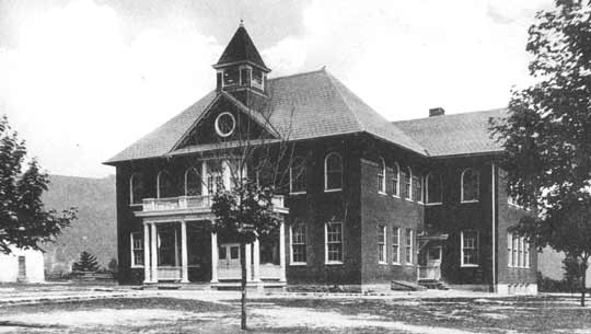
The West Virginia Schools for the Deaf and the Blind was established in 1870 upon the campus of the Romney Classical Institute.
Geography
According to the United States Census Bureau, the city has a total area of 0.96 sqmi, all land.
Climate
The climate in this area is characterized by hot, humid summers and generally cold winters. According to the Köppen Climate Classification system, Romney has a humid continental climate, abbreviated "Dfa" on climate maps.
| Jan record high F = 79 | Feb record high F = 85 | Mar record high F = 94 | Apr record high F = 101 | May record high F = 101 | Jun record high F = 104 | Jul record high F = 107 | Aug record high F = 109 | Sep record high F = 104 | Oct record high F = 98 | Nov record high F = 85 | Dec record high F = 80 | year record high F = 109
| Jan record low F = -20 | Feb record low F = -20 | Mar record low F = -4 | Apr record low F = 7 | May record low F = 23 | Jun record low F = 29 | Jul record low F = 38 | Aug record low F = 35 | Sep record low F = 24 | Oct record low F = 13 | Nov record low F = -1 | Dec record low F = -15 | year record low F = -20
|access-date = October 14, 2023}}{{cite web |access-date = October 14, 2023}}
Demographics
|align-fn=center 2013 Estimate
2010 census
As of the census of 2010, there were 1,848 people, 843 households, and 410 families living in the city. The population density was 1925.0 PD/sqmi. There were 967 housing units at an average density of 1007.3 /sqmi. The racial makeup of the city was 95.8% White, 2.7% African American, 0.2% Native American, 0.1% Asian, 0.1% from other races, and 1.1% from two or more races. Hispanic or Latino of any race were 1.4% of the population.
There were 843 households, of which 23.7% had children under the age of 18 living with them, 31.2% were married couples living together, 13.2% had a female householder with no husband present, 4.3% had a male householder with no wife present, and 51.4% were non-families. 46.5% of all households were made up of individuals, and 26.2% had someone living alone who was 65 years of age or older. The average household size was 2.01 and the average family size was 2.83.
The median age in the city was 41.9 years. 23.6% of residents were under the age of 18; 9.4% were between the ages of 18 and 24; 20.3% were from 25 to 44; 23% were from 45 to 64; and 23.6% were 65 years of age or older. The gender makeup of the city was 44.1% male and 55.9% female.
2000 census
As of the census of 2000, there were 1,940 people, 884 households, and 454 families living in the city. The population density was 2,114.3 PD/sqmi. There were 974 housing units at an average density of 1,061.5 /sqmi. The racial makeup of the city was 96.91% White, 1.91% African American, 0.05% Native American, 0.52% Asian, 0.21% from other races, and 0.41% from two or more races. Hispanic or Latino of any race were 0.67% of the population.
There were 884 households, out of which 21.7% had children under the age of 18 living with them, 33.7% were married couples living together, 14.6% had a female householder with no husband present, and 48.6% were non-families. 44.8% of all households were made up of individuals, and 26.8% had someone living alone who was 65 years of age or older. The average household size was 1.97 and the average family size was 2.72.
In the city, the population was spread out, with 25.2% under the age of 18, 7.4% from 18 to 24, 20.1% from 25 to 44, 21.3% from 45 to 64, and 26.1% who were 65 years of age or older. The median age was 42 years. For every 100 females, there were 76.2 males. For every 100 females age 18 and over, there were 68.5 males.
The median income for a household in the city was $22,261, and the median income for a family was $34,271. Males had a median income of $28,667 versus $20,000 for females. The per capita income for the city was $15,765. About 17.2% of families and 24.6% of the population were below the poverty line, including 29.5% of those under age 18 and 18.2% of those age 65 or over.
Schools and recreation
- Hampshire High School Sports Complex, US Route 50 East
- Baseball Field, Cross Country Trails, Running Track, Soccer Field, Softball Field
- Hampshire Park & 4-H Camp, South Branch River Road (CR 8)
- Picnic Pavilions, Baseball Field, Basketball Court, Volleyball Court, Tennis Courts
- Old Romney High School, 111 School Street
- Baseball Field, Basketball Courts, Football Field, Running Track
- Romney Recreation Center, 260 School Street
- Swimming Facilities
- West Virginia Schools for the Deaf and Blind Grounds, East Main Street
- Baseball Field, Basketball Courts, Picnic Pavilions, Running Track, Soccer Field, Swimming Facilities

Government
Romney is governed by a Mayor–council government. As of 2022, the mayor was Beverly C. Keadle, and the council members were Duncan Hott, John Duncan III, Paula O’Brien, Robin Pancake, Savanna Morgret and William Taylor.
Transportation
_at_Bolton_Street_in_Romney,_Hampshire_County,_West_Virginia.jpg)
Romney is served by two primary highways, the more prominent of them being U.S. Route 50. US 50 heads eastward from Romney towards Winchester and Interstate 81. To the west, US 50 intersects U.S. Route 220, climbs the Allegheny Front, briefly enters Garrett County, Maryland, and then returns to West Virginia, eventually reaching Grafton. The other primary highway serving Romney is West Virginia Route 28, which heads southward towards Moorefield and north towards Cumberland, Maryland and Interstate 68. Although not usually used for daily transport, the Potomac Eagle Scenic Railroad has its terminal here.
Notable people
- Stephen Ailes, 8th United States Secretary of the Army
- James Dillon Armstrong, state legislator and circuit court judge
- William Armstrong, U.S. Representative
- John Rinehart Blue, state legislator
- William C. Clayton, state legislator
- Edna Brady Cornwell, First Lady of West Virginia
- John J. Cornwell, 15th Governor of West Virginia
- William B. Cornwell, lawyer and businessman
- John Collins Covell, principal of the West Virginia Schools for the Deaf and Blind
- Samuel Lightfoot Flournoy, state legislator
- Samuel Lightfoot Flournoy, lawyer
- Henry Bell Gilkeson, state legislator and principal of the West Virginia Schools for the Deaf and Blind
- Howard Hille Johnson, founder of the West Virginia Schools for the Deaf and Blind
- James Sloan Kuykendall, state legislator
- Charles S. Lawrence, Institute of Food Technologists Executive Vice President
- Thomas Bryan Martin, colonial-era Virginia politician
- Angus William McDonald, Confederate States Army colonel
- Marshall McDonald, United States Fish Commissioner
- Jerry Mezzatesta, state legislator
- Alexander W. Monroe, Speaker of the West Virginia House of Delegates
- Samuel Mulledy, academic
- Thomas Mulledy, academic
- Ann Pancake, author
- Chet Pancake, filmmaker
- Sam Pancake, actor
- Isaac Parsons, state legislator
- Isaac Parsons, Confederate military officer and politician
- Lee Hawse Patteson, First Lady of West Virginia
- David Shear, Romney mayor and businessperson
- Randall Terry, anti-abortion activist
- Christian Streit White, local politician
- John Baker White, local politician
- John Baker White, West Virginia Board of Control member
- Robert White, Attorney General of West Virginia
- Robert White, state legislator
- Charles M. Williams, Harvard Business School professor
- Andrew Wodrow, local politician
- Joshua Soule Zimmerman, state legislator
References
- Ailes, John C. Romney, West Virginia, 1762-1962. Romney, West Virginia, Hampshire Review, 1962.
- Ambler, Charles Henry. "Romney In The Civil War." West Virginia History, Charleston, West Virginia, 1943–44. Arc 1. 4: 5.
- Ansel, William H., Jr. Frontier Forts Along The Potomac And Its Tributaries. Parsons, West Virginia, McClain Publishing Company, reprint 1995.
- Hampshire County 250th Anniversary Committee: Hampshire County, West Virginia, 1754-2004. 2004.
- Maxwell, Hu. History of Hampshire County, West Virginia: From its earliest settlement to the present. Morgantown, West Virginia, A.B. Boughner, 1897.
- Sauers, Richard A. The Devastating Hand of War: Romney, West Virginia During the Civil War. Leesburg, Virginia, Gauley Mount Press, 2000.
References
- (2022). "Town Council". Town of Romney Municipal Government.
- (September 5, 2019). "2019 U.S. Gazetteer, West Virginia Places". [[United States Census Bureau]].
- "City and Town Population Totals: 2020-2021". US Census Bureau.
- {{GNIS. 2390646
- "Find a County". National Association of Counties.
- "An Act for establishing the town of Romney, in the county of Hampshire, and for other purposes therein mentioned, Hening's Statutes at Large, Vol. VII, Chapter XII".
- Burgesses, Virginia General Assembly House of. (1907-01-01). "Journals of the House of Burgesses of Virginia, 1761-1765". Colonial Press, E. Waddey Company.
- {{Harvnb. Federal Writers' Project. 1937
- {{Harvnb. Miller. Maxwell. 1913
- {{Harvnb. Brannon. 1976
- Maier, p. 10.
- "History". Town of Romney Municipal Government.
- "US Gazetteer files 2010". [[United States Census Bureau]].
- [http://www.weatherbase.com/weather/weather-summary.php3?s=37764&cityname=Romney%2C+West+Virginia%2C+United+States+of+America&units= Climate Summary for Romney, West Virginia]
- United States Census Bureau. "Census of Population and Housing".
- "Population Estimates". [[United States Census Bureau]].
- "U.S. Census website". [[United States Census Bureau]].
This article was imported from Wikipedia and is available under the Creative Commons Attribution-ShareAlike 4.0 License. Content has been adapted to SurfDoc format. Original contributors can be found on the article history page.
Ask Mako anything about Romney, West Virginia — get instant answers, deeper analysis, and related topics.
Research with MakoFree with your Surf account
Create a free account to save articles, ask Mako questions, and organize your research.
Sign up freeThis content may have been generated or modified by AI. CloudSurf Software LLC is not responsible for the accuracy, completeness, or reliability of AI-generated content. Always verify important information from primary sources.
Report