From Surf Wiki (app.surf) — the open knowledge base
River Tyne
River in North East England

River in North East England
| Field | Value | |
|---|---|---|
| name | River Tyne | |
| name_etymology | ||
| image | File:Newcastle Quayside with bridges.jpg | |
| image_caption | River Tyne Gateshead Quayside | |
| mapframe | yes | |
| mapframe-zoom | 8 | |
| <!---------------------- LOCATION --> | subdivision_type1 | Country |
| subdivision_name1 | United Kingdom | |
| subdivision_type2 | Constituent country | |
| subdivision_name2 | England | |
| subdivision_type3 | County | |
| subdivision_name3 | {{unbulleted list | |
| subdivision_name5 | ||
| length_km | 118 | |
| length_ref | ||
| discharge1_location | Bywell | |
| discharge1_avg | 44.6 m3/s | |
| discharge1_max | ||
| source1 | South Tyne | |
| source1_location | Alston Moor, Cumbria, England | |
| source2 | North Tyne | |
| source2_location | Deadwater Fell, Kielder, Northumberland, England | |
| mouth | Tynemouth | |
| mouth_location | Tynemouth, North Tyneside, England | |
| mouth_coordinates | ||
| basin_size_km2 | 2933 | |
| basin_size_ref | ||
| tributaries_left | River Derwent, River Team, River Don | |
| tributaries_right | Ouse Burn |
| mapframe-zoom = 8 |Cumbria |Northumberland |Tyne and Wear

The River Tyne is a river in North East England. Its length (excluding tributaries) is 118 km. It is formed by the North Tyne and the South Tyne, which converge at Warden near Hexham in Northumberland at a place dubbed 'The Meeting of the Waters'.
The Tyne Rivers Trust measure the whole Tyne catchment as 2936 km2, containing 4399 km of waterways.
Course
North Tyne
The Ordnance Survey records 'the source of the North Tyne river' at grid reference NY 605974 at Deadwater, a few tens of metres short of the Scottish border. It flows southeast through the village of Kielder before entering first Bakethin Reservoir and then Kielder Water, both set within Kielder Forest. It then passes by the village of Bellingham before the River Rede enters as a left-bank tributary at Redesmouth. It passes Hadrian's Wall near Chollerford before joining the South Tyne near Warden to the northwest of Hexham.

South Tyne
The South Tyne rises at Tyne Head on Alston Moor, Cumbria close to the sources of the Tees and the Wear. Initially it flows north through the North Pennines Area of Outstanding Natural Beauty (AONB), enters Northumberland downstream of Alston and turns to the east as it approaches the town of Haltwhistle. Paralleling Hadrian's Wall which lies to the north, the river continues past Redburn and Haydon Bridge to join the North Tyne at Warden. This low level east-west corridor through the Pennines is referred to as the Tyne Gap.
Tyne
From the confluence of the North and South Tyne at Warden, the river flows east through Northumberland by Hexham, Corbridge and Prudhoe and enters the county of Tyne and Wear to the east of Wylam. The river subsequently forms the boundary between Newcastle upon Tyne on the north bank and the Borough of Gateshead on the south bank for 13 mi, in the course of which it flows under ten bridges. To the east of Gateshead and Newcastle, the Tyne divides Hebburn and Jarrow on the south bank from Walker and Wallsend on the north bank, forming the boundary between the boroughs of North Tyneside and South Tyneside. The Tyne Tunnel runs under the river to link Jarrow and Wallsend and is roughly where the mouth of the River Don forms. Finally the river flows between South Shields and Tynemouth into the North Sea.{{cite web |archive-url = http://webarchive.nationalarchives.gov.uk/20140328084622/http://www.environment-agency.gov.uk/static/documents/Leisure/APEM_410230_Tyne_SAP_Review_Final_070708.pdf| archive-date = 28 March 2014 | access-date = 17 May 2013}}
Geography
Thomas John Taylor (1810–1861) theorised that the main course of the river anciently flowed through what is now Team Valley, its outlet into the tidal river being by a waterfall at Bill Point (in the area of Bill Quay). His theory was not far from the truth, as there is evidence that prior to the last ice age, the River Wear once followed the current route of the lower River Team and merged with the Tyne at Dunston. Ice diverted the course of the Wear to its current location, flowing east the course of the Tyne and joining the North Sea at Sunderland.
The River Tyne is estimated to be around 30 million years old.{{cite web |access-date = 30 July 2017 |archive-url = https://web.archive.org/web/20170326012335/http://tyneriverstrust.org/about-us/history-of-the-tyne |archive-date = 26 March 2017 |url-status = dead
Islands (Aits) of the Tyne includes Broomhaugh Island and Gold Island. Many of the aits that were once there are now gone due to dredging, such as Kings Meadow, Clarenee Islands, Little Annie, and Ryton Island.
Conservation
The conservation of the Tyne has been handled by various bodies over the past 500 years. Conservation bodies have included: Newcastle Trinity House, The tidal river has been managed by the Port of Tyne Authority since 1968.
The River Tyne has a charity dedicated to protecting and enhancing its waters and surrounding areas. The Tyne Rivers Trust, established in 2004, is a community-based organisation that works to improve habitat, promote better understanding of the Tyne catchment area and build the reputation of the Tyne catchment as a place of environmental excellence.
Port of Tyne
Main article: Port of Tyne
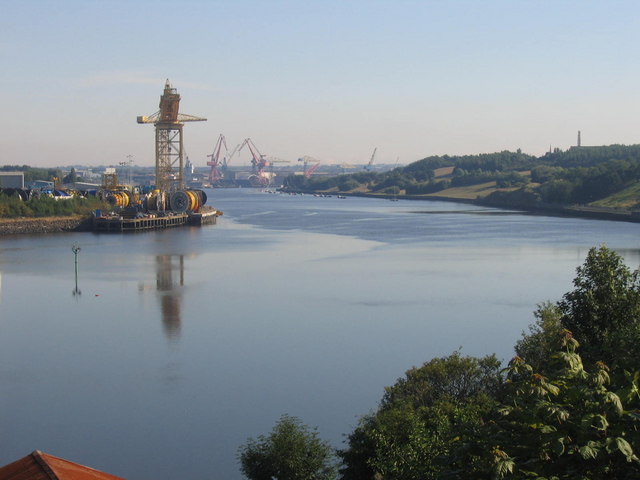
]] With its proximity to surrounding coalfields, the Tyne was a major route for the export of coal from the 13th century until the decline of the coal mining industry in North East England in the second half of the 20th century. The largest coal staithes (a structure for loading coal onto ships) were located at Dunston in Gateshead, Hebburn and Tyne Dock, South Shields. The wooden staithes at Dunston, built in 1890, have been preserved, although they were partially destroyed by fire in 2006 and then a further fire in May 2020 means that the Staithes is becoming more vulnerable to vandalism and would need extensive financing to preserve it and make it secure. In 2016, Tyne Dock, South Shields was still involved with coal, importing 2 million tonnes of shipments a year. The lower reaches of the Tyne were, in the late 19th and early 20th centuries, one of the world's most important centres of shipbuilding, and there are still shipyards in South Shields and Hebburn to the south of the river. To support the shipbuilding and export industries of Tyneside, the lower reaches of the river were extensively remodelled during the second half of the 19th century, with islands (including Kings Meadow, the largest) removed and meanders in the river straightened.
Name and etymology
Nothing definite is known of the origin of the designation Tyne, nor is the river known by that name until the Saxon period: Tynemouth is recorded in Anglo-Saxon as Tinanmuðe (probably dative case). The Vedra on the Roman map of Britain may be the Tyne, or may be the River Wear. Ptolemy's Tína could be a "misplaced reference" to either this river or the Tyne in East Lothian. There is a theory that *tīn was a word that meant "river" in the local Celtic language or in a language spoken in England before the Celts came: compare Tardebigge.
A supposed pre-Celtic root *tei, meaning 'to melt, to flow' has also been proposed as an etymological explanation of the Tyne and similarly named rivers, as has a Brittonic derivative of Indo-European *teihx, meaning 'to be dirty' (Welsh tail, 'manure').
River crossings
Main article: List of crossings of the River Tyne
In popular literature
LJ Ross' thriller Seven Bridges from the DCI Ryan series evolves around the Tyne bridges.
Artworks and sculpture
Newcastle-upon-Tyne

The river is represented, and personified, in a sculpture unveiled in 1968 as part of the new Civic Centre (seat of Newcastle City Council). Sculpted by David Wynne, the massive bronze figure River God Tyne incorporates flowing water into its design.
Salmon Trail
The Environment Agency is currently working with architects and cultural consultancy xsite, in collaboration with Commissions North, to create a travelling sculpture trail along the River Tyne.
The Tyne Salmon Trail will serve as a celebration of the river, its heritage and its increasingly diverse ecosystem. Historically a major symbol in the regional identity of the North East of England, the river plays host to a plethora of different species, the number of which is growing year on year in line with the river's improving health. The trail looks to capture the imagination of residents and tourists visiting the area – providing them with the ultimate 'fact finding' design experience, which celebrates the salmon's migratory journey in the Northeast of England.
FINS, REFLECTION and JOURNEY were the first three cubes to be launched in December 2007 from a family of ten. Each cube is inspired by the textures, changing colours, movement and journey of the salmon. With each offering a 'modern day keepsake' to take away, in the form of a designed Bluetooth message.
The other cubes will be moving along the River Tyne over one year visiting different locations from Kielder to the Mouth of the Tyne in the summer 2008 before starting their long journey back to their birthplace.
Conversation Piece
Bamboo Bridge
For three days, from 18 to 20 July 2008, a temporary bamboo artwork was installed over the Tyne close to the Gateshead Millennium Bridge. The Bambuco Bridge was created as part of that year's 'SummerTyne' festival.
References
Sources
- Leona J. Skelton. Tyne after Tyne: An Environmental History of a River's Battle for Protection, 1529–2015. Winwick White Horse Press, 2017. .
References
- Owen, Susan. (2005). "Rivers and the British Landscape". Carnegie.
- "The River: Fascinating Facts about the River Tyne". Tyne Rivers Trust.
- "Wheresthepath".
- "Tyne Gap and Hadrian's Wall". Natural England.
- "Thomas John Taylor". Grace's Guide to British Industrial History.
- James Guthrie. (1880). "The river Tyne: its history and resources". Andrew Reid and Company Limited.
- Land Use Consultants. (2003). "Urban Landscape Study of the Tyne Gorge". Gateshead Council.
- Port of Tyne staff. (30 July 2017). "Tyne Improvement Commission". Port of Tyne.
- Henderson, Tony. (16 January 2015). "River Tyne's story revealed in study by environmental historian". The Journal.
- (2008). "Tyne Rivers Trust". Tynerivertrust.org.
- (20 November 2003). "Coal heritage goes up in flames". BBC.
- (1926). "The History of the Celtic Placenames of Scotland". Irish Academic Press.
- "The Brittonic Language in the Old North".
- See the [https://ljrossauthor.com/book/seven-bridges/ author's website], retrieved 21 January 2023.
- (2000). "Public Sculpture of North-East England". Liverpool University Press.
- (2008). "Tyne Salmon Trail".
- Strug, Leah. (21 July 2008). "Attraction's sending art lovers fishy messages". South Shields Gazette.
This article was imported from Wikipedia and is available under the Creative Commons Attribution-ShareAlike 4.0 License. Content has been adapted to SurfDoc format. Original contributors can be found on the article history page.
Ask Mako anything about River Tyne — get instant answers, deeper analysis, and related topics.
Research with MakoFree with your Surf account
Create a free account to save articles, ask Mako questions, and organize your research.
Sign up freeThis content may have been generated or modified by AI. CloudSurf Software LLC is not responsible for the accuracy, completeness, or reliability of AI-generated content. Always verify important information from primary sources.
Report