From Surf Wiki (app.surf) — the open knowledge base
Rifle, Colorado
City in Colorado, United States
.jpg)
City in Colorado, United States
| Field | Value | |
|---|---|---|
| <!-- Basic info ----------------> | name | Rifle, Colorado |
| settlement_type | Home rule municipality | |
| motto | ||
| image_skyline | Rifle, Colorado.JPG | |
| image_caption | Railroad Avenue in Rifle looking north. | |
| image_map | Garfield County Colorado Incorporated and Unincorporated areas Rifle Highlighted 0864255.svg | |
| map_caption | Location in Garfield County and Colorado | |
| <!-- Location ------------------> | subdivision_type | Country |
| subdivision_name | United States | |
| subdivision_type1 | State | |
| subdivision_name1 | Colorado | |
| subdivision_type2 | County | |
| subdivision_name2 | Garfield County | |
| subdivision_type3 | City | |
| subdivision_name3 | Rifle | |
| government_type | Home-rule municipality | |
| leader_title | Mayor | |
| leader_name | Clint Hostettler | |
| established_title | Founded | |
| established_date | 1882 | |
| established_title2 | Incorporated | |
| established_date2 | August 18, 1905 | |
| established_title3 | ||
| founder | Abram Maxfield | |
| named_for | Rifle Creek | |
| <!-- Area ---------------------> | unit_pref | US |
| area_footnotes | ||
| area_total_km2 | 18.53 | |
| area_land_km2 | 18.22 | |
| area_water_km2 | 0.31 | |
| area_total_sq_mi | 7.15 | |
| area_land_sq_mi | 7.03 | |
| area_water_sq_mi | 0.12 | |
| <!-- Population -----------------------> | population_as_of | 2020 |
| population_footnotes | ||
| population_total | 10437 | |
| population_density_km2 | 532.75 | |
| population_density_sq_mi | 1379.87 | |
| population_est | ||
| timezone | Mountain (MST) | |
| utc_offset | -7 | |
| timezone_DST | MDT | |
| utc_offset_DST | -6 | |
| coordinates | ||
| elevation_footnotes | ||
| elevation_ft | 5519 | |
| postal_code_type | ZIP code | |
| postal_code | 81650 | |
| area_code | 970 | |
| blank_name | FIPS code | |
| blank_info | 08-64255 | |
| blank1_name | GNIS feature ID | |
| blank1_info | 2410947 | |
| website |
Rifle is a home-rule municipality in, and the most populous community of, Garfield County, Colorado, United States. Its population was 10,437 at the 2020 census. Rifle is a regional center of the cattle-ranching industry located along Interstate 70 and the Colorado River just east of the Roan Plateau, which dominates the western skyline of the town. The town was founded in 1882
History
The land on which Rifle resides was once in the heart of the Ute Nation, a classification of the Indigenous peoples of the Great Basin. The most common tribe in the area were the Tabagauche, who hunted and lived on the land slightly to the east of Rifle in the Roaring Fork Valley. Due to their location, the Tabagauche were somewhat less exposed to White settlers, and to some extent their ways remained less altered than other native peoples. In 1878, Nathan Meeker was appointed as the director of the White River Ute Agency (the town of Meeker 40 miles north of Rifle was named after him). Meeker had no training or knowledge of Ute culture, and launched into a campaign centered on sedentary agriculture and European-American schooling. As this clashed with the culture of the nomadic Utes, he was met with resistance. It all came to a head when Meeker had the pasture and racetrack for the Ute's horses plowed under. The event that followed is known as the Meeker Massacre in 1879, during which Meeker and his 10 employees were killed. The aftermath of the conflict resulted in nearly all members of the Ute nation being forcibly removed from Colorado into eastern Utah, although the federal government had formerly guaranteed them the land on which they were residing.
Rifle became more and more settled as the 19th century gave way to the 20th. In 1889, the railroad cut through from the east and ended in Rifle for a while before connecting lines were completed. This opened up the floodgates for new travelers, settlers, and trade. Long drives of cattle over the mountains towards the Front Range and Denver became a thing of the past. Rifle was now a thriving hub for commerce. If it needed to be shipped east to a buyer's market, or shipped west into ranching country, it came through the town.
The first major economy known to Rifle was ranching. The land surrounding the town was arid, and much of it was unsuitable for farming without irrigation. Despite the large stretches of land available, tension arose and manifested between those who tended cattle and those who herded sheep. Good grazing practices were not in place, and the summer pastures at the top of the Roan Plateau were contested. One rancher lost two-thirds of his flock and went bankrupt when competing cowboys drove the sheep over the cliff.
Rifle is located in the east portion of the Piceance Basin, which is home to different forms of fossil fuels, the largest quantity of which is oil shale. The unreliability of this fossil fuel has left the city in the throes of a cycling boom-and-bust economy.
, an organization called the Campaign to Save Roan Plateau has been engaged in an effort to minimize oil and gas drilling on the top of the Roan Plateau, which locals call the Bookcliffs. The Roan Plateau is accessible from the JQS Trail, located 3 mi north of Rifle, or from the Piceance Creek road.
Geography
Rifle is located in the valley of the Colorado River where Rifle Creek joins from the north. Most of the city is on the north side of the river, but some city land lies to the south. Interstate 70 passes through the city along the south side of the river, with access from Exit 90. I-70 leads east 26 mi to Glenwood Springs, the Garfield County seat, and southwest 60 mi to Grand Junction. U.S. Route 6 runs along the north side of the Colorado River through Rifle, providing a local parallel route to I-70. Colorado State Highway 13 intersects I-70 and US-6, passing through the southern and western parts of Rifle, then leading north 41 mi to Meeker.
According to the United States Census Bureau, the city of Rifle has a total area of 14.7 km2, of which 0.2 km2, or 1.18%, is covered by water.
Climate
|Jan record high F = 62 |Feb record high F = 69 |Mar record high F = 81 |Apr record high F = 92 |May record high F = 99 |Jun record high F = 102 |Jul record high F = 104 |Aug record high F = 102 |Sep record high F = 99 |Oct record high F = 88 |Nov record high F = 79 |Dec record high F = 65 |year record high F = 104 |Jan record low F = −38 |Feb record low F = −34 |Mar record low F = −16 |Apr record low F = 4 |May record low F = 17 |Jun record low F = 22 |Jul record low F = 33 |Aug record low F = 31 |Sep record low F = 21 |Oct record low F = 7 |Nov record low F = −16 |Dec record low F = −27 |year record low F= −38 |access-date = January 17, 2016 |access-date = June 15, 2021
Demographics
As of the census of 2010, 9,172 people, 3,221 households, and 2,230 families resided in the city. The population density was 1,581.1 PD/sqmi. The 2,586 housing units had an average density of 602.7 /sqmi. The racial makeup of the city was 81.0% White, 0.5% African American, 1.3% Native American, 0.6% Asian, 0.1% Pacific Islander, 13.4% from other races, and 3.1% from two or more races. Hispanics or Latinos of any race were 30.4% of the population.
Of the 3,221 households, 40.0% had children under 18 living with them, 30.8% were married couples living together, 10.1% had a female householder with no husband present, and 30.8% were not families. About 23.5% of all households were made up of individuals, and 7.1% had someone living alone who was 65 or older. The average household size was 2.81 and the average family size was 3.35.
In the city, the age distribution was 30.6% under 18, 9.2% from 18 to 24, 34.4% from 25 to 44, 17.1% from 45 to 64, and 8.5% who were 65 or older. The median age was 31 years. For every 100 females, there were 106.1 males. For every 100 females 18 and over, there were 105.7 males.
The median income for a household in the city was $42,734, and for a family was $48,714. Males had a median income of $36,517 versus $25,527 for females. The per capita income for the city was $17,376. About 3.4% of families and 6.4% of the population were below the poverty line, including 7.8% of those under age 18 and 9.8% of those age 65 or over.
Tourism and attractions
.jpg)
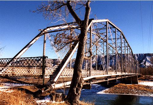
Rifle Mountain Park, located 16 mi north of Rifle, is maintained by the City of Rifle. It is popular with rock climbers. Other outside attractions near the city include Rifle Falls State Park, Rifle Falls Fish Hatchery, Rifle Gap State Park, Harvey Gap State Park, and access to BLM land, including Hubbard Mesa Open Area, Rifle Arch, and the Roan Plateau.
Six miles north of the center of the city is Rifle Creek Golf Course.
in 2014, the New Ute theater was opened in downtown Rifle.
Rifle is home to the Garfield County Fair Grounds. One week out of the year, the city bustles with activities surrounding family and professional rodeos, Xtreme bull riding, live music, and a demolition derby.
Education
Rifle is within the Garfield Re-2 School District. The city is served by three elementary schools, a middle school, and a high school:
- Graham Mesa Elementary School
- Highland Elementary School
- Wamsley Elementary School
- Rifle Middle School
- Rifle High School
Rifle’s higher-education needs are served by Colorado Mountain College, which operates a campus just east of the city. In 2022, CMC Rifle had an enrollment of 1,346 students.
Transportation
The city is served by the Rifle Garfield County Airport. The state-run bus service Bustang connects Rifle to Grand Junction and Denver. The city is also served by the Union Pacific/Rio Grande line between Denver and Ogden.
In popular culture
On August 10, 1972, Christo and Jeanne-Claude completed the Valley Curtain project at Rifle Gap, 6 mi north of town. The completed curtain hung for only 28 hours before it was ripped by a gust of wind.
Notable people
- David Bernhardt, former secretary of the interior
- Lauren Boebert, U.S. Representative
- Bo Nickal, freestyle wrestler and mixed martial artist
References
References
- "Active Colorado Municipalities". [[Colorado.
- "Colorado Counties". [[Colorado.
- [http://www.rifleco.org/ City of Rifle website]
- (December 1, 2004). "Colorado Municipal Incorporations". [[Colorado.
- "2019 U.S. Gazetteer Files". United States Census Bureau.
- "QuickFacts: Colorado, United States". United States Census Bureau.
- "ZIP Code Lookup". [[United States Postal Service]].
- {{GNIS. 2410947
- by Abram Maxfield, and was incorporated in 1905 along [[Rifle Creek]], near its mouth on the Colorado. The community takes its name from the creek.''Rifle Shots: The Story of Rifle, Colorado'', compiled by the Reading Club of Rifle, Colorado, 1973.
- Marsh, Charles. (1982). "The Utes of Colorado- People of the Shining Mountains". Pruett Publishing Company.
- Save Roan Plateau. December 1, 2007http://www.saveroanplateau.org/.
- (April 2020}}{{cbignore). "Geographic Identifiers: 2010 Demographic Profile Data (G001): Rifle city, Colorado". U.S. Census Bureau.
- "Census of Population and Housing". Census.gov.
- "U.S. Census website". [[United States Census Bureau]].
- "Mountain Project: Climbing Rifle Mountain Park." Mountain Project. October 29, 2001. December 1, 2007 http://www.mountainproject.com/v/colorado/rifle/rifle_mountain_park/105744310.
- "Colorado Parks and Wildlife".
- "Colorado Parks and Wildlife".
- "Colorado Parks and Wildlife".
- "Colorado Parks and Wildlife".
- "Hubbard Mesa Open Area".
- "BLM Colorado | Colorado River Valley Field Office | Recreation | Rifle Arch".
- "Archived copy".
- "Rifle, CO - Rifle Creek Golf Course".
- "About the Ute Theater - Ute Theater".
- "Garfield County Fair & Rodeo July 27 – August 1, 2021 {{!}}".
- "About Garfield Re-2". [[Garfield Re-2 School District]].
- "Institutional Fact Book". Colorado Mountain College.
- "Bustang Schedules". CDOT.
- "Valley Curtain." Christo and Jeanne-Claude. December 1, 2007 http://www.christojeanneclaude.net/vc.shtml.
- "Do You Know Bo Nickal?".
This article was imported from Wikipedia and is available under the Creative Commons Attribution-ShareAlike 4.0 License. Content has been adapted to SurfDoc format. Original contributors can be found on the article history page.
Ask Mako anything about Rifle, Colorado — get instant answers, deeper analysis, and related topics.
Research with MakoFree with your Surf account
Create a free account to save articles, ask Mako questions, and organize your research.
Sign up freeThis content may have been generated or modified by AI. CloudSurf Software LLC is not responsible for the accuracy, completeness, or reliability of AI-generated content. Always verify important information from primary sources.
Report