From Surf Wiki (app.surf) — the open knowledge base
Redding, California
City in California, United States
City in California, United States
| Field | Value |
|---|---|
| name | Redding, California |
| settlement_type | City |
| image_skyline | {{Photomontage |
| photo1a | Sundial Bridge at Turtle Bay (cropped).jpg |
| photo2a | Cascade Theater 1935 - Redding, CA (cropped).JPG |
| photo2b | ReddingLorenzHotel 01 (cropped).jpg |
| photo3a | Redding Old City Hall (cropped).jpg |
| photo3b | Pine Street School Courtyard.jpg |
| spacing | 2 |
| position | center |
| color_border | white |
| color | white |
| size | 266 |
| foot_montage | Top: Sundial Bridge at Turtle Bay; middle: Cascade Theatre, Hotel Lorenz; bottom: Old City Hall, Pine Street School}} |
| image_flag | Flag of Redding, California.svg |
| image_seal | Seal of Redding, California.png |
| image_map | Shasta County California Incorporated and Unincorporated areas Redding Highlighted.svg |
| map_caption | Location of Redding in Shasta County, California |
| pushpin_map | California#USA |
| pushpin_label | Redding |
| pushpin_map_caption | Location in the United States |
| pushpin_relief | 1 |
| coordinates | |
| subdivision_type | Country |
| subdivision_name | United States |
| subdivision_type1 | State |
| subdivision_name1 | California |
| subdivision_type2 | County |
| subdivision_name2 | Shasta |
| established_title | Incorporated |
| established_date | October 4, 1887 |
| founder | Pierson B. Reading |
| government_type | Council-manager |
| leader_title1 | Mayor |
| leader_name1 | Jack Munns |
| unit_pref | Imperial |
| area_footnotes | |
| area_total_km2 | 158.44 |
| area_total_sq_mi | 61.17 |
| area_land_km2 | 154.48 |
| area_land_sq_mi | 59.65 |
| area_water_km2 | 3.96 |
| area_water_sq_mi | 1.53 |
| area_water_percent | 2.50 |
| elevation_footnotes | |
| elevation_m | 172 |
| elevation_ft | 564 |
| population_total | 93611 |
| population_as_of | 2020 |
| population_rank | 83rd in California |
| population_density_sq_mi | auto |
| population_density_km2 | auto |
| population_demonym | Reddingite |
| timezone | PST |
| utc_offset | −08:00 |
| timezone_DST | PDT |
| utc_offset_DST | −07:00 |
| postal_code_type | ZIP codes |
| postal_code | 9600196003, 96049, 96099 |
| area_code_type | Area code |
| area_code | 530, 837 |
| blank_name | FIPS code |
| blank_info | |
| blank1_name | GNIS feature IDs |
| blank1_info | , |
| website |
Redding is a city in and the county seat of Shasta County, California, and the economic and cultural capital of the Shasta Cascade region of Northern California. Redding lies along the Sacramento River, 162 mi north of Sacramento, and 120 mi south of California's northern border with Oregon. Its population was 93,611 at the 2020 census.
Etymology
During the California gold rush, the area that now comprises Redding was called Poverty Flats. In 1868 the first land agent for the Central Pacific Railroad, a former Sacramento politician named Benjamin Bernard Redding, bought property in Poverty Flats on behalf of the railroad so that it could build a northern terminus there. In the process of building the terminus, the railroad also built a town in the same area, which they named Redding in honor of Benjamin Redding.
In 1874, there was a dispute over the name by local legislators and it was changed for a time to Reading, in order to honor Pierson B. Reading, who arrived in the area in 1843, owned the Buenaventura land grant on which Redding sits, and had died only a few years before, in 1868. The name was officially changed back to Redding by 1880.
History
Indigenous culture
The area is inhabited by a tribe of Native Americans called the Wintu. At their height, the Wintu had as many as 239 villages in the Shasta County area.
Spanish and Mexican eras
Although Europeans had been to California as early as 1542, when Juan Cabrillo sailed to what is now San Diego Bay, indigenous natives long remained the only inhabitants of the Northern California region.
The first European settlement in the area was established in 1844 by Pierson B. Reading, an early California pioneer who received a Rancho Buena Ventura Mexican land grant for 26,632 acre that is now covered by Redding and Cottonwood, California. At the time, it was the northernmost nonnative settlement in California.
Gold Rush era
During the Gold Rush, 49ers found gold to the north on Rock, Middle and Salt creeks, near Shasta, California, and to the south along Oregon and Olney creeks but the area that is now Redding was poor placer gold ground and called Poverty Flats. In 1868 the first land agent for the Central Pacific Railroad, a former Sacramento politician named Benjamin B. Redding, bought property in Poverty Flats on behalf of the railroad for a northern terminus, which the tracks reached in 1872. In the process of building the terminus, the railroad also built the town of Redding which was officially incorporated on October 4, 1887. In 1888, Redding won the county seat from Shasta.
20th century
In the early twentieth century the town's economic growth was spurred by the significant copper and iron mineral extraction industry nearby. The mining industry eventually declined, causing the economy and population to falter by 1920. It recovered in the thirties as the economy boomed due to the construction of Shasta Dam to the northwest. The building of the dam, which was completed in 1945, caused Redding's population to nearly double, also spurring the growth and development of other towns in the area.

Redding continued to grow steadily in the 1950s due to the region's growing lumber industry and tourism brought about by the newly completed dam. The constructions of Whiskeytown and Keswick dams also helped boost the economy by bringing new workers to the area. Interstate 5 was built during the sixties and seventies, which added to development and tourism in the region.
Growth in Redding during the 1960s and 1970s was further spurred by the annexation of an area east of the Sacramento River that included the unincorporated community of Enterprise; the residents voted to support the annexation primarily to acquire less expensive electricity via Redding's municipal utility, which receives power from the dam.
During the 1970s, the lumber industry suffered from decline. In the early 1990s Lumber mills in the area closed down due to the preservation of the living habitat of the Spotted Owl. This heavily impacted the Redding area. The economy picked up, due to a retail and housing boom in the late 1980s that continued until the mid-1990s.
Also in the 1970s, the Market Street Redevelopment Project, established in 1968, began the development of the Midtown Mall. The mall was established to prevent further property deterioration and to restore and maintain the economic health of the downtown area's commercial and retail activity. The mall suffered multiple difficulties. The passage of Proposition 13 in 1978 reduced the mall's property valuation and consequently, the city had to continuously loan money to keep the bonds for the mall's parking structure from going into default; the bonds completely repaid in 2003 and Midtown began to pay off its more than $1.5 million debt to the City of Redding. By the 1980s, the properties around the mall and along the old State Highway 99/273 corridor continued to suffer urban blight, including deteriorating and dilapidated utilities and structures and inappropriate mixed land uses; this required further public intervention in the form of another Market Street Redevelopment Project with significant changes to Midtown in 1990 to include a mix of residential and commercial land around the original project.
21st century
Following redevelopment of Midtown, property values within the Market Street Redevelopment Project area improved; further redevelopment continued. A plan for the downtown area adopted in January 2001 led to the renovation of the historic Cascade Theatre, the removal of the Midtown Mall roof creating an open air pedestrian street, the installation of a visitor way-finding system, the completion of a Health Sciences and University Center with partnership with Shasta College, and the renovation of various buildings along California Street with the help of a private developer.
In 2017, the city adopted a new flag after holding a redesign contest.
The 21st century has also seen a number of devastating wildfires near and in Redding. In 1999, the Jones Fire destroyed over 100 structures, followed by the Bear Fire in 2004. In late July 2018, the Carr Fire in Shasta County seriously impacted the Redding area with the destruction of at least 1,100 buildings, with several thousand more threatened, 38,000 people instructed to evacuate and 8 deaths. Most recently, the Fawn Fire in 2021 also resulted in the evacuation of over 4,000 people and the destruction of 185 buildings.
Geography
According to the United States Census Bureau, the city has a total area of 61.2 sqmi. 59.6 sqmi of it is land, and 1.5 sqmi of it (2.50%) is beneath water.
Redding is located at the very northwestern end of the Central Valley, which transitions into the Cascade foothills. The city is surrounded by mountains to the north, east, and west and fertile farm land to the south. Outermost parts of the city are part of the Cascade foothills, whereas southern and central areas are in the Sacramento Valley.
The elevation in Redding is 495 ft on average, whereas anywhere to the north, east, or west of downtown ranges between 550 and. Southern portions range between 400 and.
The Shasta Dam on the Sacramento River provides a considerable level of flood protection for Redding. The dam is capable of controlling flows up to 79,000 cubic feet (7,300 cubic meters) per second. The flow rate exceeded this threshold in both 1970 and 1974.
Soils in and around town are composed mostly of clay or gravelly loam texture, with red or brown mineral horizons. They are slightly or moderately acidic in their natural state.
There are several rare and endangered species in Redding and its immediate vicinity. The Redding Redevelopment Plan EIR notes the California State listed endangered species, slender Orcutt grass (Orcuttia tenuis), occurs in eastern Redding near the municipal airport, where vernal pools are known to exist. This endemic grass is a Federal Candidate for listing and is endangered throughout its range, confined to several populations, and seriously threatened by agriculture, overgrazing, and residential development. Vernal pools provide the preferred habitat for this plant, which the California Native Plant Society considers a rare and endangered species. These same vernal pools also support federally protected species such as the federally threatened vernal pool fairy shrimp (Branchinecta lynchi).
Climate

.jpg)
Redding has a hot-summer Mediterranean climate (Köppen: Csa), with very hot, dry summers and cool, wet winters. Redding is known for very high summer temperatures, despite being located north of the 40th parallel north. The somewhat strange juxtaposition of its northern position within the United States and non-desert climate, with the extreme summer heat, has long been noted by visitors and residents. The exceptional temperatures found in the city are often cited in national news sources.
Winter (October–April) provides the most precipitation of any season in Redding—the weather tends to be either rainy or foggy and at times, snow occurs. While summers are mostly hot and dry, thunderstorms are not uncommon. The average daily maximum temperature in July stays near 100 °F. The highest official recorded temperature in Redding is 119 °F on July 6, 2024. Redding has an average possible sunshine of 88%, the second-highest percentage (after Yuma, Arizona) of any US city.
Summer overnight lows are unusually warm by Sacramento Valley standards and on average warmer than coastal towns' daytime highs. The warmest night annually averages 79 F. Since the station opened in 1986, the hottest night was 86 F in June 2004. Redding's warm summer days and nights compared to areas further south are a result of a greater distance to maritime influences than the lower end of the valley.
Redding occasionally receives snow, though it has received as much as 23 in of snow in a single storm, occurring on December 4–7, 1909 and December 22–24, 1968, including 16 in on December 23, 1968, the most in any calendar day on record. It rarely gets sleet or freezing rain. Frost occurs commonly in December through February, less often in March or November. In spring, rain is common. The city is located near the foothills of the Cascade and Klamath mountain ranges and it therefore gets much more rain than most places in the Sacramento Valley. The Northern part of the city can get up to a few more inches of rain a year due to its closer location to the mountains; temperature differentials between land and sea cause moist air from the latter to flow over the southern Sacramento valley during the summer months, producing intense heat in Redding. The direction of these winds switches from the north and east in the summer, as hot, high-pressure air flows from land to sea, making the area very dry. Tornadoes are extremely rare; flooding occurs only around the area near the Sacramento River. The coldest temperature recorded in Redding was 16 °F on January 17, 2012, and December 9, 2009. The average coldest daytime high of the year is 41 F and the lowest on record is 29 F in 1990, which remains the latest year to record an ice day.
- Redding Weather Service Office, January 1893–April 1929
- Benton Field, May 1929–July 1944
- Two differing fire stations, August 1944–August 1986
- Redding Regional Airport since September 1986}}) | Jan record high F = 87 | Feb record high F = 87 | Mar record high F = 93 | Apr record high F = 98 | May record high F = 109 | Jun record high F = 117 | Jul record high F = 119 | Aug record high F = 118 | Sep record high F = 116 | Oct record high F = 106 | Nov record high F = 99 | Dec record high F = 83 | Jan avg record high F = 70.5 | Feb avg record high F = 74.3 | Mar avg record high F = 80.7 | Apr avg record high F = 88.0 | May avg record high F = 97.4 | Jun avg record high F = 106.5 | Jul avg record high F = 110.5 | Aug avg record high F = 108.2 | Sep avg record high F = 104.9 | Oct avg record high F = 94.9 | Nov avg record high F = 79.8 | Dec avg record high F = 68.9 | year avg record high F = 112.0 | Jan avg record low F = 27.0 | Feb avg record low F = 28.8 | Mar avg record low F = 32.0 | Apr avg record low F = 34.5 | May avg record low F = 42.6 | Jun avg record low F = 51.3 | Jul avg record low F = 58.0 | Aug avg record low F = 56.1 | Sep avg record low F = 48.9 | Oct avg record low F = 39.1 | Nov avg record low F = 29.7 | Dec avg record low F = 25.7 | year avg record low F = 23.5 | Jan record low F = 16 | Feb record low F = 20 | Mar record low F = 27 | Apr record low F = 28 | May record low F = 31 | Jun record low F = 38 | Jul record low F = 48 | Aug record low F = 44 | Sep record low F = 39 | Oct record low F = 29 | Nov record low F = 21 | Dec record low F = 16
Demographics
.jpg)
2020 census
| Race / Ethnicity (NH = Non-Hispanic) | title=P004: Hispanic or Latino, and Not Hispanic or Latino by Race – 2000: DEC Summary File 1 – Redding city, California | url=https://data.census.gov/table?g=160XX00US0659920&tid=DECENNIALSF12000.P004 | publisher=United States Census Bureau | access-date=January 26, 2024 | archive-date=August 12, 2024 | archive-url=https://web.archive.org/web/20240812214036/https://data.census.gov/table/DECENNIALSF12000.P004?g=160XX00US0659920 | url-status=live }} | title=P2: Hispanic or Latino, and Not Hispanic or Latino by Race – 2010: DEC Redistricting Data (PL 94-171) – Redding city, California | url=https://data.census.gov/cedsci/table?q=p2&g=160XX00US0659920&tid=DECENNIALPL2010.P2 | publisher=United States Census Bureau | access-date=January 26, 2024 | archive-date=January 25, 2024 | archive-url=https://web.archive.org/web/20240125202316/https://data.census.gov/cedsci/table?q=p2&g=160XX00US0659920&tid=DECENNIALPL2010.P2 | url-status=live }} | % 2000 | % 2010 |
|---|---|---|---|---|---|---|---|---|---|---|---|---|---|---|---|---|
| White alone (NH) | 69,293 | 73,038 | 68,751 | 85.69% | ||||||||||||
| Black or African American alone (NH) | 828 | 1,025 | 1,299 | 1.02% | ||||||||||||
| Native American or Alaska Native alone (NH) | 1,625 | 1,665 | 1,747 | 2.01% | ||||||||||||
| Asian alone (NH) | 2,372 | 2,974 | 4,086 | 2.93% | ||||||||||||
| Pacific Islander alone (NH) | 79 | 128 | 180 | 0.10% | ||||||||||||
| Other race alone (NH) | 142 | 123 | 518 | 0.18% | ||||||||||||
| Mixed race or Multiracial (NH) | 2,133 | 3,121 | 6,540 | 2.64% | ||||||||||||
| Hispanic or Latino (any race) | 4,393 | 7,787 | 10,490 | 5.43% | ||||||||||||
| Total | 80,865 | 89,861 | 93,611 | 100.00% |
The 2020 United States census counted 93,611 people, 37,761 households, and 23,231 families in Redding. The population density was 1,569.4 per square mile (606.0/km). There were 40,083 housing units at an average density of 672.0 per square mile (259.5/km). The racial makeup was 76.97% (72,057) white or European American (73.44% non-Hispanic white), 1.49% (1,395) black or African-American, 2.37% (2,214) Native American or Alaska Native, 4.44% (4,161) Asian, 0.23% (216) Pacific Islander or Native Hawaiian, 3.49% (3,270) from other races, and 11.0% (10,298) from two or more races. Hispanic or Latino of any race was 11.21% (10,490) of the population.
Of the 37,761 households, 27.8% had children under the age of 18; 42.1% were married couples living together; 30.7% had a female householder with no spouse or partner present. 29.8% of households consisted of individuals and 14.8% had someone living alone who was 65 years of age or older. The average household size was 2.5 and the average family size was 3.0. The percent of those with a bachelor’s degree or higher was estimated to be 17.7% of the population.
21.6% of the population was under the age of 18, 8.4% from 18 to 24, 25.7% from 25 to 44, 23.1% from 45 to 64, and 21.1% who were 65 years of age or older. The median age was 39.8 years. For every 100 females, there were 107.1 males. For every 100 females ages 18 and older, there were 110.7 males.
The 2016–2020 5-year American Community Survey estimates show that the median household income was $56,098 (with a margin of error of +/- $2,238). The median family income was $68,340 (+/- $3,919). Males had a median income of $37,945 (+/- $3,187) versus $27,470 (+/- $2,240) for females. The median income for those above 16 years old was $32,199 (+/- $1,165). Approximately, 10.3% of families and 16.5% of the population were below the poverty line, including 19.8% of those under the age of 18 and 8.8% of those ages 65 or over.
2010 census
The 2010 United States census reported that Redding had a population of 89,861. The population density was 1,468.9 PD/sqmi. The racial makeup of Redding was 77,117 (85.8%) White, 1,092 (1.2%) African American, 2,034 (2.3%) Native American, 3,034 (3.4%) Asian, 156 (0.2%) Pacific Islander, 2,307 (2.6%) from other races, and 4,121 (4.6%) from two or more races. There were 7,787 people of Hispanic or Latino origin, of any race (8.7%).
The Census reported that 87,841 people (97.8% of the population) lived in households, 1,138 (1.3%) lived in non-institutionalized group quarters, and 882 (1.0%) were institutionalized.
There were 36,130 households, out of which 11,012 (30.5%) had children under the age of 18 living in them, 16,001 (44.3%) were married couples living together, 4,806 (13.3%) had a female householder with no husband present, 1,984 (5.5%) had a male householder with no wife present. There were 2,570 (7.1%) unmarried opposite-sex partnerships, and 204 (0.6%) same-sex married couples or partnerships. 10,344 households (28.6%) were made up of individuals, and 4,622 (12.8%) had someone living alone who was 65 years of age or older. The average household size was 2.43. There were 22,791 families (63.1% of all households); the average family size was 2.94.
The population was spread out, with 20,518 people (22.8%) under the age of 18, 9,436 people (10.5%) aged 18 to 24, 21,725 people (24.2%) aged 25 to 44, 23,424 people (26.1%) aged 45 to 64, and 14,758 people (16.4%) who were 65 years of age or older. The median age was 38.5 years. For every 100 females, there were 93.8 males. For every 100 females age 18 and over, there were 90.4 males.
There were 38,679 housing units at an average density of 632.3 /mi2, of which 19,968 (55.3%) were owner-occupied, and 16,162 (44.7%) were occupied by renters. The homeowner vacancy rate was 2.3%; the rental vacancy rate was 6.9%. 48,179 people (53.6% of the population) lived in owner-occupied housing units and 39,662 people (44.1%) lived in rental housing units.
Economy
_(cropped).jpg)
.jpg)
Redding is the economic hub of the Shasta Cascade region of Northern California.
The Redding Metropolitan Statistical Area (MSA) was recognized as the 29th Most Dynamic MSA in the United States in 2019 by the Walton Family Foundation. Redding was recognized for having a diversified economy with several large employers in different sectors.
The Redding Cultural District is one of 14 Arts and Culture Districts recognized by the State of California Arts Council. The district includes Downtown Redding; the adjacent Turtle Bay Complex; and City of Redding Parks across the Sacramento River from Downtown and Turtle Bay.
Top employers
According to the city's 2016 Comprehensive Annual Financial Report, the top employers in Redding are:
| # | Employer | # of employees |
|---|---|---|
| 1 | Mercy Medical Center | 1,832 |
| 2 | Shasta County | 1,750 |
| 3 | City of Redding | 1,129 |
| 4 | Shasta Regional Medical Center | 856 |
| 5 | CA Transportation Department | 663 |
| 6 | Redding Rancheria | 523 |
| 7 | Wal-Mart | 450 |
| 8 | Shasta Union High School District | 406 |
| 9 | Shasta College | 352 |
| 10 | Blue Shield of California | 330 |
Government

State and federal representation
In the California State Legislature, Redding is in , and .
In the United States House of Representatives, Redding is in .
Municipal government
The city council is composed of Mayor Jack Munns, Vice Mayor Mike Littau, Erin Resner, Tenessa Audette, and Paul Dhanuka. The city manager is Barry Tippin.
Redding is a general law city operating under the council-manager form of government.
Parks and recreation

Museums and public art
- Sculpture park at City Hall
- Sundial Bridge at Turtle Bay, by Santiago Calatrava
- Santiago Calatrava sculpture, at Domke Plaza
- Shasta Historical Society
Architecture
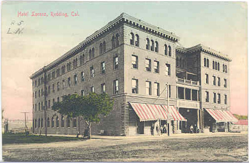
- Hotel Lorenz
- Pilgrim Congregational Church
Venues
- Cascade Theatre
- The Dip
- IOOF Hall
- Riverfront Amphitheater
- Old City Hall
- Redding Civic Auditorium
- Axiom Repertory Theatre
Performing arts
- Riverfront Playhouse
- Axiom Repertory Theater
Education
.jpg)
.JPG)
Higher education
Public
- Shasta College
Private
- National University
- Shasta Bible College and Graduate School
- Simpson University
High schools
Public
- Shasta High School
- Enterprise High School
- Foothill High School
- Pioneer High School
Secondary
- University Preparatory School
Charter schools
- Stellar Charter School
Trade schools
- Redding Institute of Technology
- Shasta School of Cosmetology
- CloudWise Academy
Media
- Redding Record Searchlight
- After Five
Television
Radio
Transportation

Major highways
- [[File:I-5 (CA).svg|25px]] Interstate 5 runs through the east central portion of Redding.
- [[File:California 299.svg|25px]] CA 299, formerly [[File:US 299 (1961 cutout).svg|25px]] U.S. 299, runs through the western, central, and northeastern parts of the city.
- [[File:California 44.svg|25px]] CA 44 runs through the middle and eastern part of town. Its western terminus is at Market Street (California 273) in downtown Redding.
- [[File:California 273.svg|25px]] CA 273, formerly the Interstate 5 Business Route and also formerly [[File:US 99 (1961 cutout).svg|25px]] U.S. 99, runs through the city.
Rail and bus transportation
Amtrak provides service to Redding station, operating its Coast Starlight daily in both directions between Seattle, Washington, and Los Angeles, California via Portland, Oregon; Sacramento, California; Oakland, California; San Jose, California; Santa Barbara, California and all Intermediate station stops. Amtrak Thruway also provides twice daily service to Stockton or Sacramento for connections to the Gold Runner, which serve the San Francisco Bay Area, San Joaquin Valley and the Los Angeles area via bus connections.
Redding's municipal bus transportation system is called RABA (Redding Area Bus Authority). RABA serves routes throughout the City of Redding and also provides transportation to/from Redding's suburbs. Transportation is also available by RABA to Burney, by Sage Stage to Alturas and by Trinity Transit to Weaverville. Redding is also served by the intercity bus companies Greyhound and Fronteras del Norte.
Shasta Regional Transportation Agency has proposed a weekday commuter bus to/from Redding and the Sacramento Valley Station, following a route similar to the twice daily Amtrak Thruway 3.
Air transportation
Air transportation for the Redding area is available at Redding Municipal Airport and Benton Field.
Notable people
· Only people who already have a Wikipedia article may appear here. This establishes notability. · The biographical article must mention how they are associated with Redding, whether born, raised, or residing. · The fact of their association should have a reliable source cited. · Alphabetical by last name please
This list includes notable persons who were born/raised/worked in, lived in, or whose identity was significantly influenced by Redding, as well as music groups that were founded in the area.
- David de Berrytheater composer and actor
- Eloise B. Cushingattorney
- Shane Drakemusic video director
- Ashley Parker Angelrecording artist and actor
- Francesca Eastwoodactor
- Lynsi Snyder owner of In-N-Out
- Rich Eisensportscaster
- Kathleen Kennedyfilm producer
- Matthew Kennedyauthor
- Tommy Kirkfilm actor
- Tom Meyerprofessor, speaker, and author
- Kevin RoseInternet entrepreneur
- Cory Asburycontemporary Christian singer
- Duffy Bishopelectric blues singer and songwriter
- Brian Johnson - contemporary worship singer and songwriter
- Scott Jossfiddle player, songwriter
- Randy Millerdrummer of The Myriad
- Craig Padillaambient electronic musician and film score composer
- Bryce Pinkham – actor and singer
- Jessica Prattsinger/songwriter
- Roy Rogersguitarist
- Bruce Turgon musician, songwriter, producer
- Rick Bosettiprofessional baseball player
- Greg CadaretMLB player
- Mel Heinfootball player, 1938 MVP, NFL Hall of Fame inductee
- Paul Howardformer NFL player
- Eddie Machenheavyweight boxer
- Buck Martinezprofessional MLB player, manager, broadcaster
- Matt NicholsCanadian Football League player
- Ryan O'CallaghanNFL football player
- Frank Crowe chief engineer and designer of the Hoover Dam.
- Jonathan Foster singer-songwriter
- Hilary Pecis (born 1979)artist
- Bill PlummerMLB player, coach and manager
- Megan Rapinoeprofessional soccer player, Olympic gold medalist
- Ricky Rayfootball player in the Canadian Football League
- Lynne Robertscollege basketball coach
- Jason Sehornformer NFL player
- John Strohmayerformer MLB player and high school coach
- Raymond JacobsUS Marine, said to be in photo of first flag raised on Iwo Jima
- Brian Sandoval29th governor of Nevada
- Sam Butcherartist, Precious Moments, Inc.
- Jeffery Danglplant immunologist
- Bill JohnsonChristian minister and evangelist
- Ruggles brothersstagecoach robbers
- Michael Zagarissports and music photographer
- Terry Riley American composer
References
Informational notes
Citations
References
- "2019 U.S. Gazetteer Files". United States Census Bureau.
- {{Cite GNIS. 277582. Redding
- "Geography Profile: Redding city, California".
- Donion, Preston. (October 4, 2022). "City of Redding turns 135 years old". KRCR.
- "How Redding got its Name".
- (1964). "In the Shadow of the Mountain, a Short History of Shasta County, California". Edward Peterson.
- . (1980). "Papers On Wintu Ethnography : 239 Wintu Villages In Shasta County Circa 1850". *Redding Museum and Art Center*.
- "California Cities by Incorporation Date". California Association of [[Local Agency Formation Commission]]s.
- "Historic Redding California".
- (2010). "Market Street Redevelopment Project Area". Redding Redevelopment Agency Five-Year Implementation Plan 2010-2014.
- "City of Redding Flag".
- "Carr Fire Incident Update 7/29/18 PM".
- (July 28, 2018). "'Terrifying' tornadoes of flame leave 2 dead as inferno destroys Californian city of Redding". The Daily Telegraph.
- ''Environmental Impact Report for the Redding Redevelopment Plan'', Earth Metrics, City of Redding and California State Clearinghouse Report (1990)
- "Web Soil Survey".
- Rocca, A.M.. (2004). "Redding". Arcadia.
- Sistek, Scott. (July 5, 2024). "Historic heat wave toppling all-time temperature records in the West". Fox Weather.
- Berardelli, Jeff. (September 3, 2020). "Another record-breaking heat wave is building in the West".
- (September 5, 1988). "The West sizzled in a September heat wave, closing...".
- "NOAA".
- "Threaded Station Extremes".
- "NOWData – NOAA Online Weather Data".
- "U.S. Climate Normals Quick Access – Station: Redding MUNI AP, CA". National Oceanic and Atmospheric Administration.
- "Western Regional Climate Center Data".
- "Census of Population and Housing".
- "P004: Hispanic or Latino, and Not Hispanic or Latino by Race – 2000: DEC Summary File 1 – Redding city, California". United States Census Bureau.
- "P2: Hispanic or Latino, and Not Hispanic or Latino by Race – 2010: DEC Redistricting Data (PL 94-171) – Redding city, California". United States Census Bureau.
- "P2: Hispanic or Latino, and Not Hispanic or Latino by Race – 2020: DEC Redistricting Data (PL 94-171) – Redding city, California". United States Census Bureau.
- "US Census Bureau, Table P16: HOUSEHOLD TYPE".
- "US Census Bureau, Table DP1: PROFILE OF GENERAL POPULATION AND HOUSING CHARACTERISTICS".
- US Census Bureau. "Gazetteer Files".
- "US Census Bureau, Table P1: RACE".
- "US Census Bureau, Table P2: HISPANIC OR LATINO, AND NOT HISPANIC OR LATINO BY RACE".
- "US Census Bureau, Table S1101: HOUSEHOLDS AND FAMILIES".
- "US Census Bureau, Table S1501: EDUCATIONAL ATTAINMENT".
- "US Census Bureau, Table S1903: MEDIAN INCOME IN THE PAST 12 MONTHS (IN 2020 INFLATION-ADJUSTED DOLLARS)".
- "US Census Bureau, Table S2001: EARNINGS IN THE PAST 12 MONTHS (IN 2020 INFLATION-ADJUSTED DOLLARS)".
- "US Census Bureau, Table S1701: POVERTY STATUS IN THE PAST 12 MONTHS".
- "US Census Bureau, Table S1702: POVERTY STATUS IN THE PAST 12 MONTHS OF FAMILIES".
- "2010 Census Interactive Population Search: CA – Redding city". U.S. Census Bureau.
- Janiszewski, Erik. (June 11, 2019). "PRESS RELEASE: REDDING MSA RECOGNIZED ONCE AGAIN".
- "Comprehensive Annual Financial Report".
- "Senators". State of California.
- "Members Assembly". State of California.
- {{Cite GovTrack. CA. 1
- "City of Redding".
- "City of Redding".
- "City Council Information". City of Redding.
- (April 30, 2014). "New plaza to open at Sundial Bridge in time for Celebrate 10". Redding Record Searchlight.
- "Redding Civic Auditorium | Concert, Show & Event Tickets".
- "Axiom Repertory Theatre".
- (January 30, 2014). "Modoc County, California : Redding".
- "North State Intercity Bus System Business Plan June 2018".
- "Shasta Intercity Bus Transportation Studies | Shasta Regional Transportation Agency, CA".
- Buck, Fielding. (October 10, 2023). "Lynsi Snyder's In-N-Out book gives an inside, top-down and ground-up history of the burger chain".
- "Hilary Pecis Brings Still-Life Art to Rockefeller Center".
- Christman, Laura. (June 19, 2013). "Back to his roots: Music pioneer Terry Riley returns for Redding concert".
This article was imported from Wikipedia and is available under the Creative Commons Attribution-ShareAlike 4.0 License. Content has been adapted to SurfDoc format. Original contributors can be found on the article history page.
Ask Mako anything about Redding, California — get instant answers, deeper analysis, and related topics.
Research with MakoFree with your Surf account
Create a free account to save articles, ask Mako questions, and organize your research.
Sign up freeThis content may have been generated or modified by AI. CloudSurf Software LLC is not responsible for the accuracy, completeness, or reliability of AI-generated content. Always verify important information from primary sources.
Report