From Surf Wiki (app.surf) — the open knowledge base
Ratchaburi province
| Field | Value |
|---|---|
| name | Ratchaburi |
| native_name | ราชบุรี |
| native_name_lang | th |
| settlement_type | Province |
| translit_lang1_info1 | 叻丕 |
| lêh4 pi2 | |
| translit_lang1_type1 | Chinese |
| translit_lang1 | Other |
| nickname | Mueang Ong (Thai: เมืองโอ่ง) |
| (lit. City of Jars) | |
| mottoes | คนสวยโพธาราม คนงามบ้านโป่ง เมืองโอ่งมังกร วัดขนอนหนังใหญ่ ตื่นใจถ้ำงาม ตลาดน้ำดำเนินฯ เพลินค้างคาวร้อยล้าน ย่านยี่สกปลาดี |
| ("Beautiful women of Photharam. Exquisite women of Ban Pong. City of dragon jars. Nang Yai of Wat Khanon. Sensational caves. Damnoen (Saduak) floating market. Amazing millions of bats. The area of good taste Jullien's golden carp.") | |
| image_skyline | {{multiple image |
| border | infobox |
| total_width | 280 |
| image_style | border:1; |
| perrow | 2/2/2 |
| image1 | NationalMuseumRatchaburi1.JPG |
| image2 | Kaengsommaew 01.jpg |
| image3 | Ku Bua 1.jpg |
| image4 | ณ สัทธา อุทยานไทย Nasatta (96).jpg |
| image5 | สะพานแขวนเทือกเขางู.jpg |
| image6 | Chulalongkorn Bridge, Ratchaburi.jpg |
| image_size | 200px |
| image_caption | From top: Old Ratchaburi Provincial Hall, now Ratchaburi National Museum; Kaeng Som Maew, a large stone islet in the Phachi River; Wat Khlong, the largest ruin of Khu Bua; Na Satta Thai Park; Khao Ngu Stone Park; Chulalongkorn Bridge, the railway bridge spans across the Mae Klong River in the Ratchaburi town |
| image_flag | Flag of Ratchaburi.svg |
| image_seal | Seal Ratchaburi.png |
| image_map | Thailand Ratchaburi locator map.svg |
| mapsize | frameless |
| map_caption | Map of Thailand highlighting Ratchaburi province |
| subdivision_type | Country |
| subdivision_name | Thailand |
| seat_type | Capital |
| seat | Ratchaburi |
| leader_title | Governor |
| leader_name | Thitilak Kampha |
| leader_title1 | PAO President |
| area_footnotes | |
| area_total_km2 | 5,189 |
| area_rank | 43rd |
| population_footnotes | |
| population_total | 864,037 |
| population_as_of | 2024 |
| population_rank | 27th |
| population_density_km2 | 167 |
| population_density_rank | 18th |
| demographics_type2 | GDP |
| demographics2_footnotes | |
| demographics2_title1 | Total |
| demographics2_info1 | baht 173 billion |
| (US$6.1 billion) (2019) | |
| demographics_type1 | Human Achievement Index |
| demographics1_footnotes | |
| demographics1_title1 | HAI (2022) |
| demographics1_info1 | 0.6577 "low" |
| Ranked 17th | |
| timezone1 | ICT |
| utc_offset1 | +7 |
| postal_code_type | Postal code |
| postal_code | 70xxx |
| area_code_type | Calling code |
| area_code | 032 |
| iso_code | TH-70 |
| website |
lêh4 pi2 (lit. City of Jars) ("Beautiful women of Photharam. Exquisite women of Ban Pong. City of dragon jars. Nang Yai of Wat Khanon. Sensational caves. Damnoen (Saduak) floating market. Amazing millions of bats. The area of good taste Jullien's golden carp.") (US$6.1 billion) (2019) Ranked 17th
Ratchaburi province (, ) or Rat Buri () is one of Thailand's seventy-six provinces (changwat) lies in Western Thailand. Neighbouring provinces are (from north clockwise) Kanchanaburi, Nakhon Pathom, Samut Sakhon, Samut Songkhram and Phetchaburi. In the west it borders the Tanintharyi Region of Myanmar.
Ratchaburi is 80 km west of Bangkok and borders Myanmar to the west with the Tenasserim Hills as a natural border. The Mae Klong flows through the centre of Ratchaburi town.
Geography
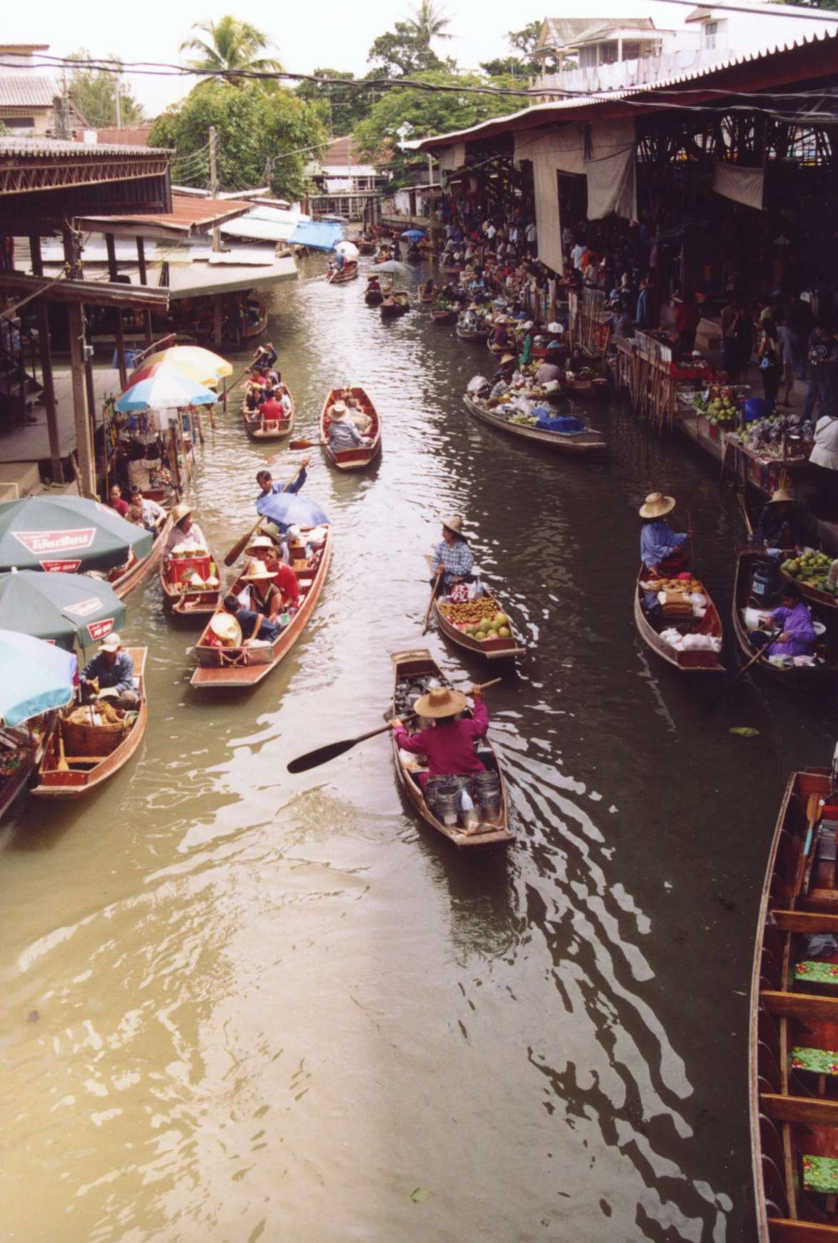
Ratchaburi province is a medium-sized province with an area of about 5196 km2. The eastern part of the province contains the flat river plains of the Mae Klong, crisscrossed by many khlongs. The most famous tourist spot in this area is the Damnoen Saduak Floating Market. The west of the province is more mountainous, and includes the Tenasserim Hills. As the mountains are made mostly of limestone, there are several caves containing stalactites. Some caves are inhabited by large colonies of bats, and it is an impressive sight when they swarm out in the evening to feed. Other caves like the Khao Bin are accessible for visitors.
The area of Ratchaburi province is divided into three parts. First, the border in the west which is shared with Myanmar and is about 60 km long. The second contains the Tenasserim mountains and forests with an elevation of about 200–300 meters. The central area of the province is rich in wetlands due to river flow. Ratchaburi has important natural resources in its forest of which it covers an area of 1,711 km² or 33 percent of provincial area. Moreover, it has minerals such as tin, tantalum, feldspar, quartz, limestone, and marlstone.
The main river of the western part is the Phachi River. On the left bank of the Phachi is the Chaloem Phrakiat Thai Prachan National Park along with eight other national parks, make up region 3 (Ban Pong) of Thailand's protected areas.
There is one wildlife sanctuary, Mae Nam Phachi Wildlife Sanctuary, along with two other wildlife sanctuaries, make up region 3 (Ban Pong) of Thailand's protected areas.
- Chaloem Phrakiat Thai Prachan National Park, 329 km2 56,310 visitors in fiscal year 2024.
- Mae Nam Phachi Wildlife Sanctuary, 489 km2.
|}
History
The history of the city of Ratchaburi dates back to the Dvaravati period, when it was an important city of the Mon Kingdom. Of the city of Khu Bua nearby only ruins remains. According to legend it dates back to the mythical Suvannabhumi Kingdom predating Dvaravati.
"Ratchaburi" means 'the land of the king'. Ratchaburi dates back to ancient times and was important during the Dvaravati period. The city of Ratchburi is on the banks of the Mae Klong River and was a town of the Suvarnabhumi Kingdom.
From the evidence of archaeological sites and many antiquities, believed that people have settled in this area since the Middle Stone Age, as well as discovering an ancient city in the Dvaravati period at Mueang Ratchaburi district. King Rama I used to take a position of Royal Yokkrabat of Ratchaburi in the late Ayutthaya period.
In the late Ayutthaya period and early Rattanakosin period, there is historical evidence that Ratchaburi is an important frontier city, It is a battlefield for many ages. Especially during the reign of King Rama I has brought troops to set up the Burmese battle in Ratchaburi area many times, the most important one was the Burmese–Siamese War (1785–1786).
Later in 1817, In the reign of King Rama II has ordered to build a new city wall on the left bank of the Mae Klong River until the present. In the reign of King Rama V in 1894, has changed the government and included the city that are close together to set up as counties and included the city of Ratchaburi, Kanchanaburi, Samut Songkhram, Phetchaburi, Pran Buri and Prachuap Khiri Khan to set up as Ratchaburi county.
Demographics
Hill tribes, mostly Karen living near the Myanmar border, make up about one percent of the population. Some Mon, Lawa, Lao, Chinese and Khmer minorities live in the province. Most Mon live in the upper part of the province like Ban Pong and Photharam districts, and tend to live along the river.
Ratchaburi is 98.3 percent Buddhist.
Symbols
The provincial seal shows the royal sword above the royal sandals on a phan, as the name Ratchaburi means 'city of the king'. The name derives from the fact that King Rama I was born here. The provincial slogan is "Beautiful women of Photharam. Exquisite women of Ban Pong. City of dragon jars. Nang Yai of Wat Khanon. Sensational caves. Damnoen (Saduak) floating market. Amazing millions of bats. The area of good taste Jullien's golden carp." The provincial flower is the Pink Shower Tree (Cassia bakeriana), and the provincial tree is Wrightia pubescens. Jullien's golden carp (Probarbus jullieni) is the provincial fish, same as neighbouring province Kanchanaburi, that has good taste and flourished in the Mae Klong River in the past, but is now critically endangered.
Transportation
Rail
The main railway station in Ratchaburi is Ratchaburi railway station.
Health
Public
Ratchaburi Hospital is the main and largest hospital of the province, classified as a regional hospital by the Ministry of Public Health. In the lower tier, three general hospitals are located in Ratchaburi: Ban Pong Hospital, Photharam Hospital and Damnoen Saduak Hospital. The remaining six districts are served by community hospitals.
Administrative divisions

Provincial government
The province is divided into 10 districts (amphoes). The districts are further subdivided into 104 sub-districts (tambons) and 935 villages (mubans).
Local government
As of 26 November 2019 there are: one Ratchaburi Provincial Administration Organisation (ongkan borihan suan changwat) and 34 municipal (thesaban) areas in the province. Ratchaburi, Ban Pong, Tha Pha and Photharam have town (thesaban mueang) status. Further 30 subdistrict municipalities (thesaban tambon). The non-municipal areas are administered by 77 Subdistrict Administrative Organisations - SAO (ongkan borihan suan tambon).
Human achievement index 2022
| Province Ratchaburi, with an HAI 2022 value of 0.6577 is "somewhat high", occupies place 17 in the ranking. |
|---|
Since 2003, United Nations Development Programme (UNDP) in Thailand has tracked progress on human development at sub-national level using the Human achievement index (HAI), a composite index covering all the eight key areas of human development. National Economic and Social Development Board (NESDB) has taken over this task since 2017.
| 62 - 77 | "low" |
|---|
| [[File:HAI 2022 rankings.svg | 950px]] |
|---|
Gallery
File:Khao Binn.jpg|Khao Bin bat cave File:วัดมหาธาตุวรวิหาร อ.เมือง จ.ราชบุรี (18).jpg|Wat Mahathat image:ริมน้ำแม่กลองท่ารถ บ้านโป่ง - panoramio (1).jpg| Bus terminal by Mae Klong, Ban Pong image:มหาวิทยาลัยราชภัฏหมู่บ้านจอมบึง1 - panoramio (1).jpg|Muban Chombueng Rajabhat University, a branch of Rajabhat University in Chom Bueng file:The Scenery Vintage Farm - สวนผึ้ง, ราชบุรี - panoramio.jpg|The Scenery Vintage Farm, resort of Suan Phueng file:ชุมทางหนองปลาดุก - panoramio.jpg|Sign of Nong Pladuk Junction Railway Station, the junction station of southern railway line and the starting point of the Death railway image:สถานีรถไฟเจ็ดเสมียน - panoramio - SIAMSEARCH.jpg|Chet Samian Railway Station, Photharam file:Ratchaburi Shadow Puppet Museum (Wat Khanon) 1.jpg|Nang Yai Shadow Puppet Museum in Wat Khanon, Photharam file:ถนนเฉลิมพระเกียรติ ร.9 บ้านโป่ง.jpg|Chaloem Phrakiat Rama 9 Road, Ban Pong image:Ratchaburi Musuem - 2017-04-16 (035).jpg|Corridor in Ratchaburi National Museum
References
References
- "Table 2 Forest area Separate province year 2019". Royal Forest Department.
- "Official statistics registration systems". Department of Provincial Administration (DOPA).
- (July 2019). "''Gross Regional and Provincial Product, 2019 Edition''". Office of the National Economic and Social Development Council (NESDC).
- "ข้อมูลสถิติดัชนีความก้าวหน้าของคน ปี 2565 (PDF)".
- "Ratchaburi".
- (2019). "ตารางที่ 2 พี้นที่ป่าไม้ แยกรายจังหวัด พ.ศ.2562".
- (June 2025). "Ratchaburi has important "natural resources"".
- (December 2020). "ข้อมูลพื้นที่อุทยานแห่งชาติ ที่ประกาศในราชกิจจานุบกษา 133 แห่ง".
- "สถิตินักท่องเที่ยวที่เข้าไปอุทยนห่งชาติ ปีงบประมาณ พ.ศ. 2567".
- (2019). "ตาราง 5 พื้นที่เขตรักษาพันธุ์สัตว์ป่า พ.ศ. 2562".
- Choomjit, Y. (1994). ''History of Ratchaburi''. Bangkok: Odienstore.
- (14 September 2017). "Time-travelling along the Mae Klong River". Bangkok Post.
- "Population by religion, region and area, 2015".
- "Welcome to Ratchaburi Province, Thailand".
- "สัญลักษณ์ประจำจังหวัด". Canghwadrachburiffff.
- Ratchaburi is divided into "10 districts", Retrieved 4 Nov 2013, from http://www.encyclopediathai.org/sunthai/center/ratburi/ratburi.htm {{Webarchive. link. (2012-12-15)
- (26 November 2019). "Number of local government organizations by province". Department of Local Administration (DLA).
This article was imported from Wikipedia and is available under the Creative Commons Attribution-ShareAlike 4.0 License. Content has been adapted to SurfDoc format. Original contributors can be found on the article history page.
Ask Mako anything about Ratchaburi province — get instant answers, deeper analysis, and related topics.
Research with MakoFree with your Surf account
Create a free account to save articles, ask Mako questions, and organize your research.
Sign up freeThis content may have been generated or modified by AI. CloudSurf Software LLC is not responsible for the accuracy, completeness, or reliability of AI-generated content. Always verify important information from primary sources.
Report