From Surf Wiki (app.surf) — the open knowledge base
Ras al-Helal
| Field | Value | |
|---|---|---|
| official_name | Ras al-Helal | |
| native_name | رأس الهلال | |
| settlement_type | Village | |
| dot_x | dot_y = | |
| pushpin_map | Libya | |
| pushpin_label_position | bottom | |
| pushpin_map_caption | Location in Libya | |
| subdivision_type | Country | |
| subdivision_name | Libya | |
| subdivision_type1 | Region | |
| subdivision_name1 | Cyrenaica | |
| subdivision_type2 | District | |
| subdivision_name2 | Derna | |
| leader_title1 | ||
| established_title | ||
| established_title2 | ||
| established_title3 | ||
| unit_pref | Imperial | |
| area_total_km2 | ||
| area_land_km2 | ||
| population_blank1_title | Ethnicities | |
| population_blank2_title | Religions | |
| timezone | EET | |
| utc_offset | +2 | |
| coordinates | ||
| elevation_footnotes | ||
| postal_code_type | ||
| registration_plate_type | License Plate Code | |
| registration_plate | 60 |
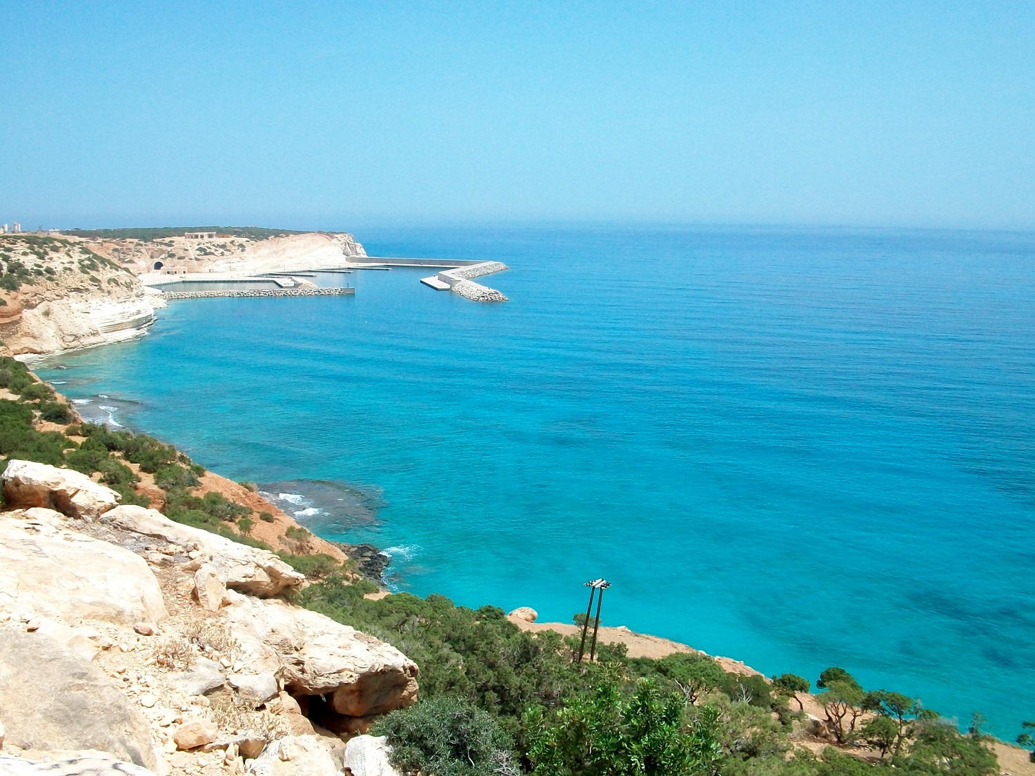
Ras al-Helal (, Raʾs al-Helal, "Crescent Cape") is a village on the southern shore of the Mediterranean Sea in Derna District, Cyrenaica, Libya. It takes its name from its cape, which appears to have a crescent shape when viewed from the surrounding Jebel Akhdar (English: The Green Mountain) mountainous plateau's foothills. It had a population totaling 2,235 in 2006. Ras al-Helal is known for its green, forested beach and its nearby waterfalls.
Geography
Ras al-Helal is the southwest endpoint of the Levantine Sea in the eastern Mediterranean. It is located in Cyrenaica 55 km to the north-east of Bayda.
Beach
The Mediterranean coast of Libya is almost 1900 km long, and nearly all its beaches are far from forests or significant vegetation. Being one of the few exceptions, Ras al-Helal attracts many vacationers. The area is isolated because of the lack of a direct coastal road connecting the nearby western town of Susa with Benghazi, the country's second largest city and the largest on the Cyrenaica coast.
Waterfalls


The Ras al-Helal waterfalls are located up in the Jebel Akhdar, some 3.5 km from the coastal road. They are considered one of the most beautiful natural places in the country and attract many Libyan visitors and vacationers. The access road to the waterfalls, constructed during the Italian occupation, is old, narrow, and in poor condition. Some viewing locations for the waterfalls are along dangerous cliffs, so visiting alone is not safe.
References
References
- Amraja M. el Khajkhaj, "Noumou al Mudon as Sagheera fi Libia", Dar as Saqia, Benghazi-2008, p.123.
This article was imported from Wikipedia and is available under the Creative Commons Attribution-ShareAlike 4.0 License. Content has been adapted to SurfDoc format. Original contributors can be found on the article history page.
Ask Mako anything about Ras al-Helal — get instant answers, deeper analysis, and related topics.
Research with MakoFree with your Surf account
Create a free account to save articles, ask Mako questions, and organize your research.
Sign up freeThis content may have been generated or modified by AI. CloudSurf Software LLC is not responsible for the accuracy, completeness, or reliability of AI-generated content. Always verify important information from primary sources.
Report