From Surf Wiki (app.surf) — the open knowledge base
Quistinic
| Field | Value |
|---|---|
| name | Quistinic |
| native name | Kistinid |
| commune status | Commune |
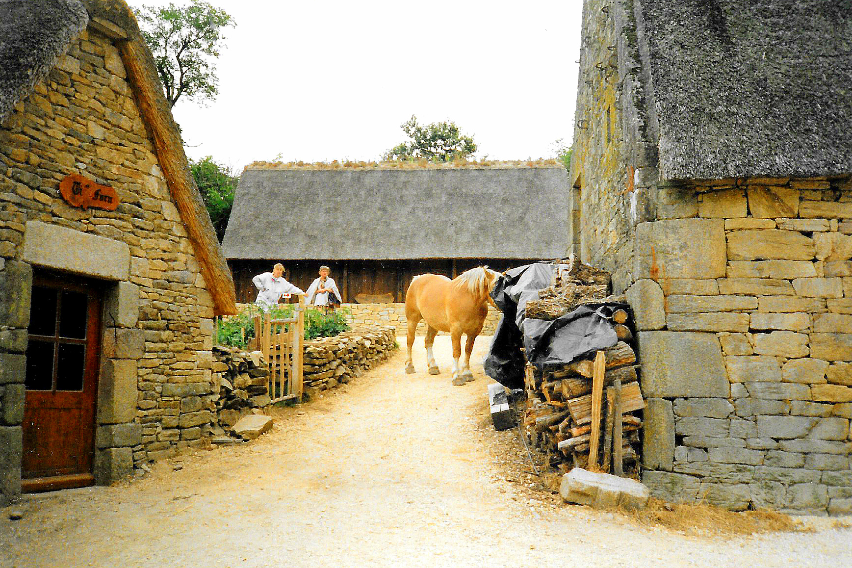
| image | France - Morbihan - Quistinic - Poul Fétan.jpg |
| caption | The village of Poul-Fetan |
| image coat of arms | Blason ville fr Quistinic (Morbihan).svg |
| coordinates | |
| INSEE | 56188 |
| postal code | 56310 |
| arrondissement | Lorient |
| canton | Guidel |
| mayor | Antoine Pichon |
| term | 2020–2026 |
| intercommunality | Lorient Agglomération |
| elevation min m | 20 |
| elevation max m | 177 |
| area km2 | 42.95 |
| population | |
| population date | |
| population footnotes |
|image coat of arms = Blason ville fr Quistinic (Morbihan).svg
Quistinic (; ) is a commune in the Morbihan department of Brittany in north-western France. Its sister city is the rural village of Loughshinny, which is in County Dublin, Ireland.
Population
The inhabitants of Quistinic are called Quistinicois in French.
|graph-pos = bottom |1793 |2385 |1800 |2090 |1806 |2241 |1821 |2132 |1831 |2453 |1836 |2481 |1841 |2422 |1846 |2491 |1851 |2559 |1856 |2336 |1861 |2312 |1866 |2377 |1872 |2286 |1876 |2403 |1881 |2460 |1886 |2430 |1891 |2378 |1896 |2382 |1901 |2556 |1906 |2521 |1911 |2555 |1921 |2321 |1926 |2565 |1931 |2644 |1936 |2639 |1946 |2510 |1954 |2226 |1962 |2072 |1968 |1901 |1975 |1608 |1982 |1517 |1990 |1412 |1999 |1312 |2009 |1403 |2014 |1429 |2020 |1421
Toponymy
Quistinic is a word in the Breton language. It means "Chestnut Forest".
Geography
thumb|left|The Blavet valley in Quistinic The village centre is located 25 km northeast of Lorient, 39 km northwest of Vannes and 110 km west of Rennes. Historically, Quistinic belongs to the Vannetais. The river Blavet forms the commune's eastern and southern borders. The neighborhood of the hamlet of Poul Fetan, in Quistinic, offers a nice view over the Blavet valley. Quistinic is characterised by a bocage landscape.
Neighboring communes
Quistinic is border by Bubry and Melrand to the north, by Saint-Barthélemy and Baud to the east, by Languidic to the south and by Lanvaudan to the west.
Map
Village of Poul-Fétan
**** which etymologically means "Lavoir (wash-house) of the fountain" () is an historical center that is located within Quistinic. This hamlet, originating in the sixteenth century, has been completely restored with traditional materials. The houses are covered with thatching, and the old lavoir and the ancient hemp rusting containers are present. Visitors can notably enter the Longère located in a farmhouse and witness an interior of the early twentieth century reconstituted and observe the craftsmen at work showing their expertise.
Gallery
File:Quistinic (56) Chapelle de Locmaria 01.JPG|Chapel of Locmaria File:Villeneuve Jacquelot Quistinic.JPG| Villeneuve-Jacquelot castle File:Quistinic_maison_niches_à_pigeons.jpg|Old house in the village centre File:Quistinic_monument_aux_morts.jpg|Monument erected in memory of the victims of the twentieth century wars.
References
References
- (7 July 2020). "Maires du Morbihan". Préfecture du Morbihan.
- [https://www.insee.fr/fr/metadonnees/geographie/commune/56188-quistinic INSEE commune file]
- [https://www.jumelage-feteducidre.fr/ Jumelage Quistinic-Loughshinny-Sumène]
- {{Cassini-Ehess. 28519. Quistinic
- [https://www.insee.fr/fr/statistiques/7633058?geo=COM-56188#ancre-POP_T1 Population en historique depuis 1968], INSEE
- Dubost, Jean-Michel. (1980). "Restauration du village de Poul-Fetan en Quistinic [Morbihan]".
This article was imported from Wikipedia and is available under the Creative Commons Attribution-ShareAlike 4.0 License. Content has been adapted to SurfDoc format. Original contributors can be found on the article history page.
Ask Mako anything about Quistinic — get instant answers, deeper analysis, and related topics.
Research with MakoFree with your Surf account
Create a free account to save articles, ask Mako questions, and organize your research.
Sign up freeThis content may have been generated or modified by AI. CloudSurf Software LLC is not responsible for the accuracy, completeness, or reliability of AI-generated content. Always verify important information from primary sources.
Report