From Surf Wiki (app.surf) — the open knowledge base
Puna, Hawaii
District of Hawaiʻi County, Hawaii

District of Hawaiʻi County, Hawaii

Puna is one of the 9 districts of Hawaii County on the Island of Hawaii (Big Island; County of Hawaii). It is located on the windward side (east side) of the island and shares borders with South Hilo district in the north and Kaū district in the west. With a size of just under 320,000 acre or 500 sq. miles, Puna is slightly smaller than the island of Kauai.
Puna cropland supports floriculture, nurseries and macadamia nuts. Most of the state’s papayas crops are grown in the lower Puna area which is regarded as the best place in the Islands to grow the crop.
The Puna District is subject to frequent lava eruptions and flows, which include the complete destruction of the community of Kapoho, a result of the devastating 2018 lower Puna eruption, as Puna is located on a volcanic rift zone of Kilauea Volcano.
History
Kingdom of Hawaii
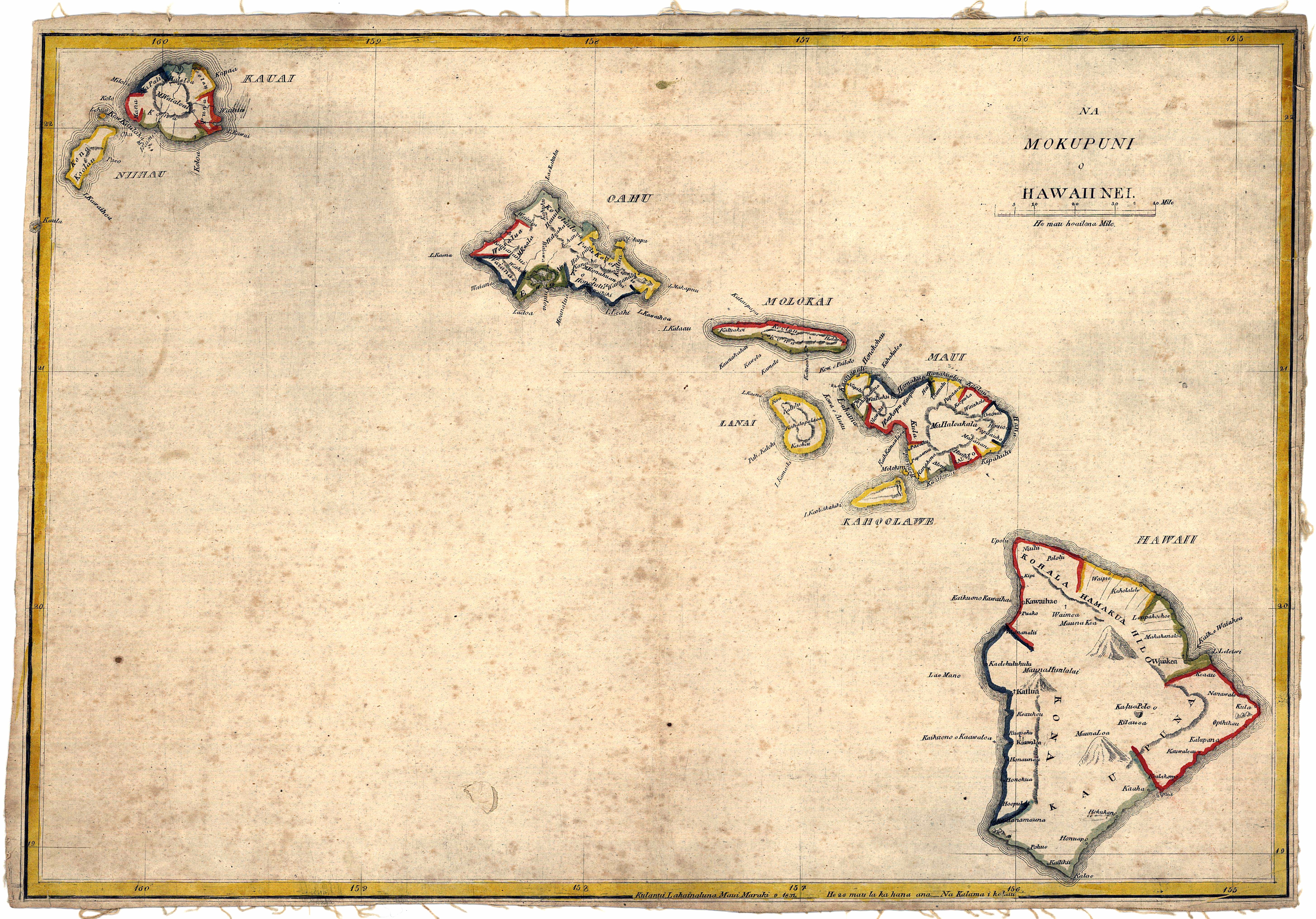
Kalama's map of 1837 shows that Puna was a Moku (traditional district) covering the southeastern corner of the island before the great mahele of the Hawaiian Kingdom.
Recent lava activity
Kīlauea is one of the world's most active volcanoes, and until August 2018 was continuously in action since 1983 along Kīlauea's East Rift Zone, and closely monitored by the Hawaii Volcano Observatory. The Royal Gardens subdivision and the villages of Kaimu and Kalapana were largely destroyed by lava flows and in the Fall of 2014, lava briefly touched the outskirts of Pahoa, the main village in Puna, before halting and seeking a new course south into the ocean at Kamokuna.
Hawaii Volcanoes National Park, when constructed, had two entrances. The entrance from lower Puna was cut off in 1986, and several miles of the road along the ocean were covered by several flows that occurred over the course of the eruption. Millions of tourists came each year to witness the spectacle of a torrent of lava plunging into the sea and exploding as it hit the water. Lava flows continued to add new land to the old shoreline, often resulting in an unstable delta that periodically formed cracks and broke off into the sea; visitors were provided with viewing stations at a safe distance.
2014 lava flow
In June 2014, a lava flow dubbed the June 27th flow started flowing from a vent of a spatter cone called Puʻu ʻŌʻō on the east rift zone of Kīlauea Volcano in a northwest direction towards the villages of Kaohe Homesteads and Pahoa.
In early September it appeared that the lava flow was en route to the small community of Kaohe Homesteads. Community leaders and state officials began to draw up plans for evacuations and the mayor signed an emergency proclamation as residents of the Kaohe Homesteads subdivision learned that lava from Kilauea Volcano was just 0.8 mile away and could reach them within a week. On September 13, a release from the Hawaiian Volcano Observatory stated that the flow had begun to shift away from the subdivision as it had interacted with both the cracks and down-dropped blocks within the East Rift Zone of Kīlauea volcano and a natural valley that leveled away from Kaohe Homesteads.
In early October 2014, the lava flow was heading towards the community of Pahoa, Hawaii. On October 25, the flow had crossed Cemetery Road at Apa'a Road near the Pahoa Recycling and Transfer Station, a waste/trash station, which was closed and relocated due to the lava flow. The flow was quickly advancing on a nearby cemetery and triggered the first series of evacuations. On November 10, the flow claimed a home.
Officials feared that if the lava flow continued on its path it would cover and close the only route in and out of lower Puna, Highway 130. On October 22, The National Park Service announced that it would help state and county officials create an emergency route along 8 miles of the buried Chain of Craters Road in order to help Puna residents who would lose access to the rest of Hawai‘i if that lava flow covered Highway 130. Construction of the Chain of Craters alternate route began by making a path over a wall of lava rock covering the road in Hawaii Volcanoes National Park. The $12 million to $15.5 million route, to be re-established between the park and Kalapana as a gravel road, would have been the only road in and out of lower Puna, if the June 27 lava flow had made its way to the sea. The park closed the end of Chain of Craters Road as construction began. Nearly 8 miles of the roadway, officially known as Chain of Craters Road inside the park and Highway 130 outside of it, had been covered by past flows from the ongoing Puʻu ʻŌʻō eruption that threatened Pahoa. Chain of Craters Road, which opened in 1965, had portions blocked or covered by lava for 37 years of its 49-year existence, according to the park. The road is about 19 miles long inside the park.
The lava flow stopped just short of the village of Pahoa. In 2016 a new flow (called Episode 61G by the United States Geological Survey) emerged from Puʻu ʻŌʻō in a southerly direction, the shortest way to the ocean, across an area that had been covered in lava during the preceding decades. The emergency road connecting Hwy 130 to the Chain of Craters Road was severed by the new flow. In 2018 this road was again cleared through the 2016 lava to provide emergency access around the 2018 lower Puna eruption.
2018 eruption
Main article: 2018 lower Puna eruption
On May 3, 2018, a fissure opened and lava started spewing out on Mohala Street in Leilani Estates. By June 5, 2018, reports from Hawai'i County officials indicated that hundreds of homes in several subdivisions had been destroyed by the ongoing eruption. By early August, when the eruption ended, over 13.7 square miles had been covered by lava, including about 875 acres of new land offshore.
File:USGS Kīlauea image-405.jpg|Map of ongoing intrusion and earthquake activity along Kīlauea's East Rift Zone (May 2, 2018) File:USGS Kīlauea multimediaFile-1936.jpg|Collapse in the crater of Pu‘u ‘Ō‘ō, creating an ash plume (May 3, 2018) File:USGS Kīlauea multimediaFile-1938.jpg|Eruption in the Leilani Estates subdivision (May 3, 2018) File:USGS Kīlauea multimediaFile-1955.jpg|Lava from a fissure slowly advanced to the northeast on Hoʻokāpu Street in Leilani Estates subdivision (May 5, 2018) File:USGS Kīlauea image-409.jpg|Map of the locations of eruptive fissures (May 5, 2018)
Geography
Communities
For statistical purposes, the United States Census Bureau has defined many of these communities as a census-designated places (CDP). The census definition of these areas may not precisely correspond to local understanding of the area with the same name.
- Āinaloa
- Black Sands
- Eden Roc
- Fern Acres
- Fern Forest
- Glenwood
- Hawaiian Acres
- Hawaiian Beaches
- Hawaiian Paradise Park
- Kalapana
- Kapoho
- Keaau
- Kehena
- Kurtistown
- Leilani Estates
- Mountain View
- Nānāwale Estates
- Orchidland
- Pāhoa
- Vacationland Hawaii
- Volcano Village
Housing
The affordable housing prices have led to an enormous increase in developments in Puna, and have made this district the fastest growing area on the Big Island. Between 1990 and 2020 the population increased by 150% and slightly surpassed the population of the South Hilo district (including the city of Hilo), which in comparison only grew by about 15%. However, between 2002 and 2006 the price of houses more than doubled and the price of vacant land increased over fivefold, as increasing numbers of people from outside the district (often from the mainland U.S.) bought into the last affordable market in the state.
Homeowners Insurance can be more difficult to secure in the parts of Puna that are located in Lava Flow Hazard Zones 1 or 2. The entire Kīlauea rift zone region is in Zone 1, while the southeastern slope is in Zone 2. Most home insurance companies will not cover homes in Zone 1 or 2 for values over $350,000. Most of the volcanic destruction of private property in Hawaii since the 20th century has occurred in lower Puna, including the destruction of sections of Kapoho, Royal Gardens, Kalapana and Kaimū. Since 1983 (but prior to 2018), lava flows destroyed about 190 structures and covered approximately 50 square miles out of the 500 square miles of Puna. Living in Puna has some other unique considerations. For example, most homes in Puna rely on rainwater catchment for their household water. This lack of water availability for firefighting is also an issue with insurance companies.
Climate
The climate is a mild tropical climate with abundant rainfall, especially in the northern parts and areas of higher elevation. The terrain is characterized by gentle slopes with no defined waterways. Although rainfall is occasionally very heavy (one storm in 2003 brought 36 inches (90 cm) of rain in 24 hours), flooding is rare due to the slope and porosity of the volcanic rock. The vegetation ranges from rainforest to desert shrub and coastal strand. Large areas of native forest are present in the Wao Kele o Puna and Kahauala tracts.
Places of interest
Besides visiting the active Kīlauea volcano and the formerly active and now cooled lava flows in the area of Kalapana, another interesting site within the Puna district was the heated tide pools at Ahalanui Beach Park (aka Pualaa County Park), where spring water was naturally heated through geothermal energy and this mixed with ocean water along the shoreline. Prior to the eruption in 1960 at Kapoho, the pools were not heated but were cold; in 2018 the park was overrun by lava.
- Hawaii Volcanoes National Park, (the entrance is inside the district of Kaū)
- Issac Hale Beach Park (Pohoiki) (was heavily effected by the 2018 eruption and has since reopened)
- Mauna Loa Macadamia Nut Corporation
Notable people
- Arthur Johnsen, Artist
- William "Billy" Kenoi, Mayor of Hawaii County (2008–2016)
- Harry Kim, Mayor of Hawaii County (2000–2008 and 2016-2020)
- Jason Scott Lee, Actor, owner and creator of Ulua Theatre, Volcano Village resident
- Joseph Nāwahī, Native Hawaiian legislator, newspaper publisher, and painter
- Emily Naeole, Hawaii County Councilwoman
- Abra Moore, Folk-styled rock singer-songwriter
- William H. Shipman, Founder of W. H. Shipman Ltd., agricultural entrepreneur, and major private land owner in Puna
Gallery
File:Metrosideros polymorpha.jpg|Ōhiā lehua is the predominant endemic tree found in Puna. File:KalapanaPlume2008.jpg|Kupaianaha lava flow plume in Puna near Kalapana. File:Three Waikupanaha and one Ki lava ocean entries w-edit2.jpg|Three entries plus Waikupanaha in April 2008. File:Starr 050423-6662 Santalum ellipticum.jpg|Sandalwood was abundant in Puna prior to the early 1820s. File:Sugar cane madeira hg.jpg|Sugarcane was the main agricultural product in Puna for the 20th century. File:MacNut2.JPG|Macadamia nuts, pictured here in the shell & as a dry roasted nut, are still a significant agricultural industry in Puna. File:Coffee Flowers Show.jpg|Coffee was the main crop in the 1800s for Puna and has recently made a return. File:Koeh-029.jpg|Papaya from Hawaii is almost exclusively from Puna. File:Hawaii Lava Tree State Park 000.jpg|Albizia trees are a seriously invasive species throughout the District of Puna, as evidenced by this picture near the "Tree Tunnel" at Lava Tree State Park. File:Kilauea-flow-map 01.jpg|A map showing the flow direction of the June 27th Lava Flow (as of 11/24/14). File:Island of Hawai'i - Landsat mosaic.jpg|This satellite image shows how most of Puna is covered in a lush green canopy, with some visible lava flows in the District of Puna. File:Kilauea Lava Hazard Map.gif|All of the eastern flank of Kīlauea lies within the District of Puna with a small portion of Mauna Loa running along the northern boundary. The flows erupted since 1800 are shown in gray and dated. Twenty-eight percent of the area encompassed by Zones 1 and 2 on the east half of the volcano have been covered by lava since 1955. The major housing subdivisions of Puna are shown in green.
References
References
- [http://co.hawaii.hi.us/databook_current/map01.htm Hawaii County Data Book] {{webarchive. link. (July 8, 2011)
- NAPIER, A. KAM. (October 26, 2018). "Hawai‘i Island’s Agriculture Recovery Challenge". [[Hawaii Public Radio]].
- (1837). "Na Mokopuni o Hawaii Nei". Unsure.
- "Hawaiian Land Areas". Self.
- [https://hvo.wr.usgs.gov/kilauea/summary/ Kīlauea lava flows] {{Webarchive. link. (March 13, 2017 (USGS).)
- [http://www.hawaiitourismauthority.org/research/ Hawaiian Tourism Authority]
- "Volcanic Hazards on the Island of Hawai`i".
- (27 June 2014). "New Video: Pu'u O'o crater develops new outlet for lava". KITV 4.
- (9 September 2014). "Lava on track to reach Pahoa in two weeks". Honolulu Star Advertiser.
- (4 September 2014). "Big Isle resident vows to stay until lava burns house". Honolulu Star Advertiser.
- "Lava slows, misses first homes for now".
- (23 October 2014). "Pahoa Transfer Station to Close Friday". Big Island Now.
- (26 October 2014). "Lava enters Pahoa cemetery grounds". KITV 4.
- (26 October 2014). "Lava nears, evacuations loom". West Hawaii Today.
- "First house claimed by Puna lava flow".
- ""End of the Road" would close during emergency route construction". NPS.
- (22 October 2014). "Lava-clearing to begin on Ka‘u side of historic road". West Hawaii Today.
- (3 May 2018). "Overnight, earthquakes and lava become the new norm on Hawaii island".
- "Hawaiinewsnow - Lava claims hundreds of homes, including Big Island mayor's".
- [https://volcanoes.usgs.gov/observatories/hvo/maps_uploads/image-540.jpg USGS East Rift Zone map, August 9, 2018]
- "USGS: Volcano Hazards Program - Hawaiian Volcano Observatory".
- "RESIDENT POPULATION OF COUNTIES AND JUDICIAL DISTRICTS: 1990 TO 2020".
- "Lava flow zone hazard maps USGS".
- "Hazard zones for lava flows on Kilauea USGS".
- "USGS Summary of the Pu
uŌ `ō-Kupaianaha Eruption, 1983-present". - [http://www2.ctahr.hawaii.edu/oc/freepubs/pdf/HH-10.pdf College of Tropical Agriculture and Human Resources (CTAHR) University of Hawaii at Manoa]
- "Free CTAHR Publications".
- [http://www.hawaiicounty.gov/active-alerts/east-rift-zone-eruption-thursday-71218-600-am.html Hawaii County Civil Defense message]
- [http://www.midweek.com/content/story/theweekend_coverstory/acting_naturally/ Midweek Magazine Cover Story] {{webarchive. link. (September 27, 2011)
- [http://www.co.hawaii.hi.us/council/district05.htm Hawai{{okinai County Council Biography] {{webarchive. link. (October 6, 2011)
- Dobbyn, Paula. (2023-05-30). "Puna Is The Fastest Growing Place In Hawaii. But It Comes With A Catch".
This article was imported from Wikipedia and is available under the Creative Commons Attribution-ShareAlike 4.0 License. Content has been adapted to SurfDoc format. Original contributors can be found on the article history page.
Ask Mako anything about Puna, Hawaii — get instant answers, deeper analysis, and related topics.
Research with MakoFree with your Surf account
Create a free account to save articles, ask Mako questions, and organize your research.
Sign up freeThis content may have been generated or modified by AI. CloudSurf Software LLC is not responsible for the accuracy, completeness, or reliability of AI-generated content. Always verify important information from primary sources.
Report