From Surf Wiki (app.surf) — the open knowledge base
Provinces of Afghanistan
First-level administrative territorial entity of Afghanistan

First-level administrative territorial entity of Afghanistan
| Field | Value | |
|---|---|---|
| name | Provinces of Afghanistan | |
| alt_name | Wilayat | |
| map | [[File:Afghanistan adm location map.svg | 250px]] |
| category | Unitary state | |
| territory | Afghanistan | |
| current_number | 34 provinces | |
| population_range | 167,425 (Nuristan) – 5,211,452 (Kabul) | |
| area_range | 1908 km2 (Kapisa) – 58305 km2 (Helmand) | |
| government | Provincial governments | |
| subdivision | District |
The provinces of Afghanistan (Pashto and wilāyat) are the primary administrative divisions of the Islamic Emirate of Afghanistan. There are 34 provinces in Afghanistan. Each province encompasses a number of districts or usually over 1,000 villages.
Provincial governors played a critical role in the reconstruction of the Afghan state following the creation of the new government under Hamid Karzai. According to international security scholar Dipali Mukhopadhyay, many of the provincial governors of the western-backed government were former warlords who were incorporated into the political system.
History of administrative divisions of Afghanistan
The administrative divisions of Afghanistan have evolved through a gradual process of centralisation, shaped by geography, military power, and the state's efforts to extend authority from Kabul to peripheral regions. Until the 20th century, governance relied largely on personal rule, tribal alliances, and tribute rather than clearly defined territorial units.
Early modern period
Before the establishment of modern state institutions, the territory of present-day Afghanistan was not divided into fixed provinces. Under the Durrani Empire (1747–1823), administration functioned through a loose confederation of tribal leaders and appointed relatives. Core centres of authority included Kandahar, Kabul, Herat, and western regions such as Sistan. Control was exercised through military levies, revenue extraction, and personal loyalty, while boundaries remained fluid and weakly institutionalised.
Following the death of Ahmad Shah Durrani in 1772, internal dynastic conflicts led to fragmentation. By the early 19th century, power was divided among principalities centred on Kabul, Kandahar, and Herat, alongside semi-autonomous northern khanates in Balkh, Kunduz, and Badakhshan. Local chieftains exercised de facto authority in rural areas, often limiting the reach of central rule. A renewed process of unification occurred under Dost Mohammad Khan from 1826, who gradually brought Ghazni, Hazarajat, northern Turkestan, Kandahar, and Herat under central control by 1863. Administration remained personal and dynastic, with key regions governed by family members and local rulers integrated through tribute rather than direct bureaucracy.
Centralization efforts during the 19th and early 20th centuries
During the 19th century, Afghan rulers increasingly sought to formalise territorial administration. Provinces were defined broadly along major river systems and watersheds, such as the Kabul River, Helmand River, Hari Rud, and the Oxus basin. By around 1880 and the ascent of Emir Abdur Rahman Khan, British historian W. P. Andrew identified the main provinces as Cabul, Jellalabad, Ghuzni, Candahar, Herat, and Balkh (also called Afghan Turkestan), although these units were not systematically surveyed and are known mainly from written sources. In addition, he identified the rugged regions inhabited by the Ghilzai and Hazara, roughly corresponding with Paktia and Hazarajat respectively.
In 1890, Afghanistan was first mentioned in the Statesman's Yearbook as a separate entity, stating that the dominions of the Emirate of Afghanistan are divided into the four provinces of Kabul, Turkistan, Herat, and Kandahar, as well as the districts of Badakhshan and Wakhan, at the time being seen as separate provinces. Since 1892, Wakhan was included into the district of Badakhshan as part of its dependencies. Between 1891 and 1893, a thorough description of the administrative divisions of Afghanistan was compiled by British military officers, drawing on reports, surveys, and Afghan Boundary Commission records. The works cover the six provinces of Badakhshan, Afghan Turkistan, Herat, Kabul, Kandahar, and Farah, with the latter being formed out of parts of Herat and Kandahar as well as the de facto independent Sistan and Garmsir regions during the time of Sher Ali Khan. An overview over all provinces and their districts and subdistricts is provided below:
| Province |
|---|
| Districts | Subdistricts | Source |
|---|---|---|
| Kataghan/Kunduz | – | |
| Andarab | ||
| Khinjan | ||
| Doshi | ||
| Ghori | ||
| Baghlan | ||
| Narin | ||
| Khost | ||
| Farkhar | ||
| Rustak | ||
| Shiva | ||
| Ragh | ||
| Zebak | ||
| Ishkasham | ||
| Gharan | ||
| Faisabad | ||
| Shighnan | ||
| Roshan | ||
| Wakhan |
| Districts | Subdistricts | Source |
|---|---|---|
| Mazar-i-Sharif | Mazar-i-Sharif | |
| Shor Tepa | ||
| Chaharkind | ||
| Buinnkara? | ||
| Kishindi | ||
| Ak Kupruk | ||
| Tanj? | ||
| Balkh | – | |
| Akcha | Akcha | |
| Khwaja Salar | ||
| Daolatabad | ||
| Shibarghan | – | |
| Andkhoi | ||
| Tashqurghan | Pir Nakhchir | |
| Ghaznigak | ||
| Kaldar | ||
| Haibak | – | |
| Dara Yusuf | ||
| Doab and Rui | ||
| Saighan and Kamard | ||
| Balkhab | ||
| Sang Charak | ||
| Sar-i-Pul | ||
| Maimana |
| Districts | Subdistricts | Source |
|---|---|---|
| Herat | – | |
| Ghorian | ||
| Karokh | ||
| Obeh | ||
| Sabzwar | ||
| Shahfilan | ||
| Badghis | ||
| Murghab | ||
| Taimani | ||
| Firozkohi |
| Districts | Subdistricts | Source |
|---|---|---|
| Kabul | Kabul | |
| Chardeh | ||
| Paghman | ||
| Butkhak | ||
| Chaharasia | ||
| Chahil Dukhteran | ||
| Jalalabad | – | |
| Laghman | ||
| Kunar | ||
| Khost | ||
| Zurmat | ||
| Katawaz | ||
| Mukur | ||
| Ghazni | ||
| Logar | Logar | |
| Surkhao | ||
| Kushi | ||
| Cherkh | ||
| Maidan | – | |
| Koh Daman | ||
| Kohistan | Tagao | |
| Nijrao | ||
| Panjshir | ||
| Charikar | ||
| Ghorband | – | |
| Bamian | Bamian | |
| Yak Walang | ||
| Dai Zangi | ||
| Besud | – | |
| Hazarajat | Dai Kundi | |
| Ghazni Hazara | ||
| independent Hazaras |
| Districts | Subdistricts | Source |
|---|---|---|
| Farah | – | |
| Lash-Juwain/Hokat | ||
| Sistan/Chakhansur | ||
| Shahiwan | ||
| Gulistan | ||
| Bakwa | ||
| Pusht-i-Rud | Pusht-i-Rud/Girishk | |
| Garmsel | ||
| Naozad | ||
| Zamindawar |
| Districts | Subdistricts | Source |
|---|---|---|
| Kandahar | Kariajat | |
| Mohalajat | ||
| Daman/Karezat | ||
| Tirin | – | |
| Derawat | ||
| Dahla | 15 subdivisions | |
| Deh-i-Buchi | – | |
| Khakrez | ||
| Kushk-i-Nakhud | ||
| Maiwand | ||
| Nish | ||
| Ghorak | ||
| Kalat-i-Ghilzai | Omaki | |
| Nawa-i-Ghundan | ||
| Ulan-Rabat and Shahjui | ||
| Khakah and Tasi | ||
| Nawa-i-Arghandab | ||
| Arghistan | – | |
| Tarnak | ||
| Mizan | Takir | |
| Makrah | ||
| Takhum | ||
| Alam Gul Khar | ||
| Siajui | ||
| Selim | ||
| Yakir | ||
| Arghasu | ||
| Shekan | ||
| Maruf | – | |
| Kadanai | ||
| Shorawak |
In 1896, Afghanistan took control over Kafiristan, including it into the province of Kabul. In 1905, the province of Badakhshan was merged into Afghan Turkistan.
Provincial reform in the early 1920s

A major reform was introduced in 1300 Hijri (1921/22 Gregorian) under King Amanullah Khan with a formal regulation on sub-national administration. This established a multi-tier system consisting of provinces (wilayat), high governorates (hokumat-i a'lā), governorates (hokumat), sub-districts (alāqa), and villages (qarya). All units reported to the central government, reflecting an emphasis on central control rather than decentralisation. The system was administratively complex and unevenly applied.
The provinces were:
- Southern Province – dissolved in 1964 to create Paktia Province.
- Turkestan Province – dissolved somewhere between 1929 and 1946.
- Qataghan-Badakhshan Province – dissolved in 1963 into Badakhshan Province and Qataghan Province, the latter of which was also dissolved that same year.
- Qataghan Province – dissolved in 1963 into Baghlan Province, Kunduz Province, and Takhar Province.
- Eastern Province – dissolved in 1964 to create Nangarhar Province.
- Farah-Chakansur Province – dissolved in 1964 into Farah Province and Nimruz Province.
- Mazar-i-Sharif Province – dissolved in 1964 into Balkh Province and Jowzjan Province.
- Meymaneh Province – dissolved in 1964 into Faryab Province.
Mid-20th century reforms
Between the 1920s and 1960s, successive governments sought to simplify the administrative structure. Large historical provinces such as Turkestan, Qataghan-Badakhshan, Eastern, Southern, and Farah-Chakansur were gradually dissolved or subdivided. High governorates and governorates were transformed into provinces or districts, while sub-districts remained in use until the late 20th century.
The 1964 Constitution marked a turning point by introducing the principle of balanced regional development and consultative provincial councils. An administrative law enacted in 1965 established a clear hierarchy of provinces, districts, and villages and formally listed all recognised units. In 1963–1964, the country was reorganised into 28 provinces, replacing fewer, larger units with smaller provinces to improve governance and development planning. This framework remained largely in place until the end of the monarchy in 1973.
During war times in the 20th and 21st century

From the late 1960s onward, local demands and administrative needs led to a gradual increase in the number of districts and provinces. Between the Soviet–Afghan War and the Afghan civil wars, 4 new provinces were created: Paktika, Khost, Sar-i Pul, and Nuristan. A law on local administration in 2000 abolished large districts and sub-districts, upgrading most sub-districts to full districts. After the fall of the first Taliban regime in 2001, the interim and subsequent governments retained the existing provincial structure, with governors appointed by the central authority.

Two new provinces were created in 2004 following the adoption of the Constitution of Afghanistan. Daykundi was formed from districts of Uruzgan, and Panjshir was separated from Parwan. These changes increased the total number of provinces to 34. No further provincial boundary changes occurred during the remainder of the Islamic Republic period, although the number of districts continued to expand. By 2021, Afghanistan consisted of 34 provinces and 378 districts, reflecting long-term administrative expansion rather than major territorial reorganisation.
Since 2021
Following the Taliban's return to power in August 2021, the 34-province framework was retained. Provincial governors and senior officials have been appointed directly by the central leadership, reinforcing a highly centralised system of administration. While formal provincial boundaries have remained unchanged, governance practices have shifted toward tighter political and ideological control, with provinces functioning primarily as instruments of security and enforcement under the Islamic Emirate.
Provinces of Afghanistan
Administrative
The following table lists the province, capital, number of districts, UN region, region, ISO 3166-2:AF code and license plate code.
| Province | Capital | Districts | UN Region | Region | ISO | Platecode |
|---|---|---|---|---|---|---|
| Badakhshan | Fayzabad | 29 | North East | North | AF-BDS | BDN |
| Badghis | Qala i Naw | 7 | West | Central | AF-BDG | BDG |
| Baghlan | Puli Khumri | 16 | North East | North | AF-BGL | BAG |
| Balkh | Mazar-i-Sharif | 15 | North West | North | AF-BAL | BLH |
| Bamyan | Bamyan | 7 | West | Central | AF-BAM | BAM |
| Daykundi | Nili | 8 | South West | South | AF-DAY | DYK |
| Farah | Farah | 11 | West | Central | AF-FRA | FRH |
| Faryab | Maymana | 14 | North West | North | AF-FYB | FYB |
| Ghazni | Ghazni | 19 | South East | South | AF-GHA | GAZ |
| Ghor | Chaghcharan | 11 | West | Central | AF-GHO | GHR |
| Helmand | Lashkargah | 13 | South West | South | AF-HEL | HEL |
| Herat | Herat | 15 | West | Central | AF-HER | HRT |
| Jowzjan | Sheberghan | 9 | North West | North | AF-JOW | JZJ |
| Kabul | Kabul | 18 | Central | Central | AF-KAB | KBL |
| Kandahar | Kandahar | 16 | South West | South | AF-KAN | KRD |
| Kapisa | Mahmud-i-Raqi | 7 | Central | Central | AF-KAP | KPS |
| Khost | Khost | 13 | South East | South | AF-KHO | KST |
| Kunar | Asadabad | 15 | East | Central | AF-KNR | KNR |
| Kunduz | Kunduz | 7 | North East | North | AF-KDZ | KDZ |
| Laghman | Mihtarlam | 5 | East | Central | AF-LAG | LGM |
| Logar | Pul-i-Alam | 7 | Central | Central | AF-LOG | LGR |
| Nangarhar | Jalalabad | 23 | East | Central | AF-NAN | NGR |
| Nimruz | Zaranj | 5 | South West | South | AF-NIM | NRZ |
| Nuristan | Parun | 7 | East | Central | AF-NUR | NUR |
| Paktia | Gardez | 11 | South East | South | AF-PIA | PAK |
| Paktika | Sharana | 15 | South East | South | AF-PKA | PKT |
| Panjshir | Bazarak | 7 | Central | Central | AF-PAN | PJR |
| Parwan | Charikar | 9 | Central | Central | AF-PAR | PRN |
| Samangan | Aybak | 5 | North West | North | AF-SAM | SAM |
| Sar-e Pol | Sar-e Pol | 7 | North West | North | AF-SAR | SRP |
| Takhar | Taloqan | 16 | North East | North | AF-TAK | TAK |
| Uruzgan | Tarinkot | 6 | South West | South | AF-URU | ORZ |
| Wardak | Maidan Shar | 9 | Central | Central | AF-WAR | WDK |
| Zabul | Qalat | 9 | South West | South | AF-ZAB | ZAB |
Demographic
The following table lists the province, population in 2024, area in square kilometers and population density.
| Province | Population | Area | Density/ |
|---|---|---|---|
| Badakhshan | 1,130,535 | 44,836 | 25.2 |
| Badghis | 575,212 | 20,794 | 27.7 |
| Baghlan | 1,093,013 | 18,255 | 59.9 |
| Balkh | 1,560,365 | 16,186 | 96.4 |
| Bamyan | 531,344 | 18,029 | 29.5 |
| Daykundi | 553,372 | 17,501 | 31.6 |
| Farah | 604,420 | 49,339 | 12.3 |
| Faryab | 1,192,381 | 20,798 | 57.3 |
| Ghazni | 1,461,703 | 22,461 | 65.1 |
| Ghor | 833,304 | 36,657 | 22.7 |
| Helmand | 1,552,838 | 58,305 | 26.6 |
| Herat | 2,332,654 | 55,869 | 41.8 |
| Jowzjan | 648,804 | 11,293 | 57.5 |
| Kabul | 5,966,395 | 4,524 | 1,319.0 |
| Kandahar | 1,532,662 | 54,845 | 27.9 |
| Kapisa | 523,201 | 1,908 | 274.2 |
| Khost | 682,333 | 4,235 | 161.1 |
| Kunar | 535,488 | 4,926 | 108.7 |
| Kunduz | 1,233,223 | 8,081 | 152.6 |
| Laghman | 528,879 | 3,978 | 132.9 |
| Logar | 465,698 | 4,568 | 101.9 |
| Nangarhar | 1,840,831 | 7,727 | 240.9 |
| Nimruz | 197,513 | 42,410 | 4.7 |
| Nuristan | 175,507 | 9,267 | 18.9 |
| Paktia | 830,994 | 5,583 | 148.8 |
| Paktika | 656,430 | 19,516 | 33.6 |
| Panjshir | 182,054 | 3,772 | 48.3 |
| Parwan | 792,273 | 5,715 | 138.6 |
| Samangan | 552,763 | 13,438 | 41.1 |
| Sar-e Pol | 666,737 | 16,386 | 40.7 |
| Takhar | 1,175,306 | 12,459 | 94.3 |
| Uruzgan | 467,659 | 11,474 | 40.8 |
| Wardak | 707,486 | 10,348 | 68.4 |
| Zabul | 412,150 | 17,472 | 23.6 |
Regions of Afghanistan
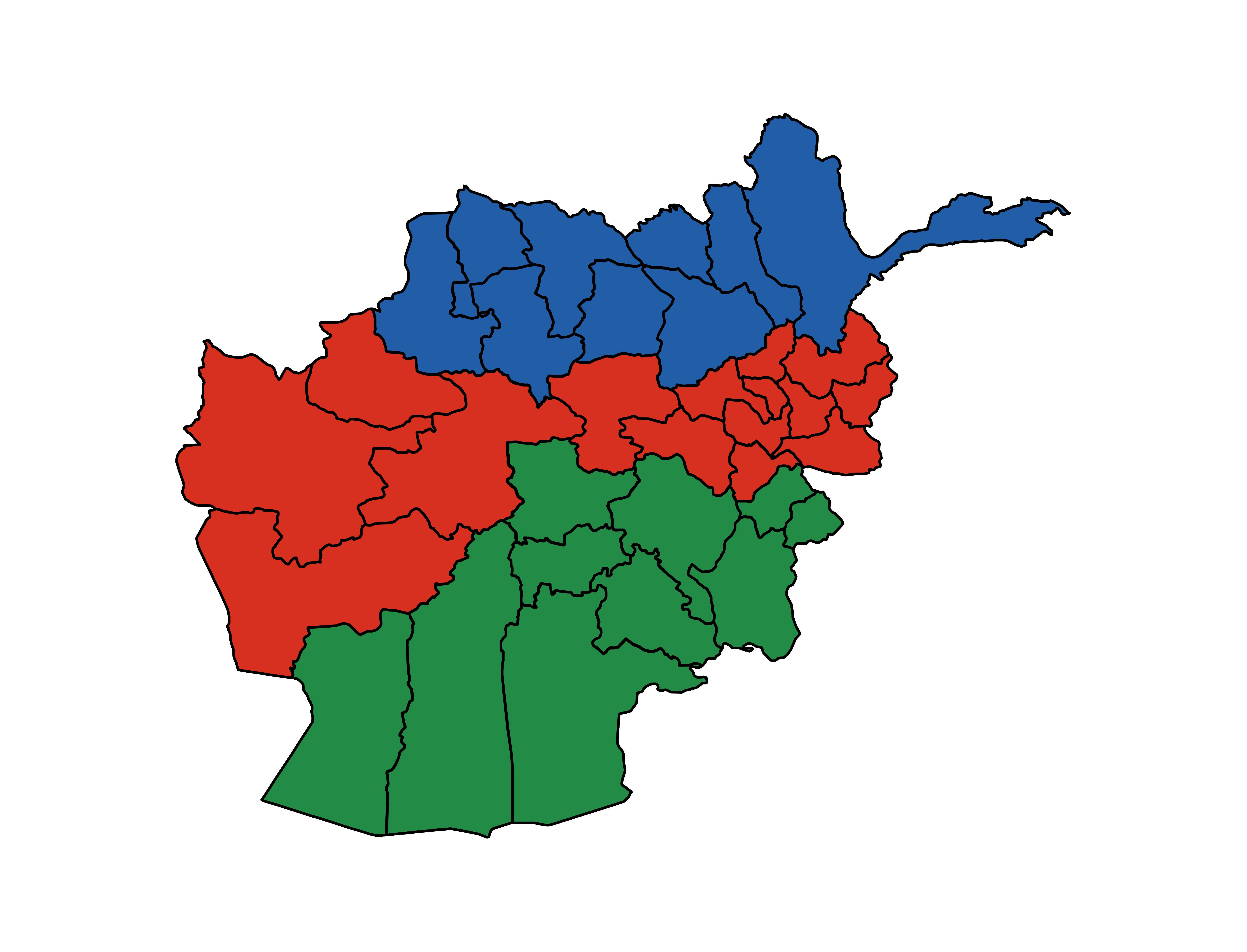
The following tables summarize data from the demographic table.
| Region | Population | Area | Density/ |
|---|---|---|---|
| Central | 16,594,746 | 237,335 | 69.9 |
| North | 9,253,127 | 161,730 | 57.2 |
| South | 8,347,654 | 253,801 | 32.9 |
UN regions

| Region | Population | Area | Density/ |
|---|---|---|---|
| Central | 8,637,107 | 30,835 | 280.1 |
| East | 3,080,705 | 25,812 | 119.4 |
| North East | 4,632,077 | 83,631 | 55.4 |
| North West | 4,621,050 | 78,100 | 59.2 |
| South East | 3,631,460 | 51,795 | 70.1 |
| South West | 4,716,194 | 202,006 | 23.3 |
| West | 4,876,934 | 180,688 | 27.0 |
References
References
- Mukhopadhyay, Dipali. (2014). "Warlords, Strongman Governors, and the State in Afghanistan".
- [https://www.unm.edu/~ybosin/documents/durrani.pdf Durrani empire, popular protests, 1747–1823]
- [https://www.iranicaonline.org/articles/afghanistan-xi-admin/ AFGHANISTAN xi. Administration]
- [https://www.iranicaonline.org/articles/dost-mohammad-khan/ DŌST MOḤAMMAD KHAN]
- [https://www.globalsecurity.org/military/world/afghanistan/history-emirate.htm Emirate of Afghanistan (1823-1926)]
- [https://www.acted.org/wp-content/uploads/2023/02/annex-iii.-district-creation-and-manteqa-final-1.pdf Relationship between manteqas and newly created districts in Afghanistan]
- Andrew, W. P.. (1880). "Our Scientific Frontier".
- [https://babel.hathitrust.org/cgi/pt?id=hvd.32044105224273&seq=331&q1=afghanistan The Statesman's Year-Book 1890], p. 301–302.
- [https://babel.hathitrust.org/cgi/pt?id=hvd.32044105224257&seq=352&q1=afghanistan The Statesman's Year-Book 1892], p. 313–314.
- [https://archive.org/details/dli.pahar.1298/mode/2up The Military Geography of Afghanistan – Part 1 – Badakhshan]
- [https://archive.org/details/dli.pahar.1299/mode/2up The Military Geography of Afghanistan – Part 2 – Afghan Turkistan]
- [https://pahar.in/pahar/Books%20and%20Articles/Afghanistan/1893%20The%20Military%20Geography%20of%20Afghanistan%20Part%203%20Herat%20by%20Barrow%20(secret)%20s.pdf The Military Geography of Afghanistan – Part 3 – Herat]
- [https://archive.org/details/dli.pahar.1301/mode/2up The Military Geography of Afghanistan – Part 4 – Kabul]
- [https://archive.org/details/dli.pahar.1302 The Military Geography of Afghanistan – Part 5 – Farah and Kandahar]
- [https://www.jstor.org/stable/pdf/1798621.pdf Journey from Bandar Abbas to Mash-Had by Sistan, with Some Account of the Last-Named Province]
- [https://dlme-prod.stanford.edu/library/catalog/loc-2015481589 Niẓāmnāmah-ʼi taqsīmāt-i mulkīyah-ʼi Afghānistān]
- [https://www.infoplease.com/encyclopedia/places/asia/afghanistan/afghanistan-overview#attempts-at-modernization-and-reform Afghanistan. Attempts at Modernization and Reform]
- [https://www.pbs.org/newshour/politics/asia-jan-june11-timeline-afghanistan A historical timeline of Afghanistan]
- [https://thekhorasandiary.com/en/2025/02/12/taliban-governance-shakeup-haibatullahs-close-aides-appointed-to-secure-kandahar-and-northern-provinces Taliban Governance shakeup: Haibatullah’s close aides appointed to secure Kandahar and Northern Provinces]
- [https://amu.tv/170801/ Taliban reshuffle provincial leadership, reassign loyalists to key posts]
- "Afghan school books - Geography G-12".
- "Library".
- "Estimated Population of Afghanistan 2024-25".
This article was imported from Wikipedia and is available under the Creative Commons Attribution-ShareAlike 4.0 License. Content has been adapted to SurfDoc format. Original contributors can be found on the article history page.
Ask Mako anything about Provinces of Afghanistan — get instant answers, deeper analysis, and related topics.
Research with MakoFree with your Surf account
Create a free account to save articles, ask Mako questions, and organize your research.
Sign up freeThis content may have been generated or modified by AI. CloudSurf Software LLC is not responsible for the accuracy, completeness, or reliability of AI-generated content. Always verify important information from primary sources.
Report