From Surf Wiki (app.surf) — the open knowledge base
Pripyat (river)
River in Eastern Europe
River in Eastern Europe
| Field | Value |
|---|---|
| name | Pripyat |
| name_other | Prypiat, Prypiać, Prypeć |
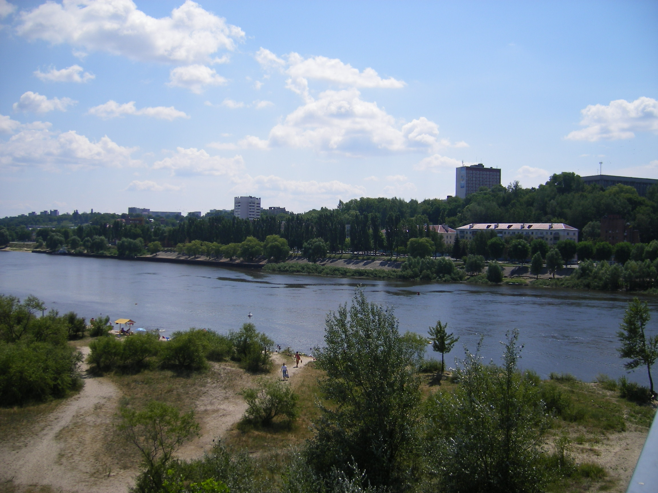
| image | The Pripyat River (02710031).jpg |
| image_caption | Pripyat River |
| map | Bo-map.png |
| map_caption | Course of the Pripyat River |
| mapframe | yes |
| mapframe-zoom | 5 |
| source1_location | Volyn Oblast, Ukraine |
| source1_coordinates | |
| mouth | Dnieper |
| mouth_location | Kyiv Reservoir |
| mouth_coordinates | |
| subdivision_type1 | Country |
| subdivision_name1 | Ukraine, Belarus |
| length | 761 km |
| discharge1_avg | 377 m3/s |
| basin_size | 121000 km2 |
| progression | |
| tributaries_left | Pina, Yaselda, Tsna, Lan, Sluch, Ptsich, Brahinka |
| tributaries_right | Turiya, Stokhid, Styr, Horyn, Stsviha, Ubort, Zhelon, Slovechna, Uzh |
| mapframe-zoom = 5
The Pripyat or Prypiat is a river in Eastern Europe. The river, which is approximately 761 km long, flows east through Ukraine, Belarus, and into Ukraine again, before draining into the Dnieper at Kyiv Reservoir.
Name etymology
Max Vasmer notes in his etymological dictionary that the historical name of the river mentioned in the earliest East Slavic document, the Primary Chronicle, is *Pripet''' (Припеть), and cites the opinion of other linguists that the name meant "tributary", comparing with Greek and Latin roots. He also rejects some opinions which were improperly based on the stem -пять -pjat, rather than original -петь.
The name may also derive from the local word pripech used for a river with sandy banks.
Geography
The Pripyat begins in the Volhynian Upland, between the villages of and in Volyn Oblast, Ukraine. 204 km downstream, it crosses the border of Belarus, where it travels 500 km through Polesia, Europe's largest wilderness, within which lie the vast sandy wetlands known as the Pripet Marshes, a dense network of swamps, bogs, rivers and rivulets within a forested basin. For the last 50 kilometers the Pripyat flows again in Ukraine and flows several kilometers south of Chernobyl into the Kyiv Reservoir.
The length of the river is 775 km, and the area of the watershed is 114,300 km2. The width of the floodplain varies from 4 to 15 km over the course of the river, with occasional flooding reaching 30 km. 495 km of the whole river length lies within Belarus, with the rest in Ukraine.
The Pripyat is navigable up to Pinsk, where the Dnieper-Bug Canal leads to the Bug River.
The Pripyat passes through the exclusion zone established around the site of the Chernobyl nuclear disaster. The nearby city of Pripyat, Ukraine (population 45,000), which was named after the river, was completely evacuated after the Chernobyl disaster.
The Pripyat is known for its numerous oxbow lakes and channels.
Dredging for E40 waterway
Dredging of the river started in 2020 to enable the E40 waterway to pass through the area. The dredging raised concerns about radioactive contamination around the Chernobyl nuclear power plant, as the river comes within 2.5 km of the nuclear reactor.
Notes
References
- Припять, Great Soviet Encyclopedia
- Pripyat // Dictionary of Contemporary Geographical Names / Rus. geogr. oh Moscow center; By common. Ed. acad. V. M. Kotlyakova. Institute of Geography, Russian Academy of Sciences. - Yekaterinburg: U-Factorium, 2006.
- Joint River Management Program. Final Report: River Pripyat Basin (February 2004)
Bibliography
- (in Russian, English and Polish) Ye.N.Meshechko, A.A.Gorbatsky (2005) Belarusian Polesye: Tourist Transeuropean Water Mains, Minsk, Four Quarters,
- (in Belarusian, Russian and English) T.A.Khvagina (2005) POLESYE from the Bug to the Ubort, Minsk Vysheysha shkola, .
References
- (2011). "Main Geographic Characteristics of the Republic of Belarus. Main characteristics of the largest rivers of Belarus". Data of the Ministry of Natural Resources and Environmental Protection of the Republic of Belarus..
- Max Vasmer, ''Etymological dictionary of the Russian language'', article "Припять" in Russian translation
- Room, Adrian. (1997). "Placenames of the World". McFarland.
- "Басейнове управління водних ресурсів річки Прип'ять (БУВР Прип'яті)".
- "Belarus Map (Physical)".
- "Pripet River {{!}} Belarus, Ukraine, Russia {{!}} Britannica".
- (8 November 2016). "Belarus Mid-Pripyat State Landscape Zakaznik". Ramsar Sites Information Service.
- (2023-05-01). "Environmental Risks of Water Resources in the Belarusian Polesie". Limnological Review.
- "Pripyat city photo and text about history {{!}} Чернобыль, Припять, зона отчуждения ЧАЭС".
- "Prypiat-Stokhid National Park".
- "Prypiat-Stokhid National Nature Park".
- (23 December 2020). "Chernobyl fears resurface as river dredging begins in exclusion zone". The Guardian.
This article was imported from Wikipedia and is available under the Creative Commons Attribution-ShareAlike 4.0 License. Content has been adapted to SurfDoc format. Original contributors can be found on the article history page.
Ask Mako anything about Pripyat (river) — get instant answers, deeper analysis, and related topics.
Research with MakoFree with your Surf account
Create a free account to save articles, ask Mako questions, and organize your research.
Sign up freeThis content may have been generated or modified by AI. CloudSurf Software LLC is not responsible for the accuracy, completeness, or reliability of AI-generated content. Always verify important information from primary sources.
Report