From Surf Wiki (app.surf) — the open knowledge base
Portage County, Ohio

| Field | Value |
|---|---|
| county | Portage County |
| state | Ohio |
| image_flag | Flag of Portage County, Ohio.svg |
| seal | Seal of Portage County Ohio.svg |
| founded year | 1808 |
| founded date | June 7 |
| seat wl | Ravenna |
| largest city wl | Kent |
| area_total_sq_mi | 504 |
| area_land_sq_mi | 487 |
| area_water_sq_mi | 17 |
| area percentage | 3.3 |
| census yr | 2020 |
| pop | 161791 |
| pop_est_as_of | 2024 |
| density_sq_mi | 320 |
| time zone | Eastern |
| web | https://www.portagecounty-oh.gov/ |
| named for | the portage between the Cuyahoga and Tuscarawas Rivers |
| ex image | Portage County courthouse.jpg |
| ex image cap | Portage County Courthouse |
| district | 13th |
| district2 | 14th |
Portage County is a county in the U.S. state of Ohio. As of the 2020 census, the population was 161,791. Located in Northeast Ohio, Portage County is part of the Akron Metropolitan Statistical Area, which is also included in the Cleveland–Akron–Canton Combined Statistical Area. Its county seat is Ravenna and its largest city is Kent. The county, named for the portage between the Cuyahoga and Tuscarawas rivers, was created in 1807 and formally organized in 1808. In addition to the cities of Kent and Ravenna, Portage County also includes the cities of Aurora and Streetsboro, along with five villages, 18 civil townships, and several unincorporated places within those townships. Additionally, the county includes parts of the city of Tallmadge, and part of the village of Mogadore, both of which are mostly in neighboring Summit County.
History
The name "Portage" comes from an old Native American path called "Portage Path", which ran between the Cuyahoga and Tuscarawas rivers, where travelers portaged their canoes. The location of the trail today is within the boundaries of neighboring Summit County.
As of 1600, the area was likely almost entirely home to the Whittlesey culture, a presumably Algonquian people who lived along the southern shore of Lake Erie, to the west of the Erie Nation. They were a mixed culture people and also exhibited signs of picking up traits from both Fort Ancients and Iroquoians. The Erie may have also held a bit of the area, but this is unclear. During the Beaver Wars, approximately 1632–1701, the Whittlesey and Erie were already at war when the Erie decided to also declare war on the Iroquois for the atrocities being committed against allied tribes in Canada. The Erie lost around 1650 and the Whittlesey were likely similarly subjugated afterwards, as the Iroquois conquered all the way to the shores of Lake Michigan by the 1670s.
The Iroquois placed a vassal tribe of captured Huron in the area who became known as the Wyandot, while they conquered further west. Later, the French made it to the Mississippi River and volunteered to aid the Natives in that region to push the Iroquois back to New York. By the end of the Beaver Wars, the Wyandot had broken free of Iroquois control and reabsorbed surviving Hurons taking refuge all over the Great Lakes, but set aside the area roughly between the Cuyahoga River, the Mahoning River and the Ohio-Pennsylvania border as a collective hunting ground, to be enjoyed by all the tribes of the region. The Lenape had a village around modern day Youngstown, possibly established during the 1690s, from which they and the Seneca and Shawnee from further south staged ventures into the region and up in Ashtabula County, the Ottawas, or Mississaugas, from the western end of Lake Erie were allowed to maintain a village at Conneaut. Ashtabula itself seems to come from the Algonquian name for the area and roughly translates to "Place with Enough for everyone." The Lenape later lost rights to the eastern extremes of their territory between the Potomac River and the Mahoning River by a government proclamation in 1763, but sources say they began relocating into Tuscarawas and Holmes Counties in 1758 in preparation for such an event.
The region continued being used as such until around 1785, when the newly formed United States tried issuing a treaty stripping the vast majority of what is now Ohio from Native control and began offering subsidies for people to move into the region, sparking the Northwest Indian War from 1785-1795. In the aftermath, the government issued the Treaty of Greenville, which stripped even more land from the Natives than originally planned and opened up northeast Ohio for white settlement for the first time. Most Natives did not leave and mixed tribal communities still existed all over the state for some time afterwards, with permanent Ottawa, Seneca, and Wyandot villages still existing in what is now Portage and Geauga Counties, but all written accounts of Natives seems to have ceased sometime around the War of 1812, which is also when the Shawnee War (1811-1813) was occurring. The local government had its own land arrangements with the Natives for a time. It is unclear where the Natives went, after that, but this may coincide with the 1811–1812 New Madrid earthquakes, one of the most massive earthquakes to ever hit the east coast in recorded history, and was interpreted by many Ohio Natives that they should throw their support behind Shawnee cult leader, Tenskwatawa, at the Prophettown stronghold, which also coincides with the outbreak of the Shawnee War, later that year. Most of the Eastern nations got sucked up into his cult and many Natives relocated to live near him.
Portage County is also home to a burial mound—Towner's Mound, in Franklin Township—which outdates all the above mentioned cultures. It was unique in structure to other types of burial mounds from the Adena, Hopewell, and Fort Ancient cultures, but identical to two other excavated mounds in North Benton, Ohio, and Warren, Pennsylvania.
After the discovery of the New World, the land that became Portage County was originally part of the French colony of Canada (New France), which was ceded in 1763 to Great Britain and renamed the Province of Quebec. In the late 18th century the land became part of the Connecticut Western Reserve in the Northwest Territory, then was purchased by the Connecticut Land Company in 1795.
The first European settler in what is now Portage County was Abraham Honey in 1798 in the area now known as Mantua Township, followed by Asa Hall in what is now Atwater Township in April 1799. In June 1799, Benjamin Tappan, Jr. arrived and founded Ravenna, David Daniels came to what is now Palmyra Township, and Ebenezer Sheldon settled in what is now Aurora. A family group of Huguenot refugees also eventually migrated to Portage County by 1804.
When first settled, the area that presently constitutes Portage County was part of the original Jefferson County, which had been organized in 1797. In 1800, the area was made part of Trumbull County, which followed the boundaries of the Connecticut Western Reserve. In 1802, all of what is now Portage County was organized under the name of Franklin Township with other townships being formed later. On February 10, 1807, the Ohio state legislature passed the act to create Portage County from Trumbull County and it took effect June 7, 1807. Portage County remained attached to Trumbull County until June 8, 1808, when the first elections were held. Initially, the county included a large area of the Western Reserve that encompassed most of present-day Summit County, all of Medina and Huron counties, and parts of Lorain and Ashland counties. There were six organized townships in 1808: Franklin, Deerfield, Aurora, Hiram, Springfield, and Hudson with new townships organized later, reaching a maximum of 30. The present-day boundaries of Portage County were established in 1840 following the 1812 creation of Medina County, a slight boundary adjustment in 1827 with Cuyahoga County, and finally the creation of Summit County in 1840, which took 10 townships from Portage County along with 3 townships from Medina County and two from Stark County.
What is referred to as the last great train robbery in US history occurred in Garrettsville in 1935. The government sent in a massive team to investigate, whom the locals called the G-Men. Today, the James A. Garfield schools in Garrettsville have the G-Men as their team mascot.
Portage County was also the site of the Kent State shootings on May 4, 1970.
Geography

According to the U.S. Census Bureau, the county has a total area of 504 sqmi, of which 487 sqmi is land and 17 sqmi (3.3%) is water.
West Branch State Park is a very large state park in central Portage County, consisting of a large green surrounding the Michael J. Kirwan Dam and Reservoir. There are a number of smaller state and local parks.
Adjacent counties
- Geauga County (north)
- Trumbull County (east)
- Mahoning County (southeast)
- Stark County (south)
- Summit County (west)
- Cuyahoga County (northwest)
Major highways
Demographics
|align-fn=center 1790-1960 1900-1990 1990-2000 2020
2020 census
As of the 2020 census, the county had a population of 161,791. The median age was 39.8 years. 18.4% of residents were under the age of 18 and 17.9% of residents were 65 years of age or older. For every 100 females there were 95.0 males, and for every 100 females age 18 and over there were 92.9 males age 18 and over.
The racial makeup of the county was 86.4% White, 5.0% Black or African American, 0.2% American Indian and Alaska Native, 2.1% Asian,
62.0% of residents lived in urban areas, while 38.0% lived in rural areas.
There were 65,624 households in the county, of which 24.8% had children under the age of 18 living in them. Of all households, 46.5% were married-couple households, 19.8% were households with a male householder and no spouse or partner present, and 26.1% were households with a female householder and no spouse or partner present. About 28.9% of all households were made up of individuals and 11.2% had someone living alone who was 65 years of age or older.
There were 70,672 housing units, of which 7.1% were vacant. Among occupied housing units, 68.9% were owner-occupied and 31.1% were renter-occupied. The homeowner vacancy rate was 1.1% and the rental vacancy rate was 8.1%.
Racial and ethnic composition
| Race / Ethnicity (NH = Non-Hispanic) | title=1980 Census of Population - General Social and Economic Characteristics - Ohio- Table 59 - Persons by Spanish Origin, Race, and Sex: 1980 AND Table 58 - Race by Sex: 1980 | url=https://www2.census.gov/library/publications/decennial/1980/volume-1/ohio/1980censusofpopu80137un_bw.pdf | website=United States Census Bureau | page=49-67 and 27-47}} | Pop 1990 | title=P004: Hispanic or Latino, and Not Hispanic or Latino by Race – 2000: DEC Summary File 1 – Portage County, Ohio | url=https://data.census.gov/table?g=050XX00US39151&tid=DECENNIALSF12000.P004 | website=United States Census Bureau | access-date= }} | title=P2: Hispanic or Latino, and Not Hispanic or Latino by Race – 2010: DEC Redistricting Data (PL 94-171) – Portage County, Ohio | url=https://data.census.gov/cedsci/table?q=p2&g=050XX00US39151&tid=DECENNIALPL2010.P2 | website=United States Census Bureau | access-date= }} | Pop 2020 | % 1980 | % 1990 | % 2000 | % 2010 | % 2020 |
|---|---|---|---|---|---|---|---|---|---|---|---|---|---|---|---|---|---|---|---|
| White alone (NH) | 130,450 | 136,407 | 142,825 | 147,527 | 138,774 | 96.02% | 95.67% | 93.93% | 91.39% | 85.77% | |||||||||
| Black or African American alone (NH) | 3,529 | 3,867 | 4,812 | 6,611 | 7,934 | 2.60% | 2.71% | 3.16% | 4.10% | 4.90% | |||||||||
| Native American or Alaska Native alone (NH) | 185 | 281 | 260 | 274 | 233 | 0.14% | 0.20% | 0.17% | 0.17% | 0.14% | |||||||||
| Asian alone (NH) | 672 | 1,175 | 1,238 | 2,283 | 3,400 | 0.49% | 0.82% | 0.81% | 1.41% | 2.10% | |||||||||
| Native Hawaiian or Pacific Islander alone (NH) | x | x | 14 | 33 | 38 | x | x | 0.01% | 0.02% | 0.02% | |||||||||
| Other race alone (NH) | 252 | 57 | 127 | 145 | 558 | 0.19% | 0.04% | 0.08% | 0.09% | 0.34% | |||||||||
| Mixed race or Multiracial (NH) | x | x | 1,692 | 2,473 | 7,349 | x | x | 1.11% | 1.53% | 4.54% | |||||||||
| Hispanic or Latino (any race) | 768 | 798 | 1,093 | 2,073 | 3,505 | 0.57% | 0.56% | 0.72% | 1.28% | 2.17% | |||||||||
| Total | 135,856 | 142,585 | 152,061 | 161,419 | 161,791 | 100.00% | 100.00% | 100.00% | 100.00% | 100.00% |
2010 census
As of the 2010 United States census, there were 161,419 people, 62,222 households, and 40,757 families living in the county.{{cite web |access-date=December 27, 2015 |archive-url=https://archive.today/20200213014751/http://factfinder.census.gov/bkmk/table/1.0/en/DEC/10_DP/DPDP1/0500000US39133 |archive-date=February 13, 2020 |url-status=dead |access-date=December 27, 2015 |archive-url=https://archive.today/20200213184534/http://factfinder.census.gov/bkmk/table/1.0/en/DEC/10_SF1/GCTPH1.CY07/0500000US39133 |archive-date=February 13, 2020 |url-status=dead |access-date=December 27, 2015 |archive-url=https://archive.today/20200213015143/http://factfinder.census.gov/bkmk/table/1.0/en/ACS/10_5YR/DP02/0500000US39133 |archive-date=February 13, 2020 |url-status=dead
Of the 62,222 households, 29.6% had children under the age of 18 living with them, 50.1% were married couples living together, 10.9% had a female householder with no husband present, 34.5% were non-families, and 25.4% of all households were made up of individuals. The average household size was 2.47 and the average family size was 2.96. The median age was 37.4 years.
The median income for a household in the county was $50,447 and the median income for a family was $65,306. Males had a median income of $46,014 versus $34,250 for females. The per capita income for the county was $25,097. About 8.1% of families and 13.5% of the population were below the poverty line, including 16.2% of those under age 18 and 4.4% of those age 65 or over.{{cite web |access-date=December 27, 2015 |archive-url=https://archive.today/20200213020447/http://factfinder.census.gov/bkmk/table/1.0/en/ACS/10_5YR/DP03/0500000US39133 |archive-date=February 13, 2020 |url-status=dead
2000 census
As of the census of 2000, there were 152,061 people, 56,449 households, and 39,175 families living in the county. The population density was 309 PD/sqmi. There were 60,096 housing units at an average density of 122 /mi2. The racial makeup of the county was 94.40% White, 3.18% Black or African American, 0.18% Native American, 0.82% Asian, 0.01% Pacific Islander, 0.22% from other races, and 1.19% from two or more races. 0.72% of the population were Hispanic or Latino of any race. 23.5% were of German, 11.0% Irish, 9.9% Italian, 9.7% English, 9.7% American and 5.2% Polish ancestry according to Census 2000. 96.1% spoke English and 1.2% Spanish as their first language.
There were 56,449 households, out of which 32.30% had children under the age of 18 living with them, 55.60% were married couples living together, 10.10% had a female householder with no husband present, and 30.60% were non-families. 23.30% of all households were made up of individuals, and 7.40% had someone living alone who was 65 years of age or older. The average household size was 2.56 and the average family size was 3.03.
In the county, the population was spread out, with 23.70% under the age of 18, 14.30% from 18 to 24, 28.60% from 25 to 44, 22.30% from 45 to 64, and 11.00% who were 65 years of age or older. The median age was 34 years. For every 100 females there were 95.40 males. For every 100 females age 18 and over, there were 92.40 males.
The median income for a household in the county was $44,347, and the median income for a family was $52,820. Males had a median income of $37,434 versus $26,232 for females. The per capita income for the county was $20,428. About 5.90% of families and 9.30% of the population were below the poverty line, including 9.90% of those under age 18 and 5.70% of those age 65 or over.
Using the Gini coefficient to measure household inequality, Portage County received a .43 in 2012. In 2013 16.1% of the population, or 25,196 people, were poor or impoverished. The county saw an increase in its poor population, as this can be compared to a 9.3% poverty rate (13,395 people) in 1999.
Government
As of January 2025, the following officials are in county-wide elected office:
| Position | Name | Party |
|---|---|---|
| Commissioner | Michael Tinlin | Republican |
| Commissioner | Jill Crawford | Republican |
| Commissioner | Sabrina Christian-Bennett | Republican |
| Auditor | Matt Kelly | Republican |
| Prosecuting Attorney | Connie Lewandowski | Republican |
| Clerk of Courts | Jill Fankhauser | Democrat |
| Sheriff | Bruce Zuchowski Jr. | Republican |
| Recorder | Lori Calcei | Republican |
| Treasurer | Joseph Bica | Republican |
| Engineer | Larry D. Jenkins Jr. | Democrat |
| Coroner | Dean Deperro | Democrat |
Politics
From 1992 to 2012, Portage County had been reliably Democratic but following a trend seen throughout large parts of Ohio, in 2016 Donald Trump won Portage County by 9.87 points and then again in 2020 by 12.44 points, becoming the first Republican in almost three decades to win the county, the last time being George H. W. Bush in 1988.
Education
The county is served by multiple public school districts, private schools, and public libraries, and is home to two institutions of higher education.
Libraries
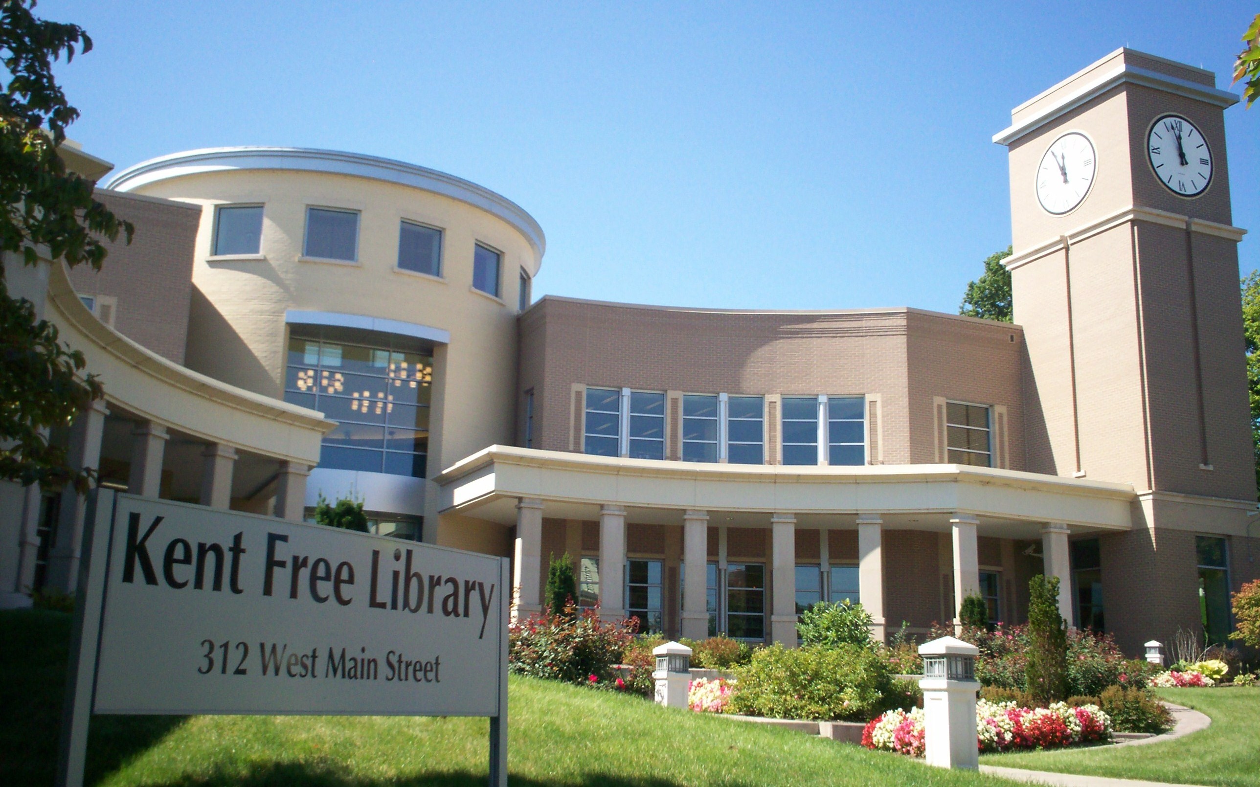
The Portage County Library Consortium is a library consortium consisting of Kent Free Library in Kent, Reed Memorial Library in Ravenna, and the six branches of the Portage County Library District, which are located in Aurora, Brimfield, Garrettsville, Randolph, Streetsboro, and Windham. The consortium allows patrons of any member library to use their library card at another consortium location or request materials housed at another library. Through the SearchOhio database, the consortium is connected to OhioLINK, which provides local access to the State Library of Ohio and dozens of university and college libraries across the state.
The county is also home to the Kent State University Libraries in Kent, an academic library system with a collection of over 2.5 million volumes. The KSU system, one of three members of the Association of Research Libraries in Ohio, includes the 12-story main library and individual libraries for architecture, fashion, performing arts, and maps, on the main campus in Kent. It also includes individual libraries at each of the university's seven regional campuses in Northeast Ohio.
Public school districts
Portage County is home to eleven public school districts.
| District | Location | Communities served |
|---|---|---|
| Aurora City School District | Aurora | Aurora, small part of Reminderville |
| Crestwood Local School District | Mantua | Mantua, Mantua Township, Hiram, most of Hiram Township, most of Shalersville Township |
| James A. Garfield Local School District | Garrettsville | Garrettsville, Nelson Township, Freedom Township, part of Hiram Township, small part of Charlestown Township |
| Field Local School District | Brimfield | Most of Brimfield and Suffield Townships, parts of Tallmadge and Kent annexed from Brimfield |
| Kent City School District | Kent | Sugar Bush Knolls, most of Kent and Franklin Township, small portion of Streetsboro |
| Ravenna School District | Ravenna | Ravenna, Ravenna Township, small portion of Shalersville Township |
| Rootstown Local School District | Rootstown | Rootstown Township and small portion of Brimfield Township |
| Southeast Local School District | Palmyra | Edinburg Township, Palmyra Township, Paris Township, most of Charlestown Township, most of Deerfield Township |
| Streetsboro City School District | Streetsboro | most of Streetsboro |
| Waterloo Local School District | Atwater | Atwater Township, Randolph Township, small portion of Deerfield Township |
| Windham Exempted Village School District | Windham | Windham, Windham Township |

In addition, there are parts of five neighboring districts which serve portions of Portage County residents.
| District | Location | Communities served in Portage County |
|---|---|---|
| Lake Local School District | Uniontown | small part of Suffield Township |
| Mogadore Local School District | Mogadore | Mogadore, small part of Suffield Township |
| Springfield Local School District | Springfield | small part of Suffield Township |
| Stow-Munroe Falls City School District | Stow | small part of Franklin Township |
| Tallmadge City School District | Tallmadge | small part of Tallmadge in Portage County |
| West Branch Local School District | Beloit | small part of Deerfield Township |
Portage County also has two public schools that serve students from multiple districts:
- Maplewood Career Center in Ravenna, a joint vocational school for students in grades 11 and 12 from nine of the county's school districts (all but Kent and Aurora) and Mogadore.
- Bio-Med Science Academy, a year-round public science, technology, engineering, mathematics, and medicine (STEM+M) high school located on the campus of Northeast Ohio Medical University in Rootstown with campuses in Ravenna and Shalersville. The academy has students enrolled from Portage County and adjacent counties.
Private schools
- Crossroads Christian Academy, a Christian school for grades K4–12 operated by and housed at First Baptist Church in Streetsboro
- St. Joseph School, a Roman Catholic school for grades PK–8 in St. Joseph, affiliated with the Diocese of Youngstown
- St. Patrick School, a Roman Catholic school for grades K–8 in Kent, affiliated with the Diocese of Youngstown
- Valley Christian Academy, a Christian school for grades PK–8 in Aurora
Higher education
Portage County is home to three institutions of higher learning:
- Kent State University, located in Kent; a large regional public research university with around 40,000 students. It serves as the county's largest employer.
- Hiram College, located in Hiram in northeastern Portage County; a small liberal arts college of around 1,200 students.
- Northeast Ohio Medical University (NEOMED), located in Rootstown, in the south-central part of the county. It is a public medical school and a consortium of Kent State University, the University of Akron, Youngstown State University, and Cleveland State University, with colleges of medicine, pharmacy, and graduate studies.
Culture
Theater
- Kent Stage
Museums
- Kelso House Museum, Brimfield
- Kent Historical Society Museum, Kent
- Kent State University Museum, Kent
- Kent State School of Art Galleries, Kent
- Cowrie-Lowrie-Beatty Portage County Historical Society Museum, Ravenna
Media
- Record-Courier, a newspaper based in Ravenna that covers news for the entire county online and in print
- The Portager, an online news source based in Randolph that covers the entire county
- KentStater, an online news source from Kent State University independent student media outlets The Kent Stater and TV2
- Weekly Villager, online news source based in Garrettsville with news from Portage, Geauga, and Trumbull counties
Communities

Portage County is arranged as a 4 x 5 grid of 20 rectangles and contains 18 unincorporated townships, and all or part of five cities and six villages. Under Ohio law, there are two types of incorporated municipal jurisdictions: cities and villages; and any territory within a county that is not part of an incorporated municipality is part of a township. Townships have limited local government and services.
In addition to the cities, village, and townships, the United States Census Bureau has four census-designated places (CDP) in Portage County. These CDPs are for statistical purposes only and have no government or official boundaries separate from the township they are located in. There are also 17 additional named places in the county. All 17 places are considered part of whatever jurisdiction they are located in (township or municipality) and have no formal boundaries or additional government of their own.
Camp James A. Garfield, formerly known as the Ravenna Training and Logistics Site and commonly known as the Ravenna Arsenal, occupies much of the land in Charlestown, Paris, and Windham townships, as well as a small part of Freedom Township. While the portions of Camp Garfield are still considered part of the various townships they cover, the land is under the jurisdiction of the US federal government.
Cities
- Aurora
- Kent
- Ravenna (county seat)
- Streetsboro
- Tallmadge
Villages
- Garrettsville
- Hiram
- Mantua
- Mogadore
- Sugar Bush Knolls
- Windham
Townships
- Atwater
- Brimfield
- Charlestown
- Deerfield
- Edinburg
- Franklin
- Freedom
- Hiram
- Mantua
- Nelson
- Palmyra
- Paris
- Randolph
- Ravenna
- Rootstown
- Shalersville
- Suffield
- Windham
Census-designated places
- Atwater in Atwater Township
- Brady Lake in Franklin Township
- Brimfield in Brimfield Township
- Suffield in Suffield Township
Unincorporated communities
- Black Horse
- Campbellsport
- Cobbs Corners
- Diamond
- Drakesburg
- Earlville
- Freedom Station
- Hiram Rapids
- Lloyd
- Mahoning
- Mishler
- Moran
- New Milford
- St. Joseph
- Twin Lakes
- Wayland
- Yale
Notable people
- Nettie Sanford Chapin (1830–1901), teacher, historian, author, newspaper publisher, suffragist
- Peter J. Barber (1830-1905), architect, known for his work in Santa Barbara, California
Notes
References
References
- "2020 Population and Housing State Data".
- "P1: RACE - Census Bureau Table".
- (2007). "Ohio: Individual County Chronologies". The Newberry Library.
- "Portage County Profile - County Breakout".
- Cherry, Peter Peterson. (1911). "The Portage Path". The Western Reserve Company.
- Brown, R.C.. (1972). "History of Portage County Ohio". Warner, Beers, and Company.
- "Whittlesey Culture".
- Jesuit Relations
- Connelley, William Elsey. (1928). "Indian Myths". Rand McNally & Company.
- Hanna, Charles A.. (1911). "The Wilderness Trail; or, The Ventures and Adventures of the Pennsylvania Traders on the Allegheny Path". [[G. P. Putnam's Sons]].
- "History".
- Mahr, August C.. (November 1959). "Practical Reasons for Algonkian Indian Stream and Place Names". The Ohio Journal of Science.
- O'Connell, Linda Matys. (November 27, 2006). "How peace was made". [[The Morning Call]].
- Mitchener, Charles Hallowell. "Ohio Annals: Historic Events in the Tuscarawas and Muskingum Valleys".
- "Treaty of Fort McIntosh (1785)".
- Barnes, Celia. (2003). "Native American Power in the United States, 1783–1795". Fairleigh Dickinson University Press.
- "Treaty With The Wyandot, Etc., 1785".
- "About Streetsboro".
- Williams, H. Z.. (1882). "History of Trumbull and Mahoning Counties".
- Ehle, John. (1988). "Trail of Tears: The Rise and Fall of the Cherokee Nation". [[Doubleday (publisher).
- Edmunds., R. David. (1985). "The Shawnee Prophet". University of Nebraska Press.
- (May 2015). "Towner Mound: Creating Content and Sparking Curiosity for the Portage County Parks". Kent State University.
- Brown and Norris, pp. 229–232
- Calvin, Claude W.. (1945). "The Calvin Families". Edwards Brothers, Inc..
- Guerrieri, Vince. (November-December 2021). "America's Last Great Train Heist".
- Philip, Philip. (May 4, 2005). "The Kent State Shootings, 35 Years Later". [[NPR]].
- (August 22, 2012). "2010 Census Gazetteer Files". United States Census Bureau.
- "U.S. Decennial Census". United States Census Bureau.
- "Historical Census Browser". University of Virginia Library.
- (March 27, 1995). "Population of Counties by Decennial Census: 1900 to 1990". United States Census Bureau.
- (April 2, 2001). "Census 2000 PHC-T-4. Ranking Tables for Counties: 1990 and 2000". United States Census Bureau.
- (2021). "2020 Decennial Census Demographic Profile (DP1)".
- (2021). "2020 Decennial Census Redistricting Data (Public Law 94-171)".
- (2023). "2020 Decennial Census Demographic and Housing Characteristics (DHC)".
- "1980 Census of Population - General Social and Economic Characteristics - Ohio- Table 59 - Persons by Spanish Origin, Race, and Sex: 1980 AND Table 58 - Race by Sex: 1980".
- "1990 Census of Population - General Population Characteristics - Ohio: Table 6 - Race and Hispanic Origin".
- "P004: Hispanic or Latino, and Not Hispanic or Latino by Race – 2000: DEC Summary File 1 – Portage County, Ohio".
- "P2: Hispanic or Latino, and Not Hispanic or Latino by Race – 2010: DEC Redistricting Data (PL 94-171) – Portage County, Ohio".
- "P2: Hispanic or Latino, and Not Hispanic or Latino by Race – 2020: DEC Redistricting Data (PL 94-171) – Portage County, Ohio".
- included in the Asian category in the 1980 Census
- included in the Asian category in the 1990 Census
- not an option in the 1980 Census
- not an option in the 1990 Census
- "U.S. Census website". [[United States Census Bureau]].
- "Portage County - Gini coefficient Portage County, Ohio".
- (January 2015). "The Ohio Poverty Report". Ohio Development Services Agency.
- "2025 List of Officials".
- "Joseph Bica".
- Leip, David. "Dave Leip's Atlas of U.S. Presidential Elections".
- (November 5, 2024). "2024 Senate Election (Official Returns)".
- "SearchOhio and OhioLINK".
- "About SearchOhio".
- "About University Libraries". [[Kent State University]].
- Exner, Rich. (2008). "Property Tax 2007". [[The Plain Dealer]].
- "Bio-Med Science Academy".
- "About Us". Crossroads Christian Academy.
- "St. Joseph School". St. Joseph School.
- "Classrooms". St. Patrick School.
- "About Us". Valley Christian Academy.
- "About NEOMED". [[Northeast Ohio Medical University]].
- "About The Portager".
- "About Us".
- "Weekly Villager".
This article was imported from Wikipedia and is available under the Creative Commons Attribution-ShareAlike 4.0 License. Content has been adapted to SurfDoc format. Original contributors can be found on the article history page.
Ask Mako anything about Portage County, Ohio — get instant answers, deeper analysis, and related topics.
Research with MakoFree with your Surf account
Create a free account to save articles, ask Mako questions, and organize your research.
Sign up freeThis content may have been generated or modified by AI. CloudSurf Software LLC is not responsible for the accuracy, completeness, or reliability of AI-generated content. Always verify important information from primary sources.
Report