From Surf Wiki (app.surf) — the open knowledge base
Poocholamad
| Field | Value |
|---|---|
| name | Poocholamad |
| settlement_type | village |
| image_skyline | File:സ്രാമ്പ്യ.jpeg |
| image_caption | Poocholamadu Cheroor Srambia |
| pushpin_map | |
| pushpin_label_position | right |
| pushpin_map_caption | Location in Kerala, India |
| subdivision_type | Country |
| subdivision_name | India |
| subdivision_type1 | State |
| subdivision_name1 | Kerala |
| subdivision_type2 | District |
| subdivision_name2 | Malappuram |
| established_title | |
| unit_pref | Metric |
| population_density_km2 | auto |
| demographics_type1 | Languages |
| demographics1_title1 | Official |
| demographics1_info1 | Malayalam, English |
| timezone1 | IST |
| utc_offset1 | +5:30 |
| postal_code_type | PIN |
| postal_code | 676 314,676 318 |
| area_code_type | Telephone code |
| area_code | 0494 |
| registration_plate | KL- |
| blank1_name_sec1 | Nearest city |
| blank1_info_sec1 | Vengara, Kottakkal |
| blank1_name_sec2 | Climate |
| blank1_info_sec2 | moderate (Köppen) |

Poocholamad is a village in Kannamangalam in the Malappuram district, state of Kerala, India. It is part of the Gram Panchayat government. It is also included in Vengara Assembly constituency and Malappuram Lokhasabha constituency.
Geography
Poocholamad is 2.065 km away from Vengara and 1.36816 km from Achanambalam town. The village shares borders with Cheroor on the east side, Vettuthod, Gandhikunnu on the south side, Muttumpuram on the west side, and Achanambalam on the northside (these are small villages).
Transportation
Poocholamad is 7 km away from NH17 (Kakkad) and 2 km from Vengara. There is some bus service from Vengara and Kunnumpuram. The nearest airport is Calicut International Airport, 15 km away. There is a railway station in Parappanangadi, 20 km away from the village. The capital city is Malappuram, located 17 km away from the village. The nearest university is Calicut University, 16 km away.
Educational institutions in Poocholamad
- Government Lower Primary School Nottappuram
- Misbahul Islam Madrassa
- Poocholamad Anganwadi high school
Schools near Poocholamad
- G.M.U.P School, Kannamangalam(Achanambalam)
- P.P.T.M.Y.High School, Cherur
- Govt. Girls High School, Vengara
Colleges near Poocholamad
- P.S.M.O. College, Tirurangadi
- E.M.E.A college, Kondotty
- Government College, Malappuram
Places of worship
- Poocholamad Juma Masjid
- Thonniyil Shiva Temple
Special attractions
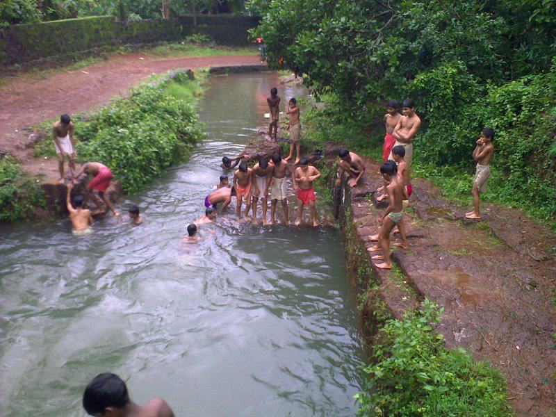
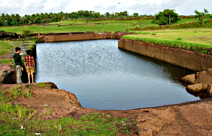
- Nharan Kulam (Pond)
- Thazhathe Kulam
- Puthan Kulam
Culture
Poocholamadu village is a predominantly Muslim populated area. Hindus exist in comparatively smaller numbers. The culture of the locals is based upon Muslim traditions. Duffmuttu, Kolkali, and Aravana muttu are common folk arts of this locality. There are many libraries attached to mosques giving a rich source of Islamic studies. Most of the books are written in Arabi-Malayalam which is a version of the Malayalam language written in Arabic script. People gather in mosques for their evening prayer and remain sitting after the prayers discussing social and cultural issues. Business and family issues are also sorted out during these evening meetings. The Hindu minority of this area keeps their rich traditions by celebrating various festivals in their temples. Hindu rituals are done here with a regular devotion like other parts of Kerala.
Transportation
Poocholamadu connects to other parts of India through Parappanangadi town. National Highway 66 passes through Ramanattukara and the northern stretch connects to Goa and Mumbai. The southern stretch connects to Cochin and Trivandrum. State Highway 28 starts from Nilambur and connects to Ooty, Mysore, and Bangalore through Highways 12, 29, and 181. The nearest airport is at Kozhikode. The nearest major railway station is at Parappanangadi.
References
References
- "Pin Code: KANNAMANGALAM, MALAPPURAM, KERALA, India, Pincode.net.in".
- "Election Details".
- "Malappuram News, Malappuram District Map, Malappuram Muslim, Malappuram Hospitals, Malappuram College, Malappuram Directory".
This article was imported from Wikipedia and is available under the Creative Commons Attribution-ShareAlike 4.0 License. Content has been adapted to SurfDoc format. Original contributors can be found on the article history page.
Ask Mako anything about Poocholamad — get instant answers, deeper analysis, and related topics.
Research with MakoFree with your Surf account
Create a free account to save articles, ask Mako questions, and organize your research.
Sign up freeThis content may have been generated or modified by AI. CloudSurf Software LLC is not responsible for the accuracy, completeness, or reliability of AI-generated content. Always verify important information from primary sources.
Report