From Surf Wiki (app.surf) — the open knowledge base
Poltava Governorate
1802–1925 unit of Russia in present day Ukraine

1802–1925 unit of Russia in present day Ukraine
| Field | Value |
|---|---|
| native_name | Полтавская губерния |
| native_name_lang | ru |
| conventional_long_name | Poltava Governorate |
| common_name | Poltava |
| subdivision | Governorate |
| nation | the Russian Empire (1802–1917) and Ukrainian successor states (1917–25) |
| capital | Poltava |
| political_subdiv | 15 uezds (1802–1923) |
| 7 okruhas (1923–25) | |
| today | Poltava Oblast |
| Kharkiv Oblast | |
| Kyiv Oblast | |
| Sumy Oblast | |
| event_start | Established |
| year_start | 1802 |
| event_end | Abolished |
| year_end | 1925 |
| image_coat | Coat of arms of Poltava Governorate 1878.svg |
| image_map | Poltava Governorate (1913).png |
| image_map_caption | Poltava Governorate in 1913 |
| image_map2 | Poltava in Russian Empire (1914).svg |
| image_map2_caption | Location in the Russian Empire |
| p1 | Little Russia Governorate (1796–1802) |
| s1 | Kremenchutsky Okruha |
| s2 | Lubensky Okruha |
| s3 | Poltavsky Okruha |
| s4 | Prylutsky Okruha |
| s5 | Romensky Okruha |
| stat_year1 | (1897) |
| stat_area1 | 49,894 |
| stat_pop1 | 2,778,151 |
7 okruhas (1923–25) Kharkiv Oblast Kyiv Oblast Sumy Oblast
Poltava Governorate was an administrative-territorial unit (guberniya) of the Russian Empire. It was officially created in 1802 from the disbanded Little Russia Governorate and had its capital in Poltava.
Its borders encompassed the modern Poltava Oblast of Ukraine, in addition to Berestyn, Pereiaslav, Romny and Zolotonosha.
It was bordering the Chernigov and Kursk Governorates to the north, Kiev Governorate to the west, Kharkov Governorate to the east and the Kherson and Yekaterinoslav Governorates to the south.
History
In 1802, the Little Russia Governorate was disbanded and its territory split between the new Chernigov and Poltava Governorates.
The governorate was part of the Ukrainian People's Republic from 1917 to 1920, interrupted in 1918 by the Ukrainian State.
After the formation of the Ukrainian SSR, the territory was wholly included into the new Soviet Republic. Initially the governorate system was retained – although variations included the which was temporarily formed on its territory (August 1920 – December 1922), and the passing of the Pereyaslavsky Uyezd to the Kiev Governorate. However, on June 3, 1925, the governorate was liquidated and succeeded by five okruhas (which already were its subdivisions as of March 7, 1923): Kremenchutsky, Lubensky, Poltavsky, Prylutsky and Romensky (the remaining two okrugs existed within the governate, Zolotonoshsky and Krasnohradsky, were also liquidated).
Demographics
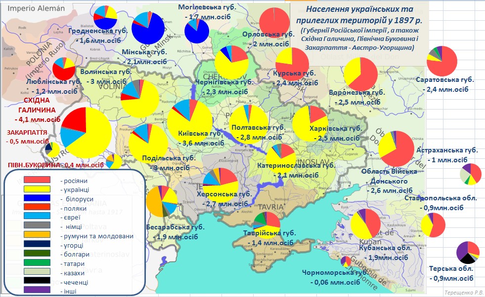
The governorate had a population of 2,778,151 according to the 1897 Russian Empire census. Most people (90.13%) lived on the countryside, while a tenth (9.87%) lived in towns and cities. In 1914, the population had increased to 2,794,727.
Largest towns and cities
According to the 1897 census, nine settlements had more than 10,000 people.
- Kremenchug – 63,007 (Jewish – 29,577, Ukrainian – 18,980, Russian – 12,130)
- Poltava – 53,703 (Ukrainian – 30,086, Russian – 11,035, Jewish – 10,690)
- Romny – 22,510 (Ukrainian – 13,856, Jewish – 6,341, Russian – 1,933)
- Priluki – 18,532 (Ukrainian – 11,850, Jewish – 5,719, Russian – 821)
- Pereyaslav – 14,614 (Ukrainian – 8,348, Jewish – 5,737, Russian – 468)
- Kobeliaki – 10,487 (Ukrainian – 7,708, Jewish – 2,115, Russian – 564)
- Zenkov – 10,443 (Ukrainian – 8,957, Jewish – 1,261, Russian – 187)
- Lubny – 10,097 (Ukrainian – 5,975, Jewish – 3,001, Russian – 960)
- Mirgorod – 10,037 (Ukrainian – 8,290, Jewish – 1,248, Russian – 427)
In bold are cities with a population of over 50,000.
Native Languages
By the 1897 census, Ukrainian was by far the most native spoken language in the governorate, followed by Yiddish and Russian.
| Language | Number | percentage (%) | males | females | |||||
|---|---|---|---|---|---|---|---|---|---|
| Ukrainian | 2,583,133 | 92.98 | 1,276,578 | 1,306,555 | |||||
| Yiddish | 110,352 | 3.97 | 53,860 | 56,492 | |||||
| Russian | 72,941 | 2.63 | 38,851 | 34,090 | |||||
| German | 4,579 | 0.16 | 2,257 | 2,322 | |||||
| Polish | 3,891 | 0.14 | 2,782 | 1,109 | |||||
| Belarusian | 1,344 | 0.05 | 823 | 521 | |||||
| Persons | |||||||||
| that did not identify | |||||||||
| their native language | 92 | 65 | 27 | ||||||
| Other | 1,819 | 0.07 | 1,323 | 496 |
In bold are native languages spoken by more people than the state language.
Religion
By the 1897 census, the majority religion in the governorate and virtually the state religion was Eastern Orthodox Christianity with some of the population following Judaism. Other religions were much less common.
| Religion | Number | percentage (%) | males | females | |||||
|---|---|---|---|---|---|---|---|---|---|
| Eastern Orthodoxy | 2,654,645 | 95.55 | 1,314,851 | 1,339,794 | |||||
| Judaism | 110,944 | 3.99 | 54,073 | 56,871 | |||||
| Other (Roman Catholicism, Lutheranism, Old Believers) | 12,562 | 0.45 | 7,615 | 4,947 |
Administrative divisions
The governorate was divided into 15 uk (uk in Ukrainian):
| Uezd | Administrative seat | Area | Population | |||||
|---|---|---|---|---|---|---|---|---|
| (1897 census) | Transliteration (Cyrillic) | Coat of arms | Transliteration (Cyrillic) | |||||
| Gadyachsky (Гадячский) | [[File:Gadyach COA (Poltava Governorate) (1782).png | 42px | center]] | Gadyach (Гадячъ) | 2,162.4 verst2 | 142,806 | ||
| Zenkovsky (Зеньковский) | [[File:Zenkov COA (Poltava Governorate) (1782).gif | 42px | center]] | Zenkov (Зеньковъ) | 1,977.5 verst2 | 140,304 | ||
| Zolotonoshsky (Золотоношский) | [[File:Zolotonosha COA (Poltava Governorate) (1782).gif | 42px | center]] | Zolotonosha (Золотоноша) | 3,888.6 verst2 | 227,594 | ||
| Kobelyaksky (Кобелякский) | [[File:Kobelyaki COA (Poltava Governorate) (1842).gif | 42px | center]] | Kobeliaki (Кобеляки) | 3,227.2 verst2 | 217,875 | ||
| Konstantinogradsky (Константиноградский) | [[File:Konstantinograd COA (Poltava Governorate) (1842).gif | 42px | center]] | Konstantinograd (Константиноградъ) | 5,341.7 verst2 | 230,310 | ||
| Kremenchugsky (Кременчугский) | [[File:Kremenchug COA (Poltava Governorate) (1798).gif | 42px | center]] | Kremenchug (Кременчугъ) | 3,013.2 verst2 | 244,894 | ||
| Lokhvitsky (Лохвицкий) | [[File:Lohvitsa city coa 1782.gif | 42px | center]] | Lokhvitsa (Лохвица) | 2,320.5 verst2 | 150,985 | ||
| Lubensky (Лубенский) | [[File:Lubny COA (Poltava Governorate) (1782).gif | 42px | center]] | Lubny (Лубны) | 2,059.6 verst2 | 136,613 | ||
| Mirgorodsky (Миргородский) | [[File:Mirgorod COA (Poltava Governorate) (1782).gif | 42px | center]] | Mirgorod (Миргородъ) | 2,336.7 verst2 | 157,790 | ||
| Pereyaslavsky (Переяславский) | [[File:Pereyaslavl COA (Poltava Governorate) (1782).png | 42px | center]] | Pereyaslav (Переяславъ) | 3,595.2 verst2 | 185,306 | ||
| Piryatinsky (Пирятинский) | [[File:Герб Пирятина (1782).png | 42px | center]] | Piryatin (Пирятинъ) | 2,871.6 verst2 | 163,505 | ||
| Poltavsky (Полтавский) | [[File:Poltava COA (Poltava Governorate) (1803).gif | 42px | center]] | Poltava (Полтава) | 2,977.9 verst2 | 227,795 | ||
| Priluksky (Прилукский) | [[File:Priluki COA (Poltava Governorate) (1782).gif | 42px | center]] | Priluki (Прилуки) | 2,877.4 verst2 | 192,502 | ||
| Romensky (Роменский) | [[File:Romny COA (Poltava Governorate) (1782).gif | 42px | center]] | Romny (Ромны) | 2,285.2 verst2 | 186,497 | ||
| Khorolsky (Хорольский) | [[File:Khorol herb.png | 42px | center]] | Khorol (Хороль) | 2,909.3 verst2 | 173,375 |
Notes
References
References
- [https://www.demoscope.ru/weekly/ssp/rus1897_01.php Russian Empire census of 1897] {{in lang. ru
- [https://www.demoscope.ru/weekly/ssp/rus_lan_97_uezd_eng.php?reg=1149 Language statistics of Poltava Governorate in 1897: Urban population]
- [https://www.demoscope.ru/weekly/ssp/rus_lan_97_uezd_eng.php?reg=1150 Language statistics of Poltava Governorate in 1897: Districts without urban population]
- [https://www.demoscope.ru/weekly/ssp/rus_lan_97_uezd_eng.php?reg=1148 Language statistics of Poltava Governorate in 1897]
- ru
This article was imported from Wikipedia and is available under the Creative Commons Attribution-ShareAlike 4.0 License. Content has been adapted to SurfDoc format. Original contributors can be found on the article history page.
Ask Mako anything about Poltava Governorate — get instant answers, deeper analysis, and related topics.
Research with MakoFree with your Surf account
Create a free account to save articles, ask Mako questions, and organize your research.
Sign up freeThis content may have been generated or modified by AI. CloudSurf Software LLC is not responsible for the accuracy, completeness, or reliability of AI-generated content. Always verify important information from primary sources.
Report