From Surf Wiki (app.surf) — the open knowledge base
Plymouth Hoe
Public space in Plymouth, England
.jpg)
Public space in Plymouth, England
Plymouth Hoe, referred to locally as The Hoe, is a large south-facing open public space in the English coastal city of Plymouth, Devon.
The Hoe is adjacent to and above the low limestone cliffs that form the seafront and commands views of Plymouth Sound, Drake's Island, and across the Hamoaze to Mount Edgcumbe in Cornwall. The name derives from the Anglo-Saxon word hoh, a sloping ridge shaped like an inverted foot and heel (a term that survives in a few other placenames, notably Sutton Hoo).
History
Plymouth Hoe is perhaps best known for the probably apocryphal story that Sir Francis Drake played his famous game of bowls here in 1588 while waiting for the tide to change before sailing out with the English fleet to engage with the Spanish Armada. The British Library holds a 1591 Spry map of Plimmouth from this era.
A Tudor fortress guarded the neck of water between the eastern Hoe and Mount Batten and some sheer granite and limestone cannon points remain, however in the late 1660s, following The Restoration, a massive star-shaped stone fortress known as the Royal Citadel, was constructed to replace it. Its purpose was to protect the port and probably also to intimidate the townsfolk who had leaned towards Parliament during the Civil War. It remains occupied by the military.

From 1880 there was a popular bandstand on the Hoe. It was removed for scrap metal during the Second World War and never rebuilt.{{cite web | archive-url = https://web.archive.org/web/20130928230446/http://www.plymouthdata.info/Hoe%20Bandstand.htm | archive-date = 28 September 2013 | access-date = 13 February 2015 | archive-url = https://web.archive.org/web/20130928225758/http://www.plymouthdata.info/Belvedere.htm | archive-date = 28 September 2013 | access-date = 13 February 2015 | archive-url = https://web.archive.org/web/20130928225830/http://www.plymouthdata.info/Camera%20Obscura.htm | archive-date = 28 September 2013 | access-date = 13 February 2015 | archive-url = https://web.archive.org/web/20130807172112/http://www.plymouthdata.info/Promenade%20Pier.htm | archive-date = 7 August 2013 | access-date = 13 February 2015
There is an imposing series of Victorian terraces to the west of the naval memorial which previously continued to the Grand Hotel and, until it was destroyed by bombing, the grand clubhouse of the Royal Western Yacht Club. The club then merged with the Royal Southern and occupied that club's older premises which it had created from the regency public steam baths by the basin at West Hoe before the rejuvenated club moved in the late 1980s to Queen Anne Battery.
Landmarks

A prominent landmark on the Hoe is Smeaton's Tower. This is the upper portion of John Smeaton's Eddystone Lighthouse, which was originally built on the Eddystone Rocks, located 14 mi to the south, in 1759. It was dismantled in 1882 and moved, stone by stone, to the Hoe where it was re-erected.{{cite web | access-date = 6 September 2006}}
Smeaton's Tower overlooks Tinside Lido, a 1930s outdoor pool or lido which sits upon the limestone shoreline at the base of the cliff. Most of the works to create the swimming areas and Madeira Road were carried out to make work for the local unemployed during the Depression.
A statue of Sir Francis Drake by Joseph Boehm (a copy of the original in his home town of Tavistock) was placed here in 1884 to commemorate him.{{cite book |access-date=2 March 2008
The Hoe also includes a long broad tarmacked promenade (currently a disabled motorists car park) which serves as a spectacular military parade ground and which is often used for displays by Plymouth-based Royal Navy, Royal Marines, the Army garrison, as well as for travelling funfairs and open-air concerts.
Set into the shape of the southern sea facing fortifications of the Royal Citadel is the Citadel Hill Laboratory of the Marine Biological Association of the UK, which also houses the Sir Alister Hardy Foundation for Ocean Science. Below and to the east, perched on the rocky foreshore is the clubhouse of the Royal Plymouth Corinthian Yacht Club.
Tourism
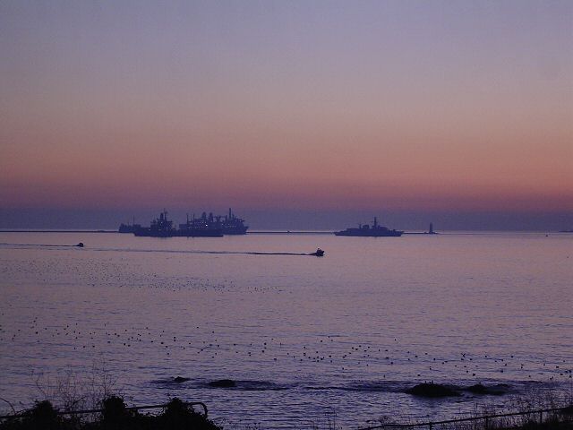
The Hoe is a popular area for Plymothians and visitors. There is always a great deal of activity on the water, including frequent warship movements, ferries going and coming from France and Spain, fishing trawlers and a swarm of larger and smaller sailing boats. The Fastnet yacht race ends here. The annual two-day British Firework Championships attracts tens of thousands of spectators.
For forty years, there has been controversy about development on the edges of the Hoe green space. The erection of two discount hotel chain buildings, at the southern end of Armada Way and the other at the Sound end of Leigham Street, contrast with their Victorian surroundings. The former Grand Hotel has been converted into apartments{{Cite news | archive-url = https://archive.today/20130505152926/http://www.thisisplymouth.co.uk/news/8million-restoration-work-begins-Grand-Hotel/article-773035-detail/article.html | url-status = dead | archive-date = 5 May 2013 | access-date = 4 May 2010
The Plymouth Dome, a turreted and domed building, built into a small old quarry site above Tinside as an historical theme tourist attraction,{{Cite news | access-date = 4 May 2010
Tombstoning
In the early 21st century Plymouth Hoe became notorious for the practice of tombstoning, which involves leaping feet-first into the sea from any accessible high point. This caused a number of serious injuries and deaths, leading to the dismantling of seafront diving boards and closure of parts of the waterfront to discourage the activity.
References
References
- Matthews, Constance Mary. (1974). "How place names began, and how they develop". Lutterworth Press.
- Bracken, C. W.. (1931). "A History of Plymouth and her Neighbours". Underhill.
- An early and explicit reference is made in [[Richard Carew (antiquary). Richard Carew]] (1602), ''The Survey of Cornwall'', text here:[http://www.gutenberg.org/dirs/etext06/srvcr10.txt]. Note that Carew refers to Plymouth Hoe as "the Hawe at Plymmouth".
- Geoffrey of Monmouth, Historia Regum Britanniae 1.12–16 [[s:History of the Kings of Britain/Book 1#16. on Wikisource]]
- (1989). "The Buildings of England – Devon". Penguin.
- (1890). "History of Plymouth: From the Earliest Period to the Present Time". W. Brenden.
- Blackledge, Sam. (13 January 2016). "Gary Rhodes ends involvement with Rhodes @ The Dome as Plymouth restaurant re-brands". Plymouth Herald.
- (18 June 2010). "Devon deaths warning over Plymouth Hoe tombstoning". BBC News.
- (17 February 2010). "'Unsafe' diving platform removed". BBC News.
This article was imported from Wikipedia and is available under the Creative Commons Attribution-ShareAlike 4.0 License. Content has been adapted to SurfDoc format. Original contributors can be found on the article history page.
Ask Mako anything about Plymouth Hoe — get instant answers, deeper analysis, and related topics.
Research with MakoFree with your Surf account
Create a free account to save articles, ask Mako questions, and organize your research.
Sign up freeThis content may have been generated or modified by AI. CloudSurf Software LLC is not responsible for the accuracy, completeness, or reliability of AI-generated content. Always verify important information from primary sources.
Report