From Surf Wiki (app.surf) — the open knowledge base
Plateau de Beille
French ski resort
French ski resort
| Field | Value |
|---|---|
| name | Plateau de Beille |
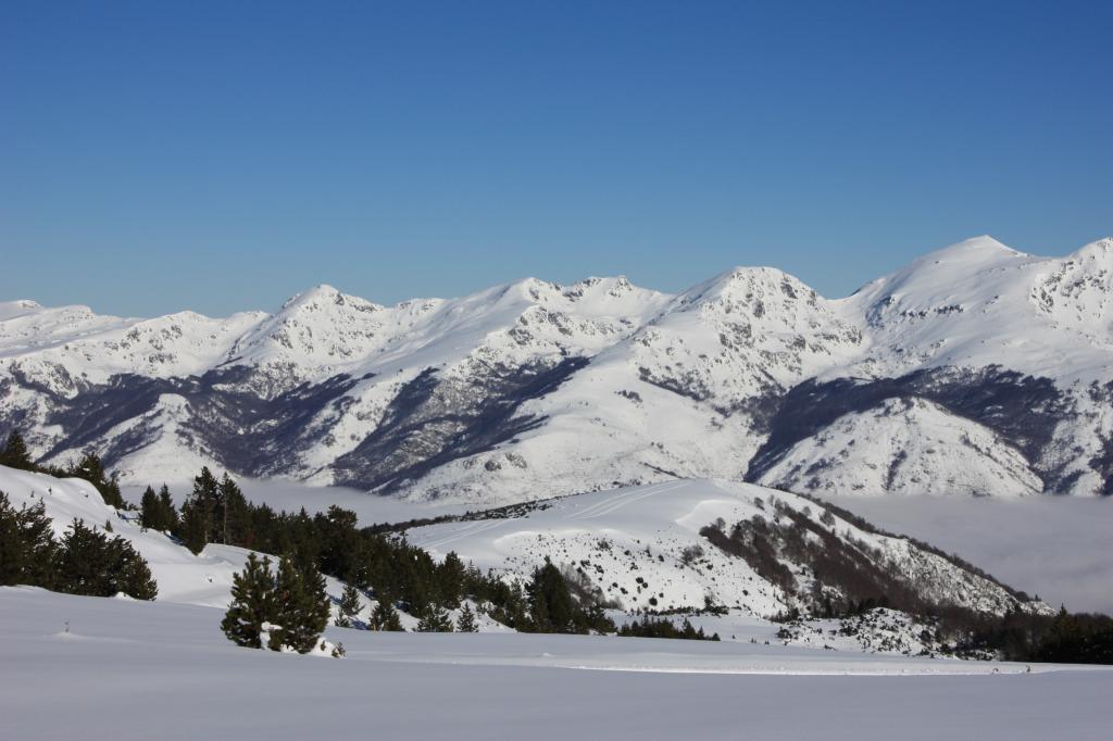
| picture | Ariègeoise-Plateau de Beille- km16.JPG |
| location | Ariège, Occitanie, France |
| nearest_city | Andorra la Vella |
| coordinates | |
| pushpin_map | France#France Occitanie#Pyrenees |
| pushpin_relief | y |
| top_elevation | 2000 m |
| base_elevation | 1650 m |
| skiable_area | 70 km |
| number_trails | Black: 2, 21 km |
| Red: 5, 32.3 km | |
| Blue: 5, 14 km | |
| Green: 1, 1 km | |
| external_link |
Red: 5, 32.3 km Blue: 5, 14 km Green: 1, 1 km |}} Plateau de Beille (; ) is a ski resort in the Pyrenees. It is situated in the Ariège department, and in the region of the Occitanie. The winter sports resort lies at a height of 1790 m.
For a long time, this plateau was only a place of livestock, especially cattle. It has recently become the site of a large winter sports resort of the Pyrenees, mainly dedicated to the practice of cross-country skiing, with tracks between 1650 and altitude. The ski station is located between Tarascon-sur-Ariège and Ax-les-Thermes, close to the Spanish border, and above the communes of Les Cabannes, Albiès and Vèbre. Road access to the plateau (the D522) starts from Les Cabannes. Moreover, the Plateau de Beille is a crossing point of the GR 10 hiking trail that crosses the Pyrenees from east to west.
Since 1998, the ascent from Les Cabannes to the plateau has regularly been used as the final ascent of a stage in the Tour de France. On the first four such occasions, the stage winner at Plateau de Beille also emerged as the winner of the general classification of that Tour.
Geography
The Plateau de Beille is bounded by two tributaries of the Ariège Valley, these being the to the west, and the Labail stream to the east. The plateau ends at the south by the Col de Finestres at 1967 m where it passes the GR 10; to the north, the slope falls steeply to the Ariège Valley.
If one considers the whole delimited area, it has benches with an altitude approximately between 1700-2000 m, on an area of about 1450 ha.
Geology
The substrate of the plateau is essentially composed of gneiss (gneiss of Riète or Aston), i.e. a granite metamorphosed by plutonic lifts. Formed during the Cenozoic, it suffered a first uprising during the formation of the Pyrenees about 40 to 50 million years ago, various levels between 25 million years and 10 million years ago, then a new uprising. In the Quaternary, its perimeter was determined by deep glacial valleys.
Flora and fauna
The Plateau de Beille is a Zone naturelle d'intérêt écologique, faunistique et floristique [Natural Zone of Ecological Interest, Fauna and Flora] (ZNIEFF) type I. Its habitat consists of short lawns, forests of Pinus uncinata at altitude, a beech-fir forest on its lower slopes, moorland and some bogs. In the bogs are oblong-leaved sundew (Drosera intermedia), round-leaved sundew (Drosera rotundifolia) and bog club moss (Lycopodiella inundata), rare and protected species, but also the marsh cinquefoil (Comarum palustre) and tussock cottongrass (Eriophorum vaginatum).
With regard to wildlife, of particular note is the presence of the capercaillie, the golden eagle, the bearded vulture and, for mammals, the European pine marten (Martes martes) and the Pyrenean chamois.
Sport
Ski resort
Created in 1988, the Plateau de Beille Nordic ski resort was opened in 1989. The facilities include 70 km of cross-country trails, 42 km of snowshoe trails, a biathlon stadium and a school for dog sledding. In summer activities are organised for, among other things, scooters hauled by sled dogs and discovery walks concerning pastoralism. Mountain biking trails follow the route of the cross-country ski slopes. It is a daytime station, with the exception of bivouacs in light structures, which have been implemented from 2007, no accommodation is guaranteed.
With regard to attendance and turnover, in 2008 Beille was the first Nordic ski station in the Pyrenees and the 4th at the French level.
Management is performed by the Régie des Espaces Nordiques des Vallées d'Ax (RENVA) under the tutelage of the . The station is a partner with its neighbours of Ax 3 Domaines, and .
Cycling
The Plateau de Beille is a regular place of various races. It was discovered by the Route du Sud in 1995, followed by the Tour de France in 1998, and every other year constitutes the final mountain for the cyclists of the .
Details of climb
Starting from Les Cabannes at 535 m, the climb to the Plateau de Beille at 1790 m is 15.8 km long. Over this distance, the climb is 1255 m at an average gradient of 7.9%. The maximum gradient is 10.8%.
It is a formidable ascent. The first 12 km are generally done under forest canopy and the last 4 km are uncovered through the pastures, where cattle sometimes cross the road.
While the valley roads are virtually flat, as soon as leaving the central square of Les Cabannes, riders face a very steep ramp to arrive at the height of the Château de Gudanes (commune of Château-Verdun). During the first kilometres, the tar road surface is smooth but then becomes granular, which adds to the difficulty. The forest offers very little respite, the slope is high and regular with many hairpins and it is during the 6th kilometre where it is possible to traverse a flat section of about 400 m. The percentages are often higher than 8%; the 9th kilometre, preceding Henry IV fountain, is one of the steepest sections.
After leaving the forest, the percentages are slightly lower but more irregular. At the 12th kilometre, it passes the Cabanne de Pierrefite with a short flat part followed by a difficult break in gradient. After having crossed a hairpin a little further up the road, the final section offers a moderate slope and the finish takes place at the large car park outside the building of the ski station, at an altitude of 1790 m.
Tour de France

Since its discovery by the Tour de France in 1998, the Plateau de Beille has served as stage finish seven times (in 1998, 2002, 2004, 2007, 2011, 2015 and 2024). The ascent is ranked as hors catégorie in the mountains classification.
On the first four occasions, the stage winner has gone on to win the Tour: Marco Pantani in 1998, Lance Armstrong in 2002 and 2004 (but whose titles were removed from him in October 2012), and Alberto Contador in 2007 who won the Tour de France as a result of the exclusion of the Danish Michael Rasmussen.
Tour de France stage finishes
| Year | Stage | Start of stage | Distance (km) | Category of climb | Stage winner | Yellow jersey |
|---|---|---|---|---|---|---|
| 2024 | 15 | Loudenvielle | 197.7 | HC | Tadej Pogačar | Tadej Pogačar |
| 2015 | 12 | Lannemezan | 195 | HC | Joaquim Rodríguez | Chris Froome |
| 2011 | 14 | Saint-Gaudens | 168.5 | HC | Jelle Vanendert | Thomas Voeckler |
| 2007 | 14 | Mazamet | 170 | HC | Alberto Contador | Michael Rasmussen |
| 2004 | 13 | Lannemezan | 205.5 | HC | Lance Armstrong | Thomas Voeckler |
| 2002 | 12 | Lannemezan | 198 | HC | Lance Armstrong | |
| 1998 | 11 | Bagnères-de-Luchon | 170 | HC | Marco Pantani | Jan Ullrich |
*The 1998 Tour de France finish was at 1747 m whereas in later years the finish has been at 1780 m.
Route du Sud
The Plateau de Beille has also been used seven times for a stage finish of the Route du Sud.
- 1995: ESP Carmelo Mirando
- 1996: ITA Giuseppe Guerini
- 1997: FRA Laurent Roux
- 1998: FRA Armand de Las Cuevas
- 1999: USA Lance Armstrong
- 2001: ITA Francesco Casagrande
- 2002: USA Levi Leipheimer (ITT)
Gallery
File:Les Cabannes- début montée Beille.JPG|Difficult slope from the rise on leaving Les Cabannes File:Numérisation0001.jpg|The mountain of Quié de Sinsat at 1484 m File:Plateau de Beille- cabanne de Pierrefite.JPG|The Pierrefite cabin to the right, 4 km from the finish File:AsCy-Beille-14.JPG|The hairpin turn at 2.5 km from the finish File:Numérisation0010.jpg|Cattle and horses on the road at 1 km from the finish File:Plateau de Beille- départ pistes.JPG|The start of the ski slopes File:Vue au Nord en direction de la Montagne de la Tabe.jpg|View north to the Montagne de la Tabe File:numérisation0008.jpg|Restaurant at the finish next to the large car park
Bibliography
General
Cycling
References
References
- Ruisseau de Lavail, according to IGN maps
- Dessarps, Pierre-Damien. (July 2008). "Du plan de gestion environnementale au plan de développement territorial : l'exemple original du plateau de Beille en Pyrénées ariègeoises". Institut des sciences et industries du vivant et de l'environnement.
- Pierre-Damien Dessarps, ibid., p. 10.
- "ZNIEFF 730011933 - PLATEAU DE BEILLE MONT REDON PRAT MOLL".
- Pierre-Damien Dessarps, ibid., p.12.
- Pierre-Damien Dessarp, ibid., pp. 26-29.
- "Plateau de Beille from Les Cabannes : 1790m".
- (April 2014). "Le Plateau de Beille. Le défi de l’Ariégeoise". Le Cycle.
- (September 2007). "Le Plateau de Beille. Le juge de paix". Le Cycle.
- (September 2007). "Le Plateau de Beille. Le juge de paix". Le Cycle.
- (2007-07-25). "Rasmussen out of Tour de France". Europsort (via Yahoo).
- "Le Plateau de Beille dans le Tour de France". ledicodutour.
This article was imported from Wikipedia and is available under the Creative Commons Attribution-ShareAlike 4.0 License. Content has been adapted to SurfDoc format. Original contributors can be found on the article history page.
Ask Mako anything about Plateau de Beille — get instant answers, deeper analysis, and related topics.
Research with MakoFree with your Surf account
Create a free account to save articles, ask Mako questions, and organize your research.
Sign up freeThis content may have been generated or modified by AI. CloudSurf Software LLC is not responsible for the accuracy, completeness, or reliability of AI-generated content. Always verify important information from primary sources.
Report