From Surf Wiki (app.surf) — the open knowledge base
Pir Panjal Range
Mountain range of the Lower Himalayas
Mountain range of the Lower Himalayas
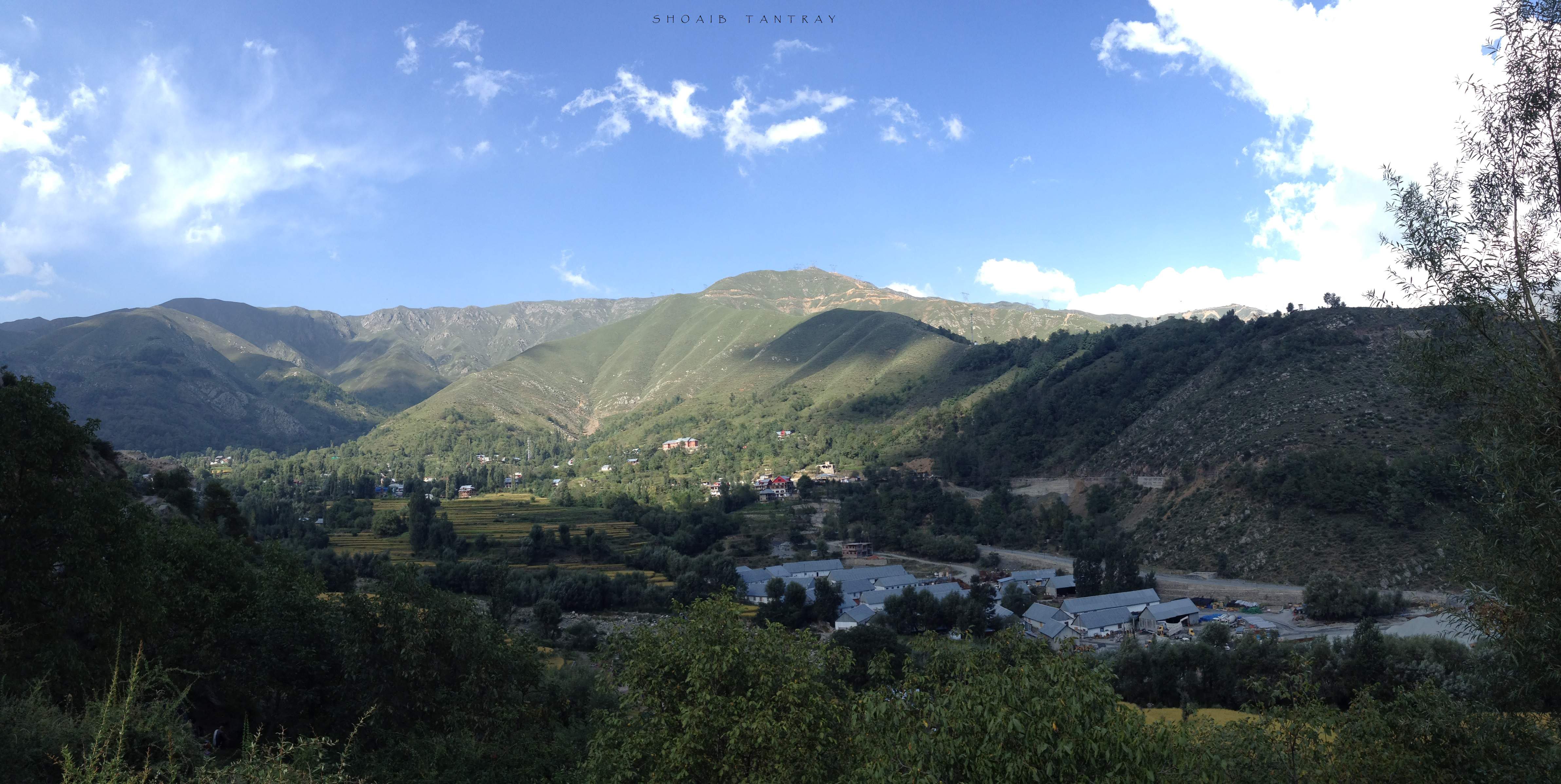
The Pir Panjal Range () is a range of mountains in the Lower Himalayan region located in the Western Himalayas of the northern Indian subcontinent. It runs southeast to northwest between the Beas and Neelam/Kishanganga rivers, in the Indian state of Himachal Pradesh and Indian-administered union territory of Jammu and Kashmir, with its northwestern end extending into territory administered by Pakistan. The Himalayas show a gradual elevation towards the Dhauladhar and Pir Panjal ranges. Pir Panjal is the largest and westernmost range of the Lesser Himalayas. Near the bank of the Sutlej River, it dissociates itself from the main Himalayan range and forms a divide between the Beas and Ravi rivers on one side and the Chenab on the other. Further west, the Pir Panjal range forms the southwestern boundary of the Kashmir Valley, separating it from the hills of Jammu region, forming a divide between the Jhelum River and Chenab River.
Etymology
The Pir Panjal range is named after the Pir Panjal Pass, whose original name as recorded by Srivara, is Panchaladeva (IAST: Pāñcāladeva, meaning the deity of Panchala). Panchala is a country mentioned in the Mahabharata in the northwest Uttar Pradesh. However, there are also traditions that place the Mahabharata regions in western Punjab and southern Kashmir. Scholar Dineshchandra Sircar has analysed the geography described in the Shakti‐sangama Tantra, where this is indeed the case. Scholar M. A. Stein believes that the concept of deity must have been translated into that of a Pir after the region was Islamised.
Peaks of the range
Deo Tibba (6001 m) and Indrasan (6221 m) are two important peaks at the eastern end of the mountain range. They can be approached from both the Parvati-Beas Valley (Kulu District), Upper Belt of Chamba Himachal Pradesh and the Chandra (Upper Chenab) Valley (Lahaul and Spiti District) in Himachal Pradesh. The hill station of Gulmarg in Kashmir lies in this range.
Passes
Haji Pir Pass (altitude 2637 m) on the western Pir Panjal range on the road between Poonch and Uri in Indian-administered Kashmir. Despite taking the pass twice in military operations (in 1948 and 1965), India left the pass under Pakistani control.
Pir Panjal Pass (also called Peer Ki Gali) connects the Kashmir Valley with Rajouri and Poonch via the Mughal Road. It is the highest point of the Mughal Road at 3490 m and lies to the southwest of the Kashmir Valley. The nearest town to the pass in the Kashmir valley is Shopian.
Munawar Pass (altitude 3600 m) is north of Peer Ki Gali, overlooking Rajouri.
Banihal pass (2832 m) lies at the head of the Jhelum River at the southern end of the Kashmir Valley. Banihal and Qazigund lie on either side of the pass.
Sinthan pass connects the Kashmir Valley with Kishtwar in the Jammu region.
Saach Pass, at 4414 m in the Chamba district, connects Chamba with the Pangi Valley of Himachal Pradesh, India.
Rohtang La (altitude 3978 m) in the eastern Pir Panjal range connects Manali in the Kullu Valley to Keylong in the Lahaul Valley.
| mark-coord1 =
| mark-size1 = 8
| label-size1 = 11
| label-color1 = black
| label-pos1 = bottom
| mark-title1 = Haji Pir pass
| mark-image1 =
| mark-description1 = on Uri–Poonch road
| mark-coord2 =
| mark-size2 = 8
| label-size2 = 11
| label-color2 = black
| label-pos2 = bottom
| mark-title2 = Haji Pir pass
| mark-image2 =
| mark-description2 = on Mughal Rad
| mark-coord3 =
| mark-size3 = 8
| label-size3 = 11
| label-color3 = black
| label-pos3 = bottom
| mark-title3 = Banihal pass
| mark-image3 =
| mark-description3 = on Jammu–Srinagar road
| mark-coord4 =
| mark-size4 = 8
| label-size4 = 11
| label-color4 = black
| label-pos4 = top
| mark-title4 = Srinagar
| mark-image4 =
| mark-description4 = capital of the Kashmir Valley
| mark-coord5 =
| mark-size5 = 8
| label-size5 = 11
| label-color5 = black
| label-pos5 = right
| mark-title5 = Jammu
| mark-image5=
| mark-description5= capital of the Jammu Division
| mark-coord6 =
| mark-size6 = 8
| label-size6 = 11
| label-color6 = black
| label-pos6 = right
| mark-title6 = Sinthan pass
| mark-image6=
| mark-description6= connects Kishtwar to Kashmir
| mark-coord7 =
| mark-size7 = 8
| label-size7 = 11
| label-color7 = black
| label-pos7 = left
| mark-title7 = Sach pass
| mark-image7 =
| mark-description7 = connects Chamba with Pangi
| mark-coord8 =
| mark-size8 = 8
| label-size8 = 11
| label-color8 = black
| label-pos8 = left
| mark-title8 = Rohtang La
| mark-image8 =
| mark-description8 = connects Kullu with Lahaul
Tunnels
Jawahar Tunnel
The Jawahar Tunnel is a 2.85 km long tunnel through Pir Panjal mountain under the Banihal pass connects Banihal with Qazigund on the other side of the mountain. The Jawahar Tunnel was named after the first Prime Minister of India was constructed in the early 1950s and commissioned in December 1956 to ensure snow-free passage throughout the year. It is at elevation of about 2194 m. It was originally designed for 150 vehicles per day but is now used by more than 7,000 vehicles daily. Therefore, a new wider and longer tunnel has been planned at a lower elevation.
Banihal Qazigund Road Tunnel
Main article: Banihal Qazigund Road Tunnel
Construction of a new 8.45 km long twin-tube Banihal Qazigund Road Tunnel started in 2011 and was commissioned in 2021. The new tunnel is at a lower elevation than the existing Jawahar tunnel and has reduced the road distance between Banihal and Qazigund by 16 km. It is also less prone to snow avalanches as it is at a lower elevation.
Atal Tunnel
Main article: Atal tunnel
The Atal Tunnel has been built under the Rohtang Pass in the eastern Pir Panjal range of the Himalayas on the Leh-Manali Highway. With 8.8 km length, the tunnel is the second longest road tunnel in India and has reduced the distance between Manali and Keylong by about 60 km. The tunnel is at 3100 m elevation whereas the Rohtang pass is at 3978 m elevation. Lying on the Manali-Leh axis, this is one of the two routes to Ladakh.
Banihal Railway Tunnel
Main article: Pir Panjal Railway Tunnel
The Pir Panjal Railway Tunnel, an 11.215 km railway tunnel, passes through the Pir Panjal Range in Jammu and Kashmir. It connects Quazigund and Banihal and is a part of the Udhampur-Srinagar-Baramulla railway project. The tunnel was commissioned on 26 June 2013 for regular service. It is India's longest railway tunnel.
References
References
- "Pir Panjal Range {{!}} Location, Himalayas, & Tunnel {{!}} Britannica".
- (June 2014). "Home ministry chalks out plan to settle Kashmiri Pandits".
- Sircar, Dineschandra. (1971). "Studies in the Geography of Ancient and Medieval India". Motilal Banarsidass.
- Stein, M. A.. (1900). "Kalhana's Rajatarangini: A chronicle of the kings of Kasmir, Volume 2". Archibald Constable and Co..
- [http://www.britannica.com/EBchecked/topic/461483/Pir-Panjal-Range Pir Panjal Range (mountain system, Asia) – Britannica Online Encyclopedia]
- Kapadia, Harish. (1999). "Across Peaks & Passes in Ladakh, Zanskar & East Karakoram". Indus Publishing.
- (21 April 2013). "Pir Panjal Range". Tourist Link.
- Himachal Tourism"[https://himachaltourism.gov.in/destination/unexplored/]". ''Himachal Tourism''. Accessed 6 December 2019.
- (2 November 2023). "Old tunnel on Kashmir highway to be transformed as tourist destination". Deccan Herald.
- (2 November 2023). "Old tunnel on Kashmir highway to be transformed as tourist destination". Deccan Herald.
- [http://mod.nic.in/Samachar/mar5/html/army.htm Beacon Light in the Tunnel] {{webarchive. link. (1 September 2012)
- (8 April 2012). "Passages of employment to Srinagar's denizens".
- (14 October 2011). "India's longest railway tunnel unveiled in Jammu & Kashmir". [[The Times of India]].
This article was imported from Wikipedia and is available under the Creative Commons Attribution-ShareAlike 4.0 License. Content has been adapted to SurfDoc format. Original contributors can be found on the article history page.
Ask Mako anything about Pir Panjal Range — get instant answers, deeper analysis, and related topics.
Research with MakoFree with your Surf account
Create a free account to save articles, ask Mako questions, and organize your research.
Sign up freeThis content may have been generated or modified by AI. CloudSurf Software LLC is not responsible for the accuracy, completeness, or reliability of AI-generated content. Always verify important information from primary sources.
Report