From Surf Wiki (app.surf) — the open knowledge base
Pima County, Arizona
County in Arizona, United States

County in Arizona, United States
| Field | Value |
|---|---|
| county | Pima County |
| state | Arizona |
| ex image | Pima County Courthouse 10.JPG |
| ex image size | 300px |
| ex image cap | Pima County Courthouse |
| seal | Seal of Pima County, Arizona.png |
| founded year | 1864 |
| founded date | November 9 |
| seat wl | Tucson |
| largest city | Tucson |
| area_total_sq_mi | 9189 |
| area_land_sq_mi | 9187 |
| area_water_sq_mi | 2.1 |
| area percentage | 0.02% |
| population_as_of | 2020 |
| population_total | 1043433 |
| pop_est_as_of | 2024 |
| population_est | 1080149 |
| population_density_sq_mi | auto |
| time zone | Mountain |
| web | www.pima.gov |
| district | 6th |
| district2 | 7th |
| named for | Pima people |
| coordinates | |
| logo | Pima County, AZ logo.svg |
Pima County ( ) is a county in the south central region of the U.S. state of Arizona, one of 15 counties in the state. As of the 2020 census, the population was 1,043,433, making it Arizona's second-most populous county. The county seat is Tucson, where most of the population is centered. The county is named after the Pima Native Americans, also known as Akimel O'odham, who are indigenous to this area.
Pima County includes the entirety of the Tucson Metropolitan Statistical Area, and it is the third largest metropolitan area in the Southwestern United States.
Pima County contains parts of the Tohono O'odham Nation, as well as all of the San Xavier Indian Reservation, the Pascua Yaqui Indian Reservation, Organ Pipe Cactus National Monument, Ironwood Forest National Monument and Saguaro National Park.
The vast majority of the county population lies in and around the city of Tucson, filling much of the eastern part of the county with urban development. As Arizona's second-largest city, Tucson is a major commercial and academic center. Other urban areas include the Tucson suburbs of Marana, Oro Valley, Sahuarita, South Tucson, and Green Valley. The rest of the county is sparsely populated; the largest towns are Sells, the capital of the Tohono O'odham Nation, and Ajo in the county's far western region.
History
Pima County, one of the four original counties in Arizona, was created by the 1st Arizona Territorial Legislature with land acquired through the Gadsden Purchase from Mexico in 1853. The original county consisted of all of Arizona Territory east of longitude 113° 20' and south of the Gila River. Soon thereafter, the counties of Cochise, Graham and Santa Cruz were carved from the original Pima County.
Geography
According to the United States Census Bureau, the county has a total area of 9189 sqmi, of which 9187 sqmi is land and 2.1 sqmi (0.02%) is water.
Topographic features
- Mountains of Pima County
- Fresnal Canyon
Major highways
- [[File:I-10 (AZ).svg|20px]] Interstate 10
- [[File:I-19 (AZ).svg|20px]] Interstate 19
- [[File:US 80 (AZ historic).svg|20px]] Historic U.S. Route 80
- [[File:Arizona 77.svg|20px]] State Route 77
- [[File:Arizona 83.svg|20px]] State Route 83
- [[File:Arizona 85.svg|20px]] State Route 85
- [[File:Arizona 86.svg|20px]] State Route 86
- [[File:Arizona 210.svg|25px]] State Route 210
- [[File:Arizona 989.svg|25px]] State Route 989
Adjacent counties and municipalities
- Yuma County – west
- Maricopa County – north
- Pinal County – north
- Graham County – northeast
- Cochise County – east
- Santa Cruz County – southeast east and south
- Altar, Sonora, Mexico – south
- Caborca, Sonora, Mexico – south
- General Plutarco Elías Calles, Sonora, Mexico – south
- Sáric, Sonora, Mexico – south
National protected areas
- Buenos Aires National Wildlife Refuge
- Cabeza Prieta National Wildlife Refuge (part)
- Coronado National Forest (part)
- Ironwood Forest National Monument (part)
- [[File:Pima County Historic Courthouse.jpg|alt=Official Pima County Logo|thumb|Old Pima County Courthouse]] Las Cienegas National Conservation Area (part)
- Organ Pipe Cactus National Monument
- Saguaro National Park
Sonoran Desert Conservation Plan
The Sonoran Desert Conservation Plan (SDCP) is Pima County's plan for desert conservation. The SDCP addresses natural and cultural resources, ranches, endangered species compliance and wildlife corridors.
Demographics
|align-fn=center 1790–1960 1900–1990 1990–2000 2010–2020
Racial and ethnic composition
| Race / Ethnicity (NH = Non-Hispanic) | title=P2: Hispanic or Latino, and Not Hispanic or Latino by Race – 2010: DEC Redistricting Data (PL 94-171) – Pima County, Arizona | url=https://data.census.gov/cedsci/table?q=p2&g=050XX00US04019&tid=DECENNIALPL2010.P2 | website=United States Census Bureau | access-date= }} | title=P004: Hispanic or Latino, and Not Hispanic or Latino by Race – 2000: DEC Summary File 1 – Pima County, Arizona | url=https://data.census.gov/table?g=050XX00US04019&tid=DECENNIALSF12000.P004 | website=United States Census Bureau | access-date= }} | 1990 | 1980 |
|---|---|---|---|---|---|---|---|---|---|---|
| White alone (NH) | 51.5% | |||||||||
| (536,868) | 55.3% | |||||||||
| (541,700) | 61.5% | |||||||||
| (518,720) | 68.2% | |||||||||
| (454,919) | ||||||||||
| Black alone (NH) | 3.5% | |||||||||
| (36,254) | 3.2% | |||||||||
| (31,075) | 2.9% | |||||||||
| (24,047) | 2.9% | |||||||||
| (19,455) | ||||||||||
| American Indian alone (NH) | 2.3% | |||||||||
| (23,670) | 2.4% | |||||||||
| (23,558) | 2.6% | |||||||||
| (21,821) | 2.5% | |||||||||
| (17,005) | ||||||||||
| Asian alone (NH) | 2.9% | |||||||||
| (29,844) | 2.5% | |||||||||
| (24,592) | 2% | |||||||||
| (16,595) | 1.7% | |||||||||
| (11,228) | ||||||||||
| Pacific Islander alone (NH) | 0.2% | |||||||||
| (1,937) | 0.1% | |||||||||
| (1,336) | 0.1% | |||||||||
| (891) | ||||||||||
| Other race alone (NH) | 0.5% | |||||||||
| (4,657) | 0.2% | |||||||||
| (1,461) | 0.1% | |||||||||
| (1,012) | 0.2% | |||||||||
| (1,011) | ||||||||||
| Multiracial (NH) | 3.6% | |||||||||
| (37,415) | 1.8% | |||||||||
| (17,739) | 1.6% | |||||||||
| (13,082) | — | |||||||||
| Hispanic/Latino (any race) | 35.7% | |||||||||
| (372,788) | 34.6% | |||||||||
| (338,802) | 29.3% | |||||||||
| (247,578) | 24.5% | |||||||||
| (163,262) |
2020 census
As of the 2020 census, the county had a population of 1,043,433. Of the residents, 20.0% were under the age of 18 and 21.9% were 65 years of age or older; the median age was 41.2 years. For every 100 females there were 96.6 males, and for every 100 females age 18 and over there were 94.8 males. 91.2% of residents lived in urban areas and 8.8% lived in rural areas.
The racial makeup of the county was 60.7% White, 3.8% Black or African American, 3.3% American Indian and Alaska Native, 3.0% Asian, 0.2% Native Hawaiian and Pacific Islander, 12.2% from some other race, and 16.7% from two or more races. Hispanic or Latino residents of any race comprised 35.7% of the population.
There were 427,021 households in the county, of which 25.5% had children under the age of 18 living with them and 28.6% had a female householder with no spouse or partner present. About 31.1% of all households were made up of individuals and 13.6% had someone living alone who was 65 years of age or older.
There were 470,132 housing units, of which 9.2% were vacant. Among occupied housing units, 63.6% were owner-occupied and 36.4% were renter-occupied. The homeowner vacancy rate was 1.7% and the rental vacancy rate was 7.7%.
2010 census
As of the census of 2010, there were 980,263 people, 388,660 households, and 243,167 families living in the county.{{cite web |access-date=January 20, 2016 |archive-url=https://archive.today/20200213030136/http://factfinder.census.gov/bkmk/table/1.0/en/DEC/10_DP/DPDP1/0500000US04019 |archive-date=February 13, 2020 |url-status=dead |access-date=January 20, 2016
The largest ancestry groups were:{{cite web |access-date=January 20, 2016
- 30.8% Mexican
- 16.2% German
- 10.6% Irish
- 9.9% English
- 4.5% Italian
- 3.1% French
- 2.8% American
- 2.7% Polish
- 2.4% Scottish
- 1.8% Scotch-Irish
- 1.7% Norwegian
- 1.6% Dutch
- 1.6% Swedish
- 1.1% Russian
Of the 388,660 households, 29.8% had children under the age of 18 living with them, 44.5% were married couples living together, 12.8% had a female householder with no husband present, 37.4% were non-families, and 29.2% of all households were made up of individuals. The average household size was 2.46 and the average family size was 3.06. The median age was 37.7 years.
The median income for a household in the county was $45,521 and the median income for a family was $57,377. Males had a median income of $42,313 versus $33,487 for females. The per capita income for the county was $25,093. About 11.2% of families and 16.4% of the population were below the poverty line, including 22.6% of those under age 18 and 8.5% of those age 65 or over.
2000 census
As of the census of 2000, there were 843,746 people, 332,350 households, and 212,039 families living in the county. The population density was 92 /mi2. There were 366,737 housing units at an average density of 40 /mi2. The racial makeup of the county was 75.1% White, 3.0% Black or African American, 3.2% Native American, 2.0% Asian, 0.1% Pacific Islander, 13.3% from other races, and 3.2% from two or more races. 29.3% of the population were Hispanic or Latino of any race. 22.8% reported speaking Spanish at home.
There were 332,350 households, out of which 29.2% had children under the age of 18 living with them, 47.7% were married couples living together, 11.8% had a female householder with no husband present, and 36.2% were non-families. 28.5% of all households were made up of individuals, and 9.4% had someone living alone who was 65 years of age or older. The average household size was 2.47 and the average family size was 3.06.
In the county, the population was spread out, with 24.6% under the age of 18, 10.9% from 18 to 24, 28.4% from 25 to 44, 21.9% from 45 to 64, and 14.2% who were 65 years of age or older. The median age was 36 years. For every 100 females there were 95.7 males. For every 100 females age 18 and over, there were 92.7 males.
The median income for a household in the county was $36,758, and the median income for a family was $44,446. Males had a median income of $32,156 versus $24,959 for females. The per capita income for the county was $19,785. About 10.5% of families and 14.7% of the population were below the poverty line, including 19.4% of those under age 18 and 8.2% of those age 65 or over.
Metropolitan Statistical Area
The United States Office of Management and Budget has designated Pima County as the Tucson, AZ Metropolitan Statistical Area. The United States Census Bureau ranked the Tucson, AZ Metropolitan Statistical Area as the 53rd most populous metropolitan statistical area of the United States as of July 1, 2012.
The Office of Management and Budget has further designated the Tucson, AZ Metropolitan Statistical Area as a component of the more extensive Tucson-Nogales, AZ Combined Statistical Area,
Government, policing, and politics
Pima County is governed by a five-member Board of Supervisors who set ordinances and run services for the areas that do not fall within any city or town's jurisdiction.
In Arizona, counties are creatures of the state, and do not have charters of their own. The county Board of Supervisors acts under powers delegated by state law, mainly related to minor ordinances and revenue collection. With few exceptions, these powers are narrowly construed. The state legislature devotes considerable time to local matters, with legislative approval required for many of the most basic local issues.
Board of Supervisors and elected positions
The Pima County Board of Supervisors is responsible for steering public policy in the region. The five-member board provides direction to the County Administrator, Jan Lesher, and the county's various departments as they work to ensure safe communities, nurture economic development, sustainably manage natural resources and protect public health. In addition to overseeing the delivery of a host of municipal services, from roads to parks and libraries and law enforcement, board members also are responsible for approving the county budget. Elected to four-year terms, board members also set the amount of taxes to be levied.
| Party | District | Name | First elected | Area(s) represented | Official Website |
|---|---|---|---|---|---|
| Democratic | District 1 | Rex Scott | 2020 | Oro Valley, Marana, Catalina Foothills | |
| Democratic | District 2 | Matt Heinz | 2020 | Tucson, Sahuarita, South Tucson | |
| Democratic | District 3 | Jennifer Allen | 2024 | Tucson, Marana, Three Points, Sahuarita | |
| Republican | District 4 | Steve Christy | 2016 | Tucson, Vail, Summerhaven, Green Valley | |
| Democratic | District 5 | Andrés Cano | 2025 | Tucson, Sahuarita, Green Valley |
Along with the Board of Supervisors the Arizona State Constitution allows for 7 other county elected officials.
| Party | Office | Name | First elected | References |
|---|---|---|---|---|
| Democratic | Assessor | Suzanne Droubie | 2020 | |
| Democratic | County Attorney | Laura Conover | 2020 | |
| Democratic | County Recorder | Gabriella Cázares-Kelly | 2020 | |
| Democratic | County School Superintendent | Dustin Williams | 2016 | |
| Democratic | Sheriff | Chris Nanos | 2020 | |
| Democratic | Treasurer | Brian Johnson | 2024 | |
| Democratic | Clerk of Superior Court | Gary Harrison | 2020 |
Pima County sheriff
The Pima County Sheriff's Department provides court protection, administers the county jail, provides coroner service, and patrols the unincorporated parts of Pima County. It is the seventh largest sheriff's department in the nation. Incorporated towns within the county with municipal police departments are Tucson, Marana, Oro Valley, and Sahuarita.
Politics
Being home to a major population center and a major research university, Pima County is one of the most reliably Democratic counties in Arizona. After voting Democratic through 1930s and 1940s, it swung Republican following major population increase after World War II, becoming a Republican-leaning county. However, in 1964, it rejected Arizona's native son Barry Goldwater by seven points, who won statewide by one point. However, despite the county's Republican lean, Democrats would not win 40% of the vote only twice - in 1972, when George McGovern lost in a 49-state landslide and due to a balloting error in the county, the Socialist Workers Party came a distant third with 18% of the vote; and in 1980, when Jimmy Carter lost many votes to independent John B. Anderson. Following Bill Clinton's plurality victory by 12 points in 1992, all Democrats since 1996 have won the county by a majority and no Republican has come closer than six points in recapturing the county. In both 2016 and 2020, Donald Trump became the first Republican since Bob Dole in 1996 to fail to win 40% of the county's vote. However, Trump won 41.7% of the county's vote in his third presidential run in 2024.
Communities

Cities
- South Tucson
- Tucson (county seat)
Towns
- Marana (partially in Pinal County)
- Oro Valley
- Sahuarita
Census-designated places
- Ajo
- Ak Chin
- Ali Chuk
- Ali Chukson
- Ali Molina
- Anegam
- Arivaca
- Arivaca Junction
- Avra Valley
- Casas Adobes
- Catalina
- Catalina Foothills
- Charco
- Chiawuli Tak
- Comobabi
- Corona de Tucson
- Cowlic
- Drexel Heights
- Elephant Head
- Flowing Wells
- Green Valley
- Gu Oidak
- Haivana Nakya
- J-Six Ranchettes
- Kleindale
- Ko Vaya
- Littletown (former)
- Maish Vaya
- Nelson
- Nolic
- Picture Rocks
- Pimaco Two (former)
- Pisinemo
- Rillito
- Rincon Valley
- San Miguel
- Santa Rosa
- Sells
- South Komelik
- Summerhaven
- Summit
- Tanque Verde
- Three Points
- Topawa
- Tucson Estates
- Tucson Mountains
- Vail
- Valencia West
- Ventana
- Wahak Hotrontk
- Why
- Willow Canyon
Indian communities
- Pascua Yaqui
- San Xavier
- Tohono O'odham (part)
Other communities
- Drexel-Alvernon
- East Sahuarita
- Kentucky Camp
- Lukeville
- Redington
- Sasabe
- Tortolita
Ghost towns
- Achi
- Ahan Owuch
- Ak Chut Vaya
- Allen
- Cerro Colorado
- Helvetia
- Hahuul Kawuch Vay, Arizona
- Kentucky
- Pantano
- Redington
- San Rafael
- Total Wreck
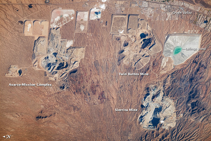
- Twin Buttes
- List of ghost towns in Arizona
County population ranking
The population ranking of the following table is based on the 2020 census of Pima County.
† county seat
| Rank | City/Town/etc. | Population (2020 Census) | Municipal type | Incorporated |
|---|---|---|---|---|
| 1 | † Tucson | 542,629 | City | 1775 |
| 2 | Casas Adobes | 70,973 | CDP | |
| 3 | Catalina Foothills | 52,401 | CDP | |
| 4 | Marana | 51,908 | Town | 1977 |
| 5 | Oro Valley | 47,070 | Town | 1974 |
| 6 | Sahuarita | 34,134 | Town | 1994 |
| 7 | Drexel Heights | 27,523 | CDP | |
| 8 | Green Valley | 22,616 | CDP | |
| 9 | Tanque Verde | 16,250 | CDP | |
| 10 | Flowing Wells | 15,657 | CDP | |
| 11 | Valencia West | 14,101 | CDP | |
| 12 | Vail | 13,604 | CDP | |
| 13 | Tucson Estates | 12,069 | CDP | |
| 14 | Tucson Mountains | 10,862 | CDP | |
| 15 | Picture Rocks | 9,551 | CDP | |
| 16 | Corona de Tucson | 9,240 | CDP | |
| 17 | Catalina | 7,551 | CDP | |
| 18 | Rincon Valley | 5,612 | CDP | |
| 19 | Avra Valley | 5,569 | CDP | |
| 20 | Three Points | 5,184 | CDP | |
| 21 | Summit | 4,724 | CDP | |
| 22 | South Tucson | 4,613 | City | 1940 |
| 23 | Ajo | 3,039 | CDP | |
| 24 | Sells | 2,121 | CDP | |
| 25 | Arivaca Junction | 970 | CDP | |
| 26 | J-Six Ranchettes | 647 | CDP | |
| 27 | Arivaca | 623 | CDP | |
| 28 | Elephant Head | 588 | CDP | |
| 29 | Santa Rosa | 474 | CDP | |
| 30 | Pisinemo | 359 | CDP | |
| 31 | Nelson | 249 | CDP | |
| 32 | Topawa | 233 | CDP | |
| 33 | San Miguel | 205 | CDP | |
| 34 | South Komelik | 176 | CDP | |
| 35 | Kleindale | 165 | CDP | |
| 36 | Anegam | 149 | CDP | |
| 37 | Maish Vaya | 129 | CDP | |
| 38 | Gu Oidak | 126 | CDP | |
| 39 | Why | 122 | CDP | |
| 40 | Ali Chuk | 119 | CDP | |
| 41 | Ali Chukson | 113 | CDP | |
| 42 | Cowlic | 105 | CDP | |
| 43 | Rillito | 94 | CDP | |
| 44 | Wahak Hotrontk | 88 | CDP | |
| 45 | Haivana Nakya | 72 | CDP | |
| 46 | Summerhaven | 71 | CDP | |
| 47 | Ali Molina | 61 | CDP | |
| 48 | Ventana | 52 | CDP | |
| 49 | Ak Chin | 50 | CDP | |
| 50 | Chiawuli Tak | 48 | CDP | |
| 51 | Comobabi | 44 | CDP | |
| 52 | Ko Vaya | 43 | CDP | |
| 53 | Charco | 27 | CDP | |
| 54 | Nolic | 12 | CDP | |
| 55 | Willow Canyon | 2 | CDP |
Education
School districts with territory in the county, no matter how slight (even if the schools and administration are in other counties), include:
Unified:
- Ajo Unified School District
- Amphitheater Unified School District
- Catalina Foothills Unified School District
- Flowing Wells Unified School District
- Indian Oasis-Baboquivari Unified School District
- Marana Unified School District
- Sahuarita Unified School District
- Sunnyside Unified School District
- Tanque Verde Unified School District
- Tucson Unified School District
- Vail Unified School District
Elementary:
- Altar Valley Elementary School District
- Continental Elementary School District
- Empire Elementary School District
- Redington Elementary School District
- San Fernando Elementary School District
Arizona State Schools for the Deaf and Blind is based in Tucson.
Tourist attractions
Annual events
- Pima County Fair Tucson Gem and Mineral Show Tucson Rodeo
Locations of interest
- Arizona-Sonora Desert Museum
- Old Tucson Studios
- Arizona Historical Society (museum)
- Tucson Gem & Mineral Show
- Titan Missile Museum
- Pima Air and Space Museum
- Mission San Xavier del Bac
County-Designated Historic Landmarks
- Ferguson House, Hacienda Del Bosquito, Desert Treasures, Designated 2018
- Harrenstein House, Designated 2018
- Viewpoint, Christina and Earl J. Johnson House, Designated 2021
- Jacobson House, Designated 2022
Notes
References
References
- "State & County QuickFacts". United States Census Bureau.
- "Find a County". National Association of Counties.
- Wagoner, Jay J.. (1970). "Arizona Territory 1863–1912: A Political history". University of Arizona Press.
- (September 27, 2000). "History: Pima County". Pima County Justice Court.
- (August 23, 2012). "2010 Census Gazetteer Files". United States Census Bureau.
- Pima County. (2023). "The Sonoran Desert Conservation Plan".
- "County Population Totals and Components of Change: 2020-2024". United States Census Bureau.
- "U.S. Decennial Census". United States Census Bureau.
- "Historical Census Browser". University of Virginia Library.
- "Population of Counties by Decennial Census: 1900 to 1990". United States Census Bureau.
- "Census 2000 PHC-T-4. Ranking Tables for Counties: 1990 and 2000". United States Census Bureau.
- "P2: Hispanic or Latino, and Not Hispanic or Latino by Race – 2020: DEC Redistricting Data (PL 94-171) – Pima County, Arizona".
- "P2: Hispanic or Latino, and Not Hispanic or Latino by Race – 2010: DEC Redistricting Data (PL 94-171) – Pima County, Arizona".
- "P004: Hispanic or Latino, and Not Hispanic or Latino by Race – 2000: DEC Summary File 1 – Pima County, Arizona".
- "Arizona: 1990".
- "General Social and Economic Characteristics: Arizona".
- (2023). "2020 Decennial Census Demographic and Housing Characteristics (DHC)".
- (2021). "2020 Decennial Census Demographic Profile (DP1)".
- (2021). "2020 Decennial Census Redistricting Data (Public Law 94-171)".
- "DP03 Selected Economic Characteristics – 2006–2010 American Community Survey 5-Year Estimates". [[United States Census Bureau]].
- (April 3, 2013). "Language Map Data Center". Mla.org.
- (February 28, 2013). "OMB Bulletin No. 13-01: Revised Delineations of Metropolitan Statistical Areas, Micropolitan Statistical Areas, and Combined Statistical Areas, and Guidance on Uses of the Delineations of These Areas". [[Office of Management and Budget]].
- (March 2013). "Table 1. Annual Estimates of the Population of Metropolitan and Micropolitan Statistical Areas: April 1, 2010 to July 1, 2012". [[United States Census Bureau]], Population Division.
- (March 2013). "Table 2. Annual Estimates of the Population of Combined Statistical Areas: April 1, 2010 to July 1, 2012". [[United States Census Bureau]], Population Division.
- "Board appoints Jan Lesher as County Administrator".
- (April 16, 2013). "Board of Supervisors - Pima County". Pima.gov.
- "Office of The Pima County Assessor".
- "Pima County Attorney".
- "Pima County Recorder's Office - Recorder Chronology".
- "Meet the Superintendent - Pima County Schools - Tucson, AZ".
- "Pima County Sheriff's Department :: Welcome from Sheriff Napier".
- "Home".
- "Home".
- Pima County Sheriff wikipedia site
- Seeley, John. (November 22, 2000). "Early and Often".
- "Dave Leip's Atlas of United States Presidential Elections".
- "Our Campaigns".
- "2020: DEC Redistricting Data (PL-94-171)". [[United States Census Bureau]].
- "2020 CENSUS - SCHOOL DISTRICT REFERENCE MAP: Pima County, AZ". [[United States Census Bureau]].
This article was imported from Wikipedia and is available under the Creative Commons Attribution-ShareAlike 4.0 License. Content has been adapted to SurfDoc format. Original contributors can be found on the article history page.
Ask Mako anything about Pima County, Arizona — get instant answers, deeper analysis, and related topics.
Research with MakoFree with your Surf account
Create a free account to save articles, ask Mako questions, and organize your research.
Sign up freeThis content may have been generated or modified by AI. CloudSurf Software LLC is not responsible for the accuracy, completeness, or reliability of AI-generated content. Always verify important information from primary sources.
Report