From Surf Wiki (app.surf) — the open knowledge base
Phai Kho Don

| Field | Value |
|---|---|
| official_name | Phai Kho Don |
| native_name | ไผ่ขอดอน |
| settlement_type | Tambon |
| image_seal | File:Logo of Phai Kho Don.png |
| subdivision_type | Country |
| subdivision_name | Thailand |
| subdivision_type2 | Province |
| subdivision_name2 | Phitsanulok |
| subdivision_type3 | District |
| subdivision_name3 | Mueang Phitsanulok |
| government_type | Subdistrict Administrative Organization (SAO) |
| area_total_km2 | 34.2 |
| population_as_of | 2022 |
| population_footnotes | |
| population_total | 4,083 |
| population_density_km2 | 119 |
| timezone | ICT |
| utc_offset | +7 |
| postal_code_type | Postal code |
| postal_code | 65000 |
| area_code_type | Calling code |
| area_code | 055 |
| blank_name_sec1 | Geocode |
| blank_info_sec1 | 65011900 |
| website |
**Phai Kho Don ** () is a subdistrict in the Mueang Phitsanulok District of Phitsanulok Province, Thailand. The area is urban and lowland area. In 2022 it had a population of 4,083 and 1,573 households. The economy of Phai Kho Don subdistrict is mainly based on rice production.
Geography
The topography of Phai Kho Don subdistrict is fertile lowlands and uplands and is located in the lower northern part of Thailand. The subdistrict is bordered to the north by Phrom Phiram district, to the east by Chom Thong subdistrict, to the south by Ban Krang subdistrict and to the west by Phrom Phiram district. Ban Krang subdistrict lies in the Nan Basin, which is part of the Chao Phraya Watershed. The Nan river flows east of the subdistrict. The irrigation canal (Huai Nong Khlong Bueng) that flows through Chom Thong subdistrict has a side canal that flows through Phai Kho Don subdistrict and is an important source of water for agricultural consumption.
History
The Phai Kho Don subdistrict is a high-altitude area that does not flood in the rainy season. It was a passageway for pedestrians, carts and bridleway between Muang Thani (Sukhothai) and the city of Song Kwae (Phitsanulok). The local legend is that when the Burmese army camped on a high place and built a memorial in the form of a rectangular pillar, with a swan on top. The Wat Suwan Pradit symbol of swan pillar is still there.
On 10 October 1996 Ministry of Interior announced the establishment of Phai Kho Don Subdistrict Administrative Organization - SAO (ongkan borihan suan tambon).
Administration
Central government
The administration of ฺPhai Kho Don subdistrict (tambon) is responsible for an area that covers 21,350 rai ~ 34.2 sqkm and consists of six administrative villages (muban). As of 2022: 4,083 people and 1,573 households.
| Village | English | Thai | People | Households |
|---|---|---|---|---|
| Moo1 | Ban Phai Kho Don | บ้านไผ่ขอดอน | 759 | 304 |
| Moo2 | Ban Phai Kho Don | บ้านไผ่ขอดอน | 870 | 333 |
| Moo3 | Ban Phai Kho Don | บ้านไผ่ขอดอน | 983 | 393 |
| Moo4 | Ban Phai Kho Don | บ้านไผ่ขอดอน | 721 | 265 |
| Moo5 | Ban Phai Kho Don | บ้านไผ่ขอดอน | 489 | 195 |
| Moo6 | Ban Phai Kho Don | บ้านไผ่ขอดอน | 261 | 83 |
Local government
Phai Kho Don Subdistrict Administrative Organization - Phai Kho Don SAO () covers the whole Phai Kho Don subdistrict.
Temples
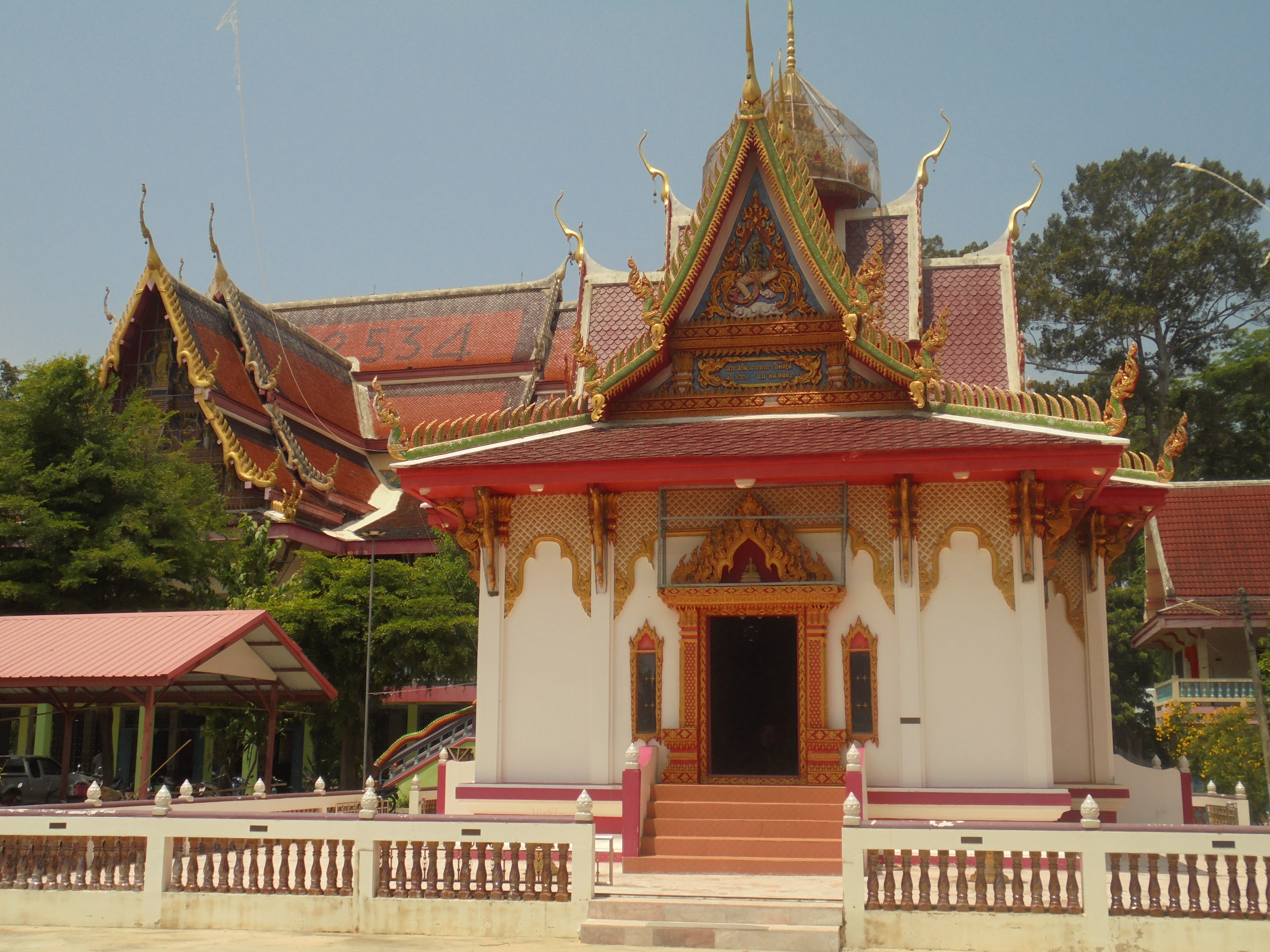
Phai Kho Don subdistrict is home to the following active temples, where Theravada Buddhism is practised by local residents:
| Temple name | Thai | Location | ||
|---|---|---|---|---|
| Wat Luang Pho Daeng | ||||
| Wat Suwan Pradit |
Economy
The economy of Phai Kho Don subdistrict is mainly dependent on agriculture (farming). Secondary occupations are in commerce, civil service and state-owned enterprises.
Education
The following schools are located in Phai Kho Don subdistrict.
- Community school 11 Wat Suwan Pradit - Moo4
- Ban Phai Kho Don child development center
Healthcare
There is Phai Kho Don health-promoting hospital in Moo4.
Transport
- Highway 12, Phitsanulok-Sukhothai route.
Electricity
All households in Phai Kho Don subdistrict have access to the electricity grid of Provincial Electricity Authority (PEA).
Waterworks
Provincial Waterworks Authority (PWA) supplied tap water to all households of Phai Kho Don subdistrict.
Communications
All households in Phai Kho Don subdistrict have access to the fixed and mobile telephone network.
References
References
- "Official statistics registration systems". Department of Provincial Administration.
- "อาณาเบตติดต่อ".
- "ประวัติความเป็นมาตำบล".
- "เขตการปกครอง".
- "list of temples".
- "อาชีพในตำบล".
- "การศึกษาในตำบล".
- "การสาธารณสุขในตำบล".
- "ไฟฟ้าในตำบล".
- "ประปาในตำบล".
- "การสื่อสารในตำบล".
This article was imported from Wikipedia and is available under the Creative Commons Attribution-ShareAlike 4.0 License. Content has been adapted to SurfDoc format. Original contributors can be found on the article history page.
Ask Mako anything about Phai Kho Don — get instant answers, deeper analysis, and related topics.
Research with MakoFree with your Surf account
Create a free account to save articles, ask Mako questions, and organize your research.
Sign up freeThis content may have been generated or modified by AI. CloudSurf Software LLC is not responsible for the accuracy, completeness, or reliability of AI-generated content. Always verify important information from primary sources.
Report