From Surf Wiki (app.surf) — the open knowledge base
Pensacola metropolitan area
| Field | Value | |||||||
|---|---|---|---|---|---|---|---|---|
| name | Pensacola metropolitan area | |||||||
| official_name | Pensacola–Ferry Pass–Brent, FL | |||||||
| Metropolitan Statistical Area | ||||||||
| settlement_type | Metropolitan Statistical Area | |||||||
| image_skyline | Grumman YF-14A Tomcat 157984 Museum (NMNA).JPG | |||||||
| imagesize | 280px | |||||||
| image_caption | F-14A Tomcat in front of the | |||||||
| National Naval Aviation Museum | ||||||||
| image_map | {{maplink | frame=yes | plain=yes | frame-align=center | frame-width=290 | frame-height=290 | zoom=9 | frame-coord= |
| type1 | shape | id1=Q156643 | title1=Escambia County | stroke-color1=#FBBF00 | stroke-width1=0.5 | fill1=#FFFE00 | fill-opacity1=0.4 | |
| type2 | shape | id2=Q494500 | title2=Santa Rosa County | stroke-color2=#FBBF00 | stroke-width2=0.5 | fill2=#FFFE00 | fill-opacity2=0.4 | |
| type3 | shape | id3=Q494476 | title3=Okaloosa County | stroke-color3=#FF9200 | stroke-width3=0.5 | fill3=#FF9200 | fill-opacity3=0.4 | |
| type4 | shape | id4=Q503455 | title4=Walton County | stroke-color4=#FF9200 | stroke-width4=0.5 | fill4=#FF9200 | fill-opacity4=0.4 | |
| type5 | shape | id5=Q488865 | title5=Bay County | stroke-color5=#FF0000 | stroke-width5=0.5 | fill5=#FF0000 | fill-opacity5=0.4 | |
| type6 | shape | id6=Q263418 | title6=Washington County | stroke-color6=#FF0000 | stroke-width6=0.5 | fill6=#FF0000 | fill-opacity6=0.4 | |
| type7 | shape | id7=Q486306 | title7=City of Pensacola | stroke-color7=#0003FF | stroke-width7=0.5 | fill7=#0003FF | fill-opacity7=0.5 | |
| type8 | shape | id8=Q1408146 | title8=Ferry Pass CDP | stroke-color8=#169000 | stroke-width8=0.5 | fill8=#169000 | fill-opacity8=0.5 | |
| type9 | shape | id9=Q909661 | title9=Brent CDP | stroke-color9=#560000 | stroke-width9=0.5 | fill9=#560000 | fill-opacity9=0.5 | |
| map_caption | Interactive Map of Florida Panhandle | |||||||
| with inset of Pensacola MSA | ||||||||
| subdivision_type | Country | |||||||
| subdivision_name | United States | |||||||
| subdivision_type1 | State(s) | |||||||
| subdivision_name1 | Florida | |||||||
| subdivision_type2 | Largest city | |||||||
| subdivision_name2 | Pensacola | |||||||
| subdivision_type3 | Other cities | |||||||
| subdivision_name3 | Navarre | |||||||
| Gulf Breeze | ||||||||
| Milton | ||||||||
| Jay | ||||||||
| Pace | ||||||||
| Ensley | ||||||||
| Warrington | ||||||||
| Brent | ||||||||
| Ferry Pass | ||||||||
| McDavid | ||||||||
| Pensacola Beach | ||||||||
| Cantonment | ||||||||
| Perdido Key | ||||||||
| Myrtle Grove | ||||||||
| Walnut Hill | ||||||||
| West Pensacola | ||||||||
| Molino | ||||||||
| Innerarity Point | ||||||||
| Goulding | ||||||||
| Gonzalez | ||||||||
| Barrineau Park | ||||||||
| unit_pref | US | |||||||
| area_total_sq_mi | 2049 | |||||||
| elevation_max_ft | Jay Florida 290 | |||||||
| elevation_max_m | 88.39 | |||||||
| population_as_of | 2020 census | |||||||
| population_total | 511,503 | |||||||
| population_density_sq_mi | 219.12 | |||||||
| population_density_km2 | 230.99 | |||||||
| population_rank | 110 in the U.S. | |||||||
| demographics_type2 | GDP | |||||||
| demographics2_footnotes | ||||||||
| demographics2_title1 | Total | |||||||
| demographics2_info1 | $27.080 billion (2022) | |||||||
| timezone | CST | |||||||
| utc_offset | -6 | |||||||
| timezone_DST | CDT | |||||||
| utc_offset_DST | -5 | |||||||
| website |
Metropolitan Statistical Area National Naval Aviation Museum with inset of Pensacola MSA Gulf Breeze Milton Jay Pace Ensley Warrington Brent Ferry Pass McDavid Pensacola Beach Cantonment Perdido Key Myrtle Grove Walnut Hill West Pensacola Molino Innerarity Point Goulding Gonzalez Barrineau Park
The Pensacola metropolitan area is the metropolitan area centered on Pensacola, Florida. It is also known as the Pensacola–Ferry Pass–Brent Metropolitan Statistical Area, a metropolitan statistical area (MSA) used for statistical purposes by the United States Census Bureau and other agencies. The Pensacola Standard Metropolitan Statistical Area was first defined in 1958, with Pensacola as the principal city, and included Escambia and Santa Rosa counties. The MSA was renamed Pensacola–Ferry Pass–Brent MSA in 2003, with the unincorporated census-designated places Ferry Pass and Brent added as principal cities. The population of the MSA in the 2020 census was 511,502.
The five incorporated cities within the MSA are Pensacola (Population: 54,312), Milton (10,197), Gulf Breeze (6,302), Century (1,713), and Jay (524). In addition, several unincorporated census-designated places account for a great number of the population. Most notable is Navarre (43,540); its population makes it the second largest community in the metro area, only behind Pensacola.
Demographics
| Year | Escambia County, FL | Santa Rosa County, FL | Total |
|---|---|---|---|
| 2000 Census | 294,410 | 117,743 | 412,153 |
| 2010 Census | 297,619 | 151,372 | 448,991 |
| 2020 Census | 321,905 | 188,000 | 509,905 |
As of the census of 2020, there were 509,905 people residing within the MSA. The racial makeup of the MSA was 70.2% White, 15.7% African American, 0.7% Native American, 2.7% Asian, 0.2% Pacific Islander, 2.2% from other races, and 8.3% from two or more races. Hispanic or Latino of any race were 6.4% of the population.
Economy
Personal income
The median income for a household in the MSA was $38,558, and the median income for a family was $44,319. Males had a median income of $32,966 versus $22,164 for females. The per capita income for the MSA was $19,365.
Tourism
Tourism in the Pensacola Bay area brings in about $552 million annually. Palafox Place contains multiple venues for nightlife.
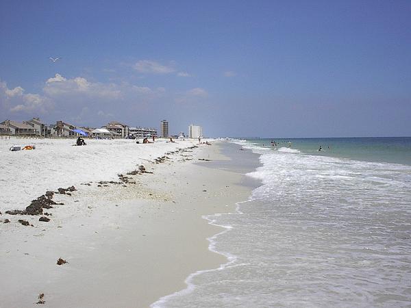
Beaches
- Pensacola Beach
- Navarre Beach
- Perdido Key
Retail
- Cordova Mall
- University Town Plaza
Transportation
Commercial airports
| Airport | IATA code | ICAO code | County |
|---|---|---|---|
| Pensacola International Airport | PNS | KPNS | Escambia |
Interstate Highways

- [[Image:I-10.svg|20px]] Interstate 10 in Florida
- [[Image:I-110.svg|20px]] Reuben O'Donovan Askew Parkway (Interstate 110)
U.S. Highways
- [[Image:US 29.svg|20px]] U.S. Highway 29
- [[Image:US 90.svg|20px]] U.S. Highway 90
- U.S. Highway 90 Alternate
- [[Image:US 98.svg|20px]] U.S. Highway 98
- U.S. 98 BUS
State Highways
- [[Image:Florida 4.svg|20px]] State Road 4
- [[Image:Florida 87.svg|20px]] State Road 87
- [[Image:Florida 97.svg|20px]] State Road 97
- [[Image:Florida 196.svg|20px]] State Road 196
- [[Image:Florida 281.svg|20px]] [[Image:Toll Florida 281.svg|20px]] State Road 281
- [[Image:Florida 289.svg|20px]] State Road 289
- [[Image:Florida 727.svg|20px]] State Road 727
- [[Image:Florida 290.svg|20px]] State Road 290
- [[Image:Florida 291.svg|20px]] State Road 291
- [[Image:Florida 292.svg|20px]] State Road 292
- [[Image:Florida 294.svg|20px]] State Road 294
- [[Image:Florida 295.svg|20px]] State Road 295
- [[Image:Florida 296.svg|20px]] State Road 296
- [[Image:Florida 297.svg|20px]] State Road 297
- [[Image:Florida 298.svg|20px]] State Road 298
- [[Image:Florida 399.svg|20px]] State Road 399
Codes of metropolitan Pensacola
Area codes
Main article: List of Florida area codes
- 850, 448
ZIP codes
The following is a list of ZIP codes for selected areas within the metropolitan area.
Escambia County
- 32501 in Pensacola, downtown north of Wright Street
- 32502 in Pensacola, downtown south of Wright Street
- 32503 in Pensacola, east of Palafox Street
- 32504 in Pensacola, northeast Pensacola
- 32505 in Pensacola, inner western suburbs
- 32506 in Pensacola, western suburbs
- 32507 in Pensacola, Warrington and Perdido Key
- 32508 in Pensacola, Naval Air Station Pensacola
- 32509 in Pensacola, NOLF Saufley Field
- 32511 in Pensacola, Corry Station Naval Technical Training Center
- 32512 in Pensacola, Naval Hospital Pensacola
- 32513 in Pensacola
- 32514 in Pensacola, northern suburbs including Ferry Pass
- 32516 in Pensacola
- 32520 in Pensacola, used by Gulf Power
- 32521 in Pensacola, used by the City of Pensacola
- 32522 in Pensacola
- 32523 in Pensacola
- 32524 in Pensacola
- 32526 in Pensacola, northwestern suburbs including Bellview and Beulah
- 32533 in Cantonment
- 32534 in Ensley
- 32559 in Pensacola
- 32560 in Gonzalez
- 32568 in McDavid, Walnut Hill
- 32577 in Molino
- 32591 in Pensacola
Santa Rosa County
- 32530 in Bagdad
- 32561 in Gulf Breeze
- 32562 in Gulf Breeze
- 32563 in Gulf Breeze
- 32564 in Holt, serves parts of Santa Rosa and Okaloosa counties
- 32565 in Jay
- 32566 in Navarre
- 32570 in Milton
- 32571 in Pace
- 32572 in Milton
- 32583 in Milton
Culture
Pensacola shares some aspects of European colonial culture seen in other Gulf cities like New Orleans; Galveston, TX; Biloxi, MS; and Mobile, AL. Initially settled by the Spanish, Pensacola celebrates this history with the annual Festival of the Five Flags. Pensacola also celebrates Mardi Gras each year, though, the city's festivities focus on the weekend before Mardi Gras.
Pensacola has a vibrant food culture that blends Southern cuisine with the bountiful seafood offerings of its coastal geographic setting. Among its popular dishes are fried mullet, shrimp and grits, fried grouper sandwiches, and grilled red snapper. Pensacola is world renowned for its seafood markets, none better know than Joe Patti's Seafood, the largest seafood market in America. Pensacola's proximity to fertile agricultural lands allows for seasonal harvests of peanuts, butter beans, silver corn, tomatoes, strawberries, and blue berries.
.JPG)
Performing arts
- Pensacola Symphony Orchestra
- Pensacola Saenger Theatre
- Pensacola Opera
- Pensacola Little Theatre
- Choral Society of Pensacola
- Ballet Pensacola
- Pensacola Children's Chorus
Museums
- National Museum of Naval Aviation
- Parts of the Gulf Islands National Seashore:
- Fort Barrancas
- Fort Pickens
- Pensacola Museum of Art
- Historic Pensacola's Museum of Industry
- Historic Pensacola's Museum of Commerce
- Pensacola MESS Hall
- Milton Historical Society
Sports

- Pensacola Blue Wahoos, Double-A baseball
- Pensacola Ice Flyers, ice hockey
- Pensacola FC, Soccer
- West Florida Argos, various sports
References
References
- "Total Gross Domestic Product for Pensacola-Ferry Pass-Brent, FL (MSA)". [[Federal Reserve Bank of St. Louis]].
- (March 2020). "Metro Area History 1950–2020".
- (May 5, 2021). "Resident Population in Pensacola-Ferry Pass-Brent, FL (MSA)".
- Siler, Wes. (October 2022). "Navarre Incorporation Feasibility Study (October 2022 Update)".
- "ACS Demographic and Housing Estimates (DP05 - 2019 5-Year Estimates Data Profiles): Navarre CDP, Florida". U.S. Census Bureau.
- "Navarre Beach 2020 Census". U.S. Census Bureau.
- "U.S. Census website". [[United States Census Bureau]].
- Fahrenthold, David A.. (2 May 2010). "Obama to survey environmental damage in gulf". Washington Pose.
This article was imported from Wikipedia and is available under the Creative Commons Attribution-ShareAlike 4.0 License. Content has been adapted to SurfDoc format. Original contributors can be found on the article history page.
Ask Mako anything about Pensacola metropolitan area — get instant answers, deeper analysis, and related topics.
Research with MakoFree with your Surf account
Create a free account to save articles, ask Mako questions, and organize your research.
Sign up freeThis content may have been generated or modified by AI. CloudSurf Software LLC is not responsible for the accuracy, completeness, or reliability of AI-generated content. Always verify important information from primary sources.
Report