From Surf Wiki (app.surf) — the open knowledge base
Peace River
River in Canada

River in Canada
| Field | Value | |||||||
|---|---|---|---|---|---|---|---|---|
| name | Peace River | |||||||
| native_name | {{plainlist | 1= | ||||||
| * <ref>{{cite web | last1 | David W. | first1=Leonard | title=Peace River | url=https://www.thecanadianencyclopedia.ca/en/article/peace-river | website=The Canadian Encyclopedia | publisher=Historica Canada | access-date=4 December 2021}} |
| name_etymology | Peace Point, Alberta, where a treaty marking the river as the boundary between Beaver and Cree was signed in 1781 | |||||||
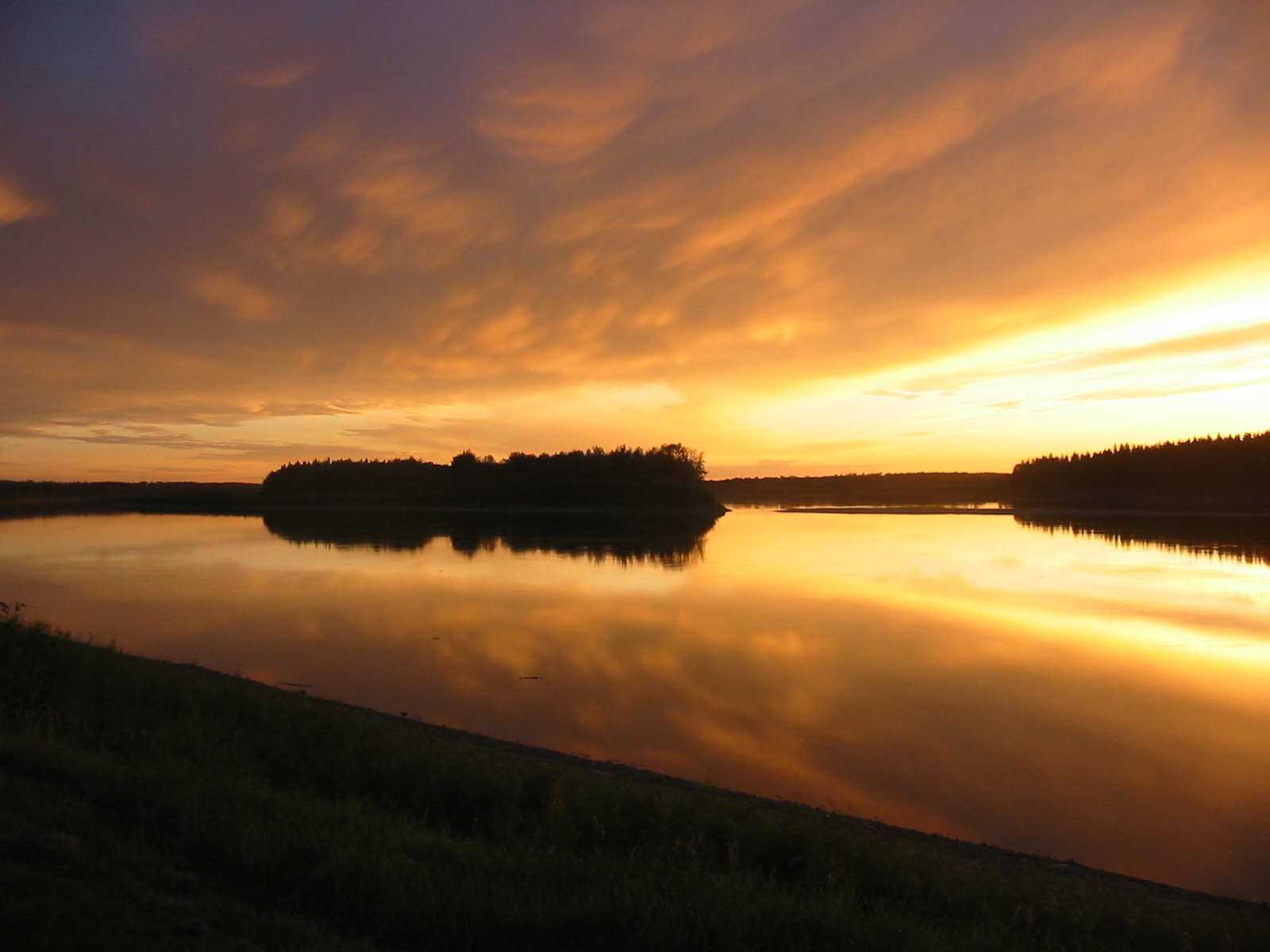
| image | Peace River Valley Site C Flooding Area.jpg | |||||||
| image_size | 300 | |||||||
| image_caption | Peace River Valley in BC | |||||||
| map | Peace_River_Watershed.png | |||||||
| map_size | 300 | |||||||
| map_caption | Map of the Peace River watershed in western Canada | |||||||
| pushpin_map_size | 300 | |||||||
| subdivision_type1 | Country | |||||||
| subdivision_name1 | Canada | |||||||
| subdivision_type3 | Province | |||||||
| subdivision_name3 | British Columbia, Alberta | |||||||
| subdivision_type5 | Cities | |||||||
| subdivision_name5 | Fort Saint John, British Columbia, Peace River, Alberta | |||||||
| length | 1923 km | |||||||
| discharge1_location | Peace Point, Alberta | |||||||
| discharge1_min | 344 m3/s | |||||||
| discharge1_avg | 2110 m3/s | |||||||
| discharge1_max | 9790 m3/s | |||||||
| source1 | Finlay River | |||||||
| source1_location | Thutade Lake, British Columbia | |||||||
| source1_coordinates | ||||||||
| source1_elevation | 1140 m | |||||||
| source2 | Parsnip River | |||||||
| source2_location | Near Mount Barton, British Columbia | |||||||
| source2_coordinates | ||||||||
| source2_elevation | 1716 m | |||||||
| source_confluence | Williston Lake | |||||||
| source_confluence_coordinates | ||||||||
| source_confluence_elevation | 748 m(Elevation of Williston Lake) | |||||||
| mouth | Slave River | |||||||
| mouth_location | Confluence of Peace with Athabasca River, Alberta | |||||||
| mouth_coordinates | ||||||||
| river_system | Mackenzie River watershed | |||||||
| basin_size | 306000 km2 | |||||||
| tributaries_left | Finlay River, Halfway River, Beatton River, Clear River (Alberta), Ponton River | |||||||
| tributaries_right | Parsnip River, Pine River, Kiskatinaw River, Pouce Coupé River, Smoky River, Wabasca River, Mikkwa River |
- bea
- fr The Peace River () is a 1923 km river in Canada that originates in the Rocky Mountains of northern British Columbia and flows to the northeast through northern Alberta. The Peace River joins the Athabasca River in the Peace-Athabasca Delta to form the Slave River, a tributary of the Mackenzie River. The Finlay River, the main headwater of the Peace River, is regarded as the ultimate source of the Mackenzie River. The combined Finlay–Peace–Slave–Mackenzie river system is the 13th longest river system in the world.
History
The regions along the river are the traditional home of the Dane-zaa people, called the Beaver by the Europeans. The fur trader Peter Pond is believed to have visited the river in 1785. In 1788 Charles Boyer of the North West Company established a fur trading post at the river's junction with the Boyer River.
In 1792 and 1793, the explorer Alexander Mackenzie travelled up the river to the Continental Divide. Mackenzie referred to the river as Unjegah, from the Dane-zaa meaning "large river."
The decades of hostilities between the Dane-zaa and the Cree, (in which the Cree dominated the Dane-zaa), ended in 1781 when a smallpox epidemic decimated the Cree. The Treaty of the Peace was celebrated by the smoking of a ceremonial pipe. The treaty made the Peace River a border, with the Dane-zaa to the North and the Cree to the South.
In 1794, a fur trading post was built on the Peace River at Fort St. John; it was the first European settlement established on the British Columbia mainland.
Post-settlement
Main article: Peace River Country
The rich soils of the Peace River valley in Alberta have been producing wheat crops since the late 19th century. In the early 21st century, the BC Grain Producers Association was researching the productivity of wheat and other grain crops near Dawson Creek. The Peace River region is also an important centre of oil and natural gas production. There are also pulp and paper plants along the river in Alberta and British Columbia.
The Peace River has two navigable sections, separated by the Vermilion Chutes, near Fort Vermilion.{{cite news |archive-date = 2013-09-21 |archive-url = https://web.archive.org/web/20130921054140/http://www.bchistory.ca/awards/article/Affleck.pdf |url-status = dead |access-date = 2012-12-06 The first steam-powered vessel to navigate the Peace River was the Grahame, a Hudson's Bay Company vessel built at Fort Chipewyan, on Lake Athabasca. Brothers of the Oblate Order of Mary Immaculate built the St. Charles to navigate the upper reaches of the River, from Fort Vermilion to Hudson's Hope. Approximately a dozen vessels were to navigate the river. Most of the early vessels were wood-burning steamships, fuelled by wood cut from the river's shore. The last cargo vessel was the Watson's Lake, retired in 1952.
Hydroelectric development
Hydroelectric development began on the Peace River in 1968 and continues to be an important source of renewable energy for British Columbia's main electricity provider, BC Hydro. The river’s first dam, the W. A. C. Bennett Dam, was completed in 1968 and is British Columbia's largest dam and the third-largest hydroelectric facility in Canada. It supplies over 30% of British Columbia's total power demand. Engineers took advantage of the W. A. C. Bennet Dam's large reservoir storage to further develop the river with the Peace Canyon Dam opened in 1980. The Site C dam is under construction and scheduled to be finished in 2025; it will further benefit from the upstream dams and generate additional electrical capacity to meet British Columbia's growing demand for green energy and reduce the carbon footprint of residents. both the Alberta government and private producers were studying the possibility of hydroelectric development on the Alberta stretch of the river with one run-of-the-river project currently being proposed.
| Name | Height | Capacity | Province | Year completed | Owner | Reservoir name |
|---|---|---|---|---|---|---|
| W. A. C. Bennett Dam | 186 m | 2730 | B.C. | 1968 | BC Hydro | Williston Lake |
| Peace Canyon Dam | 50 m | 694 | B.C. | 1980 | BC Hydro | Dinosaur Lake |
| Site C Dam | 60 m | 1100 | B.C. | 2025 planned | BC Hydro | TBD |
| Amisk Dam | 24 m | 370 | Alberta | late 2020s | Concord Green Energy | TBD |
Geography
Course
This river is 1923 km long (from the head of Finlay River to Lake Athabasca). It drains an area of approximately 302500 km2. At Peace Point, where it drains in the Slave River, it has an annual discharge of 68.2 e9m3.
A large man-made lake, Williston Lake, has been formed on the upper reaches by the construction of the W. A. C. Bennett Dam for hydroelectric power generation. Prior to its flooding, the confluence of the Finlay and Parsnip Rivers at Finlay Forks was distinct. A half mile east of that location were the half-mile long Finlay Rapids and a further seven miles east is the Peace Pass, which separates the Muskwa Ranges and the Hart Ranges of the Canadian Rockies.
The only river cutting completely through the Rockies, it nowadays flows into Dinosaur Lake, a reservoir for the Peace Canyon Dam. After the dams, the river flows east into Alberta and then continues north and east into the Peace-Athabasca Delta in Wood Buffalo National Park, at the western end of Lake Athabasca. Water from the delta flows into the Slave River east of Peace Point and reaches the Arctic Ocean via the Great Slave Lake and Mackenzie River.
Communities
Communities located directly on the river include:
- Hudson's Hope, British Columbia
- Taylor, British Columbia
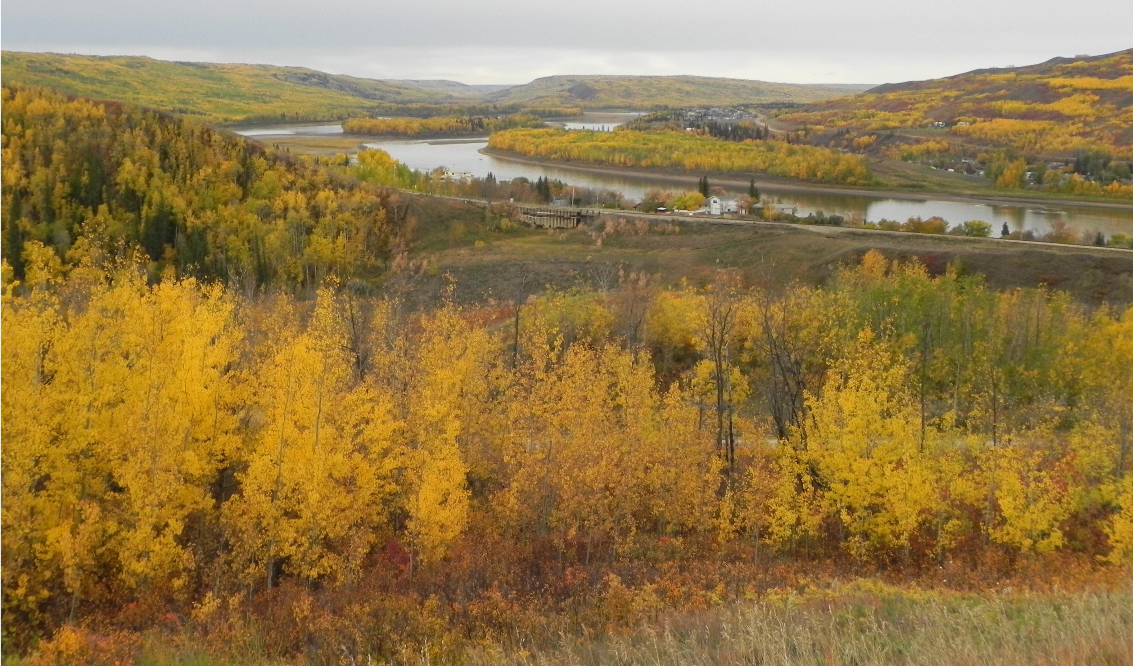
- Peace River, Alberta
- Fort Vermilion, Alberta
Many provincial parks and wildland reserves are established on the river, such as Butler Ridge Provincial Park, Taylor Landing Provincial Park, Beatton River Provincial Park, Peace River Corridor Provincial Park in British Columbia and Dunvegan Provincial Park, Dunvegan West Wildland Provincial Park, Peace River Wildland Provincial Park, Greene Valley Provincial Park, Notikewin Provincial Park, Wood Buffalo National Park in Alberta.
A few Indian reserves are also on the river banks, among them Beaver Ranch 163, John D'Or Prairie 215, Fox Lake 162, Peace Point 222 and Devil's Gate 220.
Tributaries
Tributaries of the Peace River include: ;Williston Lake
- Finlay River
- Omineca River
- Ingenika River
- Ospika River
- Parsnip River
- Manson River
- Nation River
- Clearwater Creek
- Nabesche River
- Carbon Creek
;Northeastern British Columbia
- Gething Creek, Moosbar Creek, Johnson Creek, Starfish Creek, Bullrun Creek, Portage Creek, Maurice Creek, Lynx Creek, Farrell Creek
- Halfway River
- Cache Creek, Wilder Creek, Tea Creek
- Moberly River
- Pine River
- Eight Mile Creek
- Beatton River
- Doig River
- Blueberry River
- Golata Creek, Mica Creek
- Kiskatinaw River
- Alces River
;Alberta
- Moonlight Creek
- Pouce Coupe River
- Clear River
- Sneddon Creek
- Montagneuse River
- Fourth Creek, Hamelin Creek
- Ksituan River
- Hines Creek, Dunvegan Creek, Boucher Creek
- Leith River (Little Burnt River)
- Saddle River (Burnt River)
- Griffin Creek, Mcallister Creek, Strong Creek
- Smoky River
- Heart River
- Pat's Creek, Three Creeks, Carmon Creek
- Whitemud River
- Cadotte River
- Buchanan Creek, Keppler Creek
- Notikewin River
- Scully Creek
- Wolverine River
- Buffalo River
- Keg River
- Steephill Creek
- Boyer River
- Caribou River
- Beaver Ranch Creek
- Wabasca River
- Lawrence River
- Mikkwa River (Little Red River)
- Dummy Creek, Waldo Creek
- Pakwanutik River
- Garden Creek, Drolet Creek, Swan River, Vermilion River, Trident Creek, Portage River
- Jackfish River
- Jodoin Creek
- Claire River
;Lake Claire
- Lake Claire
- Birch River
- McIvor River
- Mamawi Lake
- Baril River
- Chenal Des Quatre Fourches
- Revolution Coupe
- Scow Channel
Footnotes
References
- http://pgnewspapers.pgpl.ca/fedora/repository
References
- "Peace River". Historica Canada.
- (1959–2000). "Peace River at Peace Point". R-ArcticNet.
- (1973-03-09). "Hydrology of Lake Athabasca: Past, Present and Future". International Association of Hydrological Science.
- [http://www.britannica.com/eb/article-9058854 "Peace River"], ''Encyclopædia Britannica'', 2006. Retrieved September 12, 2006, from Encyclopædia Britannica Premium Service
- link. (2016-03-03 Edmonton: Dawson Creek Historical Society.)
- "BC Peace Region 2018 Field Crop Variety Performance". BC Grain Producers Association.
- "Peace Region".
- "About the Site C project".
- (2020). "Home".
- Atlas of Canada. "Rivers in Canada".
- [http://www3.gov.ab.ca/env/water/basins/BasinForm.cfm Alberta Environment] {{webarchive. link. (2007-01-16 - Alberta river basins)
- Fort George Tribune, 20 Jun 1914
- Prince George Citizen, 26 Sep 1916
This article was imported from Wikipedia and is available under the Creative Commons Attribution-ShareAlike 4.0 License. Content has been adapted to SurfDoc format. Original contributors can be found on the article history page.
Ask Mako anything about Peace River — get instant answers, deeper analysis, and related topics.
Research with MakoFree with your Surf account
Create a free account to save articles, ask Mako questions, and organize your research.
Sign up freeThis content may have been generated or modified by AI. CloudSurf Software LLC is not responsible for the accuracy, completeness, or reliability of AI-generated content. Always verify important information from primary sources.
Report