From Surf Wiki (app.surf) — the open knowledge base
Pasacao
Municipality in Camarines Sur, Philippines
Municipality in Camarines Sur, Philippines
| Field | Value | |
|---|---|---|
| name | ||
| image_skyline | Pasacao Aerial.JPG | |
| image_caption | Aerial shot of Pasacao with its port and oil depot | |
| image_flag | Flag_of_Pasacao,_Camarines_Sur.png | |
| flag_size | 120x80px | |
| image_seal | Pasacao_Official_Sel.png | |
| seal_size | 100x80px | |
| image_map | ||
| map_caption | ||
| mapframe | yes | |
| pushpin_map | Philippines | |
| pushpin_label_position | left | |
| pushpin_map_caption | Location within the | |
| coordinates | ||
| settlement_type | ||
| subdivision_type | Country | |
| subdivision_name | Philippines | |
| subdivision_type1 | Region | |
| subdivision_name1 | ||
| subdivision_type2 | Province | |
| subdivision_name2 | ||
| official_name | ||
| nickname | Summer Capital of Camarines Sur | |
| motto | Matatag na Bayan ng Pasacao | |
| subdivision_type3 | District | |
| subdivision_name3 | 2nd district | |
| established_title | Founded | |
| established_date | 1872 | |
| parts_type | Barangays | |
| parts_style | para | |
| p1 | 19 (see Barangays) | |
| leader_title | Mayor | |
| leader_name | Niño A. Tayco | |
| leader_title1 | Vice Mayor | |
| leader_name1 | Jorge R. Bengua | |
| leader_title2 | Representative | |
| leader_name2 | Luigi Villafuerte | |
| leader_title3 | Municipal Council | |
| leader_name3 | {{PH Town Council | |
| 1 | ||
| 2 | Maryol Tayco | |
| 3 | Randy U. Latosa | |
| 4 | Melinda T. Sambajon | |
| 5 | Rose Bee Tolentino | |
| 6 | Carlo Bañas | |
| 7 | Khristian Obordo | |
| 8 | Mark Anthony Bas | |
| 9 | Junard De Alday | |
| leader_title4 | Electorate | |
| leader_name4 | voters (electorate_point_in_time}} | ) |
| government_type | ||
| government_footnotes | ||
| elevation_m | ||
| elevation_max_m | 756 | |
| elevation_min_m | 0 | |
| elevation_footnotes | ||
| area_footnotes | ||
| area_total_km2 | ||
| population_footnotes | ||
| population_total | ||
| population_as_of | ||
| population_density_km2 | auto | |
| population_blank1_title | Households | |
| population_blank1 | ||
| population_demonym | Pasaqueño | |
| timezone | PST | |
| utc_offset | +8 | |
| postal_code_type | ZIP code | |
| postal_code | ||
| postal2_code_type | ||
| postal2_code | ||
| area_code_type | ||
| area_code | ||
| website | pasacao.gov.ph | |
| demographics_type1 | Economy | |
| demographics1_title1 | ||
| demographics1_info1 | 3rd income class municipality | |
| demographics1_title2 | Poverty incidence | |
| demographics1_info2 | 41.62% (2015) | |
| demographics1_title3 | Revenue | |
| demographics1_info3 | ₱197,378,822.82 | |
| demographics1_title4 | Revenue rank | |
| demographics1_title5 | Assets | |
| demographics1_info5 | ||
| demographics1_title6 | Assets rank | |
| demographics1_title7 | IRA | |
| demographics1_title8 | IRA rank | |
| demographics1_title9 | Expenditure | |
| demographics1_info9 | ||
| demographics1_title10 | Liabilities | |
| demographics1_info10 | ||
| demographics_type2 | Service provider | |
| demographics2_title1 | Electricity | |
| demographics2_info1 | ||
| demographics2_title2 | Water | |
| demographics2_info2 | Pasacao Water District (PAWADI) | |
| demographics2_title3 | Telecommunications | |
| demographics2_info3 | General Telephone System Incorporated (GTSI) | |
| demographics2_title4 | Cable TV | |
| blank_name_sec1 | ||
| blank_info_sec1 | ||
| blank1_name_sec1 | Native languages | |
| blank1_info_sec1 | ||
| blank2_name_sec1 | Crime index | |
| blank1_name_sec2 | Major religions | |
| blank1_info_sec2 | Roman Catholicism | |
| blank2_name_sec2 | Feast date | |
| blank2_info_sec2 | August 30 | |
| blank3_name_sec2 | Catholic diocese | |
| blank3_info_sec2 | Diocese of Libmanan | |
| blank4_name_sec2 | Patron saint | |
| blank4_info_sec2 | Saint Rose of Lima | |
| elevation_min_ft | 0 | |
| elevation_min_point | Ragay Gulf | |
| elevation_max_point | Mount Bernacci |
Pasacao (), officially the Municipality of Pasacao (; ), is a 1st class municipality in the province of Camarines Sur, Philippines. According to the , it has a population of people. The area is noted for its brown sand beaches and is sometimes referred to as the "Summer Capital of Camarines Sur.
During the Spanish colonization in the 16th century, a settlement surrounded a port in what is now Pasacao, serving as a primary embarkation point in Camarines Sur and the only sea link to Manila. This strategic location supported commerce and trade across the archipelago.
Colloquially, "Pasacao" refers to this former settlement, which is still recognized separately as the modern town center housing government and business hubs. The settlement was designated as a town in 1854 and expanded to incorporate neighboring barrios, leading to the establishment of a municipality during the American colonial period in the early 20th century.
Etymology
The town's name is derived from the Spanish-Tagalog portmanteau Pasa-Ikaw (English: Pass it on). This is because dock guards stationed at the Pasacao Port would regularly issue directions to passengers by shouting "Pasa ikaw, Pasa ikaw." Passengers mistook the phrase for the town's name, Pasacao.
History
Early European travelers noted that Pasacao, located at the present-day town center, was seen as separate from nearby barangays like Dalupaon and Tinalmud. This suggests that these areas were independent villages before being formally organized. The current municipality of Pasacao, which now includes all its barangays, was officially established during the American colonial period, while the individual barangays existed earlier as separate communities.
Spanish colonization
From 1585 to the 19th century, Pasacao served as a crucial defense port against Moro pirate incursions. The raid in Caranan on October 4, 1779, is an example. Pasacao and 9 other towns and two missions were entirely destroyed. In 1823, the town had an estimated population of only 200 people due to frequent attacks. To defend Pasacao against these raids, Alcalde Jacinto Rodriguez Morales contributed material for a balwark. The fortification of Pasacao in 1848, which included Cabusao in Camarines Sur, Pantao (now Libon), and Donsol in Sorsogon, was motivated by these attacks.
Between 1609 and 1616, during the governor generalship of Juan de Silva, two galleons, the Nuestra Senora de Guadalupe and Angel dela Guardia, were built in Barangay Dalupaon, as well as the Astillero de Dalupaon (English: Dalupaon Shipyard). Guadalupe was vital in the galleon commerce between Manila and Acapulco, as well as the defense of the Philippines against the Dutch at the Battle of Playa Honda.
In 1627, an attempt was made to establish a canal linking a river in Pasacao to the Bicol River, which would have connected the town to Nueva Caceres (now Naga). However, the project was abandoned due to concerns about the high costs involved. There was also uncertainty over whether the small boats that would utilize the canal would justify the expense, and fears arose that seawater intrusion might threaten the town's rice fields.
Japanese occupation
In World War II, the , based near Mount Bernacci, carried out significant operations against Japanese forces. Notably, after Japanese ships docked at Pasacao Pier, they were bombed as part of the guerrilla resistance, marking Pasacao’s involvement in the region’s wartime activities.
The Six Daughters of Charity arrived in Pasacao to establish Naga's first regular girls' school, Universidad de Santa Isabel.
Post-colonization
On July 20, 1966, a major fire devastated the commercial and residential center of Pasacao. The blaze, ignited by sparks from a chimney, swept through approximately 13 blocks, resulting in damage estimated at PHP 3 to 4 million. The fire left about 700 families, or 3,000 individuals, homeless. Key structures, including the mayor's residence and a rural bank were destroyed.
Local firefighting efforts were hampered by inadequate equipment, and looting occurred amidst the chaos. In response, President Marcos allocated PHP 10,000 in initial aid, and Governor Armando B. Cledera provided PHP 10,000 worth of goods and materials. Various organizations, including the Philippine Red Cross and the Naga City Filipino-Chinese Chamber of Commerce, contributed food and supplies to support the affected residents.
Geography
Pasacao is located on the northwest coast of Camarines Sur. It shares its northwestern border with Libmanan, marked by Mount Bernacci, while San Fernando lies to the east and Pamplona to the north. The town center is nestled in a valley between the Ragay Hills, offering direct access to the Bicol Plains. Pasacao's 29.56 km coastline lies on the southern part of the municipality, facing the Ragay Gulf, which is part of the Sibuyan Sea. [[File:Pasacao 2.jpg|thumb|left|Daruanak Island|149x149px]]
It covers an area of approximately 149.54 km2. The municipality is characterized by flat lowlands in the north and east, consisting of silt, and mountainous regions in the west. The western area mainly features rolling hills that are part of the highlands surrounding the Ragay Gulf, with the terrain primarily consisting of limestones, sandstones, and marls. The town's topography is characterized by steep slopes, with elevations ranging from sea level to over 400 m above sea level. The highest point in the town is Mount Bernacci, which stands at 756 m above sea level.
Pasacao is characterized by several rivers, notably including the Caranan, Cagbunini, Itulan, Balogo, and Tinalmud Rivers. All these waterways flow into the Ragay Gulf. Among them, the Tinalmud River is the longest, extending approximately 10.5 km.
Pasacao's coastline extends approximately 22 km. Its brown sand beaches, are used for activities like swimming, snorkeling, and fishing. Balogo Beach, the most notable beach, is near Daruanak Island, the town's landmark and one of the major features of the official seal.
Biodiversity & resources
Pasacao is home to 73 species across 64 genera and 41 families, including 10 mammals, 53 birds, 4 reptiles, and 6 amphibians.[[File:Mount Tigbi viewed from Cuco.jpg|left|thumb|151x151px|Mount Tigbi]]Suminabang Cave, located in Caranan near Dalupaon, hosts insectivorous species such as the Caroline swiftlet (Aerodramus inquietus) and the Philippine forest roundleaf bat (Hipposideros obscurus). Another cave in Bahay, situated on the slopes of Mt. Tigbi, features a distinctive dog-head shaped entrance and is accessible after a one-hour hike. This cave is part of a limestone mountain range that forms the natural boundary between Bahay and Caranan.
Coastal Pasacao is abundant in marine species, including sea urchins, seaweeds, shellfish, and sea cucumbers. Indo-Pacific Bottlenose dolphins (Tursiops aduncus) and Spotted dolphins (Stenella attenuata) have been sighted in the town's coastal waters.
On August 9, 1993, a fish sanctuary and marine reserve were established under Municipal Ordinance No. 93-007, covering 32 hectares in Calibayan, Dalupan, and 112 hectares in Sarimao, Caranan. The reserve includes a site in Suminabang, Dalupaon, where a Japanese warship wreck can be seen underwater.
Barangays
Pasacao is politically subdivided into 19 barangays.
Poblacion
| Barangays | Population (2020) | Total | 100% | 53,461 |
|---|---|---|---|---|
| Antipolo | 1.78% | 953 | ||
| Bagong Silang | 1.03% | 550 | ||
| Bahay | 3.56% | 1,905 | ||
| Balogo | 10.82% | 5,785 | ||
| Caranan | 19.57% | 10,460 | ||
| Cuco | 3.75% | 2,004 | ||
| Dalupaon | 7.44% | 3,977 | ||
| Hubo | 1.46% | 780 | ||
| Itulan | 2.29% | 1,226 | ||
| Macad | 3.41% | 1,823 | ||
| Odicon | 5.69% | 3,043 | ||
| Quitang | 5.59% | 2,991 | ||
| Salvacion | 1.86% | 995 | ||
| San Antonio | 1.15% | 613 | ||
| San Cirilo | 9.97% | 5,53 | ||
| Santa Rosa Del Norte | 7.74% | 4,136 | ||
| Santa Rosa Del Sur | 6.60% | 3,527 | ||
| Tilnac | 1.73% | 927 | ||
| Tinalmud | 4.55% | 2,435 |
Climate
| Jan avg record high C = 28 | Feb avg record high C = 29 | Mar avg record high C = 30 | Apr avg record high C = 31 | May avg record high C = 32 | Jun avg record high C = 32 | Jul avg record high C = 30 | Aug avg record high C = 31 | Sep avg record high C = 31 | Oct avg record high C = 30 | Nov avg record high C = 29 | Dec avg record high C = 29 | Jan avg record low C = 24 | Feb avg record low C = 23 | Mar avg record low C = 24 | Apr avg record low C = 24 | May avg record low C = 26 | Jun avg record low C = 26 | Jul avg record low C = 26 | Aug avg record low C = 26 | Sep avg record low C = 25 | Oct avg record low C = 25 | Nov avg record low C = 25 | Dec avg record low C = 25 According to the Köppen climate classification system, Pasacao has a tropical rainforest climate. The north-east monsoon dominates the area; therefore, rainfall is evenly spread throughout the year. From October to January, the wind blows from north to east, from east to southeast from February to April, and from May to September, it blows from east to southeast. From December to May, the area is rather dry, and the rest of the year is wet. The town is occasionally affected by typhoons during the wet season, which can cause flooding and landslides in some areas.
Based on PAGASA’s Climate Projections, the temperature in Pasacao is estimated to rise ranging from 0.9 °C to 1.1 °C in year 2020, and will continue to rise in 2050 ranging from 1.8 °C to 2.2 °C. This will affect vital ecosystems such as forest, agriculture, and coastal and marine. The agricultural sector may experience loss as studies reveal that 1 °C increase in temperature causes 10% decrease in rice yield.
Demographics
In the 2024 census, the population of Pasacao was 50,708 people, with a density of {{sigfig|50708/149.54|2}} PD/km2.
Language
The primary language spoken in Pasacao is Bikol, specifically the Central Bikol dialect. However, many residents also speak Tagalog and English, which are the official languages of the Philippines.
Religion
Despite the presence of a single church, Saint Rose of Lima Parish, and a few chapels, Roman Catholicism is the dominant religion in the municipality. The Church of Jesus Christ of Latter-day Saints, Iglesia ni Kristo, Born Again denominations, Jehovah's Witnesses, and other Christian denominations are also present across the municipality.
Economy
Pasacao’s economy is primarily driven by agriculture, which occupies approximately 59.6% of the municipality’s total land. Key activities include crop cultivation, livestock and poultry raising, and fishing, which provide the main sources of livelihood for residents. Trade and commerce are concentrated around the Public Market, the town’s main commercial hub, which attracts both local residents and visitors from neighboring areas. Its proximity to Pasacao Port further facilitates the movement of goods and contributes to local revenues.
Forestry is another important component of the local economy, with around 383 hectares of land dedicated to forest production. Industrial activity remains limited, with establishments operating across sectors such as construction, utilities, and mining. Most of these are concentrated in Barangay Santa Rosa del Sur, followed by Santa Rosa del Norte, San Cirilo, and Caranan.
Despite possessing natural and cultural resources, the municipality’s tourism sector is relatively underdeveloped. The industry primarily serves short-term or passing visitors, reflecting the limited development of tourism sites and supporting facilities.
The town was formerly included in the Metro Naga area before the designation was discontinued in 2017.
Culture
Pasacao holds its annual fiesta and Pasa-Pasa Ikaw Festival on August 29–30 in honor of Saint Rose of Lima, the town's patron saint. The municipal government organizes various events, including pageant competitions, civic parades, and other activities. These festivals are key to Pasacao's cultural calendar, showcasing the town's heritage and offering opportunities for local celebration. Additionally, the Daruanak Summer Festival takes place during the summer season.
Infrastructure
Pasacao is served by 21 healthcare facilities, including 19 barangay health, two clinics and the Municipal Health Office in Barangay Santa Rosa del Norte.
Solid waste management in the municipality is handled through three Materials Recovery Facilities located in Caranan, San Cirilo, and Santa Rosa del Sur, which support recycling and materials recovery.
Commercial and civic center
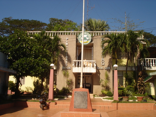
The Public Market in Barangay Santa Rosa del Sur serves as the main hub for trade, facilitating the sale of agricultural, fishery, and general goods for residents. Signature Park in Barangay Santa Rosa del Norte functions as a civic and recreational area, encompassing the Central Business District, an evacuation court, and an eco-park plaza. The park is also designated to host the municipal office, which is under construction.
Roadways
Pasacao is primarily accessible via the Danao-Pasacao Road,** **a 8.89 km (5.52 mi) road which extends from a junction with the Pan-Philippine Highway in Tambo, Pamplona, to various local road networks within the town's barangays. This road serves as the main route connecting Pasacao to surrounding areas and facilitates internal transportation. Complementing this, the 40.69 km (25.28 mi) Pasacao-Balatan Tourism Coastal Highway, developed under the Build, Build, Build program, links the municipality with neighboring towns including San Fernando, Minalabac, Bula, and Balatan, integrating 15 barangays along the route. These roadways are critical for regional connectivity, the movement of goods, and access to local services.
Ports

The nearby smaller Pasacao Fishport is primarily utilized for fishing and unloading fish, as well as pump boats and fastcrafts for short trips.
Education
The Pasacao Schools District Office governs all educational institutions within the municipality. It oversees the management and operations of all private and public, from primary to secondary schools.
The municipality has several educational institutions catering to different levels of education. For elementary education, the town has 16 public schools and 2 private schools. At the secondary level, there are 6 public high schools and 2 private high schools. Students can continue their studies in nearby cities like Naga and Legazpi.
A key institution in Pasacao is the Central Bicol State University of Agriculture (CBSUA) - Pasacao Campus, which offers undergraduate programs in education. The town also supports non-formal education through the Alternative Learning System (ALS) for out-of-school youth and adults, and technical and vocational training through the Camarines Sur Institute of Fisheries and Marine Sciences (CASIFMAS), which offers courses in various vocational fields.
Below is the list of the tertiary and secondary level existing schools on the municipality.
Primary and elementary schools
- Arborvitae Plains Montessori
- Bagong Silang Elementary School
- Bahay Elementary School
- Balagon Elementary School
- Balogo Baptist Christian School
- Balogo Elementary School
- Caranan Elementary School (North)
- Caranan Elementary School (South)
- Compra Elementary School
- Cuco Elementary School
- Dalupaoon Elementary School
- Hubo Elementary School
- Itulan Elementary School
- La Florianne Institute of Learning
- Lyceo de Pasacao
- Macad Elementary School
- Odicon Elementary School
- Pasacao Academy
- Pasacao Central School
- Quitang Elementary School
- Salvacion Elementary School
- San Antonio Elementary School
- Tilnac Elementary School
- Tinalmud Elementary School
Secondary schools
- Antipolo Heights Integrated School
- Arbovitae Plains Montessori
- Balogo Baptist Christian School (Junior High School)
- Dalupaon National High School
- Dr. Lorenzo P. Ziga Memorial High School
- Juan F. Triviño Memorial High School
- La Florianne Institute of Learning (Junior High School)
- Lyceo de Pasacao
- Pasacao Academy
- Pasacao Municipal High School
- Rolando R. Andaya Memorial High School
Higher educational institutions
- Camarines Sur Institute of Fisheries & Marine Sciences
- Camarines Sur Institute of Fisheries & Marine Sciences (Caranan Campus)
- Central Bicol State University for Agriculture
Notable people
- Tomas Karingal
Notes
References
References
- {{DILG detail
- "PSA releases the 2015 Municipal and City Level Poverty Estimates".
- Barrameda, Shiena M.. (2013-06-12). "Saving Pasacao as summer capital".
- Ibalon, Dateline. (2025-03-06). "The Port of Pasacao: A Historical, Trade and Transportation Hub".
- Abella, Domingo. (1954). "{{ill".
- "History of Pasacao {{!}} LGU Pasacao Official Website".
- Jr, Juan Escandor. (2012-06-20). "Camarines Sur village relives days of galleons".
- Best, Elsdon. (1892). "The Races of the Philippines". The Journal of the Polynesian Society.
- "133rd Parish Fiesta Celebration in honor of Saint Rose of Lima". Diocese of Libmanan.
- Abella, Domingo. (1954). "Bikol Annals: The see of Nueva Cáceres".
- (1911). "The Philippine Journal of Science". Bureau of Science.
- Milano, Ben H.. (July 28, 1966). "4M fire razes Pasacao". The Bicol Mail.
- Jagor, Fedor. "Travels in the Philippines". Filipina Book Guild.
- "Final Draft Pasacao CLUP Volume III".
- (1967-01-01). "The Philippine Island World: A Physical, Cultural, and Regional Geography". University of California Press.
- Gula, Louie P.. (2022-07-18). "Philippine Culture: Kultura ng Pilipinas". Amazon.
- "Barangays {{!}} LGU Pasacao Official Website".
- "Municipality of Pasacao {{!}} Philippine Statistics Authority {{!}} Republic of the Philippines".
- "Pasacao Climate Weather Averages".
- "Pasa-Pasa Ikaw Festival sa Pasacao, Camarines Sur –".
- pmbautista. (2023-08-15). "Four Amazing August Festivals You Can Drive to From Manila".
- (2021-10-15). "Pasacao Mayor cites economic gains".
- "Camarines Sur 2nd District Road Data".
- "Groundworks for Pasacao-Balatan Tourism Coastal Highway now underway".
- (January 15, 2021). "Masterlist of Schools".
This article was imported from Wikipedia and is available under the Creative Commons Attribution-ShareAlike 4.0 License. Content has been adapted to SurfDoc format. Original contributors can be found on the article history page.
Ask Mako anything about Pasacao — get instant answers, deeper analysis, and related topics.
Research with MakoFree with your Surf account
Create a free account to save articles, ask Mako questions, and organize your research.
Sign up freeThis content may have been generated or modified by AI. CloudSurf Software LLC is not responsible for the accuracy, completeness, or reliability of AI-generated content. Always verify important information from primary sources.
Report