From Surf Wiki (app.surf) — the open knowledge base
Palisades Interstate Parkway
Highway in New Jersey and New York
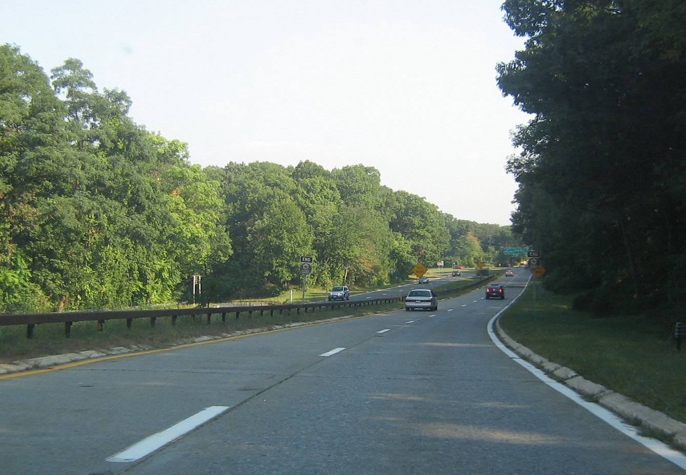
_from_the_pedestrian_overpass_just_south_of_Exit_3_in_Alpine,_Bergen_County,_New_Jersey.jpg)
Highway in New Jersey and New York
| Field | Value | ||||||||
|---|---|---|---|---|---|---|---|---|---|
| country | USA | ||||||||
| type | Pkwy | ||||||||
| route | Palisades Interstate | ||||||||
| maint | Palisades Interstate Park Commission | ||||||||
| map | |||||||||
| map_custom | yes | ||||||||
| map_notes | Map of the New York City metropolitan area with Palisades Interstate Parkway highlighted in red | ||||||||
| length_mi | 37.00 | ||||||||
| length_ref | |||||||||
| established | 1958 | ||||||||
| allocation | {{plainlist | ||||||||
| *{{Jct | state | NJ | NJ | 445 | nolink=yes | noshield1=yes}} (unsigned) in New Jersey | |||
| *{{Jct | state | NY | NY | 987C | nolink=yes | noshield1=yes}} (unsigned) in New York | |||
| *{{Jct | state | NY | US | 6}} from Harriman State Park to Bear Mountain State Park | |||||
| restrictions | No commercial vehicles | ||||||||
| tourist | [[File:MUTCD M10-1.svg | 20px]] Palisades Scenic Byway | |||||||
| direction_a | South | ||||||||
| terminus_a | in Fort Lee, NJ | ||||||||
| junction | {{plainlist | ||||||||
| *{{jct | state | NJ | US | 9W | NJ | 67}} in Fort Lee, NJ | |||
| *{{jct | state | NY | NY | 303}} in Tappan, NY | |||||
| *{{jct | state | NY | CR | 20 | county1=Rockland}} in Orangeburg, NY | ||||
| *{{jct | state | NY | NY | 59}} in West Nyack, NY | |||||
| *{{jct | state | NY | I | 87 | I | 287 | NYST}} in West Nyack, NY | ||
| *{{jct | state | NY | US | 202 | NY | 45 | CR | 47 | county3=Rockland}} in Mount Ivy, NY |
| *{{jct | state | NY | US | 6 | Parkway | Seven Lakes}} in Harriman State Park | |||
| direction_b | North | ||||||||
| terminus_b | in Bear Mountain State Park | ||||||||
| states | New Jersey, New York | ||||||||
| counties | NJ: Bergen | ||||||||
| NY: Rockland, Orange | |||||||||
| system1 | |||||||||
| system2 | |||||||||
| browse |
- (unsigned) in New Jersey
- (unsigned) in New York
- from Harriman State Park to Bear Mountain State Park
- in Fort Lee, NJ
- in Tappan, NY
- in Orangeburg, NY
- in West Nyack, NY
- in West Nyack, NY
- in Mount Ivy, NY
- in Harriman State Park NY: Rockland, Orange The Palisades Interstate Parkway (PIP) is a 38.25 mi controlled-access parkway in the U.S. states of New Jersey and New York. The parkway is a major commuter route into New York City from Rockland and Orange counties in New York and Bergen County in New Jersey. The southern terminus of the route is at the George Washington Bridge in Fort Lee, New Jersey, where it connects to Interstate 95 (I-95), US 1-9, and US 46. Its northern terminus is at a traffic circle in Fort Montgomery, New York, where the PIP meets US 9W and US 202 at the Bear Mountain Bridge. At exit 18, the PIP forms a concurrency with US 6 for the remaining duration of its run.
The route is named for the Hudson River Palisades, a line of cliffs rising along the western side of the Hudson River. The PIP is designated, but not signed as Route 445 in New Jersey and New York State Route 987C (NY 987C), an unsigned reference route, in New York. As with most parkways in the New York metropolitan area, commercial traffic is prohibited from using the PIP. The Palisades Interstate Parkway was built from 1947 to 1958, and fully opened to traffic on August 28, 1958.
Route description
The mainline of the parkway is designated as Route 445 in New Jersey and NY 987C in New York. The latter is one of New York's reference routes. A 0.42 mi spur connecting the parkway to US 9W in Fort Lee, New Jersey, is designated ** Route 445S**. All three designations are unsigned and used only for inventory purposes. The parkway is owned and maintained by the Palisades Interstate Park Commission but occasional maintenance is performed by the New Jersey and New York state departments of transportation. Commercial vehicles are prohibited on the entire length of the Palisades Interstate Parkway.
New Jersey
_at_the_exit_for_U.S._Route_9W_(Fletcher_Avenue,_Fort_Lee,_Interstate_95,_Interstate_80,_New_Jersey_Route_4,_U.S._Route_46)_in_Fort_Lee,_Bergen_County,_New_Jersey.jpg)

The Palisades Interstate Parkway begins at the George Washington Bridge (GWB) in Fort Lee, New Jersey. Passengers from the upper level of the GWB can directly access the PIP northbound, while passengers from the lower level of the bridge must travel through GWB Plaza on US 9W before getting on the parkway. Passengers traveling northbound on the New Jersey Turnpike (I-95) must be in local lanes to directly get on the PIP or be forced to get off the last exit in Fort Lee before the GWB. Once the PIP leaves the GWB, it proceeds north along the New Jersey Palisades, past the Englewood Cliffs Service Area. Unlike service areas further north along the parkway, there are two in Englewood, one for northbound drivers and one for southbound drivers. The others are in the center median shared by drivers going in both directions. There are also three different scenic lookout points over the Palisades near the northern tip of the island of Manhattan at the Harlem River. After this, the PIP parallels US 9W and the Hudson River for its entire run in New Jersey. The PIP leaves New Jersey into New York in the borough of Rockleigh.
The entire New Jersey portion of the Palisades Interstate Parkway is within Bergen County. It is designated as a state scenic byway known as the Palisades Scenic Byway. The PIP, the New Jersey Turnpike, Interstate 278, and Interstate 676 are the only highways that use sequential exit numbering in New Jersey; all others in the state are based on mileage, except for the Atlantic City–Brigantine Connector in Atlantic City, which uses lettered exits (no numerals).
New York
The parkway enters Rockland County in the hamlet of Palisades. At about the border the PIP changes direction from due north along the Hudson River to a north-west direction. Shortly after the Kings Ferry Service Area in the center median, the first two exits in New York are key exits for two colleges in Rockland County. Exit 5 provides a link to St. Thomas Aquinas College, and exit 6 provides a link to Dominican College. In West Nyack, the PIP has a key interchange with the New York State Thruway (I-87 and I-287). This intersection is about 7 mi west of the Tappan Zee Bridge. After the PIP's interchange with the NY Thruway, the PIP turns slightly north-east. At exit 13, the PIP intersects US 202 as the route crosses south of Harriman State Park in Mount Ivy. This is the first of two meetings between the PIP and US 202. At exit 15, the PIP has its last busy intersection in Rockland County with County Route 106 (CR 106, formerly part of NY 210) in Stony Point. From here, the PIP enters Harriman State Park, and at exit 16, the PIP intersects Lake Welch Parkway, which is one of several parkways commissioned within the park.
The parkway enters Orange County north of Lake Welch Parkway at exit 16 and south of the Palisades Interstate Park Commission Visitor Center, located in the center median in what was originally a parkway service area. The first interchange in Orange County is exit 17 at Anthony Wayne Recreation Area. At exit 18, the PIP intersects US 6 and Seven Lakes Drive. US 6 west heads toward the Thruway and NY 17 5 mi west in Harriman. US 6 east forms the PIP's only concurrency for the last 2 mi of the PIP's run. Seven Lakes Drive joins the two routes for 1 mi before departing at exit 19. The two routes then enter Bear Mountain State Park in an eastern direction. Finally, the Palisades Interstate Parkway meets its end at US 9W and US 202 at a traffic circle near the Hudson River and the Bear Mountain Bridge. US 6 and US 202 head east over the bridge, while US 9W heads north toward the United States Military Academy in West Point. (Southbound US 9W, breaking off to the right, is the same road as westbound US 202.)
History
In 1933–34, the first thoughts of a Palisades Interstate Parkway were developed by engineer and environmentalist William A. Welch, who was general manager and chief engineer of the Palisades Interstate Park Commission. The plan was to build a parkway to connect the New Jersey Palisades with the state parks along the Hudson River in Rockland and Orange counties. Welch would soon garner the support of John D. Rockefeller, who donated 700 acre of land along the New Jersey Palisades overlooking the Hudson River in 1933. Instead, they built an 8 mi road along the western bank of the Hudson River called the Henry Hudson Drive, a small scenic road that is a precursor to the Parkway and is still open today.
During the 1940s, Rockefeller renewed the push for a parkway along the New Jersey Palisades, and teamed with ultimate PIP planner, Robert Moses, to establish and design the parkway. The plan originally was to have the PIP stretch from the Garden State Parkway, along the Hudson River, to the George Washington Bridge, and then north along its present-day route ending at the Bear Mountain Bridge. This southern extension was never built, but construction began on the current PIP in New York on April 1, 1947. Construction on the New Jersey portion began about one year later, paralleling the nearby Henry Hudson Drive.
The PIP is known for its stone arch overpasses throughout its route and its several scenic overlooks in New Jersey. All sorts of unique trees and flowers can be seen along the route as well. In 1998, because of all the natural and constructed beauty, the PIP was designated as a national landmark by the National Park Service.
The Parkway suffered from severe flooding and a minor structural collapse on July 9, 2023, near the Bear Mountain Bridge as a result of severe storms.
Exit list
While most highways in the U.S. reset their mile markers and exit numbers when crossing a state line, the Palisades Parkway does not reset either.
Rest areas
_at_the_service_plaza_in_Englewood_Cliffs,_Bergen_County,_New_Jersey.jpg)
There are some rest areas on the Palisades Interstate Parkway.
- Sparkill (located just south of Exit 5, fuel and convenience store. Open 24 Hours. Park and Ride also available. Accessible both sides.) (New York)
- Englewood Cliffs (located past exit 1 just before the George Washington Bridge, fuel and convenience store. There are two separate rest areas on both sides. Phone service is also available.) (New Jersey)
- Alpine Lookout (Alpine): (North side only. Located near exit 2. Parking/scenic view area only. No fuel.) (New Jersey)
- Rockefeller Lookout (Englewood Cliffs): (North side only. Parking/scenic view area only. No fuel.) (New Jersey)
- Bear Mountain/Tomkins Cove (located between exits 16 and 17. Information and book store. No fuel. Accessible both sides.) (New York)
- State Line Lookout (Visitor center and lookout. No fuel). (New Jersey)
Palisades Interstate Parkway Police
The Palisades Interstate Parkway Police is a highway law enforcement agency for protecting the New Jersey section of the Palisades Interstate Parkway. Its headquarters is located in Alpine, New Jersey.
Controversies
In May 2018, State Assemblyman Gordon Johnson suggested instituting state oversight of the department.
After a number of press reports of misconduct, the Bergen County Prosecutor's Office conducted an investigation that led to Chief Michael Coppola being suspended for ninety days starting in mid-July 2018. The prosecutor found the department had an incentive program to encourage officers to write more traffic tickets.
The investigation also showed that most of the department's high-speed chases were in violation of the State Attorney General's policy on such pursuits. At least one of these resulted in a fatal crash.
In August 2018, Coppola resigned after he was arrested for allegedly buying cocaine and having it shipped to his post office box. He was replaced by Steven Shallop.
References
References
- "TITLE 16. DEPARTMENT OF TRANSPORTATION - CHAPTER 32. TRUCK ACCESS". [[New Jersey Department of Transportation]].
- "New York Parkway truck restriction brochure". [[New York City Department of Transportation]] and [[New York State Department of Transportation]].
- (May 2010). "NJ Route 445 Straight Line Diagram". [[New Jersey Department of Transportation]].
- (July 25, 2008). "2007 Traffic Data Report for New York State". [[New York State Department of Transportation]].
- (May 2010). "NJ Route 445S Straight Line Diagram". New Jersey Department of Transportation.
- (July 17, 2014). "NJDOT to begin Palisades Parkway repaving project". NJDOT.
- New York State Department of Transportation. (January 2012). "Official Description of Highway Touring Routes, Bicycling Touring Routes, Scenic Byways, & Commemorative/Memorial Designations in New York State".
- (October 18, 2018). "Palisades Interstate Parkway speed limit's now 55 mph from GW to Bear Mountain bridges".
- "overview map of Palisades Interstate Parkway".
- "Scenic Byways in New Jersey – Palisades Interstate Parkway". [[New Jersey Department of Transportation]].
- (July 19, 2001). "Atlantic City–Brigantine Connector Grand Opening July 27, 2001". [[South Jersey Transportation Authority]].
- (August 13, 1999). "National Register of Historic Place Listings". National Park Service.
- {{NRISref
- [http://www.nj.gov/dep/hpo/1identify/nrsr_lists/Bergen.pdf New Jersey and National Registers of Historic Places – Bergen County], p. 1. [[New Jersey Department of Environmental Protection]] – Historic Preservation Office, updated January 25, 2016. Accessed April 7, 2016.
- [http://www.njpalisades.org/pdfs/bywayCmp.pdf#page=66 ''Palisades Scenic Byway Corridor Management Plan''], [[Palisades Interstate Park Commission]]. Accessed April 7, 2016. "In 1934 Welch formally presented the map, entitled ''Key Map Preliminary Survey Top of Palisades and Palisades Interstate Park New Jersey Section'' to the PIPC. In addition to the survey, Welch and Shurtleff also prepared a paper entitled ''A Scenic Parkway on the Top of the Palisades within the Palisades Interstate Park, State of New Jersey''. This report, subsequently referred to as Welch's 'Parkway Plan', included a suggested route for the parkway, a design concept and a strategy for accomplishing the project."
- With this favorable momentum for the new route, the proposed route was accepted as a Civil Works Administration project under [[Franklin D. Roosevelt]]'s [[New Deal coalition]]. However, the New Jersey Highway Commission did not support construction, so the idea of a parkway was put on hold.Ingraham, Joseph C. [https://www.nytimes.com/1958/08/24/archives/the-parkways-last-link-scenic-palisades-route-to-open-in-entirety.html "THE PARKWAY'S LAST LINK; Scenic Palisades Route To Open in Entirety This Week"], ''[[The New York Times]]'', August 24, 1958. Accessed April 7, 2016. "THE piecemeal construction of the Palisades Interstate Parkway, which has been abuilding since 1947, will come to an end this week when Governor Harriman cuts a ceremonial ribbon marking completion of the forty-two-mile road from the George Washington Bridge to Bear Mountain."
- "Henry Hudson Drive {{!}} Palisades Interstate Park in New Jersey".
- Construction was delayed twice due to material shortages, but that did not stop the PIP from being opened in stages during the 1940s and 1950s. The route was completed in New Jersey in 1957, and on August 28, 1958, the final piece of the PIP was completed between exits 5 and 9 in southern Rockland County.Staff. [https://www.nytimes.com/1958/08/28/archives/palisades-route-will-open-today-officials-to-mark-completion-of.html "PALISADES ROUTE WILL OPEN TODAY; Officials to Mark Completion of Final Link in 42-Mile Interstate Parkway"], ''[[The New York Times]]'', August 28, 1958. Accessed April 7, 2016. "The final gap in a scenic route overlooking the Hudson River will be closed with a ceremony at noon today at Orangeburg, N. Y. "
- "News on the Palisades Parks". The Palisades Park Conservancy.
- (2023-07-10). "Major Problems On Hudson Valley Roads Monday".
- "Palisades Interstate Parkway Police – Protecting the Motoring Public and Park Patrons".
- Nobile, Tom. "Ex-Palisade Parkway police chief caught in cocaine sting is denied early exit from probation".
This article was imported from Wikipedia and is available under the Creative Commons Attribution-ShareAlike 4.0 License. Content has been adapted to SurfDoc format. Original contributors can be found on the article history page.
Ask Mako anything about Palisades Interstate Parkway — get instant answers, deeper analysis, and related topics.
Research with MakoFree with your Surf account
Create a free account to save articles, ask Mako questions, and organize your research.
Sign up freeThis content may have been generated or modified by AI. CloudSurf Software LLC is not responsible for the accuracy, completeness, or reliability of AI-generated content. Always verify important information from primary sources.
Report