From Surf Wiki (app.surf) — the open knowledge base
Pacifica, California
City in San Mateo County, California, US
City in San Mateo County, California, US
| Field | Value |
|---|---|
| name | Pacifica |
| settlement_type | City |
| native_name | |
| image_skyline | {{multiple image |
| total_width | 280 |
| border | infobox |
| perrow | 1/2/2/1 |
| caption_align | center |
| image1 | Pacifica aerial (cropped).jpg |
| alt1 | View of Pacifica |
| caption1 | Aerial view of Pacifica |
| image2 | Sánchez Adobe exterior 1.JPG |
| alt2 | Sánchez Adobe |
| caption2 | Sánchez Adobe |
| image3 | 0080 rocks.jpg |
| alt3 | San Pedro Rock |
| caption3 | San Pedro Rock |
| image4 | Pacifica, California sky and sea.jpg |
| alt4 | Mori Point |
| caption4 | Mori Point |
| image5 | Pacifica CA - 51145056641.jpg |
| alt5 | Pacifica Pier |
| caption5 | Pacifica Pier |
| image_seal | Seal of Pacifica, California.gif |
| image_blank_emblem | Logo of Pacifica, California.png |
| blank_emblem_type | Logo |
| nickname | The fog capital of California |
| image_map | |
| coordinates | |
| subdivision_type | Country |
| subdivision_name | United States |
| subdivision_type1 | State |
| subdivision_name1 | California |
| subdivision_type2 | County |
| subdivision_name2 | San Mateo |
| leader_title | Mayor |
| leader_name | Sue Beckmeyer |
| leader_title1 | Mayor Pro Tempore |
| leader_name1 | Christine Boles |
| established_title | Incorporated |
| established_date | November 22, 1957{{cite web |
| url | http://www.calafco.org/docs/Cities_by_incorp_date.doc |
| title | California Cities by Incorporation Date |
| format | Word |
| publisher | California Association of Local Agency Formation Commissions |
| access-date | August 25, 2014 |
| url-status | dead |
| archive-url | https://web.archive.org/web/20131017052413/http://www.calafco.org/docs/Cities_by_incorp_date.doc |
| archive-date | October 17, 2013 |
| unit_pref | Imperial |
| area_footnotes | |
| area_total_sq_mi | 12.59 |
| area_land_sq_mi | 12.58 |
| area_water_sq_mi | 0.01 |
| area_total_km2 | 32.61 |
| area_land_km2 | 32.59 |
| area_water_km2 | 0.02 |
| area_water_percent | 0.07 |
| elevation_footnotes | |
| elevation_ft | 82 |
| elevation_m | 25 |
| population_as_of | 2020 |
| population_footnotes | |
| population_total | 38640 |
| population_density_km2 | auto |
| population_density_sq_mi | auto |
| timezone | Pacific |
| utc_offset | -8 |
| timezone_DST | PDT |
| utc_offset_DST | -7 |
| postal_code_type | ZIP codes |
| postal_code | 94044, 94045 |
| area_code_type | Area code |
| area_code | 650 |
| blank_name | FIPS code |
| blank_info | |
| blank1_name | GNIS feature IDs |
| blank1_info | , |
| website |
|access-date = August 25, 2014 |url-status = dead |archive-url = https://web.archive.org/web/20131017052413/http://www.calafco.org/docs/Cities_by_incorp_date.doc |archive-date = October 17, 2013
Pacifica (, meaning "Peaceful") is a city in San Mateo County, California, on the coast of the Pacific Ocean between San Francisco and Half Moon Bay.
History
Before European settlers arrived, Pacifica was home to two significant Ohlone Indian villages: Pruristac located at San Pedro Creek near present-day Adobe Drive, and Timigtac on Calera Creek in the Rockaway Beach neighborhood.
Pacifica is the location of the oldest European encounter with the San Francisco Bay. An expedition led by Gaspar de Portolà sighted the bay by climbing the hills of Sweeney Ridge in Pacifica on November 4, 1769. Before then, earlier Spanish maritime explorers of the California coast Juan Cabrillo and Sebastian Vizcaino had missed the San Francisco Bay because heavy fog so frequently shrouded its entrance from the Pacific Ocean (the Golden Gate). Sighting the San Francisco Bay accelerated the Spanish colonization of Alta California because it was the only large, safe, centrally located harbor on the Alta California coast. The Spanish had known about Monterey Bay since the sixteenth century, but, unlike San Francisco Bay, it was too exposed to rough currents and winds to be used as major harbor for their trade between Asia and Mexico. In the Spanish era, Pacifica was the site of the San Pedro Valley Mission Outpost (1786–1793) of Mission Dolores. That was dissolved when a newly independent Mexico secularized the mission system. Pacifica is also the site of the still-extant Mexican-era Sánchez Adobe, built in 1846. The city is located on a part of the Mexican land grant Rancho San Pedro given to Francisco Sanchez in 1839.

During World War II, the area around the present-day Sharp Park recreational area held the Sharp Park Detention Station, an INS processing facility for Japanese Americans, Japanese nationals, and other "foreign enemies" during Japanese internment. The Stanford professor Yamato Ichihashi spent six weeks in Sharp Park. He described the facility, writing, "The ground is limited by tall iron net-fences and small in area; barracks 20' x 120' are well-built and painted outside and inside and are regularly arranged; there are 10 of these for inmates, each accommodating about 40, divided into 5 rooms for 8 persons each; if double-decked (beds), 80 can be put in."
On February 20, 1956, the Hazel's Inn raid occurred in Sharp Park. Sheriff Earl Whitmore told the San Mateo County Times at the time, "The purpose of the raid was to let it be known that we are not going to tolerate gatherings of homosexuals in this county." Ninety people were arrested that night, and the majority were San Francisco residents.
Pacifica was incorporated in 1957, relatively recently in the history of San Mateo County. Its first elected mayor was Jean Fassler, one of the first women mayors in California. It was the union of nine previously separate, unincorporated communities–Fairmont, Westview, Pacific Manor (or just Manor), Sharp Park, Fairway Park, Vallemar, Rockaway Beach, Linda Mar and Pedro Point–some of which were stops on the short-lived Ocean Shore Railroad. The name "Pacifica" was chosen from Thomas Barca, by vote; "Coastside" was a close runner-up. In 1960, the city seal was designed by resident Ralph Barkey, who was inspired by Ralph Stackpole's towering "Pacifica" statue produced for the 1939–1940 Golden Gate International Exposition on Treasure Island in the San Francisco Bay.
Geography

Topography
Pacifica straddles San Pedro Creek which flows from the western slope of Sweeney Ridge. The far eastern portion of Pacifica includes San Andreas Creek which flows down the eastern slope of Sweeney Ridge. The Portola expedition followed these two creeks in the discovery of San Francisco Bay. Calera Creek runs through Pacifica Quarry and is protected as ESHA Environmentally Sensitive Habitat.
Climate
|Pacifica, California |45|58|6.1 |46|60|6.5 |46|61|4.5 |48|64|2.4 |49|67|1.0 |51|69|0.3 |52|69|0.1 |53|71|0.1 |53|72|0.1 |52|70|1.5 |50|64|2.9 |46|59|6.6

Pacifica has a warm-summer Mediterranean climate (Köppen climate classification Csb) typical of coastal areas of California. The National Weather Service has maintained a cooperative weather station in Pacifica since November 1, 1983. Based on those records, average January temperatures range from 45.8 to and average September temperatures range from 53.9 to. There are an average of 3.0 days with highs of 90 °F or higher and an average of 0.2 day with lows of 32 °F or lower. The highest temperature on record was 102 °F on October 5, 1987, and the lowest temperature was 23 °F on December 22, 1990. Annual precipitation averages 30.29 in and has ranged from 15.88 in in 1990 to 43.17 in in 1996. The most rainfall in one month was 18.05 in in February 1998 and the most rainfall in 24 hours was 5.00 in on December 27, 2004. There are an average of 66 days annually with measurable precipitation, most of which falls from October through May. Summer fogs often produce light drizzle in the night and morning hours. Condensation from the fogs also produces fog drip from trees overnight. No measurable snowfall has been recorded since records began. The southeastern portions of the municipality, such as Park Pacifica, are known to be much sunnier than the rest of the city.
|Jan record high F = 74 |Feb record high F = 78 |Mar record high F = 82 |Apr record high F = 93 |May record high F = 95 |Jun record high F = 98 |Jul record high F = 100 |Aug record high F = 96 |Sep record high F = 98 |Oct record high F = 102 |Nov record high F = 81 |Dec record high F = 74
|Jan avg record high F = |Feb avg record high F = |Mar avg record high F = |Apr avg record high F = |May avg record high F = |Jun avg record high F = |Jul avg record high F = |Aug avg record high F = |Sep avg record high F = |Oct avg record high F = |Nov avg record high F = |Dec avg record high F = |year avg record high F =
|Jan avg record low F = |Feb avg record low F = |Mar avg record low F = |Apr avg record low F = |May avg record low F = |Jun avg record low F = |Jul avg record low F = |Aug avg record low F = |Sep avg record low F = |Oct avg record low F = |Nov avg record low F = |Dec avg record low F = |year avg record low F =
|Jan record low F = 29 |Feb record low F = 27 |Mar record low F = 33 |Apr record low F = 37 |May record low F = 38 |Jun record low F = 44 |Jul record low F = 42 |Aug record low F = 40 |Sep record low F = 36 |Oct record low F = 38 |Nov record low F = 35 |Dec record low F = 22
|Jan snow depth inch = |Feb snow depth inch = |Mar snow depth inch = |Apr snow depth inch = |May snow depth inch = |Jun snow depth inch = |Jul snow depth inch = |Aug snow depth inch = |Sep snow depth inch = |Oct snow depth inch = |Nov snow depth inch = |Dec snow depth inch = |year snow depth inch =
|access-date = August 29, 2025 |access-date = August 29, 2025
Cityscape
Pacifica is divided into roughly eleven districts from north to south:
- Fairmont
- Westview (Pacific Highlands)
- Pacific Manor (Manor)
- Edgemar
- Sharp Park
- Fairway Park
- Vallemar
- Rockaway Beach
- Pedro Point and Shelter Cove in the south west
- Linda Mar, Linda Mar Valley, (formerly Pedro Valley or San Pedro Valley) in the south.
- Park Pacifica in south east portions of the city (called the Back of the Valley).
- Terra Nova
Demographics
2020
The 2020 United States census reported that Pacifica had a population of 38,640. The population density was 3,070.8 PD/sqmi. The racial makeup of Pacifica was 53.0% White, 1.9% African American, 0.8% Native American, 21.7% Asian, 0.7% Pacific Islander, 6.3% from other races, and 15.6% from two or more races. Hispanic or Latino of any race were 19.1% of the population.
The census reported that 99.6% of the population lived in households, 0.2% lived in non-institutionalized group quarters, and 0.2% were institutionalized.
There were 14,180 households, out of which 30.7% included children under the age of 18, 54.6% were married-couple households, 7.0% were cohabiting couple households, 23.3% had a female householder with no partner present, and 15.1% had a male householder with no partner present. 20.9% of households were one person, and 10.0% were one person aged 65 or older. The average household size was 2.72.
The age distribution was 19.0% under the age of 18, 6.7% aged 18 to 24, 27.5% aged 25 to 44, 28.5% aged 45 to 64, and 18.3% who were 65years of age or older. The median age was 42.7years. For every 100 females, there were 97.0 males.
There were 14,652 housing units at an average density of 1,164.4 /mi2, of which 14,180 (96.8%) were occupied. Of these, 67.8% were owner-occupied, and 32.2% were occupied by renters.
In 2023, the US Census Bureau estimated that 21.9% of the population were foreign-born. Of all people aged 5 or older, 73.4% spoke only English at home, 9.0% spoke Spanish, 4.3% spoke other Indo-European languages, 12.2% spoke Asian or Pacific Islander languages, and 1.1% spoke other languages. Of those aged 25 or older, 95.5% were high school graduates and 48.5% had a bachelor's degree.
The median household income in 2023 was $156,819, and the per capita income was $69,917. About 4.2% of families and 6.2% of the population were below the poverty line.
2010
At the 2010 census Pacifica had a population of 37,234. The population density was 2,941.1 PD/sqmi. The racial makeup of Pacifica was 55.6% white, 16.8% (6,243) Hispanic or Latino of any race, 976 (2.6%) African American, 206 (0.6%) Native American, 7,230 (19.4%) Asian, 315 (0.8%) Pacific Islander, 1,703 (4.6%) from other races, and 2,638 (7.1%) from two or more races.
The census reported that 37,052 people (99.5% of the population) lived in households, 64 (0.2%) lived in non-institutionalized group quarters, and 118 (0.3%) were institutionalized.
There were 13,967 households, 4,511 (32.3%) had children under the age of 18 living in them, 7,385 (52.9%) were opposite-sex married couples living together, 1,592 (11.4%) had a female householder with no husband present, 709 (5.1%) had a male householder with no wife present. There were 869 (6.2%) unmarried opposite-sex partnerships, and 237 (1.7%) same-sex married couples or partnerships. 3,126 households (22.4%) were one person and 1,098 (7.9%) had someone living alone who was 65 or older. The average household size was 2.65. There were 9,686 families (69.3% of households); the average family size was 3.12.
The age distribution was 7,707 people (20.7%) under the age of 18, 2,842 people (7.6%) aged 18 to 24, 10,011 people (26.9%) aged 25 to 44, 12,155 people (32.6%) aged 45 to 64, and 4,519 people (12.1%) who were 65 or older. The median age was 41.5 years. For every 100 females, there were 95.6 males. For every 100 females age 18 and over, there were 93.4 males.
There were 14,523 housing units at an average density of 1,147.2 per square mile, of the occupied units 9,545 (68.3%) were owner-occupied and 4,422 (31.7%) were rented. The homeowner vacancy rate was 0.9%; the rental vacancy rate was 4.8%. 26,567 people (71.4% of the population) lived in owner-occupied housing units and 10,485 people (28.2%) lived in rental housing units.
| Demographic profile | 2010 |
|---|---|
| Total Population | 37,234 - 100.0% |
| One Race | 34,596 - 92.9 |
| Not Hispanic or Latino | 30,991 - 83.2 |
| White alone | 20,703 - 55.6% |
| Black or African American alone | 902 - 2.4% |
| American Indian and Alaska Native alone | 123 - 0.3 |
| Asian alone | 7,045 - 18.9% |
| Native Hawaiian and Other Pacific Islander alone | 285 - 0.8% |
| Some other race alone | 155 - 0.4% |
| Two or more races alone | 1,778 - 4.8% |
| Hispanic or Latino (of any race) | 6,243 - 16.8% |
|}
2000
At the 2000 census, the median income for a household in the city was $31,737, and the median family income was $48,361 (these figures had risen to $52,000 and $62,463 respectively as of a 2007 estimate). Males had a median income of $50,761 versus $40,261 for females. The per capita income for the city was $30,183. About 1.2% of families and 2.9% of the population were below the poverty line, including 1.2% of those under age 18 and 4.9% of those age 65 or over.
The oldest person to ever live in Pacifica is Rose G. Rosenthal who was born on April 8, 1901, and died December 27, 2008.
The Reverend Herschell Harkins Memorial pier was constructed in 1973 and was designed to carry sewage piping out to sea. It was closed in 1992 due to corrosion of some of the structure. Since then the pier has been repaired and is a well known fishing spot; on July 8–9, 1995, over 1,000 salmon were caught from the pier.
Economy
Top employers
According to the city's 2019 Comprehensive Annual Financial Report, the top employers in the city are:
| # | Employer | # of Employees |
|---|---|---|
| 1 | Pacifica School District | 499 |
| 2 | City of Pacifica | 282 |
| 3 | Safeway | 262 |
| 4 | Jefferson Union High School District | 137 |
| 5 | Oceana Market | 55 |
| 6 | Ace Hardware | 36 |
| 7 | Recology of the Coast | 35 |
| 8 | Rite Aid | 34 |
| 9 | Ross | 31 |
| 10 | North Coast County Water District | 22 |
Government
Governed by a city council of five elected members, with each council seat in turn serving as mayor for a one-year term. A city manager, city attorney and city clerk are appointed and serve in support of the council to enact the ordinances passed by the council, which meets biweekly on the second and fourth Mondays of the month.
Departments
The major City departments, ranked by cost:
- 32% - Police and Communication Services
- 23% - Fire and Emergency Services
- 6% - Development and Engineering
- 6% - Childcare programs
- 5% - City Attorney
- 5% - Public Works
- 5% - Parks, Beach & Recreation
- 5% - Finance and MIS As of August 1, 2011, the South San Francisco Police Department took over the Pacifica emergency calls dispatch.
State and federal representation
In the California State Legislature, Pacifica is in , and in .
In the United States House of Representatives, Pacifica is in .
According to the California Secretary of State, as of February 10, 2019, Pacifica has 25,029 registered voters. Of those, 13,404 (53.6%) are registered Democrats, 3,290 (13.1%) are registered Republicans, and 7,154 (28.6%) have declined to state a political party.
Culture

Pacifica is well known regionally as a popular surfing destination. Surfers and families often visit Pacifica State Beach, also known as Linda Mar Beach. It is also the site of the World Dog Surfing Championships. Rockaway Beach is a scenic location and offers recreation, shopping and dining. Pacifica is also a popular place to hike, with many trails that wind along the beaches and bluffs, including Mori Point, San Pedro Valley County Park, Frontierland Park, the Sanchez Adobe, Milagra Ridge, and the privately owned Rockaway Quarry, and a popular mountain biking destination, with many trails crossing the hillsides that surround the city, including Pedro Mountain Road, Sweeney Ridge, and areas of the Golden Gate National Recreation Area. Fishermen frequent the local beaches and the Pacifica Pier, often catching striped bass and salmon. 2005 marked the opening of the top-ranked Pacifica Skatepark. Pacifica is also home to the Sharp Park Golf Course, which was designed in 1931 by architect Alister MacKenzie.
For live local theater and performing arts, Pacifica Spindrift Players is a local favorite, in addition to Pacifica Performances, which provides performing arts including musical presentations. The world class bromeliad nursery Shelldance Orchid Gardens, is located just off Highway 1 in Pacifica, adjacent to the Sweeney Ridge hiking trailhead. The Taco Bell Cantina at Pacifica, a 1960 building that is one of the few restaurants remaining on the west side of Highway 1, has a reputation as the most beautiful in the world.
Media
The local weekly newspaper, the Pacifica Tribune, is mailed out every Wednesday. It is part of Coastside News Group, a locally owned California Benefit Corporation that includes the Half Moon Bay Review and Coastside Magazine. It originated as the Coastside Tribune early in the twentieth century.
Other media include:
- The San Mateo Daily Journal
- The Coastsider,
- Coastside Magazine, published by the award-winning Half Moon Bay Review,
- Pacificariptide,
- Peninsula Press - a project of Stanford_journalism.
Pacifica Community Television, Pacifica's Emmy Award-winning local public-access television cable TV channel 26, has continuously operated for 30 years, featuring community based television. On national television, Guy Fieri visited Gorilla BBQ for the fifth season of Diners, Drive-Ins and Dives in 2009.
The final scene of Harold and Maude in which Harold makes the leap off a cliff was filmed at Mori Point in Pacifica. The 2003 film House of Sand and Fog and the 2012 Chasing Mavericks were also filmed in Pacifica.
The 2007 National Book Award finalist Story of a Girl by Sara Zarr is set in Pacifica. In 2017, it was adapted into a Lifetime movie.
Education
Primary and secondary schools
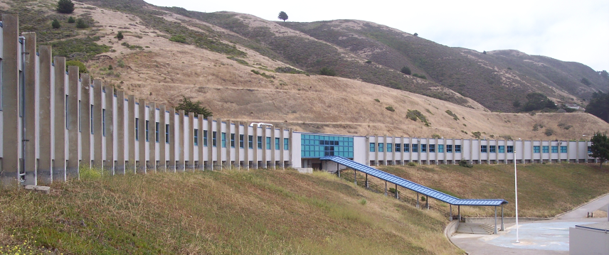

The public elementary and middle school district, known as Pacifica School District, (formerly the Laguna Salada School District), consists of Vallemar, Cabrillo, Ingrid B. Lacy, Sunset Ridge, Ortega, Linda Mar and Ocean Shore schools, and also a home schooling program. The administration office is located at 375 Reina del Mar Avenue, adjacent to Vallemar School. Each school enrolls about 550–600 students. There are two private K–8 schools, Good Shepherd School and Pacific Bay Christian School, a K–12 school which was founded as a segregation academy.
Pacifica also previously had an established elementary school from 1969 to 2005 known as Oddstad (Oddstad Andres) Elementary located in the Park Pacifica neighborhood. Though now non-operational, the campus site has been host to numerous community events, and private courses as well as sporting events and leisure.
Pacifica has one private high school and two public high schools which are part of the Jefferson Union High School District. Oceana High School in the central part of the city while Terra Nova High School and Pacific Bay Christian School are in the south. Many students in the northern part of Pacifica attend Jefferson High School or Westmoor High School nearby in adjacent Daly City. Oceana's teaching paradigm is geared toward longer classes, senior exhibitions, and mandated community service. Much larger Terra Nova is a more traditional institution, featuring numerous sports, clubs, and a broad-based and enriching educational experience.
Public libraries
San Mateo County Libraries, a member of the Peninsula Library System, operates the Pacifica-Sanchez Library and the Pacifica-Sharp Park Library.
Notable residents
- Chuy Campusano (1944–1997), Chicano muralist
- Anthony Gordon former college football player for the Washington State Cougars and current free agent in the National Football League grew up in Pacifica.
- Keith Hernandez MVP Baseball player and World Series Champion for the St. Louis Cardinals and New York Mets.
- Kevin Kelly founding executive editor of Wired magazine
- Derek Kirk Kim, Korean-American comics artist. His debut graphic novel Same Difference features scenes from Pacifica.
- Greg Reynolds former MLB pitcher for the Colorado Rockies, as well as uncle of Anthony Gordon (American football) grew up in Pacifica, and had his start pitching for Terra Nova, and continued to Stanford University.
- Rob Schneider grew up in Pacifica. In 1997, he formed the Rob Schneider Music Foundation to support its school music program, and has since donated approximately $2 million.
Sister city
- SPA Balaguer, Catalonia, Spain
References
References
- "2020 U.S. Gazetteer Files". United States Census Bureau.
- {{Cite GNIS. 277613. Pacifica
- "Pacifica (city) QuickFacts". [[United States Census Bureau]].
- {{Cite EPD. 18
- "Transcription".
- (August 27, 2009). "Local history: Pacifica's Sharp Park land once housed a war-time internment camp". Pacifica Tribune.
- "Sharp Park Detention Station". UC Berkeley, Bancroft Library.
- (1997). "Morning Glory, Evening Shadow: Yamato Ichihashi and His Internment Writings, 1942-1945". Stanford University Press.
- "LGBT Timeline". ACLU.
- "Pre-Stonewall, There Was Compton's in San Francisco". The Bay Area Reporter.
- (1996). "Ocean Shore Railroad".
- (2002). "Pacifica". Arcadia Publishing.
- "Pacifica Historic Weather Averages in California (94044)".
- "California".
- "Neighborhoods".
- "Pacific Manor, Pacifica".
- "Sharp Park, Pacifica".
- "Fairway Park, Pacifica".
- "Pedro Point, Pacifica".
- "Shelter Cove, Pacifica".
- "Census of Population and Housing". Census.gov.
- "Pacifica city, California; DP1: Profile of General Population and Housing Characteristics - 2020 Census of Population and Housing".
- "Pacifica city, California; P16: Household Type - 2020 Census of Population and Housing".
- "Pacifica city, California; CP02: Comparative Social Characteristics in the United States - 2023 ACS 5-Year Estimates Comparison Profiles".
- "Pacifica city, California; DP03: Selected Economic Characteristics - 2023 ACS 5-Year Estimates Comparison Profiles".
- "2010 Census Interactive Population Search: CA - Pacifica city". U.S. Census Bureau.
- "Census.gov".
- link. (February 11, 2020 . Factfinder.census.gov. Retrieved on July 21, 2013.)
- "U.S. Census website". [[United States Census Bureau]].
- (2019). "City of Pacifica, California : Comprehensive Annual Financial Report For the Fiscal Year Ended June 30, 2019".
- "City Government".
- "Adopted Budget: Fiscal Year 2016-2017".
- [http://psc.apcointl.org/2011/06/29/pacifica-city-council-approves-outsourcing-police-communications-to-south-san-francisco/ Pacifica City Council Approves Outsourcing Police CommunicationS to South San Francisco. Public Safety Communications]. Psc.apcointl.org (June 29, 2011). Retrieved on 2013-07-21.
- "Statewide Database". UC Regents.
- {{Cite GovTrack. CA. 16
- "CA Secretary of State – Report of Registration – February 10, 2019".
- "Pacifica Mountain Biking".
- (August 13, 2016). "Pacifica's Skatepark turns 5 years old". Pacifica Tribune.
- (November 30, 2015). "Wild Equity Institute - Restore Sharp Park".
- "Pacifica Spindrift Players".
- "Pacifica Performances".
- "Shelldance Gardens".
- Cortez, Mario. (April 3, 2025). "'World's most beautiful' Taco Bell reopens after remodel. Here's a look". San Francisco Chronicle.
- "pacificalocalnews.com - Proudly serving Pacifica, California".
- "hmbreview.com".
- "San Mateo Daily Journal".
- "Coastsider". Coastsider.
- "Coastside Magazine".
- "Riptide".
- Yelizarova, Anna. "Multimedia, data-driven news in Silicon Valley". Peninsula Press.
- "Restaurants In The Bay Area Featured On Diners, Drive-Ins, And Dives!".
- (August 14, 2020). "Pacifica Sets the Stage for Hollywood's Silver Screen".
- (May 2007). "Story of a Girl (review)". Bulletin of the Center for Children's Books.
- "[https://smcl.org/libraries/index.html San Mateo County Library Locations]." San Mateo County Library. Retrieved on October 6, 2009.
- (October 19, 1977). "Murals and a Sculpture Will Decorate Pacifica". Pacifica Tribune.
- (January 4, 1978). "Artists Unveil Designs for City Mural Project". [[Pacifica Tribune]].
- (August 5, 1977). "San Mateo County project: Dressing up blank walls with murals". [[The Peninsula Times Tribune]].
- (August 24, 2021). "Pacifica's Gordon makes NFL debut".
- (2002). "Pacifica". Arcadia Publishing.
This article was imported from Wikipedia and is available under the Creative Commons Attribution-ShareAlike 4.0 License. Content has been adapted to SurfDoc format. Original contributors can be found on the article history page.
Ask Mako anything about Pacifica, California — get instant answers, deeper analysis, and related topics.
Research with MakoFree with your Surf account
Create a free account to save articles, ask Mako questions, and organize your research.
Sign up freeThis content may have been generated or modified by AI. CloudSurf Software LLC is not responsible for the accuracy, completeness, or reliability of AI-generated content. Always verify important information from primary sources.
Report