From Surf Wiki (app.surf) — the open knowledge base
Pacific Highway (Australia)
Highway in New South Wales and Queensland
Highway in New South Wales and Queensland
| Field | Value |
|---|---|
| type | highway |
| state | nsw |
| road_name | Pacific Highway |
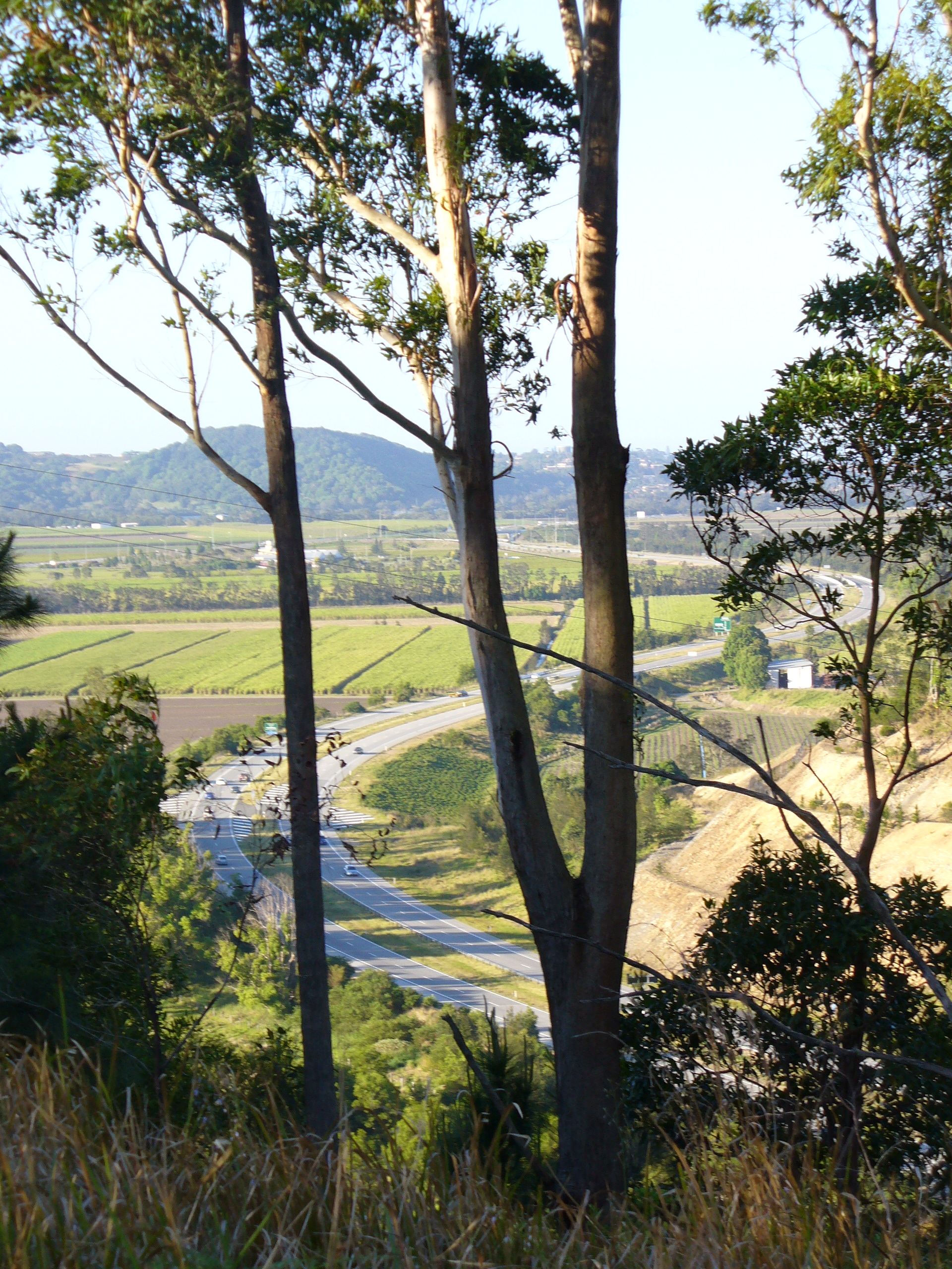
| image | Pacific Highway from Wattley Hill Road - panoramio - Rob Freijs.jpg |
| caption | View of the Pacific Highway from Wattley Hill Road, New South Wales (c. 2007) |
| location | Location Pacific Hwy.svg |
| length | 779 |
| length_ref | |
| gazetted | August 1928 (NSW, as Main Road 10) |
| December 1930 (QLD) | |
| split | yes |
| section1 | to |
| direction_a1 | North |
| direction_b1 | South |
| end_a1 | Pacific Motorway |
| end_b1 | Maitland Road |
| section2 | to Tuggerah, |
| then Ourimbah to | |
| direction_a2 | Northeast |
| direction_b2 | Southwest |
| end_a2 | Stewart Avenue |
| end_b2 | Mann Street |
| section3 | Kariong to |
| direction_a3 | North |
| direction_b3 | South |
| end_a3 | Wisemans Ferry Road |
| end_b3 | Warringah Freeway |
| through | , |
| former | See Former route numbers |
| show_links | yes |
December 1930 (QLD)
-
Bruxner Highway
-
Big River Way
-
Big River Way
-
Waterfall Way
-
Oxley Highway
-
New England Highway
-
Newcastle Inner City Bypass
-
Industrial Drive then Ourimbah to
-
Newcastle Inner City Bypass
-
Central Coast Highway
-
Motorway Link
-
Cumberland Highway
-
Pacific Motorway
-
Mona Vale Road
-
Ryde Road
-
Gore Hill Freeway
-
Lane Cove Tunnel
-
M1 (Brunswick Heads–Glenugie)
-
A1 (Glenugie–Raleigh)
-
M1 (Raleigh–Port Macquarie)
-
A1 (Port Macquarie–Hexham)
-
A43 (Hexham–Mayfield West, Newcastle West–Doyalson)
-
B83 (Kariong–Wahroonga)
-
A1 (Wahroonga–Artarmon)
-
Concurrency:
-
A38 (Roseville–Chatswood)
The Pacific Highway is a national highway and major transport route of 790 km along the east coast of Australia from Sydney to Brisbane. It is an integral part of Highway 1 which circumnavigates the Australian continent. At its inception, the highway was a single carriageway between Sydney and Brisbane. In Australian culture and as a tourist drive, it remains so. Over time, segments of the highway have been upgraded, realigned, or renamed. Between 1996 and 2020, sections of the highway were upgraded to controlled-access highway (motorway) standards.
Location
A map of Pacific Highway between to its northern terminus, northwest of . Thereafter, Pacific Motorway continues north to Brisbane.
KEY |right}}
The Pacific Highway is divided into the following sections:
- Brisbane to the New South Wales–Queensland border: This section has been completely replaced by the Pacific Motorway.
- Queensland border to Brunswick Heads: Upgraded to motorway standard under the 1996 Upgrade Masterplan and renamed the Pacific Motorway in 2013.
- Brunswick Heads to Hexham: Converted to dual carriageway or freeway standard, with works completed in 2020 as part of the 1996 Upgrade Masterplan.
- Hexham to Wahroonga: Replaced as the main national route by the Pacific Motorway (also known as the Sydney–Newcastle Freeway and formerly the F3 Freeway). This occurred progressively between 1965 and 1993.
- Wahroonga to Sydney CBD: Remains a divided metropolitan road, formerly part of the Metroad system. A motorway alternative is provided via the M2 route, incorporating the Lane Cove Tunnel, M2 Hills Motorway, and NorthConnex.
Gazette definition
Since the most recent declaration of the highway in the April 2010 gazette, the New South Wales section of the highway is officially made up of four separate sections: Warringah Freeway, North Sydney to Gosford Interchange near Kariong; Henry Parry Drive, Wyoming to Pacific Motorway at Ourimbah Interchange; Wyong Road, Tuggerah to Hunter Street, Wickham; and Maitland Road, Warabrook to the state border with Queensland. Since February 2013, the freeway section of the highway north of Brunswick Heads is also concurrently gazetted and is named and signposted Pacific Motorway. South of here, the section between Brunswick Heads and Bruxner Highway near Ballina is also signposted Pacific Motorway, however, it was not declared as such in the gazette as of February 2019, therefore it remains as only Pacific Highway in the gazette. Former sections of the highway removed from the gazette, such as between Gosford and Tuggerah, are still signposted as Pacific Highway.
Major cities and towns along Pacific Highway include: Gosford, Wyong, Newcastle, Taree, Port Macquarie, Kempsey, Coffs Harbour, Grafton, Ballina and Byron Bay, all in New South Wales; and Gold Coast in Queensland.
Major river crossings include the Hawkesbury, Hunter, Myall (east of Bulahdelah), Manning (south of Coopernook), Hastings (west of Port Macquarie), Macleay (east of Frederickton), Nambucca (near Macksville), Bellinger (near Raleigh), Clarence (via the Harwood Bridge near Maclean), Richmond (at Ballina), Brunswick, and Tweed rivers.
Sydney to Kariong
From Sydney, Pacific Highway starts as the continuation of Bradfield Highway at the northern end of the Sydney Harbour Bridge, immediately north of the Sydney central business district, and is the main route as far as the suburb of Wahroonga. Between the Harbour Bridge and the Gore Hill Freeway at Artarmon, the highway has no route number. From Gore Hill Freeway to Wahroonga, it is designated as route A1. When the Warringah Freeway was constructed in the late 1960s, southbound traffic was diverted through North Sydney via Mount Street, and in October 1985 it was redirected via Berry Street.
From Wahroonga Kariong, the Pacific Highway runs mostly parallel to the freeway, before diverting through the Central Coast via Gosford and Wyong. The section from Cowan to Kariong follows a winding scenic route with speed limits of 60 or 70 km/h (37 or 43 mph).
Kariong to Hexham
The section of the former Pacific Highway from the Wiseman’s Ferry Road junction at Kariong to the Gosford exit near Brian McGowan Bridge was redesignated as the Central Coast Highway, A49. North of Gosford, the highway continues without a route number through the Central Coast suburbs of Ourimbah and Wyong, before connecting with a spur of the Pacific Motorway near Doyalson, signed as route A43. At this point, the Pacific Highway is signed as route A43 for most of its length, forming a four- to six-lane regional highway that passes Lake Macquarie and continues through the suburbs of Lake Macquarie and Newcastle before rejoining route A1 at Hexham.
From Bennetts Green to Sandgate, the highway is paralleled by the Newcastle Inner City Bypass, which runs through New Lambton and Jesmond.
North of Hexham
From Hexham, the Pacific Highway passes through the Mid North Coast and Northern Rivers region to Brunswick Heads where it becomes the Pacific Motorway continuing to Brisbane.
Former sections
Former sections of the Pacific Highway were created when parts of the route were removed from the gazette definition or bypassed by new alignments. Some former sections of the Pacific Highway that were removed from the gazette definition continue to be referred to and signposted as Pacific Highway.
Removed from gazette definition
Between Sydney and Hexham, some sections of the highway were re-gazetted as other roads or are no longer included in the gazette definition of the Pacific Highway. However, as of January 2019, many of these roads are still referred to and signposted as the Pacific Highway.
The first two sections of the highway to be removed from the gazette was the Calga to Kariong section and a section in Gosford between Racecourse Road/Etna Street and Brian McGowan Bridge in November 1996. The remaining section within Gosford, between Kariong and Brian McGowan Bridge, was re-gazetted and renamed Central Coast Highway in August 2006. These changes resulted in the previously undivided section between Ourimbah and Sydney to be split into two: Kariong to Sydney, and Ourimbah to Wyoming.
The April 2010 gazette removed the sections between Racecourse Road/Etta Street and Henry Parry Drive/Pemmel Street in Gosford, between Ourimbah and Tuggerah, and between Hunter Street and Industrial Drive in Newcastle from the existing declaration of the highway, but redeclared the section between Calga and Kariong. , this is the most recent gazette to redefine the declaration of Pacific Highway. Even though these three removed sections are not gazetted as part of Pacific Highway anymore, street signage continues to show "Pacific Highway" and maps often show both the current road name and "Pacific Highway" together.
In Queensland, Pacific Highway used to go into Brisbane, however, most sections have been renamed to other roads or highways. For example, the section of Pacific Highway between Coolangatta and Currumbin is now part of Gold Coast Highway.
Bypassed
Sections of the highway between Hexham and the Queensland/NSW border that were bypassed and replaced by new sections of Pacific Highway, were renamed and downgraded to local roads, and are no longer part of Pacific Highway. As the new sections are just bypasses, this meant that the section between Hexham and Queensland border is still a continuous route. Prominent bypassed sections of the highway between Hexham and the border include:
- The former 151 km section Twelve Mile Creek and Taree through Stroud and Gloucester, with the new route over mostly dirt roads gazetted in 1952. The affected roads were upgraded over a number of years, including the construction of major bridges to replace the low-level crossing at Nabiac and the ferry at Karuah. The upgrading of the northern section was completed first and through traffic ran temporarily over the road between Bulahdelah and Booral. The southern part from Bulahdelah to Twelve Mile Creek via Karuah was completed about 1960. The old section was later renamed Bucketts Way.
- The former 39 km section through Kempsey and Frederickton which included the site of the Kempsey bus crash. This section was replaced by a new freeway bypass and bridge over the Macleay River in 2013 and 2016, and was renamed the Macleay Valley Way.
- The former 46 km between Eungai Creek and Raleigh via Macksville and Nambucca Way. This section was bypassed in 2016 and 2018 and was renamed Giinagay Way
- The former 55 km section between Glenugie and Maclean via Grafton which included the site of the Grafton bus crash. This section was replaced by a new alignment of the highway in 2020 and was renamed Big River Way.
In May 2009, the portion of the Tugun Bypass (newly opened in June 2008) within New South Wales boundaries was declared as the new alignment of Pacific Highway between Tweed Heads interchange and the Queensland border. The 1 km older bypassed alignment along Tweed Heads Bypass (opened 1992) towards the border at Coolangatta was gazetted as Gold Coast Highway instead, extending the already existing Gold Coast Highway in Queensland, into New South Wales. The Tugun Bypass was handed over to the NSW government in June 2018. The section of the bypassed highway within Queensland borders between Stewart Road and Gold Coast Highway was officially renamed Tugun-Currumbin Road, but is signposted as Stewart Road.
History
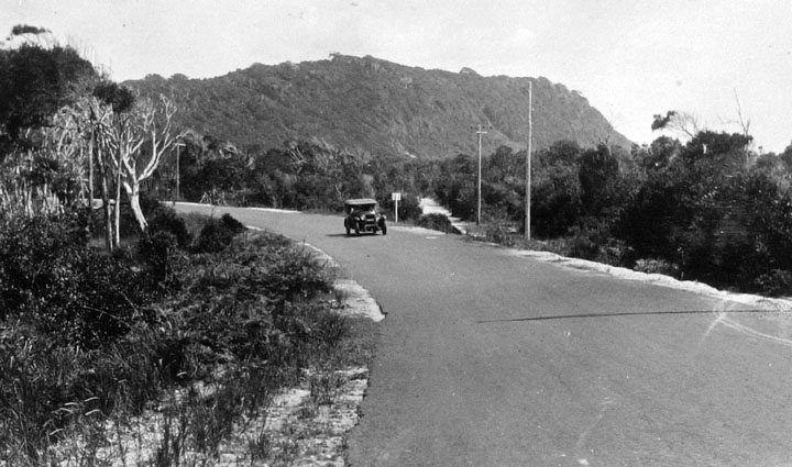
Initially, the primary mode of transport connecting the coastal areas between Sydney and Brisbane was by boat. However, a continuous inland route from Newcastle to Brisbane via the Northern Tablelands had been in existence since the 1840s. A direct coastal route between Sydney and Newcastle was not completed until 1930, and completion of the sealing of the Pacific Highway did not occur until 1958 (at Koorainghat, south of Taree). The last of the many ferries across the coastal rivers was not superseded by a bridge until 1966 (the Harwood Bridge across the south channel of the Clarence River, the north channel having been bridged in 1931).
Between 1925 and 1930 the Main Roads Board of New South Wales reconstructed and sealed a route between Hornsby and Calga that had been abandoned some forty years earlier, to provide a direct road link between Sydney and Newcastle. In addition, a replacement route from Calga into the gorge of Mooney Mooney Creek and up to the ridge at Kariong above Gosford was also required. This new Sydney–Newcastle route via Calga and Gosford was some 80 km shorter than the previous route via Parramatta, McGraths Hill, Maroota, Wisemans Ferry, Wollombi and Cessnock. At first, the old Peats Ferry was reinstated to cross the Hawkesbury River, with construction of the bridge not beginning until 1938, due to the Great Depression. Due to the onset of the Second World War, the Peats Ferry Bridge was not completed until May 1945.
The passing of the Main Roads Act of 1924 through the Parliament of New South Wales provided for the declaration of Main Roads, roads partially funded by the State government through the Main Roads Board (later the Department of Main Roads, and eventually Transport for NSW). Great Northern Highway was declared (as Main Road No. 9), running from North Sydney via Hornsby, Peat's Ferry, Gosford, Swansea and Newcastle to Hexham (still under construction), and North Coast Highway was declared (as Main Road No. 10), running from Hexham, Stroud, Gloucester, Taree, Port Macquarie, Kempsey, Coffs Harbour, South Grafton, Ballina, Byron Bay, Mullumbimby, and Murwillumbah to Tweed Heads, on the same day, 8 August 1928. With the passing of the Main Roads (Amendment) Act of 1929 to provide for additional declarations of State Highways and Trunk Roads, these were amended to State Highways 9 and 10 on 8 April 1929.
In Queensland, there existed a series of local roads, which could be used by early motor vehicle owners to drive from Brisbane to the state border at Tweed Heads, but these roads were not designed for cars, and hence the journey was more like an adventure, only undertaken by the experienced motorist. The railway line to Southport and Tweed Heads was the preferred mode of transport. It wasn't until 1920 when Queensland's Main Roads Board was formed that the Main South Coast Road was declared. It was declared as the Pacific Highway in December 1930, although the final part of the highway (the Logan River bridge) wasn't opened until July of the next year. In New South Wales, a section of State Highway 9 (Great Northern Highway) from Hexham to Sydney, was re-declared as part of as State Highway 10; its entire length (including North Coast Highway from Hexham to the state border with Queensland, and the newly added section of Great Northern Highway) was renamed Pacific Highway to match Queensland's declaration on 26 May 1931; The Great Northern Highway was truncated to meet the Pacific Highway at Hexham (and was later renamed to New England Highway in 1933).
Until the 1990s most road freight between Sydney and Brisbane passed along the New England Highway instead, due to the easier topography of the Northern Tablelands it traverses. Between 1950 and 1967, traffic on Pacific Highway quadrupled due to the attraction of coastal towns between Sydney and Brisbane for retirement living and tourism.
1989 Grafton and Kempsey bus crashes
Two major coach accidents on Pacific Highway in 1989 near Grafton (in which 21 people died) and at Clybucca near Kempsey (in which 35 people died) resulted in a public outcry over the poor quality of the road and its high fatality rate. Pacific Highway was never part of the federally funded system of National Highways. This appears to be because when the federal government funding of the 'national highway' system began in 1974, the longer New England Highway was chosen rather than Pacific Highway as the Sydney–Brisbane link, due to its easier topography and consequent lower upgrade costs.
1990s
In 1994, the Roads and Traffic Authority considered the environmental impact statement of a proposal for a toll road between Coolongolook and Possum Brush. The proposal was from Snowy Mountains Engineering Corporation Ltd and Travers Morgan Pty Ltd.
Until December 1997, a short 3.5 km section of the highway between Ourimbah and Kangy Angy was used by Sydney–Newcastle Freeway traffic as there was no freeway alternative. This section of Pacific Highway was designated as part of National Route 1 and subsequently National Highway 1. It was also upgraded to dual carriageway in the early 1970s. Due to the shared freeway and highway traffic, the at-grade interchanges between the freeway and the highway at Ourimbah and Kangy Angy became bottlenecks during peak times. In December 1997, the Ourimbah Creek Road to Kangy Angy stage of the freeway, located 150 m west of the highway, opened to traffic. The new freeway section was one of the last sections of the freeway to be completed and was referred to as the "missing link" of the freeway. Pacific Highway was bypassed and reduced to one lane per direction, and the northbound carriageway and bridge over Ourimbah Creek north of Palmdale Road were removed. The at-grade interchange between the freeway and the highway at Kangy Angy was also removed.
The section of the highway from Cowan to Kariong follows a scenic winding route with varying speed limits, typically 60 or. This section was damaged quite severely during severe weather in June 2007. Five people died when a bridge over Piles Creek collapsed and the entire section was closed due to subsidence 2 km further south. The road was reopened in 2009 when the Holt-Bragg Bridge was opened, named after the family that had perished.
The New South Wales section of Pacific Highway from Brunswick Heads to the state border with Queensland was re-declared as part of Pacific Motorway in February 2013.
The passing of the Roads Act of 1993 through the Parliament of New South Wales updated road classifications and the way they could be declared within New South Wales. Under this Act, Pacific Highway today retains its declaration as Highway 10, across all four of its gazetted sections, from the state border with Queensland (via Pacific Motorway) to North Sydney.
2000s and beyond
Pacific Highway was signed National Route 1 across its entire length in 1955. With the conversion to the newer alphanumeric system in 2013, this was replaced with route M1 for sections classified as a motorway, and route A1 for sections classified as a highway (except between Hexham and Wahroonga, where it is designated route A43 through most of the Central Coast between Hexham and Doyalson, and route B83 between Kariong and Wahroonga).
1996 upgrade masterplan
Four lane dual carriageway standard

The highway was heavily used by interstate traffic and its upgrade was beyond the resources of the New South Wales government alone. The NSW and federal governments argued for years about how the responsibility for funding the highway's upgrade should be divided between themselves, only coming up with a mutually acceptable upgrade package just after the 1996/97 financial year.
As part of a joint New South Wales and federal funding arrangement and upgrade masterplan, single carriageway sections from Tweed Heads to Hexham were progressively converted to freeway or dual carriageway standards commencing in 1996. At the time, the plan targeted to have Pacific Highway upgraded to dual carriageway by 2016. The strategy divided the remaining sections into three levels of priority:
- Priority 1: Tweed Heads to Ballina, Port Macquarie to Hexham, Woolgoolga to Raleigh
- Priority 2: Raleigh to Port Macquarie
- Priority 3: Ballina to Woolgoolga
In the meantime, numerous sections of existing single carriageway road were upgraded by re-alignments and safety improvement work including the addition of overtaking lanes, pavement widening and median barriers. Overall the highway became safer and travelling times were substantially reduced, particularly during holiday periods..
The four-lane dual carriageway upgrade of the highway was completed in December 2020. Continuous dual carriageway, much of it freeway standard, now extends from in Newcastle to the Queensland border. As of completion, about 15 billion have been invested in the upgrade by the federal and state governments, and fatalities have dropped by more than 75% since the upgrade started in 1996.
| Section | Total length (km) | Completion date | Before Upgrade | After Upgrade |
|---|---|---|---|---|
| Tweed Heads to Ballina (Bruxner Highway) | ||||
| including part of Pacific Motorway | 90.5 | 91 | December 2015 | |
| Ballina to Coffs Harbour | 206.5 | 204 | December 2020 | |
| Coffs Harbour to Port Macquarie (Oxley Highway) | 151 | 145 | June 2018 | |
| Port Macquarie to Mayfield West (Newcastle) | 221 | 217 | 2013 | |
| Totals | 666 | 657 | December 2020 |
Coffs Harbour Bypass
The Coffs Harbour Bypass is a 14 km realignment of Pacific Highway that will bypass the city of Coffs Harbour, including up to 12 sets of traffic lights. It is being built as a four-lane motorway with three tunnels. It is the last section of the Pacific Highway Upgrade, and is being funded by the state and federal governments. The project was granted planning approval by the state government in November 2020 and the federal government in December 2020. Tenders for its construction were let in June 2022, with major construction commencing in early 2023. It is expected to be open to traffic in late 2026.
Motorway standard upgrade
The highway was upgraded to dual carriageway that is either an arterial standard (Class A) or a motorway standard (Class M). The Class M sections between Woolgoolga and Ballina are:
- Thrumster to Eungai Rail
- Congarinni to Boambee
- Woolgoolga to Halfway Creek
- Glenugie to Harwood
- Woodburn to Pimlico
Following the dual carriageway upgrade, the only remaining project of the Pacific Highway Upgrade is the Coffs Harbour Bypass. Additionally, the M1 to Raymond Terrace project, which is classified as a separate project, will be a motorway extending and connecting the Pacific Motorway (Sydney to Newcastle section) to the upgraded Pacific Highway at Raymond Terrace. Construction formally commenced in January 2024 and is expected to be completed by 2028.
Projects
| Project | Length (km) | Construction dates | Value | Status | Description | Distance from | ||||||||
|---|---|---|---|---|---|---|---|---|---|---|---|---|---|---|
| Sydney (km) | Start | End | ||||||||||||
| Ballina to border | ||||||||||||||
| Tugun Bypass | 7 | June 2006 | 3 June 2008 | $543 million | Complete | Part of the Pacific Motorway, partly in Queensland. Upgrade not part of the program. Funded by the Queensland Government and Federal Government | 823 | |||||||
| Banora Point | 2.5 | December 2009 | 22 September 2012 | $359 million | Complete | Part of the Pacific Motorway | 817 | |||||||
| Chinderah bypass | 5.8 | 1993 | 29 November 1996 | $67 million | Complete | Part of the Pacific Motorway | 812 | |||||||
| Yelgun to Chinderah | 28.6 | May 2000 | 6 August 2002 | $348 million | Complete | Part of the Pacific Motorway, includes 3 interchanges | 784 | |||||||
| Brunswick Heads Bypass (stage 1) | 3.4 | 12 September 1996 | 5 June 1998 | $17 million | Complete | Part of the Pacific Motorway, first 2 lanes | 774 | |||||||
| Brunswick Heads to Yelgun | 8.6 | July 2005 | 11 July 2007 | url=http://www.abigroup.com.au/ProjectDetail.aspx?PageID=79&ProjectID=68 | title=Brunswick Heads to Yelgun – Pacific Highway | publisher=AbiGroup | access-date=6 February 2014 | archive-date=22 February 2014 | archive-url=https://web.archive.org/web/20140222204402/http://www.abigroup.com.au/ProjectDetail.aspx?PageID=79&ProjectID=68 | url-status=live}} | Complete | Part of the Pacific Motorway, duplication | 777 | |
| Tandy's Lane realignment | 5.5 | October 1999 | 19 December 2001 | url=http://www.baulderstone.com.au/project-portfolio/project-details/tandys-lane?fp=,797,50,770,793,796, | title=Tandy's Lane | publisher=Baulderstone | access-date=6 February 2014 | archive-date=19 May 2022 | archive-url=https://web.archive.org/web/20220519224835/https://www.lendlease.com/expertise/what-we-do/ | url-status=live}} | Complete | Part of the Pacific Motorway | 773 | |
| Ewingsdale to Tyagarah realignment | 4.3 | Late 1996 | 16 October 1998 | $22 million | Complete | Part of the Pacific Motorway | 765 | |||||||
| Ewingsdale interchange | 1.9 | February 1999 | 20 December 2000 | $22.5 million | Complete | Part of the Pacific Motorway | 764 | |||||||
| Tintenbar to Ewingsdale | 17 | May 2012 | 18 December 2015 | $862 million | Complete | Four lane motorway (limited access), new alignment, 110 km/h speed limit, twin-tube road tunnel under St Helena Hill. | 749 | |||||||
| Ballina Bypass | 12 | May 2008 | March 2011 (Cumbalum Interchange to Ross Lane Interchange) | |||||||||||
| 29 November 2011 (Teven Road to Cumbalum Interchange) | ||||||||||||||
| 20 December 2011 (southbound lanes from Teven Road to Bruxner Highway) | ||||||||||||||
| 11 February 2012 (northbound lanes from Teven Road to Bruxner Highway) | ||||||||||||||
| 28 April 2012 (Pacific Highway to the Bruxner Highway) | $640 million | Complete | New alignment | 737 | ||||||||||
| Woolgoolga to Ballina | ||||||||||||||
| Pimlico to Ballina Bypass | 6 | December 2019 | Complete | Duplication of existing highway. New bridge over Emigrant Creek | ||||||||||
| Pimlico to Teven | 2.3 | November 2013 | 5 May 2016 | $92 million | Stage 2 complete | Duplication, rebuilding of old carriageway, stage 3 completed in December 2019 as part of Woolgoolga to Ballina project | 733 | |||||||
| Woodburn to Pimlico | 34 | 17 September 2020 | Complete | New alignment, bypasses Woodburn, Wardell, and Broadwater. Bridge over the Richmond River at Wardell was the last bridge to open for the Pacific Highway Upgrade | ||||||||||
| Devils Pulpit to Woodburn | 15 | 11 December 2020 | Complete | Duplication of existing highway | ||||||||||
| Devils Pulpit | 7.3 | December 2011 | 20 March 2014 | $77 million | Complete | Four lanes, partly new alignment | 678 | |||||||
| Mororo to Devils Pulpit | 15 | 27 August 2020 | Complete | Duplication of existing highway | ||||||||||
| Maclean to Mororo | 9 | 22 September 2020 | Complete | Duplication of existing highway. New bridge over the Clarence River at Harwood opened 6 December 2019 | ||||||||||
| Tyndale to Maclean | 12 | 1 April 2020 | Complete | New alignment. Maclean Interchange fully opened on 5 August 2020. | ||||||||||
| Glenugie to Tyndale | 36 | 19 May 2020 | Complete | Four lane divided highway, new alignment, also known as Grafton Bypass. Old bypassed alignment renamed Big River Way | ||||||||||
| Glenugie upgrade | 2.5 | 2010 | 9 February 2012 | $60 million | Complete | Four lanes, new alignment for southbound traffic. New northbound carriageway opened adjacent to southbound carriageway on 26 November 2020 as part of Woolgoolga to Ballina project | 590 | |||||||
| Wells Crossing to Glenugie | 8 | 26 November 2020 | Complete | New two-lane alignment for northbound traffic, adjacent to the existing southbound carriageway that was built as part of Glenugie Upgrade | ||||||||||
| Halfway Creek to Glenugie | 12 | 23 August 2017 | Complete | Duplication of existing highway between Grays Road and Franklin Road (Glenugie upgrade) | ||||||||||
| Halfway Creek | 3.4 | Late 2002 | June 2004 | Complete | Partly new alignment. | 583 | ||||||||
| Woolgoolga to Halfway Creek | 14 | July 2015 | December 2017 | Complete | Duplication of existing highway, partly new alignment. 10 km Corindi Beach bypass opened to traffic on 24 October 2017. Old bypassed alignment renamed Solitary Islands Way | 561 | ||||||||
| Sapphire to Woolgoolga | 25 | August 2010 | 30 July 2014 | $850 million | Complete | Four lane divided highway, partly new alignment, 10 km Woolgoolga bypass opened to traffic on 16 December 2013. Old bypassed alignment renamed Solitary Islands Way | 535 | |||||||
| Korora Hill Reconstruction | 1.5 | January 1997 | 15 December 1997 | $6 million | Complete | Duplication and reconstruction | 533 | |||||||
| Coffs Harbour | ||||||||||||||
| Coffs Harbour Bypass | 12 | 2021 | 2024 | $1.2 billion | Construction | four lane freeway with 3 interchanges, new alignment, 2 tunnels and a cut and cover tunnel | 524 | |||||||
| Port Macquarie to Coffs Harbour | ||||||||||||||
| Lyons Rd to Englands Rd | 5.3 | October 1997 | 25 May 2001 | $73m | Complete | Duplication and reconstruction | 520 | |||||||
| Bonville upgrade | 9.6 | November 2006 | 16 September 2008 | $245m | Complete | Duplication and reconstruction, covered tunnel for koalas | 514 | |||||||
| Raleigh Deviation | 8 | January 1995 | 24 September 1998 | $72m | Complete | Duplication and reconstruction | 506 | |||||||
| Nambucca Heads to Urunga | 22 | November 2013 | 22 July 2016 | $780 million | Complete | Four lane limited access motorway, 110 km/h, 3 interchanges, bypasses Urunga. Old bypass alignment renamed Giinagay Way | 484 | |||||||
| Warrell Creek to Nambucca Heads | 20 | December 2014 | 18 December 2017 (Nambucca and Macksville bypass) | $830 million | Complete | Four lane limited access motorway, 110 km/h, 2 interchanges, including bypasses of Warrell Creek, Macksville and Nambucca Heads. Old bypass alignment renamed Giinagay Way | 464 | |||||||
| Eungai Duplication | 4.2 | January 1998 | March 1999 | $15m | Complete | url=http://www.ozroads.com.au/NSW/Highways/Pacific/eungai-allgomera.htm | title=Pacific Highway: Section: Eungai Creek/Allgomera Creek | publisher=ozroads | access-date=7 February 2014 | archive-date=24 September 2015 | archive-url=https://web.archive.org/web/20150924063136/http://www.ozroads.com.au/NSW/Highways/Pacific/eungai-allgomera.htm | url-status=live}} | 455 | |
| Frederickton to Eungai | 26.5 | August 2013 | 16 May 2016 | $675 million | Complete | Four lane divided highway. Freeway from Stuarts Point interchange to South Kempsey. 110 km/h speed limit | 427 | |||||||
| Kempsey Bypass | 14.5 | June 2010 | 27 March 2013 | $618 million | Complete | Dual carriageway motorway with 3.2 km bridge over Macleay River, new alignment. Old bypassed alignment renamed Macleay Valley Way | 413 | |||||||
| Kundabung to Kempsey | 14 | November 2014 | 6 September 2017 (Opened to 2 lanes each way on 1 November 2017) | $230 million | Complete | Upgrade of current road to four lanes, partially limited-access (One lane opened in each carriageway. Other lanes are open end of October 2017) | 398 | |||||||
| Oxley Highway to Kundabung | 23 | October 2014 | 17 November 2017 | $820 million | Complete | Four lane divided road (freeway south of Haydon's Wharf Road interchange), bridges over the Hastings and Wilson rivers, 2 interchanges, deep cutting through Cooperabung range. | 373 | |||||||
| Newcastle to Port Macquarie | ||||||||||||||
| Herons Creek Deviation Duplication | 14 | November 1997 | 3 July 1998 | $19m | Complete | Duplication of the first carriageway, which was opened in 2 stages: the northern stage from Ryans Road to the Oxley Highway in December 1990 and the southern stage in November 1993. | 359 | |||||||
| Herons Creek to Stills Road Upgrade | 3.5 | March 2011 | 25 October 2013 | $60m | Complete | Replacement of substandard carriageway (part of the old highway) to raise the road to freeway standard. | 356 | |||||||
| Coopernook to Herons Creek | 33 | November 2007 | 23 July 2010 | url=http://www.peterbesseling.com/media/lastest-news/kew-bypass-opens-pacific-highway | title=Kew Bypass opens on Pacific Highway | publisher=Peter Besseling | access-date=7 February 2014 | archive-date=28 February 2014 | archive-url=https://web.archive.org/web/20140228101441/http://peterbesseling.com/media/lastest-news/kew-bypass-opens-pacific-highway | url-status=live}} | Complete | Upgrade of highway to four lanes including a western bypass of Moorland, Johns River and an eastern bypass of Kew. | 325 | |
| Coopernook Bypass | 4.2 | February 2004 | 22 March 2006 | $44m | Complete | Four lane bypass. | 321 | |||||||
| Taree to Coopernook | 7.5 | November 2001 | 4 August 2005 | $59m | Complete | Upgrade to four lanes, two new bridges over Ghinni Ghinni Creek and two cattle underpasses. Some upgrading, including four-lane sections had commenced in September 1996 and was completed in 1998. | 312 | |||||||
| Taree Bypass | 14.5 | July 1993 (first carriageway) | 14 December 1997 (first carriageway); 12 April 2000 (second carriageway) | url=http://www.rms.nsw.gov.au/roadprojects/projects/pac_hwy/documents/completed_posters/taree_bypass.pdf | title=Taree Bypass | publisher=Roads and Maritime Services | access-date=7 February 2014 | archive-date=21 February 2014 | archive-url=https://web.archive.org/web/20140221151045/http://www.rms.nsw.gov.au/roadprojects/projects/pac_hwy/documents/completed_posters/taree_bypass.pdf | url-status=live }} | Complete | Four lane highway, new alignment | 303 | |
| Possum Brush to Taree | 17 | 1990 | 19 August 1991 (Possum Brush Deviation); 24 May 1994 (Rainbow Flat Deviation) | Complete | Four lane highway, old road used for northbound carriageway between Failford Road and Bonvale Close, planned to be replaced as part of Failford Road to Tritton Road upgrade | 294 | ||||||||
| Failford Road to Tritton Road upgrade | 3 | In planning | New carriageway and interchange with Failford Road | 293 | ||||||||||
| Bundacree Creek to Possum Brush | 9.7 | September 2004 | 4 November 2006 | url=http://www.rms.nsw.gov.au/roadprojects/projects/pac_hwy/documents/completed_posters/taree_bypass.pdf | title=Bundacree Creek to Possum Brush | publisher=Roads and Maritime Services | access-date=8 February 2014 | archive-date=21 February 2014 | archive-url=https://web.archive.org/web/20140221151045/http://www.rms.nsw.gov.au/roadprojects/projects/pac_hwy/documents/completed_posters/taree_bypass.pdf | url-status=live }} | Complete | Four lanes generally along old alignment, including upgrade of existing Nabiac bypass, new interchange and bridges. | 277 | |
| Wang Wauk to Bundacree Creek | 4.8 | August 1997 | 10 December 1998 | $21m | Complete | Four lanes generally along old alignment. | 272 | |||||||
| Coolongolook to Wang Wauk | 11.7 | December 1999 | 29 July 2001 | url=http://www.rms.nsw.gov.au/roadprojects/projects/pac_hwy/documents/completed_posters/coolongolook_wang_wauk.pdf | title=Coolongolook to Wang Wauk | publisher=Roads and Maritime Services | access-date=8 February 2014 | archive-date=21 February 2014 | archive-url=https://web.archive.org/web/20140221151145/http://www.rms.nsw.gov.au/roadprojects/projects/pac_hwy/documents/completed_posters/coolongolook_wang_wauk.pdf | url-status=live }} | Complete | Four lanes generally along old alignment, 80 km/h zone through Coolongolook. | 263 | |
| Bulahdelah to Coolongolook | 23 | April 1997 | 27 October 1999 | $130m | Complete | Four lanes freeway on new alignment. Replaces the original winding highway which is now called Wootton Way. | 236 | |||||||
| Bulahdelah upgrade | 8.6 | August 2010 | 27 June 2013 | $315 million | Complete | Four lane highway, new alignment. Initial earthworks began in 2007. | 232 | |||||||
| to Bulahdelah | 11 (section 1), 23 (section 2 and 3) | June 2005 (section 1) February 2007 (sections 2 and 3) | 15 December 2006 (section 1), 2 October 2009 (sections 2 and 3) | $114m (section 1), – (sections 2 and 3) | Complete | Four lane highway (section 1 from Karuah to 2 km north of Myall Way and sections 2 and 3 further north) | 193 | |||||||
| Karuah bypass | 9.8 | June 2002 | 22 September 2004 | $117m | Complete | Four lane freeway, bridge over Karuah River and interchanges at either end. | 187 | |||||||
| Raymond Terrace to Karuah | 18 | August 1998 | 1 December 2000 | $86m | Complete | Four lane highway, consisting of new 2-lane northbound carriageway and upgrade of old road as southbound carriageway | 165 | |||||||
| Raymond Terrace Bypass | 7.6 | November 1993 | 17 December 1998 | $78m | Complete | Four lane freeway, including 1 interchange and pairs of bridges at three other places | 162 | |||||||
| Newcastle | ||||||||||||||
| M1 to Raymond Terrace | 15 | In planning | Four lane freeway connecting the M1 to Pacific Highway, four interchanges, 2.6 km bridge over the Hunter River, bypasses Hexham, Tarro and Beresfield while replacing the existing route through Heatherbrae | 147 |
Funding issues
In 2007 mounting pressure was placed on the federal government to provide additional funding for the highway. On 10 October 2007 the Federal Minister for Transport and Regional Services pledged $2.4 billion in funding for the highway, subject to dollar for dollar funding by the NSW state government. However, the NSW state government refused to match funding. In the lead up to the 2007 federal election, then opposition leader Kevin Rudd pledged $1.5 billion in funding. As part of AusLink 2 (Nation Building Program), the federal government announced in its 2009 federal budget that $3.1 billion would be spent on the highway up until 2014 at which time just 63% of the highway would be duplicated. The NSW government will spend just $500 million over that same period, with $300 million cut as a result of the 2008 mini budget.
From time to time, there are proposals in the media for the private sector to build a fully controlled-access high-speed tollway between Newcastle and the Queensland border, possibly using the BOT system of infrastructure provision. Nothing eventuated from these proposals.
Other upgrades
Other sections of Pacific Highway (between Hexham and Sydney) have been upgraded or proposed to be upgraded:
- The section of Pacific Highway between Ourimbah Street and Parsons Road at is being duplicated , including a rail bridge over the Sydney to Newcastle rail line.
- Since December 2020, the 6 km section (Maitland Road) between Newcastle Inner City Bypass and New England Highway is being proposed to be widened from four lanes to six lanes.
Former route numbers
Pacific Highway was signed National Route 1 along its entire length in 1955. Over time, as road projects reallocated the route, or bypassed it entirely, these remaining sections were replaced with others. Former road routes of Pacific Highway have included:
- National Route 1 (1955–2013): –
- National Route 1 (1955–1988) / State Route 111 (1988–2013): –
- National Route 1 (1955–1979) / State Route 83 (1979–2013): –
- National Route 1 (1955–1993) / Metroad 1 (1993–2013): –
- National Route 1 (1955–1992) / State Route 14 (1992–1998) / Metroad 10 (1998–2007): –
- National Route 1 (1955–1992): –
Safety
The Pacific Highway was one of the most dangerous and deadly stretches of road in Australia, partly due to its high traffic levels. Between 1995 and 2009, over 400 people died on the highway. In 1989, two separate bus crashes, the Grafton bus crash (in which 21 people died) and the Kempsey bus crash (in which 35 died) on the highway were two of the worst road accidents in Australia's history. In 2010, 38 people died on Pacific Highway, and in 2011, 25 people. Over the past 15 years, the New South Wales Roads & Traffic Authority reports that about 1,200 people have been injured each year.
In January 2012, a ute swerved into the path of a B-double truck, which then veered off-road and crashed into two houses at Urunga. 11-year-old boy Max McGregor, who was sleeping in one of the houses, and the ute driver died from the incident. Another seven people were taken to Coffs Harbour Hospital. It was found that the ute driver had a blood alcohol concentration of 0.245, five times over the limit, equal to more than 25 standard drinks. The section of the highway through Urunga was bypassed in 2016.
Much of the danger of Pacific Highway lay in the fact that it contained long stretches of undivided road along which all types of vehicles, including private automobiles, buses, vans and trucks, simultaneously travelled at speeds approaching and in excess of 100 km/h. The undivided sections carried a high risk of head-on collisions. This was relieved to an extent by the provision of regular passing lanes, but these did not fully cope with the high level of traffic during holiday periods. After the 1989 crashes, the investigating coroner, Kevin Waller, recommended that the highway be fully divided along its entire length. Motorists surveyed by the National Roads and Motorists' Association (NRMA) voted Pacific Highway the worst road in New South Wales in 2012.
Major intersections
The major intersections of Pacific Highway, spread over 779 km on the eastern seaboard of New South Wales comprise a mix of freeway grade-separated conditions, suburban and urban roads. Between Pacific Motorway at Brunswick Heads in the north, and the highway's southern terminus at Bradfield Highway and Cahill Expressway in North Sydney, major intersections include: : Ewingsdale Road (B62) : Bruxner Highway (B60) : Big River Way (B76) – towards Gwydir Highway : Big River Way (B91) – towards Summerland Way : Waterfall Way (B78) : Oxley Highway (B56) : New England Highway (A43) : Nelsons Bay Road (B63) : Parry Street (A15) : Newcastle Inner City Bypass (A37) : Sparks Road (B70) : Central Coast Highway (A49) : Motorway Link (A43) : Cumberland Highway (Pennant Hills Road) (A28) : Mona Vale Road / Ryde Road (A3) : Gore Hill Freeway (M1) : Lane Cove Tunnel (M2) : Gore Hill Freeway (M1) : Warringah Freeway (M1)
References
References
- "Pacific Highway: Brunswick Heads to North Sydney".
- (17 August 1928). "Main Roads Act, 1924–1927". National Library of Australia.
- (2002). "From Bulldust to Beef Roads and Beyond: Main Roads – The first 50 years". National Library of Australia.
- Smith, Roff M.. (2019). "Australia". [[National geographic]].
- NSW, Transport for. (2024-09-17). "Pacific Highway upgrade {{!}} NSW Government".
- (April 2017). "Schedule of Classified Roads and Unclassified Regional Roads". Roads and Maritime Services.
- North Sydney Traffic Management Scheme ''[[Daily Telegraph (Sydney). Daily Telegraph]]'' 24 September 1985 page 14
- (22 November 1996). "Roads Act". National Library of Australia.
- "Kariong to Doyalson". Roads & Traffic Authority.
- "Central Coast Highway – Kariong to Doyalson". Roads & Traffic Authority.
- "Government Gazette of NSW 11 August 2006 Page 46". NSW Government.
- "Government Gazette of NSW 23 April 2010 Page 55". NSW Government.
- "Maps – Hunter Region Gazettal maps?publisher=NSW Roads & Maritime Services".
- (22 August 1952). "Main Roads Act, 1924–1951". National Library of Australia.
- (28 January 1959). "NRMA says road clear". [[The Biz (newspaper).
- (21 August 2012). "Renaming of the Pacific Highway following completion of the Kempsey Bypass". [[Kempsey Shire Council]].
- "Government Gazette of NSW 1 May 2009 Page 35". NSW Government.
- "Gold Coast Highway – New South Wales section: Tweed Heads West to Bilinga". Ozroads.
- (4 June 2018). "Bypass handed back to NSW". Tweed Daily News.
- (September 2009). "Gold Coast Highway Southern Corridor – Newsletter". Department of Transport and Main Roads.
- "Tugun Bypass Layouy".
- [http://classic.austlii.edu.au/au/legis/nsw/num_act/mra1924n24133/ State of New South Wales, ''An Act to provide for the better construction, maintenance, and financing of main roads; to provide for developmental roads; to constitute a Main Roads Board''] {{webarchive. link. (11 August 2022 10 November 1924)
- [https://legislation.nsw.gov.au/view/pdf/asmade/act-1929-15 State of New South Wales, ''An Act to amend the Main Roads Act, 1924–1927; to confer certain further powers upon the Main Roads Board; to amend the Local Government Act, 1919, and certain other Acts; to validate certain payments and other matters; and for purposes connected therewith.''] {{webarchive. link. (12 August 2022 8 April 1929)
- (29 May 1931). "Main Roads Act, 1924–1929". National Library of Australia.
- (14 February 1933). "New England Highway". National Library of Australia.
- (24 March 1933). "Main Roads Act, 1924–1931". National Library of Australia.
- (3 December 2003). "Pacific Highway Upgrade". [[Parliament of New South Wales]].
- "Proposed toll road : Coolongolook to Possum Brush : environmental impact statement : volume 1".
- "Proposed toll road : Coolongolook to Possum Brush : environmental impact statement : volume 2".
- (1994). "F3 Sydney – Newcastle Freeway : Ourimbah Creek Road to Kangy Angy Creek : review of environmental factors : volume 2". Roads and Traffic Authority.
- "National Highway 1 – Former Alignment from Ourimbah Creek Rd to Kangy Angy".
- "SYDNEY-NEWCASTLE FWY: Construction Information".
- (30 October 1998). "Annual Report 1998". Roads and Traffic Authority.
- (1 February 2013). "Government Gazette of the state of New South Wales".
- [https://legislation.nsw.gov.au/view/html/inforce/current/act-1993-033 State of New South Wales, ''An Act to make provision with respect to the roads of New South Wales; to repeal the State Roads Act 1986, the Crown and Other Roads Act 1990 and certain other enactments; and for other purposes.''] {{webarchive. link. (11 August 2022 10 November 1924)
- [[Transport for NSW]]. (August 2022). "Schedule of Classified Roads and Unclassified Regional Roads". Government of New South Wales.
- (10 May 2013). "New South Wales Government Gazette No. 57". [[Parliament of New South Wales]].
- (2012). "Road number and name changes in NSW". Government of New South Wales.
- (2019). "Pacific Highway upgrade: Achievement report – July/August 2019". Roads and Maritime Services.
- (11 December 2020). "Pacific Highway upgrade hits newest milestone just in time for Christmas". Nambucca Guardian.
- (11 December 2020). "Historic Pacific Highway upgrade hits the finish line". Transport for NSW – Roads and Maritime.
- (22 August 2018). "Project sections". Transport for NSW.
- (22 August 2018). "Ballina to the Queensland border". Transport for NSW.
- (22 August 2018). "Coffs Harbour to Ballina". Transport for NSW.
- (22 August 2018). "Port Macquarie to Coffs Harbour". Transport for NSW.
- (22 August 2018). "Newcastle to Port Macquarie". Transport for NSW.
- "Project need and objectives".
- (November 2019). "Coffs Harbour bypass – Project update – Design refinements". Roads and Maritime Services.
- "Coffs Harbour Bypass". Major Projects – Department of Planning, Industry and Environment.
- (8 December 2020). "Coffs Harbour bypass planning approval". Transport for NSW – Roads and Maritime.
- (7 June 2023). "Full steam ahead on Coffs Harbour bypass". Minister for Infrastructure, Transport, Regional Development and Local Government.
- (7 December 2020). "Woolgoolga to Ballina Pacific Highway upgrade – Local access – Project update". Transport for NSW.
- (22 August 2018). "Coffs Harbour Bypass". Transport for NSW.
- "M1 Pacific Motorway extension to Raymond Terrace".
- (July 2021). "M1 Pacific Motorway extension to Raymond Terrace Project update – Environmental Impact Statement". Transport for NSW.
- (16 January 2024). "Construction underway on M1 Pacific Motorway extension to Raymond Terrace". Prime Minister of Australia.
- (7 January 2014). "Tugun Bypass project". Queensland Government.
- "Banora Point project". [[Roads and Maritime Services]].
- "Project Fact Sheet: Chinderah Bypass". [[Roads and Maritime Services]].
- "Pacific Highway: Section: Chinderah to Tweed Heads". ozroads.
- "Yelgun to Chinderah (official opening brochure)". [[Roads and Maritime Services]].
- "Project Fact Sheet: Brunswick Heads Bypass (stage 1)". [[Roads and Maritime Services]].
- "Brunswick Heads to Yelgun". [[Roads and Maritime Services]].
- "Brunswick Heads to Yelgun – Pacific Highway". AbiGroup.
- "Tandy's Lane". [[Roads and Maritime Services]].
- "Pacific Highway: Section: Ewingsdale to Brunswick Heads". ozroads.
- "Tandy's Lane". Baulderstone.
- "Project Fact Sheet: Ewingsdale to Tyagarah". [[Roads and Maritime Services]].
- "Project Fact Sheet: Ewingsdale interchange". [[Roads and Maritime Services]].
- "Tintenbar to Ewingsdale". [[Roads and Maritime Services]].
- (28 November 2012). "Ballina Bypass". [[Roads and Maritime Services]].
- [http://www.rms.nsw.gov.au/projects/northern-nsw/coffs-harbour-ballina/woolgoolga-ballina.html Woolgoolga to Ballina] {{dead link. (August 2023)
- [http://www.theland.com.au/news/agriculture/general/news/pacific-highway-upgrade-continues/2704167.aspx Pacific Highway upgrade continues] {{Webarchive. link. (6 January 2015 . The Land)
- [http://www.nbnnews.com.au/index.php/2014/09/20/green-light-for-the-woolgoolga-to-ballina-upgrade/ Green Light for The Woolgoolga to Ballina Upgrade] {{Webarchive. link. (6 January 2015 . NBN News)
- (22 August 2018). "Broadwater to Ballina Bypass".
- "Pimlico to Teven upgrade". [[Roads and Maritime Services]].
- (5 May 2016). "New section of Pacific Highway to open this afternoon".
- (17 September 2020). "New Pacific Highway interchanges to open tonight". The Northern Star.
- (17 September 2020). "Pacific Highway upgrade opens, waking Wardell residents with long-dreaded traffic noise". ABC News.
- (3 November 2020). "Bridging Two Capitals to Boost Freight". Transport for NSW.
- "Devils Pulpit upgrade". [[Roads and Maritime Services]].
- (26 August 2020). "Pacific Highway upgrade opens new sections". Transport for NSW – Roads and Maritime.
- (27 August 2020). "New section of Pacific Highway open to traffic". Minister for Infrastructure, Transport and Regional Development.
- (22 August 2018). "Maclean to Devils Pulpit". Transport for NSW.
- (22 September 2020). "Dual carriageway opening between Maclean and Mororo". Kevin Hogan MP.
- (6 December 2019). "Harwood Bridge officially open to traffic". [[NBN Television.
- (1 April 2020). "Safer journeys between Tyndale and Maclean". Mirage News.
- (March 2020). "Woolgoolga to Ballina Pacific Highway upgrade – Tyndale to Maclean – Project update". Transport for NSW.
- (4 August 2020). "Maclean Interchange opens to traffic". Transport for NSW – Roads and Maritime.
- "New Highway Upgrade Open". Big Rigs.
- (19 May 2020). "Pacific Highway from Glenugie to Tyndale open". Echo Netdaily.
- (18 April 2020). "Grafton Bypass to open in May". NBN News.
- "Glenugie upgrade". [[Roads and Maritime Services]].
- "Glenugie upgrade". Roads Australia.
- (26 November 2020). "Wells Crossing to Glenugie Pacific Highway lanes open". Transport for NSW – Roads and Maritime.
- Charles, Caitlan. "Highway works 70% complete". Grafton Daily Examiner.
- "Halfway Creek to Glenugie".
- "Halfway Creek". [[Roads and Maritime Services]].
- "Pacific Highway: Section: Halfway Creek". ozroads.
- (22 August 2018). "Woolgoolga to Halfway Creek". Transport for NSW.
- "Woolgoolga to Halfway Creek".
- (July 2017). "Woolgoolga to Ballina project – Woolgoolga to Glenugie traffic staging – Pacific Highway upgrade – July 2017". Roads and Maritime Services.
- (24 October 2017). "No halfway measures as Woolgoolga to Halfway Creek Pacific Highway upgrade opens to traffic". Kevin Hogan MP.
- "Sapphire to Woolgoolga". [[Roads and Maritime Services]].
- (30 July 2014). "Honk, honk". ABC News Coffs Coast.
- (16 December 2013). "Pacific Highway upgrade – Sapphire to Woolgoolga". Roads and Maritime Services.
- "Project Fact Sheet: Korora Hill Reconstruction". [[Roads and Maritime Services]].
- "Coffs Bypass timeline". [[Coffs Coast Advocate]].
- "Lyons Rd to Englands Rd". [[Roads and Maritime Services]].
- "Pacific Highway: Section: Lyons Rd to Englands Rd". ozroads.
- "Lyons Rd to Englands Rd". [[Roads and Maritime Services]].
- "Bonville upgrade". [[Roads and Maritime Services]].
- "Pacific Highway: Section: Bonville (9-19km south of Coffs Harbour)". ozroads.
- "Project Fact Sheet: Raleigh Deviation". [[Roads and Maritime Services]].
- "Nambucca Heads to Urunga upgrade". [[Roads and Maritime Services]].
- [http://www.rms.nsw.gov.au/documents/projects/key-build-programs/pacific-highway/pacific-highway-monthly-achievement-report-october-2014.pdf Pacific Highway Upgrade] {{Webarchive. link. (24 December 2014 . Roads and Maritime Services)
- "Final countdown for Pacific Hwy opening".
- "Pacific Highway Upgrade Achievement Report – September 2015".
- Ramsey, Britt. (2016-07-21). "Nambucca Heads to Urunga bypass open".
- Davis, Mel. (2017-12-06). "Macksville highway bypass to open before Christmas". Port Macquarie News.
- "Pacific Highway upgrade of 'notorious' section now open to traffic".
- (29 June 2018). "Warrell Creek to Nambucca Highway upgrade completed". Nambucca Guardian.
- "Project Fact Sheet: Eungai Duplication". [[Roads and Maritime Services]].
- "Pacific Highway: Section: Eungai Creek/Allgomera Creek". ozroads.
- "Frederickton to Eungai". [[Roads and Maritime Services]].
- "Kempsey Bypass". [[Roads and Maritime Services]].
- NSW, Roads and Maritime Services. "Kundabung to Kempsey project". Roads and Maritime Services.
- (17 November 2017). "Port Macquarie to Kundabung – Pacific Highway upgrade officially opens". Fairfax Regional Media.
- "Project Fact Sheet: Herons Creek Duplication". [[Roads and Maritime Services]].
- "Pacific Highway: Herons Creek to Oxley Highway". ozroads.
- "Herons Creek to Stills Road Upgrade". [[Roads and Maritime Services]].
- [http://www.rms.nsw.gov.au/roadprojects/projects/pac_hwy/documents/131205_pacific_highway_monthly_achievement_report.pdf] {{Webarchive. link. (29 March 2014 Pacific Highway Achievement Report October 2013)
- "Coopernook to Herons Creek". [[Roads and Maritime Services]].
- "Kew Bypass opens on Pacific Highway". Peter Besseling.
- "Coopernook Bypass". [[Roads and Maritime Services]].
- "Pacific Highway: Section: Coopernook". ozroads.
- "Taree to Coopernook". [[Roads and Maritime Services]].
- "Taree Bypass". [[Roads and Maritime Services]].
- "Pacific Highway: Section: Taree". ozroads.
- "Taree Bypass". [[Roads and Maritime Services]].
- "Pacific Highway: Section: Possum Brush to Taree". ozroads.
- "Failford Road to Tritton Road upgrade". [[Roads and Maritime Services]].
- "Bundacree Creek to Possum Brush". [[Roads and Maritime Services]].
- "Pacific Highway: Section: Bundacree Creek to Possum Brush". ozroads.
- "Bundacree Creek to Possum Brush". [[Roads and Maritime Services]].
- "Wang Wauk to Bundacree Creek". [[Roads and Maritime Services]].
- "Coolongolook to Wang Wauk". [[Roads and Maritime Services]].
- "Pacific Highway: Section: Coolongolook to Wang Wauk River". ozroads.
- "Coolongolook to Wang Wauk". [[Roads and Maritime Services]].
- "Bulahdelah to Coolongolook". [[Roads and Maritime Services]].
- "Bulahdelah upgrade". [[Roads and Maritime Services]].
- "Bulahdelah Upgrade Project History".
- "Karuah to Bulahdelah section 1". [[Roads and Maritime Services]].
- "Karuah to Bulahdelah sections 2 and 3". [[Roads and Maritime Services]].
- "Pacific Highway: Section: Karuah to Bulahdelah". ozroads.
- "Karuah bypass". [[Roads and Maritime Services]].
- "Pacific Highway: Section: Karuah". ozroads.
- "The Karuah Highway: Bypass Economic and Social Impacts: 5 year report". [[Roads and Maritime Services]].
- "Raymond Terrace to Karuah Upgrade". [[Roads and Maritime Services]].
- "Raymond Terrace Bypass". [[Roads and Maritime Services]].
- NSW, Roads and Maritime Services. "M1 Pacific Motorway extension to Raymond Terrace".
- (6 November 2007). "Rudd pledges $1.5b for Pacific Hwy upgrade". [[Australian Broadcasting Corporation]].
- (12 May 2009). [http://www.minister.infrastructure.gov.au/aa/releases/2009/May/budget-infra_02-2009.aspx Federal Road Investment Program Steps Up A Gear] {{Webarchive. link. (26 March 2012 . Media Release. Minister for Infrastructure and Transport.)
- "Nation Building program Projects Pacific Highway". Australian Government.
- (19 October 2009). "Pacific Highway upgrade". NSW [[Roads & Traffic Authority]].
- Gordon, Josh. (8 March 2009). "Pacific Highway to hell". Sydney Morning Herald.
- Lewis, Steve. (28 June 2007). "Drivers hit with more toll roads". News.com.au.
- (15 March 2021). "New rail bridge for Pacific Highway at Lisarow". Transport for NSW – Roads and Maritime.
- "Pacific Highway duplication at Lisarow".
- (2 December 2020). "Have your say on the Pacific Hwy at Hexham". Transport for NSW – Roads and Maritime.
- "Pacific Highway improvements at Hexham (Hexham Straight)".
- [http://www.ozroads.com.au/NationalSystem/hwy1-nsw.htm Highway One – NSW Section] {{Webarchive. link. (20 April 2013 , ''Ozroads Website''. Retrieved on 15 May 2013{{Self-published source). (October 2013)
- [http://www.ozroads.com.au/NSW/RouteNumbering/State%20Routes/111/sr111.htm NSW State Route 111] {{Webarchive. link. (25 April 2013 , ''Ozroads'', Retrieved on 1 June 2013.{{Self-published source). (October 2013)
- [http://www.ozroads.com.au/NSW/RouteNumbering/State%20Routes/83/sr83.htm NSW State Route 83] {{Webarchive. link. (10 December 2013 , ''Ozroads'', Retrieved on 1 June 2013.{{Self-published source). (October 2013)
- [http://www.ozroads.com.au/NSW/RouteNumbering/Metroads/1/metroad1.htm Metroad 1] {{Webarchive. link. (21 April 2013 , ''Ozroads'', Retrieved on 1 June 2013.{{Self-published source). (October 2013)
- [http://www.ozroads.com.au/NSW/RouteNumbering/Deccomissioned%20Routes/SR14/sr14.htm NSW State Route 14] {{Webarchive. link. (3 November 2013 , ''Ozroads'', Retrieved on 3 June 2013.{{Self-published source). (October 2013)
- [http://www.ozroads.com.au/NSW/RouteNumbering/Metroads/10/metroad10.htm Metroad 10] {{Webarchive. link. (3 November 2013 , ''Ozroads'', Retrieved on 1 June 2013.{{Self-published source). (October 2013)
- Scott, Belinda. (22 December 2009). "Australia's worst crash". North Coast News.
- (11 June 2013). "Crash statistics". [[Government of New South Wales]].
- (8 January 2012). "Boy killed by truck ploughing into bedroom". ABC News.
- (10 February 2012). "Horror crash driver 'five times over limit'". ABC News.
- "Death road detour for retired NSW coroner Kevin Waller". Daily Telegraph.
- (2012). "Motorists vote Pacific Highway worst". [[NRMA.
This article was imported from Wikipedia and is available under the Creative Commons Attribution-ShareAlike 4.0 License. Content has been adapted to SurfDoc format. Original contributors can be found on the article history page.
Ask Mako anything about Pacific Highway (Australia) — get instant answers, deeper analysis, and related topics.
Research with MakoFree with your Surf account
Create a free account to save articles, ask Mako questions, and organize your research.
Sign up freeThis content may have been generated or modified by AI. CloudSurf Software LLC is not responsible for the accuracy, completeness, or reliability of AI-generated content. Always verify important information from primary sources.
Report