From Surf Wiki (app.surf) — the open knowledge base
Outflow (meteorology)
Air that flows outwards from a storm system
Air that flows outwards from a storm system
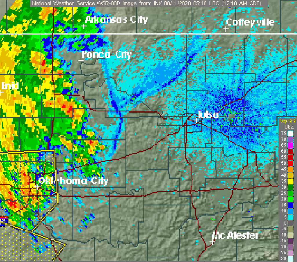
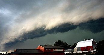
Outflow, in meteorology, is air that flows outwards from a storm system. It is associated with ridging, or anticyclonic flow. In the low levels of the troposphere, outflow radiates from thunderstorms in the form of a wedge of rain-cooled air, which is visible as a thin rope-like cloud on weather satellite imagery or a fine line on weather radar imagery. For observers on the ground, a thunderstorm outflow boundary often approaches in otherwise clear skies as a low, thick cloud that brings with it a gust front.
Low-level outflow boundaries can disrupt the center of small tropical cyclones. However, outflow aloft is essential for the strengthening of a tropical cyclone. If this outflow is restricted or undercut, the tropical cyclone weakens. If two tropical cyclones are close, the upper-level outflow from the upwind system can limit the development of the other system.
Thunderstorms
For thunderstorms, outflow tends to indicate the development of a system. Large quantities of outflow at the upper levels of a thunderstorm indicate its development. Too much outflow in the lower levels of a thunderstorm, however, can choke off the low-level inflow which fuels it. Squall lines typically bow out the most, or bend the most convex outward, at the leading edge of low level outflow due to the formation of a mesoscale high-pressure area which forms within the stratiform rain area behind the initial line. This high-pressure area is formed due to strong descending motion behind the squall line, and could come in the form of a downburst.

Tropical cyclones
The development of a significant mesoscale convective complex can send out a large enough outflow boundary to weaken the cyclone as the tropical cyclone center moves into the more stable air mass behind the leading edge of thunderstorm outflow, or outflow boundary. Moderate vertical wind shear can lead to the initial development of the convective complex and surface low similar to the mid-latitudes, but it must relax to allow tropical cyclogenesis to continue.
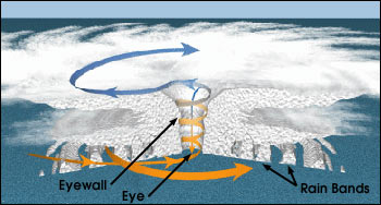
While the most obvious motion of clouds is toward the center, tropical cyclones also develop an upper-level (high-altitude) outward flow of clouds. These originate from air that has released its moisture and is expelled at high altitude through the "chimney" of the storm engine. This outflow produces high, thin cirrus clouds that spiral away from the center. The clouds are thin enough for the sun to be visible through them. These high cirrus clouds may be the first signs of an approaching tropical cyclone. As air parcels are lifted within the eye of the storm the vorticity is reduced, causing the outflow from a tropical cyclone to have anticyclonic motion. If two tropical cyclones are in proximity to one another, the outflow from the system downstream (normally to the west) can hinder the development of the system upstream (normally to the east).
Local effects

Low-level outflow boundaries from thunderstorms are cooler and more moist than the air mass the thunderstorm originally formed within due to its wet bulbing by rain, forming a wedge of denser air which spreads out from the base of the parent thunderstorm. If wind speeds are high enough, such as during microburst events, dust and sand can be carried into the troposphere, reducing visibility. This type of weather event is known as a haboob, and is most common in the late spring within Sudan. Upper-level outflow can consist of thick cirrus clouds which would then obscure the sun and reduce solar insolation around the outermost edge of tropical cyclones.
References
References
- [[National Weather Service]]. (2009-06-25). "O". [[National Oceanic and Atmospheric Administration]].
- Peter S. Parke and Norvan J. Larson (2005). [http://www.crh.noaa.gov/dlh/science/event_archive/summer_archive/1999blowdown/1999blowdown.php Boundary Waters Windstorm.] [[National Weather Service]] Forecast Office, [[Duluth, Minnesota]]. Retrieved on 2008-07-30.
- Diana Yates. (2008). "Birds migrate together at night in dispersed flocks, new study indicates". [[University of Illinois]] at Urbana - Champaign.
- link. (2008-09-24 [[American Meteorological Society]]. {{ISBN). 1-878220-34-9. Retrieved on 2009-05-03.
- John A. Knaff and John F. Weaver. (September 2000). "A Mesoscale Low-Level Thunderstorm Outflow Boundary Associated with Hurricane Luis". [[American Meteorological Society]].
- University of Illinois (1999-10-04). [http://ww2010.atmos.uiuc.edu/(Gh)/guides/mtr/hurr/grow/home.rxml Hurricanes.] Retrieved 2008-08-17.
- [[National Weather Service]]. (September 2006). "Hurricanes... Unleashing Nature's Fury: A Preparedness Guide". [[National Oceanic and Atmospheric Administration]].
- [[Atlantic Oceanographic and Meteorological Laboratory]], Hurricane Research Division. (2004-08-13). "Frequently Asked Questions: What's it like to go through a hurricane on the ground? What are the early warning signs of an approaching tropical cyclone?". [[National Oceanic and Atmospheric Administration]].
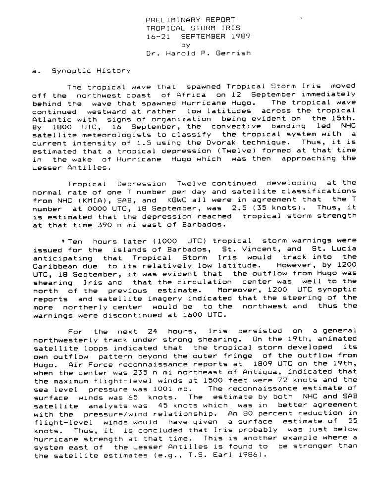
- Dr. Harold P. Gerrish. (1989). "Preliminary Report: Tropical Storm Iris - 16–21 September 1989". [[National Hurricane Center]].
- John F. Weaver. (June 1982). "History of Thunderstorm Forecasting: Part VI: The Thunderstorm (to 1900)". Storm Track.
- Western Region Climate Center (2002). [http://www.wrcc.dri.edu/ams/glossary.html#H H.] {{Webarchive. link. (2017-05-21 Desert Research Institute. Retrieved on 2006-10-22.)
- Glossary of Meteorology. (June 2000). "Haboob". [[American Meteorological Society]].
This article was imported from Wikipedia and is available under the Creative Commons Attribution-ShareAlike 4.0 License. Content has been adapted to SurfDoc format. Original contributors can be found on the article history page.
Ask Mako anything about Outflow (meteorology) — get instant answers, deeper analysis, and related topics.
Research with MakoFree with your Surf account
Create a free account to save articles, ask Mako questions, and organize your research.
Sign up freeThis content may have been generated or modified by AI. CloudSurf Software LLC is not responsible for the accuracy, completeness, or reliability of AI-generated content. Always verify important information from primary sources.
Report