From Surf Wiki (app.surf) — the open knowledge base
Otaihanga
Settlement in Wellington Region, New Zealand
Settlement in Wellington Region, New Zealand
| Field | Value |
|---|---|
| name | Otaihanga |
| native_name_lang | |
| settlement_type | Town |
| image_skyline | Waikanae River Otaihanga.jpg |
| image_caption | The Waikanae River as viewed from its southern bank in Otaihanga. Across the river is the town of Waikanae Beach. |
| coordinates | |
| mapframe | yes |
| mapframe-zoom | 11 |
| subdivision_type | Country |
| subdivision_name | New Zealand |
| subdivision_type1 | Region |
| subdivision_name1 | Wellington Region |
| subdivision_type2 | Territorial authority |
| subdivision_name2 | Kāpiti Coast District |
| subdivision_type3 | Ward |
| subdivision_name3 | Paraparaumu Ward |
| subdivision_type4 | Community |
| subdivision_name4 | Paraparaumu Community |
| seat_type | Electorates |
| seat | |
| leader_title | Territorial Authority |
| leader_name | Kāpiti Coast District Council |
| leader_title1 | Regional council |
| leader_name1 | Greater Wellington Regional Council |
| leader_title2 | Kāpiti Coast Mayor |
| leader_name2 | |
| leader_title3 | Mana MP |
| leader_name3 | |
| leader_title4 | Te Tai Hauāuru MP |
| leader_name4 | |
| website | |
| area_code | 04 |
| area_footnotes | |
| area_total_km2 | 4.16 |
| population_footnotes | |
| population_total | |
| population_as_of | |
| population_density_km2 | auto |
| postal_code_type | Postcode(s) |
| postal_code | 5036 |
| mapframe-zoom = 11
Otaihanga is on the Kāpiti Coast of New Zealand's North Island. It is just north of Paraparaumu on the south bank of the Waikanae River and is roughly 55 km north of New Zealand's capital city, Wellington. Its name is Māori for "the place made by the tide".
The New Zealand Ministry for Culture and Heritage gives a translation of "place of Taihanga [a personal name]" for Ōtaihanga.
Demographics
Otaihanga statistical area covers 4.16 km2. It had an estimated population of as of with a population density of people per km2.
Otaihanga had a population of 855 in the 2023 New Zealand census, an increase of 57 people (7.1%) since the 2018 census, and an increase of 120 people (16.3%) since the 2013 census. There were 417 males, 432 females, and 9 people of other genders in 309 dwellings. 3.9% of people identified as LGBTIQ+. The median age was 44.9 years (compared with 38.1 years nationally). There were 150 people (17.5%) aged under 15 years, 144 (16.8%) aged 15 to 29, 414 (48.4%) aged 30 to 64, and 144 (16.8%) aged 65 or older.
People could identify as more than one ethnicity. The results were 93.3% European (Pākehā); 18.9% Māori; 3.5% Pasifika; 3.2% Asian; 0.4% Middle Eastern, Latin American and African New Zealanders (MELAA); and 4.2% other, which includes people giving their ethnicity as "New Zealander". English was spoken by 97.5%, Māori by 3.2%, Samoan by 0.4%, and other languages by 8.4%. No language could be spoken by 2.5% (e.g. too young to talk). New Zealand Sign Language was known by 0.4%. The percentage of people born overseas was 20.4, compared with 28.8% nationally.
Religious affiliations were 22.1% Christian, 0.4% Māori religious beliefs, 0.4% New Age, and 1.8% other religions. People who answered that they had no religion were 70.2%, and 5.6% of people did not answer the census question.
Of those at least 15 years old, 174 (24.7%) people had a bachelor's or higher degree, 405 (57.4%) had a post-high school certificate or diploma, and 123 (17.4%) people exclusively held high school qualifications. The median income was $44,700, compared with $41,500 nationally. 126 people (17.9%) earned over $100,000 compared to 12.1% nationally. The employment status of those at least 15 was 372 (52.8%) full-time, 114 (16.2%) part-time, and 12 (1.7%) unemployed.
The demographics for Otaihanga are also incorporated in Paraparaumu#Demographics.
Attractions
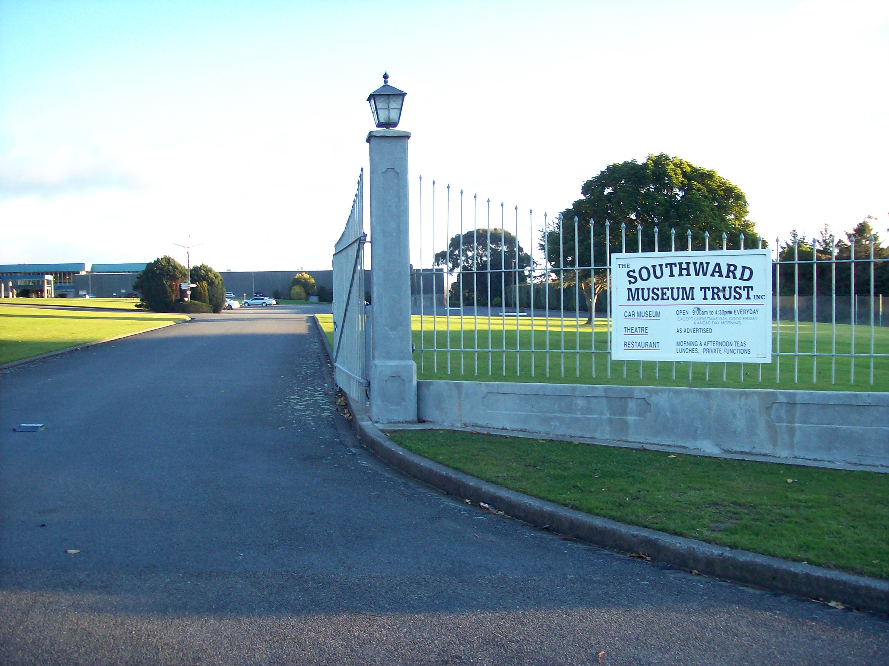
Located in Otaihanga is one of the Kāpiti Coast's most significant tourist attractions, the Southward Car Museum on Otaihanga Road between the North Island Main Trunk railway to the west and State Highway 1 to the east. It has one of the largest collections of cars in the Southern Hemisphere and contains other attractions such as heritage planes, and it has a large theatre.
Otaihanga once had an African Lion Safari Park, which closed in 1982.
Economy
Agriculture used to take place, but has now largely ceased as residential developments have been built. Otaihanga has become primarily residential, and some small-scale commercial businesses operate. The Kāpiti Coast's main rubbish tip is in Otaihanga.
Education
There are no educational institutions in Otaihanga, but there are primary schools and a secondary school, Paraparaumu College, minutes away in Paraparaumu. One of the primary schools, Kenakena School, has been involved in works to improve Otaihanga's environment at Greendale Reserve.
Environment

As Otaihanga is on the banks of the Waikanae River, it can be susceptible to flooding during storms and periods of high rainfall. Serious flooding in the first week of January 2005 damaged 18 houses and necessitated the evacuation to higher ground of a number of residents by boat. After the flooding, the raising of three houses was prioritised and long term options such as upgrading flood stopbanks and extracting gravel from the riverbed were investigated.
The main parkland in Otaihanga is the Otaihanga Domain, on the banks of the Waikanae River. It is used for leisure activities and has no sporting facilities. It has family amenities and a footbridge across the river to Waikanae. Another parkland, Greendale Reserve, was formerly two rundown paddocks but it has been the subject of local volunteer efforts to revitalise its environment and restore native plants. These efforts began in 1997 and have involved the students of Kenakena School. In 2006, the volunteer work was honoured by a Conservation Week Merit Award, with the school receiving the 2006 Young Conservationist Award.
Transport

State Highway 1 runs through eastern Otaihanga. The intersection of the highway and Otaihanga Road is a notorious traffic black spot and in August 2006, Transit New Zealand lowered the speed limit of the highway in the area from 100 km/h to 80 km/h as an attempt to reduce accidents. A roundabout was installed in 2013 but the design of the roundabout has been criticised.
Otaihanga is on the North Island Main Trunk railway, on a section built by the Wellington and Manawatu Railway Company. The two ends of the line met at Otaihanga and the last spike was driven at a public ceremony by Governor William Jervois. The railway opened on 3 November 1886 and passed into the ownership of the New Zealand Railways Department on 8 December 1908. There was a passenger halt at Otaihanga until 1902. Kāpiti Line commuter services stop at Paraparaumu and the terminus at Waikanae.
References
References
- {{LINZ. 34268. 21 May 2021
- Kāpiti Coast District Council, [http://www.kapiticoast.govt.nz/districtdevelopment/economicdevelopment/tourism.htm "Tourism"] {{webarchive. link. (2008-10-14 , accessed 28 November 2007.)
- (6 August 2019). "1000 Māori place names". New Zealand Ministry for Culture and Heritage.
- "Stats NZ Geographic Data Service".
- {{NZ census 2018. Otaihanga (237400). otaihanga. Otaihanga
- "Totals by topic for dwellings, (RC, TALB, UR, SA3, SA2, Ward, Health), 2013, 2018, and 2023 Censuses". Stats NZ – Tatauranga Aotearoa – Aotearoa Data Explorer.
- "Totals by topic for individuals, (RC, TALB, UR, SA3, SA2, Ward, Health), 2013, 2018, and 2023 Censuses". Stats NZ – Tatauranga Aotearoa – Aotearoa Data Explorer.
- (22 February 1982). "The KAPITI OBSERVER. 1950 etc…". Kapiti Observer.
- Kāpiti Coast District Council, [http://www.kapiticoast.govt.nz/healthyservices/wastemanagement "Waste Management"], accessed 28 November 2007.
- Greater Wellington Regional Council, [http://www.gw.govt.nz/story6199.cfm "Friends of Greendale"], accessed 28 November 2007.
- (6 January 2005). "18 homes flooded north of Wellington". [[The New Zealand Herald]].
- Greater Wellington Regional Council, [http://www.gw.govt.nz/story8399.cfm "House Raising in Otaihanga Brought Forward"], posted 8 March 2005, accessed 28 November 2007.
- Kāpiti Coast District Council, [http://www.kapiticoast.govt.nz/openspaces/parksandreserves/ "Parks and Reserves"] {{Webarchive. link. (3 July 2007 , accessed 28 November 2007.)
- Transit New Zealand Wellington Regional Office, [http://www.transit.govt.nz/news/MediaReleaseView.do?MediaReleaseId=nz.govt.transit.transweb.content.news.MediaRelease-10329 "Media Release: Speed Limit Change At Otaihanga"], posted 1 August 2006, accessed 28 November 2007.
- (23 July 2013). "Work starts on Otaihanga intersection". Stuff/Fairfax.
- (31 March 2015). "Minor flaws found in State Highway 1's Otaihanga roundabout". Stuff/Fairfax.
This article was imported from Wikipedia and is available under the Creative Commons Attribution-ShareAlike 4.0 License. Content has been adapted to SurfDoc format. Original contributors can be found on the article history page.
Ask Mako anything about Otaihanga — get instant answers, deeper analysis, and related topics.
Research with MakoFree with your Surf account
Create a free account to save articles, ask Mako questions, and organize your research.
Sign up freeThis content may have been generated or modified by AI. CloudSurf Software LLC is not responsible for the accuracy, completeness, or reliability of AI-generated content. Always verify important information from primary sources.
Report