From Surf Wiki (app.surf) — the open knowledge base
Osterley
District of Isleworth, London, England
District of Isleworth, London, England
| Field | Value |
|---|---|
| country | England |
| map_type | Greater London |
| region | London |
| static_image | Shops on Thornbury Road - geograph.org.uk - 2692122.jpg |
| static_image_caption | Shops on Thornbury Road, Osterley |
| population | 13,031 |
| population_ref | (2011 Census. Osterley and Spring Grove Ward) |
| official_name | Osterley |
| coordinates | |
| os_grid_reference | TQ145775 |
| london_borough | Hounslow |
| post_town | HOUNSLOW |
| postcode_area | TW |
| postcode_district | TW5 |
| post_town1 | ISLEWORTH |
| dial_code | 020 |
| postcode_area1 | TW |
| postcode_district1 | TW7 |
| constituency_westminster | Brentford & Isleworth |
the area of London
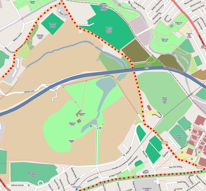
Osterley ( ) is an affluent district of Isleworth in west London, England, 8.7 mi from Charing Cross in the London Borough of Hounslow. Most of its land use is mixed agricultural and aesthetic parkland at Osterley House (National Trust), charity-run, much of which is open to paying visitors.
Osterley is on elevated soil, bisected by the A4 (Great West Road), and extends north of the M4 motorway. Syon Lane forms the border to the east, while the border with Heston is to the west. Osterley extends south of the A4, including St Mary's Church.
Most of the land of Osterley is the large ancestral private estate of Osterley Park (one of the largest open spaces in west London) and its mansion. These were formerly owned by the Jersey family and were used during World War II as the home for Tom Wintringham's Home Guard training school. They are now National Trust property. In the 1930s, when the Great West Road was completed, ribbon development housing appeared, and this gradually expanded to form the comparatively small residential sections within Osterley.
Besides Osterley House and Park, the district is also known for one of the London residences of The Sultan of Brunei (Aviary Farm in Windmill Lane).
Politics
Osterley is part of the Brentford and Isleworth constituency for elections to the House of Commons of the United Kingdom.
Osterley is part of the Osterley and Spring Grove ward for elections to Hounslow London Borough Council.
Sport and Leisure
Osterley has a non-League football club CB Hounslow United F.C. who play at the Osterley Sports Ground.
The training ground of Premier League club Brentford is located at 100 Jersey Road, Osterley.
Demography and housing
In the 2011 census, the Osterley ward was recorded as being 30% White British. Other significant ethnic groups were Other Whites (12.8%) and Indians. The proportion who ethnically identify as BAME (Black, Asian and minority Ethnic) was 54.4% of the population.
51.9% of people living in Osterley were born in the U.K. The other most common countries of birth were India (12.7%), Pakistan (2.8%), Kenya (2.2%), Ireland (1.8%), and North Africa (1.3%).
The largest religious affiliations in Isleworth are Christians (39.2%), Muslims (13.8%), Hindus (13.7%), those with no religion (11.9%), and Sikhs (11.8%).
| Ward | Detached | Semi-detached | Terraced | Flats and apartments | Caravans/temporary/mobile homes/houseboats | url=http://neighbourhood.statistics.gov.uk | title= Neighbourhood statistics | publisher=Office for National Statistics}} |
|---|---|---|---|---|---|---|---|---|
| Osterley and Spring Grove | 420 | 1,900 | 467 | 1,981 | 4 | 24 |
| Ward | Population | Households | % Owned outright | % Owned with a loan | hectares |
|---|---|---|---|---|---|
| Osterley and Spring Grove | 13,031 | 4,796 | 29 | 33 | 634 |
Transport and locale
Nearest tube station
- Osterley tube station
Nearest railway stations
- Syon Lane railway station
- Isleworth railway station
Nearest places
- Kew Gardens is approximately 20 minutes away.
References
References
- "Hounslow Ward population 2011". Office for National Statistics.
- (1962). "Heston and Isleworth: Introduction". Institute of Historical Research.
- (12 October 2020). "The London Borough of Hounslow (Electoral Changes) Order 2020".
- "Brentford FC Performance Centre".
- "Osterley and Spring Grove- UK Census Data 2011". Ukcensusdata.com.
- "Ward Profiles and Atlas – London Datastore".
- "Osterley and Spring Grove Demographics (Hounslow, England)". Osterley-and-spring-grove.localstats.co.uk.
- "Neighbourhood statistics". [[Office for National Statistics]].
This article was imported from Wikipedia and is available under the Creative Commons Attribution-ShareAlike 4.0 License. Content has been adapted to SurfDoc format. Original contributors can be found on the article history page.
Ask Mako anything about Osterley — get instant answers, deeper analysis, and related topics.
Research with MakoFree with your Surf account
Create a free account to save articles, ask Mako questions, and organize your research.
Sign up freeThis content may have been generated or modified by AI. CloudSurf Software LLC is not responsible for the accuracy, completeness, or reliability of AI-generated content. Always verify important information from primary sources.
Report