From Surf Wiki (app.surf) — the open knowledge base
Osaka Prefecture
Prefecture of Japan

Prefecture of Japan
| Field | Value | |
|---|---|---|
| native_name | 大阪府 | |
| settlement_type | Prefecture | |
| image_skyline | {{multiple image | |
| border | infobox | |
| total_width | 280 | |
| image_style | border:1; | |
| perrow | 1/2/2/1/2 | |
| image1 | Osaka Castle 03bs3200.jpg | |
| alt1 | 大阪城と大阪ビジネスパーク | |
| image2 | Dotombori neon signs at 3rd November 2014.JPG | |
| alt2 | 道頓堀 | |
| image3 | Kishiwada-Danjiri-Matsuri Osaka Japan.jpg | |
| alt3 | 岸和田だんじり祭 | |
| image4 | Tondabayashi-Jinaimachi-Nakaike-20080127.jpg | |
| alt4 | 富田林寺内町 | |
| image5 | Mozu Kofun Group zenkei-2.jpg | |
| alt5 | 百舌鳥古墳群 | |
| translit_lang1 | Japanese | |
| translit_lang1_type | Japanese | |
| translit_lang1_info | 大阪府 | |
| translit_lang1_type1 | Rōmaji | |
| translit_lang1_info1 | Ōsaka-fu | |
| image_flag | Flag of Osaka.svg | |
| flag_size | 100px | |
| image_blank_emblem | Emblem of Osaka Prefecture.svg | |
| blank_emblem_size | 80px | |
| blank_emblem_type | Symbol | |
| mapframe | yes | |
| mapframe-zoom | 8 | |
| image_map1 | Map of Japan with highlight on 27 Osaka prefecture.svg | |
| coordinates | ||
| subdivision_type | Country | |
| subdivision_name | Japan | |
| subdivision_type1 | Region | |
| subdivision_name1 | Kansai | |
| subdivision_type2 | Island | |
| subdivision_name2 | Honshu | |
| seat_type | Capital | |
| seat | Osaka | |
| parts_type | Subdivisions | |
| parts_style | para | |
| p1 | Districts: 5 | |
| p2 | Municipalities: 43 | |
| leader_title | Governor | |
| leader_name | Vacant (since 22 January 2026) | |
| area_total_km2 | 1905.14 | |
| area_water_percent | 17.9 | |
| area_rank | 46th | |
| population_total | 8823358 | |
| population_as_of | 1 July 2019 | |
| population_rank | 3rd | |
| population_density_km2 | auto | |
| demographics_type2 | GDP (2022) | |
| demographics2_footnotes | ||
| demographics2_title1 | Total | |
| demographics2_info1 | JP¥ 43,124 billion | |
| US$ 318.6 billion | ||
| iso_code | JP-27 | |
| website | ||
| module | {{Infobox place symbols | embedded=yes |
| country | Japan | |
| bird | Bull-headed shrike (Lanius bucephalus) | |
| flower | Japanese apricot (Prunus mume) | |
| Primrose (Primula sieboldii) | ||
| tree | Ginkgo tree (Ginkgo biloba) |
| mapframe-zoom = 8 US$ 318.6 billion Primrose (Primula sieboldii)
Osaka Prefecture is a prefecture of Japan located in the Kansai region of Honshu. Osaka Prefecture has a population of 8,778,035 () and has a geographic area of 1905 km2. Osaka Prefecture borders Hyōgo Prefecture to the northwest, Kyoto Prefecture to the north, Nara Prefecture to the southeast, and Wakayama Prefecture to the south.
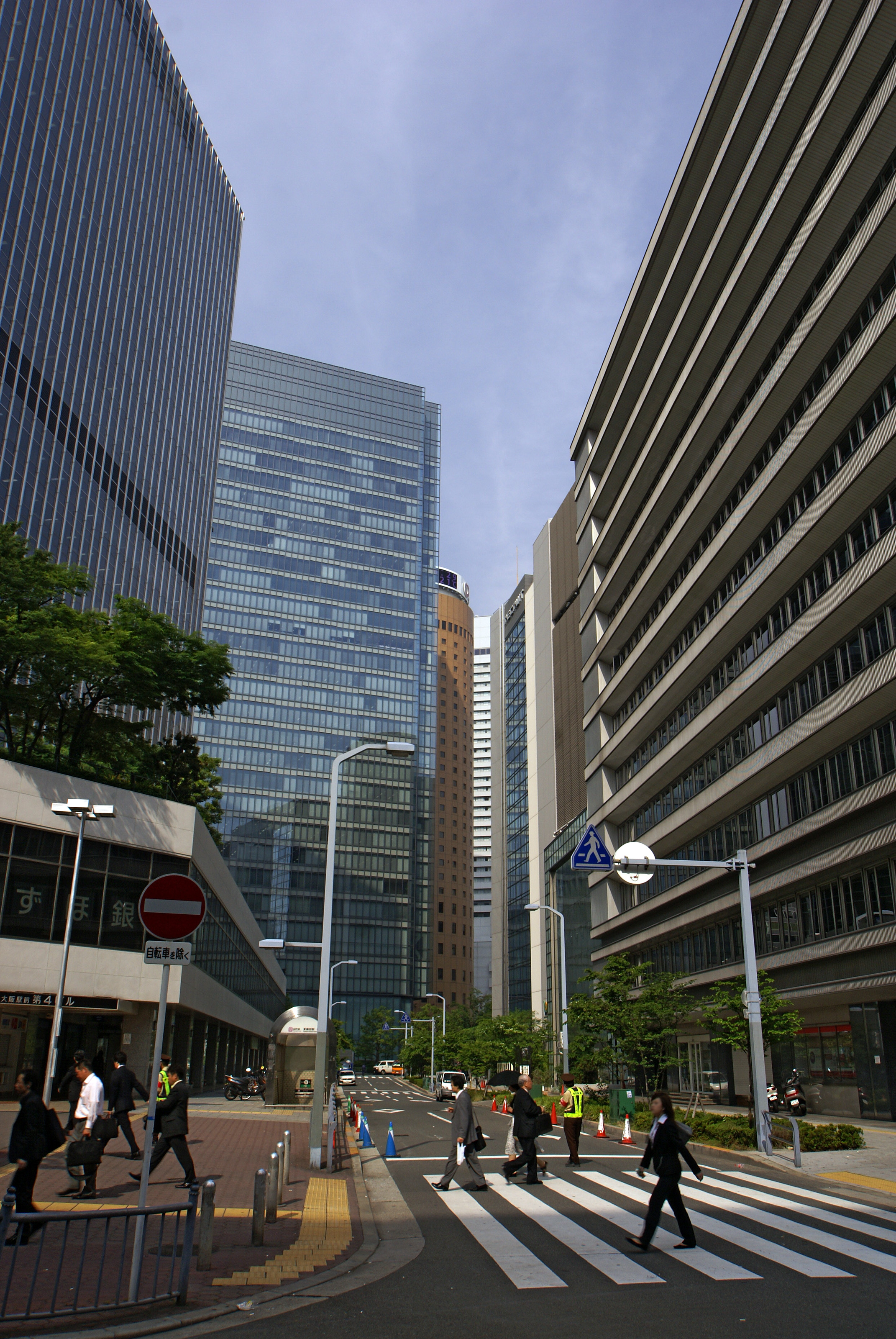
Osaka is the capital and largest city of Osaka Prefecture, and the third-largest city in Japan, with other major cities including Sakai, Higashiōsaka, and Hirakata. Osaka Prefecture is located on the western coast of the Kii Peninsula, forming the western is open to Osaka Bay. Osaka Prefecture is the third-most-populous prefecture, but by geographic area the second-smallest; at 4600 PD/km2 it is the second-most densely populated, below only Tokyo. Osaka Prefecture is one of Japan's two "urban prefectures" using the designation fu (府) rather than the standard ken for prefectures, along with Kyoto Prefecture. Osaka Prefecture forms the center of the Keihanshin metropolitan area, the second-most-populated urban region in Japan after the Greater Tokyo area and one of the world's most productive regions by GDP.
History
Prior to the Meiji Restoration, the modern-day area of Osaka Prefecture was split between Kawachi, Izumi, and Settsu provinces.
Osaka Prefecture was created on June 21, 1868, at the very beginning of the Meiji era. During the instigation of Fuhanken Sanchisei in 1868, the prefecture received its suffix fu, designating it as a prefecture.
On September 1, 1956, the city of Osaka was promoted to a city designated by government ordinance and thereby divided into 24 wards. Sakai became the second city in the prefecture to be promoted to a city designated by government ordinance on April 1, 2006, and was divided into seven wards.
In 2000, Fusae Ota became Japan's first female governor when she replaced Knock Yokoyama, who resigned after prosecution for sexual harassment. Tōru Hashimoto, previously famous as a counselor on television, was elected in 2008 at the age of 38, becoming the youngest governor in Japan.
On June 18, 2018, an earthquake struck the northern region of the prefecture. It killed 4 people and caused minor damage across Greater Osaka.
Proposed reorganisation
Main article: Osaka Metropolis plan
In 2010, the Osaka Restoration Association was created with backing by Governor Tōru Hashimoto, with hopes of reforming Osaka Prefecture into the Osaka Metropolis and merging with the City of Osaka. In the 2011 local elections, the association was able to win the majority of the prefectural seats and Hashimoto was elected as mayor of Osaka.
A referendum on the issue was held in 2015 and was defeated with 50.38% of voters opposed to the plan. A second referendum in 2020 was rejected by 50.6% of voters.
Geography
Osaka Prefecture neighbors the prefectures of Hyōgo and Kyoto in the north, Nara in the east and Wakayama in the south. The Yodo and Yamato Rivers flow through the prefecture.
Prior to the construction of Kansai International Airport, Osaka was the smallest prefecture in Japan. The artificial island on which the airport was built added enough area to make it slightly larger than Kagawa Prefecture.
As of 1 April 2012, 11% of the total land area of the prefecture was designated as Natural Parks, namely Kongō-Ikoma-Kisen and Meiji no Mori Minō Quasi-National Parks and Hokusetsu and Hannan-Misaki Prefectural Natural Parks.
Municipalities
]]


Since 2005, Osaka consists of 43 municipalities: 33 cities, nine towns and one village. As of 2021, the 33 cities include two designated major cities, seven core cities and two (transitional) special case cities (after legal abolition in 2015, to be replaced with the core city system in the 2020s).
| Flag, name w/o suffix | Full name | District | |||||||||||||||||
|---|---|---|---|---|---|---|---|---|---|---|---|---|---|---|---|---|---|---|---|
| (-gun) | Area (km2) | Population | Map | LPE code | |||||||||||||||
| (w/o pref. [27...], | |||||||||||||||||||
| checksum [-x]) | Japanese | transcription | translation | [[File:Flag of Osaka Prefecture.svg | frameless | 25x25px]] Osaka | 大阪府 | Ōsaka-fu | Osaka Prefecture | – | 1,905.14 | 8,823,358 | 000 | ||||||
| ISO: JP-27 | |||||||||||||||||||
| [[File:Flag of Daito, Osaka.svg | frameless | 25x25px]] Daitō | 大東市 | Daitō-shi | Daitō City | – | 18.27 | 119,329 | [[File:Daito in Osaka Prefecture Ja.svg | frameless | 70x70px]] | 218 | |||||||
| [[File:Flag of Fujiidera, Osaka.svg | frameless | 25x25px]] Fujidera | 藤井寺市 | Fujidera-shi | Fujidera City | – | 8.89 | 65,075 | [[File:Fujiidera_in_Osaka_Prefecture_Ja.svg | frameless | 70x70px]] | 226 | |||||||
| [[File:Flag of Habikino, Osaka.svg | frameless | 25x25px]] Habikino | 羽曳野市 | Habikino-shi | Habikino City | – | 26.44 | 113,256 | [[File:Habikino in Osaka Prefecture Ja.svg | frameless | 70x70px]] | 222 | |||||||
| [[File:Flag of Hannan, Osaka.svg | frameless | 25x25px]] Hannan | 阪南市 | Hannan-shi | Hannan City | – | 36.1 | 55,798 | [[File:Hannan in Osaka Prefecture Ja.svg | frameless | 70x70px]] | 232 | |||||||
| [[File:Flag of Higashiosaka, Osaka.svg | frameless | 25x25px]] Higashiōsaka | 東大阪市 | Higashi-Ōsaka-shi | Higashi-Osaka City | ||||||||||||||
| (East Osaka City) | – | 61.78 | 495,011 | [[File:Higashiosaka in Osaka Prefecture Ja.svg | frameless | 70x70px]] | 227 | ||||||||||||
| [[File:Flag of Hirakata, Osaka.svg | frameless | 25x25px]] Hirakata | 枚方市 | Hirakata-shi | Hirakata City | – | 65.08 | 401,449 | [[File:Hirakata in Osaka Prefecture Ja.svg | frameless | 70x70px]] | 210 | |||||||
| [[File:Flag of Ibaraki, Osaka.svg | frameless | 25x25px]] Ibaraki | 茨木市 | Ibaraki-shi | Ibaraki City | – | 76.52 | 280,562 | [[File:Ibaraki in Osaka Prefecture Ja.svg | frameless | 70x70px]] | 211 | |||||||
| [[File:Flag of Ikeda, Osaka.svg | frameless | 25x25px]] Ikeda | 池田市 | Ikeda-shi | Ikeda City | – | 22.09 | 103,028 | [[File:Ikeda in Osaka Prefecture Ja.svg | frameless | 70x70px]] | 204 | |||||||
| [[File:Flag of Izumi, Osaka.svg | frameless | 25x25px]] Izumi | 和泉市 | Izumi-shi | Izumi City | – | 84.98 | 186,370 | [[File:Izumi in Osaka Prefecture Ja.svg | frameless | 70x70px]] | 219 | |||||||
| [[File:Flag of Izumiōtsu, Osaka.svg | frameless | 25x25px]] Izumiōtsu | 泉大津市 | Izumi-Ōtsu-shi | Izumi-Ōtsu City | ||||||||||||||
| (as opposed to Ōtsu City in Ōmi Province) | – | 13.36 | 75,398 | [[File:Izumiotsu in Osaka Prefecture Ja.svg | frameless | 70x70px]] | 206 | ||||||||||||
| [[File:Flag of Izumisano, Osaka.svg | frameless | 25x25px]] Izumisano | 泉佐野市 | Izumi-Sano-shi | Izumi-Sano City | ||||||||||||||
| (as opposed to Sano City in Shimotsuke Province) | – | 55.03 | 100,649 | [[File:Izumisano in Osaka Prefecture Ja.svg | frameless | 70x70px]] | 213 | ||||||||||||
| [[File:Flag of Kadoma, Osaka.svg | frameless | 25x25px]] Kadoma | 門真市 | Kadoma-shi | Kadoma City | – | 12.28 | 124,516 | [[File:Kadoma in Osaka Prefecture Ja.svg | frameless | 70x70px]] | 223 | |||||||
| [[File:Flag of Kaizuka, Osaka.svg | frameless | 25x25px]] Kaizuka | 貝塚市 | Kaizuka-shi | Kaizuka City | – | 43.99 | 88,345 | [[File:Kaizuka in Osaka Prefecture Ja.svg | frameless | 70x70px]] | 208 | |||||||
| [[File:Flag of Kashiwara Osaka.svg | frameless | 25x25px]] Kashiwara | 柏原市 | Kashiwara-shi | Kashiwara City | – | 25.39 | 76,383 | [[File:Kashiwara in Osaka Prefecture Ja.svg | frameless | 70x70px]] | 221 | |||||||
| [[File:Flag of Katano, Osaka.svg | frameless | 25x25px]] Katano | 交野市 | Katano-shi | Katano City | – | 25.55 | 76,383 | [[File:Katano in Osaka Prefecture Ja.svg | frameless | 70x70px]] | 230 | |||||||
| [[File:Flag of Kawachinagano, Osaka.svg | frameless | 25x25px]] Kawachinagano | 河内長野市 | Kawachi-Nagano-shi | Kawachi-Nagano City | ||||||||||||||
| (as opposed to Nagano City in Shinano Province) | – | 109.61 | 105,872 | [[File:Kawachinagano in Osaka Prefecture Ja.svg | frameless | 70x70px]] | 216 | ||||||||||||
| [[File:Flag of Kishiwada, Osaka.svg | frameless | 25x25px]] Kishiwada | 岸和田市 | Kishiwada-shi | Kishiwada City | – | 72.68 | 197,629 | [[File:Kishiwada in Osaka Prefecture Ja.svg | frameless | 70x70px]] | 202 | |||||||
| [[File:Flag of Matsubara, Osaka.svg | frameless | 25x25px]] Matsubara | 松原市 | Matsubarashi | Matsubara City | – | 16.66 | 121,125 | [[File:Matsubara in Osaka Prefecture Ja.svg | frameless | 70x70px]] | 217 | |||||||
| [[File:Flag of Minoo, Osaka.svg | frameless | 25x25px]] Minoh | 箕面市 | Minoo-shi | Minoo City | – | 47.84 | 134,435 | [[File:Minoh in Osaka Prefecture Ja.svg | frameless | 70x70px]] | 220 | |||||||
| [[File:Flag of Moriguchi, Osaka.svg | frameless | 25x25px]] Moriguchi | 守口市 | Moriguchi-shi | Moriguchi City | – | 12.73 | 143,877 | [[File:Moriguchi in Osaka Prefecture Ja.svg | frameless | 70x70px]] | 209 | |||||||
| [[File:Flag of Neyagawa, Osaka.svg | frameless | 25x25px]] Neyagawa | 寝屋川市 | Neyagawa-shi | Neyagawa City | – | 24.73 | 236,758 | [[File:Neyagawa in Osaka Prefecture Ja.svg | frameless | 70x70px]] | 215 | |||||||
| [[File:Flag of Osaka, Osaka.svg | frameless | 25x25px]] Osaka (capital) | 大阪市 | Ōsaka-shi | Osaka City | – | 225.21 | 2,668,586 | [[File:Osaka in Osaka Prefecture Ja.svg | frameless | 70x70px]] | 100 | |||||||
| [[File:Flag of Ōsakasayama, Osaka.svg | frameless | 25x25px]] Ōsakasayama | 大阪狭山市 | Ōsaka-Sayama-shi | Osaka-Sayama City | ||||||||||||||
| (as opposed to Sayama City in Saitama) | – | 11.86 | 57,993 | [[File:Osakasayama in Osaka Prefecture Ja.svg | frameless | 70x70px]] | 231 | ||||||||||||
| [[File:Flag of Sakai, Osaka.svg | frameless | 25x25px]] Sakai | 堺市 | Sakai-shi | Sakai City | – | 149.82 | 828,741 | [[File:Sakai in Osaka Prefecture Ja.svg | frameless | 70x70px]] | 140 | |||||||
| [[File:Flag of Sennan, Osaka.svg | frameless | 25x25px]] Sennan | 泉南市 | Sennan-shi | Sennan City | ||||||||||||||
| (Sen[shū] South City) | |||||||||||||||||||
| (after Sennan District) | – | 48.48 | 62,076 | [[File:Sennan in Osaka Prefecture Ja.svg | frameless | 70x70px]] | 228 | ||||||||||||
| [[File:Flag of Settsu, Osaka.svg | frameless | 25x25px]] Settsu | 摂津市 | Settsu-shi | Settsu City | – | 14.88 | 85,290 | [[File:Settsu_in_Osaka_Prefecture_Ja.svg | frameless | 70x70px]] | 224 | |||||||
| [[File:Flag of Shijōnawate, Osaka.svg | frameless | 25x25px]] Shijōnawate | 四條畷市 | Shijōnawate-shi | Shijōnawate City | – | 18.74 | 55,832 | [[File:Shijonawate in Osaka Prefecture Ja.svg | frameless | 70x70px]] | 229 | |||||||
| [[File:Flag of Suita, Osaka.svg | frameless | 25x25px]] Suita | 吹田市 | Suita-shi | Suita City | – | 36.11 | 378,322 | [[File:Suita in Osaka Prefecture Ja.svg | frameless | 70x70px]] | 205 | |||||||
| [[File:Flag of Takaishi, Osaka.svg | frameless | 25x25px]] Takaishi | 高石市 | Takaishi-shi | Takaishi City | – | 11.35 | 56,583 | [[File:Takaishi in Osaka Prefecture Ja.svg | frameless | 70x70px]] | 225 | |||||||
| [[File:Flag of Takatsuki, Osaka.svg | frameless | 25x25px]] Takatsuki | 高槻市 | Takatsuki-shi | Takatsuki City | – | 105.31 | 350,914 | [[File:Takatsuki in Osaka Prefecture Ja.svg | frameless | 70x70px]] | 207 | |||||||
| [[File:Flag of Tondabayashi, Osaka.svg | frameless | 25x25px]] Tondabayashi | 富田林市 | Tondabayashi-shi | Tondabayashi City | – | 39.66 | 112,993 | [[File:Tondabayashi in Osaka Prefecture Ja.svg | frameless | 70x70px]] | 214 | |||||||
| [[File:Flag of Toyonaka, Osaka.svg | frameless | 25x25px]] Toyonaka | 豊中市 | Toyonaka-shi | Toyonaka City | – | 36.38 | 396,014 | [[File:Toyonaka in Osaka Prefecture Ja.svg | frameless | 70x70px]] | 203 | |||||||
| [[File:Flag of Yao, Osaka.svg | frameless | 25x25px]] Yao | 八尾市 | Yaoshi | Yao City | – | 41.71 | 268,013 | [[File:Yao in Osaka Prefecture Ja.svg | frameless | 70x70px]] | 212 | |||||||
| [[File:Flag of Chihaya-Akasaka, Ōsaka.svg | frameless | 25x25px]] Chihayaakasaka | 千早赤阪村 | Chihaya-Akasaka-mura | Chihaya-Akasaka Village | Minamikawachi | 37.38 | 5,467 | [[File:Chihayaakasaka in Osaka Prefecture Ja.svg | frameless | 70x70px]] | 383 | |||||||
| [[File:Flag of Kanan, Osaka.svg | frameless | 25x25px]] Kanan | 河南町 | Kanan-chō | Kanan Town | 25.26 | 16,027 | [[File:Kanan in Osaka Prefecture Ja.svg | frameless | 70x70px]] | 382 | ||||||||
| [[File:Flag of Taishi Osaka.svg | frameless | 25x25px]] Taishi | 太子町 | Taishi-chō | Taishi Town | 14.17 | 13,634 | [[File:Taishi in Osaka Prefecture Ja.svg | frameless | 70x70px]] | 381 | ||||||||
| [[File:Flag of Kumatori, Osaka.svg | frameless | 25x25px]] Kumatori | 熊取町 | Kumatori-chō | Kumatori Town | Sennan | 17.23 | 43,988 | [[File:Kumatori in Osaka Prefecture Ja.svg | frameless | 70x70px]] | 361 | |||||||
| [[File:Flag of Misaki, Osaka.svg | frameless | 25x25px]] Misaki | 岬町 | Misakichō | Misaki Town | 49.08 | 16,267 | [[File:Misaki in Osaka Prefecture Ja.svg | frameless | 70x70px]] | 366 | ||||||||
| [[File:Flag of Tajiri Osaka.svg | frameless | 25x25px]] Tajiri | 田尻町 | Tajiri-chō | Tajiri Town | 4.96 | 8,377 | [[File:Tajiri in Osaka Prefecture Ja.svg | frameless | 70x70px]] | 362 | ||||||||
| [[File:Flag of Nose, Osaka.svg | frameless | 25x25px]] Nose | 能勢町 | Nose-chō | Nose Town | Toyono | 98.68 | 9,971 | [[File:Nose in Osaka Prefecture Ja.svg | frameless | 70x70px]] | 322 | |||||||
| [[File:Flag of Toyono, Osaka.svg | frameless | 25x25px]] Toyono | 豊能町 | Toyono-chō | Toyono Town | 34.37 | 19,519 | [[File:Toyono in Osaka Prefecture Ja.svg | frameless | 70x70px]] | 321 | ||||||||
| [[File:Flag of Shimamoto, Osaka.svg | frameless | 25x25px]] Shimamoto | 島本町 | Shimamoto-chō | Shimamoto Town | Mishima | 16.78 | 29,970 | [[File:Shimamoto in Osaka Prefecture Ja.svg | frameless | 70x70px]] | 301 | |||||||
| [[File:Flag of Tadaoka, Osaka.svg | frameless | 25x25px]] Tadaoka | 忠岡町 | Tadaoka-chō | Tadaoka Town | Senboku | 4.03 | 17,187 | [[File:Tadaoka in Osaka Prefecture Ja.svg | frameless | 70x70px]] | 341 | |||||||
| [[File:Map of Osaka Prefecture Ja.svg | frameless | 87x87px]] |
Mergers
Main article: List of mergers in Osaka Prefecture
After the modern reactivation of districts in 1878/79, Osaka, including Sakai which was only merged into Osaka in 1881, consisted of 5 urban districts (-ku) and 27 rural districts (-gun), excluding 15 districts in Yamato Province which was later separated from Osaka as Nara Prefecture in 1887. When the prefectures were subdivided into modern municipalities in 1889, the five urban districts were turned into two district-independent cities: Osaka City and Sakai City, and Osaka's [rural] districts were subdivided into 12 towns and 310 villages. After Osaka City had absorbed many surrounding municipalities in the interwar/Taishō period, the number of municipalities in Osaka had already dropped to 149 by 1953. The Great Shōwa mergers of the 1950s reduced the total to 47 by 1961, including 26 cities by then. The current total of 43 was reached during the Great Heisei mergers in 2005.
Economy


.jpg)


The gross prefecture product of Osaka for the fiscal year 2004 was ¥38.7 trillion, second after Tokyo with an increase of 0.9% from the previous year. This represented approximately 48% of the Kinki region. The per capita income was ¥3.0 million, seventh in the nation. Commercial sales the same year was ¥60.1 trillion.
Overshadowed by such globally renowned electronics giants as Panasonic and Sharp, the other side of Osaka's economy can be characterized by its Small and Medium Enterprises (SMEs) activities. The number of SMEs based in Osaka in 2006 was 330,737, accounting for 99.6% of the total number of businesses in the prefecture.{{cite web |access-date=2007-03-13 |archive-date=2007-03-23 |archive-url=https://web.archive.org/web/20070323003306/http://www.chusho.meti.go.jp/pamflet/hakusyo/h18/download/2006hakusho_eng.pdf |url-status=dead
The Osaka Securities Exchange, specializing in derivatives such as Nikkei 225 Futures, is based in Osaka.
There are many electrical, chemical, pharmaceutical, heavy industry, food, and housing companies in Osaka Prefecture.
Major companies
Main article: Category:Companies based in Osaka Prefecture
Major factories and research institutes
Main article: Hanshin Industrial Region, Kansai Science City
Demographics

According to the 2005 Population Census of Japan, Osaka prefecture has a population of 8,817,166, an increase of 12,085, or 0.14%, since the Census of year 2000.
As of 2022, the prefecture has about 93,000 ethnic Korean persons, the largest such population of any prefecture in Japan. As of 2013, most ethnic Korean children attend ordinary Japanese public schools, although some Korean schools operated by the Chongryon and classes for ethnic Koreans had opened in the prefecture. During the Japanese rule of Korea many ethnic Koreans came to the Osaka area to look for work. Many people from Jeju came to the Osaka area after a 1922 ferry line between Osaka and Jeju opened. During World War II Japanese authorities forced additional ethnic Koreans to move to the Osaka area.
Temples and shrines
- Shitennō-ji
- Kanshin-ji
- Sumiyoshi Taisha
Museums
- National Museum of Ethnology, Japan http://www.minpaku.ac.jp/english/
- Open-Air Museum of Old Japanese Farm Houses (Hattori Ryokuchi Park)
- OSTEC (Osaka Science and Technology Center) Exhibition Hall
- Japan Folk Crafts Museum, Osaka 大阪日本民芸館
Education
Public elementary and junior high schools in the prefecture are operated by the municipalities. Public high schools are operated by the Osaka Prefectural Board of Education.
Universities
- Hagoromo University of International Studies (Sakai)
- Hannan University (Matsubara)
- Kansai Gaidai University (Hirakata) (Kansai University of Foreign Studies)
- Kansai Medical University (Hirakata, Osaka)
- Kansai University (Suita, Takatsuki, Osaka city)
- Kindai University (Higashiosaka)
- Osaka University (Toyonaka and Suita)
- Osaka University of Arts (Kanan)
- Osaka University of Economics (Osaka)
- former Osaka University of Foreign Studies (Minoh)
- Osaka Kyoiku University (Kashiwara)
- Osaka City University (Osaka city)
- Osaka Prefecture University (Sakai)
- Osaka International Educational University (Moriguchi)
- Osaka University of Health and Sport sciences (Kumatori)
- Osaka University of Commerce (Higashiosaka)
- Osaka University of Economic and Law (Yao)
- Osaka College of Music (Toyonaka)
- Osaka Electro Communication University (Neyagawa)
- Osaka Gakuin University (Suita)
- Otemon Gakuin University (Ibaraki)
- Setsunan University (Neyagawa)
- St Andrews University (Momoyama Gakuin University) (Izumi)
- Taisei Gakuin University (Mihara, Sakai)
- Tezukayama Gakuin University (Ōsakasayama, Sakai)
Parks
- The Expo Commemoration Park (Suita) held the Expo '70. It is about 260 ha and includes a Japanese garden, National Museum of Art, Osaka, and the amusement park "Expoland".
- Hattori Ryokuchi Park (Toyonaka), about 150 ha.
- Tsurumi Ryokuchi Park (Osaka), about 100 ha. The horticulture exposition of Expo '90 was held here.
- Nagai Park (Osaka), about 66 ha. The IAAF World Championships in Athletics were held in 2007 at Nagai Stadium in this park.
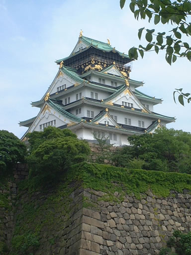
- Osaka Castle Park (Osaka), about 106 ha.
- Nakanoshima Park (Osaka), housing the Museum of Oriental Ceramics, public hall, Osaka Prefectural Nakanoshima Library, and the city hall of Osaka.
- Yamadaike Park (Osaka), about 73.7 ha.
- Osaka Prefectural Park (Hirakata), operated by Osaka Prefecture.
Transportation
Rail
- JR Central
- Tokaido Shinkansen (Shin-Osaka Station)
- JR West
- Sanyo Shinkansen (Shin-Osaka Station)
- Osaka Loop Line
- Osaka Higashi Line
- Tokaido Main Line
- JR Kyoto Line
- JR Kobe Line
- Gakkentoshi Line
- Yamatoji Line
- Hanwa Line
- JR Tozai Line
- JR Yumesaki Line
- Kansai Airport Line
- Osaka Metro
- Midosuji Line
- Tanimachi Line
- Yotsubashi Line
- Chuo Line
- Sennichimae Line
- Sakaisuji Line
- Nagahori Tsurumi-ryokuchi Line
- Imazatosuji Line
- Keihan Electric Railway
- Keihan Main Line
- Keihan Nakanoshima Line
- Keihan Katano Line
- Kintetsu
- Osaka Line
- Nara Line
- Shigi Line
- Keihanna Line
- Minami Osaka Line
- Domyoji Line
- Nagano Line
- Hankyu
- Hankyu Kyoto Line
- Hankyu Senri Line
- Hankyu Takarazuka Line
- Hankyu Minoo Line
- Hankyu Kobe Line
- Nose Electric Railway
- Hanshin Electric Railway
- Hanshin Main Line
- Hanshin Namba Line
- Nankai Electric Railway
- Nankai Main Line
- Takashinohama Line
- Tanagawa Line
- Airport Line
- Koya Line
- Semboku Line
- Mizuma Railway
- Kita-Osaka Kyuko Railway
People movers
- Osaka Monorail
- Nanko Port Town Line
Road

Expressways
- Meishin Expressway
- Chugoku Expressway
- Hanshin Expressway
- Nishi-Meihan Expressway
- Second Keihan Highway
- Hanwa Expressway
- Second Hanna Highway
- Minami Hanna Highway
National highways
- National Route 1
- National Route 2
- National Route 25
- National Route 26
- National Route 43
- National Route 163
- National Route 165
- National Route 166
- National Route 168
- National Route 170
- National Route 171
- National Route 173
- National Route 176
- National Route 307
- National Route 308
- National Route 309
- National Route 310
- National Route 371
- National Route 423
- National Route 477
- National Route 479
- National Route 480
- National Route 481
Airports
- Osaka International Airport - Domestic flights
- Kansai International Airport - International and domestic flights
Sister regions
Osaka Prefecture has sister region relationships with:
- CHN Shanghai, China (1980)
- IDN East Java, Indonesia (1984)
- NED Rotterdam, Netherlands (1984)
- FRA Val-d'Oise, France (1987)
- AUS Queensland, Australia (1988)
- RUS Primorsky Krai, Russia (1992)
- USA California, United States (1994)
- ITA Lombardy, Italy (2002)
- UAE Dubai, United Arab Emirates (2002)
- VIE Ho Chi Minh City, Vietnam (2007)
Sports
The sports teams listed below are based in Osaka.
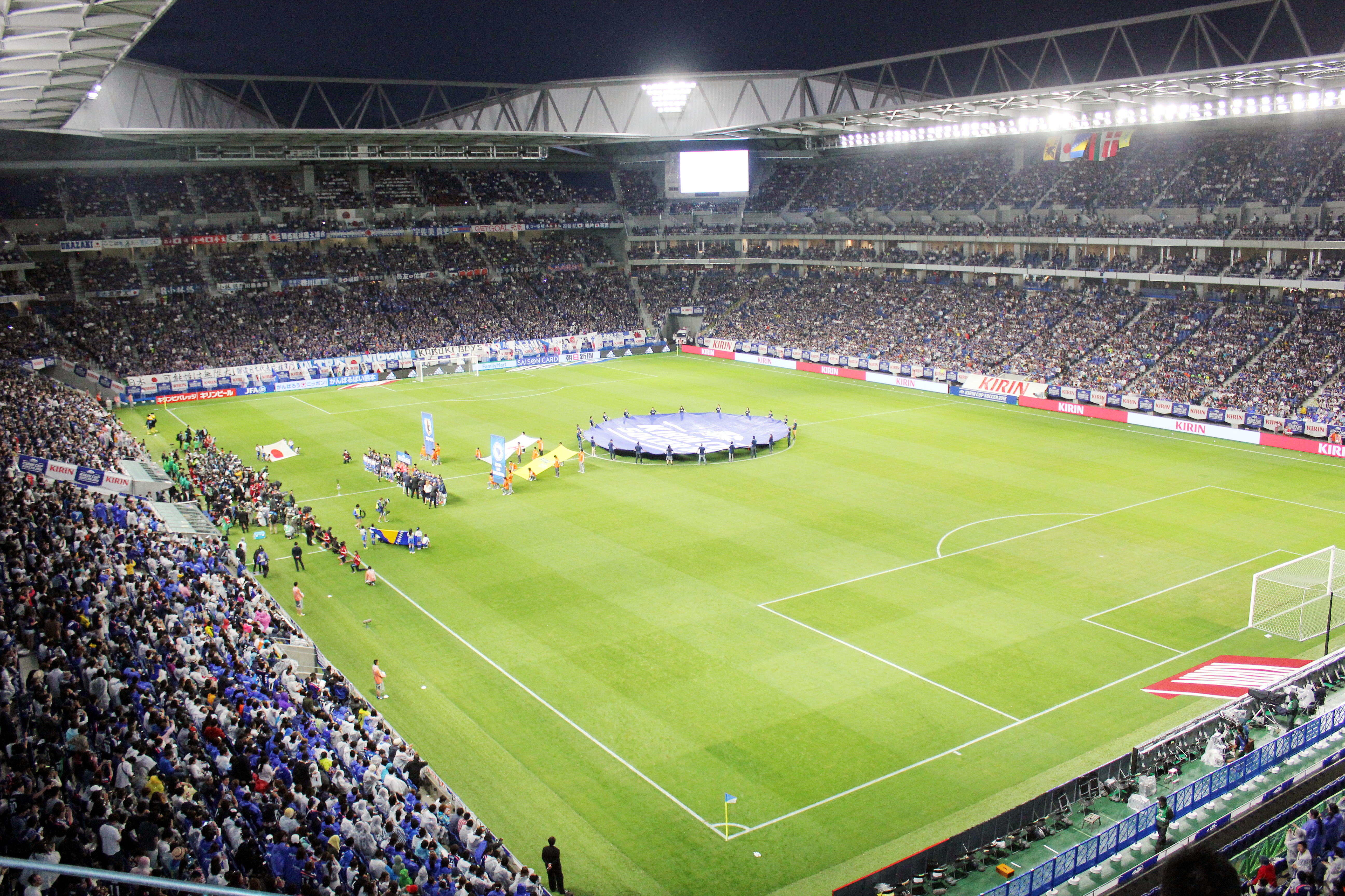
Association with football(soccer)
League
- Cerezo Osaka (J1 League)
- FC Osaka (J3 League)
- Gamba Osaka (J1 League)
Baseball
- Orix Buffaloes
- Hanshin Tigers
Basketball
- Osaka Evessa
Volleyball
- Osaka Blazers Sakai
- Suntory Sunbirds
- Panasonic Panthers
Rugby union
- Red Hurricanes Osaka
- Hanazono Liners
The prefectural symbols
The symbol of Osaka Prefecture, called the sennari byōtan or "thousand gourds", was originally the crest of Toyotomi Hideyoshi, the feudal lord of Osaka Castle.
Notes
References
- Nussbaum, Louis-Frédéric and Käthe Roth. (2005). Japan encyclopedia. Cambridge: Harvard University Press. ; OCLC 58053128
References
- "2020年度国民経済計算(2015年基準・2008SNA) : 経済社会総合研究所 - 内閣府".
- NHK Publishing. (24 May 2016)
- Nussbaum, Louis-Frédéric. (2005). "Osaka-fu" in {{Google books. p2QnPijAEmEC. ''Japan Encyclopedia'', p. 759. p2QnPijAEmEC. p. 477
- Nussbaum, "Osaka" in {{Google books. p2QnPijAEmEC. p. 759
- "Statistics Bureau Home Page".
- 大阪府教育委員会. (2002-03-29). "岸和田城跡".
- 泉南市教育委員会. (1987-09-21). "海会寺".
- Nussbaum, "Provinces and prefectures" in {{Google books. p2QnPijAEmEC. p. 780
- "大阪のあゆみ (History of Osaka)".
- "City Devolution Models, Japan's Designated Cities {{!}} Japan Local Government Centre (JLGC) : London".
- "Our City 堺市".
- Tolbert, Kathryn. [https://www.washingtonpost.com/wp-srv/WPcap/2000-02/08/062r-020800-idx.html "Election of First Female Governor Boosts Japan's Ruling Party"], ''The Washington Post'', February 8, 2000.
- Harding, Robin. (June 11, 2018). "Battle to remodel Osaka is legacy of Japan's Trump". [[The Financial Times]].
- (June 18, 2018). "Magnitude 6.1 quake in Japan's Osaka area kills four, halts factories". [[Reuters]].
- Johnston, Eric. (November 2, 2020). "Osaka referendum defeat raises questions about future of city's politics". The Japan Times.
- [http://www.gsi.go.jp/WNEW/PRESS-RELEASE/1999/0129.htm "平成10年全国都道府県市区町村の面積の公表について(Official announcement on the national territory and area of 1998, by prefectures, cities, districts, towns and villages)"] {{webarchive. link. (2003-06-11 , ''Geographical Survey Institute, Government of Japan'', January 29, 1999.)
- [http://www.alpsmap.co.jp/column/column017.html "コラム Vol.017 全国都道府県市区町村面積調 (Column: "National Area Investigation" vol.017)"] {{webarchive. link. (2007-09-28 , ''Alps Mapping K.K.'', March 8, 2001.)
- "General overview of area figures for Natural Parks by prefecture". [[Ministry of the Environment (Japan).
- "平成16年度の県民経済計算について (Prefectural Economy for the fiscal year 2004 based on 93SNA) ''Cabinet Office, Government of Japan''".
- "大阪府民経済計算 (Osaka Prefectural Economy based on 93SNA) ''Osaka Prefectural Government''".
- "なにわの経済データ (The Naniwa Economy Data)".
- "Astro-Technology SOHLA".
- (2007-03-12). "Japan Advertising Council".
- ""Smaller firms build a satellite" ''City of Osaka, Chicago Office''".
- The New Energy and Industrial Technology Development Organization
- ""Study of PETSAT" ''NEDO, 2005''".
- "Table 1: 大阪府の人口の推移 ( Population Change of Osaka Prefecture)". Osaka Prefectural Government.
- "大阪府の国籍・地域(出身地)別 在留外国人数".
- Aoki, Eriko. "Korean children, textbooks, and educational practices in Japanese primary schools" (Chapter 8). In: Ryang, Sonia. ''[[Koreans in Japan: Critical Voices from the Margin]]'' (Routledge Studies in Asia's Transformations). [[Routledge]], October 8, 2013. {{ISBN
- [http://www.expo90.jp/english/index.html 財団法人 国際花と緑の博覧会記念協会:English:Expo'90 Foundation] {{webarchive. link. (2011-10-21)
- "Osaka's sister regions".
This article was imported from Wikipedia and is available under the Creative Commons Attribution-ShareAlike 4.0 License. Content has been adapted to SurfDoc format. Original contributors can be found on the article history page.
Ask Mako anything about Osaka Prefecture — get instant answers, deeper analysis, and related topics.
Research with MakoFree with your Surf account
Create a free account to save articles, ask Mako questions, and organize your research.
Sign up freeThis content may have been generated or modified by AI. CloudSurf Software LLC is not responsible for the accuracy, completeness, or reliability of AI-generated content. Always verify important information from primary sources.
Report