From Surf Wiki (app.surf) — the open knowledge base
Ortigas Avenue
Major Metro Manila-Rizal arterial
Major Metro Manila-Rizal arterial
| Field | Value | ||||||
|---|---|---|---|---|---|---|---|
| country | PHL | ||||||
| name | Ortigas Avenue | ||||||
| marker_image | [[File:N60 (Philippines).svg | 75px]] [[File:N184 (Philippines).svg | 75px]] | ||||
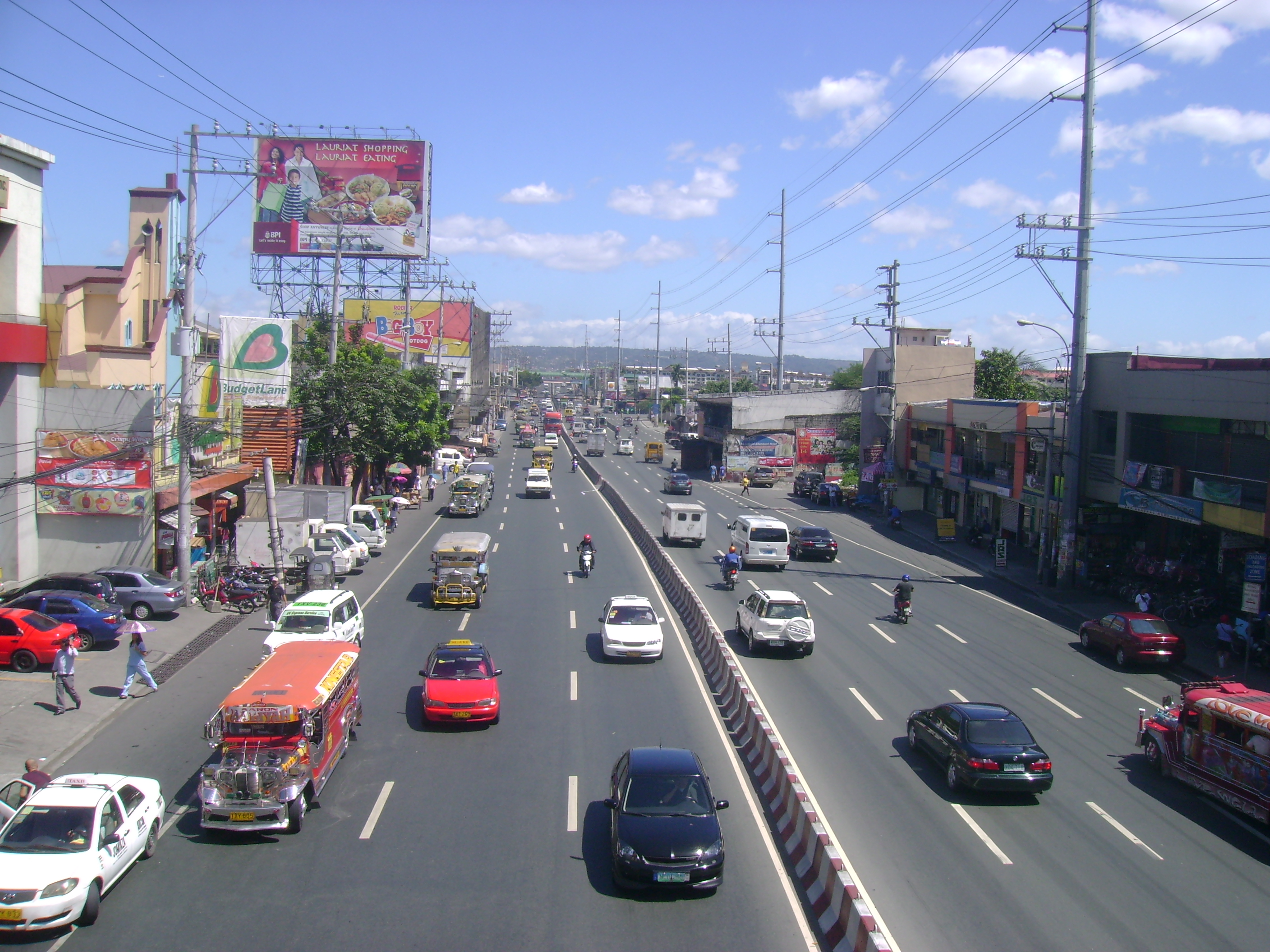
| image | Ortigas Avenue, Ortigas Center (Pasig; 03-17-2021).jpg | ||||||
| image_width | 300px | ||||||
| image_notes | Looking west towards Ortigas Center | ||||||
| length_km | 12.1 | ||||||
| length_notes | Including extension from Pasig to Taytay | ||||||
| maint | Department of Public Works and Highways | ||||||
| allocation | {{plainlist | ||||||
| * {{jct | country | PHL | N | 60 | nolink=yes}} from Quezon City to Taytay | ||
| * {{jct | country | PHL | N | 184}} in San Juan and Mandaluyong | |||
| direction_a | West | ||||||
| terminus_a | at the Quezon City–San Juan boundary | ||||||
| *{{jct | country | PHL | AH | N1 | name1=Epifanio de los Santos Avenue}} | ||
| *{{jct | country | PHL | N | 11 | name1=Circumferential Road 5}} | ||
| * {{jct | country | PHL | N | 601 | name1=Bonifacio Avenue | road | Felix Avenue}} |
| direction_b | East | ||||||
| terminus_b | / Taytay Diversion Road / L. Wood Street in Taytay | ||||||
| regions | Metro Manila, Calabarzon | ||||||
| provinces | Rizal | ||||||
| cities | San Juan, Mandaluyong, Quezon City, Pasig | ||||||
| towns | Cainta, Taytay |
- R-5
- from Quezon City to Taytay
- in San Juan and Mandaluyong
Ortigas Avenue is a 12.1 km highway connecting eastern Metro Manila and western Rizal in the Philippines. It is one of the busiest highways in Metro Manila, serving as the main thoroughfare of the metro's east–west corridor, catering mainly to traffic to and from Rizal.
The western terminus of the highway is at the boundary of San Juan and Quezon City. The highway then traverses through Ortigas Center and along the cities of Mandaluyong, Quezon City, and Pasig, followed by the municipality of Cainta, and finally ending in the municipality of Taytay.
The portion of Ortigas Avenue from EDSA–Ortigas Interchange, Quezon City to the Buli Bridge at the Pasig–Cainta boundary is designated as Radial Road 5 (R-5). The highway is also designated as National Route 60 (N60) and National Route 184 (N184) of the Philippine highway network, respectively.
Etymology
The highway is named after Filipino lawyer and businessman Don Francisco Emilio Barcinas Ortigas Sr. (1875–1935), popularly known as "Don Paco" or simply Francisco Ortigas. Ortigas is known for establishing a partnership with several businessmen (now Ortigas & Company) in 1931 to purchase the 4033 hectare Hacienda de Mandaluyon from the Augustinian Order, which now spans the cities of San Juan, Mandaluyong, Pasig, and Quezon City.
Route description

Ortigas Avenue cuts eastwards from the city boundary of San Juan and Quezon City in Metro Manila to Antipolo in Rizal, passing through residential, industrial, and commercial areas, including Ortigas Center, its namesake central business district. Its section from Bonny Serrano Avenue to EDSA forms part of National Route 184 (N184), a secondary national road under the Philippine highway network. Meanwhile, the rest of the route east of EDSA forms part of National Route 60 (N60), a primary national road. Eastwards past the C5–Ortigas Interchange in Pasig, the avenue is called Ortigas Avenue Extension. Its section from Dr. Sixto Antonio Avenue in Pasig to Felix Avenue at the Cainta Junction is officially known as Pasig–Cainta Road and forms part of the Manila East Road. From Cainta Junction to Kaytikling Rotunda in Taytay, it is alternatively known as Cainta-Kayticling-Antipolo-Teresa-Morong Road.
Ortigas Avenue starts as a physical continuation of Granada Street past Bonny Serrano Avenue at the boundary of San Juan and Quezon City. It then cuts through Greenhills, San Juan and northeast of Wack Wack Golf and Country Club in Mandaluyong. It crosses EDSA at the EDSA–Ortigas Interchange at the boundary of Mandaluyong and Quezon City, and marks the northern border of Ortigas Center, before making a slight curve at Meralco Avenue. The avenue soon cuts through Ugong, enters Pasig, and crosses Circumferential Road 5 at the C5–Ortigas Interchange, where the Bridgetowne development is located. It soon crosses the Marikina River and Manggahan Floodway, entering the barangay of Rosario, still in Pasig. The avenue partially becomes a single carriageway, changing back into a dual carriageway, and then enters the province of Rizal at Cainta, past SM City East Ortigas (formerly Ever Gotesco Ortigas).
It crosses Bonifacio and Felix Avenues at Cainta Junction. It then continues to Taytay and passes over the Kaytikling Rotunda with Taytay Diversion Road in Taytay, Rizal before continuing as Manila East Road.
Bicycle lanes
Most of the road from its intersection with Bonny Serrano Avenue to the Pasig–Cainta border has Class II paint-separated one-way bicycle lanes as part of the Metropolitan Bike Lane Network. Additionally, the entire span of Ortigas Avenue from Bonny Serrano Avenue to Connecticut Street in San Juan has bollards as protection. However, these bollards are frequently damaged by motorists who intrude into the bicycle lanes, as the San Juan city government has struggled to regularly replace damaged bollards since its implementation in 2020.
On August 18, 2023, San Juan Mayor Francis Zamora issued an advisory stating that the city has removed the bollards along the Ortigas Avenue bicycle lanes to be replaced with cat's eye markers. The advisory stated that this was done following a "thorough evaluation" conducted by the Metropolitan Manila Development Authority to "restore roads to their optimal capacity" due to "congestion and a reduction in road capacity".
Proposal for an elevated expressway (R-5/Ortigas Expressway)
Ireka Construction Berhad, a Malaysian company, and EEI Corporation entered into a memorandum of understanding in 1996 to construct the elevated highway as part of a joint venture with the Philippine National Construction Corporation (PNCC). This would have been the Philippines' first elevated road of this length. The Metro Manila Skyway, which is being built on top of the South Luzon Expressway, is a similar project.
In 1999, a joint venture of Strategic Alliance Development Corporation (STRADEC), Marubeni, and Kumagai Gumi under the build-operate transfer (BOT) scheme proposed the construction of a 5.7 km 6-lane Ortigas Expressway as a multi-story structure over the existing Ortigas Avenue Extension from E. Rodriguez (junction with C-5) to the Circumferential Road 6. No new proposals were made since then.
Intersections
Landmarks

San Juan
- Greenhills
Mandaluyong
- Wack Wack Golf and Country Club
- La Salle Green Hills
- Department of Migrant Workers
Quezon City
- EDSA Shrine
- Robinsons Galleria
Pasig
- Ortigas Building
- Meralco main office
- Meralco Theater
- The Medical City Ortigas
- Ateneo School of Medicine and Public Health
- Christ's Commission Fellowship
- Bridgetowne
- International Pipe Industries (IPI)
- Santo Rosario de Pasig Church
- SM City East Ortigas
Cainta
- Robinsons Cainta
- Primark Town Center Cainta
Taytay
- Kaytikling Rotunda
References
References
- "Latest alignment of all radial and circumferential roads in Metro Manila". Department of Public Works and Highways.
- (November 24, 2016). "The Most Influential and Enduring Families of the Philippines".
- Calero, Javier. (June 9, 2016). "The men behind Heneral Luna". Business World Online.
- (August 25, 2022). "List of all bike lanes based on DPWH classifications".
- Luna, Franco. (April 8, 2022). "The Road Ahead: In San Juan, 'culture shift' among drivers needed for cyclists to thrive". [[The Philippine Star]].
- Zamora, Francis. (August 18, 2023). "Public Advisory".
- (November 26, 1996). "EEI Teams Up With Malaysian For R5 Project.". Manila Standard.
- (1999). "METRO MANILA URBAN TRANSPORTATION INTEGRATION STUDY TECHNICAL REPORT NO. 7: TRANSPORTATION PROJECT REVIEW".
- "Road and Bridge Inventory".
This article was imported from Wikipedia and is available under the Creative Commons Attribution-ShareAlike 4.0 License. Content has been adapted to SurfDoc format. Original contributors can be found on the article history page.
Ask Mako anything about Ortigas Avenue — get instant answers, deeper analysis, and related topics.
Research with MakoFree with your Surf account
Create a free account to save articles, ask Mako questions, and organize your research.
Sign up freeThis content may have been generated or modified by AI. CloudSurf Software LLC is not responsible for the accuracy, completeness, or reliability of AI-generated content. Always verify important information from primary sources.
Report