From Surf Wiki (app.surf) — the open knowledge base
Oroville, California
City in California, United States

City in California, United States
| Field | Value |
|---|---|
| name | Oroville, California |
| official_name | City of Oroville |
| settlement_type | City |
| image_skyline | {{multiple image |
| total_width | 280 |
| border | infobox |
| perrow | 1/3/2/1 |
| caption_align | center |
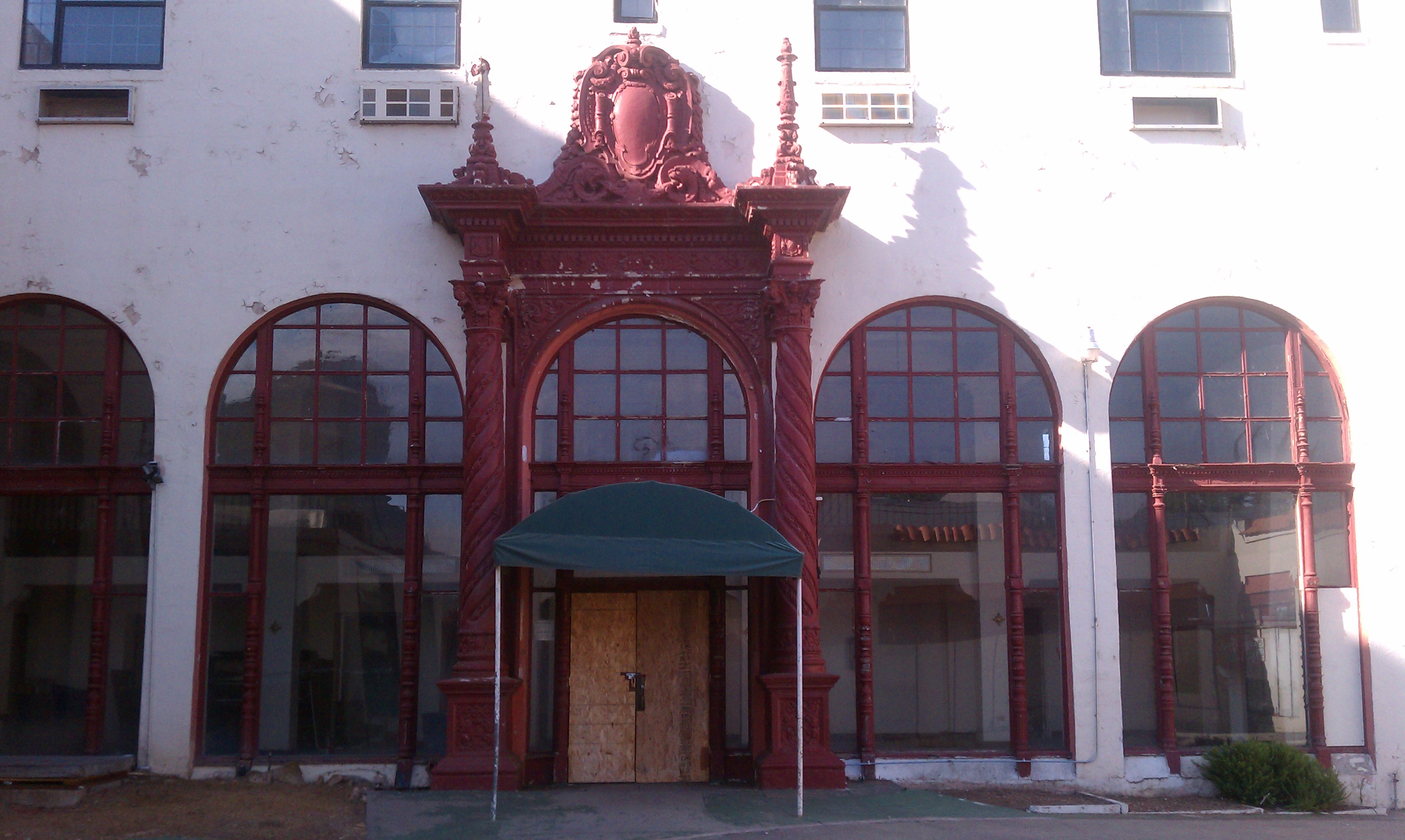
| image1 | Oroville Inn (2024)-L1004244.jpg |
| caption1 | Oroville Inn |
| image2 | Oroville State Theatre (2023)-L1004160.jpg |
| caption2 | State Theatre |
| image3 | Historic downtown oroville.jpg |
| caption3 | Downtown |
| image_seal | Seal of Oroville, California.png |
| nickname | "City of Gold" |
| image_map | Butte_County_California_Incorporated_and_Unincorporated_areas_Oroville_Highlighted.svg |
| mapsize | 250x200px |
| map_caption | Location of Oroville in Butte County, California |
| pushpin_map | USA |
| pushpin_map_caption | Location in the contiguous United States |
| pushpin_relief | 1 |
| coordinates | |
| subdivision_type | Country |
| subdivision_name | United States |
| subdivision_type1 | State |
| subdivision_type2 | County |
| subdivision_name1 | California |
| subdivision_name2 | Butte |
| established_title | Incorporated |
| established_date | January 3, 1906 |
| leader_title | City Council |
| leader_name | Mayor: David Pittman |
| Vice Mayor: Eric Smith | |
| leader_title1 | State Senator |
| leader_name1 | |
| leader_title2 | State Assembly |
| leader_name2 | |
| leader_title3 | U.S. Congress |
| leader_name3 | |
| unit_pref | Imperial |
| area_footnotes | |
| area_total_km2 | 35.88 |
| area_total_sq_mi | 13.85 |
| area_land_km2 | 35.83 |
| area_land_sq_mi | 13.83 |
| area_water_km2 | 0.05 |
| area_water_sq_mi | 0.02 |
| area_water_percent | 0.13 |
| elevation_m | 51 |
| elevation_ft | 167 |
| population_total | 20042 |
| population_as_of | 2020 |
| population_density_sq_mi | 1448.75 |
| population_density_km2 | 559.36 |
| population_urban | 40,190 |
| population_urban_footnotes | |
| postal_code_type | ZIP codes |
| postal_code | 95940, 95965, 95966 |
| area_codes | 530, 837 |
| timezone | PST |
| utc_offset | -8 |
| timezone_DST | PDT |
| utc_offset_DST | -7 |
| blank_name | FIPS code |
| blank_info | 06-54386 |
| blank1_info | , |
| website |
Vice Mayor: Eric Smith
Tracy Johnstone Janet Goodson Scott Thomson Shawn Webber Chuck Reynolds
Oroville (Oro, Spanish for "Gold" and Ville, French for "town") is a city in and the county seat of the Butte County of the U.S. state of California. Its population was 15,506 at the 2010 census, up from 13,004 in the 2000 census. After the 2018 Camp Fire that destroyed much of the town of Paradise, Oroville's population increased as many people who lost their homes moved there.
Oroville is considered the gateway to Lake Oroville and Feather River recreational areas. The Berry Creek Rancheria of Maidu Indians of California is headquartered in Oroville.
Oroville is adjacent to State Route 70 and in close proximity to State Route 99, which connects Butte County with Interstate 5. The city of Chico is about 23 mi northwest of the city, and the state capital, Sacramento, around 70 mi to the south.
Oroville's nickname is the "City of Gold", which is essentially the Spanish name of the city in English. The National Arbor Day Foundation has declared Oroville a Tree City USA for 41 years.
History
Oroville is on the banks of the Feather River, which flows from the Sierra Nevada onto the flat floor of the California Central Valley. During the California Gold Rush, it was created as the Feather River's head of navigation to serve miners. The original inhabitants of Oroville were the Konkow subdivision of Maidu people. In their native language, the Oroville area is ʔópamtani.
The town was originally named "Ophir City", but was renamed Oroville when the first post office opened in 1854 (oro is Spanish for "gold"). The City of Oroville was incorporated on January 3, 1906.
Gold was found at Bidwell Bar, one of California's first gold-mining sites, bringing thousands of prospectors to the Oroville area. Now inundated by the waters of enormous Lake Oroville, which was filled in 1968, Bidwell Bar is memorialized by the Bidwell Bar Bridge, an original remnant of the area and the first suspension bridge in California (California Historical Landmark #314). The Western Pacific Railroad built the all-weather Feather River Canyon route across the Sierra Nevada in the early 20th century, earning it the moniker "The Feather River Route". The California Zephyr made frequent stops at Oroville station during its 20-year existence. This was included on the Union Pacific Railroad's Feather River Canyon Subdivision in 1983. State Route 70, a significant thoroughfare, runs almost parallel to the train line that winds through the canyon.
The Chinese Temple (CHL No. 770 and listed on the National Register of Historic Places) was built in 1863 to cater to the biggest Chinese colony north of Sacramento. Chinese laborers established the Temple as a place of worship for followers of Chinese folk religion and the three major Chinese religions: Taoism, Buddhism, and Confucianism. It has a large collection of antiques as well as a garden.
The olive-canning industry was founded in Oroville by Freda Ehmann, credited as the "mother of the California ripe olive industry". She built a large cannery in Oroville and by 1900 was the president of the world's largest canned olive factory. Ehmann was a believer in women's suffrage and a friend of Susan B. Anthony.
Ishi, Oroville's most famous resident, was the last of the Yahi people and is considered the last "Stone Age" Indian to come out of the wilderness and into Western civilization. When he appeared out of the hills in East Oroville in 1911, he was immediately thrust into the national spotlight. The Visitor Center at Lake Oroville has a thorough exhibit and documentary film on Ishi and his life in society.
Archaeological finds place the northwestern border for the prehistoric Martis people in the Oroville area.
1881 lynching
On August 7, 1881, pioneer Jack Crum was allegedly stomped to death by local bully Tom Noacks in Chico, California. The young Noacks was feared by the locals of Butte County, not only because of his size and strength, but allegedly because he was mentally unbalanced and enjoyed punching oxen in the head.
Noacks was arrested and jailed in the Chico jail. Once word got out that the old pioneer had been murdered, the authorities moved Noacks to the Butte County county jail in Oroville for his safety. Crum's friends, knowing that Noacks was in the county jail, made their way to Oroville with rope in hand. Knocking on the jail door, the men told the jailer that they had a prisoner from the town of Biggs, California. Once inside the jail, they overpowered the jailer and dragged Noacks from his cell. They took Noacks to Crum's former farm and hanged him from an old cottonwood tree. Nobody was ever prosecuted for the lynching.
Hate groups
Hate groups began appearing in Oroville media stories beginning in 1976 with a neo-Nazi husband and wife couple killed in a shootout. In 1980, members of the American Nazi Party moved to Oroville from Tracy, California, to re-organize as Chico Area National Socialists. In September 1982, 17-year-old Joseph Hoover was murdered by his Nazi colleagues after he told police he helped spread anti-Black hate literature at Oroville High School. Local Nazi leader Perry "Red" Wartham was convicted of Hoover's murder and sentenced to 27 years, and two more male high school–age Nazi recruits were convicted as accessories to murder. In 2016, an Oroville man was found spreading Nazi hate messages in Sacramento. In January 2004, a white power publication was distributed in the Kelly Ridge area east of Oroville.
Oroville Dam crisis
Main article: Oroville Dam crisis
On February 7, 2017, after heavy rains, a defect formed in a spillway of Oroville Dam. For the first time since its construction, the secondary spillway was overtopped on February 11. Shortly after being put into service, this structure began to show signs of being undermined, raising fears of catastrophic failure. Owing to their inability to predict the continued safety of this spillway, the Butte County Sheriff ordered evacuations of downstream residents from Butte, Sutter, and Yuba counties.
COVID-19
In November 2021, citing alleged federal and state overreach during the COVID-19 pandemic, the Oroville city council passed a resolution declaring the city as its own "Constitutional Republic" and refused to enforce federal orders that it said violated its citizens' rights.
The resolution to declare the town a constitutional republic was an attempt to limit state and federal restrictions related to the COVID-19 pandemic in California. One rural law expert stated that the designation was unclear and would not operate to shield the city from following state and federal laws.
Geography
According to the United States Census Bureau, the city has a land area of 13.83 mi2.
Oroville is situated at the head of navigation on the Feather River. The Yuba River flows into the Feather River near Marysville, California and these flow together to the Sacramento River. Geologically, Oroville is situated at the meeting place of three provinces: the Central Valley alluvial plain to the west, the crystalline Sierra Nevada to the SE and the volcanic Cascade Mountains to the north. It has a Mediterranean climate.
Oroville sits on the eastern rim of the Great Valley, defined today by the floodplains of the Sacramento River and its tributaries. Around Oroville these sediments are dominated by thick fans of Feather River sediments, but just east of this there is a thin, N–S band of late Cretaceous sediments. These sit on top of the Sierran basement, which beneath eastern Oroville comprise greenschist-facies metavolcanic rocks of Jurassic age, giving way to granites of the Sierra batholith to the east. These are manifestations of a vigorous island arc sequence, built out over an east-dipping subduction zone of mid-to-late Mesozoic age. The gold veins lace this ancient arc, remobilized by Mesozoic shearing and intrusions of igneous rock. The crystalline foothills are locally overlain by a Cenozoic sequence of Eocene clean beach sands overlain by Neogene volcanics, including the Diamond Head-like profile of "Table Mountain".
Climate
According to the Köppen Climate Classification system, Oroville has a hot-summer Mediterranean climate, abbreviated "Csa" on climate maps.
According to US climate data, on the average Oroville receives 30.7 in of precipitation per year, which is about 20% less than the national average, but somewhat higher than the average California rainfall total.
|Jan record high F = 83 |Feb record high F = 86 |Mar record high F = 97 |Apr record high F = 98 |May record high F = 107 |Jun record high F = 116 |Jul record high F = 115 |Aug record high F = 115 |Sep record high F = 115 |Oct record high F = 105 |Nov record high F = 90 |Dec record high F = 84
|Jan avg record high F = 67.5 |Feb avg record high F = 72.5 |Mar avg record high F = 77.9 |Apr avg record high F = 89.3 |May avg record high F = 96.1 |Jun avg record high F = 104.8 |Jul avg record high F = 107.0 |Aug avg record high F = 104.0 |Sep avg record high F = 101.1 |Oct avg record high F = 92.5 |Nov avg record high F = 77.2 |Dec avg record high F = 67.5 |year avg record high F = 107.7
|Jan avg record low F = 29.1 |Feb avg record low F = 32.1 |Mar avg record low F = 34.3 |Apr avg record low F = 37.8 |May avg record low F = 43.7 |Jun avg record low F = 49.9 |Jul avg record low F = 52.7 |Aug avg record low F = 52.0 |Sep avg record low F = 48.3 |Oct avg record low F = 40.8 |Nov avg record low F = 32.6 |Dec avg record low F = 28.9 |year avg record low F = 27.3
|Jan record low F = 15 |Feb record low F = 21 |Mar record low F = 25 |Apr record low F = 29 |May record low F = 30 |Jun record low F = 35 |Jul record low F = 43 |Aug record low F = 35 |Sep record low F = 36 |Oct record low F = 29 |Nov record low F = 22 |Dec record low F = 12
Demographics
2020
The 2020 United States census reported that Oroville had a population of 20,042. The population density was 1,448.7 PD/sqmi. The racial makeup of Oroville was 62.9% White, 3.7% African American, 3.5% Native American, 9.8% Asian, 0.3% Pacific Islander, 6.7% from other races, and 13.2% from two or more races. Hispanic or Latino of any race were 16.3% of the population.
The census reported that 95.1% of the population lived in households, 1.6% lived in non-institutionalized group quarters, and 3.3% were institutionalized.
There were 7,161 households, out of which 35.8% included children under the age of 18, 33.1% were married-couple households, 10.9% were cohabiting couple households, 35.6% had a female householder with no partner present, and 20.4% had a male householder with no partner present. 28.9% of households were one person, and 13.2% were one person aged 65 or older. The average household size was 2.66.
The age distribution was 25.7% under the age of 18, 9.0% aged 18 to 24, 27.9% aged 25 to 44, 22.0% aged 45 to 64, and 15.4% who were 65years of age or older. The median age was 34.7years. For every 100 females, there were 98.4 males.
There were 7,705 housing units at an average density of 557.0 /mi2, of which 7,161 (92.9%) were occupied. Of these, 44.2% were owner-occupied, and 55.8% were occupied by renters.
In 2023, the US Census Bureau estimated that 8.4% of the population were foreign-born. Of all people aged 5 or older, 82.1% spoke only English at home, 8.4% spoke Spanish, 1.2% spoke other Indo-European languages, 7.8% spoke Asian or Pacific Islander languages, and 0.5% spoke other languages. Of those aged 25 or older, 83.0% were high school graduates and 13.0% had a bachelor's degree.
The median household income in 2023 was $51,893, and the per capita income was $25,124. About 13.1% of families and 21.8% of the population were below the poverty line.
2010
The 2010 United States census The racial makeup was 11,686 (75.2%) White, 453 (2.9%) African American, 573 (3.7%) Native American, 1,238 (8.0%) Asian, 56 (0.4%) Pacific Islander, 554 (3.6%) from other races, and 986 (6.3%) from two or more races. Hispanic or Latino of any race were 1,945 persons (12.5%).
The Census reported that 14,662 people (94.3% of the population) lived in households, 72 (0.5%) lived in non-institutionalized group quarters, and 812 (5.2%) were institutionalized.
There were 5,646 households, out of which 2,126 (37.7%) had children under the age of 18 living in them, 1,893 (33.5%) were opposite-sex married couples living together, 1,174 (20.8%) had a female householder with no husband present, 430 (7.6%) had a male householder with no wife present. There were 615 (10.9%) unmarried opposite-sex partnerships, and 33 (0.6%) same-sex married couples or partnerships. 1,699 households (30.1%) were made up of individuals, and 718 (12.7%) had someone living alone who was 65 years of age or older. The average household size was 2.60. There were 3,497 families (61.9% of all households); the average family size was 3.22.
The population was spread out, with 4,267 people (27.4%) under the age of 18, 1,969 people (12.7%) aged 18 to 24, 3,940 people (25.3%) aged 25 to 44, 3,417 people (22.0%) aged 45 to 64, and 1,953 people (12.6%) who were 65 years of age or older. The median age was 31.5 years. For every 100 females, there were 93.7 males. For every 100 females age 18 and over, there were 91.8 males.
There were 6,194 housing units at an average density of 476.0 /mi2, of which 5,646 were occupied, of which 2,423 (42.9%) were owner-occupied, and 3,223 (57.1%) were occupied by renters. The homeowner vacancy rate was 3.6%; the rental vacancy rate was 8.4%. 6,293 people (40.5% of the population) lived in owner-occupied housing units and 8,369 people (53.8%) lived in rental housing units.
Oroville is home to a considerable number of ethnic Hmong. The Hmong migrated from Southeast Asia, especially from the country Laos, after the Vietnam War. The Hmong were allies of the American forces during the Vietnam War, many were recruited to help fight the Communist-aligned North Vietnamese forces in Laos and Vietnam. The Hmong people were given blanket political asylum after the fall of Saigon to the NVA in 1975. Every year there is an annual festival during autumn which was originally a harvest festival but now called the New Year celebration. In 2010, 773 people of Hmong descent lived in the city of Oroville, 726 in South Oroville, 640 in Thermalito, and 140 in Oroville East. In 2010, the Oroville/Chico Hmong community was the 9th largest in the Western US.
In the 1950s, a community of Romanians migrated from Europe, with 560 remaining at the time of the 2010 census.
Native Americans made up 3.7% of Oroville's population in 2010. The largest tribal group is the local Maidu. The Berry Creek Rancheria of Maidu Indians of California is headquartered in Oroville, with 306 members. The world's largest museum of Maidu culture is located in Oroville East, at the Lookout Museum.
Economy
The economy of Oroville is largely driven by tourism to Lake Oroville and the Feather River recreation areas. The largest industries in Oroville as of 2017 are: Healthcare and Social Assistance (20%), Retail Trade (11%), and Accommodation and Food Service (10%).
As the neighboring city of Chico experiences growth in retail, education, and technology industries, Oroville has experienced population growth associated with commuters attracted to lower property costs, and a smaller cost of living. Recently, Oroville has seen an increase in economic development. Oroville Hospital announced in 2018 a hospital expansion, and in 2019 received $200 million in bonds for a five-story hospital tower expected to be competed in 2022.
Top employers
According to the city's 2020–2021 Annual Comprehensive Financial Report, the top employers in the city are:
| # | Employer | # of Employees |
|---|---|---|
| 1 | County of Butte | 2,320 |
| 2 | Oroville Medical Complex | 1,650 |
| 3 | Pacific Coast Producers | 992 |
| 4 | Walmart Stores, Inc. | 289 |
| 5 | Graphic Packaging International | 205 |
| 5 | Walmart Stores, Inc. | 234 |
| 6 | Ammunition Accessories | 158 |
| 7 | Sierra Pacific Industries | 128 |
| 8 | Home Depot USA | 126 |
| 9 | City of Oroville | 111 |
| 10 | Roplast Industries, Inc | 93 |
| 11 | Currier Square Spe LLC | 67 |
Tourism
- The Oroville Dam is the tallest dam in the US and one of the 20 largest dams in the world. This dam is 770 ft tall and 6920 ft long, and it impounds Lake Oroville, which has a capacity of 3500000 acre.ft of water, making it the second largest reservoir in California.
- Lake Oroville is a man-made lake that was formed by the Oroville Dam. At 900 ft when full, the lake has a surface of 15500 acre for recreation and 167 mi of shoreline. Lake Oroville features an abundance of camping, picnicking, horseback riding, hiking, sail and power boating, water-skiing, fishing, swimming, boat-in camping, floating campsites, and horse camping.
- Lake Oroville Visitor Center is located in Kelly Ridge and overlooks the Oroville Dam and Lake Oroville. The visitor center is home to a museum with interpretive displays, the history of the dam and the State Water Project. A 47 ft viewing tower allows the visitor the opportunity to have a panoramic view of the lake and surrounding areas.
- Mother Orange Tree, located in Oroville, is the oldest of all Northern California orange trees.
- The Feather River Fish Hatchery raise Chinook salmon and steelhead along the Feather River. The annual Oroville Salmon Festival is held on the fourth Saturday of September at both the Hatchery and downtown Oroville.
- Riverbend Park is a 210 acre park on the Feather River established in 2006. The river features boat access and fishing. Other available activities include disc golf, running and walking trails, a river beach, and water fountains to play in on hot days.
- Brad Freeman Bike Trail – a 41 mi bike trail running along the Feather River up to the dam, down through the city then out to the Thermalito Forebay and Afterbay.
- Oroville Chinese Temple – built in 1863 by members of the Chinese Popular Religion. The Oroville Municipal Airport is located south of State Route 162 west of State Route 70.
Parks and recreation
Oroville has several parks featuring playgrounds, picnic tables and benches.
Parks and trails
Parks
- Riverbend Park
- Bedrock Park
- The C.F. Lott Home in Sank Park – A Victorian revival home built in 1856 by "Judge" Lott. Sank Park, a lush shaded garden with a gazebo, encompasses an entire city block that Judge Lott bought in 1855 for $200
- Hammon Park
- Hewitt Park
- Rotary Park
- Martin Luther King Jr. Park
- Playtown USA Park
- Gary Nolan Baseball Complex (Mitchell Field)
- Nelson Sports Complex
- Centennial Park
Trails
- Feather River Bike Trail
- Brad Freeman Trail
- Dan Beebe Trail
- North Table Mountain Ecological Reserve
- Kelly Ridge Recreation Area
Education
Most of Oroville is in the Oroville City Elementary School District. Portions extend into Thermalito Union School District and Palermo Union Elementary School District. All of Oroville is in the Oroville Union High School District.
The high school district includes two traditional high schools, Las Plumas High School and Oroville High School, and Prospect High School, a continuation/remedial high school. The city also has an adult school, Oroville Adult School.
Several small, rural school districts are in the surrounding areas.
Oroville City Elementary School District
Elementary schools
- Oakdale Heights Elementary
- Ophir Elementary
- Stanford Avenue Elementary
- Wyandotte Academy
- STREAM Charter School
- Helen Wilcox Elementary School
- Golden Hills Elementary
Middle schools
- Central Middle School
- Ishi Hills Middle School
- Palermo Middle School
- Nelson Ave Middle School
Oroville Union High School District
High schools
- Oroville High School
- Las Plumas High School
- Prospect High School
Higher education
- Oroville Adult School
- California State University, Chico (in Chico, 24 mi northwest of Oroville)
- Butte Community College
- Northwest Lineman College
Media
Radio
Oroville is home to KOYO-LP, a low-power community radio station owned and operated by the Bird Street Arbor Day Media Project. The station was built by numerous volunteers from Oroville and around the region in April 2002 at the second Prometheus Radio Project barnraising. KOYO-LP broadcasts music, news, and public affairs to listeners at 107.1FM.
The Oroville Mercury-Register is a newspaper published in the city and dates back to 1873. Its owned by MediaNews Group.
Transportation
Rail
The Amtrak Thruway 3 provides thrice daily connections from Oroville (with a curbside stop at 2525 Feather River Blvd) to/from Sacramento and Stockton
Roads
State Route 70 runs north–south on the west of the main part of Oroville. The road has an overpass over the Feather River in the city. State Route 162 runs through east–west of the city.
Infrastructure
Hospital
Oroville Hospital is a general acute care hospital and offers basic emergency care located in the City of Oroville.
Fire department
The Oroville Fire Department is responsible for calls within the city jurisdiction of approximately 13 sqmi with a population of 16,260 (as of 2015).
Superfund sites
Oroville has three designated superfund cleanup sites, two of which have been cleaned up and delisted: a Koppers Co. wood treatment plant, a Louisiana Pacific sawmill, and the Western Pacific railyard.
The Koppers Co. plant was listed on September 21, 1984, for pentachlorophenol (PCP), dioxin, furans, polycyclic aromatic hydrocarbons (PAHs), and heavy metals (copper, chromium, and arsenic) contamination due to chemicals spilled on unpaved areas.
The Louisiana-Pacific sawmill was listed on June 10, 1986, for pentachlorophenol (PCP), dioxin, furan, heavy metal (arsenic, boron, and copper), and polycyclic aromatic hydrocarbon (PAH) contamination. Following remediation, the site was delisted on November 21, 1996. The sawmill was shut down in 2001.
The Western Pacific Railroad yard was listed on August 30, 1990, for volatile organic compound (VOC) and heavy metals (arsenic, lead, and chromium) contamination. Following remediation, the site was delisted on August 29, 2001.
Notable people
- Isaac Austin, professional basketball player
- Kevin Brown, professional baseball player for Milwaukee Brewers in early 1990s
- Ishi, last surviving member of Yahi Native American Tribe
- Hartford H Keifer (1902–1986), authority on eriophyid mites
- Edward Abraham Kusel, photographer
- Doug LaMalfa (1960–2026), U.S. Representative of California's 1st congressional district
- Marilyn Nash, actress and casting director
- Gary Nolan, professional baseball player
- John Spence, first American combat frogman
- Adolphus Frederic St. Sure, federal judge
- Kendall Thomas, Nash Professor of Law and a co-founder of the Center for the Study of Law and Culture at Columbia Law School
- Frank Tuttle, contemporary Native American artist
- Robert H. Young, Korean War Medal of Honor recipient
- Hubert Zemke, pilot
In popular culture
In the early 1970s, the movie The Klansman was filmed in Oroville.
Sister cities
- USA – Salem, Massachusetts (United States) 2007
References
References
- "California Cities by Incorporation Date". California Association of [[Local Agency Formation Commission]]s.
- "Senators". State of California.
- "Members Assembly". State of California.
- {{Cite GovTrack. CA. 1
- "2020 U.S. Gazetteer Files". United States Census Bureau.
- "Urban and Rural: List of 2020 Census Urban Areas". [[United States Census Bureau]].
- "About".
- "Tree Cities".
- "Oroville {{!}} California, United States {{!}} Britannica".
- "History {{!}} City of Oroville, CA".
- [https://www.konkow.org/pub/dict.php Konkow Maidu Language Resource - ''Oroville'']
- {{California's Geographic Names. 288
- (January 10, 2006). "Incorporation of Oroville had its ups and downs".
- "Bidwell Bar California".
- "OLD SUSPENSION BRIDGE".
- "Oroville Chinese Temple".
- Vicki L. Ruiz. ''Cannery Women, Cannery Lives.'' University of New Mexico Press, 1987, pp. 23–24.
- (1928). "Women of the West; a series of biographical sketches of living eminent women in the eleven western states of the United States of America".
- (2006). "Ishi in Two Worlds: A Biography of the Last Wild Indian in North America". Journal of Multilingual and Multicultural Development.
- (August 29, 2003). "Revisiting Ishi". Los Angeles Times.
- O'Connor, John J.. (December 20, 1978). "TV: 'Ishi,' a Chronicle Of the Yahi Indian Tribe". The New York Times.
- Higgins, Bill. (March 20, 1992). "Makers of HBO's 'Tribe' Given a Warm Reception". [[Los Angeles Times]].
- Brauman, Sharon K.. (October 6, 2004). "NORTH FORK PETROGLYPHS". ucnrs.org.
- (2008). "California Justice: Shootouts, Lynching and Assassinations in the Golden State". Word Dancer Press.
- Matthews, Sam. (August 18, 2017). "The faded history of Tracy neofascists".
- One thousand people marched in Oroville in protest of Nazi and [[Ku Klux Klan]] activity on December 11, 1982.[https://dl.library.ucla.edu/islandora/object/edu.ucla.library.specialCollections.latimes:2255 "Demonstration march against racism, Ku Klux Klan and Neo-Nazism in Oroville, Calif., 1982 "] {{Webarchive. link. (February 23, 2023 . ''[[Los Angeles Times]]'' photograph collection at UCLA.)
- (November 8, 1982). "Oroville Nazi Official arrested". [[Lodi News Sentinel]].
- (June 17, 1983). "Neo-Nazi organizer Perry 'Red' Warthan convicted". [[United Press International]].
- Heise, Sarah. (May 10, 2016). "Oroville man accused of distributing hate-speech fliers arrested". [[KCRA]].
- Gascoyne, Tom. (January 22, 2004). "Happy MLK Day: Local rights activist denounces racist newspaper, fliers distributed in Oroville". Chico News & Review.
- KCRA Staff. (February 13, 2017). "Thousands from Yuba, Butte, Sutter counties evacuated". KCRA.
- (November 12, 2021). "Oroville is now a 'constitutional republic' — what does that mean?". East Bay Times.
- Anguiano, Dani. (November 5, 2021). "California town declares itself a 'constitutional republic' to buck Covid rules". The Guardian.
- "U.S. Census Bureau QuickFacts: Oroville city, California; United States".
- "Oroville, California Köppen Climate Classification (Weatherbase)".
- [http://www.usclimatedata.com/climate/oroville/california/united-states/usca0818 Climate Oroville – California] {{Webarchive. link. (February 14, 2017 , U.S. Climate Data. Retrieved on February 13, 2017.)
- [https://rainfall.weatherdb.com/l/19543/Oroville-California Oroville, California Average Rainfall] {{Webarchive. link. (February 22, 2017 . Retrieved on February 13, 2017.)
- "U.S. Climate Normals Quick Access – Station: Oroville MUNI AP, CA". National Oceanic and Atmospheric Administration.
- "NOAA Online Weather Data – NWS Sacramento". National Weather Service.
- "Census of Population and Housing". Census.gov.
- "Oroville city, California; DP1: Profile of General Population and Housing Characteristics - 2020 Census of Population and Housing".
- "Oroville city, California; P16: Household Type - 2020 Census of Population and Housing".
- "Oroville city, California; CP02: Comparative Social Characteristics in the United States - 2023 ACS 5-Year Estimates Comparison Profiles".
- "Oroville city, California; DP03: Selected Economic Characteristics - 2023 ACS 5-Year Estimates Comparison Profiles".
- "2010 Census Interactive Population Search: CA – Oroville city". U.S. Census Bureau.
- (October 13, 2013). "Thousands attend Oroville Hmong New Year Festival".
- "2010 U.S. Census Hmong Populations".
- "Hmong Population and Demographic Trends in the 2010 Census and 2010 American Community Survey".
- "U.S. Census Bureau QuickFacts: Oroville city, California".
- link. (September 25, 2015 ''SDSU Library and Information Access.'')
- "Oroville, CA". Data USA.
- "Cost of Living Comparison Calculator Chico, California to Oroville, California".
- "Oroville Hospital gets funds for 5-story medical tower, expects to add 700 jobs". The Sacramento Bee.
- "City of Oroville ACFR".
- "Lake Oroville SRA".
- "City of Oroville: City Parks".
- "City Museums {{!}} City of Oroville, CA".
- Geography Division. (May 31, 2025). "2020 CENSUS - SCHOOL DISTRICT REFERENCE MAP: Butte County, CA". [[U.S. Census Bureau]].
- "Route 3".
- "City Quick Facts".
- (February 24, 2006). "NPL Site Narrative for Koppers Co., Inc. (Oroville Plant)". [[United States Environmental Protection Agency]].
- "Koppers Industries Inc. (Oroville Plant)". United States Environmental Protection Agency.
- (February 24, 2006). "NPL Site Narrative for Louisiana-Pacific Corp.". [[United States Environmental Protection Agency]].
- "Louisiana-Pacific Corp.". United States Environmental Protection Agency.
- (February 24, 2006). "NPL Site Narrative for Western Pacific Railroad Co.". [[United States Environmental Protection Agency]].
- "Western Pacific Railroad Co.". United States Environmental Protection Agency.
- (October 14, 2011). "Actress Marilyn Nash dies, Starred with Chaplin in 'Monsieur Verdoux'". [[Variety (magazine).
- Perry, Tony. (November 3, 2013). "John Spence dies at 95; Navy diver and pioneering WWII 'frogman'". [[Los Angeles Times]].
- (June 29, 2020). "Kendall Thomas Takes Pride in Being an Outlier and OutLaw". Columbia Law School.
- "The Klansman".
- "Chico considers establishing permanent sister city guidelines – Chico Enterprise Record".
This article was imported from Wikipedia and is available under the Creative Commons Attribution-ShareAlike 4.0 License. Content has been adapted to SurfDoc format. Original contributors can be found on the article history page.
Ask Mako anything about Oroville, California — get instant answers, deeper analysis, and related topics.
Research with MakoFree with your Surf account
Create a free account to save articles, ask Mako questions, and organize your research.
Sign up freeThis content may have been generated or modified by AI. CloudSurf Software LLC is not responsible for the accuracy, completeness, or reliability of AI-generated content. Always verify important information from primary sources.
Report