From Surf Wiki (app.surf) — the open knowledge base
Orange, New Jersey
City in Essex County, New Jersey, US

City in Essex County, New Jersey, US
| Field | Value |
|---|---|
| name | Orange, New Jersey |
| official_name | City of Orange Township |
| settlement_type | Township |
| image_skyline | 1st Church of Orange 1719 Presb jeh.JPG |
| imagesize | 250x200px |
| image_caption | The former First Presbyterian Church |
| image_seal | Orange Seal.png |
| mapframe | yes |
| mapframe-zoom | 11 |
| mapframe-point | none |
| mapframe-wikidata | yes |
| pushpin_map | USA New Jersey Essex County#USA New Jersey#USA |
| pushpin_label | Orange |
| pushpin_map_caption | Location in Essex County##Location in New Jersey##Location in the United States |
| pushpin_relief | yes |
| subdivision_type | Country |
| subdivision_name | United States |
| subdivision_type1 | State |
| subdivision_name1 | New Jersey |
| subdivision_type2 | County |
| subdivision_name2 | Essex |
| government_footnotes | |
| government_type | Faulkner Act Mayor-Council |
| governing_body | City Council |
| leader_title | Mayor |
| leader_name | Dwayne D. Warren (term ends June 30, 2028) |
| leader_title1 | Administrator |
| leader_name1 | Christopher Hartwyk |
| leader_title2 | Deputy Clerk |
| leader_name2 | Joyce L. Lanier |
| established_title | Incorporated |
| established_date | November 27, 1806 (as township) |
| established_title2 | Reincorporated |
| established_date2 | April 3, 1872 (as city) |
| unit_pref | Imperial |
| area_footnotes | |
| area_total_km2 | 5.74 |
| area_land_km2 | 5.73 |
| area_water_km2 | 0.01 |
| area_total_sq_mi | 2.22 |
| area_land_sq_mi | 2.21 |
| area_water_sq_mi | |
| area_water_percent | 0.09 |
| area_rank | 392nd of 565 in state |
| 19th of 22 in county | |
| population_as_of | 2020 |
| population_footnotes | |
| population_total | 34447 |
| population_rank | 69th of 565 in state |
| 8th of 22 in county | |
| population_density_km2 | auto |
| population_density_sq_mi | 15565.7 |
| population_density_rank | 17th of 565 in state |
| 3rd of 22 in county | |
| population_est | 35079 |
| pop_est_as_of | 2024 |
| pop_est_footnotes | |
| timezone | Eastern (EST) |
| utc_offset | −05:00 |
| timezone_DST | Eastern (EDT) |
| utc_offset_DST | −04:00 |
| elevation_footnotes | |
| elevation_ft | 197 |
| coordinates_footnotes | |
| coordinates | |
| postal_code_type | ZIP Codes |
| postal_code | 07050–07051 |
| area_code | 973 |
| blank_name | FIPS code |
| blank_info | |
| blank1_name | GNIS feature ID |
| blank1_info | 1729742 |
| website |
|mapframe-zoom = 11 |mapframe-point = none |mapframe-wikidata = yes
19th of 22 in county
8th of 22 in county 3rd of 22 in county
The City of Orange (known simply as Orange) is a township in Essex County, in the U.S. state of New Jersey. As of the 2020 United States census, the township's population was 34,447,
The New Jersey Legislature originally incorporated Orange as a township on November 27, 1806, from parts of what was then Newark Township. Parts of the township were taken on April 14, 1834, to form the now-defunct Clinton Township. On January 31, 1860, Orange was reincorporated as a town. Parts of the town were taken to form South Orange Township (April 1, 1861, now known as Maplewood), Fairmount (March 11, 1862, since a part of West Orange), East Orange (March 4, 1863) and West Orange (April 10, 1863). On April 3, 1872, Orange was reincorporated as a city. In 1982, the city was one of four Essex County municipalities to pass a referendum to become a township, joining 11 municipalities that had already made the change, of what ultimately were more than a dozen Essex County municipalities to reclassify themselves as townships to take advantage of federal revenue sharing policies that allocated townships a greater share of government aid to municipalities on a per capita basis. or William IV, Prince of Orange.
Despite the differences in the municipalities' character, Orange, East Orange, South Orange and West Orange are sometimes jointly called The Oranges.
In 2020, the township had New Jersey's 12th-highest property tax rate, with an equalized rate of 4.679% compared to 2.824% in the county as a whole and a statewide average of 2.279%.
History
Orange has its origins in Connecticut's New Haven Colony. In 1666, 30 of New Haven's families traveled by water to found "a town on the Passayak" River. They arrived on territory now encompassing Newark, the Oranges, and several other municipalities. The area was in the northeast portion of a land grant conveyed by King Charles II of England to his brother James, Duke of York. In 1664, James conveyed the land to two proprietors, Lord John Berkeley and Sir George Carteret. Since Carteret had been Royal Governor of the Isle of Jersey, the territory became known as "New Jersey."
Orange was initially part of the city of Newark, but it was originally known as "Newark Mountains". On June 7, 1780, the townspeople of Newark Mountains officially voted to adopt the name Orange. At the time, a significant number of people favored secession from Newark. This did not occur until November 27, 1806, when the territory now encompassing all of the Oranges was finally detached.
On April 13, 1807, the first government was elected, but not until March 13, 1860, was Orange officially incorporated as a city. Immediately, the new city began fragmenting into smaller communities, primarily because of local disputes about the costs of establishing paid police, fire, and street departments. South Orange was organized on January 26, 1861; Fairmount (later to become part of West Orange) on March 11, 1862; East Orange on March 4, 1863; and West Orange (including Fairmount) on March 14, 1863.
Early center of transportation
Orange is on the Newark and Mount-Pleasant Turnpike, the main road from Newark to Morristown, and ultimately to Easton, Pennsylvania. The town became a busy thoroughfare for travelers, and hotels abounded. Initially, the stagecoach was the primary method of transportation. Omnibuses of the Eclipse and the Morris & Newark Lines serviced Orange.
The Morris and Essex Railroad arrived in Orange in November 1836, its first cars drawn by horses. On October 2, 1837, the first steam locomotive appeared, and the horses were, with minor exception, relegated to pasture. The "M&E" later became a part of the Delaware, Lackawanna and Western Railroad (DL&W), which exists today as NJ Transit's Morristown Line.
Trolley cars appeared much later, with the Orange and Newark Horse Car Railroad Company running its first car up Main Street in May 1862. The Orange Crosstown Line, eventually extending from Morris Street, Orange, to Bloomfield, was started in June 1888. (The first electric trolley in the State of New Jersey operated over a section of this line.) Eventually, all the trolleys, and the buses that replaced them, became part of the sprawling Public Service Coordinated Transport System.
Orange became an industrial city early in its history, with the tanning industry expanding rapidly after settlers found growths of hemlock trees that were a source for the tannic acid they needed, leading to the growth of many factories producing shoes and boots.
Orange was once the United States' hat-making capital. The industry can be traced there to 1792. By 1892, 21 firms were engaged in that trade, employing more than 3,700 people in plants that produced about 4.8 million hats, which had a combined value in excess of $1 million (equivalent to $ million in ). A group of brothers founded the "No-Name Hat Company" in Orange before one of them moved on to make fedoras in Philadelphia under the family name "Stetson." By 1921, only five hat-making firms were left, many having departed for places such as Norwalk and Danbury, Connecticut. By 1960, all had left.
Beer was a major industry in Orange beginning in the early 1900s, when the three Winter Brothers of Pittsburgh, Pennsylvania, arrived in the city and built the first brewery. The Orange Brewery was constructed in 1901 at a reported cost of $350,000 (equivalent to $ million in ). The production of beer ceased with prohibition in 1920, and after the repeal of the Volstead Act in 1933, the brewery was sold to John F. Trommers of Philadelphia. Trommers brewed beer under that label until 1950, when the concern was again sold to Liebmann Breweries, Incorporated, which bottled Rheingold Beer. Eventually, after passing through several other owners, the plant was closed permanently in 1977.
Other notable firms in Orange were the Monroe Calculating Company, manufacturers of the adding machines of the same name, and the Bates Manufacturing Company, producers of office accessories such as staplers and stampers.
From about 1917 to 1926, the United States Radium Corporation refined ore and extracted the radium used to make luminous paint for dials and hands of watches and other indicators. Years later, the carcinogenic effects of this material became known, and the polluted site of the factory became a liability for the city. The Radium Girls were a group of hundreds of female factory workers who contracted acute radiation syndrome after ingesting radioactive radium when they followed instructions to rub brushes on their lips that were being used to paint luminescent watch dials, many of them suffering cancers and other deformities due to the radiation poisoning. The company's facility at 422–432 Alden Street was added to the National Park Service's Historic American Buildings Survey in 1999.
Notable residents and visitors
Orange has produced such notables as baseball's Monte Irvin and heavyweight boxer Tony Galento. Actor William Bendix lived and worked here for a short while. Presidents, presidential candidates, and governors visited. Orange held major celebrations for its 100th anniversary, and another when it turned 150.
Late 20th century political and social changes
Once a multi-ethnic, economically diverse city, Orange suffered indirectly from the 1967 riots in Newark (even though Newark and Orange do not share a border) and directly from the construction of Interstate 280 through the heart of the downtown area, triggering middle-class "white flight" from aging industrial towns to the new automobile suburbs being built in western Essex County and elsewhere. By the end of the 1970s, Orange had many of the urban ills normally associated with larger cities. However, the city still features many tree-lined streets with well-maintained homes.
In 1982, citizens voted overwhelmingly to change the designation of Orange from a city to a township, thereby making it eligible for federal Revenue Sharing funds.
Geography
According to the United States Census Bureau, the township had a total area of 2.22 square miles (5.74 km2), including 2.21 square miles (5.73 km2) of land and 2) of water (0.09%).
The East Branch of the Rahway River travels through Orange.
Orange borders the Essex County municipalities of East Orange, Glen Ridge, Montclair, South Orange and West Orange.
Demographics
1840–1900 1840 1850–1870 1850 1870 1880–1890 1890–1910 1860–1930 1940–2000 2000 2020
- = Lost territory in previous decade.
2020 census
| Race / Ethnicity (NH = Non-Hispanic) | title=P004: Hispanic or Latino, and Not Hispanic or Latino by Race – 2000: DEC Summary File 1 – City of Orange township; Essex County, New Jersey | url=https://data.census.gov/table?g=060XX00US3401313045&tid=DECENNIALSF12000.P004 | publisher=United States Census Bureau}} | title=P2 Hispanic or Latino, and Not Hispanic or Latino by Race – 2010: DEC Redistricting Data (PL 94-171) – City of Orange township; Essex County, New Jersey | url=https://data.census.gov/table?q=p2&g=060XX00US3401313045&tid=DECENNIALPL2010.P2 | website=United States Census Bureau}} | % 2000 | % 2010 |
|---|---|---|---|---|---|---|---|---|
| White alone (NH) | 2,502 | 1,357 | 1,073 | 7.61% | ||||
| Black or African American alone (NH) | 24,318 | 21,067 | 21,627 | 73.99% | ||||
| Native American or Alaska Native alone (NH) | 79 | 114 | 44 | 0.24% | ||||
| Asian alone (NH) | 414 | 448 | 262 | 1.26% | ||||
| Pacific Islander alone (NH) | 17 | 3 | 7 | 0.05% | ||||
| Some Other Race alone (NH) | 168 | 169 | 303 | 0.51% | ||||
| Mixed Race or Multi-Racial (NH) | 1,273 | 445 | 1,148 | 3.87% | ||||
| Hispanic or Latino (any race) | 4,097 | 6,531 | 9,983 | 12.47% | ||||
| Total | 32,868 | 30,134 | 34,447 | 100.00% |
2010 census
The 2010 United States census counted 30,134 people, 11,202 households, and 6,878 families in the township. The population density was 13705.7 /sqmi. There were 12,222 housing units at an average density of 5558.9 /sqmi. The racial makeup was 12.80% (3,857) White, 71.83% (21,645) Black or African American, 0.57% (173) Native American, 1.51% (455) Asian, 0.02% (6) Pacific Islander, 9.95% (2,999) from other races, and 3.32% (999) from two or more races. Hispanic or Latino of any race were 21.67% (6,531) of the population.
Of the 11,202 households, 31.0% had children under the age of 18; 28.6% were married couples living together; 24.6% had a female householder with no husband present and 38.6% were non-families. Of all households, 32.7% were made up of individuals and 11.4% had someone living alone who was 65 years of age or older. The average household size was 2.66 and the average family size was 3.38.
25.0% of the population were under the age of 18, 9.8% from 18 to 24, 30.5% from 25 to 44, 23.6% from 45 to 64, and 11.2% who were 65 years of age or older. The median age was 34.4 years. For every 100 females, the population had 89.0 males. For every 100 females ages 18 and older there were 84.1 males.
The Census Bureau's 2006–2010 American Community Survey showed that (in 2010 inflation-adjusted dollars) median household income was $40,818 (with a margin of error of +/− $1,616) and the median family income was $44,645 (+/− $4,033). Males had a median income of $34,986 (+/− $3,168) versus $36,210 (+/− $2,706) for females. The per capita income for the borough was $19,816 (+/− $1,027). About 16.2% of families and 18.1% of the population were below the poverty line, including 24.6% of those under age 18 and 20.6% of those age 65 or over.
2000 census
As of the 2000 United States census there were 32,868 people, 11,885 households, and 7,642 families residing in the township. The population density was 14,903.7 PD/sqmi. There were 12,665 housing units at an average density of 5,742.8 /sqmi. The racial makeup of the township was 13.20% White, 75.10% Black or African American, 0.34% Native American, 1.26% Asian, 0.10% Pacific Islander, 5.21% from other races, and 4.79% from two or more races. Hispanic or Latino of any race were 12.47% of the population.
There were 11,885 households, out of which 33.4% had children under the age of 18 living with them, 30.7% were married couples living together, 26.3% had a female householder with no husband present, and 35.7% were non-families. 30.2% of all households were made up of individuals, and 10.5% had someone living alone who was 65 years of age or older. The average household size was 2.73 and the average family size was 3.38.
In the township the population was spread out, with 27.7% under the age of 18, 10.0% from 18 to 24, 32.2% from 25 to 44, 19.3% from 45 to 64, and 10.8% who were 65 years of age or older. The median age was 32 years. For every 100 females, there were 86.0 males. For every 100 females age 18 and over, there were 79.1 males.
The median income for a household in the township was $35,759, and the median income for a family was $40,852. Males had a median income of $33,442 versus $29,520 for females. The per capita income for the CDP was $16,861. About 15.4% of families and 18.8% of the population were below the poverty line, including 24.6% of those under age 18 and 16.7% of those age 65 or over.
As part of the 2000 Census, 75.10% of Orange's residents identified themselves as being African American, one of the highest percentages of African American people in the United States, and the fourth-highest in New Jersey (behind Lawnside at 93.60%, East Orange at 89.46%, and Irvington at 81.66%) of all places with 1,000 or more residents identifying their ancestry.
Orange has a large Haitian American population, with 11.4% of residents identifying themselves as being of Haitian ancestry, the highest of any municipality in New Jersey and the eighth-highest in the United States.
Although still a small percentage of total residents, Orange and East Orange have the largest concentrations of Guyanese Americans in the country. In the 2000 Census, 2.9% of Orange residents identified as being of Guyanese ancestry. While Queens and Brooklyn had larger populations in terms of raw numbers, Orange and East Orange (with 2.5%) had the highest percentages of people of Guyanese ancestry as a portion of the total population of all places in the United States.
Government
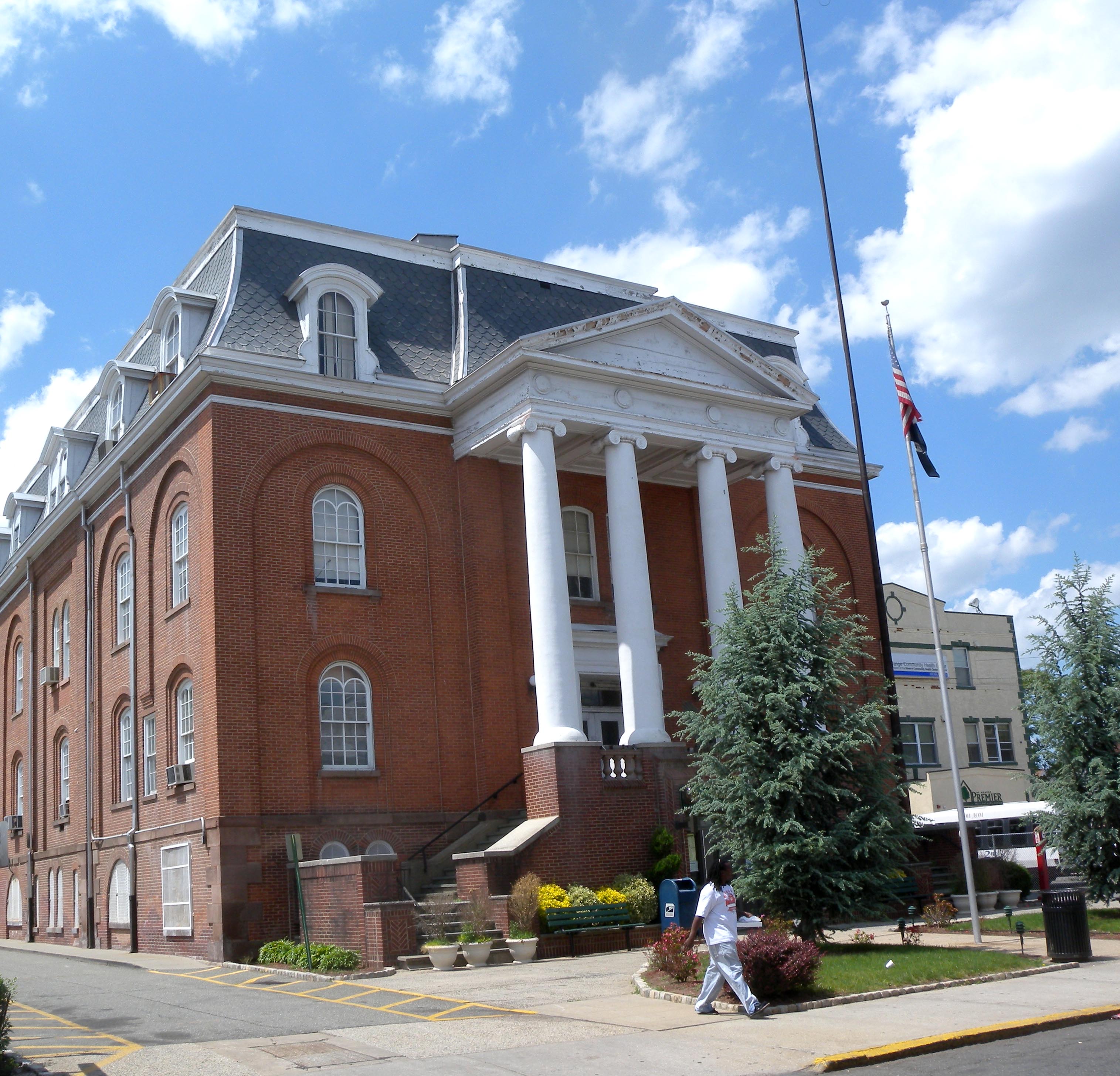
Local government
Orange is governed within the Faulkner Act, formally known as the Optional Municipal Charter Law, under the Mayor-Council form of municipal government. The city is one of 71 (of the 564) municipalities statewide that use this form of government. The governing body is comprised of the directly elected mayor and the seven-member City Council. There are four ward representatives on the city council and three at-large representatives. Councilmembers are elected to serve four-year terms of office in non-partisan elections on a staggered basis with the three at-large seats and the mayor up for election together and two years later the four ward seats up at the same time in an alternating cycle in even-numbered years as part of the May municipal election.
, the Mayor of Orange is Dwayne D. Warren, whose term of office ends June 30, 2024. Members of the City Council are Council President Adrienne Wooten (at-large, 2028), Council Vice President Tency A. Eason (North Ward, 2026), Kerry J. Coley (East Ward, 2026), Quantavia L. Hilbert (West Ward, 2026), Weldon M. Montague III (at-large, 2028), Clifford Ross (at-large, 2029) and Jamie Summers-Johnson (South Ward, 2026).
Federal, state and county representation
The City of Orange Township is in the 10th Congressional District and New Jersey's 34th state legislative district.
Politics
As of March 2011, there were 14,943 registered voters in Orange, of whom 8,490 (56.8%) were registered as Democrats, 302 (2.0%) as Republicans, and 6,147 (41.1%) as Unaffiliated. There were no voters registered as either Libertarian or as affiliated with the Green Party. |}
In the 2024 presidential election, Republican Donald Trump was the only Republican, since at least 2004, to obtain over 10.0% of the vote in Orange at 11.3%, as well as the most votes since at least the same year a 1,076 votes. At the same time, Democrat Kamala Harris, although still winning the city by a wide margin, was the only Democrat to obtain under 90.0% percent of the vote since at least 2004 with 87.5%. All of this was in correspondence with the rightward shift of Orange from the 2016 to 2020 presidential elections, as well as New Jersey and the nation as a whole from the 2020 to 2024 presidential elections.
In the 2013 gubernatorial election, Democrat Barbara Buono received 85.0% of the vote (3,809 cast), ahead of Republican Chris Christie with 14.4% (643 votes), and other candidates with 0.6% (27 votes), among the 4,560 ballots cast by the township's 16,607 registered voters (81 ballots were spoiled), for a turnout of 27.5%. In the 2009 gubernatorial election, Democrat Jon Corzine received 91.7% of the vote (4,993 ballots cast), ahead of Republican Chris Christie with 5.5% (302 votes), Independent Chris Daggett with 1.4% (74 votes) and other candidates with 0.6% (31 votes), among the 5,442 ballots cast by the city's 14,891 registered voters, yielding a 36.5% turnout.
Emergency services
Fire department

The City of Orange is served by the professional firefighters of the city of Orange Fire Department (OFD). Founded in 1872, the OFD operates out of two fire stations, located at 419 Central Avenue and 257 Washington Street. The firefighting apparatus consists of two fire engines, two quints and a ladder truck.
Education
The Orange Board of Education serves public school students in pre-kindergarten through twelfth grade. The district is one of 31 former Abbott districts statewide that were established pursuant to the decision by the New Jersey Supreme Court in Abbott v. Burke which are now referred to as "SDA Districts" based on the requirement for the state to cover all costs for school building and renovation projects in these districts under the supervision of the New Jersey Schools Development Authority.

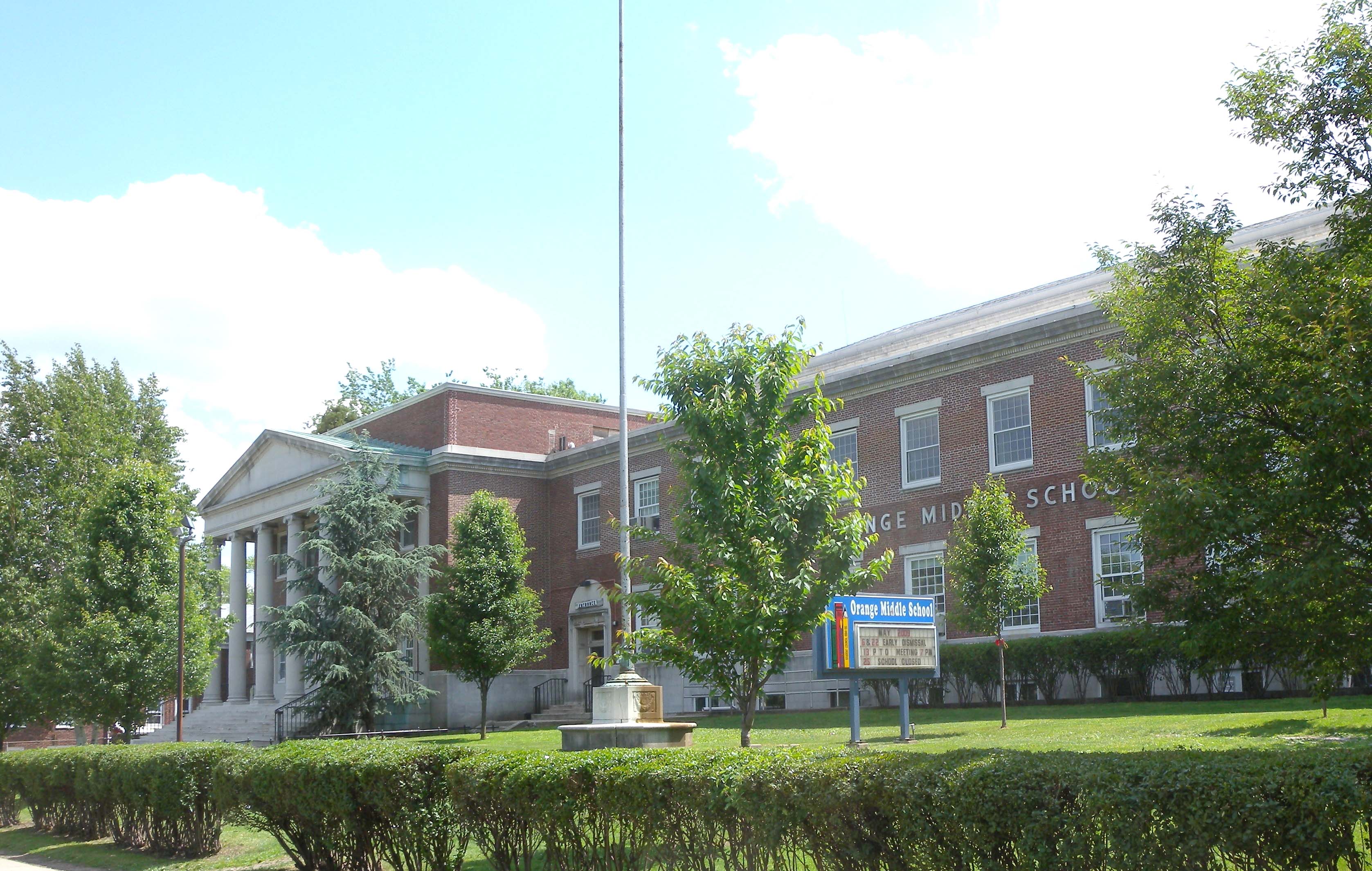
As of the 2020–21 school year, the district, comprised of 12 schools, had an enrollment of 5,629 students and 507.5 classroom teachers (on an FTE basis), for a student–teacher ratio of 11.1:1. Schools in the district (with 2020–21 enrollment data from the National Center for Education Statistics) are Orange Early Childhood Center (188 students; in Pre-K), John Robert Lewis Early Childhood Center (NA; Pre-K), Central Elementary School (319; K–2), Cleveland Street School (303; K–7), Forest Street Community School (410; Pre-K–7), Heywood Avenue School (355; Pre-K–7), Lincoln Avenue School (708; K–7), Oakwood Avenue Community School (425; Pre-K–7), Park Avenue School (569; K–7), Rosa Parks Central Community School (999; Grades 3–7; formerly Main Street School and Central School), Scholars Academy (NA), Orange Preparatory Academy (679; 8–9, formerly Orange Middle School), Orange High School (840; 10–12) and STEM Innovation Academy of the Oranges (160; 9–12).
The Orange Public Library collection contains 200,000 volumes and circulates 43,000 items annually. Built as the Stickler Memorial Library, the imposing structure designed by McKim, Mead, and White opened in 1901.
Economy
Portions of the city are part of an Urban Enterprise Zone (UEZ), one of 32 zones covering 37 municipalities statewide. Orange was selected in 1983 as one of the initial group of 10 zones chosen to participate in the program. In addition to other benefits to encourage employment and investment within the Zone, shoppers can take advantage of a reduced 3.3125% sales tax rate (half of the % rate charged statewide) at eligible merchants. Established in November 1992, the city's Urban Enterprise Zone status expires in November 2023.
Transportation
_from_the_overpass_for_South_Essex_Avenue_in_Orange,_Essex_County,_New_Jersey.jpg)
Roads and highways
, the city had a total of 44.64 mi of roadways, of which 39.14 mi were maintained by the municipality, 4.43 mi by Essex County and 1.07 mi by the New Jersey Department of Transportation.
Interstate 280 is the most significant highway serving the city, traversing along an east-west alignment from the border with West Orange to the East Orange city line. The only other significant roadway serving Orange is County Route 508, which follows Central Avenue. Principal local roads include Valley Street, Lincoln Avenue, Scotland Road and Highland Avenue.
Public transportation
The Orange and Highland Avenue stations provide NJ Transit train service along the Morris & Essex Lines (formerly Erie Lackawanna Railway). Service is available via the Kearny Connection to Secaucus Junction and New York Penn Station in Midtown Manhattan and to Hoboken Terminal. Passengers can transfer at Newark Broad Street station or Summit station to reach the other destination if necessary.
NJ Transit buses in Orange include the 21, 24, 34, 41, 44, 71, 73 and 79 routes providing service to Newark and local service on the 92 and 97 routes.
Notable people
Main article: List of people from Orange, New Jersey
Points of interest
- Orange Reservoir
- Rosedale Cemetery
- St. Johns Catholic Cemetery
- St. Johns Church
- Columbus Hall
References
References
- [https://orangenj.gov/158/Administration Department of Administration], City of Orange Township. Accessed January 22, 2025.
- [https://orangenj.gov/159/City-Clerk City Clerk], City of Orange Township. Accessed January 22, 2025.
- [https://www2.census.gov/geo/docs/maps-data/data/gazetteer/2019_Gazetteer/2019_gaz_cousubs_34.txt 2019 Census Gazetteer Files: New Jersey Places], [[United States Census Bureau]]. Accessed July 1, 2020.
- [https://www.nj.gov/labor/labormarketinformation/assets/PDFs/dmograph/est/mcd/density.xlsx Population Density by County and Municipality: New Jersey, 2020 and 2021], [[New Jersey Department of Labor and Workforce Development]]. Accessed March 1, 2023.
- {{Cite GNIS
- [https://www.census.gov/geographies/reference-files/time-series/geo/gazetteer-files.html US Gazetteer files: 2010, 2000, and 1990], [[United States Census Bureau]]. Accessed September 4, 2014.
- [http://tools.usps.com/go/ZipLookupResultsAction!input.action?resultMode=0&city=orange&state=NJ Look Up a ZIP Code], [[United States Postal Service]]. Accessed October 6, 2011.
- [https://www.area-codes.com/search.asp?frmNPA=&frmNXX=&frmCity=Orange&frmState=NJ Area Code Lookup – NPA NXX for Orange, NJ], Area-Codes.com. Accessed April 26, 2022.
- [https://mcdc.missouri.edu/applications/geocodes/?state=34 Geographic Codes Lookup for New Jersey], Missouri Census Data Center. Accessed April 1, 2022.
- [http://geonames.usgs.gov US Board on Geographic Names], [[United States Geological Survey]]. Accessed April 8, 2015.
- 2000 census]].[https://www.nj.gov/labor/labormarketinformation/assets/PDFs/census/2010/2010data/table7cm.xls Table 7. Population for the Counties and Municipalities in New Jersey: 1990, 2000 and 2010], [[New Jersey Department of Labor and Workforce Development]], February 2011. Accessed May 1, 2023.
- Snyder, John P. [https://www.state.nj.us/dep/njgs/enviroed/oldpubs/bulletin67.pdf ''The Story of New Jersey's Civil Boundaries: 1606–1968''], Bureau of Geology and Topography; Trenton, New Jersey; 1969. pp. 130–131. Accessed July 6, 2012.
- [https://web.archive.org/web/20150925103452/http://www.njstatelib.org/slic_files/imported/NJ_Information/Digital_Collections/MFMG/MFMGCH6.PDF#page=3 "Chapter VI: Municipal Names and Municipal Classification"], p. 73. [[New Jersey State Commission on County and Municipal Government]], 1992. Accessed September 24, 2015.
- [http://www.gao.gov/assets/140/137109.pdf#page=54 "Removing Tiering From The Revenue Sharing Formula Would Eliminate Payment Inequities To Local Governments"], [[Government Accountability Office]], April 15, 1982. Accessed September 24, 2015. "In 1978, South Orange Village was the first municipality to change its name to the 'township' of South Orange Village effective beginning in entitlement period 10 (October 1978 to September 1979). The Borough of Fairfield in 1978 changed its designation by a majority vote of the electorate and became the 'Township of Fairfield' effective beginning entitlement period 11 (October 1979 to September 1980).... However, the Revenue Sharing Act was not changed and the actions taken by South Orange and Fairfield prompted the Town of Montclair and West Orange to change their designation by referendum in the November 4, 1980, election. The municipalities of Belleville, Verona, Bloomfield, Nutley, Essex Fells, Caldwell, and West Caldwell have since changed their classification from municipality to a township."
- Narvaez, Alfonso A. [https://www.nytimes.com/1981/12/27/nyregion/new-jersey-journal-147786.html "New Jersey Journal"], ''[[The New York Times]]'', December 27, 1981. Accessed September 24, 2015. "Under the Federal system, New Jersey's portion of the revenue sharing funds is disbursed among the 21 counties to create three 'money pools.' One is for county governments, one for 'places' and a third for townships. By making the change, a community can use the 'township advantage' to get away from the category containing areas with low per capita incomes."
- [[Alan Karcher. 9780813525662. Accessed September 24, 2015.
- The city derives its name from [[William III of England]]Hutchinson, Viola L. [http://mapmaker.rutgers.edu/356/nj_place_names_origin.pdf#page=24 ''The Origin of New Jersey Place Names''], New Jersey Public Library Commission, May 1945. Accessed September 16, 2015.
- [[Henry Gannett
- Caldwell, Dave. [https://www.nytimes.com/2008/03/02/realestate/02livi.html "A Place to Feel Homey While Staying Hip"], ''[[The New York Times]]'', March 2, 2008. Accessed November 3, 2019. "Signs on Interstate 280 often lump the township into a region known as "the Oranges," with Orange, East Orange and West Orange. But South Orange has a decidedly different feel: less urban than Orange and East Orange, but less spread out than West Orange."
- [https://www.nj.com/politics/2021/03/here-are-the-30-nj-towns-with-the-highest-property-tax-rates.html "Here are the 30 N.J. towns with the highest property tax rates"], NJ Advance Media for [[NJ.com]], March 15, 2021. Accessed January 19, 2022. "The average equalized tax rate in New Jersey was 2.279 in 2020, according to data from the Department of Community Affairs. Here is the list of 30 New Jersey towns with the highest property tax rates.... 12. City of Orange Equalized tax rate in City of Orange Township, Essex County, was 4.679 in 2020 Average equalized tax rate in Essex County: 2.824"
- Pierson, David Lawrence. ''History of the Oranges to 1921: Reviewing the Rise, Development and Progress of an Influential Community – Volume 1''. Lewis Historical Publishing Company, New York, 1922. OCLC 3884577. '''See Chapter XXIX – The Name Orange Adopted, Page 155.''' [https://archive.org/details/historyoforanges04pier/page/155 Available via Internet Archive]
- [https://sites.google.com/site/carcomf/historyofthehatindustryatorange History of the Hat Industry at Orange, NJ]. Accessed November 3, 2019.
- Frame, Paul. [https://www.orau.org/health-physics-museum/collection/radioluminescent/index.html Radioluminescent Paint], [[Oak Ridge Associated Universities]]. Accessed November 16, 2021.
- Cowen, Ron. [https://www.nist.gov/blogs/taking-measure/new-jerseys-radium-girls-and-nist-trained-scientist-who-came-their-aid "New Jersey's 'Radium Girls' and the NIST-Trained Scientist Who Came to Their Aid"], [[National Institute of Standards and Technology]], March 16, 2022. Accessed December 17, 2025. "Because the work required fine detail to paint the tiny numbers, the factory supervisors instructed the women to lick their camel-hair brushes to a point before and after dipping the brushes in the radium paint.... In 1925, five of the women filed a lawsuit against the U.S. Radium Corporation (USRC), based in Orange, New Jersey."
- [https://tile.loc.gov/storage-services/master/pnp/habshaer/nj/nj1600/nj1643/data/nj1643data.pdf U.S. Radium Corporation; Written Historical and Descriptive Data], [[National Park Service]]. Accessed December 17, 2025.
- [[Andrew Jacobs (journalist). Jacobs, Andrew]]. [https://www.nytimes.com/2001/03/18/nyregion/back-from-the-abyss.html "Back From the Abyss"], ''[[The New York Times]]'', March 18, 2001. Accessed November 3, 2019. "White flight, the self-perpetuating sickness that helped drain vitality from prewar suburbs like Irvington, East Orange and Orange, looked as if it had found another victim."
- [https://www.arcgis.com/apps/MapSeries/index.html?appid=7ea8d1d3ae1947b4bd525b3b40fa2c66 "Everything you Want to Learn About the American City, You Can Learn in Orange, NJ"], [[ArcGIS]]. Accessed November 3, 2019. "The construction of I-280 itself caused the demolition of several hundred homes and many major community institutions that have never been replaced. As the highway provided easy transport between new suburbs and the urban centers in Newark and New York, 280 was a pathway for white flight, a factor that changed the demographics of Orange significantly after 1970."
- [https://www.rahwayriver.org/about.html About the Rahway River Watershed], Rahway River Watershed Association. Accessed December 1, 2016. "The East Branch originates between West Orange and Orange and travels through South Orange and Maplewood. "
- [https://global.mapit.mysociety.org/area/1010631/touches.html Areas touching Orange], MapIt. Accessed November 3, 2019.
- [http://www.essexregister.com/municipalities/ Municipalities], [[Essex County, New Jersey]] Register of Deeds and Mortgages. Accessed March 2, 2020.
- [https://www.state.nj.us/transportation/gis/maps/polnoroads.pdf New Jersey Municipal Boundaries], [[New Jersey Department of Transportation]]. Accessed November 15, 2019.
- [https://dspace.njstatelib.org/xmlui/handle/10929/25218?show=full ''Compendium of censuses 1726–1905: together with the tabulated returns of 1905''], [[New Jersey Department of State]], 1906. Accessed July 17, 2013.
- Dugan, Daniel A. [https://books.google.com/books?id=GexOAAAAYAAJ&pg=PA509&lpg=PA509 ''The Revised Charter, With Supplements Thereto of the City of Orange, N. J.''], p. 509. The Chronicle Press, 1900. Accessed November 5, 2012.
- [[Francis Bowen
- Raum, John O. [https://archive.org/details/historyofnewjers03raum/page/245 ''The History of New Jersey: From Its Earliest Settlement to the Present Time, Volume 1''], p. 245, J. E. Potter and company, 1877. Accessed July 17, 2013. "The city of Orange is divided into three wards. It was incorporated as a town January 31st, 1860. The present charter creating it into three wards was approved March 3d, 1869, and on the 3d of April, 1872, a supplement was approved by which it was changed to a city. Its population in 1850 was 4,385; in 1860, 8,877; and in 1870, 9,348."
- [[J. D. B. De Bow
- Staff. [https://archive.org/details/acompendiumnint00offigoog/page/n272 ''A compendium of the ninth census, 1870''], p. 259. [[United States Census Bureau]], 1872. Accessed July 17, 2013.
- Porter, Robert Percival. [https://archive.org/details/preliminaryresu01portgoog/page/n218 ''Preliminary Results as Contained in the Eleventh Census Bulletins: Volume III – 51 to 75''], p. 98. [[United States Census Bureau]], 1890. Accessed July 17, 2013.
- [https://archive.org/details/cu31924070698398/page/n342 ''Thirteenth Census of the United States, 1910: Population by Counties and Minor Civil Divisions, 1910, 1900, 1890''], [[United States Census Bureau]], p. 336. Accessed July 5, 2012.
- [https://books.google.com/books?id=kifRAAAAMAAJ&pg=PA714 ''Fifteenth Census of the United States : 1930 – Population Volume I''], [[United States Census Bureau]], p. 711. Accessed December 18, 2011.
- [https://www.nj.gov/labor/labormarketinformation/assets/PDFs/census/2kpub/njsdcp3.pdf#page=27 Table 6: New Jersey Resident Population by Municipality: 1940 - 2000], Workforce New Jersey Public Information Network, August 2001. Accessed May 1, 2023.
- link. (February 12, 2020 , [[United States Census Bureau]]. Accessed December 14, 2011.)
- [http://lwd.dol.state.nj.us/labor/lpa/census/2010/dp/dp1_ess/cityoforange1.pdf Table DP-1. Profile of General Demographic Characteristics: 2010 for City of Orange township] {{Webarchive. link. (May 6, 2012 , [[New Jersey Department of Labor and Workforce Development]]. Accessed December 14, 2011.)
- [https://www.census.gov/quickfacts/cityoforangetownshipessexcountynewjersey QuickFacts City of Orange township, Essex County, New Jersey], [[United States Census Bureau]]. Accessed January 5, 2023.
- [https://www.nj.gov/labor/labormarketinformation/assets/PDFs/census/2020/2020%20pl94%20Tables/2020_Mun/MCD%200_All.pdf Total Population: Census 2010 - Census 2020 New Jersey Municipalities], [[New Jersey Department of Labor and Workforce Development]]. Accessed December 1, 2022.
- "P004: Hispanic or Latino, and Not Hispanic or Latino by Race – 2000: DEC Summary File 1 – City of Orange township; Essex County, New Jersey". [[United States Census Bureau]].
- "P2 Hispanic or Latino, and Not Hispanic or Latino by Race – 2010: DEC Redistricting Data (PL 94-171) – City of Orange township; Essex County, New Jersey".
- "P2 Hispanic or Latino, and Not Hispanic or Latino by Race – 2020: DEC Redistricting Data (PL 94-171) - City of Orange township; Essex County, New Jersey".
- [http://factfinder.census.gov/bkmk/table/1.0/en/ACS/10_5YR/DP03/0600000US3401313045 DP03: Selected Economic Characteristics from the 2006–2010 American Community Survey 5-Year Estimates for City of Orange township, Essex County, New Jersey] {{Webarchive. link. (February 12, 2020 , [[United States Census Bureau]]. Accessed July 5, 2012.)
- [http://censtats.census.gov/data/NJ/1603413045.pdf Census 2000 Profiles of Demographic / Social / Economic / Housing Characteristics for City of Orange township, New Jersey]{{Dead link. (March 2020)
- [http://factfinder.census.gov/bkmk/table/1.0/en/DEC/00_SF1/DP1/0600000US3401313045 DP-1: Profile of General Demographic Characteristics: 2000 – Census 2000 Summary File 1 (SF 1) 100-Percent Data for City of Orange township, Essex County, New Jersey] {{Webarchive. link. (February 12, 2020 , [[United States Census Bureau]]. Accessed August 14, 2012.)
- [http://www.epodunk.com/ancestry/African-American.html African American Communities] {{Webarchive. link. (March 17, 2015 , [[EPodunk]]. Accessed August 25, 2007.)
- [http://www.epodunk.com/ancestry/Guyanese.html Guyanese Communities] {{Webarchive. link. (July 13, 2015 , [[EPodunk]]. Accessed April 3, 2011.)
- [http://www.epodunk.com/ancestry/Guyanese.html Guyanese Communities] {{Webarchive. link. (July 13, 2015 , [[EPodunk]]. Accessed August 21, 2006.)
- [https://njdatabook.rutgers.edu/sites/njdatabook.rutgers.edu/files/documents/inventory_of_municipal_forms_of_government_in_new_jersey.pdf ''Inventory of Municipal Forms of Government in New Jersey''] {{Webarchive. link. (June 1, 2023 , [[Rutgers University]] Center for Government Studies, July 1, 2011. Accessed June 1, 2023.)
- ''2012 New Jersey Legislative District Data Book'', [[Rutgers University]] [[Edward J. Bloustein School of Planning and Public Policy]], March 2013, p. 125.
- link. (June 4, 2023 , p. 10. [[Rutgers University]] Center for Government Studies. Accessed June 1, 2023.)
- [https://orangenj.gov/170/Mayors-Office Mayor's Office], City of Orange Township. Accessed January 22, 2025.
- [https://orangenj.gov/183/City-Council City of Orange Township Council], City of Orange Township. Accessed January 22, 2025.
- [https://orangenj.gov/DocumentCenter/View/5025/2024-Adopted-Budget-872024 2024 Municipal Data Sheet], City of Orange Township. Accessed December 10, 2024.
- [https://essexcountynj.org/county-directory/ Essex County Directory], [[Essex County, New Jersey]]. Accessed January 22, 2025.
- [https://results.enr.clarityelections.com/NJ/Essex/121184/web.317647/#/summary May Municipal Election May 14, 2024 Official Results], [[Essex County, New Jersey]], May 22, 2024. Accessed July 1, 2024.
- [https://results.enr.clarityelections.com/NJ/Essex/112990/web.285569/#/summary Municipal Election May 10, 2022 Official Results], [[Essex County, New Jersey]], updated May 18, 2022. Accessed July 1, 2022.
- [https://www.nj.gov/state/elections/assets/pdf/2012-congressional-districts/njcd-2011-plan-components-county-mcd.pdf Plan Components Report], [[New Jersey Redistricting Commission]], December 23, 2011. Accessed February 1, 2020.
- [https://www.nj.gov/state/elections/assets/pdf/2011-legislative-districts/towns-districts.pdf Municipalities Sorted by 2011–2020 Legislative District], [[New Jersey Department of State]]. Accessed February 1, 2020.
- [https://uploads-ssl.webflow.com/5bae63366fd2b2e5b9f87e5e/5d30f0a94a82c66427e564d2_2019_CitizensGuide.pdf ''2019 New Jersey Citizen's Guide to Government''], New Jersey [[League of Women Voters]]. Accessed October 30, 2019.
- [https://www.njleg.state.nj.us/districts/districtnumbers.asp#34 Districts by Number for 2011–2020], [[New Jersey Legislature]]. Accessed January 6, 2013.
- [http://www.state.nj.us/state/elections/election-results/2011-essex-co-summary-report.pdf Voter Registration Summary – Essex], [[New Jersey Department of State]] Division of Elections, March 23, 2011. Accessed November 5, 2012.
- "NJ DOS - Division of Elections - Election Results Archive".
- "NJ DOS - Division of Elections - Election Results Archive".
- (January 29, 2014). "Governor – Essex County". New Jersey Department of Elections.
- (January 29, 2014). "Number of Registered Voters and Ballots Cast – November 5, 2013 – General Election Results – Essex County". New Jersey Department of Elections.
- [http://www.njelections.org/election-results/2009-governor_results-essex.pdf 2009 Governor: Essex County] {{Webarchive. link. (February 2, 2015 , [[New Jersey Department of State]] Division of Elections, December 31, 2009. Accessed November 5, 2012.)
- "NJ DOS - Division of Elections - Election Results Archive".
- "NJ DOS - Division of Elections - Election Results Archive".
- [https://orangenj.gov/167/Fire Fire Department], City of Orange Township. Accessed December 10, 2024.
- [https://www.straussesmay.com/seportal/Public/DistrictPolicy.aspx?policyid=0110&id=c9b1aec93259447b8b1f420c50323b40 District Policy 0110 - Identification], Orange Board of Education. Accessed February 26, 2022. "Purpose The Board of Education exists for the purpose of providing a thorough and efficient system of free public education in grades Pre-Kindergarten through twelve in the Orange Township School District. Composition: The Orange Township School District is comprised of all the area within the municipal boundaries of the City of Orange."
- [https://www.njsda.gov/About/WhatWeDo#History What We Do: History], [[New Jersey Schools Development Authority]]. Accessed March 1, 2022. "In 1998, the New Jersey Supreme Court ruled in the ''Abbott v. Burke'' case that the State must provide 100 percent funding for all school renovation and construction projects in special-needs school districts. According to the Court, aging, unsafe and overcrowded buildings prevented children from receiving the "thorough and efficient" education required under the New Jersey Constitution.... Full funding for approved projects was authorized for the 31 special-needs districts, known as 'Abbott Districts'."
- [https://www.njsda.gov/About/WhatWeDo What We Do], [[New Jersey Schools Development Authority]]. Accessed March 1, 2022.
- [https://www.njsda.gov/Content/FactSheets/31_SDA_Districts.pdf SDA Districts], [[New Jersey Schools Development Authority]]. Accessed March 1, 2022.
- [https://nces.ed.gov/ccd/districtsearch/district_detail.asp?Search=2&details=1&ID2=3412270&DistrictID=3412270 District information for Orange Board Of Education School District], [[National Center for Education Statistics]]. Accessed February 15, 2022.
- [https://nces.ed.gov/ccd/schoolsearch/school_list.asp?Search=1&DistrictID=3412270 School Data for the Orange Board of Education], [[National Center for Education Statistics]]. Accessed February 15, 2022.
- [https://www.orange.k12.nj.us/Domain/528 Orange Early Childhood Center], Orange Board of Education. Accessed February 26, 2022.
- [https://www.orange.k12.nj.us/Domain/1135 John Robert Lewis Early Childhood Center], Orange Board of Education. Accessed February 26, 2022.
- [https://www.orange.k12.nj.us/site/Default.aspx?PageID=26477 Central Elementary School], Orange Board of Education. Accessed February 26, 2022.
- [https://www.orange.k12.nj.us/Domain/687 Cleveland Street School], Orange Board of Education. Accessed February 26, 2022.
- [https://www.orange.k12.nj.us/Domain/764 Forest Street Community School], Orange Board of Education. Accessed February 26, 2022.
- [https://www.orange.k12.nj.us/Domain/856 Heywood Avenue School], Orange Board of Education. Accessed February 26, 2022.
- [https://www.orange.k12.nj.us/Domain/958 Lincoln Avenue School], Orange Board of Education. Accessed February 26, 2022.
- [https://www.orange.k12.nj.us/Domain/1060 Oakwood Avenue School], Orange Board of Education. Accessed February 26, 2022.
- [https://www.orange.k12.nj.us/Domain/243 Park Avenue School], Orange Board of Education. Accessed February 26, 2022.
- [https://www.orange.k12.nj.us/Domain/558 Rosa Parks Central Community School], Orange Board of Education. Accessed February 26, 2022.
- [https://www.orange.k12.nj.us/Domain/1625 Scholars Academy], Orange Board of Education. Accessed February 26, 2022.
- [https://www.orange.k12.nj.us/Domain/374 Orange Preparatory Academy], Orange Board of Education. Accessed February 26, 2022.
- [https://www.orange.k12.nj.us/Domain/83 Orange High School], Orange Board of Education. Accessed February 26, 2022.
- [https://www.orange.k12.nj.us/Domain/2350 STEM Innovation Academy of the Oranges], Orange Board of Education. Accessed February 26, 2022.
- [https://www.orange.k12.nj.us/domain/1183 Our Schools], Orange Board of Education. Accessed February 26, 2022.
- [https://www.orange.k12.nj.us/Page/210 Our Principals], Orange Board of Education. Accessed February 26, 2022.
- [https://rc.doe.state.nj.us/selectreport/2022-2023/13/3880 School Performance Reports for the Orange Board of Education School District], [[New Jersey Department of Education]]. Accessed April 1, 2024.
- [https://homeroom6.doe.state.nj.us/directory/school/districtid/3880 New Jersey School Directory for the Orange Board of Education], [[New Jersey Department of Education]]. Accessed February 1, 2024.
- [https://librarytechnology.org/libraries/library.pl?id=21692 Orange Public Library], LibraryTechnology.org. Accessed December 31, 2016. "The collection of the library contains 200,000 volumes. The library circulates 43,835 items per year."
- Staff. [https://www.nytimes.com/1900/05/14/archives/stickler-memorial-library-ground-broken-for-structure-to-cost.html "Stickler Memorial Library.; Ground Broken for Structure to Cost $100,000 at Orange"], ''[[The New York Times]]'', May 14, 1900. Accessed July 23, 2018.
- [https://www.orangepl.org/ About Our Library], Orange Public Library. Accessed July 31, 2014.
- [https://www.state.nj.us/dca/affiliates/uez/publications/pdf/tax_q&a_052709.pdf ''Urban Enterprise Zone Tax Questions and Answers''], [[New Jersey Department of Community Affairs]], May 2009. Accessed October 28, 2019. "The Urban Enterprise Zone Program (UEZ) was enacted in 1983. It authorized the designation of ten zones by the New Jersey Urban Enterprise Zone Authority: Camden, Newark, Bridgeton, Trenton, Plainfield, Elizabeth, Jersey City, Kearny, Orange and Millville/Vineland (joint zone)."
- [https://www.nj.gov/dca/affiliates/uez/about/ Urban Enterprise Zone Program], [[New Jersey Department of Community Affairs]]. Accessed October 27, 2019. "Businesses participating in the UEZ Program can charge half the standard sales tax rate on certain purchases, currently 3.3125% effective 1/1/2018"
- [https://www.nj.gov/dca/affiliates/uez/publications/pdf/ZONE%20EXPIRATION%20DATES%20-%202018.pdf Urban Enterprise Zone Effective and Expiration Dates], [[New Jersey Department of Community Affairs]]. Accessed January 8, 2018.
- [http://www.state.nj.us/transportation/refdata/sldiag/mileage_Essex.pdf Essex County Mileage by Municipality and Jurisdiction], [[New Jersey Department of Transportation]], May 2010. Accessed July 18, 2014.
- [https://www.state.nj.us/transportation/refdata/sldiag/pdf/00000280__-.pdf#page=4 Interstate 280 Straight Line Diagram], [[New Jersey Department of Transportation]], March 2016. Accessed February 19, 2023.
- [https://www.state.nj.us/transportation/refdata/sldiag/pdf/00000508__-.pdf#page=3 County Route 508 Straight Line Diagram], [[New Jersey Department of Transportation]], updated July 2012. Accessed February 19, 2023.
- [https://www.state.nj.us/transportation/refdata/gis/maps/Essex.pdf Essex County Highway Map], [[New Jersey Department of Transportation]]. Accessed February 19, 2023.
- [https://www.njtransit.com/station/orange-station Orange station], [[NJ Transit]]. Accessed November 29, 2025.
- [https://www.njtransit.com/station/highland-avenue-station Highland Avenue station], [[NJ Transit]]. Accessed November 29, 2025.
- [https://www.njtransit.com/abc_Morristown_line Morristown Line], [[NJ Transit]]. Accessed November 29, 2025.
- [https://web.archive.org/web/20090522212304/http://www.njtransit.com/sf/sf_servlet.srv?hdnPageAction=BusRoutesEssexCountyTo Essex County Bus / Rail Connections], [[NJ Transit]], backed up by the [[Internet Archive]] as of May 22, 2009. Accessed October 6, 2011.
- [https://www.njtransit.com/pdf/bus/Essex_County_Map.pdf Essex County System Map] {{Webarchive. link. (July 28, 2014 , [[NJ Transit]]. Accessed November 2, 2019.)
This article was imported from Wikipedia and is available under the Creative Commons Attribution-ShareAlike 4.0 License. Content has been adapted to SurfDoc format. Original contributors can be found on the article history page.
Ask Mako anything about Orange, New Jersey — get instant answers, deeper analysis, and related topics.
Research with MakoFree with your Surf account
Create a free account to save articles, ask Mako questions, and organize your research.
Sign up freeThis content may have been generated or modified by AI. CloudSurf Software LLC is not responsible for the accuracy, completeness, or reliability of AI-generated content. Always verify important information from primary sources.
Report