From Surf Wiki (app.surf) — the open knowledge base
Ontario Highway 2A
Highway in Ontario, Canada
Highway in Ontario, Canada
| Field | Value | |||
|---|---|---|---|---|
| province | ON | |||
| type | Toronto | |||
| route | 2A | |||
| maint | City of Toronto (Toronto Transportation Services) | |||
| length_km | 3.4 | |||
| length_ref | {{cite book | |||
| title | Provincial Highways Distance Table | |||
| publisher | Ministry of Transportation of Ontario | |||
| year | 1989 | |||
| issn | 0825-5350 | |||
| page | 8}} | |||
| direction_a | West | |||
| terminus_a | Highland Creek overpass | |||
| (continues as Kingston Road) | ||||
| junction | Lawson Road | |||
| Kingston Road | ||||
| Port Union Road | ||||
| direction_b | East | |||
| terminus_b | ||||
| browse | {{on-exp browse | |||
| route | Highway 2A | |||
| year | 1936 | |||
| next_link | Gardiner Expressway | |||
| next_year | 1958 | |||
| {{Browse links | province | ON | type=Expressway}} | |
| {{on-exp browse | previous_link | Highbury Avenue | route=Highway 2A | next_link=Lincoln M. Alexander Parkway}} |
(continues as Kingston Road) Kingston Road Port Union Road
Highway 2A is a municipal expressway in Toronto, Canada. Previously, King's Highway 2A was the designation of five separate provincially maintained highways in the Canadian province of Ontario, including the Toronto section. Highway 2A was an alternate route to Highway 2 in Chatham, London and Cornwall; these routes were all eventually redesignated. Highway 2A was also a highway that extended from Windsor to Tilbury, which was redesignated as Highway 98 in 1938.
The final and most familiar section of highway to be designated Highway 2A was the bypass of Highway 2 (Kingston Road) between Toronto and Newcastle, most of which became part of Highway 401 (formerly the Toronto Bypass) in July 1952. A short stub that wasn't incorporated into Highway 401 was all that remained of Highway 2A, consisting of a 3.4 km (2.1 mile) dual carriageway connecting Highway 401 with Kingston Road. Despite losing its provincial highway status in 1998, Highway 2A was never renamed and is still referenced by its highway designation on signage.
Route description
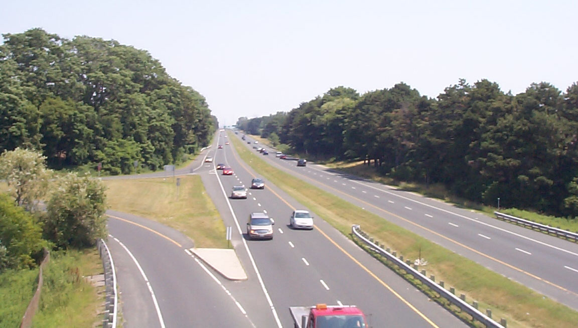
East of the Highland Creek bridges (which bypasses Old Kingston Road), Kingston Road defaults to Highway 2A, although the routing for Kingston Road continues via an off-ramp at the Lawson Road interchange. After the Lawson Road exit, the route becomes a fully controlled-access freeway until Highway 401. Despite being surrounded by urban developments, Highway 2A still retains its rural character as it remains unlit and lacks roadside businesses. The speed limit is 80 km/h, and it is patrolled by the Toronto Police Service.
History
Windsor–Tilbury
| access-date = February 11, 2014}} Renumbered as Highway 98 The Windsor to Tilbury section of Highway 2A originally was designated in 1929 along the route of what would become Highway 114, near Maidstone. When Highway 18 was redesignated between Windsor and Leamington in 1931, Highway 2 was rerouted onto its former routing. The old routing of Highway 2 prior to that became Highway 2A, and the existing Highway 2A was renumbered as Highway 3B.
Between 1931 and 1938, the route followed the Provincial Highway between Tecumseh Road in downtown Windsor, and Mill Street in Tilbury, both at junctions with Highway 2. In 1938, the entire route was renumbered as Highway 98
Chatham
| access-date = February 11, 2014}} (renumbered as Highway 2B 1961-1970) Highway 2A in Chatham was established in 1957 along the original route of Highway 2 when it was rerouted along the West Chatham Bypass (Keil Street) and Grand Avenue. The route began at Highway 2 at the intersection of Richmond Street and Keil Street, following the former into downtown Chatham, where it turned north onto Queen Street then east onto School Street. From there, the route turned north onto Centre Street, which becomes 5th Street shortly thereafter. The route crossed the Thames River, north of which it became Thames Street and continued to Highway 2 (Grand Avenue East). The route was renumbered as Highway 2B in 1961 and decommissioned by 1970.
London
| access-date = February 11, 2014}} Highway 2A in London provided an alternative parallel route to Highway 2 through the downtown core, travelling from a concurrent Highway 2 and Highway 4 eastward along Stanley Street, York Street, Florence Street and finally Highbury Avenue. At its eastern end, it met Highway 2 (Dundas Street). The route was established in 1956 and decommissioned in 1968.
Cornwall
| access-date = February 11, 2014}} Highway 2A (Alt.) in Cornwall was a short-lived designation applied along Nine Mile Road (now Power Dam Drive) and Second Street on the west side of the city. It provided an alternate bypass to the Seaway International Bridge. The route was established in 1965 and remained in place for only two years before being decommissioned in 1967.
Toronto–Newcastle
| access-date = August 15, 2024}}
As automobile use in southern Ontario grew in the early twentieth century, road design and construction advanced significantly. Following frequent erosion of the former macadamized Lake Shore Road, a cement road known as the Toronto–Hamilton Highway was proposed in January 1914.{{cite news
Over the next decade, vehicle usage increased substantially, and by 1920 Lakeshore Road was again highly congested on weekends.{{cite news Construction on what was then known as the Queen Street Extension between Highway 10 and Highway 27 began in early 1931, and between Highway 27 and the Humber River on November 1, 1931.{{cite news
Before the highway could be completed, Thomas McQuesten was appointed the new minister of the Department of Highways, with Robert Melville Smith as deputy minister, following the 1934 provincial elections.{{cite web |url-status = dead
Beginning in 1935, McQuesten applied the concept of a dual-highway to several projects along Highway 2, including a section between Birchmount Road and east of Morningside Avenue in what was then known as Scarborough Township.{{cite news
Following the war, construction resumed on roadways throughout Ontario. The expressway between Highland Creek and Oshawa was completed in December 1947. The Toronto–Barrie Highway was the primary focus of the Department of Highways at the time, and the onset of the Korean War in 1949 continued to stall construction. Despite the delays, highway minister George Doucette officially announced the plans for construction of the new trans-provincial expressway in 1950, with the Toronto to Oshawa expressway serving as a model for the design.
Along with an extension of the Highway between Oshawa and Highway 35 and Highway 115, most of Highway 2A was redesignated Highway 401 in July 1952. A short stub that wasn't incorporated into Highway 401 was all that remained of Highway 2A, consisting of a 3.4 km (2.1 mile) dual carriageway connecting Highway 401 with Kingston Road.
Highway 2A, despite being a spur route, retained in the provincial inventory until April 1, 1997, when it was transferred to the City of Toronto as part of a provincial downloading of highways to municipalities.{{cite report | access-date = September 21, 2016}}
Exit list
References
;Sources
;Bibliography
- {{cite book
- {{cite book |url-status = dead
- {{cite book
- {{cite book
- {{cite book
References
- "The history of Highway 2 when it was the gateway to Toronto".
- Emery pp. 179–182
- Shragge p. 55 "''...the Toronto-to-Hamilton highway which, when completed in 1917, was both Ontario's first concrete highway and one of the longest such inter-city stretches in the world.''"
- Shragge pp. 79–81
- Filey pp. 61–62
- Stamp pp. 19–20
- Stamp pp. 11–12
- Brown p. 105
- Shragge pp. 93–94
- MapArt 2010
This article was imported from Wikipedia and is available under the Creative Commons Attribution-ShareAlike 4.0 License. Content has been adapted to SurfDoc format. Original contributors can be found on the article history page.
Ask Mako anything about Ontario Highway 2A — get instant answers, deeper analysis, and related topics.
Research with MakoFree with your Surf account
Create a free account to save articles, ask Mako questions, and organize your research.
Sign up freeThis content may have been generated or modified by AI. CloudSurf Software LLC is not responsible for the accuracy, completeness, or reliability of AI-generated content. Always verify important information from primary sources.
Report