From Surf Wiki (app.surf) — the open knowledge base
Olt County
County of Romania
.PNG)
County of Romania
| Field | Value | |
|---|---|---|
| <!-- See Template:Infobox settlement for additional fields and descriptions --> | name | Olt County |
| native_name | Județul Olt | |
| native_name_lang | ro | |
| settlement_type | County | |
| image_skyline | {{multiple image | |
| border | infobox | |
| total_width | 300 | |
| image_style | infobox | |
| perrow | 1/2/1 | |
| caption_align | center | |
| image1 | Baraj Olt Slatina.jpg | |
| caption1 | Olt River | |
| image2 | RO OT Slatina old city street 3.jpg | |
| caption2 | Slatina | |
| image3 | Scornicesti 2013 (4).jpg | |
| caption3 | Scornicești | |
| image_flag | Flag of the county of Olt.png | |
| image_shield | [[File:Actual_Olt_county_CoA.png | 75px]] |
| image_map | Olt in Romania.svg | |
| map_alt | Administrative map of Romania with Olt county highlighted | |
| subdivision_type | Country | |
| subdivision_name | Romania | |
| subdivision_type1 | Development region | |
| subdivision_name1 | Sud-Vest | |
| subdivision_type2 | Historical region | |
| subdivision_name2 | Wallachia | |
| seat_type | Capital | |
| seat | Slatina | |
| leader_party | PSD | |
| leader_title | President of the County Board | |
| leader_name | ||
| leader_title1 | Prefect | |
| leader_name1 | ||
| unit_pref | Metric | |
| area_total_km2 | 5,498 | |
| area_rank | 22nd | |
| population_total | ||
| population_as_of | ||
| population_footnotes | ||
| population_density_km2 | auto | |
| population_rank | 19th | |
| area_code_type | Telephone code | |
| area_code | (+40) 249 or (+40) 349 | |
| iso_code | RO-OT | |
| website | County Council | |
| Prefecture | ||
| blank1_name | GDP (nominal) | |
| blank1_info | US$ 2.158 billion (2015) | |
| blank2_name | GDP per capita | |
| blank2_info | US$ 5,194 (2015) |
Olt County () is a county (județ) of Romania on the border with Bulgaria, in the historical regions of Oltenia and Muntenia (the regions are separated by the Olt river). The capital city is Slatina.
History
On 24 August 2017, the Olt County Council decided to hold a name referendum on 15 October 2017 for the proposal to change the county name to "Olt-Romanați". The referendum was eventually held on 6 and 7 October 2018. The vote was nullified, as turnout was 27.19%, below the required threshold of 30%; therefore, the Olt County retains its current name.
Demographics
In 2011, the county had a population of 415,530 and the population density was 75.57 /km2.
- Romanians - 98.01%
- Romani - 1.9%
| Year | County population | 1948 | 1956 | 1966 | 1977 | 1992 | 2002 | 2011 | 2021 |
|---|---|---|---|---|---|---|---|---|---|
| 442,442 | |||||||||
| 458,982 | |||||||||
| 476,513 | |||||||||
| 518,804 | |||||||||
| 520,966 | |||||||||
| 489,274 | |||||||||
| 415,530 | |||||||||
| 383,280 |
The county is a mainly rural one, with over 60% of the population living in villages.
Geography
The county lies in a flat area on the western part of the Romanian Plain. It is crossed by rivers from north to south, including the Olt River which gave the county its name. The Danube forms a wide valley in the south, with many ponds and small channels, which are occasionally flooded.
Neighbours
- Teleorman County to the East.
- Dolj County to the West.
- Argeș County and Vâlcea County to the North.
- Bulgaria to the South - Vratsa Province and Pleven Province.
Economy
The predominant industries in the county are:
- Metallurgy - aluminium and aluminium components.
- Railway equipment.
- Food and beverages industry.
- Textile industry.
- Mechanical components industry.
Agriculture is the main occupation in the county - over 58% of the population having agriculture as their main occupation. Both extensive agriculture, and small-scale, vegetables and fruits, are practiced. The area is well suited for irrigation.
Tourism
The main destinations for tourists are:
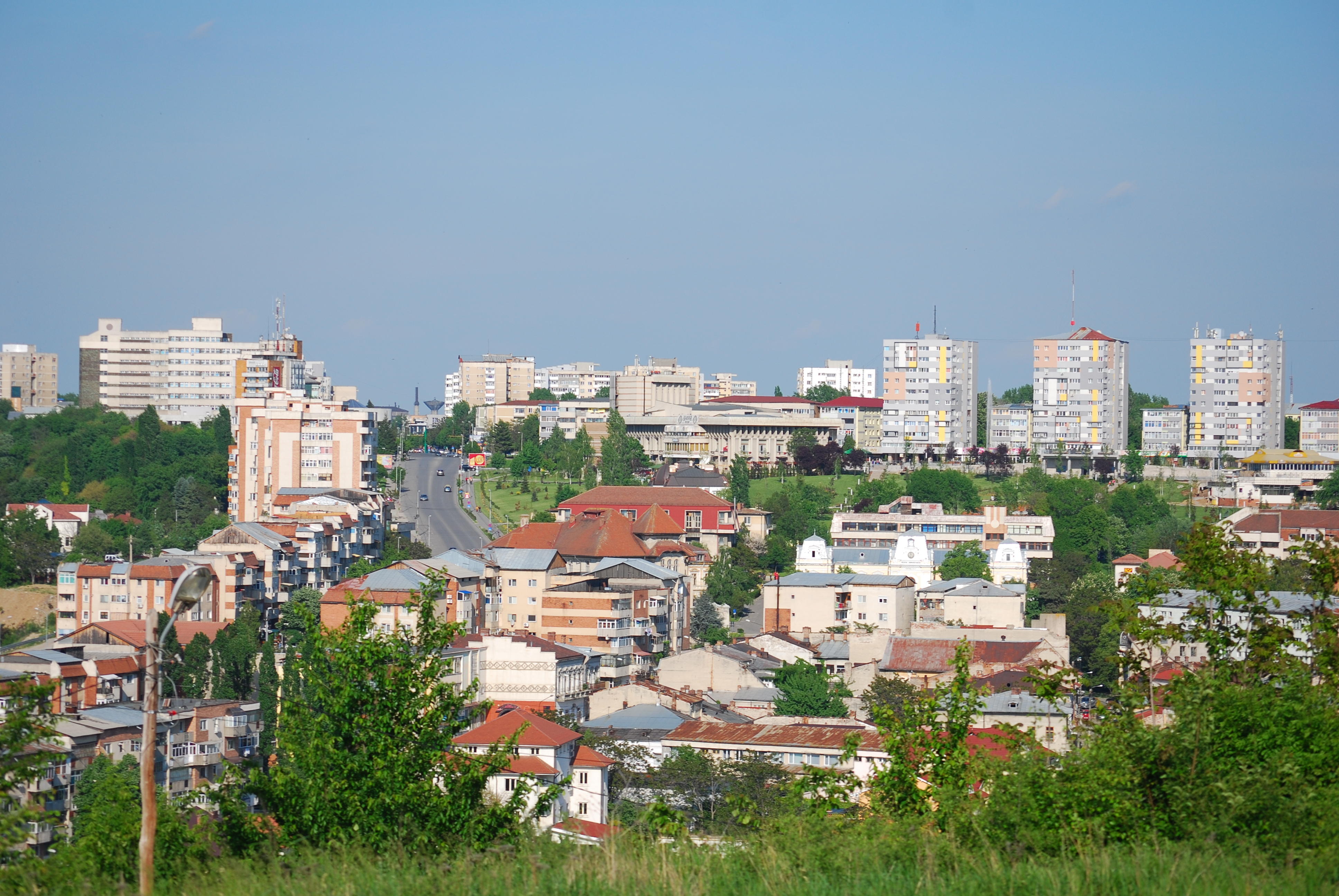
- The city of Slatina.
- Fishing on the Danube and on the Olt River.
- Town of Corabia with an ancient Roman citadel, a large orthodox cathedral, Danube sunbathes, sailing and fishing.
- The town of Scornicești - the birthplace of Nicolae Ceaușescu.
Politics
The Olt County Council, renewed at the 2024 local elections, consists of 32 councilors, with the following party composition:
| Party | Seats | Current County Council | |
|---|---|---|---|
| Social Democratic Party (PSD) | 20 | ||
| National Liberal Party (PNL) | 7 | ||
| Alliance for the Union of Romanians (AUR) | 5 |
Administrative divisions
.PNG)

Olt County has 2 municipalities, 6 towns and 104 communes:
- Municipalities
- Caracal
- Slatina - capital city; population: 87,608 (as of 2007)
- Towns
- Balș
- Corabia
- Drăgănești-Olt
- Piatra Olt
- Potcoava
- Scornicești
- Communes
- Băbiciu
- Baldovinești
- Bălteni
- Bărăști
- Bârza
- Bobicești
- Brâncoveni
- Brastavățu
- Brebeni
- Bucinișu
- Cârlogani
- Călui
- Cezieni
- Cilieni
- Colonești
- Corbu
- Coteana
- Crâmpoia
- Cungrea
- Curtișoara
- Dăneasa
- Deveselu
- Dobrețu
- Dobrosloveni
- Dobroteasa
- Dobrun
- Drăghiceni
- Făgețelu
- Fălcoiu
- Fărcașele
- Găneasa
- Găvănești
- Gârcov
- Giuvărăști
- Ghimpețeni
- Gostavățu
- Grădinari
- Grădinile
- Grojdibodu
- Gura Padinii
- Ianca
- Iancu Jianu
- Icoana
- Ipotești
- Izbiceni
- Izvoarele
- Leleasca
- Mărunței
- Mihăești
- Milcov
- Morunglav
- Movileni
- Nicolae Titulescu
- Obârșia
- Oboga
- Oporelu
- Optași-Măgura
- Orlea
- Osica de Sus
- Osica de Jos
- Pârșcoveni
- Perieți
- Pleșoiu
- Poboru
- Priseaca
- Radomirești
- Redea
- Rotunda
- Rusănești
- Sâmburești
- Sârbii-Măgura
- Scărișoara
- Schitu
- Seaca
- Șerbănești
- Slătioara
- Șopârlița
- Spineni
- Sprâncenata
- Ștefan cel Mare
- Stoenești
- Stoicănești
- Strejești
- Studina
- Tătulești
- Teslui
- Tia Mare
- Topana
- Traian
- Tufeni
- Urzica
- Vădastra
- Vădăstrița
- Vâlcele
- Valea Mare
- Văleni
- Verguleasa
- Vișina
- Vișina Nouă
- Vitomirești
- Vlădila
- Voineasa
- Vulpeni
- Vulturești
Historical county
Historically, the county was located in the southern part of Greater Romania, in the western part of the historical region of Muntenia, around and in the south of Bucharest. The county included the north-eastern part of the current Olt county, the south-western part of the present Argeș County and the north-western part of the present Teleorman County. During the interwar years, it was bordered to the north by Argeș County, to the east by the counties of Argeş and Teleorman, to the south by Teleorman County, and in the west by the counties of Romanați and Vâlcea.
Administration

The county originally was divided into three administrative districts (plăși):
- Plasa Drăgănești, headquartered at Drăgănești
- Plasa Dumitrești, headquartered at Dumitrești
- Plasa Spineni, headquartered at Spineni
Subsequently, the county established an additional district: Plasa Mijlocul, headquartered at Mijlocul
Population
According to the 1930 census data, the county population was 183,595 inhabitants, ethnically divided as follows: 98.2% Romanians, 1.2% Romanies, as well as other minorities. From the religious point of view, the population was 99.5% Eastern Orthodox, 0.2% Roman Catholic, 0.1% Jewish, as well as other minorities.
Urban population
In 1930, the county's urban population was 11,243 inhabitants, comprising 92.5% Romanians, 2.5% Hungarians, 1.5% Jews, 0.8% Germans, as well as other minorities. From the religious point of view, the urban population was composed of 94.1% Eastern Orthodox, 2.3% Roman Catholic, 1.6% Jewish, 0.9% Reformed, 0.6% Lutheran, as well as other minorities.
References
References
- The number used depends on the numbering system employed by the phone companies on the market.
- (24 August 2017). "Olt: CJ a programat pe 15 octombrie referendumul pentru schimbarea numelui județului". [[Agerpres]].
- Dorobanțu, Alin. (19 September 2018). ""DA", pentru Olt-Romanați!". Ziarul de Olt.
- (7 October 2018). "Referendumul din Olt a eșuat, deși prezența a fost mai mare decât la referendumul pentru familie". [[Libertatea]].
- National Institute of Statistics, ''[http://www.recensamant.ro/pagini/tabele/t40a.pdf "Populația după etnie"] {{webarchive. link. (2009-08-16 '')
- National Institute of Statistics, ''[http://www.insse.ro/rpl2002rezgen/18.pdf "Populația la recensămintele din anii 1948, 1956, 1966, 1977, 1992 și 2002"] {{Webarchive. link. (2006-09-22 '')
- "Consilieri Județeni".
- [http://romaniainterbelica.memoria.ro/judete/olt/ Portretul României Interbelice - Județul Olt]
This article was imported from Wikipedia and is available under the Creative Commons Attribution-ShareAlike 4.0 License. Content has been adapted to SurfDoc format. Original contributors can be found on the article history page.
Ask Mako anything about Olt County — get instant answers, deeper analysis, and related topics.
Research with MakoFree with your Surf account
Create a free account to save articles, ask Mako questions, and organize your research.
Sign up freeThis content may have been generated or modified by AI. CloudSurf Software LLC is not responsible for the accuracy, completeness, or reliability of AI-generated content. Always verify important information from primary sources.
Report