From Surf Wiki (app.surf) — the open knowledge base
Old Cairo
Neighbourhood within historic Cairo, Egypt
Neighbourhood within historic Cairo, Egypt
| Field | Value |
|---|---|
| part_of | Historic Cairo |
| Image | Cairo, Old Cairo, Hanging Church, Egypt, Oct 2004 edit.jpg |
| Caption | Old Cairo, view of the Hanging Church |
| Criteria | Cultural: i, ii, iv, v |
| Year | 1979 |
| ID | 89 |
| Area | 52,366 ha |
a specific area of historic Cairo
Old Cairo (, Egyptian pronunciation: Maṣr El-ʾAdīma) is a historic area in Cairo, Egypt, which includes the site of a Roman-era fortress, the Christian settlement of Coptic Cairo, and the Muslim-era settlement of Fustat that pre-dates the founding of Cairo proper in 969 AD. It is part of what is referred to as Historic Cairo, a UNESCO World Heritage Site.
Miṣr al-Qadīma is also a modern administrative district in the Southern Area of Cairo, encompassing the area from the Cairo Aqueduct to the north, to the Ring Road in the south, and from the Khalifa cemetery to the east, to the Nile Corniche in the west, as well as Roda Island, or Manial al-Roda. It had 250,313 residents according to the 2017 census.
History
Roman fort and Coptic Cairo
The area around present-day Cairo had long been a focal point of Ancient Egypt due to its strategic location at the junction of the Nile Valley and the Nile Delta regions, which also placed it at the crossing of major routes between North Africa and the Levant. Memphis, the capital of Egypt during the Old Kingdom and a major city up until the Ptolemaic period, was located a short distance south west of present-day Cairo.
Around the turn of the 4th century, as Memphis was declining in importance, the Romans established a large fortress along the east bank of the Nile. The fortress, called Babylon, was built by the Roman emperor Diocletian (r. 285–305) at the entrance of a canal connecting the Nile to the Red Sea that was created earlier by emperor Trajan (r. 98–115). While no structures older than the 7th century have been preserved in the area aside from the Roman fortifications, historical evidence suggests that a sizeable city existed. The city was important enough that its bishop, Cyrus, participated in the Second Council of Ephesus in 449.
The Byzantine-Sassanian War between 602 and 628 caused great hardship and likely caused much of the urban population to leave for the countryside, leaving the settlement partly deserted. The site nonetheless remained at the heart of the Coptic Orthodox community, composed of Egyptian Christians who separated from the Roman and Byzantine churches in the late 4th century.
Fustat in the early Muslim period
After the Muslim conquest of Egypt in 641 during the period of the Rashidun Caliphate, the Arab commander Amr ibn al-As established Fustat () just north of the Roman fortress, on the eastern side of the Nile. At Caliph Umar's request, the Egyptian capital was moved from Alexandria to this new city.
Foundation of Al-Askar (Abbasid period)
The reach of the subsequent Umayyads Caliphs was extensive, stretching from modern-day Spain all the way to western China. However, they were overthrown by the Abbasids, who moved the capital of the Islamic empire to Baghdad. In Egypt, this shift in power involved moving control from the city of Fustat slightly north to a new Abbasid city called al-'Askar (). Intended primarily as a city large enough to house an army, it was laid out in a grid pattern that could be easily subdivided into separate sections for various groups, such as merchants and officers.
Foundation of Al-Qata'i (Tulunid period)
Local Egyptian governors gained increasing autonomy, and in 870, governor Ahmad ibn Tulun made Egypt into a de facto independent state, though still nominally under the rule of the Abbasid Caliph. As a symbol of this independence, in 868 ibn Tulun founded yet another capital, al-Qata'i, slightly further north of al-'Askar. The capital remained there until 905, when the city was destroyed.
Later history of Fustat

_and_Old_Cairo_(Vieux_Kaire,_right)_Environs_du_Kaire_(Cairo)._Plan_général_de_Boulâq,_du_Kaire,_de_l'île_de_Roudah_(el-Rôda),_du_Vieux_Kaire_et_de_Gyzeh_(Jîzah)_(NYPL_b14212718-1268726)_(cropped).jpg)
After the destruction of al-Qata'i, the administrative capital of Egypt returned to Fustat. In the 10th century, under the Fatimids, the capital moved to nearby al-Qāhirah (Cairo), founded in 969. Cairo's boundaries grew to eventually encompass the three earlier capitals of al-Fusṭāṭ, al-Qata'i and al-‘Askar. Fustat itself was then partly destroyed by a vizier-ordered fire that burned from 1168 to 1169, as a defensive measure against the attacking Crusader Kingdom of Jerusalem.
By the end of the 15th century, the newer port of Bulaq was able to take over the role as the major commercial port from Old Cairo.
Modern district and population
Masr al-Qadima (Old Cairo) is a Cairo district in the Southern Area made up of one qism (police ward).
_District_Map.jpg)
The district had 250,313 residents in 2017 spread over 12 shiakhas as follows:
| Shiakha | Code 2017 | Population |
|---|---|---|
| `Ayn al-Ṣîra | 010910 | 30593 |
| Abû al-Sa`ûd and al-Madâbigh | 010901 | 21636 |
| Anwar and `Ishash al-Bârûd, al- | 010903 | 11731 |
| Athar al-Nabî | 010902 | 27941 |
| Duyûra, al- | 010905 | 27950 |
| Fumm al-Khalîj and Dayr al-Nuḥâs | 010911 | 6671 |
| Khawkha and al-Qanâya | 010904 | 8299 |
| Kufûr et Sâ`î al-Baḥr, al- | 010907 | 8593 |
| Kûm Ghurâb | 010912 | 60553 |
| Manyal al-gharbî, al- | 010909 | 15297 |
| Manyal al-sharqî, al- | 010908 | 19669 |
| Rawḍa et al-Miqyâs, al- | 010906 |
Historical sites and attractions
Coptic Cairo and the Babylon Fortress

The area includes Coptic Cairo, a walled enclave on the site of the partly-preserved Babylon Fortress. Parts of the ancient fortress's walls, towers, and its gate are still visible. The enclave holds a high concentration of historic Christian churches such as the Hanging Church, the Greek Orthodox Church of St. George, the Church of Saints Sergius and Bacchus, the Church of Santa Barbara, and other Christian buildings. From the 11th century to the 13th century, the Hanging Church (also known as the Church of the Virgin) and the Church of Saint Mercurius (located a short distance north of the enclave), served as the seats of the Coptic Patriarchate and the residences of the Coptic Pope. The Church of Saint Barbara and the Church of Saints Sergius and Bacchus are also notable for being among Cairo's oldest preserved churches, dating from the late 7th or early 8th century.[[File:Cairo, chiesa sospesa, interno 05.JPG|thumb|Interior of the [[Hanging Church]] in Coptic Cairo]] The area also contains the Coptic Museum, which showcases the history of Coptic art from Greco-Roman to Islamic times, and the Ben Ezra Synagogue, the oldest and best-known synagogue in Cairo, where the important collection of historic documents known as the Cairo Geniza were discovered in the 19th century.
Count Gabriel Habib Sakakini Pasha (1841–1923), who had become a household name in his time, established the Roman Catholic Cemetery in Old Cairo.
Historical sites near the fortress

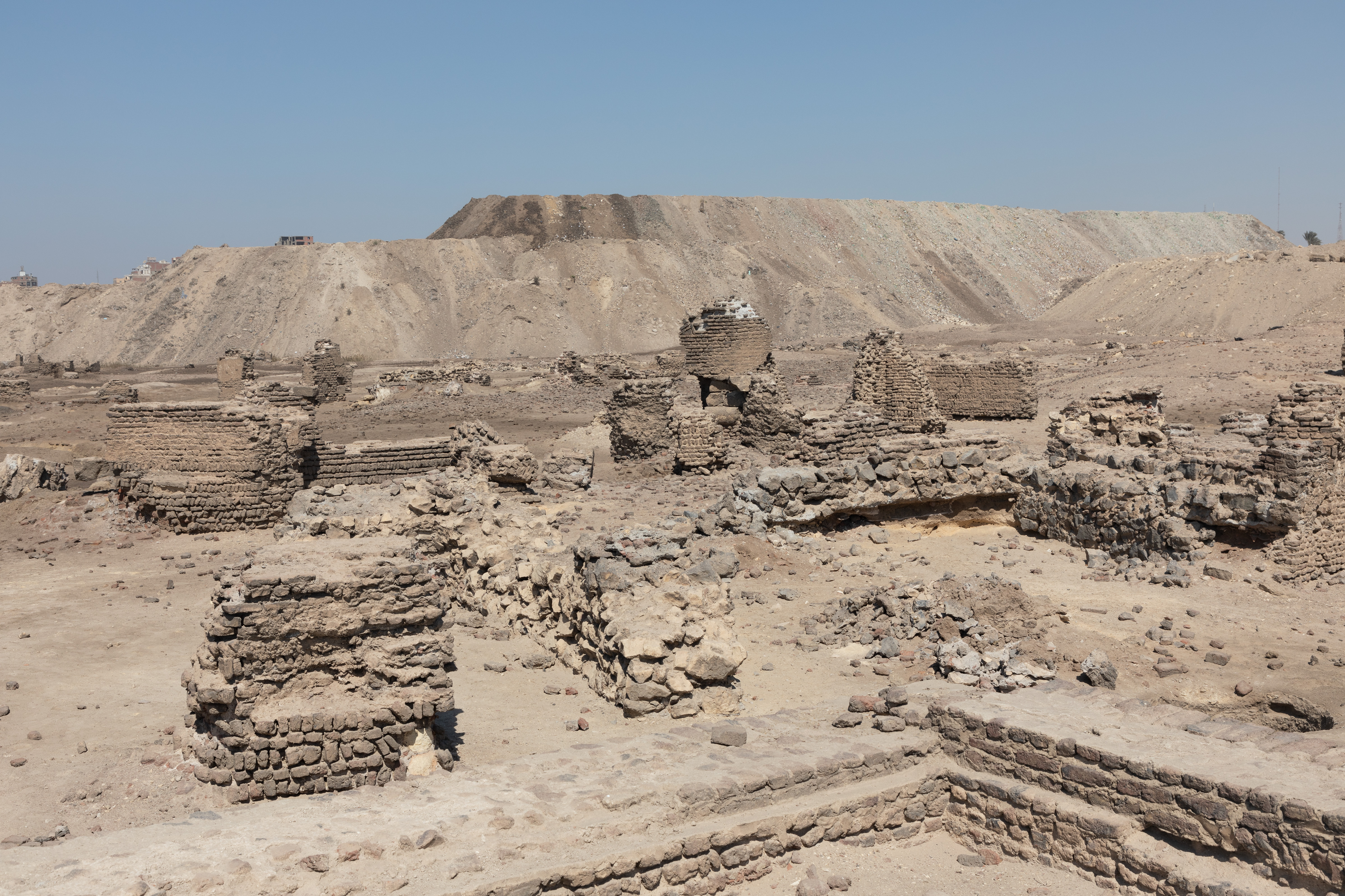
To the north of the Babylon Fortress is the Amr ibn al-'As Mosque, the first mosque in Egypt and the most important religious centre of what was formerly Fustat, but rebuilt many times since. A part of the former city of Fustat has also been excavated to the east of the mosque and of the Coptic enclave.
Nearby and to the northwest of Babylon Fortress and the mosque is the Monastery of Saint Mercurius (or Dayr Abu Sayfayn), an important and historic Coptic religious complex consisting of the Church of Saint Mercurius (mentioned above), the Church of Saint Shenute, and the Church of the Virgin (also known as al-Damshiriya). Several other historic churches are also situated to the south of Babylon Fortress.
Other nearby attractions
Further north is the Cairo Citadel Aqueduct, built during the Ayyubid and Mamluk periods (from the 12th to 16th centuries) to supply water to the Cairo Citadel to the east. Long sections of the elevated aqueduct, as well as its intake tower near the river, are still standing today.

Located on the Nile River close to Coptic Cairo is Roda Island, which is connected by a nearby footbridge. Several historic monuments are located in the island, including the Nilometer, built in 861 on the orders of the Abbasid caliph al-Mutawakkil. Although it was repaired and given a new roof in later centuries, its basic structure is still preserved, making it the oldest preserved Islamic-era structure in Cairo today.
In 2021, the National Museum of Egyptian Civilization was opened to visitors in a new building in Old Cairo, near ancient Fustat. The museum provides an overview of Egyptian history with artefacts drawn from the existing collections of other museums around the country. The 22 ancient royal mummies formerly housed in the Egyptian Museum at Tahrir Square were moved here in 2021.
Conservation and restoration
The effort to conserve Egypt's monuments has existed since the 19th century. In 1881, Khedive Tawfiq founded the Comité de Conservation des Monuments de l'Art Arabe.
In 1979, UNESCO designated Old Cairo, as part of wider Historic Cairo, as a World Heritage Site, calling it "one of the world's oldest Islamic cities, with its famous mosques, madrasas, hammams and fountains" and "the new centre of the Islamic world, reaching its golden age in the 14th century."
The archeological site of Fustat, which include excavations to the east of the main historical enclave, has been threatened by encroaching construction and modern development.
References
Notes
Citations
Bibliography
References
- "Historic Cairo". United Nations Educational, Scientific, and Cultural Organization.
- "Southern Area".
- مجدي, أحمد. (2009-02-09). "خرائط "أحياء القاهرة" من موقع الادارة العامة للمعلومات والتوثيق".
- Central Agency for Public Mobilisation and Statistics (CAPMAS). (2017). "2017 Census for Population and Housing Conditions".
- (2009). "The Grove Encyclopedia of Islamic Art and Architecture". Oxford University Press.
- Snape, Steven. (2014). "The Complete Cities of Ancient Egypt". Thames & Hudson.
- (2009). "Memphis (Egypt)". Microsoft.
- "Al-Qatta'i". menic.utexas.edu.
- "Cairo History: The City of Tents".
- (2018). "The World of the Fatimids". Aga Khan Museum; The Institute of Ismaili Studies; Hirmer.
- [http://www.egy.com/landmarks/97-04-05.shtml Egy.com] {{webarchive. link. (2008-02-25)
- "Asma el Bakri, AlexCinema".
- Toler, Pamela D.. (2016). "In Fragments from Fustat, Glimpses of a Cosmopolitan Old Cairo".
- Reguly, Eric. (30 October 2021). "Egypt's long-overdue museum revolution will thrill cultural tourists. Pity about the pandemic". The Globe and Mail.
- Ebrahim, Nadeen. (2021-04-03). "Egyptian mummies paraded through Cairo on way to new museum". Reuters.
- Centre, UNESCO World Heritage. "Historic Cairo".
- Antoniou, Jim. "The Conversation of the old City of Cairo".
- (2014-04-17). "Islamic Egypt's first capital under threat".
This article was imported from Wikipedia and is available under the Creative Commons Attribution-ShareAlike 4.0 License. Content has been adapted to SurfDoc format. Original contributors can be found on the article history page.
Ask Mako anything about Old Cairo — get instant answers, deeper analysis, and related topics.
Research with MakoFree with your Surf account
Create a free account to save articles, ask Mako questions, and organize your research.
Sign up freeThis content may have been generated or modified by AI. CloudSurf Software LLC is not responsible for the accuracy, completeness, or reliability of AI-generated content. Always verify important information from primary sources.
Report