From Surf Wiki (app.surf) — the open knowledge base
Nyurbinsky District
| Field | Value |
|---|---|
| en_name | Nyurbinsky District |
| ru_name | Нюрбинский улус |
| loc_name1 | Ньурба улууhа |
| loc_lang1 | Yakut |
| image_map | |
| map_caption | Location of Nyurbinsky District in the Sakha Republic |
| image_caption | Processing plant at Nakyn ore field, Nyurbinsky District |
| image_coa | Coat of Arms of Nyurba (Yakutia).png |
| federal_subject | Sakha Republic |
| federal_subject_ref | |
| adm_ctr_name | Nyurba |
| adm_ctr_ref | |
| no_of_cities_towns | 1 |
| selsoviet_type1 | rural okrug |
| no_of_selsoviets_type1 | 18 |
| no_of_rural_localities | 23 |
| counts_ref | |
| mun_formation1 | Nyurbinsky Municipal District |
| mun_formation1_ref | |
| mun_formation1_no_of_urban_settlements | 1 |
| mun_formation1_no_of_rural_settlements | 18 |
| mun_formation1_counts_ref | |
| area_km2 | 52400 |
| area_km2_ref | |
| pop_2010census | 15101 |
| urban_pop_2010census | 0% |
| rural_pop_2010census | 100% |
| established_date | January 9, 1930 |
| established_date_ref | |
| website | sakha.gov.ru |
Nyurbinsky District (; , ) is an administrative and municipal district (raion, or ulus), one of the thirty-four in the Sakha Republic, Russia. It is located in the central western part of the republic and borders with Olenyoksky District in the north, Verkhnevilyuysky District in the east, Suntarsky District in the south and southwest, and with Mirninsky District in the northwest. The area of the district is 52400 km2. Its administrative center is the town of Nyurba. Population (excluding the administrative center): 15,549 (2002 Census);
Geography
The district stretches for 275 km from north to south and for 187 km from east to west. The main rivers in the district are the Vilyuy and its tributaries the Markha and the Tyukyan with the Chilli.
Climate
Average January temperature ranges from -36 to and average July temperature ranges from +16 to. Annual precipitation is about 200 -.
History
The district was established on January 9, 1930. Until February 1992, it was called Leninsky District (Ленинский район).
Demographics
As of the 2021 Census, the ethnic composition was as follows:
- Yakuts: 96.4%
- Russians: 2.4%
- Evenks: 0.5%
- other ethnicities: 0.7%
Average age of the population is 29.
Economy
The economy of the district is mostly based on mining, food industry, forestry, light industry, and agriculture. Major natural resources include diamonds, gold, and brown coal. Diamond mining is mostly carried out by ALROSA company.
Transportation
The Vilyuy Highway runs through the district, connecting the town of Nyurba with Yakutsk, Vilyuysk, and Mirny.
Inhabited localities
| Towns / Cities | Population | Male | Female | Inhabited localities in jurisdiction | Rural settlements | Population | Male | Female | Rural localities in jurisdiction* |
|---|---|---|---|---|---|---|---|---|---|
| Nyurba Urban Settlement | |||||||||
| (Нюрба) | 10,157 | 4,710 (46.4%) | 5,447 (53.6%) | ||||||
| Akaninsky Nasleg | |||||||||
| (Аканинский) | 538 | 265 (49.3%) | 273 (50.7%) | ||||||
| Bordonsky Nasleg | |||||||||
| (Бордонский) | 1,918 | 955 (49.8%) | 963 (50.2%) | ||||||
| Dikimdinsky Nasleg | |||||||||
| (Дикимдинский) | 328 | 171 (52.1%) | 157 (47.9%) | ||||||
| Yedeysky Nasleg | |||||||||
| (Едейский) | 190 | 107 (56.3%) | 83 (43.7%) | ||||||
| Zharkhansky Nasleg | |||||||||
| (Жарханский) | 408 | 219 (53.7%) | 189 (46.3%) | ||||||
| Kangalassky Nasleg | |||||||||
| (Кангаласский) | 608 | 289 (47.5%) | 319 (52.5%) | ||||||
| Kyundyadinsky Nasleg | |||||||||
| (Кюндядинский) | 1,011 | 486 (48.1%) | 525 (51.9%) | ||||||
| Malzhagarsky Nasleg | |||||||||
| (Мальжагарский) | 550 | 282 (51.3%) | 268 (48.7%) | ||||||
| Markhinsky Nasleg | |||||||||
| (Мархинский) | 563 | 272 (48.3%) | 291 (51.7%) | ||||||
| Megezheksky Nasleg | |||||||||
| (Мегежекский) | 559 | 275 (49.2%) | 284 (50.8%) | ||||||
| Nyurbachansky Nasleg | |||||||||
| (Нюрбачанский) | 630 | 316 (50.2%) | 314 (49.8%) | ||||||
| Oktyabrsky Nasleg | |||||||||
| (Октябрьский) | 2,770 | 1,331 (48.1%) | 1,439 (51.9%) | ||||||
| Syulinsky Nasleg | |||||||||
| (Сюлинский) | 526 | 255 (48.5%) | 271 (51.5%) | ||||||
| Tarkayinsky Nasleg | |||||||||
| (Таркайинский) | 1,061 | 527 (49.7%) | 534 (50.3%) | ||||||
| Tyumyuksky Nasleg | |||||||||
| (Тюмюкский) | 1,034 | 504 (48.7%) | 530 (51.3%) | ||||||
| Khorulinsky Nasleg | |||||||||
| (Хорулинский) | 786 | 413 (52.5%) | 373 (47.5%) | ||||||
| Chappandinsky Nasleg | |||||||||
| (Чаппандинский) | 880 | 424 (48.2%) | 456 (51.8%) | ||||||
| Chukarsky Nasleg | |||||||||
| (Чукарский) | 741 | 384 (51.8%) | 357 (48.2%) |
Divisional source:
Population source:
*Administrative centers are shown in bold
References
Notes
Sources
References
- Law #173-Z #354-III
- Constitution of the Sakha Republic
- Law #172-Z #351-III
- Registry of the Administrative-Territorial Divisions of the Sakha Republic
- {{ru-pop-ref. 2002Census
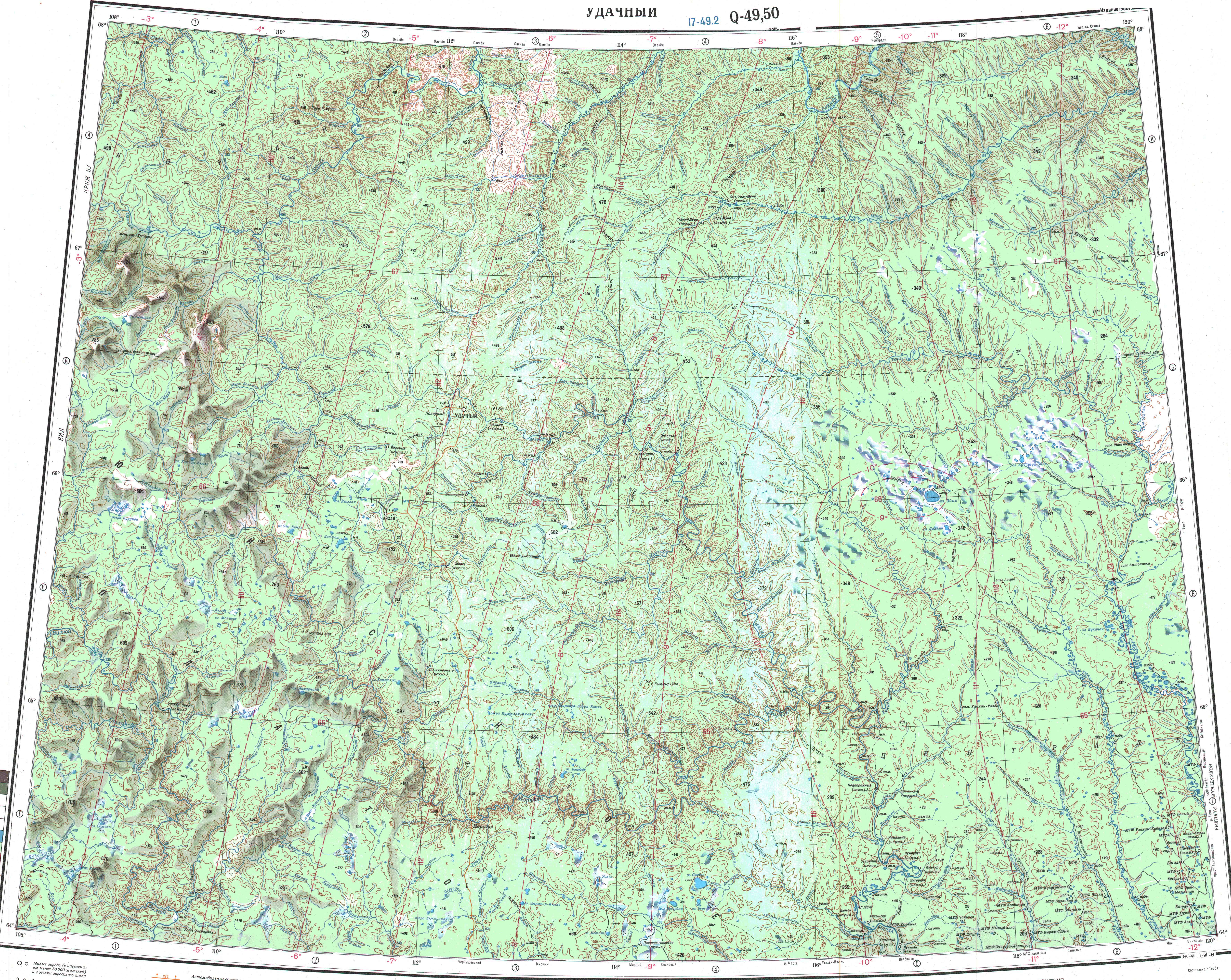
- "Q-49-50 Topographic Chart (in Russian)".
- Center of the Socioeconomic and Political Monitoring. [http://www.sitc.ru/monitoring/nyurba/index.shtml Nyurbinsky District] {{webarchive. link. (March 6, 2012 {{in lang). ru
- "Национальный состав населения". [[Federal State Statistics Service (Russia).
- [http://sakha.gov.ru/node/12539 Nyurbinsky Ulus (Raion)] Official website of the Sakha Republic
This article was imported from Wikipedia and is available under the Creative Commons Attribution-ShareAlike 4.0 License. Content has been adapted to SurfDoc format. Original contributors can be found on the article history page.
Ask Mako anything about Nyurbinsky District — get instant answers, deeper analysis, and related topics.
Research with MakoFree with your Surf account
Create a free account to save articles, ask Mako questions, and organize your research.
Sign up freeThis content may have been generated or modified by AI. CloudSurf Software LLC is not responsible for the accuracy, completeness, or reliability of AI-generated content. Always verify important information from primary sources.
Report