From Surf Wiki (app.surf) — the open knowledge base
North Vancouver (city)
City in British Columbia, Canada

City in British Columbia, Canada
| Field | Value |
|---|---|
| name | North Vancouver |
| official_name | The Corporation of the City of North Vancouver |
| native_name | |
| settlement_type | City |
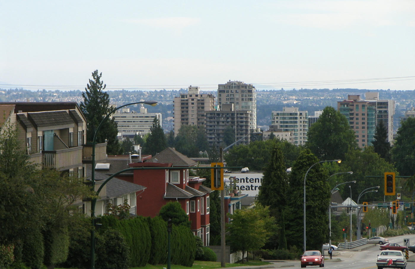
| image_skyline | {{multiple image |
| total_width | 270 |
| border | infobox |
| perrow | 1/2/2 |
| caption_align | center |
| image1 | North Vancouver 201807.jpg |
| alt1 | Skyline of the City of North Vancouver |
| caption1 | Skyline of the City of North Vancouver |
| image2 | North Van Shipyards Precinct from Lonsdale Quay.JPG |
| alt2 | The Shipyards |
| caption2 | The Shipyards |
| image3 | The Polygon Gallery.jpg |
| alt3 | The Polygon Gallery |
| caption3 | The Polygon Gallery |
| image4 | North Vancouver City Library - panoramio.jpg |
| alt4 | North Vancouver City Library |
| caption4 | North Vancouver City Library |
| image5 | Lonsdale Quay market fountain.jpg |
| alt5 | Lonsdale Quay Market |
| caption5 | Lonsdale Quay Market |
| nickname | North Van |
| image_map | City of North Vancouver in Metro Vancouver.svg |
| mapsize | 220px |
| map_caption | Location of the City of North Vancouver in Metro Vancouver |
| coordinates | |
| subdivision_type | Country |
| subdivision_name | Canada |
| subdivision_type1 | Province |
| subdivision_type2 | Regional district |
| subdivision_name1 | British Columbia |
| subdivision_name2 | Metro Vancouver |
| established_title | Incorporated |
| established_date | May 13, 1907 |
| seat | North Vancouver City Hall |
| government_footnotes | |
| government_type | Mayor-council government |
| leader_title | Mayor |
| leader_name | Linda Buchanan |
| leader_title1 | Council |
| leader_name1 | {{Collapsible list |
| title | List of councillors |
| 1 | Holly Back |
| 2 | Don Bell |
| 3 | Angela Girard |
| 4 | Jessica McIlroy |
| 5 | Shervin Shahriari |
| 6 | Tony Valente |
| unit_pref | |
| area_footnotes | |
| area_land_km2 | 11.83 |
| elevation_m | 80 |
| elevation_footnotes | tags-- |
| population_total | 58120 |
| population_as_of | 2021 |
| population_footnotes | |
| population_density_km2 | 4913.0 |
| population_est | 64847 |
| pop_est_as_of | 2023 |
| pop_est_footnotes | |
| population_demonym | North Vancouverite |
| timezone1 | PST |
| utc_offset | -8 |
| timezone_DST | PDT |
| utc_offset_DST | -7 |
| postal_code_type | Forward sortation area |
| postal_code | V7G – V7R |
| area_code | 604, 778, 236, 672 |
| area_code_type | Area codes |
| website | |
| leader_name2 | Jonathan Wilkinson (Liberal) |
| leader_name3 | Bowinn Ma (BC NDP) |
| leader_title2 | MP |
| leader_title3 | MLA |
The City of North Vancouver is a municipality city on the North Shore of the Burrard Inlet, in British Columbia, Canada. Anchored by the downtown town centre of Lonsdale, with which its urban core is largely synonymous, it consists of the smallest and most urbanized of the communities situated north of the city of Vancouver, and is part of the Metro Vancouver regional district, though it has significant industry of its ownincluding shipping, chemical production, and film production. The city is served by the Royal Canadian Mounted Police, British Columbia Ambulance Service, and the North Vancouver City Fire Department.
History
Industrial development and early settlement (1863–1891)
In 1863, T.W. Graham and George Scrimgeour pre-empted 150 acres of Crown land and established Pioneer Mills, the first sawmill at the site Moodyville. This was a key milestone in the European settlement and industrial development in what would become North Vancouver. The next year, J.O. Smith bought the struggling business, renamed it Burrard Inlet Mills and sent out the first international cargo. Sewell Prescott Moody and two partners bought out the near-bankrupt undertaking cheaply in January 1865, changed the name to Burrard Inlet Lumber Mills and made it a success. Early in 1865 it was purchased by Sewell Prescott Moody and became the centre of a thriving community, Moodyville, with a hotel and the Inlet's first school.
In 1866 Moody took on new partners George Dietz (1830–84) and Hugh Nelson (1830–93). After a fire, he rebuilt the second mill as a 330-foot (100 m) structure capable of producing 100,000 board feet (236 m3) of lumber per day. The complex was named the Moodyville Sawmill Company by the early 1870s.
In the 1880s, Arthur Heywood-Lonsdale and a relation James Pemberton Fell, made substantial investments through their company, Lonsdale Estates, and in 1882 he financed the Moodyville investments. Several locations in the North Vancouver area are named after Lonsdale and his family.
Land development and municipal incorporation
Various settlers acquired Crown grants during this period, including Frederick Howson, Thomas A. Strong, John Linn (the namesake of Lynn Valley) and Hugh Burr.
Following Vancouver's devastating fire in 1886, regional infrastructure expanded with the construction of the Vancouver Water Works dam on the Capilano River in 1888 and the formation of the Burrard Inlet Bridge and Tunnel Company in 1890 to provide direct south shore access.
On August 29, 1891, the District of North Vancouver was officially incorporated, spanning from Indian Arm to Howe Sound, with C.J. Phibbs elected as the first Reeve.
Not long after the District of North Vancouver was formed, an early land developer and second reeve of the new council, James Cooper Keith, personally underwrote a loan to commence construction of a road which undulated from West Vancouver to Deep Cove amid the slashed sidehills, swamps, and burnt stumps. The road, sometimes under different names and not always contiguous, is still one of the most important east-west thoroughfare carrying traffic across the North Shore.
Development was slow at the outset. The population of the district in the 1901 census was only 365 people. Keith joined Edwin Mahon and together they controlled North Vancouver Land & Improvement Company. Soon the pace of development around the foot of Lonsdale began to pick up. The first school was opened in 1902. The district was able to build a municipal hall in 1903 and actually have meetings in North Vancouver (instead of in Vancouver where most of the landowners lived). The first bank and first newspaper arrived in 1905. In 1906 the BC Electric Railway Company opened up a street car line that extended from the ferry wharf up Lonsdale to 12th Street. By 1911 the streetcar system extended west to the Capilano River and east to Lynn Valley.
The owners of businesses who operated on Lonsdale, as part of an initiative led by Keith and Mahon, brought a petition to the district council in 1905, calling for a new, compact city to be carved out of the unwieldy district.
During the ensuing two years there was much and sometimes heated debate. Some thought the new city should have a new name such as Northport, Hillmont or Parkhill. Burrard became the favourite of the new names but majority view was that North Vancouver remain in order to remain associated with the rising credibility of Vancouver in financial markets and as a place to attract immigrants.
Some thought the boundary of the new city should reflect geography and extend from Lynn Creek or Seymour River west to the Capilano River and extend three miles up the mountainside. That the boundary of the city which came into existence in 1907 just happened to match that of the lands owned by the North Vancouver Land & Improvement Company and Lonsdale Estate was no accident. Since the motivation for creating the city was to reserve local tax revenue for the work of putting in services for the property owned by the major developers, there was little reason to take on any of the burden beyond the extent of their holdings.
Residents in west part of the District of North Vancouver now had less reason to be connected with what remained and they petitioned to create the District of West Vancouver (the west part of the North Shore, not the west side of Vancouver) in 1912. The eastern boundary of that new municipality is for the most part the Capilano River and a community that is easily distinguished from the two North Vancouvers has since developed.
The City of North Vancouver continued to grow around the foot of Lonsdale Avenue. Serviced by the North Vancouver Ferries, it proved a popular area. Commuters used the ferries to work in Vancouver. Street cars and early land speculation, spurred interest in the area. Streets, city blocks and houses were slowly built around lower Lonsdale. Wallace Shipyards, and the Pacific Great Eastern Railway provided an industrial base, although, the late arrival of the Second Narrows railway bridge in 1925 controlled development.
Geography

The City of North Vancouver is separated from Vancouver by the Burrard Inlet, and it is surrounded on three sides by the District of North Vancouver. The city has much in common with the district and with West Vancouver; together, the three are commonly referred to as the North Shore.
The City of North Vancouver is relatively densely populated with a number of residential high-rise buildings in the Central Lonsdale and Lower Lonsdale areas.
The North Shore mountains have many drainages: Capilano River, MacKay, Mosquito, and Lynn Creeks, and Seymour River.
Climate
North Vancouver has an oceanic climate (Köppen Cfb) with cool, rainy winters and dry, warm summers. | access-date = 2018-03-26 | archive-date = 27 March 2018 | archive-url = https://web.archive.org/web/20180327084316/http://climate.weather.gc.ca/climate_normals/results_1981_2010_e.html?searchType=stnName&txtStationName=n+vancouver&searchMethod=contains&txtCentralLatMin=0&txtCentralLatSec=0&txtCentralLongMin=0&txtCentralLongSec=0&stnID=830&dispBack=0 | url-status = live
Politics
| MP | Jonathan Wilkinson (North Vancouver, 2015) |
|---|
Sites of interest
The area around lower Lonsdale Avenue features several open community spaces, including Waterfront Park, Lonsdale Quay, Ship Builders Square and the Burrard Dry Dock Pier.
Other sites of interest in the city include:
- Centennial Theatre, 2300 Lonsdale Avenue
- First Church of Christ, Scientist, a local heritage site
- The Museum and Archives of North Vancouver
- The Polygon Gallery
- Presentation House Theatre, 333 Chesterfield Avenue
- St. Edmund's Church, 535 Mahon Avenue, a local heritage site
- Trans Canada Trail Pavilion, Waterfront Park
- The Shipyards, near Lonsdale Quay, which includes Ship Builders Square and the Burrard Dry Dock Pier, on the site of the old Wallace Shipyard
- Lonsdale Quay Market, easily accessible from the Seabus. The Quay has a view of Vancouver's skyline and is locally owned and operated.
Transportation

The City of North Vancouver is connected to Vancouver by two highway bridges (the Lions Gate Bridge and the Ironworkers Memorial Second Narrows Crossing) and by a passenger ferry, the SeaBus. That system and the bus system in North Vancouver is operated by Coast Mountain Bus Company, an operating company of TransLink. The hub of the bus system is Lonsdale Quay, the location of the SeaBus terminal. Currently, there is no rail transit service on the North Shore.
The main street in the city is Lonsdale Avenue, which begins at Lonsdale Quay and goes north to 29th Street, where it continues in the District of North Vancouver, ending at Rockland Road.
Highway 1, the Trans-Canada Highway (often referred to as the "Upper Levels Highway") passes through the northern portion of the city. It is a freeway for its entire length within the City of North Vancouver. There are six interchanges on Highway 1 within the City of North Vancouver:
- Main Street/Dollarton Highway (Exit 23)
- Mountain Highway and Mt Seymour Parkway (Exit 21/22)
- Lynn Valley Road (Exit 19)
- Lonsdale Avenue (Exit 18)
- Westview Drive (Exit 17)
- Capilano Road (Exit 14)
Education
Main article: School District 44 North Vancouver
Public schools are managed by the North Vancouver School District, which operates 8 high schools and 30 elementary schools shared by the city and the District of North Vancouver.
The Conseil scolaire francophone de la Colombie-Britannique operates one Francophone school in that city: école André-Piolat, which has both primary and secondary levels.
There are also several independent private elementary and high schools in the area, including Bodwell High School and Lions Gate Christian Academy.
Post-secondary education is available at Capilano University in the district, as well as at Simon Fraser University and the University of British Columbia in neighbouring communities.
Demographics
|1911|8,196 |1921|7,652 |1931|8,510 |1941|8,914 |1951|15,687 |1961|23,656 |1971|31,847 |1981|33,640 |1991|41,475 |2001|44,303 |2006|45,165 |2011|48,196 |2016|52,898 |2021|58,120 In the 2021 Census of Population conducted by Statistics Canada, North Vancouver had a population of 58,120 living in 27,293 of its 29,021 total private dwellings, a change of from its 2016 population of 52,898. With a land area of 11.83 km2, it had a population density of in 2021.
As of the 2011 census, the median age was 41.2 years old, which is a bit higher than the national median age at 40.6 years old. There are 24,206 private dwellings with an occupancy rate of 94.1%. According to the 2011 National Household Survey, the median value of a dwelling in North Vancouver is $599,985 which is significantly higher than the national average at $280,552. The median household income (after-taxes) in North Vancouver is $52,794, a bit lower than the national average at $54,089.
Ethnicity
North Vancouver has one of the highest Middle Eastern population ratios for any Canadian city at 11.3% as of 2021, with the vast majority being Persian. The area around Lonsdale Avenue from Victoria Park to 21st Street is known as a Little Iran.
| Panethnic | |||||||||||||||||||||||||||
|---|---|---|---|---|---|---|---|---|---|---|---|---|---|---|---|---|---|---|---|---|---|---|---|---|---|---|---|
| group | 2021 | 2016 | 2011 | 2006 | 2001 | Pop. | % | Pop. | % | Pop. | % | Pop. | % | Pop. | % | Total responses | 57,505 | 52,185 | 47,685 | 44,860 | 43,930 | Total population | 58,120 | 52,898 | 48,196 | 45,165 | 44,303 |
| European | 35,420 | 34,695 | 32,800 | 32,160 | 32,960 | ||||||||||||||||||||||
| Middle Eastern | 6,510 | 4,575 | 3,655 | 3,155 | 3,015 | ||||||||||||||||||||||
| East Asian | 5,195 | 4,260 | 3,775 | 3,995 | 3,255 | ||||||||||||||||||||||
| Southeast Asian | 4,220 | 3,715 | 3,470 | 2,150 | 1,650 | ||||||||||||||||||||||
| South Asian | 2,100 | 1,840 | 1,475 | 1,340 | 980 | ||||||||||||||||||||||
| Indigenous | 1,230 | 1,150 | 970 | 925 | 1,015 | ||||||||||||||||||||||
| Latin American | 1,210 | 840 | 585 | 430 | 470 | ||||||||||||||||||||||
| African | 550 | 485 | 390 | 315 | 315 | ||||||||||||||||||||||
| Other | 1,075 | 630 | 575 | 385 | 275 |
- Note: Totals greater than 100% due to multiple origin responses.
Languages
Mother languages as reported by each person:
| Mother language | Population | % of Total Population | % of Non-official language Population |
|---|---|---|---|
| English | 35,520 | 61.4% | N/A |
| Persian | 5,760 | 10.0% | 31.1% |
| Tagalog | 1,675 | 2.9% | 9.0% |
| Chinese Languages | 1,670 | 2.9% | 9.0% |
| Spanish | 1,245 | 2.2% | 6.7% |
| Korean | 1,135 | 6.1% | 6.1% |
| French | 980 | 1.7% | N/A |
| German | 575 | 1.0% | 3.1% |
3.1% of North Vancouver residents listed both English and a non-official language as mother tongues.
Religion
According to the 2021 census, religious groups in North Vancouver included:
- Irreligion (29,580 persons or 51.4%)
- Christianity (20,915 persons or 36.4%)
- Islam (4,245 persons or 7.4%)
- Sikhism (530 persons or 0.9%)
- Buddhism (470 persons or 0.8%)
- Judaism (385 persons or 0.7%)
- Hinduism (340 persons or 0.6%)
- Indigenous Spirituality (70 persons or 0.1%)
Notes
References
References
- "CivicInfo BC {{!}} Municipality: North Vancouver (City)".
- "Mayor & Council".
- Services, Ministry of Citizens'. "Population Estimates – Province of British Columbia".
- (October 1993). "DISTRICT OF NORTH VANCOUVER HERITAGE INVENTORY".
- "Moodyville – Moodyville Sawmill Co.".
- "History – North Vancouver – North Vancouver Museum and Archives".
- [http://www2.canada.com/northshorenews/news/seniors/story.html?id=32bb1b39-273a-4a49-b616-3796aa4865f0&p=2 Canada North Shore News]
- Francis, Daniel. (2016). "Where Mountains Meet the Sea". Harbour Publishing.
- "North Vancouver Trolley {{!}} Daniel Francis".
- Lawrence, Anne-Marie. (2025-07-06). "Presentation House...if its walls could talk!".
- Sommer, Warren. (2007). "The Ambitious City: A History of the City of North Vancouver". Harbour Publishing.
- "North Vancouver's Wartime Shipbuilding – Introduction".
- "HistoricPlaces.ca – Recherche".
- "Attractions in North Vancouver".
- "Primary Buildings".
- "[http://www.csf.bc.ca/ecoles/en-colombie-britannique/carte-des-ecoles/ Carte des écoles] {{Webarchive. link. (17 August 2015 ." ''[[Conseil scolaire francophone de la Colombie-Britannique]]''. Retrieved on 22 January 2015.)
- (August 17, 2022). "Profile table, Census Profile, 2021 Census of Population – North Vancouver, City (CY) [Census subdivision], British Columbia". [[Statistics Canada]].
- Steen, Farah. (2022-03-10). "Vancouver's North Shore Persian Trail".
- Government of Canada, Statistics Canada. (2021-10-27). "Census Profile, 2016 Census".
- Government of Canada, Statistics Canada. (2015-11-27). "NHS Profile".
- Government of Canada, Statistics Canada. (2019-08-20). "2006 Community Profiles".
- Government of Canada, Statistics Canada. (2019-07-02). "2001 Community Profiles".
- Government of Canada, Statistics Canada. (2022-10-26). "Census Profile, 2021 Census of Population".
This article was imported from Wikipedia and is available under the Creative Commons Attribution-ShareAlike 4.0 License. Content has been adapted to SurfDoc format. Original contributors can be found on the article history page.
Ask Mako anything about North Vancouver (city) — get instant answers, deeper analysis, and related topics.
Research with MakoFree with your Surf account
Create a free account to save articles, ask Mako questions, and organize your research.
Sign up freeThis content may have been generated or modified by AI. CloudSurf Software LLC is not responsible for the accuracy, completeness, or reliability of AI-generated content. Always verify important information from primary sources.
Report