From Surf Wiki (app.surf) — the open knowledge base
North Queensland
Region of Queensland, Australia
Region of Queensland, Australia
| Field | Value |
|---|---|
| type | region |
| name | North Queensland |
| state | qld |
| image | Qld-regions-map.gif |
| caption | Queensland's regions |
| pop | 231628 |
| pop_year | 2011 |
| pop_footnotes | |
| area | 80041.5 |
the geographical region of Queensland
- Burdekin
- Charters Towers
- Hinchinbrook
- Mackay
- Palm Island
- Townsville
- Burdekin
- Hinchinbrook
- Mackay
- Mundingburra
- Thuringowa
- Townsville
- Whitsunday
- Dawson
- Herbert
- Kennedy
North Queensland or the Northern Region is the northern part of the Australian state of Queensland that lies just south of Far North Queensland. Queensland is a massive state, larger than many countries, and its tropical northern part has been historically remote and undeveloped, resulting in a distinctive regional character and identity. The region is prone to floods and cyclones.
The region has a population of 231,628 and covers 80041.5 km2.
Geography

There is no official boundary that separates North Queensland from the rest of the state. Unofficially it is usually considered to have a southern border beginning south of the Mackay Region southern boundary, but historically it has been as far south as Rockhampton. To the north is the Far North Queensland region, centred on Cairns and out west is the Gulf Country.
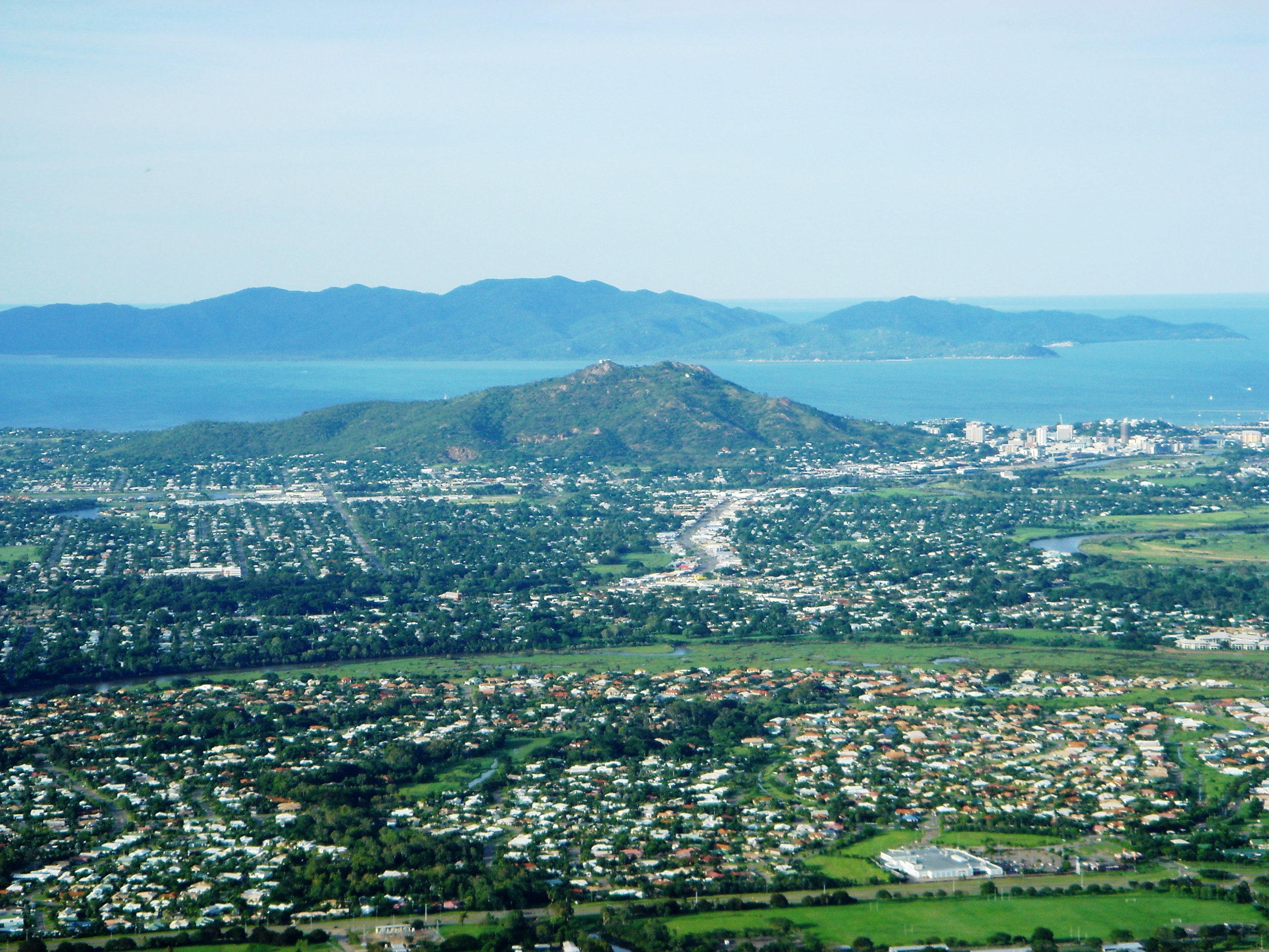
A coastal region centred on its largest settlement is the city of Townsville. The city is the location of a major seaport handling exports from mines in Mount Isa and cattle exports from coastal and inland areas. The region also contains a bulk sugar exporting terminal at Lucinda in the region's north. Mackay and the Burdekin region are Australia's sugar capital and produces the most sugar in Australia and is shipped at Mackay Harbour. Mackay is also one of Australia's biggest coal exporters as it is close to Queensland's major mines. Abbot Point, north of Bowen, is a large, coal exporting port. Dalrymple Bay, south of Mackay is another port where coal is exported. It also contains the inland city of Charters Towers and the coastal towns of Ayr and Ingham. The Burdekin is centred on the two towns of Ayr and Home Hill and while producing the largest amount of sugar, also produces seasonal fruit such as Lychees and Mangos in summer, which is the wet season.
Other communities in North Queensland include Home Hill, Sarina, Bowen, Ayr, and Proserpine. Hinchinbrook Island is the largest island on the Great Barrier Reef and the largest island national park in Australia. Great Palm Island is home to the largest discreet Indigenous community in Australia. Wallaman Falls located near Wallaman, is Australia's highest, permanent single-drop waterfall.

History
Gugu Badhun (also known as Koko-Badun and Kokopatun) is an Australian Aboriginal language of North Queensland. The language region includes areas within the local government area of Charters Towers Region, particularly the localities of Greenvale and the Valley of Lagoons, and in the Upper Burdekin River area and in Abergowrie.
Warrgamay (also known as Waragamai, Wargamay, Wargamaygan, Biyay, and Warakamai) is an Australian Aboriginal language in North Queensland. The language region includes the Herbert River area, Ingham, Hawkins Creek, Long Pocket, Herbert Vale, Niagara Vale, Yamanic Creek, Herbert Gorge, Cardwell, Hinchinbrook Island and the adjacent mainland.
Yuru (also known as Juru, Euronbba, Juru, Mal Mal, Malmal) is an Australian Aboriginal language spoken on Yuru country. The Yuru language region includes the landscape within the local government boundaries of the Shire of Burdekin, including the town of Home Hill.**
Captain James Cook passed by the region in 1770, naming several places including Magnetic Island and Cape Cleveland. Allan Cunningham was the first European to explore parts of the region. John Mackay explored the Pioneer Valley near Mackay in 1860.
The first settlement in the region was established at Port Denison in 1861, at what is now known as Bowen. In 1865, the first surveys of what was to become Townsville were conducted. In 1871, gold was discovered at Charters Towers. This led to much development for the town and for Townsville which served as a major port and service centre as both the pastoral and sugar industry spread along the coast. Work on the Great Northern Railway from Townsville to Mount Isa began in 1879 with a small section opening the following year.
An Immigration Port was established at Bowen in 1866. This was because Queensland sugar plantations relied heavily on Pacific Island labour. At first blackbirding was standard practice, until the trade became voluntary. Over 40 years about 60,000 kanakas were brought to Queensland to work.
In July 1942, Japanese naval flying boats conducted air raids on Townsville.
The Perc Tucker Regional Gallery was established at Townsville in 1981 and the TYTO Regional Art Gallery at Ingham opened in 2011.
The North Queensland Cowboys entered the Australian Rugby League in 1995.
Tourism
The region has a number of significant tourist attractions including the Great Barrier Reef and reef islands, rainforests in the Wet Tropics of Queensland, Eungella, Magnetic Island, and the Whitsunday Islands. The region has 36 national parks.
Agriculture
The region produces 90% of Australia's bananas. Other important products include sugar cane, mangoes and livestock such as cattle.
Transport

The region is serviced by Townsville Airport which is ranked as the 11th busiest airport in Australia. The airport was granted international status in 1980 and plans to return to international services in 2025. Along the coast, the Bruce Highway passes from the south through to the north of the region. The Flinders Highway links Townsville with Charters Towers and the Peak Downs Highway extends west from Mackay. The Tilt Train and Spirit of Queensland travel the North Coast railway line along the coast.
Proposed State of North Queensland
Main article: State of North Queensland
Throughout the years, there have been many calls for the formation of a new state. Many proposals have been drawn up, regarding the borders, name and the debate over which town will become the capital.
References
References
- (1 November 2011). "National Regional Profile: Northern". Australian Bureau of Statistics.
- "Port of Townsville".
- "Port of Abbot Point".
- "Dalrymple Bay Coal Terminal".
- "About Palm".
- (19 May 2021). "Wallaman Falls, Girringun National Park". Government of Queensland.
- "Gugu Badhun".
- "Warrgamay".
- "Yuru".
- "Chronological history of Townsville, 1770 to 1900". Townsville City Council.
- {{cite QPN. 20426. Mackay
- "A Short History of Thuringowa". Thuringowa City Council.
- (8 April 2015). "Bowen". The State of Queensland.
- Jordan, Frank. (2 August 2018). "Justice for the kanakas: Australia's 'invisible' Melanesians". [[Green Left (Australian newspaper).
- (30 June 2012). "The Japanese bombing of Darwin, Broome and northern Australia". Australian Government.
- Leach, Maddison. (7 February 2025). "Aussies warned to brace for banana shortage as floods rage on in north Queensland". 9News.
- "North Queensland".
- (14 May 2024). "Townsville Airport’s Master Plan Approved by Federal Government".
- "Townsville Airport's Master Plan Approved by Federal Government".
- "North Queensland State Flag proposals".
This article was imported from Wikipedia and is available under the Creative Commons Attribution-ShareAlike 4.0 License. Content has been adapted to SurfDoc format. Original contributors can be found on the article history page.
Ask Mako anything about North Queensland — get instant answers, deeper analysis, and related topics.
Research with MakoFree with your Surf account
Create a free account to save articles, ask Mako questions, and organize your research.
Sign up freeThis content may have been generated or modified by AI. CloudSurf Software LLC is not responsible for the accuracy, completeness, or reliability of AI-generated content. Always verify important information from primary sources.
Report